You can experience a castle on the Shirasu Plateau.
Features
Walking down to Maintain Castle
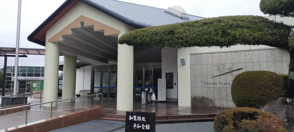
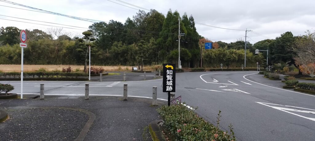
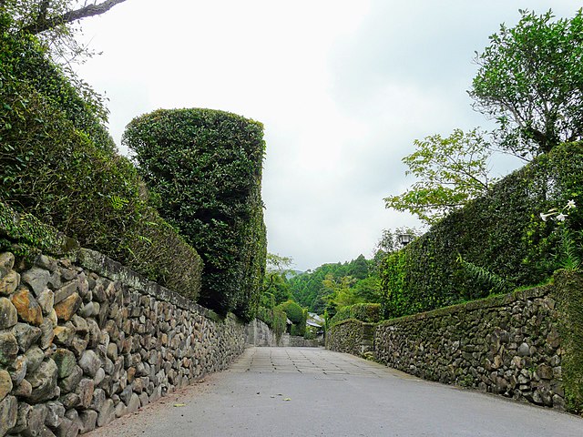
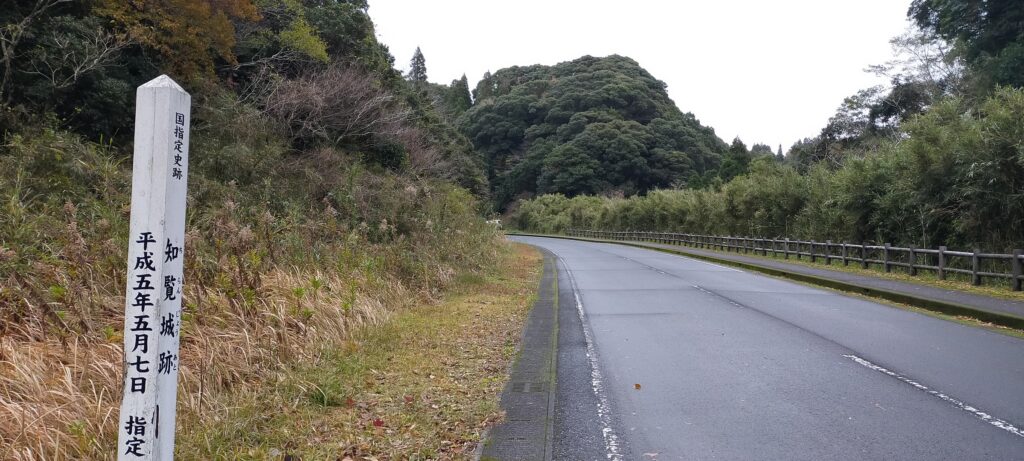
Today, the ruins of Chiran Castle are accessible either from the Chiran Samurai Residences side at the foot the plateau or from the former Chiran Airport (where Chiran Peace Museum for Kamikaze Pilots is located) side on the plateau. If you choose the latter route, you may get an interesting experience.
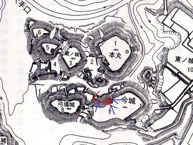
The map around the castle, the blue broken line is the route from Chiran Samurai Residences to the castle, and the red broken line is the route from the former Chiran Airport to the castle
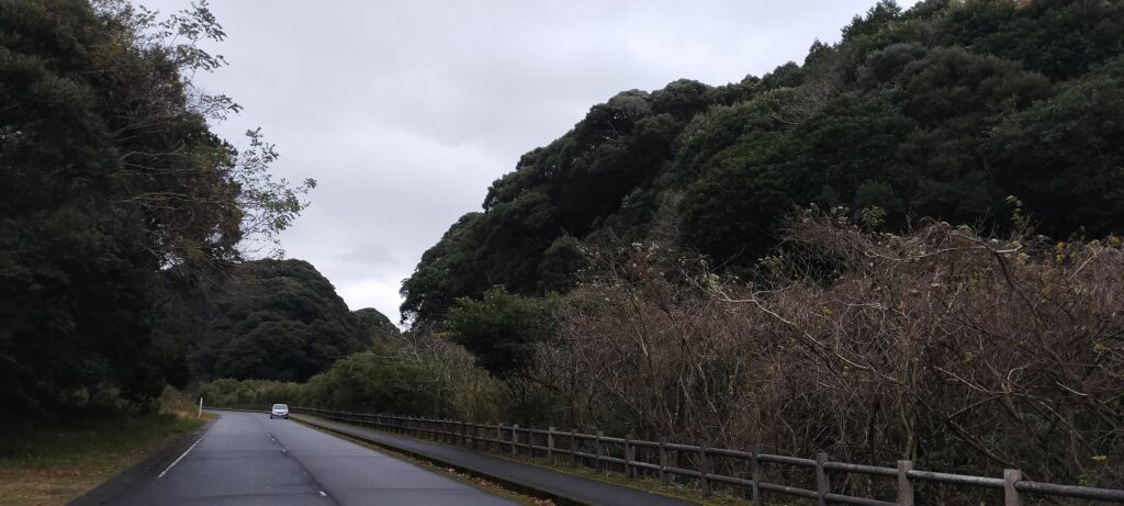
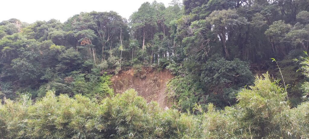
When you want to go to a mountain (or hill) castle, you will usually go up or at least go on flat ground close to the castle. However, in the case of the route from the plateau to Chiran Castle, you will go down towards the castle and eventually reach the bottom of the deep dry moats. This is because of the special location and the construction method of this castle on the edge of the plateau. You will also look up at the tall enclosures looking like mountains from the ruins’ entrance which is actually the moat’s bottom.
Chiran Peace Museum for Kamikaze PilotsThe route goes down from around thereThe route is going downArriving at the past bottom of the moat, the plateau in on the rightThe enclosures on the plateau look very tall
Walking on Bottom of Deep Dry Moat
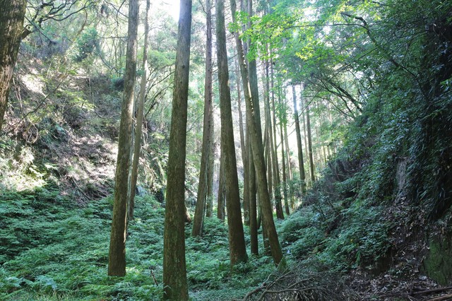
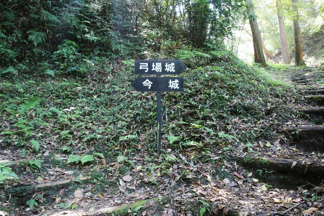
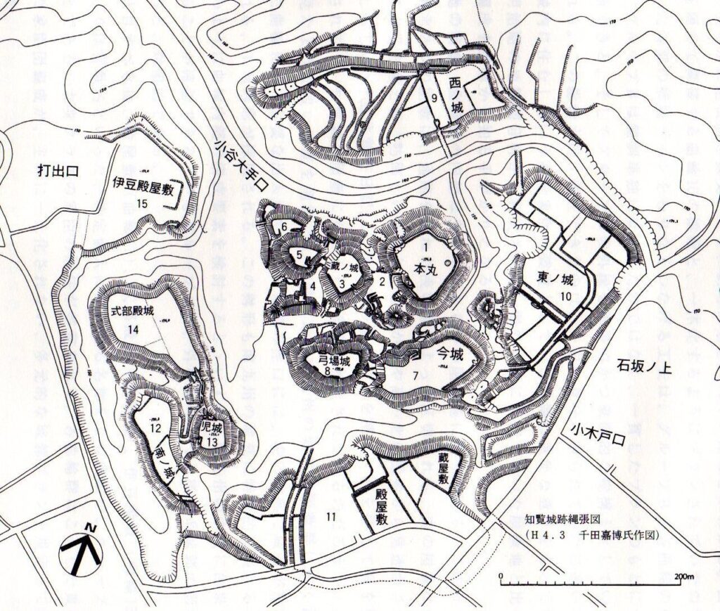
The dry moat is still about 20m deep which was filled in naturally by the collapsing volcanic ash since the period of the castle being active. Visitors first need to walk on the bottom of the moat which was also used as a path in the past. If you walk on the bottom from the entrance, two of the four primary enclosures, the Main and Kuranjo Enclosures are on the right, and the other two enclosures, Imanjo and Yunbajo Enclosures are on the left, as the signposts at the site show.
The map around the castle including the four primary enclosures
The bottom of the dry moat (licensed by PIXTA)the signpost for Imanjo and Yunbajo Enclosures at the site (licensed by PIXTA)
Protected Route to Enclosure
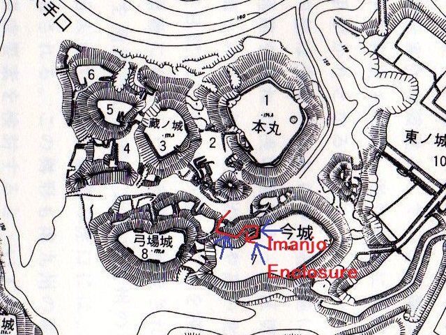
For example, if you want to go to the Imanjo Enclosure, you need to turn left and go up the path to it. However, the path doesn’t go directly to its entrance. Attackers first need to reach the wall of the enclosure and go along the side to reach it. That means the defenders of the castle would attack enemies from above before they reach the entrance. The entrance also had the defensive Masugata system. The inside of the enclosure is a flat square which has no buildings now, but you can see the earthen square shape of Masugata and earthen walls around.
The layout drawing of Chiran Castle, quoted by Minami-Kyushu City, the route to Imanjo Enclosure (the red arrow) and the counterattack from the enclosure (the blue arrow)
This castle was built using features of the Shirasu Plateau
Location and History
Many attractions of Chiran
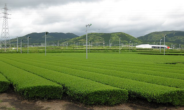
Chiran area of Minami-Kyushu City in Kagoshima Prefecture has many attractions. First, it is known for Chiran tea leaves, which is planted on Shirasu Plateau enriched with ashes of the volcanic zone in the southern Kyushu Region, largely covering the area. The city recently became the largest producer of Japanese tea in the nation in 2017.
A tea plantation at Minami-Kyushu City (licensed by Ray_go via Wikimedia Commons)
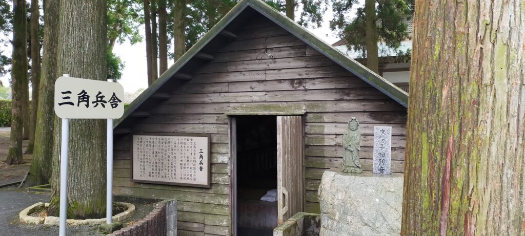
Second, the area also became popular with its history of the Kamikaze corps of Chiran Airport. The history is kind of a tragedy, however, because it was on a plateau with good wind direction, the area was suitable for building the airport. It had originally been used for the normal Japanese Army air corps practices, but was eventually turned into a base for Kamikaze due to the crucial situation of the final stage of WWII.
The Triangle Barrack of Chiran Airport for Kamikaze pilots
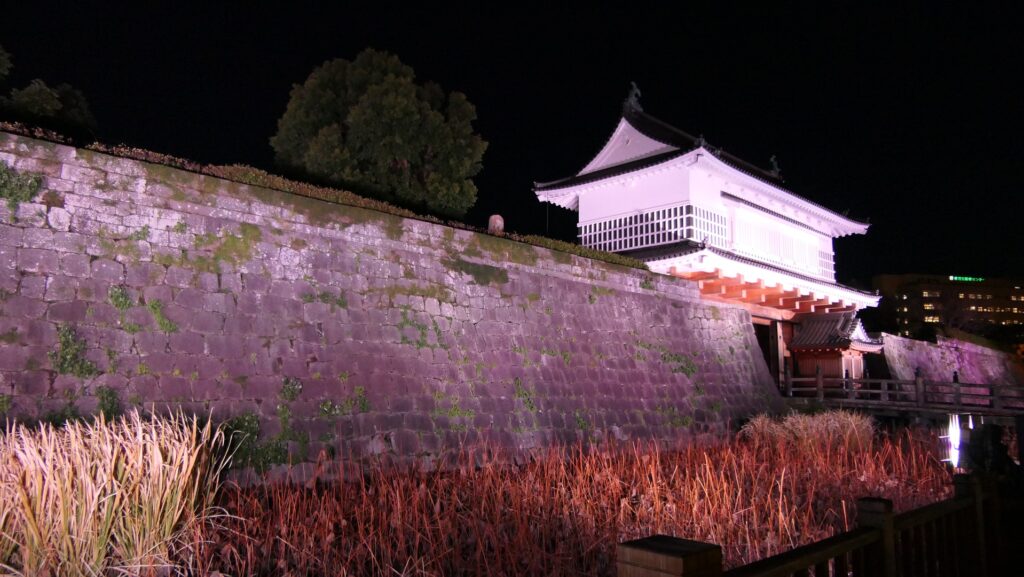
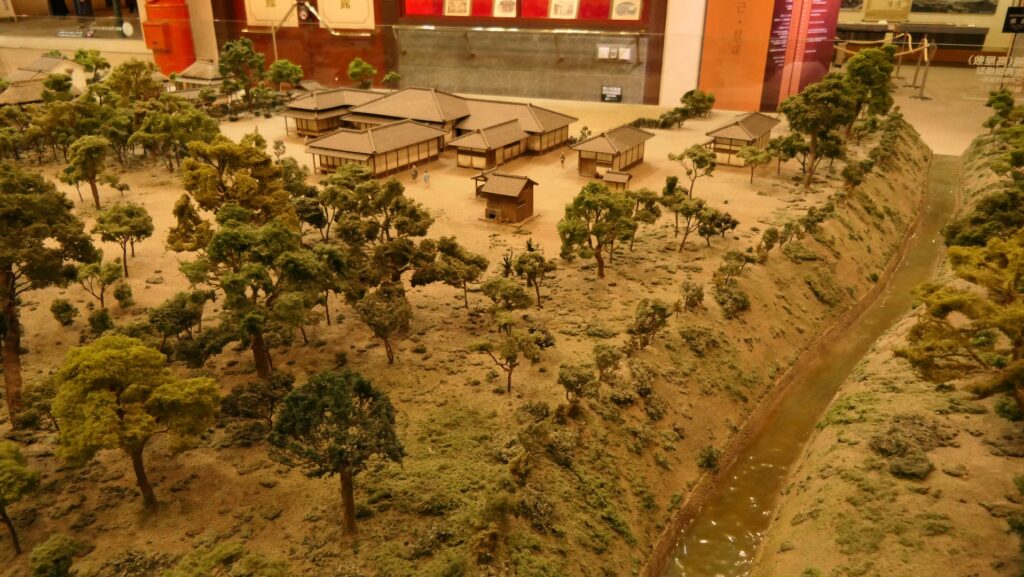
Thirdly, people often visit Chiran Samurai Residences which are located in the plains at the foot of the plateau. The residences have a traditional atmosphere with many gardens and some remaining buildings. Their main street still looks like the original one in the Edo Period. They were originally built in the 17th Century by the Sata Clan which was a relative of the Shimazu Clan, the lord of Satsuma Province including the Chiran area. The Satsuma Domain led by the Shimazu Clan was based in Kagoshima Castle far from Chiran. Other domains at that time usually brought their retainers together in their home base. However, the Satsuma Domain had a unique system called Tojo or the Outer Castles. It refers to the domain sending many of its retainers to their own sites and letting them govern and protect it by themselves. Chiran Samurai Residences were one of the Outer Castles, which was also called Chiran Roku.
The main street of Chiran Samurai Residences (licensed by Naokijp via Wikimedia Commons)The ruins of Kagoshima CastleThe miniature model of Izumi Outer Castle, a representative one in the Satsuma Domain, exhibited by the Kagoshima Prefectural Center for Historical Material
Castle is built using Shirasu Plataeu
Finally, Chiran Castle may be less popular than the three attractions above, but the Sata Clan had originally lived in the castle before they were moved to the residences at the foot of the plateau. It was a kind of mountain castle which was a common way to live and protect themselves as warriors until the 16th Century during the Sengoku Period. However, the castle was built with a very unique method using the special conditions the Chiran area had. It was located on the edge of the Shirasu Plateau which looks like a cove. A plateau made of volcanic ash is fragile so that its edge can become a cliff. Soil of the plateau is also easy to process, that way, the builders of Chiran Castle made high walls and deep moats easily. As a result, the enclosures of the castle looked like several huge columns at the edge.
The location of the castle
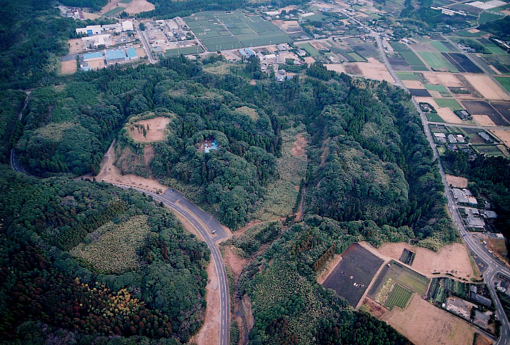
The aerial photo of Chiran Castle Ruins, quoted from the website of Minami-Kyushu City
Chiran Castle had four primary enclosures such as the Main Enclosure in the center and several sub enclosures around. Each enclosure was independent, surrounded by dry moats which were over 25m deep. If enemies wanted to attack the castle even from the plateau which was the same level as the top of the castle, they were prevented by the deep dry moats from attacking directly. They were eventually also counterattacked by the defenders from over 25m above. Some primary enclosures also had artificial defense system for their entrances , called Masugata. It refers to a square space at the entrance, where the route to the inside of the enclosure is not straight intentionally.
The relief map arountd the castle
The layout of Chiran Castle, quoted from the website of Minami-Kyushu City
History of Castle
The castle is said to be first built by the Sata Clan in the 14th Century. After that, the Ijuin Clan took the Chiran area including this castle from the Sata Clan in the 15th Century, but their master, the Shimazu Clan gave it back to the Sata Clan. In 1591, the clan was punished due to being against the Act to Ban Piracy and was banished from the castle again, but came back to the castle in 1610. Finally, the castle was burned down by an accidental fire in the same period and the clan moved to the residences at the foot of the plateau following the domain’s policy. The castle was eventually abandoned. However, the clan seemed to maintain the castle ruins in some ways because ceramic-ware in the Edo Period after the abandonment was found by the excavation team.