21.江戸城その1~Edo Castle Part1

江戸城は間違いなく日本で最大の城です。なぜなら城が東京そのものになったからです。時々、外国からの旅行者の方は、どこに有名な城や城跡があるのかと尋ねられます。もし、そこが東京の中心地であるなら、もうそこは城の中かもしれません。
Edo Castke was definitely the largest castle in Japan, because it became Tokyo itself. Some foreign tourists ask that where famous Japanese castles and ruins are. They may be standing among castles if they are in the center of Tokyo.

皇居正門石橋と伏見櫓~The Imperial Palace Main Entrance Bridge and Fushimi Turret

立地と歴史~Location and History

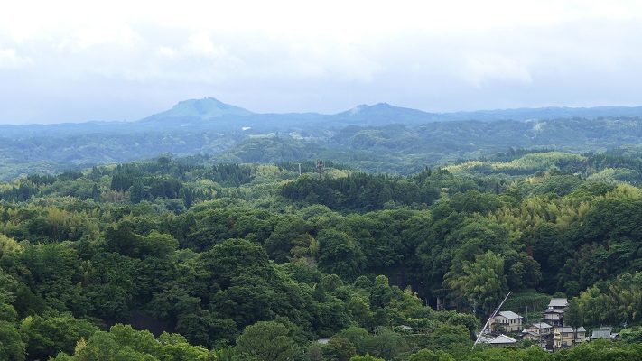
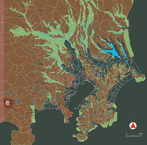
東京を含む関東平野には、中世までは大きな湿地帯がありました。この理由から、はるか昔の東海道は西日本から伸びてきて、 海を越えて房総半島に至っていました。利根、渡良瀬、隅田といった大河が直接江戸湾に注いでいたのです
The Kanto Plain including Tokyo had large waterlogged area until the Middle Ages. For this reason, the Tokaido road went from eastern Japan to Boso peninsula over the sea hundreds years ago. Large rivers like Tone, Watarase, and Sumida directly flow into what is now Tokyo Bay.

古代の関東平野の海岸線~The coastline of Kanto Plain in ancient times(licensed by Llhoi2013 via Wikimedia Commons

江戸城は1457年に太田道灌によって最初に築かれました。彼には敵との境界線であった利根川の近くに城を築く必要があったのです。その後この城は、戦国時代の間関東地方の支配者であった北条氏の支城の1つであり続けました。しかし、地理的な制約から武士たちの都とするには不十分でした。
Edo Castle was first built by Dokan Ota in 1457. He needed to build the castle near the border with his enemy, Tone River. After that, the castle had been one of the branch castles of the Hojo clan who were the ruler of Kanto region during the Warring States Period. But the castle still didn’t deserve warrior’s capital because of its geographical features.

太田道灌肖像画、大慈寺蔵~The portrait of Dokan Ota, owned by Daijiji Temple(licensed under Public Domain via Wikimedia Commons)

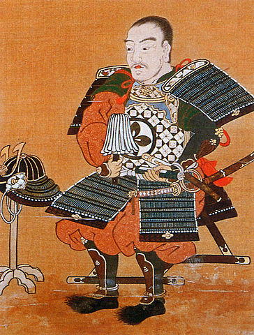
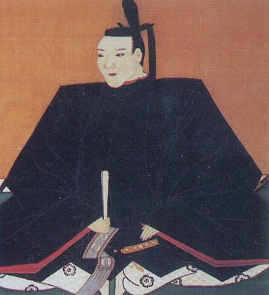
豊臣秀吉は1590年に北条氏を滅ぼし、徳川家康に対し、北条氏に代わり関東地方に転封するよう命じました。秀吉はまた、家康の首府として江戸を指定したと言われています。秀吉は、彼による攻撃を3ヶ月間も耐えた北条氏の首府、小田原に家康が居座るのを恐れたからといいます。
Hideyoshi Toyotomi defeated Hojo clan in 1590, and ordered Ieyasu Tokugawa to move to Kanto region instead of Hojo. It is said that he also designated Edo as Ieyasu’s capital because he feared Ieyasu would settle at Hojo’s capital Odawara which could withstand Toyotomi’s attack for three months.

豊臣秀吉肖像画部分、加納光信筆、高台寺蔵~part of the Portrait of Hideyoshi Toyotomi, attributed to Mitsunobu Kano, owned by Kodaiji Temple(licensed under Public Domain via Wikimedia Commons)

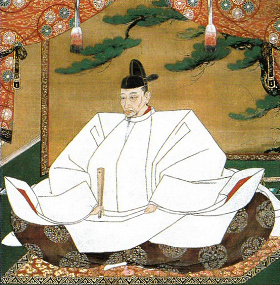
家康は江戸に到着した直後から、江戸城への驚くべき大改造を開始しました。これは、日本人による湾岸地域での都市作りの初めての試みと言われています。
Immediately after Ieyasu arrived at Edo, he started an incredible renovation of Edo Castle. It is said that it was the first attempt for Japanese people to build a city on a waterfront area.

徳川家康肖像画、加納探幽筆、大阪城天守閣蔵~The Portrait of Ieyasu Tokugawa, attributed to Tanyu Kano, owned by Osaka Castle Museum(licensed under Public Domain via Wikimedia Commons)

初期の江戸城は、現在の山の手地域にありました。現在の下町地域は、海面下か湿地帯でした。そして、江戸前島と呼ばれた砂州がありました。また、陸地と砂州の間には日比谷入江が入り込んでいました。
The first Edo Castle was in the present uptown area. The present down town area was below the Sea or waterlogged. There was a sand bank called Edo-Maeto. There was also the Hibiya arm of the sea between the land and the bank.

赤い線は現在の地図に残された江戸前島と日比谷入江の痕跡~The red line shows the remaining trace of Edo-Maetou and Hibiya Arm of the Sea on the present map

徳川家臣団は、水上交通のために江戸前島を横切る運河を掘り、川の流路を付け替えたりしました。彼らはまた、このような湾岸都市であったため、上下水道の設備も整えなければなりませんでした。その結果、江戸は水の都となったのです。
Tokugawa team created a canal across Edo-Maeto and change the route of rivers for water transportation. They also had to build a system for water supply and sewerage on such a waterfront city. As a result, Edo became a city of waterways.

戦前の東京の航空写真、まだ水路がたくさん残っていました~A aerial photo of Tokyo before the World War II, a lot of wateways still remained.

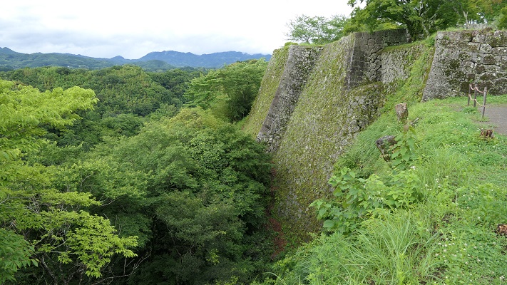
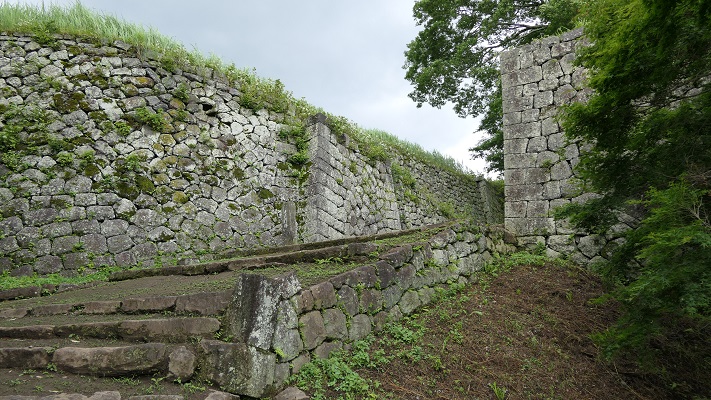
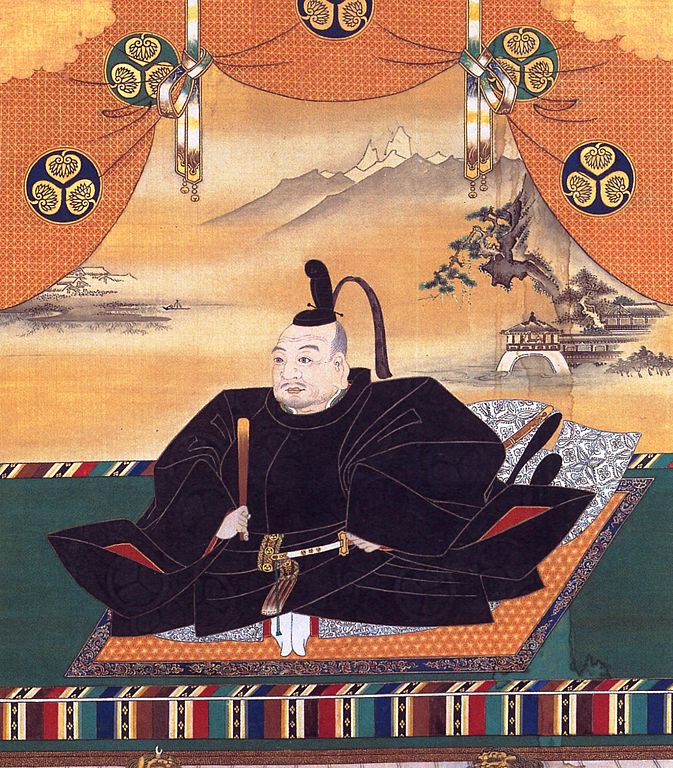
家康が1600年に天下を取った後、彼は全国の諸大名に天下普請と呼ばれる城の拡張工事を命じました。日比谷入江は城の用地拡大と防衛上の必要のため、埋め立てられました。この大規模な工事により、天守を含む多くの建物が作られ、多くの堀が掘られ、石垣が高く積まれました。
After Ieyasu got the power in 1600, he ordered lords of the whole country to improve the castle called Tenka-Bushin. They reclaimed Hibiya arm of the sea to spread the ground for the castle as well as the need for defense. Many buildings including Tenshu keep were built, many moats were dug, and high stone walls were built by the large scale construction.

「江戸図屏風」左隻部分、17世紀、国立歴史民俗博物館蔵~Part of “View of Edo” left screen. pair of six-panel folding screens, in the 17th century, owned by National Museum of Japanese History(licensed under Public Domain via Wikimedia Commons)

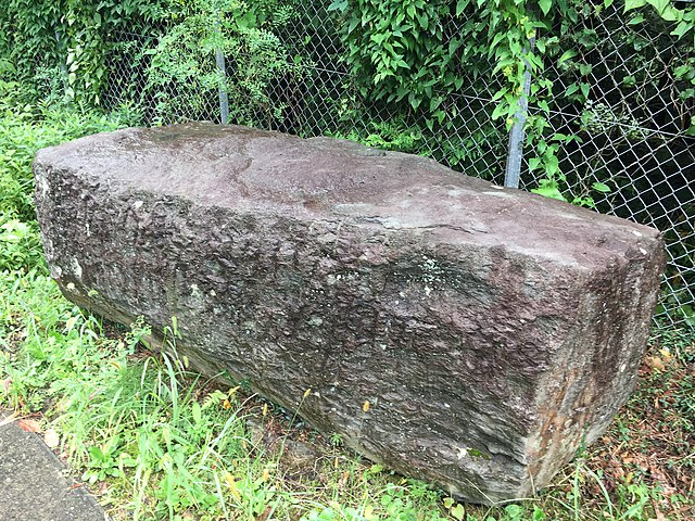
大名たちは少なくとも6万個もの百人石と呼ばれた4トン石を、伊豆半島から海を越えて江戸まで運ばねばなりませんでした。1603年から1660年まで続いた天下普請は江戸を日本一の大城郭に仕立てたのです。
These lords had to carry at least 60,000 four ton stones called Hyakunin-Ishi from Izu Peninsula to Edo over the sea. Tenka-Bushin between 1603 and 1660 resulted in Edo Castle being the largest castle in Japan.

伊豆半島に残されている江戸築城石~A quarry stone for building Edo Castle left in Izu Peninsula(licensed by GuchuanYanyi via Wikimedia Commons)

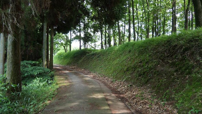
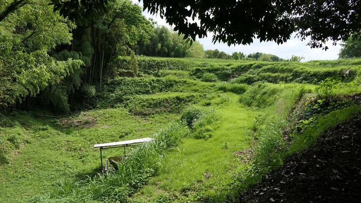
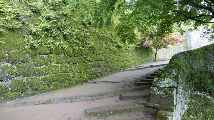
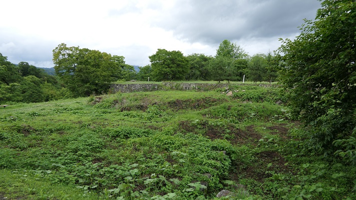
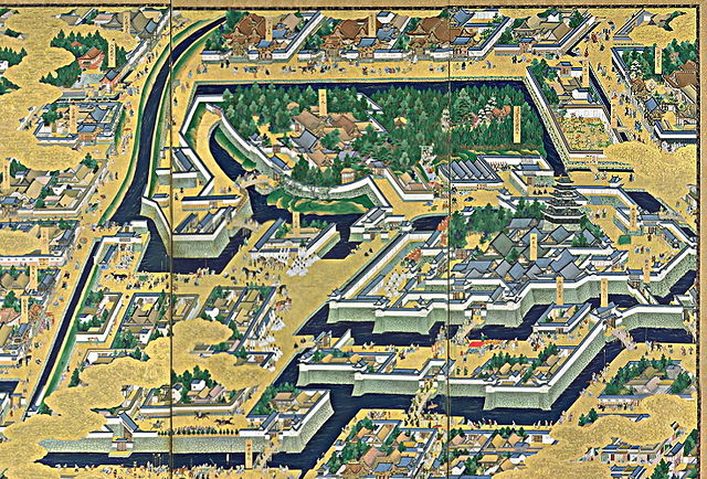
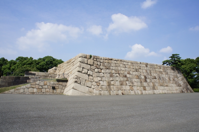
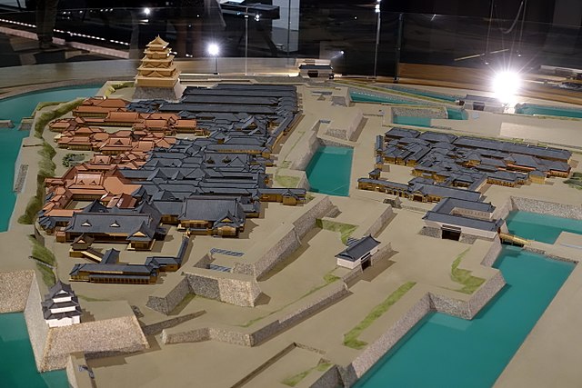
江戸城は、内郭と外郭に分かれていました。内郭は内堀の内側で、城の中心部分で、主要な曲輪である本丸、二の丸、西の丸から構成されていました。その外周は8km近くありました。そこには天守、それぞれの曲輪に御殿があり、そして警備のために多くの櫓や門がありました。
Edo castle was divided into Naikaku and Gaikaku. Naikaku was the inside of the inner moat, and consisted of the center portion of the castle including main enclosures Honmaru, Ninomaru, and Nishinomaru. Its perimeter was nearly 8 km. It had the Tenshu keep, halls for each main enclosure, many turrets and gates for security.

今に残る内郭部分の航空写真~The aerial photo of the remaining Naikaku portion

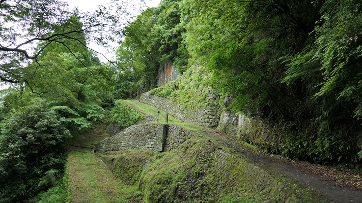
外郭は、外堀に囲まれていた区域で、その外周は約16kmもありました。見附と呼ばれた大型の門と橋のセットが約50ヶ所、主要街道と堀との交差点に置かれ、民衆と交通を監視していました。
Gaikaku was the surrounding area by outer moat whose perimeter was about 16 km, even including the city area. About 50 sets of a large gate and bridge called Mitsuke were placed at the intersections of the moat and major roads to check people and transportation.

江戸古地図上での外郭範囲~The range of Gaikaku on the old Edo map(licensed by Tateita via Wikimedia Commons)

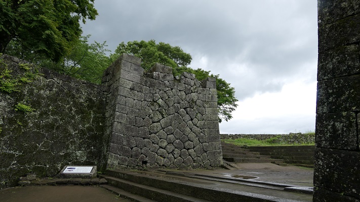
その完璧な構造にも関わらず、この城は敵からではなく、火災による被害を受けました。もっとも有名なのは1657年に発生した明暦大火です。この大火により、大半の江戸市域、江戸城、そして3代目の天守が焼け落ちました。大火の後、4代目天守の再建工事が開始されましたが、中止となりました。そのための天守台は今でも見ることができます。
Despite the perfect structure, the castle suffered not from enemies, but from fires. The most famous one was the great fire of Meireki in 1657. It burned out most of Edo City, Edo Castle, and the third Tenshu keep. After the fire, the rebuilding of a fourth Tenshu was launched, but canceled. We can now see the prepared Tenshu base for it.

4代目天守台~The base of the forth Tenshu keep(taken by 松波庄九郎 from photoAC)

将軍は本丸御殿に住み、統治を行いましたが、御殿も火災での焼失と再建を繰り返しました。幕末になってから、将軍は焼けた本丸御殿から通常は隠居した将軍が住む西の丸御殿に移らなければなりませんでした。予算がなかったからです。
Shogun lived and governed in Honmaru hall, but the hall was also burned down and restored several times. At the end of the Edo Period, Shogun had to move from the burned Honmaru hall to Nishinomaru hall where retired Shogun usually lived, because of the lack of money.

江戸東京博物館にある本丸と二ノ丸御殿の模型~The miniature model of Honmaru and Ninomaru halls at Edo-Tokyo Museum(licensed by Daderot via Wikimedeia Commons)

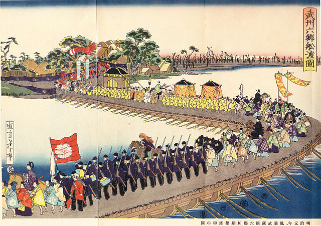
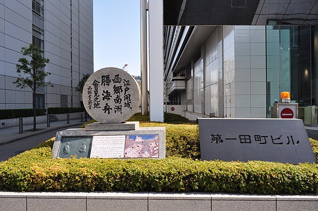
明治維新のとき、西日本の方で新政府と幕府の間で戦いが起こりました。結果として、西郷隆盛と勝海舟との会談が行なわれ、江戸城は新政府に平和裏に引き渡されました。
During the Meiji Restoration, a battle between the New Government and Shogunate was fought in eastern Japan. As a result, Edo Castle was handed over to New Government without war after the meeting between Takamori Saigo and Kaishu Katsu.

西郷・勝会談の記念碑~The monument of the meeting between Saigo and Katsu(licensed by 江戸村のとくぞう via Wikimedia Commons)

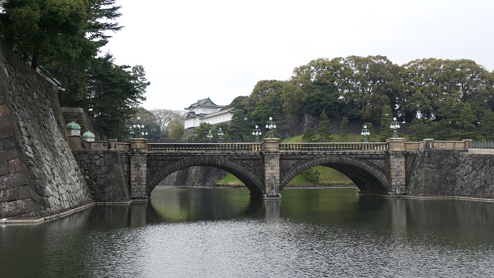
1869年、江戸は東京と名前を変え、日本の首都となりました。そして明治天皇が将軍と入れ替わりで、古都京都から東京の江戸城西の丸御殿に移りました。そのため、現在西の丸は皇居の一部となっています。
In 1869, Edo was renamed Tokyo which became the capital of Japan, before the Emperor Meiji move from old capital Kyoto to Nishinomaru hall of Edo Castle in Tokyo instead of Shogun. That’s why Nishinomaru is now part of the Imperial Palace.

明治天皇の東京到着を描いた錦絵~The picture that shows the arrival of Emperor Meiji to Tokyo(licensed under Public Domain via Wikimedia Commons)

「江戸城その2」に続きます。~To be continued in “Edo Castle Part2”

189.鞠智城~Kikuchi Castle

It was mysterious, but its achievement took root.
この城は不思議な存在でしたが、その成果は地域に根付きました。

外郭から見た復元された鼓楼~The view of the restored drum tower from the outline

立地と歴史~Location and History

鞠智城は西日本における古代山城の一つです。663年の朝鮮での白村江の戦いの後、朝廷によって築かれました。日本は百済国を助けようとしたのですが、唐と新羅の連合軍に敗れてしまったのです。天智天皇は連合軍の日本への侵攻を恐れ、山城の建設を命じ、それは百済からの難民の力を借りて行われました。そのため、これらの城は「朝鮮式山城」とも呼ばれています。
Kikuchi Castle was one of ancient mountain castles in western Japan. It was built by the Imperial Court after the Battle of Baekgang, Korea in 663. Japan tried to help Baekje, but was beaten by the ally of Tang and Silla. Emperor Tenchi was scared of invasion by the alley, so he ordered to build these castles with the help from the refugees from Baekje. That’s why these castles are also called “Korean style mountain castles”.

白村江の戦いの図~The map about the Battle of Baekgang(licensed by Samhanin via Wikimedia Commons)

鞠智城は、九州地方で記録されている5つの山城のうちの一つです。その他は、大野城、水城、基肄城、金田城です。これらの城は侵攻があった場合に想定される進路に沿って置かれました。しかしながら、鞠智城については少し変なのです。大野城が近くにある大宰府政庁からは60kmも離れていて、もう一つの想定攻撃路である有明湾からも30km離れていました。この城は補給基地であったとか、やはり有明での攻撃に備えたものだという人もいます。ある歴史家は、百済からの難民の収容施設だったのではないかと言っています。なぜならこの周辺地域は、百済との貿易や文化面で関わりがあったからです。事実、この遺跡の貯水池跡から百済観音像が発見されました。加えて、この場所は他の古代山城と比べて低い位置にあり、居住にも適していました。
Kikuchi Castle was one of the five recorded ones in Kyushu region. The others were Ono, Mizuki, Kii, and Kaneda. They had their locations on the way or alongside of expected routes for the invasion. However Kikuchi was a little strange. It was about 60 km away from the Dazaifu government, near Ono Castle, and nearly 30 km from Ariake Bay, another possible attack route. Some speculate it could have been a supply base or preparation for an attack on Ariake. A historian says that the castle could nave been an accommodation for refugees from Baekje, because the area around the castle had been related to Baekje’s in trading and culture. Indeed, a Baekje Buddha statue was excavated from the ruins of the water reservoir. In addition, this site is lower than other ancient mountains castles that made it livable for people.

九州地方の5つの記録された古代山城の位置~The location of five recorded ancient mountain castles in Kyushu region

その後侵攻の危機は去ったのですが、この城は10世紀まで約200年に渡って使われました。この城の歴史の後半においては、軍事拠点、政庁、それに倉庫として使われたようなのです。城の周辺地域は肥沃になり、貿易でも繁栄しました。城が廃城となって約300年後、菊池氏が日本の武士団の頭領となり、侵攻してきた蒙古軍と戦いました。
Despite the crisis of the invasion being resolved, the castle was used for about 200 years until the10th century. In the later stages of its life, it seemed to be an army base, government office, and storage. The area around the castle became fertile and prosperous with trading. About 300 years after the castle was abandoned, the Kikuchi clan fought with the Mongolian Invasion as the leader of Japanese warriors.

菊池武房、「蒙古襲来絵詞」より~Takefusa Kikuchi from “The picture scrolls of the Mongol invasion attempts against Japan”(licensed under Public Domain via Wikimedia Commons)

特徴~Features

近世の城が持つイメージとは違い、この城の主な構造物は、外周が3.5kmに及ぶ外郭部分です。そこには4つの門があり、その間には版築による土塁が続いていました。
Unlike the image of early modern age castles, the main structure of the castle is outlined with a perimeter about 3.5 km long. It had four gates and walls between them were made from rammed earth.

城周辺の地図~The normal map around the castle

外郭土塁の一部~Part of the earthen walls on the oitline

外郭沿いの歩道は現在トレッキングコースになっています。門跡を一つ一つたどっていくことで、城がどのくらいの大きさだったのかがわかります。
The path along the outline is now used for trekking. You can see the ruins of the gates one by one, and feel how large the castle was.

歩道は外郭の土塁に沿っています~The path goes alongside the earthen walls on the outline

駐車場から一番近いのは深迫門で、通用門として使われたとみられます。
The nearest one from the parking lot is Fukasako Gate which could have been used as the side entrance.

深迫門跡~The ruins of Fukasako Gate

次に現れるのは堀切門で、ここが正門だったようです。
The next comes Horikiri Gate which could have been the main entrance.

堀切門跡~The ruins of Horikiri Gate

池の尾門というもう一つの門跡まで見て回ることができます。
外郭の内側には、恐らく鼓楼として使われたであろう三層の塔があり、最近発掘の成果により復元されました。この塔は平面が八角形でした。これは百済から取り入れた様式であり、古代日本ではとても珍しいものです。
You can go ane see another ruins of gate called Ikenoo Gate.
Inside of the outline, the three-layer tower, probably used as the drum tower, has been restored recently with the success of excavation. This tower is octagonal which came from the Baekje style, making it very unique to ancient Japan.

復元された鼓楼~The restored drum tower

兵舎や倉庫といった別種の建物も復元されています。
Other types of buildings such as barracks and warehouses have also been restored.

復元された兵舎~The restored barrack(licensed by 小池隆 via Wikimedea Commons)
復元された倉庫~The restored warehouse(licensed by 小池隆 via Wikimedea Commons)

その後~Later Life

10世紀に廃城となった後、城跡は畠となりました。それもこの地域の繁栄を表しているのかもしれません。この地域が最初に遺跡として調査されたのは1937年のことでした。1967年から2010年に渡っては32回も発掘が行われました。それ以来、研究者はシンポジウムを開催し、この城についての議論を深めています。城跡は歴史公園「鞠智城」として整備されており、鼓楼などの建物が復元されています。
After being abandoned in the 10th century, the ruins of the castle were turned into a farm. That might have shown the prosperity of this area. This area was first researched as ruins in 1937. It was excavated 32times between 1967 and 2010. Since then, while researchers have held symposiums and debated issues with the castle, the ruins has been developed as a historical park called “Kikuchi Castle”. Several buildings such as the drum tower have been restored.

1970年代の城跡周辺の航空写真~The aeriel photo of the area around the castle ruins in the 1970s

最近の城跡周辺の航空写真~The recent aerial photo around the castle ruins

今でもまだ畠が少し残っています~Few farm still remains now

私の感想~My Impression

この城跡は西側に面しているため、晴れた日の夕方には美しい夕日を見ることができます。それは絶好の写真スポットでもあります。私としては、公園の中央にある復元建物を見るだけではなく、歩道に沿った門の跡も見て回っていただきたいです。もっとこの城のことが理解できるでしょう。できたら岡山県の鬼ノ城のように門の一つでも復元されたらと思います。そうすれば世界中から観光客を呼び寄せることも可能かもしれません。
As the ruins face the west direction, you can see the beautiful sunset on a sunny evening. It can also be a good photo spot. I recommend visiting the restored buildings at the center of the park as well as the ruins of the castle’s gate ruins along the sidewalk to know more about the castle. I hope a gate might someday be restored, like Ki-no-Jo in Okayama Prefecture. That way, the castle may attract many people from around the world.

復元された鬼ノ城の西門~The restored Western Gate of Ki-no-Jo

ここに行くには~How to get There

ここに行くには車がお勧めです。九州自動車道植木ICから約20分、熊本空港から約40分かかります。歴史公園に駐車場があります。
I recommend using a car to get there. It takes about 20 minutes from the Ueki IC on Kyushu Expressway, or about 40minutes from Kumamoto Airport. The park offers a parking lot.

リンク、参考情報~Links and References

歴史公園鞠智城・温故創生館(Only Japanese?)
・「古代山城「くくちのき(鞠智城)」九州王朝再興の夢舞台」松見正宣著、文芸社(Japanese Book)
・「古代山城 鞠智城を考える―2009年東京シンポジウムの記録」笹山晴生監修、山川出版社(Japanese Book)

95.岡城~Oka Castle

武士たちはこの「天空の城」を最後まで守り抜きました。
Warriors protected this “Sky” Castle till the end.

三の丸の高石垣~The high stone walls of Sannomaru

立地と歴史~Location and History

岡城には有名な古の武将、源義経にまつわる伝説があるのですが、定かではありません。南北朝時代になって、大友氏配下の志賀氏が最初にこの城を築いたと言われています。この城は、現在の大分県の「天神山」という岩山にあり、大野川と稲葉川という二つの川に挟まれていて、それらがこの城を難攻不落たらしめていました。事実、戦国時代後半に島津氏の攻撃を三度に渡り撃退しています。
Oka Castle has a legend about its origin of a famous ancient general, Yoshitsune Minamoto. However it is uncertain. It is said that in the period of Northern and Southern Courts, the Shiga clan under Otomo clan first built the castle. The castle was located on a rocky mountain called “Tenjin-Yama” in now Oita Prefcture, sandwiched by two rivers, “Ono-Gawa” and “Inaba-Gawa” making it impregnable. Actually, the castle repelled the Simadu clan’s attacks three times in the late Warring States Period.

城周辺の地図~The normal map around the castle

城周辺の起伏地図~The relief map around the castle

豊臣氏の支配下、中川秀茂が城主として派遣されました。城の範囲は山の全域に広がりました。彼はまた、天守、高石垣、そして大手門、近戸門、下原門という三つの門を作りました。そして城の西の方に、「竹田」という新しい城下町も作りました。
Under the Toyotomi clan’s governance, Hideshige Nakagawa was sent as the lord of the castle. The range of the castle was spread to the entire mountain. He also built the Tenshu keep, high stone walls and three entrance gates – Ote-Mon, Chikado-Mon, and Shimobaru-Mon”. He created the new castle town called “Taketa” in the west.

中川秀茂肖像画、碧雲寺蔵~The portrait of Hideshige Nakagawa, owned by Hekiunji Temple(licensed under Public Domain via Wikimedia Commons)

彼の子孫は、城と城下町を江戸時代を通して統治しました。そして戦いの準備のため、きびしい決まりを維持したのです。例えば、彼らは山の上の不便な住居に暮らし続けました。訪問者は門で厳密にチェックされ、入城を許されても藩士が常に付いて回りました。城内の畳は、籠城のときの食料とするため甘芋蔓によって作られました。岡城は山の上にあるため、頻繁な修繕を必要とします。更には火事や地震にも度々襲われました。その結果年貢は重くなり、百姓は「四原一揆」として知られる一揆を起こしたりしました。
His descendants continued to govern the castle and the town all through the Edo Period. They kept their strict rules to prepare for a battle. For example, they were living in inconvenient residences on the mountain. Visitors were checked very strictly at the gates, even if permitted to enter, clansmen always attended to them. Tatami mats were made from sweet-potato vines for food in case of a siege. Because Oka Castle was on the mountain it needed frequent maintenance. It often suffered from disasters like fires and earthquakes. Because of this taxes were high. The farmers rioted in an incident known as “Yoharu Ikki”

豊後国直入郡岡城絵図、江戸時代~The illustration of Oka Castle in Naoiri District, Bungo Province, in the Edo Period(出典:国立公文書館)

特徴~Features

現在、岡城の城跡には建物は残されていません。でも独特の雰囲気が漂っています。通常は遺跡の正門である「大手門」から入ります。石造りの曲がりくねった坂道が門の跡に通じています。
Presently, the ruins of Oka Castle have no buildings, but have a unique atmosphere. Visitors usually enter from the ruins of the main gate “Otemon”. A zigzagged slope made of stones leads you to the gate ruins.

岡城の正面入り口~The main entrance of Oka Castle

道の石造りの手すりは丸みを帯びていて「かまぼこ石」と呼ばれています。それはまた苔むしていて、とても美しく見えます。
Its stone fences are round-shaped and called semicylindrical stone “Kamaboko-Ishi”. They are also mossy and look very beautiful.

「かまぼこ石」と呼ばれる手すり~The stone fences called “Kamaboko-Ishi”
苔生した石垣と手すり~The mody stone walls and fences

門を過ぎると、「西の丸」と呼ばれた比較的広い場所があり、江戸時代には藩主の住む御殿がここにありました。
Passing through the gate, there is a relatively wide place called “Nishi-no-Maru” where the main hall for the lord was in the late Edo Period.

大手門跡~The ruins of Ote-Mon
西の丸跡~The ruins of Nishi-no-Maru

城跡の真ん中辺り、山が狭くなっている所が城の中心部分で高石垣に囲まれています。特に「三の丸」にある高石垣が観光客の間で有名です。でも、写真を撮るときは足元に十分気を付けてください。
In the center, you can see the main part of the ruins on a narrow hill surrounded by high stone walls. In particular, the ones in “San-no-Maru” are very popular among tourists. However, watch your step when taking pictures.

三の丸高石垣をもう一枚~Another shot of Sannomaru high stone walls

阿蘇山といった周りの景色の眺めも素晴らしいです。
You can also enjoy the surrounding landscape such as Mt.Aso.

城跡から見た阿蘇山の眺め~A view of Mt. Aso from the ruins of the castle
大野川に沿った道路を見下ろす~Overlooking the road along Ono River

城跡の裏側には「下原門」があります。この門は、志賀氏がいた時代には正面口として使われていました。
The back of the ruins are the gate “Shimobaru-Mon”. The gate was used as the main entrance in the Shiga clan’s Era.

下原門跡~The ruins of Shimobaru-Mon

反対側に戻ったら、通用門として使われた「近戸門」から外に出てみてはいかがでしょう。通用門といっても石組は精巧に作られています。「七曲り」と呼ばれた外に続くつづら折りは、石垣と石畳によりすごく見栄えがします。
Going back to the opposite, why not come out of the ruins of the gate “Chikado-Mon” which was used for the side gate, but its stone base has been elaborated. The outside winding road called “Nana-Magari” is good looking with stone walls and stone pavement.

近戸門跡~The ruins of Chikado-Mon
近戸門につながる道~The road connecting Chikado-Mon
近戸門下のつづら折り~The winding road under Chikado-Mon

Later Life

明治維新後、城を維持する必要はなくなりました。武士だった人たちは皆この不便な住居から町の方に移っていきました。城は荒廃しました。全ての建物は二束三文で売られていきました。若き作曲家、滝廉太郎はこの城跡を見て、有名な「荒城の月」を作りました。二の丸の地に彼の銅像があります。
After the Meiji Restoration, there was no need for keeping the castle. Former warriors all moved to town from this inconvenient residence. The castle ran to ruin. All the buildings in it were sold at a low price. A young composer, Rentaro Taki created a famous song called “Moon over the Ruined Castle” “Kojo-no-Tsuki” after looking at the ruins. You can see his statue at Ni-no-Maru.

二の丸跡にある滝廉太郎像~The statue of Rentaro Taki in the ruins of Ninomaru(licensed by As6673 via Wikipedia Commons)

地元の人たちは、1886年に最初に記念碑をこの地に建てました。1936年には、城跡は国の史跡に指定されます。現在、ここは桜の名所としても有名です。 Local people built the first monument in the ruins in 1886. They were designated as a National Historic Site in 1936. Now, they are known for cherry blossoms as well.

岡城跡の桜~The cherry blossoms in the ruins of Oka Castle(taken by kotoM from photoAC)

私の感想~My Impression

300年近くもの間、平和な江戸時代の間でさえ武士たちが岡城に住み続けたことにとても驚きました。彼らは長い間いつ起こるかわからない戦争のために備えていたのです。城を離れなければいけなくなったとき、武士たちがどう思ったのか知りたいところです。
I was surprised to know that warriors had been living in Oka Castle for nearly 300 years, even in the peaceful Edo Period. They were prepared for an unexpected war for a long time. I wish I was able to know how they felt when they had to leave the castle.

岡城の断崖~The cliff of Oka Castle

ここに行くには~How to get There

JR豊後竹田駅から歩いて30分近くかかります。
大分空港から臼杵駅まで:
大分駅行き空港アクセスバス(エアライナー)に乗り、大分駅でJR豊肥本線に乗り換えてください。
車で行く場合:大分自動車道大分光吉ICから約60分、または九州自動車道熊本ICから約90分。城跡には大きな駐車場があります。
It takes nearly 30 minutes From JR Bungo-Taketa station to get there on foot.
From Oita Airport to Bungo-Taketa st.:
Take the Airpor Eepress Airliner bus to Oita station, and transfer at the station for JR Houhi line.
If you want to go there by car: It takes about 60 minutes from the Oita-Mitsuyoshi IC on Oita Expressway, or about 90minutes from the Kumamoto IC on Kyushu Expressway. The ruins offers a large parking lot.

リンク、参考情報~Links and References

竹田市岡城跡(Only Japanese)
・「豊後岡城物語 義経、秀吉から「荒城の月」まで」吉田健二著(Japanese Book)
・「よみがえる日本の城20」学習研究社(Japanese Magazine)
・「歴史群像2015年12月号/戦国の城・豊前岡城」学研プラス(Japanese Magazine)