1.根室半島チャシ跡群~The ruins of chashi in Nemuro Peninsula

そこには確かにアイヌの人々がいたのです。
The Ainu people certainly lived there.

立地と歴史~Location and History

アイヌの人々とチャシ~Ainu people and Chashi

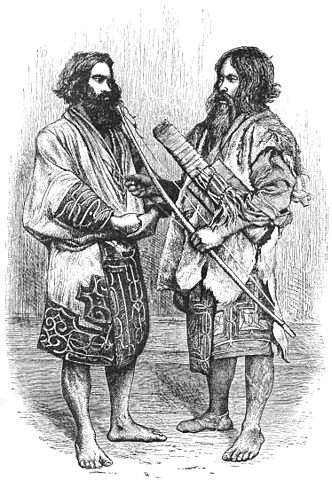
チャシはアイヌの人々によって築かれた城であると言われています。しかし詳細は不明のままです。彼らは文字を持たなかったからです。チャシとはアイヌ語で柵または柵で囲まれた場所を意味します。アイヌは北海道一帯に住んでいた先住民族で狩猟、漁撈、そして交易を生業としていました。彼らの出自もまた明らかではありませんが、13世紀頃までには独自の文化を確立したようです。そしてサハリンから千島列島に至る広大な範囲でその存在を示したのです。
Chashi are said to be castles which were built by the Ainu people, but the details are uncertain, because they had no written language. Chashi means fences or a fence line in Ainu language. Ainu are native people around Hokkaido who earned a living by hunting, fishing, and trading. Their origin is also uncertain, but they seemed to establish their own culture around the 13th century, and had a presence in a large area ranging from Sakhalin to the Kuril Islands.

イザベラ・バードによるアイヌ男性のスケッチ、19世紀~The painting of Ainu men, attributed to Isabella Lucy Bird, in the 19th Century(licensed under Public Domain via Wikimedia Commons)

発掘の成果によれば、500以上のチャシが16世紀から18世紀の間に築かれました。その当時、「サパネクル」と呼ばれたアイヌの頭領が、オホーツク、沿海州、日本の本州から来た日本人までも含む外国人との交易により力をつけていきました。これらの頭領たちがチャシを作ったと考えられています。多くのチャシは簡単な構造で、柵や空堀で囲まれた単一の曲輪でした。しかしながら、根室半島では、もっと複雑な構造の多くのチャシがありました。恐らくこの半島の頭領たちがより大きな勢力を持っていたからでしょう。
According to excavations, over 500 of Chashi were built between the 16th and 18th centuries. At that time, several heads of Ainu called “Sapanekuru” were increasing their power by trading with foreign people even form Okhotsk and Primorskii, and Japanese whose origin was the Japanese mainland. It is thought that these heads mainly built the Chashi. Many of Chashi were simple with one enclosure surrounded by a fence line and dry moat. However, in Nemuro Peninsula, there were a lot of Chashi which were more complex. It could be because the heads in the peninsula had more power than others.

城の位置~The location of the castle

なぜチャシが作られたか~Why were Chashi built?

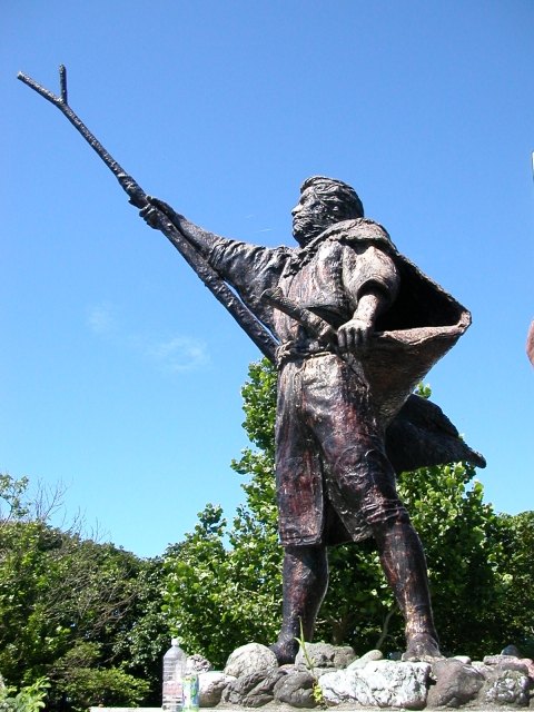
なぜチャシが作られたかについては、いくつかの説があります。もっとも広く知られているのは、「日本人」に抵抗する戦いの準備のためというものです。チャシが作られた地域が、17世紀に徳川幕府下の松前藩と実際に戦ったシャクシャインの勢力圏と一致しているからです。
There are several possible reasons for why Chashi were built. The most widely accepted theory is that they were built to prepare for battle against “Japanese”. This is because the area where they were built matches the influence area of Saksaynu who actually fought with Matsumae Domain under Tokugawa Shogunate in the 17th century.

シャクシャイン像~The statue of Saksaynu(taken by Yuka2018 from photoAC)

アイヌの頭領たちが交易で得た財物をめぐってお互いに争っていたからではないかという人もいます。進化したチャシには部外者が母屋に入るを防ぐための仕掛けが多く見られます。その建物には財物がしまってあったはずです。他には、祈祷所、祭りの場所、集会所、交渉の場所などが挙げられています。
Others point out that the heads of Ainu might have fought with each other over their properties gotten by trading. They found out that some advanced Chashi had many works to prevent outsiders from entering their main building. The building must have stored their properties. Other supposed reasons are for worship sites, festival grounds, public meeting places, places for negotiation, and so on.

ヲンネモトチャシの曲輪~An enclosure of Wonnemoto Chashi

アイヌの悲しい歴史~Ainu’s sad history

18世紀後半、松前藩の御用商人たちがアイヌの人たちを搾取しました。「メナシクル」と呼ばれた東北海道の若いアイヌの人たちがこれに激怒し、日本人に対して反乱を起こしました(クナシリ・メナシの戦い)。彼らはまたアイヌの年長の頭領たちに対しても不満があったとされています。チャシはこの戦いに備えて完成したのかもしれません。多くのアイヌと日本人がこの戦いで殺され、負傷しましたが、最後は松前藩により鎮圧されました。
In the late 18th century, the merchants, who were agents of Matsmae Domain, exploited Ainu people. Young Ainu people in eastern Hokkaido called “Menashikuru” were very angry about it and rebelled against Japanese (Menashi-Kunashir Rebellion). They were supposed to be also angry at the old heads of Aine. Their Chashi might have been completed for the battle. Many of Ainu and Japanese were killed and wounded in the battle, and lastly Matsumae Domain put down the rebellion.

乱で亡くなった日本人の墓碑~The tombstone of the Japanese killed in the rebellion

その後、松前藩はアイヌに対して交易を制限し、その結果、アイヌの社会は縮小していきました。その一方で徳川幕府と近代の日本政府はアイヌを日本人に同化させる政策を行いました。アイヌの人口は19世紀までに劇的に減少しました。チャシは全て放棄され、そして忘れ去られました。
After that, Matsumae Domain forced Ainu to limit their trading, as a result, the Ainu community was declining. Meanwhile, Tokugawa Shogunate and the modern Japanese government had the policy to assimilate Ainu into Japanese. The population of Ainu significantly decreased by the 19th century. Chashi were all abandoned and have been forgotten.

チャシから望むオホーツク海~Sea of Okhotsk from a Chashi

特徴~Features

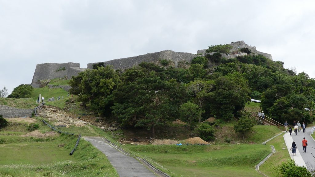
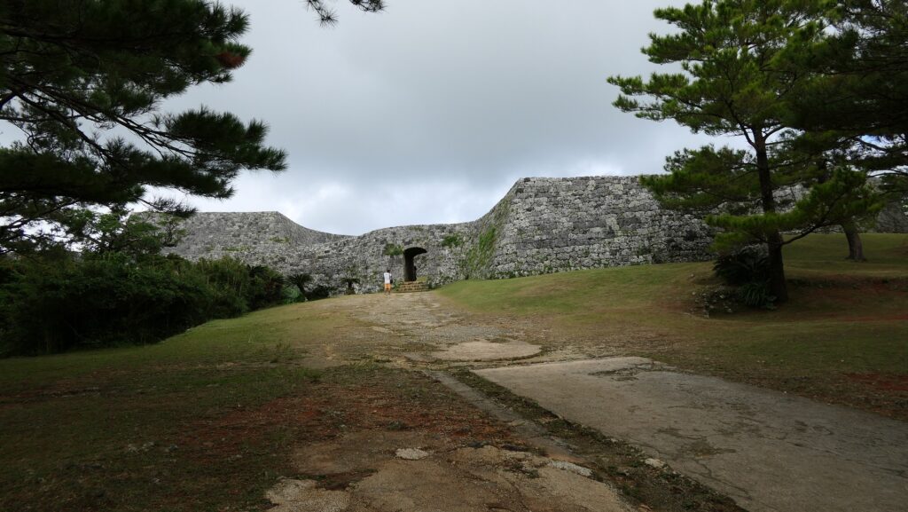
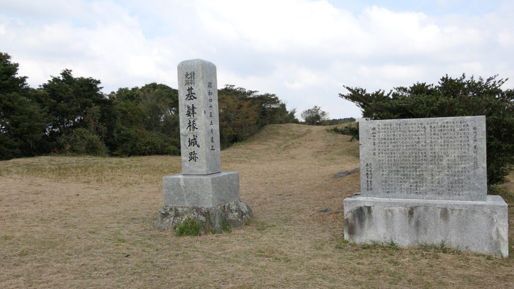
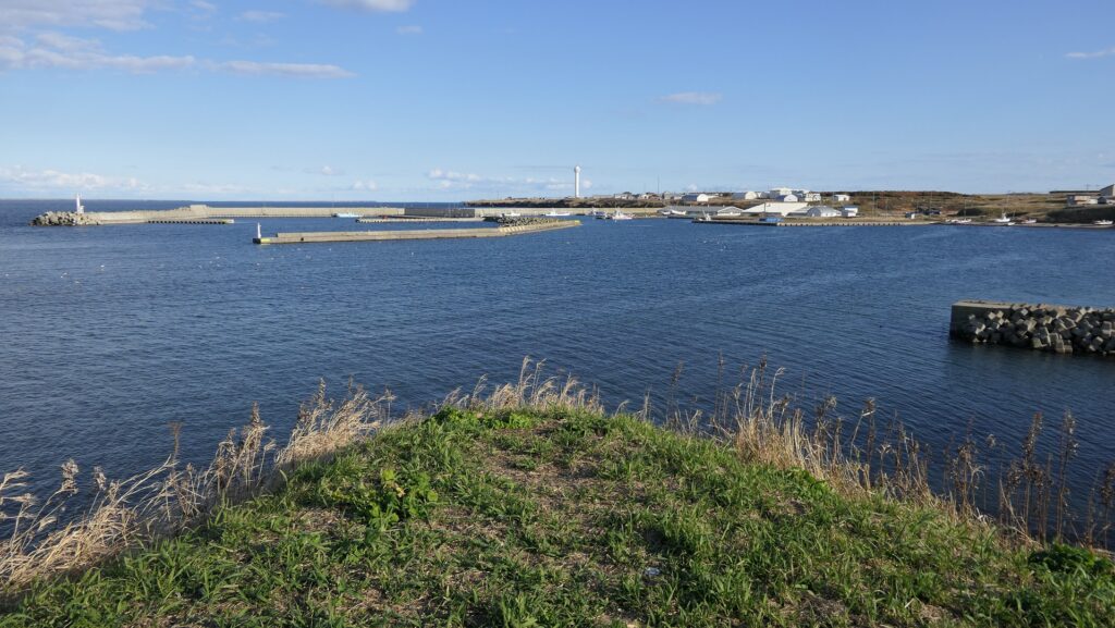
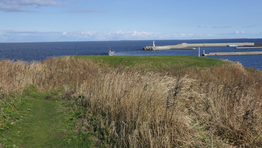
現在、根室市には30以上ものチャシ跡がありますが、そのうち24ヶ所が国の史跡に指定されています。そしてそのうちの2ヶ所が観光客向けに整備されています。
Now, Nemuro City has over 30 ruins of Chashi, 24 of them are designated as a National Historic Site, and two of them are developed for visitors by the city as below.

城周辺の地図~The map around the castle

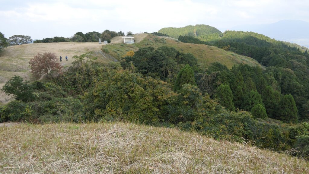
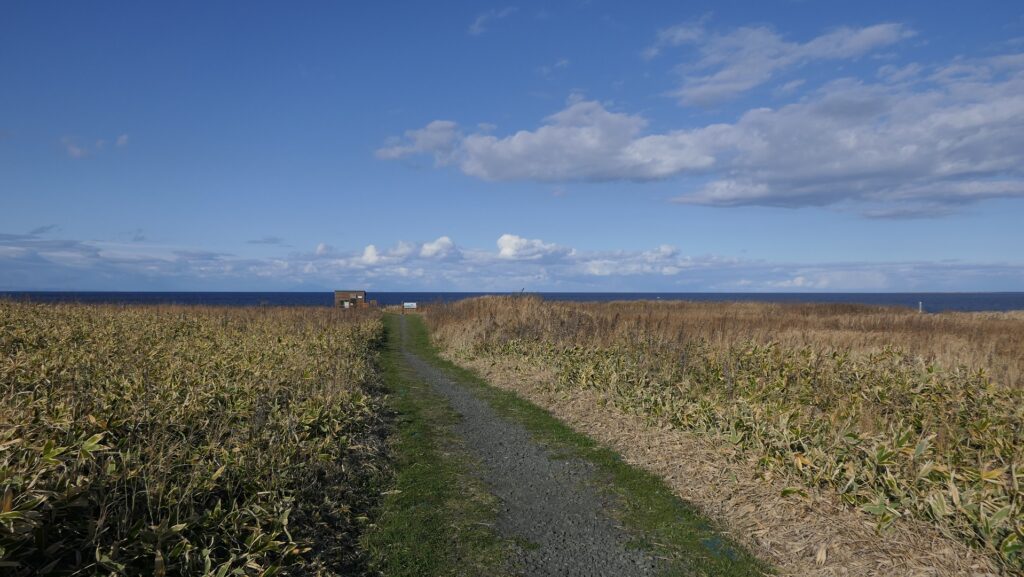
ノツカマフ1号、2号チャシ跡~Ruins of Notsukamafu N0.1 and No.2 Chashi

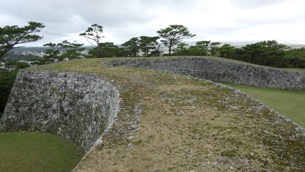
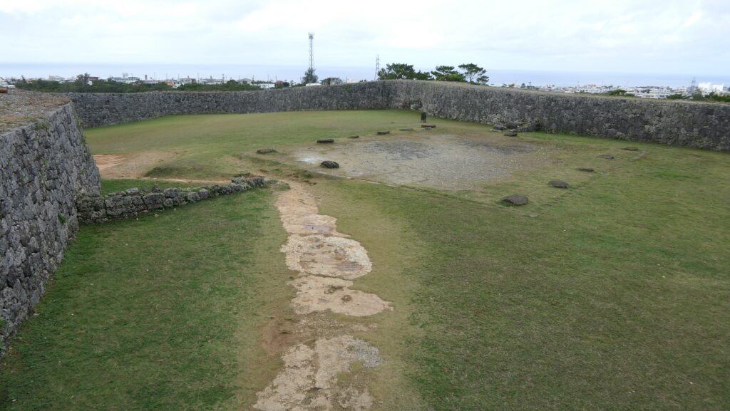
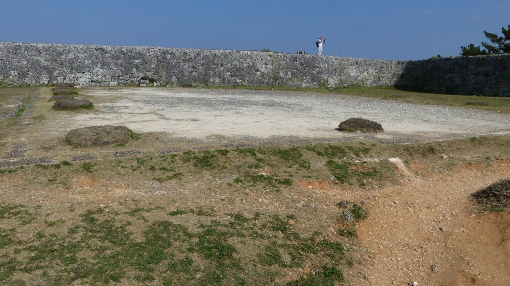
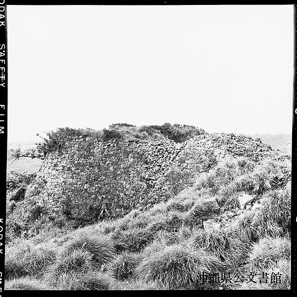
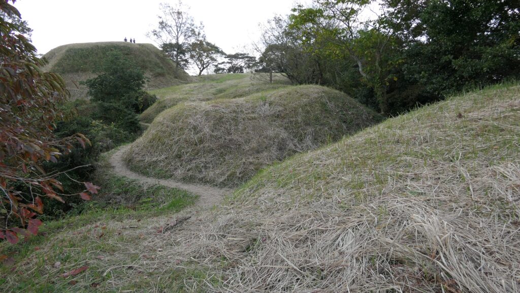
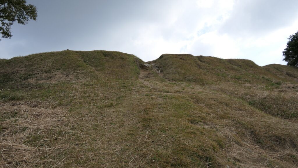
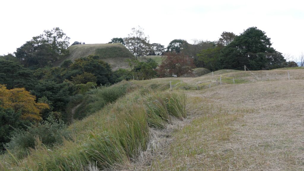
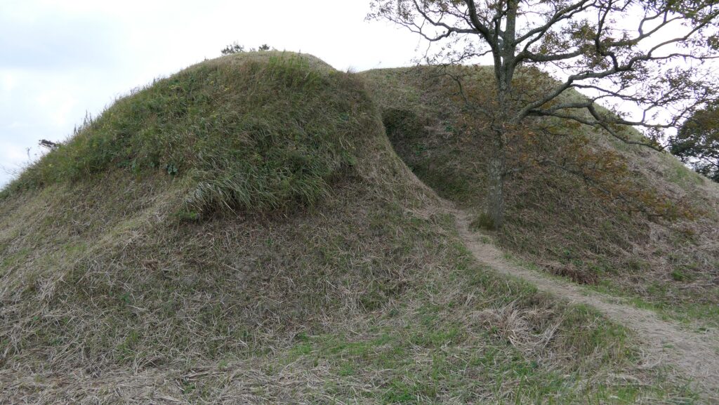
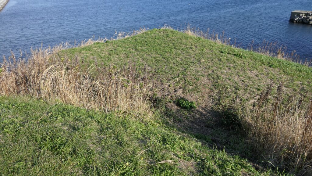
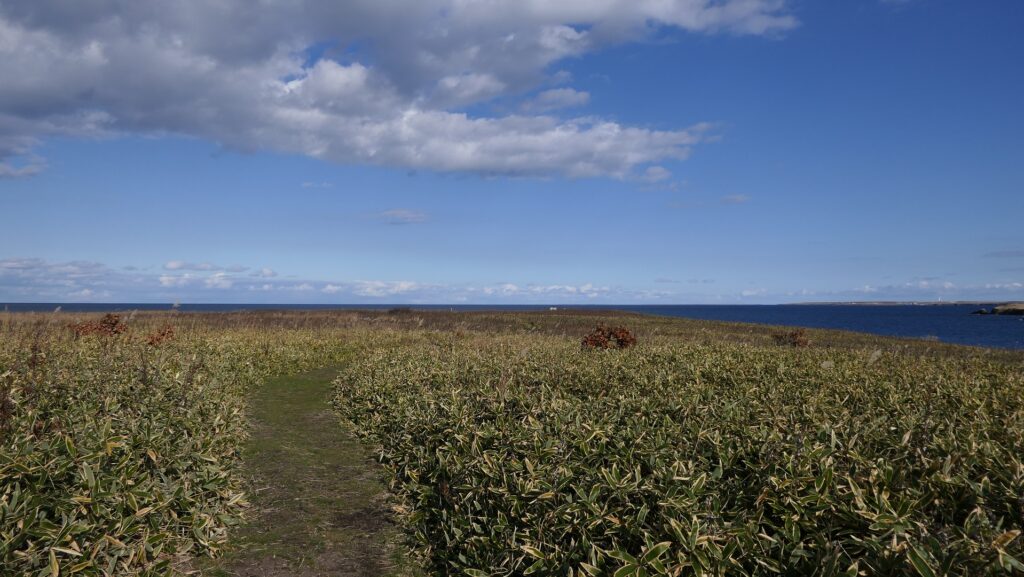
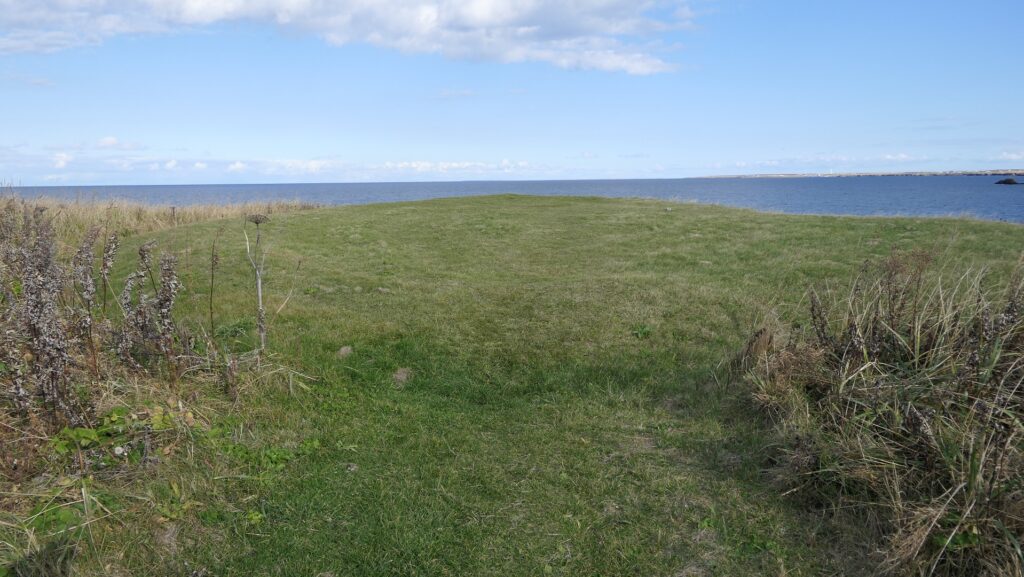
これらのチャシ跡はマップ湾に伸びるノツカ岬上にあります。1号チャシは、直径が約30mあり、2~3mの深さの空堀により隔てられ且つ囲まれた2つの丸い曲輪から構成されます。そのうちの一つには土橋を渡って入っていくことができます。
The ruins of these Chashi are on a cape Notsuka extending from Mappu Bay. No.1 Chashi consists of two round enclosures with a diameter of around 30m, divided and surrounded by 2 to 3m deep dry moats. You can enter one of them through an earthen bridge.

城周辺の航空写真~The aerial photo of around the castle

遺跡への入口~The entrance to the ruins
遺跡に続く小径~The trail which leads to the ruins
1号チャシへの土橋~The earthen bridge to No.1 Chashi
1号チャシからの眺め~A view from No.1 Chashi
1号チャシのもう一つの曲輪~Another enclosure of No.1 Chashi

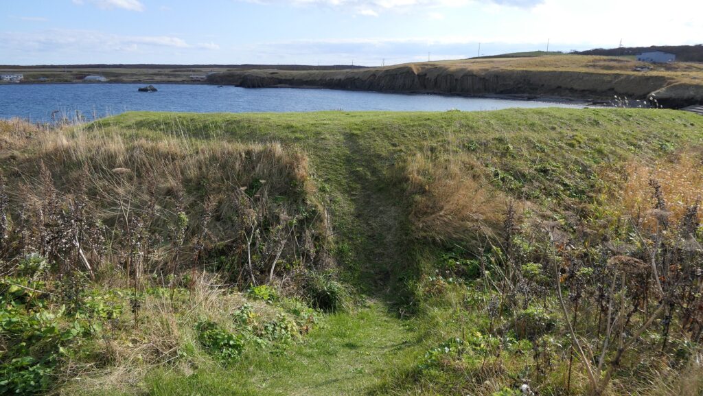
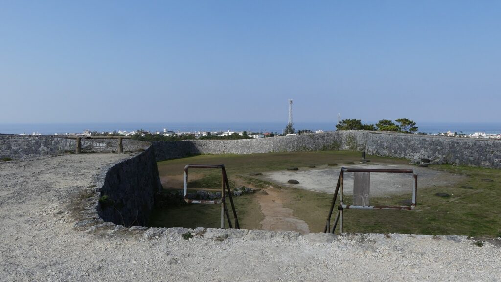
2号チャシはもっと浅い空堀に囲まれた単一の丸い曲輪から成ります。そのため、この曲輪は未完成だったのではないかとも言われています。ノツカマフは、クナシリ・メナシの戦いでのアイヌの指導者が処刑された場所です。
No.2 Chashi has a single round enclosure with a more shallow dry moat surrounding it, so it is said that it might have been uncompleted. Notsukamafu is where the Ainu leaders of Menashi-Kunashir Rebellion were executed.

2号チャシ~No.2 Chashi
2号チャシの端部分~The edge of No.2 Chashi

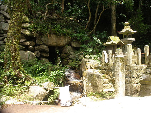
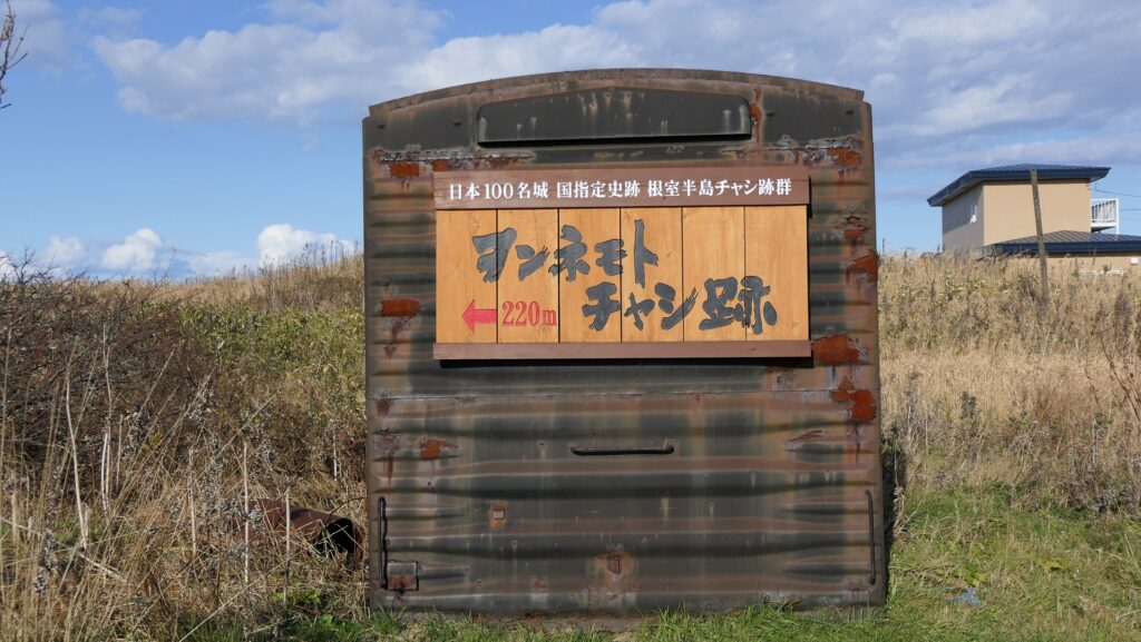
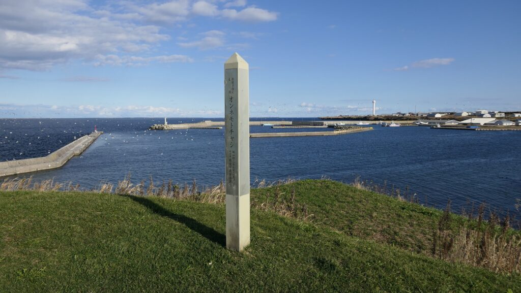
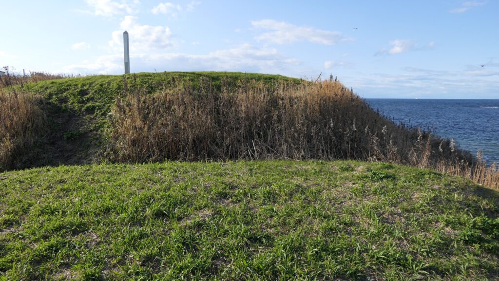
オンネモトチャシ跡~Ruins of Wonnemoto Chashi

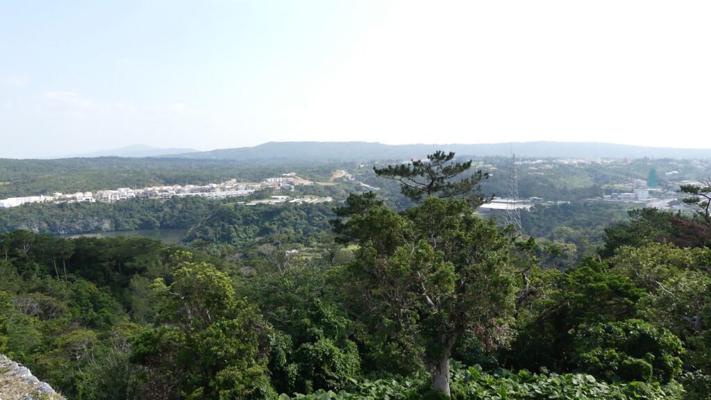
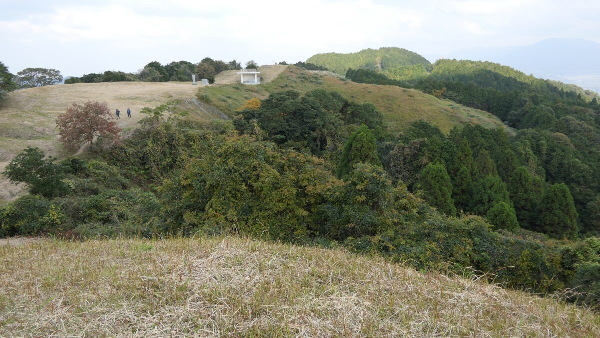
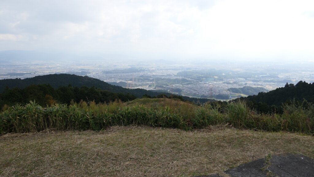
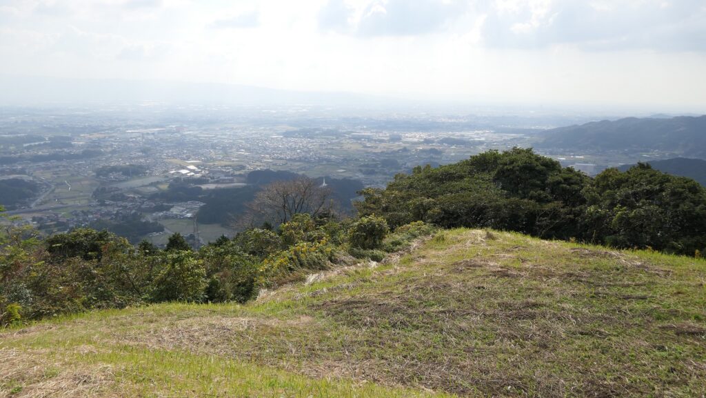
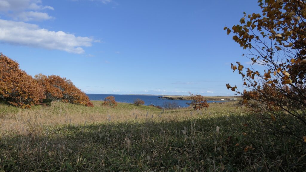
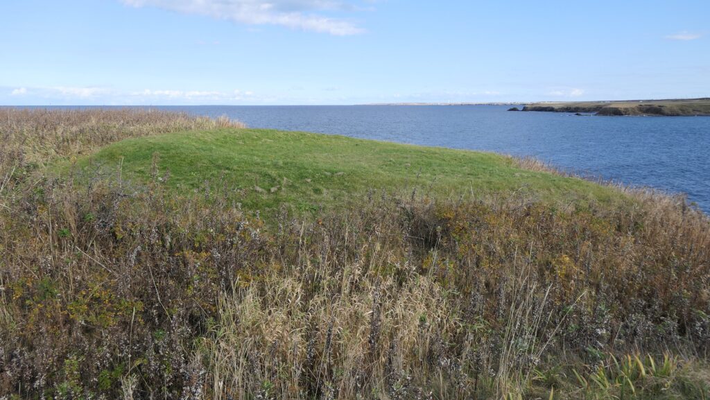
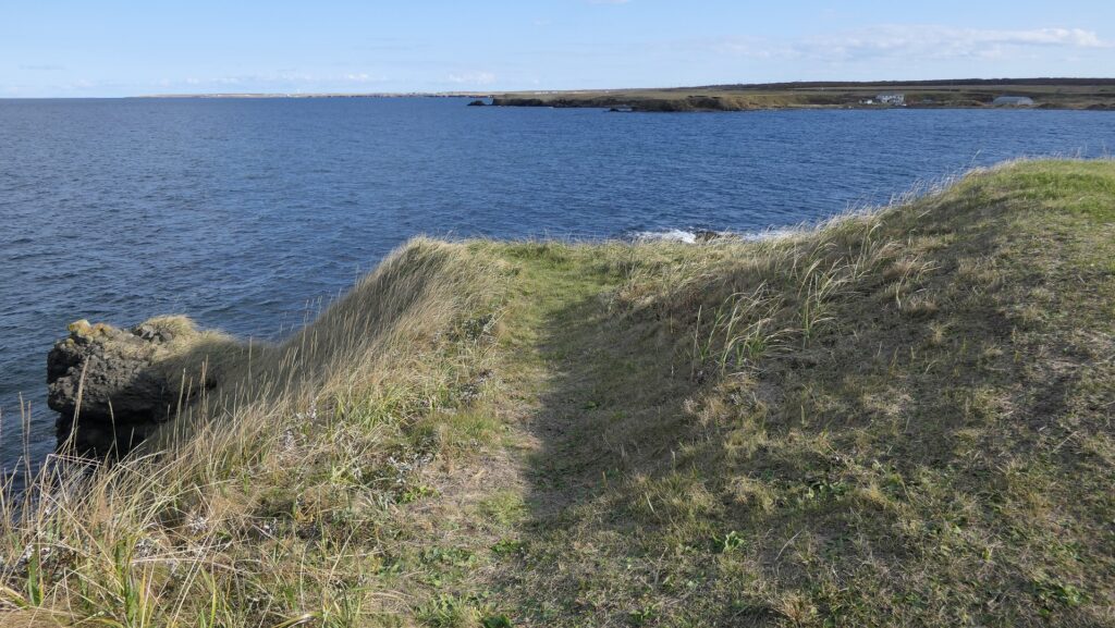
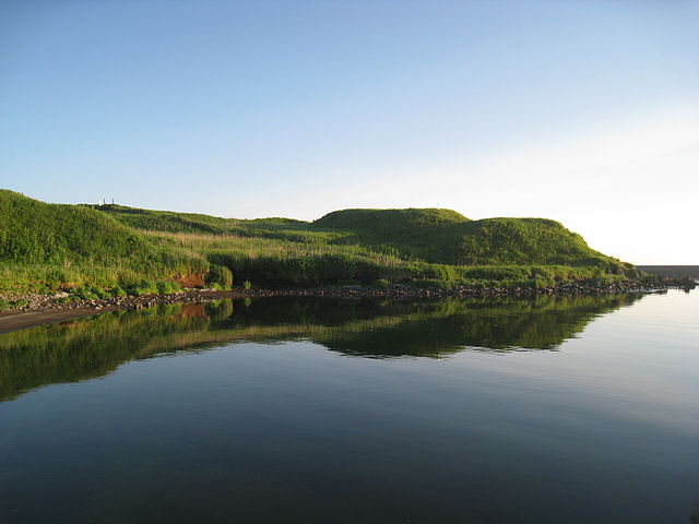
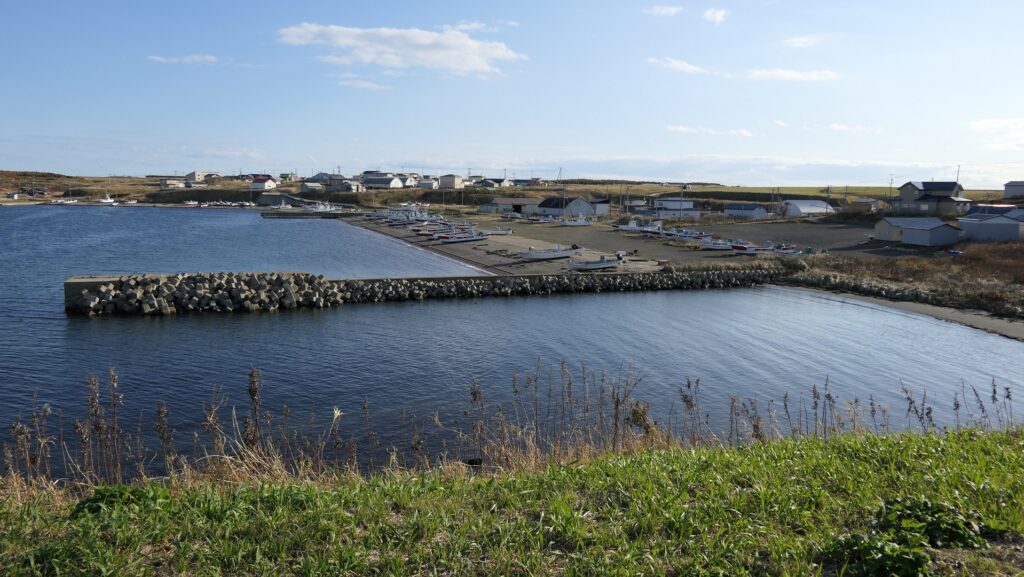
この遺跡は、温根元湾の西側から突き出た岬の上で、階段状の2つの平面から構成されます。湾の東側にある温根元漁港から見ると、なかなか壮観です。その平面は、四角く成形された曲輪で、これらもまた空堀により隔てられ且つ囲まれています。岬の先端に巧みに盛られているのがわかると思います。これらの曲輪の上に立つと、北海道の大地とオホーツク海の雄大な景色が堪能できます。
The ruins are two flat surfaces of steps on a cape protruding from the western side of Wonnemoto Bay. They have a great view when you see them from the Wonnemoto fishing port on the eastern side. The surfaces are square shaped enclosures, also divided and surrounded by dry moats. You can see them well mounded at the top of the cape. When you stand on both of them, you can see a wild landscape of the land of Hokkaido and the sea of Okhotsk.

城周辺の航空写真~The aerial photo of around the castle

温根元漁港から見たオンネモトチャシ~Wonnemoto Chashi from the Wonnemoto fishing port(licensed by 1467jp via Wikimedia Commons)
遺跡への入口~The entrance to the ruins
遺跡に続く小径~The trail which leads to the ruins
ヲンネモトチャシの標柱~ The signpost of Wonnemoto Chashi
2段になっている曲輪~The two step enclosures
温根元漁港~The Wonnemoto fishing port
遺跡からの眺め~A view from the ruins

その後~Later History

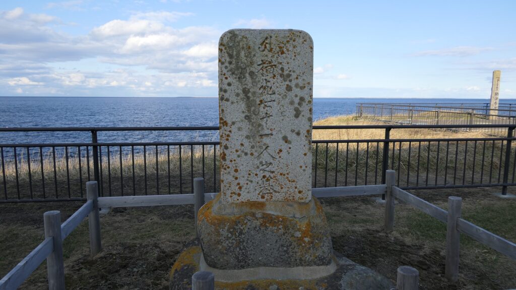
チャシの研究が進んだのは1970年代からです。歴史家が日本人や外国人が記録した古書や文書を紐解いたのです。残っているアイヌの口述歴史を調査した人もいました。行政側も北海道中のチャシ跡の発掘を進めています。その結果、根室市一帯には多くの進化したチャシがあり、歴史上の事件にも関わっていることがわかりました。市にある24ヶ所のチャシが1983年に「根室半島チャシ跡群」として国の史跡に指定されました。
The study of Chashi has been improved since the 1970s. Some historians researched old books and documents Japanese or foreign people recorded. Others investigated the remaining oral history of Ainu. Local governments have been excavating the ruins of Chashi across Hokkaido. They found out that the area around Nemuro City had many developed Chashi which are also related to the historical events. The 24 of Chashi in the city were designated as a National Historic Site called “The ruins of Chashi in Nemuro Peninsula” in 1983.

オンネモトチャシとオホーツク海~Wonnemoto Chashi and Sea of Okhotsk

私の感想~My Impression

最初にチャシ跡に立ったときには、正に地の果てに来たという感じがしました。根室市は実際、日本が南千島列島は自分の領土だと主張しているにしても、事実上ロシアとの国境の最前線にあります。しかしアイヌの歴史を学んでみると、アイヌにとってオホーツクは開かれた海だったのです。彼らには国境などないからです。チャシは最終的には日本人との闘いのために使われたのかもしれませんが、彼らなりのやり方でチャシを築き、繁栄した時期もあったのです。もし日本とロシアの間の懸案が解決された折には、開かれた海は北海道の地に戻ってくるのでしょうか。
When I first stood on the ruins of Chashi, I felt like I came to the edge of the earth. Nemuro City is actually in front of the border between Japan and Russia, though Japan insists that south Kuril Islands belong to it. After I learned about the Ainu history, I think that Okhotsk was an open sea for Ainu, because they had no border. Chashi might have lastly been used for battle with Japanese, but they had prospered by building Chashi in their own way. I wonder if the problem between Japan and Russia was resolved, the open sea could come back to Hokkaido.

日本最東端の地、納沙布岬~Nosappu Cape, The easternmost tip of Japan

ここに行くには~How to get There

これらの遺跡に行くには、車を使うことをお勧めします。
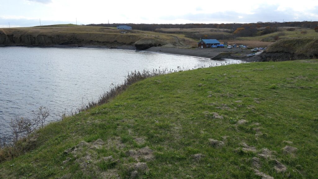
ノツカマフとオンネモトの遺跡跡は両方とも根室半島北海岸の道道35号線沿いにあります。両方の遺跡の入口前に小さな駐車スペースがあります。根室駅から約30分位のところです。
I recommend you to visit them by car.
Both the ruins of Notsukamafu and Wonnemoto are alongside Hokkaido Prefectural Route 35 in the northern coast of Nemuro Peninsula. There is a small parking lot in front of the entrance of the both ruins. It takes about 30 minutes from Nemuro Station.

リンク、参考情報~Links and References

根室半島チャシ跡群、根室市観光協会(Nemuro City Tourism Association)
・「列島縦断「幻の名城」を訪ねて/山名美和子著」集英社新書(Japanese Book)
・「歴史群像121号、戦国の城/道東のチャシ群」学研(Japanese Magazine)

199.座喜味城~Zakimi Castle

悲劇のヒーロー、護佐丸の城
A tragic hero, Gosamaru’s castle

立地と歴史~Location and History

護佐丸が作った~Gosamaru built it

座喜味城は、琉球諸島(現在の沖縄諸島)周辺に300以上築かれた「グスク」を呼ばれた大規模な要塞の一つです。沖縄本島西海岸の近く、高さ120mの丘の上に築かれました。そのため、この城は非常に戦略的な位置にあり、この島と海を広範囲に見渡すことができます。また、この城は誰がいつ築いたのか明確である数少ないグスクの一つなのです。
Zakimi Castle was one of the over 300 large-scale fortresses called “Gusuku” around the Ryukyu Islands (what is now Okinawa Islands). It was located on a 120m high hill near the western coast of the mid Okinawa Island. That’s why the castle had a very strategic location where wide views of the island and sea can be seen. It is also one of the few Gusuku which people know when and who built it.

城の位置~The location of the castle

「按司」と呼ばれた有力な領主の一人、護佐丸が15世紀初頭に最初にこの城を築きました。それ以前は、彼は別のグスク、山田城に住んでおり、後の琉球王国となる中山王国に仕えていました。1416年、中山王国が北山王国を倒した時、彼は多大な貢献をしました。その後、彼は北山(沖縄本島北部)守護職に任命されました。一方彼は新しい本拠地として座喜味城の築城を始めたのです。
One of the powerful lords called “Aji”, Gosamaru first built the castle in the first 15th century. Before that, he lived in another Gusuku called Yamada Castle, and worked under the Chuzan Kingdom, the later Ryukyu Kingdom. He made a significant contribution when the Chuzan Kingdom beat the Hokuzan Kingdom in 1416. After that, he was appointed as the military governor of the Hokuzan Region (the northern part of Okinawa Island), while he started to build Zakimi Castle as his new home base.

今帰仁城、北山王国の首都~Nakijin Castle, the capital of the Hokuzan Kingdom

護佐丸名を揚げる~Gosamaru made his mark

この城の下にある丘は、岩盤ではなく軟弱な地盤でした。しかし護佐丸は、美しい高石垣を伴う強力な城を築くことに成功したのです。この工事により、彼は勇猛な将軍としてだけではなく、優れた築城家としても知られるようになりました。彼は1422年にこの城に移り、18年間在城しました。貿易の統制を含め、この城の周辺地域を支配していました。
The hill under the castle was soft ground, not rocky, but Gosamaru succeeded in building a strong castle with beautiful, high stone walls. This construction made him a great castle builder as well as a brave general. He lived in Zakimi Castle for 18 years since moving to it in 1422. He governed the area around the castle, while controlling the trading near the castle.

座喜味城の石垣~The stone walls of Zakimi Castle

1440年、琉球王国は護佐丸に対して、座喜味城の東にある中城城に移るよう命じました。王国に対抗して力をつけていた別の有力按司、阿麻和利が島の東海岸にある勝連城にあったからです。護佐丸は、現在我々が素晴らしい城跡として見ているように、中城城をも改築したのです。彼はまた、王国の親戚筋にもなり、緊密に連携していました。
In 1440, the king of Ryukyu Kingdom ordered Gosamaru to move to Nakagusuku Castle, located east of Zakimi Castle, as another great Aji, Amawari, who lived in Katsuren Castle located in the eastern coast of the island, grew in strength against the Kingdom. Gosamaru also improved Nakagusuku Castle like we can now see the great ruins of the castle. He also became a relative of the Kingdom to work closely with it.

護佐丸が改築した中城城~Nakagusuku Castle which Gosamaru improved
阿麻和利がいた勝連城~Katsuren Castle which Amawari owned

護佐丸非命に倒れる~Gosamaru dies unnatural death

ところが、護佐丸は王国への反逆者とみなされてしまい、1458年に阿麻和利によって滅ぼされてしまいます。阿麻和利から攻撃されたとき、護佐丸は自身への疑いのことを聞き、嘆き悲しんで、阿麻和利と戦うことなく自ら命を絶ったといいます。阿麻和利が王国と護佐丸を騙したのだと言われていますが、詳細は不明です。発掘によれば、護佐丸が去った後の座喜味城は、16世紀まで使われたとのことです。
However, Gosamaru was considered a rebel against the Kingdom, and beaten by Amawari in 1458. When Amawari attacked, Gosamaru heard the doubt about him, felt very sad, and killed himself without fighting with Amawari. It is said that Amawari deceived the Kingdom and Gosamaru, but the details are uncertain. Zakimi Castle after Gosamaru left, was used until the 16th century, according to the excavation.

座喜味城~Zakimi Castle

特徴~Features

石垣の特徴~Features of stone walls

現在、座喜味城跡はよく整備され、また維持されています。この城にはもともと2つの曲輪しかなかったので、場所自体はそんなに広くありません。主には石垣が残っていますが、最高で13mの高さがあり、とても美しく見えます。曲線を描く石垣が、頂点部分でつながり、扇状に広がっています。このような形状は、軟弱な地盤を補い、頂点の部分は見張りや防御地点として使われたと言われています。それぞれの曲輪にはアーチ型の門があり、他の石をつなぎ合わせるために楔形の石が使われています。この方法は珍しい方法で、このため沖縄のグスクの中では、座喜味城の門は最も初期段階のアーチ門であると考えられています。
Now, the ruins of Zakimi Castle are well developed and maintained. The site is not so large, because the castle originally had just two enclosures. The stone walls mainly remain and look very beautiful with at highest 13m height. They are curved walls jointed by their apexes, spreading fan-wise. It is said that such a shape can cover the soft ground, and the apexes could be used as the points for monitoring and protecting. Each enclosure has an arch-shaped gate which uses a keystone connecting other stones. It is a unique method and Zakimi castle gates are thought to be the first case for arch-shaped gates among Okinawa’s Gusuku.

城周辺の航空写真~The aerial photo of around the castle

美しく屈曲している石垣~The beautiful curved stone walls
楔石を使ったアーチ型門~The arch-shaped gate using a keystone
城跡の入口~The entrance of the ruins

二の郭~Second Enclosure

城跡の入口に入って、石垣に囲まれた二の郭の門の方に歩いていきます。このアーチ門は現存しているもので、修復がなされました。郭に入ると、内側から美しい曲線からなる石垣が目に入ります。それから一の郭へと続く石段とアーチ型の門も見えてきます。一の郭の門は一旦破壊され、石段も埋められてしまいますが、両方とも現在では復元されています。
You can enter the entrance of the ruins and walk to the gate of the Second Enclosure, surrounded by the stone walls. Its arch shaped gate is the original and has been repaired. After entering the enclosure, you will see the beautiful curved shape of the stone walls from the inside. You can also see the stone steps to the First Enclosure and its arch shaped gate. The gate was once destroyed, and the steps were buried, but now both have been restored.

二の郭の入口~The entrance of the Second Enclosure
二の郭の内部~The inside of the Second Enclosure
一の郭から見た二の郭~The Second Enclosure from the First Enclosure
一の郭へ続く門~The gate to the First Enclosure

一の郭~First Enclosure

一の郭の内側は、二の郭と似た形ですが、礎石を伴った建物跡があります。もとあった建物は、瓦の破片が見つかっていないため、杮葺きか萱葺きであったようです。一部分の石垣の上には登ることができますので、東の方には島の、西の方には海の素晴らしい景色を眺めることができます。
Inside the First Enclosure, its shape is similar to the Second Enclosure. It has the ruins of buildings with cornerstones. The original buildings seemed to have a shingled or thatched roof, because pieces of roof tiles were not found. You can also go up to part of the top of the stone walls, then you will have a great view of the island on the east, and that of the sea on the west.

一の郭の内部~The inside of the First Enclosure
建物跡~The ruins of the buildings
一の郭からの海の眺め~A view of the sea from the First Enclosure
一の郭からの島の眺め~A view of the island from the First Enclosure

その後~Later History

座喜味城は長い間放置されてきました。第二次世界大戦の間、城跡は日本陸軍により高射砲陣地として使われていました。戦後になってさえ、米軍によってレーダー基地として再度利用されたのです。これは城跡がまだ戦略的に重要な場所にあったと言えるのかもしれません。しかし工事により遺跡の一部は破壊されてしましました。1972年の沖縄日本返還の後は、直ちに国の史跡に指定されました。ついには、2000年から琉球王国のグスク及び関連遺産群として世界遺産に登録されています。
Zakimi Castle had been abandoned for a long time. During World War II, the ruins were used by the Japanese Army as the ground for anti-aircraft guns. Even after the war, they were reused by the U.S. Military as a radar station. That might show the ruins still had a strategic location, but part of stone walls were destroyed due to the construction. The ruins were designated as a National Historic Site immediately after the reversion of Okinawa to Japan in 1972. Lastly, they have also been on the World Heritage List as Gusuku Sites and Related Properties of the Kingdom of Ryukyu since 2000.

1957年の座喜味城跡、沖縄県公文書館蔵~The picture of ruins of Zakimi Castle in 1957, owned by Okinawa Prefectural Archives(licensed under Public Domain via Wikimedia Commons)

私の感想~My Impression

初めて座喜味城を訪れたとき、城の石垣が完全に復元、修復されていることに驚きを感じました。この城の美しい曲線状の姿は完ぺきに沖縄の景色にマッチしています。また、城跡のとなりにあるユンタンザミュージアムに行ってみるのもお勧めです。この城のことをもっと知るともに、周辺の地域の歴史や文化を学ぶことができます。
When I saw the ruins of Zakimi Castle for the first time, I was surprised to see the stone walls have been completely restored or repaired. Their beautiful curved appearance perfectly matches the scenery of Okinawa Island. I also recommend you to visit Yuntanza Museum next to the ruins. You can learn more about the castle as well as the history and culture of the area around the castle.

石垣の曲線~The curved stone walls

ここに行くには~How to get There

ここに行くには車がお勧めです。
那覇空港から:
車の場合、那覇空港自動車道に名嘉地ICから入り、西原JCTで沖縄自動車道に合流し、沖縄南ICで降りてください。城跡はそこから30分程かかりますが、城跡周辺に駐車場があります。
I recommend you to visit it by car.
From the Naha Airport:
By car, enter Naha Airport Expressway at the Nakachi IC, join Okinawa Expressway at the Nishihara JCT, and get off the expressway at Okihawa-minami IC. The ruins are about 30 minutes away from the IC. There are parking lots around the ruins.

リンク、参考情報~Links and References

世界遺産座喜味城跡、ユンタンザミュージアム(Yuntanza Museum)
萩原さちこの城さんぽ 第10回 座喜味城(Only Japanese)
・「列島縦断「幻の名城」を訪ねて/山名美和子著」集英社新書(Japanese Book)

184.基肄城~Kii Castle

見張り台のような城
A castle like a lookout

立地と歴史~Location and History

古代山城の一つ~One of Ancient Mountain Castles

基肄城は、西日本にあった古代山城の一つです。663年に朝鮮で起きた白村江の戦いの後、朝廷により築かれました。日本は百済を助けようとしましたが、唐と新羅の連合軍に敗れたのです。天智天皇は、この連合軍による将来の侵攻の可能性を恐れ、百済からの難民の助けも借り、これらの城の築城を命じたのです。そのため、これらの城は「朝鮮式山城」とも呼ばれています。
Kii Castle is one of ancient mountain castles in western Japan. It was built by the Imperial Court after the Battle of Baekgang, Korea in 663. Japan tried to help Baekje, but was beaten by the ally of Tang and Silla. Emperor Tenchi, worried by the future possibility of invasion by this alliance, ordered the construction of these castles with the help of Baekje refugees. That’s why these castles are also called “Korean style mountain castles”.

白村江の戦いの図~The map about the Battle of Baekgang(licensed by Samhanin via Wikimedia Commons)

城特有の役割~Castle’s own Role

基肄城は、九州地方で記録がある五つのうちの一つです。その他は、大野水城麹池、そして金田です。それぞれの城には独自の役目がありました。基肄城は、物見のための城だったように思います。もし、連合軍が日本を攻めた場合、2つの考えられる侵攻ルートがありました。両方とも最初は金田城が築かれた対馬海峡にある対馬は通るでしょう。そして、壱岐島の辺りで2つに分かれることが推測され、一つは北の方角から博多湾経由で福岡平野に上陸し、もう一つは西の方角から有明湾経由で佐賀平野に上陸するものです。
Kii Castle was one of the five recorded ones in Kyushu region. The others were Ono, Mizuki, Kikuchi, and Kaneda. Each castle had its own role. I think Kii Castle was kind of a lookout castle. If the ally were to attack Japan, there would be two possible routes to enter from. Both would first pass through Tsushima Island on Tsushima Strait where Kaneda Castle was built. There are speculations that the routes may be divided around Iki Island, one would land on the Fukuoka plain through Hakata Bay from the north direction, and the other would land on the Saga plain through Ariake Bay from the west direction.

九州地方の5つの記録された古代山城の位置~The location of five recorded ancient mountain castles in Kyushu region

基山(標高404m)の上にあり、その頂上からは福岡、佐賀両平野が見渡せます。この城は主に佐賀の防衛の備えとされ、一方水城は福岡の方の備えとされました。基山には3つの峰(山頂、北峰、東峰)があり、南方になる谷を取り囲んでいました。それらの峰に沿って土塁が築かれ、その総延長は3.9kmありました。南側の谷には石垣が築かれ、排水口により水量を調整していました。城には4つの門があり、内側には倉庫や兵舎など多くの建物がありました。
Kii Castle was built on Kizan mountain (404m above sea level) and from its top both the Fukuoka and the Saga plains are visible. It was mainly prepared for the protection of Saga, while Mizuki was built for the protection of Fukuoka. Kizan mountain has three ridges (the top, the North Peak, and the East Peak) surrounding the valley on the south. The earthen walls were built along the ridges whose overall length was 3.9km. The stone walls were also built on the southern valley which had drains to control water. The castle had four gates and lots of buildings inside such as warehouses and barracks.

城周辺の起伏地図~The relief map around the castle

戦国時代に再利用~It was reused in Sengoku Period

古書によれば、基肄城は665年に築かれ、698年に修繕されました。結果的には連合軍は幸いにも日本を攻撃しませんでした。城の倉庫や兵舎は8、9世紀頃はで使われたとする歴史家もいます。15、16世紀頃、戦国時代として知られる時期には、その立地の良さから戦国大名によって再び城は使われました。
Old books say that Kii Castle was built in 665, and repaired in 698. As a result, the ally fortunately did not attack Japan. Some historians believe that the castle’s warehouses and barracks were used until around the 8th and 9th centuries. Around the 15th and 16th centuries which is also sometimes known as “Sengoku” Period or the Warring State Period, the castle was used again by some warlords, because of its good location.

戦国時代の城跡~The ruins of the castle in the Sengoku Period

特徴~Features

現在(2021年2月)、城跡の中心部に入ることと、全体を歩き通すことはできません。2018年の西日本での豪雨によりこの辺りが深刻な被害を受けたからです。行政がこの地域の道路と山道の通行を禁止しているのです。このため、観光客は行政が許可したいくつかの地点のみ見ることができます。それでは、現在行くことができる2つの地点をご紹介しましょう。
Now (in February 2021), it is impossible for anyone to enter the center of the castle ruins, and walk straight through the whole area. This is because the area was seriously destroyed by the heavy rain in western Japan in 2018. The local government bans the use of roads and trails in that area. For this reason, visitors are able to see only some spots that the Local Government has opened. I will describe two spots you can visit now.

城周辺の地図~The map around the castle

基山山頂~Summit of Kizan

ここは城の最高地点だった所で、土塁の西側部分に当たります。そしてまた戦国時代の城の本丸でもありました。その外側は急坂になっていて、現在ではグラススキー場のゲレンデとして使われています。山頂の麓には駐車場があり、城跡を訪れる際駐車することができます。15分程山頂の方に登っていくと、その途中に沢山の溝が見えてきます。それは何か入口のように見えるかもしれませんが、実は戦国時代の城主により作られた「いものがんぎ」と呼ばれる空堀跡なのです。
This was the highest spot of the castle and the western part of the earthen walls, as well as the Main Enclosure of the castle in Sengoku Period. The outside is steep slope, so it is now used as a grass ski ground. There is a parking lot on the foot of the summit where you can park your cars while visiting the ruins. Its 15 minutes climb to the top and on the way you will see many ditches . You may think they are some of the entrances, but they are, in fact, ruins of dry moats called “Imono-gangi”, made by the lord of the Sengoku castle.

土塁外側の急坂~The steep slope outside of the earthen walls
「いものがんぎ」と呼ばれる空堀跡~The ruins of dry moats called “Imono-gangi”

その空堀を越えていくと、土塁の上のよく開けた場所に至ります。土塁は南北に走っています。北の方角には基肄城を示す標識があり、福岡平野を望むことができます。
Over the dry moats, you will enter the widely open area, on the earthen walls. You can see the ridge of the mountain, the earthen walls, that goes both north and south. You can also have a view of the Fukuoka plain with the signboard of Kii Castle on the north.

基肄城の標識~The signboard of Kii Castle
福岡平野の眺め~A view of the Fukuoka Plain

次に、反対側の南の方角に向かってみると、人工の土盛りが見えてきます。これらは戦国時代の本丸の跡なのです。この本丸は山の頂に作られたのです。もう一つ、天智天皇に関わる記念碑がここにあります。山頂からは、佐賀平野を見渡すことができます。
Next, if you go to the opposite side on the south, you can find artificial mounds, which are also the ruins of the Main Enclosure in Sengoku Period. The Enclosure is situated on the top of the mountain. There is another monument for Emperor Tenchi. You can also see the Saga plain from the top.

南の方角を見る~Lookng at the south direction
戦国時代の本丸跡~The ruins of the Main Enclosure in Sengoku Period
天智天皇の記念碑~The monument for Emperor Tenchi
佐賀平野の眺め~A view of the Saga Plain

水門跡~Ruins of Water Gate

この場所は、城の南の部分に当たり、谷を埋めるため、水門と共に石垣が築かれました。石垣と水門の一部が今に残っています。ここに行くには違う道筋を進む必要があります。現存の石垣は全長26m、高さ8.5mあります。水門は石垣の下に設置され、住吉川の水を内側から外側に排出しています。
This spot was located on the southern part of the castle where the stone walls were built with the water gate to fill the valley. Part of the stone walls with the gate remain now. To visit them, you have to take a different route. The remaining stone walls are 26m long and 8.5m tall. The water gate is placed under the wall to drain the water of Sumiyoshi-gawa River from the inside to the outside.

水門跡~The ruins of the water gate(licensed by Wxrx via Wikimedia Commons)

その後~Later History

江戸時代(18、19世紀頃)においてでも、人々は基肄城が古代の遺跡であることを認識していました。というのは、公式の歴史書である「日本書紀」にこの城のことが記録されていたからです。城跡は最終的に1954年に国の特別史跡に指定されました。
Even in the Edo Period (around the 18th and 19th centuries), people recognized Kii Castle as ancient ruins, because the castle have been recorded in an official history book called “Nihon-Shoki”. The ruins were finally designated as a Special National Historic Site in 1954.

基肄城の土塁~The earthen walls of Kii Castle

私の感想~My Impression

私が基山山頂を訪れたとき、その山頂からは福岡・佐賀両平野の素晴らしい景色が見えました。そのときこの城はとても良い立地にあることが理解できたのです。役所によると城跡の中心地の道路は2022年3月までに復旧するとのことです。その後またこの城跡を訪れてみたいと思います。
When I visited the summit of Kizan, and saw great views both of the Fukuoka and Saga plains from the top, I really found out the castle had a very good location. The local government says that the roads in the center of the ruins will be repaired by March 2022. I would like to visit them again after that.

基山山頂付近~Around the top of Kizan mountain

ここに行くには~How to get There

ここには車で行くことをお勧めします。
九州自動車道の筑紫野ICから5km以内のところです。
もし基山町役場に立ち寄ることができれば、職員の方が城跡への道のりを詳しく教えてくれます。
I recommend you to go there by car at this point.
The ruins are within 5 km away from the Chikushino IC on Kyushu Expressway.
If you drop by at the Kizan Town hall, the officials will offer you the detailed routes to the ruins.

リンク、参考情報~Links and References

基肄城跡、基山町(Kizan Town Official Website)