Ruins can be accessible either from Seaside or Mountain side
Today, the ruins of Kaminokuni-Katsuyama Date have been well developed by Kaminokuni Town. The ruins spread from 70 to 110m high on the hill. You can access the ruins either on the Main Route near the seaside or on the Back Route near Iouzan Mountain which is 159m high.
The aerial photo around the castle
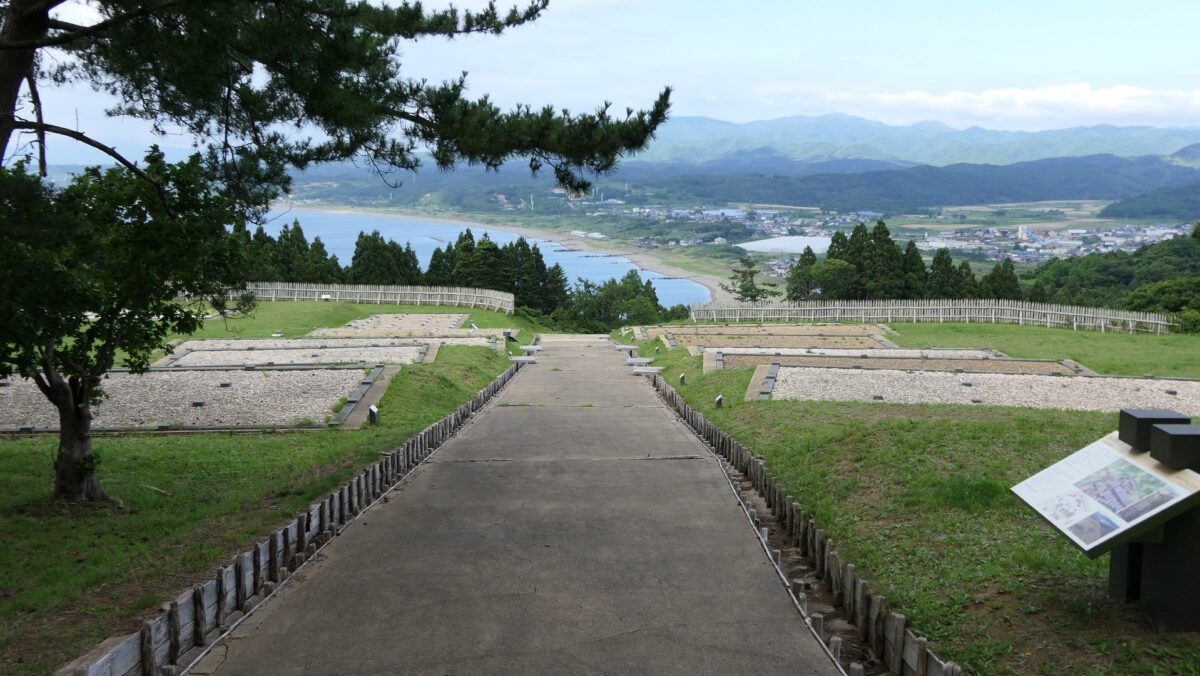
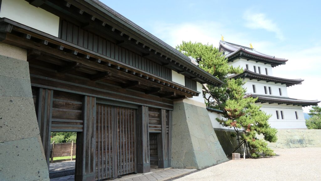
The Main Route
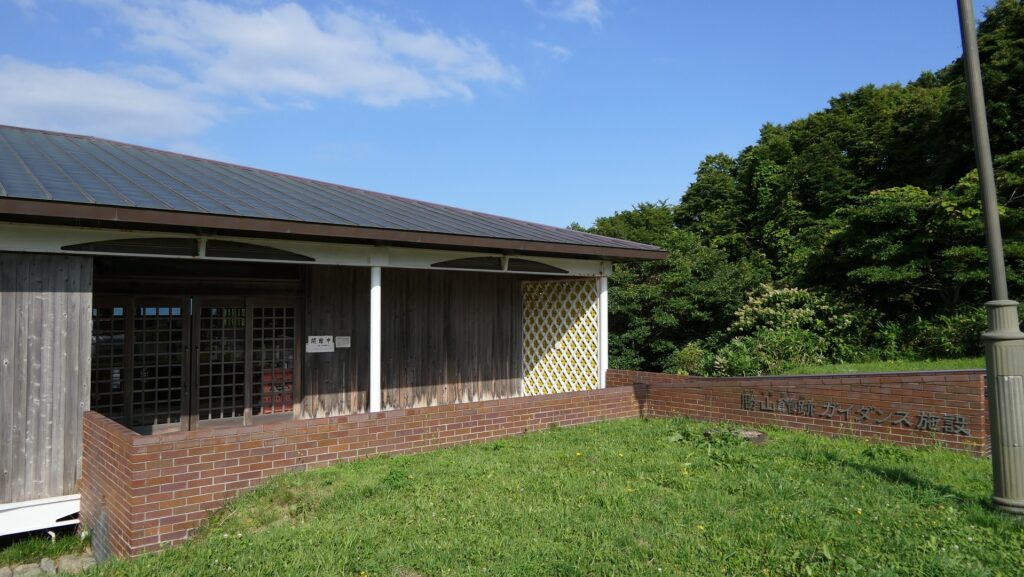
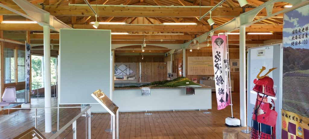
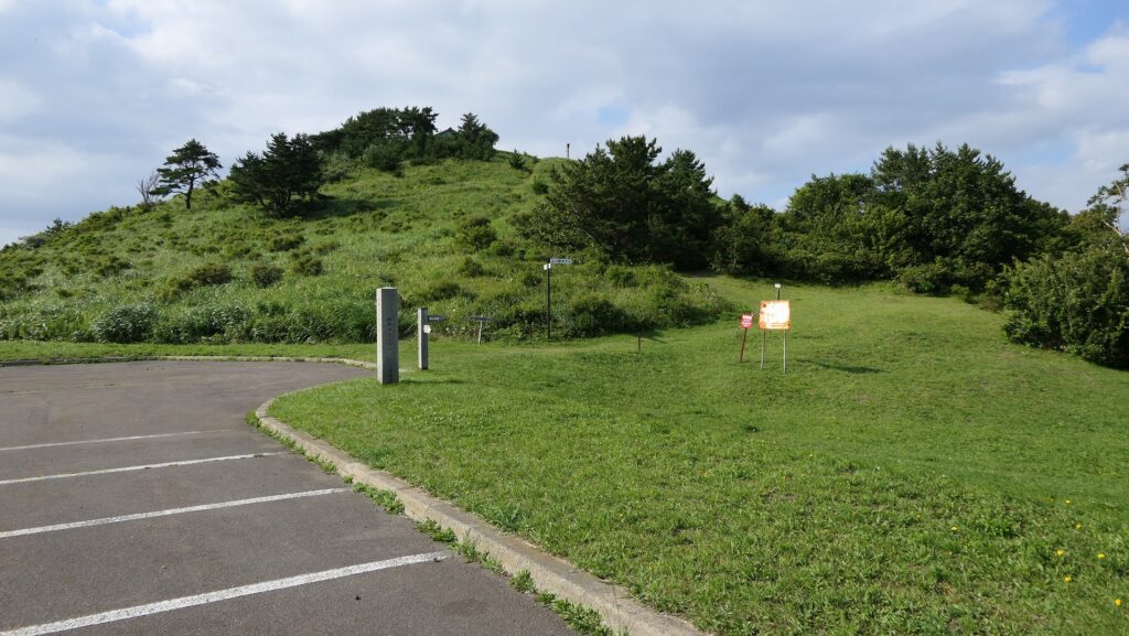
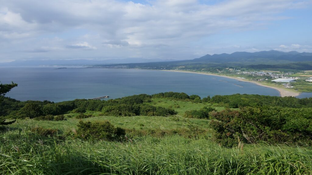
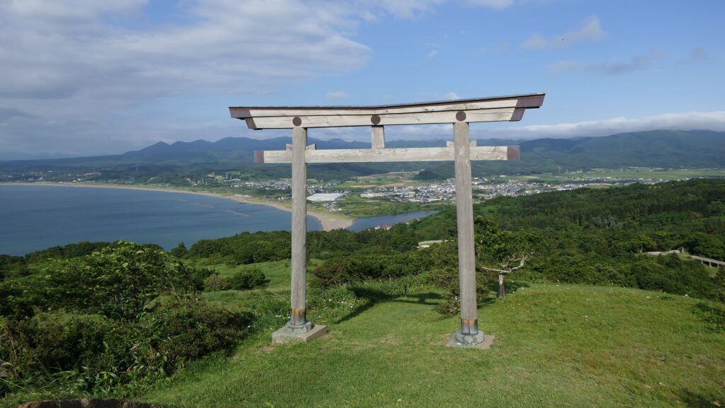
If you drive to the ruins, it may be better to park and visit the Katsuyama Castle Guidance Facility below the top of the mountain before going to the ruins. You can learn about the history and the findings of the hall. The mountain top has a good view of the sea and has the Iouzan Shrine as well which worships Nobuhiro Takeda, the founder of the hall. The top was thought to be used as the final part in case of an emergency.
The Katsuyama Castle Guidance FacilityThe interior of the guidance facilityThe top of Iouzan Mountain seen from the parking lotA view from the topThe Iouzan Shrine gateway on the top
Going to Back Route and Back Gate from Mountain
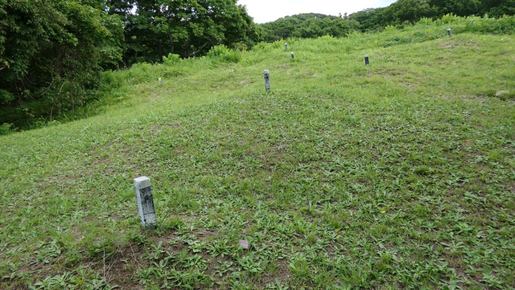
From the facility, you can walk to the Back Gate of the hall ruins passing the Iouzan Tombs which have over 600 burial mounds. Many of them are for Buddhists which are related to the mainland Japanese, but some of them are for the Ainu people. This is one of the reasons that both people lived together in the hall. Nobuhiro Takeda is thought to be buried somewhere around there.
The Iouzan TombsThe replica of an excavated Ainnu tomb, exhibited by the Katsuyama Castle Guidance Facility
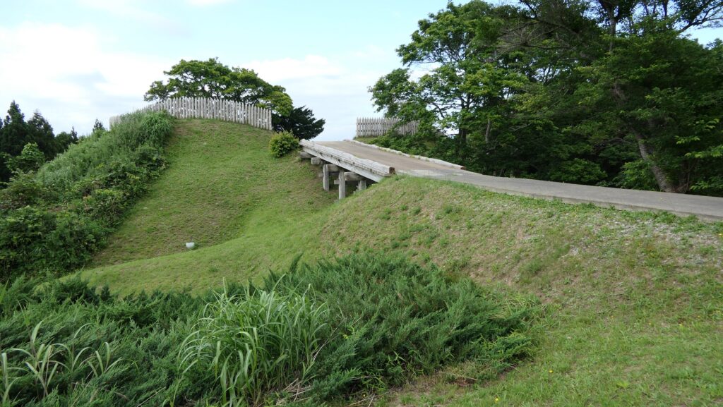
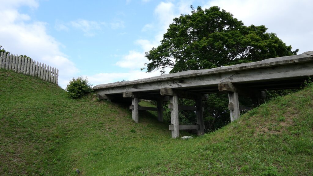
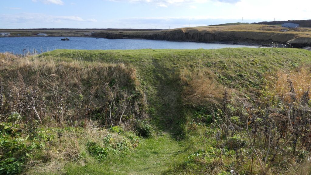
The trail will bring you to the Back Gate Ruins with a dry moat in front of them. You can go across the moat over the restored bridge and you will see some restored wooden fences around the ruins. Inside the gate is the highest point of the ruins, which had the Tategami-Hachimangu Shrine as the guardian god of the hall. The shine remained even after the hall was abandoned. The lords of the Matsumae Domain visited it to worship for their ancestors during the Edo Period. The shrine was finally moved to another location in 1876 of the Meiji Era.
The Back Gate RuinsThe dry moat and the restored Back BridgeThe ruins of Tategami-Hachimangu ShrineAround the shrine ruins
Center of Hall Ruins
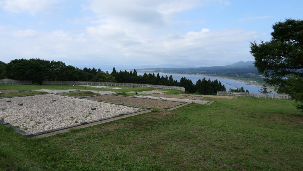
The 3.6m wide central passage goes through the ruins. Next comes the main portion of the hall, a long and wide area gently going down to the Main Gate Ruins.
The center of the hall ruinsThe imaginary drawing of the central passage with a turret gate on it, from the signboard at the site
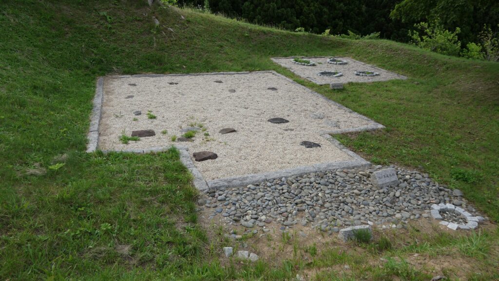
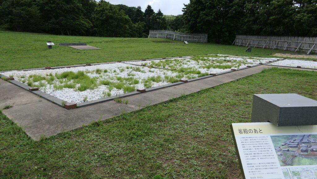
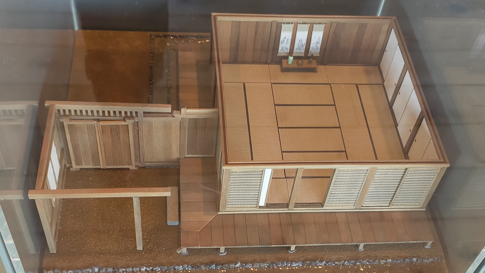
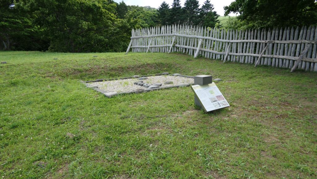
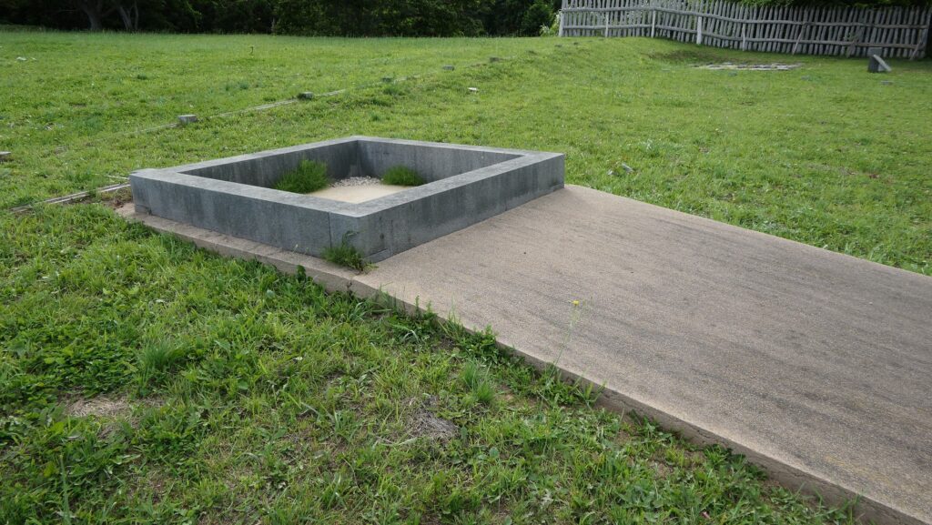
There are no buildings, but lots of flat exhibits of what buildings were built, according to the excavation achievements. The exhibits show the Main Hall, the chief retainer’s house, a public well, a blacksmith‘s workshop, a stable, warehouses, residential houses, and so on.
The imaginary drawing of buildings of the hall, from the signboard at the site, adding the English lettersThe ruins of the Main HallThe interior model of the Main Hall, exhibited by the Katsuyama Castle Guidance FacilityThe ruins of the blacksmith‘s workshopThe interior model of the workshop, exhibited by the Katsuyama Castle Guidance FacilityThe ruins of the public wellThe miniature model of the public well, exhibited by the Katsuyama Castle Guidance Facility
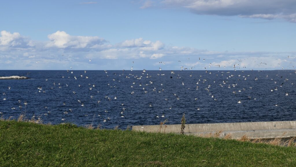
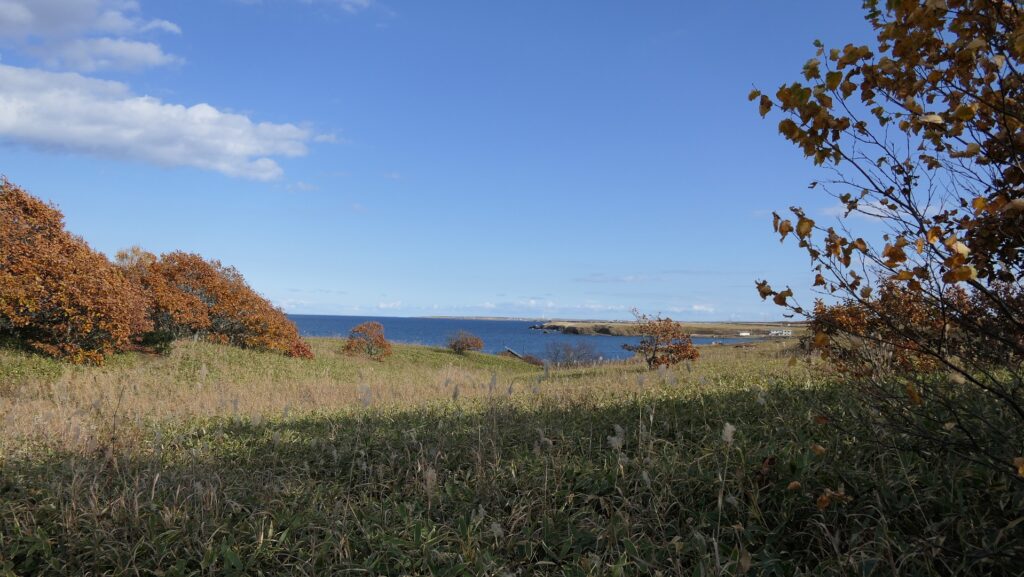
The excavation team also found about 100 thousand relics such as weapons, religious equipment, trading goods, tools, hunting and fishing items as well as household items including accessories. That means people lived their daily life there. In particular, some of the relics came from the Ainu people, such as their own penknives and poisoned arrows for hunting. This could be another evidence that the mainland and Ainu people lived together. You can also enjoy a good view of the Japan Sea and the seaside area.
The excavated lacquerware bowls, which were probably brought to the site by trading, exhibited by the Katsuyama Castle Guidance FacilityThe excavated fishing items of Ainu (below) and a replica of an Ainu harpoon, exhibited by the Katsuyama Castle Guidance FacilityThe hall ruins with a view of the area below
Japanese people get active in Hokkaido where Ainu people live
Kaminokuni-Katsuyama Date was a hall which was built in the Middle Ages in the western part of Oshima Peninsula of Hokkaido. At that time, the island was called Ezo, where the Ainu people lived. They spoke a different language and had a different way of life from the Japanese people that lived on the mainland. They earned a living by hunting, fishing and trading, unlike the mainland Japanese people, who farmed.
The location of the castle
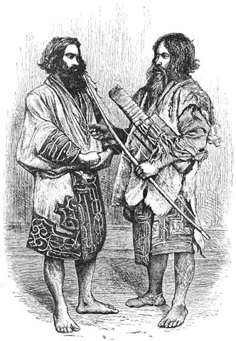
The painting of Ainu men, attributed to Isabella Lucy Bird, in the 19th Century (licensed under Public Domain via Wikimedia Commons)
In the late 14th Century, some Japanese people were active in the Oshima Peninsula, in particular the southern edge of Hokkaido. The leaders started to build several halls for living and trading alongside this peninsula. The halls were called the Dounan (southern region) 12 Halls, such as Shinori Tate in the eastern part of the peninsula which was called “Shimonokuni” or the lower province. While the western part was referred to as “Kaminokuni” or the upper province.
The ruins of Shinori Tate
Nobuhiro Takeda repels Ainu Rebellion
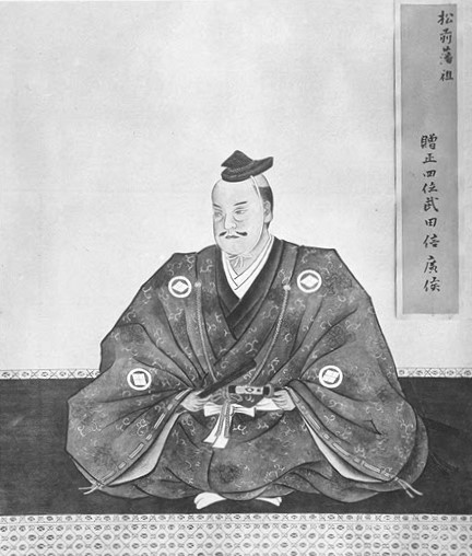
The Ando Clan, which led the Japanese people in Ezo, also tried to rule the island aggressively. Because of this, it caused an uprising of the Ainu people, who was led by their leader Koshamain in 1456. The angry Ainu people managed to capture 10 of the 12 Dounan Halls, including Shinori Tate. One of the two surviving halls was Hanazawa Tate located in the upper province, which was owned and controlled by The Kakizaki Clan, who was affiliated with the Ando Clan. They were obviously at a disadvantage however, because the rebellion was ultimately crushed when Koshamain was shot with an arrow by Nobuhiro Takeda, a guest commander of The Kakizaki Clan.
The portrait of Nobuhiro Takeda (licensed under Public Domain via Wikimedia Commons)
Nobhuhiro is originally from Wakasa province, which at that time was located in the central region of the mainland of Japan, which did a lot of trading with Ezo, via the Sea of Japan. For example, potteries like Echizen ware that were made in the surrounding areas were often used in Ezo. The province sold kelp, processed from Ezo. Nobuhiro might have been a vagrant on this well-known route. Therefore, he managed to only become the adopted son of The Kakizaki Clan, but also the chosen leader of the Japanese people in Ezo Island.
A jar of Echizen ware in the Middle Ages, owned by Hakone Museum of Art (licensed by Daderot via Wikimedia Commons)
Nobuhiro builts Kaminokuni-Katsuyama-Date
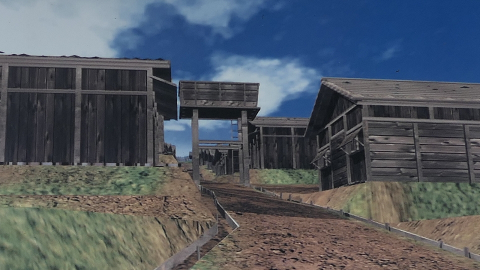
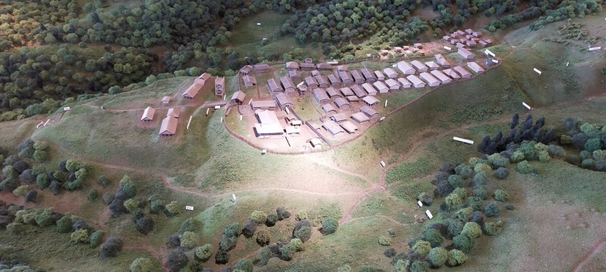
Nobuhiro would eventually build a new hall near Hanazawa Tate, on a hill located below Iouzan Mountain, which is now known as Kaminoyama-Katsuyama Date, in 1470. The word “Date” means “hall”, however because of its size, it looked more like a mountain castle or a sort of medieval city on the mountain. Nobuhiro probably built his stronger hall based on his experience because most of his previous halls ended up being captured. The hill of the hall had deep valleys on both sides, and dry moats in both the front and the back. There were lots of houses on the hill as well, which were surrounded by fences. A famous region was the Oma Port, located below the hill, so the lord of the hall managed to control the trading that happened at the coast of this region.
The miniature model of Kaminokuni-Katsuyama-Date, exhibited by the Katsuyama Castle Guidance Facility
Even after the completion of the new hall, some Ainu people would sometimes rebel and attack the hall. The Kakizaki Clan under the command of Nobuhiro, managed to repel the Ainu attacks, mainly because of the robust construction of the hall, and by the use of traps. The Kakizaki Clan were very cunning, as they managed to convince the Ainu people to join them in a peace treaty. After filling up on liquor, the Ainu people were too intoxicated to fight back, and were ultimately murdered during the party. Ainu people never doubted the Kakizaki’s intentions. On the other hand, both Japanese and Ainu people somehow managed to live in harmony together, in the medieval city. You can even find burial sites where both Japanese people and Ainu people were buried in. This led to a long and complex relationship between the Japanese people and the Ainu people.
The defense system of the front of Kaminokuni-Katsuyama-Date, from the miniature model aboveburial mounds of Ainu people around the hall
The Kakizaki Clan eventually moved their home base to Matsumae, the southern edge of the peninsula because it was more convenient location for trading. That lead to the launch of both the Matsumae Domain, as well as Matsumae Castle during the Edo Period. Soon after that, the clan renamed themselves The Matsumae Clan. Eventually, Kaminokuni-Katsuyama Date would be abandoned during early stages of the Edo Period.
そこには確かにアイヌの人々がいたのです。
The Ainu people certainly lived there.
立地と歴史~Location and History
アイヌの人々とチャシ~Ainu people and Chashi
チャシはアイヌの人々によって築かれた城であると言われています。しかし詳細は不明のままです。彼らは文字を持たなかったからです。チャシとはアイヌ語で柵または柵で囲まれた場所を意味します。アイヌは北海道一帯に住んでいた先住民族で狩猟、漁撈、そして交易を生業としていました。彼らの出自もまた明らかではありませんが、13世紀頃までには独自の文化を確立したようです。そしてサハリンから千島列島に至る広大な範囲でその存在を示したのです。 Chashi are said to be castles which were built by the Ainu people, but the details are uncertain, because they had no written language. Chashi means fences or a fence line in Ainu language. Ainu are native people around Hokkaido who earned a living by hunting, fishing, and trading. Their origin is also uncertain, but they seemed to establish their own culture around the 13th century, and had a presence in a large area ranging from Sakhalin to the Kuril Islands.
イザベラ・バードによるアイヌ男性のスケッチ、19世紀~The painting of Ainu men, attributed to Isabella Lucy Bird, in the 19th Century(licensed under Public Domain via Wikimedia Commons)
発掘の成果によれば、500以上のチャシが16世紀から18世紀の間に築かれました。その当時、「サパネクル」と呼ばれたアイヌの頭領が、オホーツク、沿海州、日本の本州から来た日本人までも含む外国人との交易により力をつけていきました。これらの頭領たちがチャシを作ったと考えられています。多くのチャシは簡単な構造で、柵や空堀で囲まれた単一の曲輪でした。しかしながら、根室半島では、もっと複雑な構造の多くのチャシがありました。恐らくこの半島の頭領たちがより大きな勢力を持っていたからでしょう。 According to excavations, over 500 of Chashi were built between the 16th and 18th centuries. At that time, several heads of Ainu called “Sapanekuru” were increasing their power by trading with foreign people even form Okhotsk and Primorskii, and Japanese whose origin was the Japanese mainland. It is thought that these heads mainly built the Chashi. Many of Chashi were simple with one enclosure surrounded by a fence line and dry moat. However, in Nemuro Peninsula, there were a lot of Chashi which were more complex. It could be because the heads in the peninsula had more power than others.
城の位置~The location of the castle
なぜチャシが作られたか~Why were Chashi built?
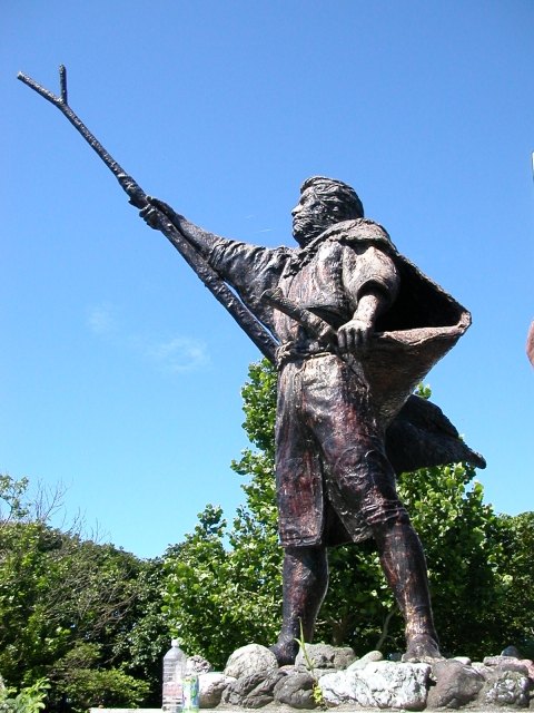
なぜチャシが作られたかについては、いくつかの説があります。もっとも広く知られているのは、「日本人」に抵抗する戦いの準備のためというものです。チャシが作られた地域が、17世紀に徳川幕府下の松前藩と実際に戦ったシャクシャインの勢力圏と一致しているからです。 There are several possible reasons for why Chashi were built. The most widely accepted theory is that they were built to prepare for battle against “Japanese”. This is because the area where they were built matches the influence area of Saksaynu who actually fought with Matsumae Domain under Tokugawa Shogunate in the 17th century.
シャクシャイン像~The statue of Saksaynu(taken by Yuka2018 from photoAC)
アイヌの頭領たちが交易で得た財物をめぐってお互いに争っていたからではないかという人もいます。進化したチャシには部外者が母屋に入るを防ぐための仕掛けが多く見られます。その建物には財物がしまってあったはずです。他には、祈祷所、祭りの場所、集会所、交渉の場所などが挙げられています。 Others point out that the heads of Ainu might have fought with each other over their properties gotten by trading. They found out that some advanced Chashi had many works to prevent outsiders from entering their main building. The building must have stored their properties. Other supposed reasons are for worship sites, festival grounds, public meeting places, places for negotiation, and so on.
ヲンネモトチャシの曲輪~An enclosure of Wonnemoto Chashi
アイヌの悲しい歴史~Ainu’s sad history
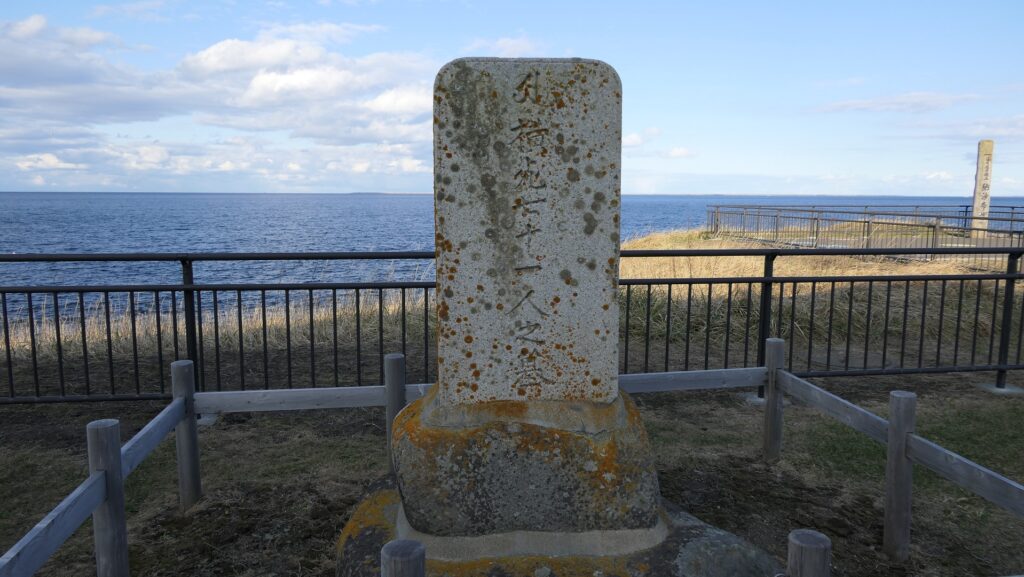
18世紀後半、松前藩の御用商人たちがアイヌの人たちを搾取しました。「メナシクル」と呼ばれた東北海道の若いアイヌの人たちがこれに激怒し、日本人に対して反乱を起こしました(クナシリ・メナシの戦い)。彼らはまたアイヌの年長の頭領たちに対しても不満があったとされています。チャシはこの戦いに備えて完成したのかもしれません。多くのアイヌと日本人がこの戦いで殺され、負傷しましたが、最後は松前藩により鎮圧されました。 In the late 18th century, the merchants, who were agents of Matsmae Domain, exploited Ainu people. Young Ainu people in eastern Hokkaido called “Menashikuru” were very angry about it and rebelled against Japanese (Menashi-Kunashir Rebellion). They were supposed to be also angry at the old heads of Aine. Their Chashi might have been completed for the battle. Many of Ainu and Japanese were killed and wounded in the battle, and lastly Matsumae Domain put down the rebellion.
乱で亡くなった日本人の墓碑~The tombstone of the Japanese killed in the rebellion
その後、松前藩はアイヌに対して交易を制限し、その結果、アイヌの社会は縮小していきました。その一方で徳川幕府と近代の日本政府はアイヌを日本人に同化させる政策を行いました。アイヌの人口は19世紀までに劇的に減少しました。チャシは全て放棄され、そして忘れ去られました。 After that, Matsumae Domain forced Ainu to limit their trading, as a result, the Ainu community was declining. Meanwhile, Tokugawa Shogunate and the modern Japanese government had the policy to assimilate Ainu into Japanese. The population of Ainu significantly decreased by the 19th century. Chashi were all abandoned and have been forgotten.
チャシから望むオホーツク海~Sea of Okhotsk from a Chashi
特徴~Features
現在、根室市には30以上ものチャシ跡がありますが、そのうち24ヶ所が国の史跡に指定されています。そしてそのうちの2ヶ所が観光客向けに整備されています。 Now, Nemuro City has over 30 ruins of Chashi, 24 of them are designated as a National Historic Site, and two of them are developed for visitors by the city as below.
城周辺の地図~The map around the castle
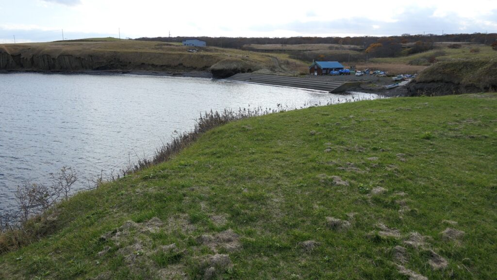
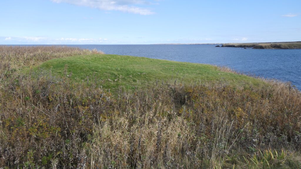
ノツカマフ1号、2号チャシ跡~Ruins of Notsukamafu N0.1 and No.2 Chashi
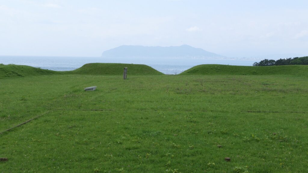
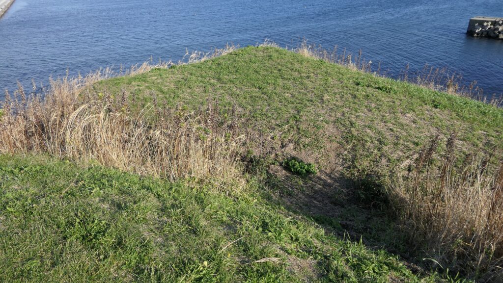
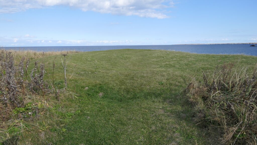
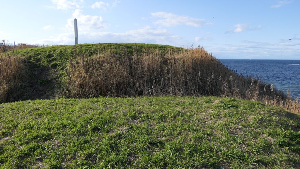
これらのチャシ跡はマップ湾に伸びるノツカ岬上にあります。1号チャシは、直径が約30mあり、2~3mの深さの空堀により隔てられ且つ囲まれた2つの丸い曲輪から構成されます。そのうちの一つには土橋を渡って入っていくことができます。 The ruins of these Chashi are on a cape Notsuka extending from Mappu Bay. No.1 Chashi consists of two round enclosures with a diameter of around 30m, divided and surrounded by 2 to 3m deep dry moats. You can enter one of them through an earthen bridge.
城周辺の航空写真~The aerial photo of around the castle
遺跡への入口~The entrance to the ruins遺跡に続く小径~The trail which leads to the ruins1号チャシへの土橋~The earthen bridge to No.1 Chashi1号チャシからの眺め~A view from No.1 Chashi1号チャシのもう一つの曲輪~Another enclosure of No.1 Chashi
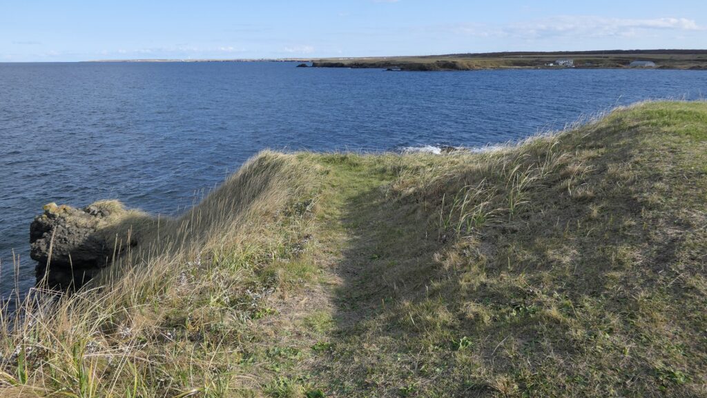
2号チャシはもっと浅い空堀に囲まれた単一の丸い曲輪から成ります。そのため、この曲輪は未完成だったのではないかとも言われています。ノツカマフは、クナシリ・メナシの戦いでのアイヌの指導者が処刑された場所です。 No.2 Chashi has a single round enclosure with a more shallow dry moat surrounding it, so it is said that it might have been uncompleted. Notsukamafu is where the Ainu leaders of Menashi-Kunashir Rebellion were executed.
2号チャシ~No.2 Chashi2号チャシの端部分~The edge of No.2 Chashi
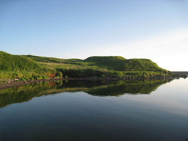
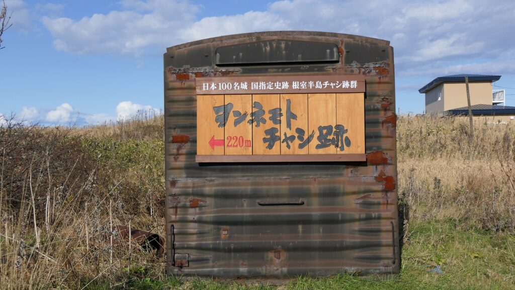
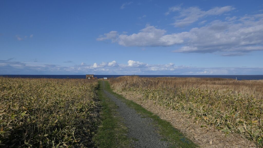
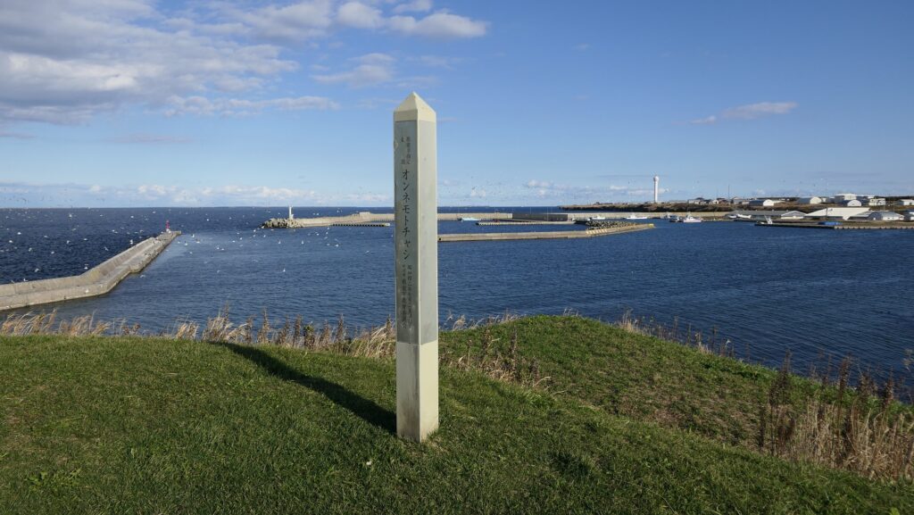
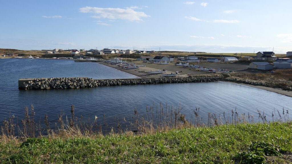
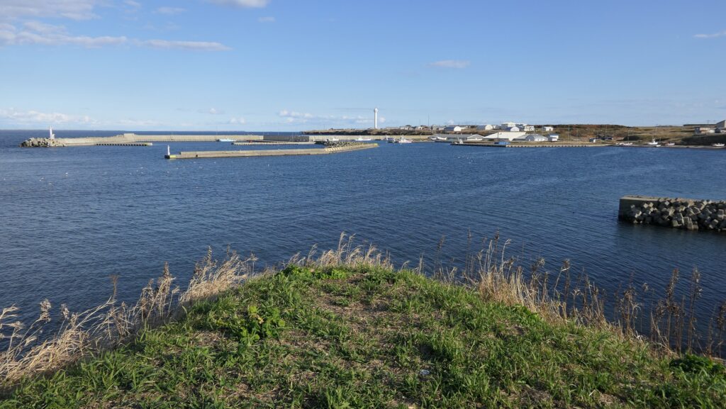
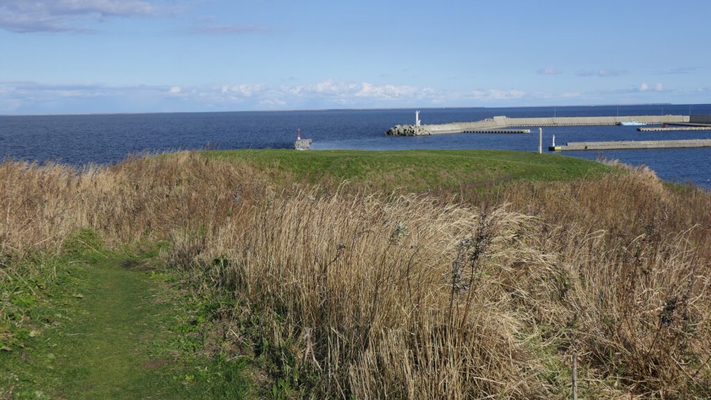
オンネモトチャシ跡~Ruins of Wonnemoto Chashi
この遺跡は、温根元湾の西側から突き出た岬の上で、階段状の2つの平面から構成されます。湾の東側にある温根元漁港から見ると、なかなか壮観です。その平面は、四角く成形された曲輪で、これらもまた空堀により隔てられ且つ囲まれています。岬の先端に巧みに盛られているのがわかると思います。これらの曲輪の上に立つと、北海道の大地とオホーツク海の雄大な景色が堪能できます。 The ruins are two flat surfaces of steps on a cape protruding from the western side of Wonnemoto Bay. They have a great view when you see them from the Wonnemoto fishing port on the eastern side. The surfaces are square shaped enclosures, also divided and surrounded by dry moats. You can see them well mounded at the top of the cape. When you stand on both of them, you can see a wild landscape of the land of Hokkaido and the sea of Okhotsk.
城周辺の航空写真~The aerial photo of around the castle
温根元漁港から見たオンネモトチャシ~Wonnemoto Chashi from the Wonnemoto fishing port(licensed by 1467jp via Wikimedia Commons)遺跡への入口~The entrance to the ruins遺跡に続く小径~The trail which leads to the ruinsヲンネモトチャシの標柱~ The signpost of Wonnemoto Chashi2段になっている曲輪~The two step enclosures温根元漁港~The Wonnemoto fishing port遺跡からの眺め~A view from the ruins
その後~Later History
チャシの研究が進んだのは1970年代からです。歴史家が日本人や外国人が記録した古書や文書を紐解いたのです。残っているアイヌの口述歴史を調査した人もいました。行政側も北海道中のチャシ跡の発掘を進めています。その結果、根室市一帯には多くの進化したチャシがあり、歴史上の事件にも関わっていることがわかりました。市にある24ヶ所のチャシが1983年に「根室半島チャシ跡群」として国の史跡に指定されました。 The study of Chashi has been improved since the 1970s. Some historians researched old books and documents Japanese or foreign people recorded. Others investigated the remaining oral history of Ainu. Local governments have been excavating the ruins of Chashi across Hokkaido. They found out that the area around Nemuro City had many developed Chashi which are also related to the historical events. The 24 of Chashi in the city were designated as a National Historic Site called “The ruins of Chashi in Nemuro Peninsula” in 1983.
オンネモトチャシとオホーツク海~Wonnemoto Chashi and Sea of Okhotsk
私の感想~My Impression
最初にチャシ跡に立ったときには、正に地の果てに来たという感じがしました。根室市は実際、日本が南千島列島は自分の領土だと主張しているにしても、事実上ロシアとの国境の最前線にあります。しかしアイヌの歴史を学んでみると、アイヌにとってオホーツクは開かれた海だったのです。彼らには国境などないからです。チャシは最終的には日本人との闘いのために使われたのかもしれませんが、彼らなりのやり方でチャシを築き、繁栄した時期もあったのです。もし日本とロシアの間の懸案が解決された折には、開かれた海は北海道の地に戻ってくるのでしょうか。 When I first stood on the ruins of Chashi, I felt like I came to the edge of the earth. Nemuro City is actually in front of the border between Japan and Russia, though Japan insists that south Kuril Islands belong to it. After I learned about the Ainu history, I think that Okhotsk was an open sea for Ainu, because they had no border. Chashi might have lastly been used for battle with Japanese, but they had prospered by building Chashi in their own way. I wonder if the problem between Japan and Russia was resolved, the open sea could come back to Hokkaido.
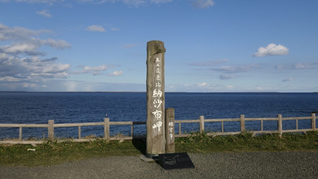
日本最東端の地、納沙布岬~Nosappu Cape, The easternmost tip of Japan
ここに行くには~How to get There
これらの遺跡に行くには、車を使うことをお勧めします。 ノツカマフとオンネモトの遺跡跡は両方とも根室半島北海岸の道道35号線沿いにあります。両方の遺跡の入口前に小さな駐車スペースがあります。根室駅から約30分位のところです。 I recommend you to visit them by car. Both the ruins of Notsukamafu and Wonnemoto are alongside Hokkaido Prefectural Route 35 in the northern coast of Nemuro Peninsula. There is a small parking lot in front of the entrance of the both ruins. It takes about 30 minutes from Nemuro Station.
リンク、参考情報~Links and References
・根室半島チャシ跡群、根室市観光協会(Nemuro City Tourism Association) ・「列島縦断「幻の名城」を訪ねて/山名美和子著」集英社新書(Japanese Book) ・「歴史群像121号、戦国の城/道東のチャシ群」学研(Japanese Magazine)