98.今帰仁城~Nakijin Castle

沖縄北部の優美な城跡です
Elegant castle ruins in the northern Okinawa

立地と歴史~Location and History

北山王国の首都~Capital of Hokuzan Kingdom

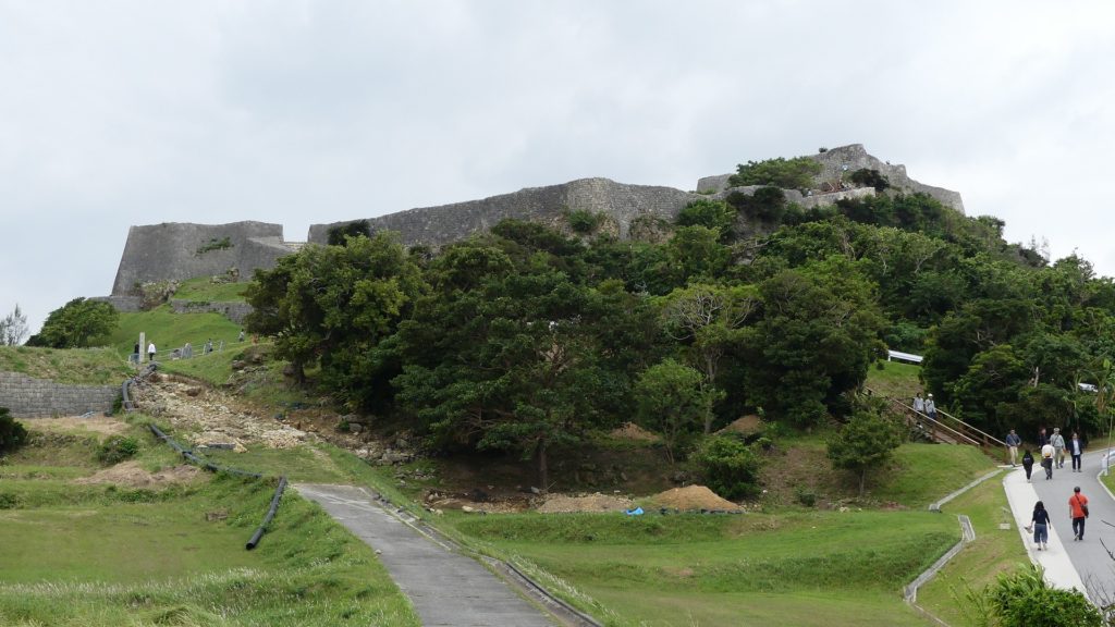
14、15世紀頃、琉球諸島(現在の沖縄諸島)は貿易により栄えました。その結果、「按司」と呼ばれる多くの有力な豪族が中国や他国と貿易を行い、力をつけていきました。彼らは「グスク」と呼ばれる大規模な要塞を琉球諸島周辺に300以上築きました。やがて「北山」「中山」「南山」のという3つの王国にまとまっていきます。今帰仁城は北山王国の首都でした。
Around the 14th and 15th centuries, the Ryukyu Islands (what is now Okinawa Islands) prospered thanks to trading. As a result, many powerful clans in Ryukyu called “Aji” traded with China and other countries, and had great power. They built over 300 large-scale fortresses called “Gusuku” around the Ryukyu Islands. They eventually gathered three large groups called the Kingdoms of “Hokuzan”, “Chuzan”, and “Nanzan”. Nakijin Castle was the capital of the Hokuzan Kingdom.

城の位置~The location of the castle

発掘の成果によれば、この城は最初は14世紀の初め頃、沖縄本島北部の本部半島にある、100mの高さの丘の上に築かれました。しかし当初は丘の上の平地を柵で囲っただけだったようです。その後、北山王国の勢力が高まるにつれ、城は拡張され、15世紀までに正殿や長大な高石垣が築かれました。中国の古書には、この城や王国から中国への朝貢があったことが記録されています。当時の中国製陶器の破片が遺跡から発掘されています。
According to the excavation, the castle was first built on a 100m high hill in Motobu peninsula of the northern Okinawa Island around the beginning of the 14th century, but it was just plane area on the hill which was surrounded by fences. After that, the castle was developed with the main palace and long, high stone walls being built until the 15th century, while the power of the Hokuzan Kingdom grew. An old Chinese book records the castle and the kingdom bringing a tribute to China. Peaces of Chinese potteries at that time are also unearthed from the ruins now.

現地にある城跡の模型~The miniature model of the castle ruins at the site

2度の落城~Castle fell twice

最盛期にはこの城は、後に琉球王国になる中山王国の首都にある首里城に匹敵する規模となりました。ところが、城はそこから2度落城します。1416年、中山王国の家臣である護佐丸がこの城を攻撃しました。最後の城主、攀安知(はんあんち)は城外で護佐丸と戦いますが、彼の部下である本部平原(もとぶていはら)の裏切りに合い敗れてしまいます。それ以来、城は琉球王国のものとなり、島の北部を治めるために「監守」と呼ばれる行政官が置かれました。
At its peak time, the castle became as large as Shuri Castle, the capital of the Chuzan Kingdom, the later Ryukyu Kingdom. However, the castle fell twice after the peak. In 1416, a retainer of Chuzan Kingdom, Gosamaru attacked the castle. The last lord of the castle, Han-annchi fought with Gosamaru outside the castle, but his retainer, Teihara Motobu betrayed him, and he was lastly beaten. Since then, Ryukyu Kingdom owned and stationed an administrator called “Kanshu” in the castle to govern the northern part of the island.

監守の業績を記した記念碑~The monument for the achievements of Kanshu

1609年、薩摩の武士たちが琉球王国に侵攻したとき、真っ先にこの城を占領し焼き払いました。侵攻後、王国は薩摩の支配下に置かれますが、この城には領主は置かれませんでした。その代わりに沖縄の人々が城を祈りの地として維持したのです。
In 1609, when the Satsuma warriors invaded Ryukyu Kingdom, they first captured and burned the castle. The kingdom was under the control of Satsuma after the invasion, but the castle had no lord. Instead, the people of Okinawa maintained the castle as a spiritual center.

祈りの場所の一つ、城内下之御嶽(うたき)~Jonai Shitano-Utaki, one of the places for praying

特徴~Features

城跡に入る~Entaring the castle ruins

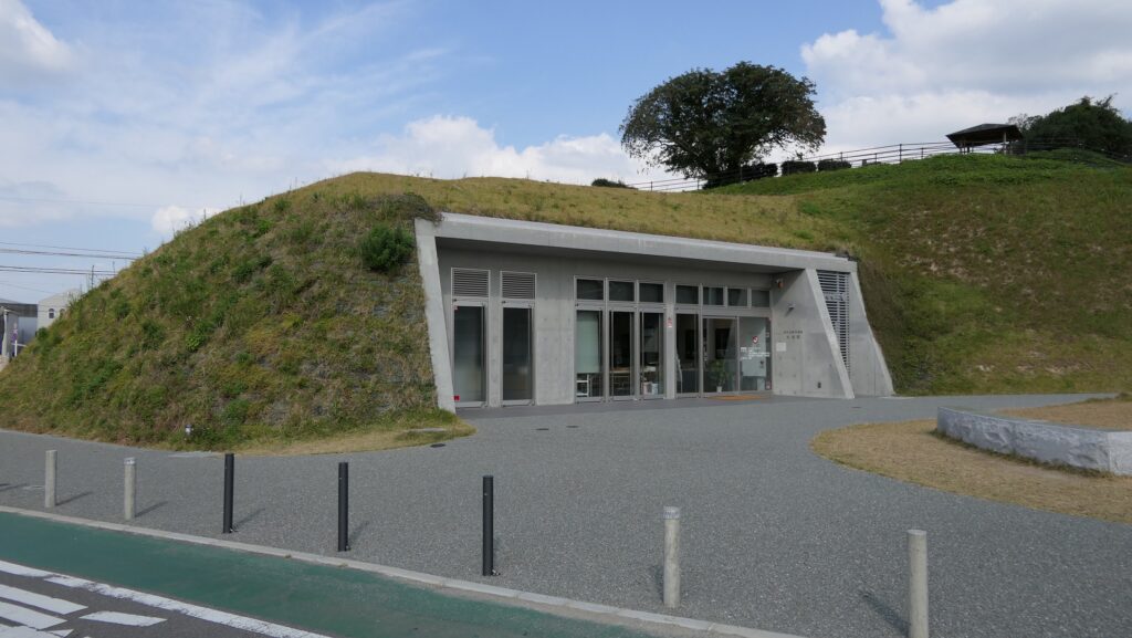
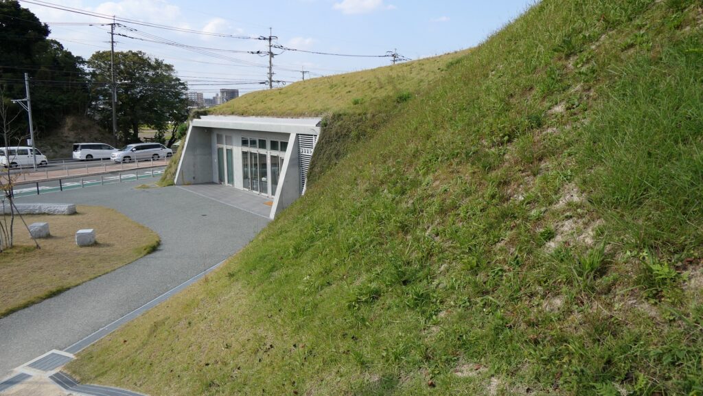
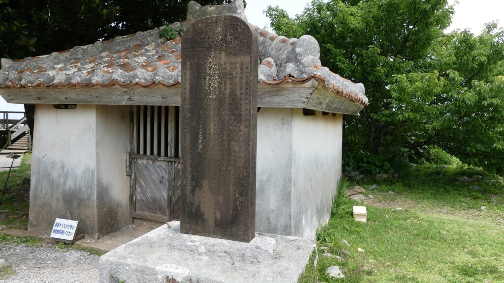
現在、今帰仁城跡は素晴らしい景色と自然の中に位置しています。城跡の近くには便利な施設もあります。グスク交流センターでは、城跡へのチケットを買ったり休憩することができます。また、歴史文化センターでは、城やその周りの地域のことをより深く学ぶことができます。
Now, the ruins of Nakijin Castle are located in wonderful views and nature. There are also useful facilities near the ruins. One of them is the Gusuku Exchange Center where you can buy a ticket to the ruins and rest. The other is the History & Culture Center where you can learn more about the castle and the area surrounding it.

城周辺の航空写真~The aerial photo of around the castl

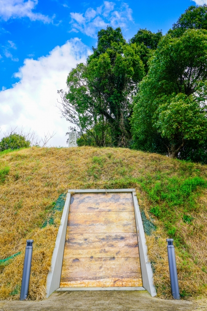
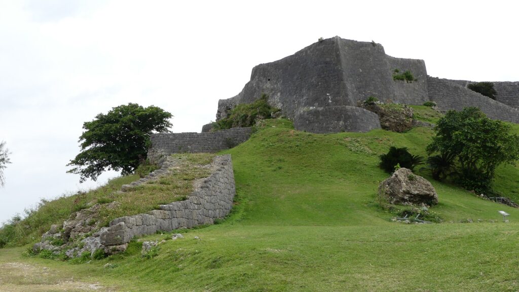
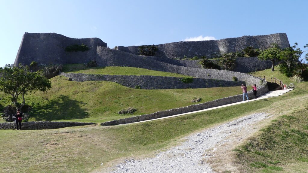
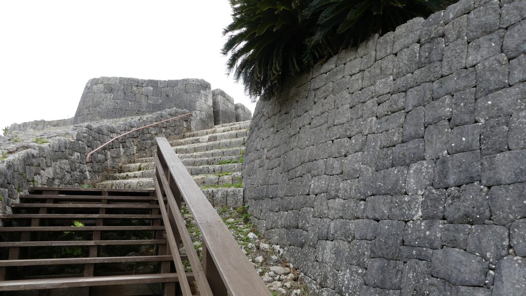
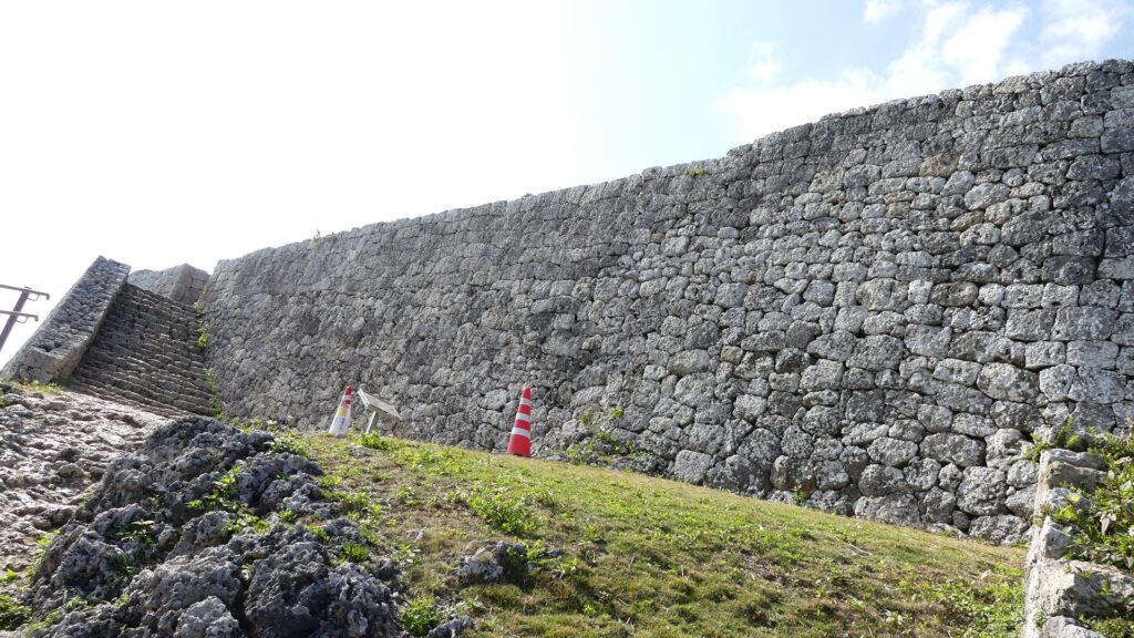
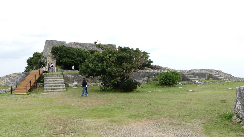
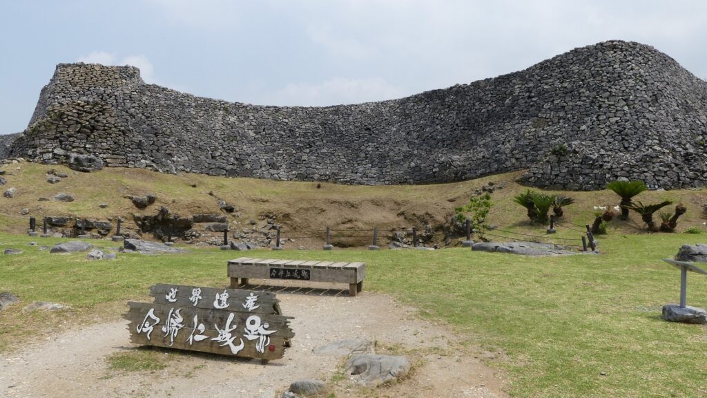
城跡の入口に歩いていくと、見事な曲線を描いた高石垣が目に入っていきます。この石垣は大隅(ウーシミ)の城壁と呼ばれ、高さが8mあり、この城の中では最も高いものです。城の守備兵は、曲線の頂点部分から敵に対して反撃することができました。城跡ガイドの方は、この石垣は中国の万里の長城に影響されていると説明しています。観光客は、現在石垣の脇にあるアーチ門を通って城跡に入っていきます。この門は1962年に復元されたものです。
When you walk to the entrance of the ruins, you will see finely curved high stone walls. They are called Ushimi Stone Walls and 8m high, the highest ones in this castle. The defenders of the castle could counterattack enemies from the top of the curve. The Guides of the ruins say that the walls were inspired by the Great Wall of China. Visitors will now enter the ruins through the arch gate beside the stone walls which was restored in 1962.

大隅(ウーシミ)の城壁~Ushimi Stone Walls
遺跡入口のアーチ門~The arch gate at the entrance

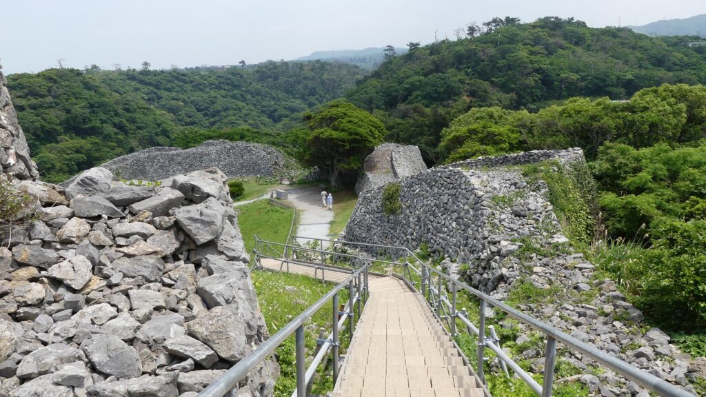
石の階段が城の中心部に向かって伸びていますが、これは最近になって観光用に作られたものです。旧道が階段の右側に沿って残っています。敵からの攻撃から守るため、狭く、急で、岩がごつごつした道になっています。
The stone steps go straight to the center of the castle, but they were built recently for tourism. The Old Pathway goes along on the right side of the steps. It is a narrow, steep and rocky path for defense against attacks in the past.

石段~The stone steps
旧道~The Old Pathway

城の中心部~Center of Castle

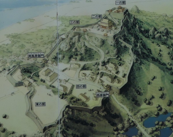
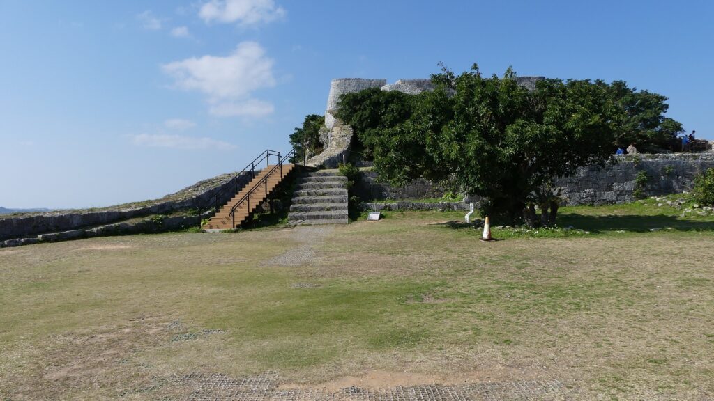
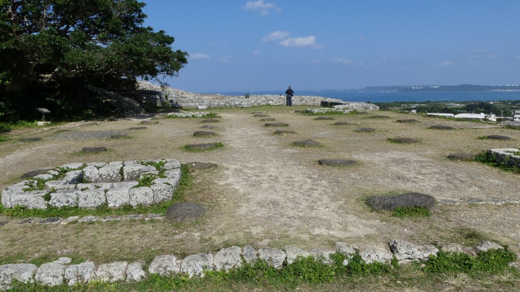
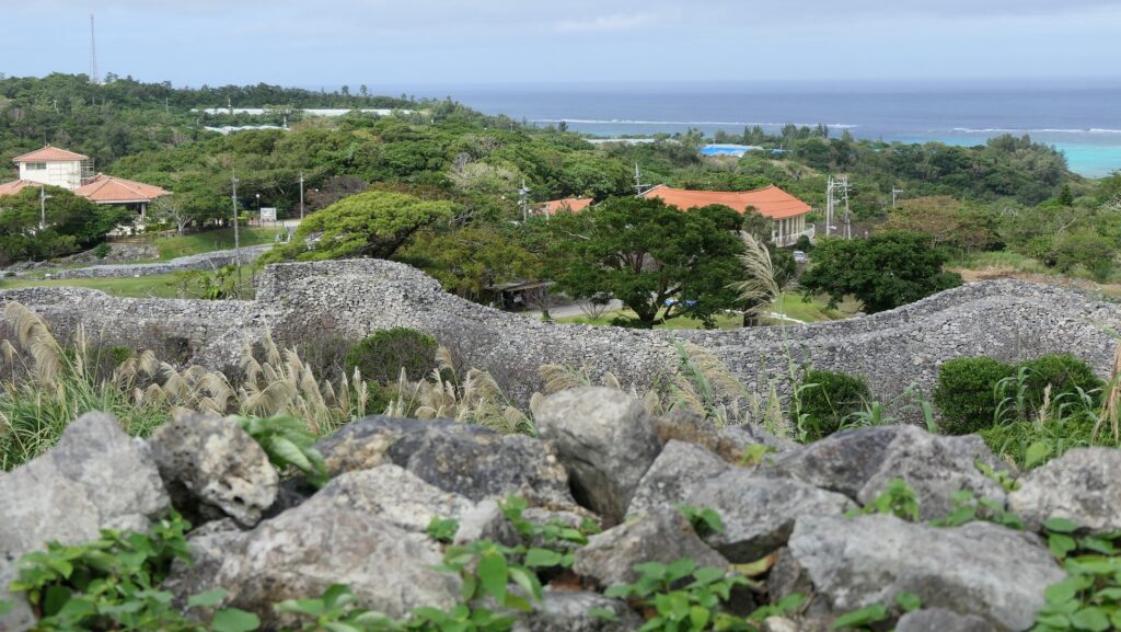
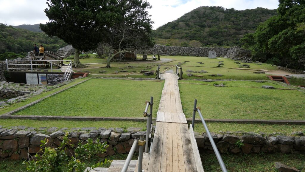
城の中心部は3つの部分に別れています。「大庭(ウーミャ)」は入口に最も近い場所であり、行事の際に使われた広場です。行事のために正殿、北殿、南殿といった建物がありました。次の場所は、「御内原(ウーチバル)」で城で奉仕する女性たちが住んでいました。ここはまた城の中では神聖な場所でした。現在では、ここから北の方角に素晴らしい海の景色が望めます。最後は「本丸」で、恐らくは城主が住んでいた場所です。発掘によっていくつもの建物があったことがわかっています。
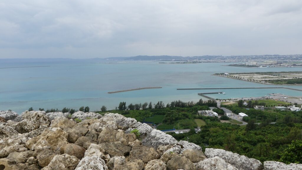
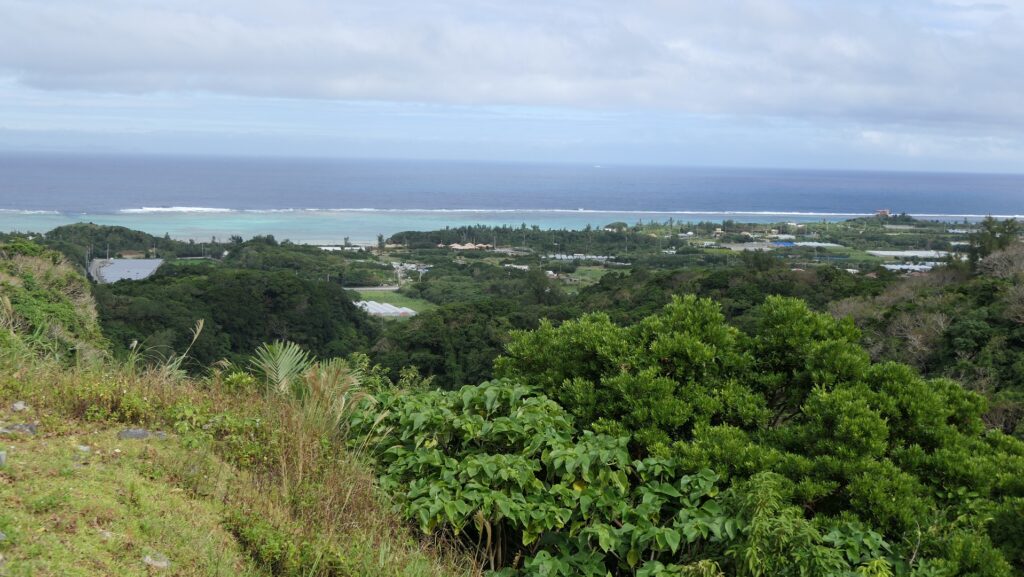
The center of the castle has three parts. “Umya” Court is the first part from the entrance, which is was used as the square for ceremonies. There were the Main, North, and South Palaces for the ceremonies. The next part is called “Uchibaru” Ground where the women who served the castle lived. It is also a very religious place for the castle. You can now have a great view of the sea in the northern direction. The last part is the Main Enclosure or “Honmaru” where the lord of the castle probably lived. The excavation found that several buildings had been built.

大庭(ウーミャ)~“Umya” Court
御内原(ウーチバル)~“Uchibaru” Ground
御内原からの眺め~A view from “Uchibaru” Ground
もう一枚~Another view
本丸~The Main Enclosure

背後にある郭~Enclosure in Back

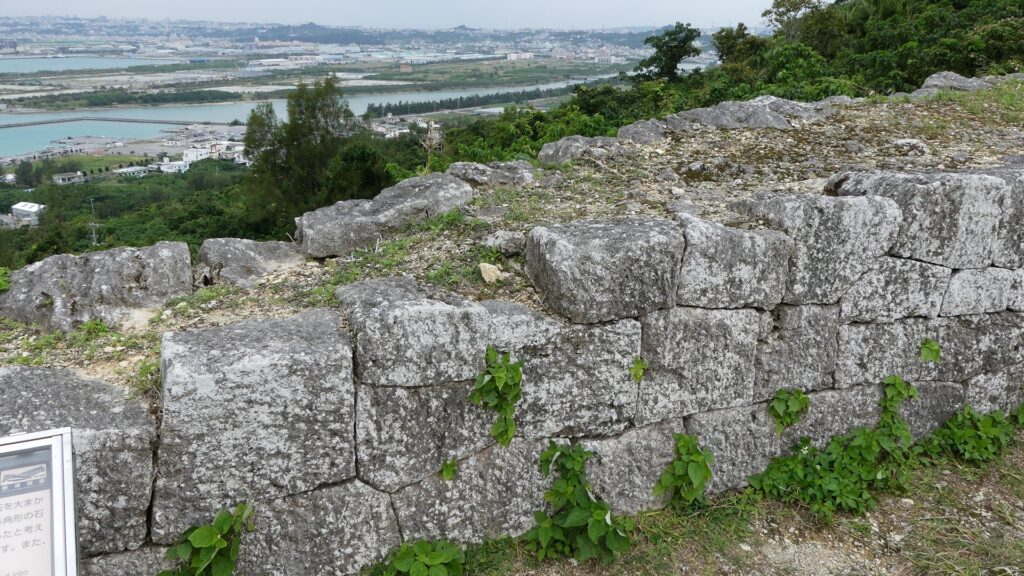
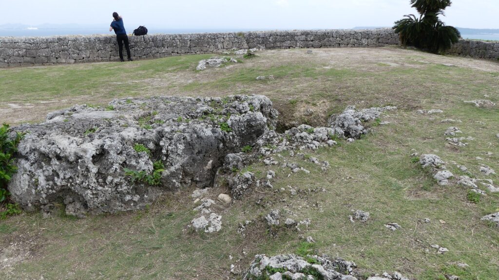
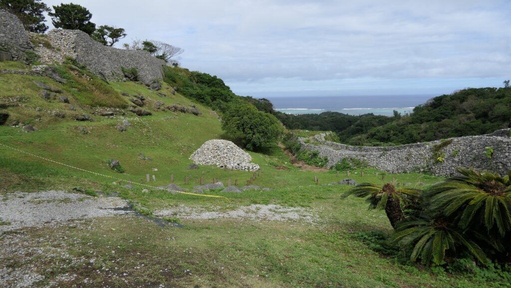
中心部からは、城の背後の部分が見え、そこに行くこともできます。「志慶真門郭(しげまじょうかく)」と呼ばれる場所で、ここもまた、長大な石垣に囲まれています。城主に仕える人たちが住んでいたと考えられています。この郭に降りていくときには、古石灰岩でできた石垣を間近に見ることができます。
You can see and go to the back of the castle from the center. This is called “Shigema-jokaku” Enclosure which is also surrounded by high, long stone walls. It is thought that the closest subjects who served the lord lived at the enclosure. You can also see the walls made of Paleozoic lime stones closely when you go down to the enclosure.

本丸から見た城の背後部分~The back of the castle from the Main Enclosure
志慶真門郭(しげまじょうかく)~“Shigema-jokaku” Enclosure
石垣~The stone walls

その後~Later History

第二次世界大戦で破壊された他の遺跡と異なり、今帰仁城跡は今に残りました。沖縄戦の戦場からは遠かったからです。戦後、城跡は1972年に国の史跡に指定されました。ついには、2000年から琉球王国のグスク及び関連遺産群として世界遺産に登録されています。
The ruins of Nakijin Castle remained though many other ruins were destroyed during World War II, as they were far away from the battlefields of Okinawa. After the war, they were designated as a National Historic Site in 1972. Lastly, they have also been on the World Heritage List as Gusuku Sites and Related Properties of the Kingdom of Ryukyu since 2000.

今帰仁城跡の正面~The front side of Nakijin Castle Ruins

私の感想~My Impression

私が初めて今帰仁城の石垣を見たときは、ただ単に石を積んであるだけのように見えました。日本の本土にある石垣は通常土か細かい石の芯の部分を覆って築かれます。その一つの理由は本土は地震が多く発生するので、石垣は強固な中心部分が必要だからでしょう。沖縄にはあまり地震がありませんが、雨が多く降ります。今帰仁城のような沖縄の城の石垣は雨を素通りさせます。後からその違いの理由を学びました。いすれにせよ、素晴らしい石垣を持つこの城跡は、沖縄の自然とよくマッチしています。
When I saw the stone walls of Nakijin Castle for the first time, they looked like the stones are just piled simply. This is because stone walls in the Mainland of Japan are were usually built covering their core of soil or small pieces of stone. One of the reasons for it this is that the Mainland often suffers from earthquakes, so stone walls needs a strong core. On the other hand, Okinawa has few earthquakes, but has a lot of rain. The stone walls of Okinawa’s castles like Nakijin can make rain slip through. I learned the reason for the difference later. Anyway, I think the ruins with elegant stone walls match the nature of Okinawa.

今帰仁城の石垣~The stone walls of Nakijin Castle

ここに行くには~How to get There

ここには車で行かれることをお勧めします。
那覇空港から:
車の場合、那覇空港自動車道に名嘉地ICから入り、西原JCTで沖縄自動車道に合流し、許田ICで降りてください。城跡はそこから30分程かかり、城跡周辺に駐車場があります。
バスの場合は、運天港行きのやんばる急行バスに乗ってください。空港から約2時間半かかりますが、城跡近くの今帰仁城址入口バス停で降りてください。
I recommend you to visit it by car.
From the Naha Airport:
By car, enter Naha Airport Expressway at the Nakachi IC, join Okinawa Expressway at the Nishihara JCT, and get off the expressway at Kyoda IC. The ruins are about 30 minutes away from the IC. There are parking lots around the ruins.
By bus, you can take the Yanbaru Express Bus bound for Unten Port. It takes about 2.5 hours from the airport to the Nakijin-joshi-iriguchi bus stop near the ruins.

リンク、参考情報~Links and References

世界遺産 今帰仁城跡(Officisl Website)
・「列島縦断「幻の名城」を訪ねて/山名美和子著」集英社新書(Japanese Book)
・「琉球王国、東アジアのコーナーストーン/赤嶺守著」講談社(Japanese Book)

182.水城~Mizuki

緑の防衛ラインが今だにくっきりと残っています。
The green defense line still stands prominently.

立地と歴史~Location and History

大宰府を守る防衛線~Difense Line to protect Dazaifu

水城は、663年の朝鮮での白村江の戦いで日本が唐と新羅の連合軍に敗れた直後、国が初めて作った本格的な軍事施設です。それは、連合軍の侵攻から古代日本の地方政府であった「大宰府」を守るための防衛ラインでした。つくられたのは664年で、大野麹智基肄などの古代山城と呼ばれた西日本の軍事施設より以前のことでした。そのため水城は、日本の城のうちの一つとみなされています(その名前自体が水の城です)。
Mizuki was the first national full-scale military facility built immediately after Japan was beaten by the ally of Tang and Silla in the Battle of Baekgang, Korea in 663. It was a defense line to protect the ancient Japanese local government, “Dazaifu” in Kyushu Island from the ally’s invasion. It was first built in 664 before other military facilities in western Japan called ancient mountain castles such as Ono, Kikuchi, and Kii. That’s why Mizuki is regarded as one of the castles of Japan (The name means Water Castle in Japanese).

白村江の戦いの図~The map about the Battle of Baekgang(licensed by Samhanin via Wikimedia Commons)

戦略的な設計~Strategic Design

この防衛ラインは東は四王寺山の麓と、西にあるもう一つの丘との間に設けられており、福岡平野では最も狭い部分に当たり、大宰府政庁の北にありました。幅80m、高さ10mの土塁が1.2kmに渡っていました。そして両側に水堀がありました。この地域の地盤が弱かったので、土塁は丈夫な枝葉の基礎の上に設置されました。この構成により土塁を強固にする方法は「敷そだ」と呼ばれました。土塁自体を強固にするためには、土を突き固める版築という方法が採用されました。水堀は、土塁の下を通る木樋によってつながっていました。その水は内側の堀から外側の堀に流れていました。
The defense line is located between the foot of Shioji-yama mountain on the east and another hill on the west, which is the narrowest part of the Fukuoka Plain, and the north of Dazaifu government. It consisted of earthen walls that were 1.2km long, 80m wide and 10m high. It was surrounded by water moats on both sides. As the earth was weak in that area so the walls were laid on a foundation of strong branches. And this method of making the structure or wall strong was called “Sikisoda”. To make the walls sturdy the workers use to ram soil on the wall and this method was called Rammed earth. The water moats were connected under the earthen walls through wooden water pipes. The water flowed from the inside into the outside part of the moat.

城の位置~The location of the castle

水城に残る土塁~The remaining earthen walls of Mizuki
復元された木樋~The restored wooden water pipe(licensed by Saigen Jiro via Wikimedia Commons)

土塁の幅は戦略的に設計されており、守備兵の矢は土塁の高い位置から放たれ外側に届くが、敵の矢は外側の低い位置から放たれ、内側には届かないようになっていました。歴史家は、朝鮮からの亡命者がこれを設計したと推定しています。
Its width was strategically designed so that when the defender’s arrows shot from the upper part of the wall, it could reach outside but when the enemy shot from lower part outside the moat, it couldn’t reach inside. Historians speculate that this method was designed by Korean refugees.

水城の構造模型~The model of Mizuki(水城館~Mizuki Site Exhibition Hall

交通の要地~Important Point for Traffic

このラインには2つの門があり、それぞれ官道が通っていました。一つは東門から博多港の方に伸びており、もう一つは西門から鴻臚館と呼ばれた中国や朝鮮からの人々をもてなす迎賓館の方に伸びていました。大宰府政庁の出入口としても使われており、この地域の交通や旅行者の出入りを監視していました。
The line had two gates for two government-run roads. One of them went through the East Gate to Hakata Port, and the other went through the West Gate to the guest house called Kouro-kan that was used to host people from China and Korea. It was also used as the entrance of Dazaifu government, and it checked transportation and passengers in and out of that region.

古代官道の推定ルート~The estimated routes of the government-run roads(現地説明板より~From the signboard at the site)

幸いにも、連合軍は日本を攻撃しませんでした。水城は大宰府政庁の道しるべとなりました。多くの人々が訪問客の出迎えや見送りのためにここを使ったのです。
Fortunately, the ally did not attack Japan. Mizuki became a landmark of Dazaifu government. Many people used it to welcome or say good-bye to visitors.

現在水城を通り抜ける道路~The present road through Mizuki

特徴~Features

現在、この辺りを通る人たちの多くは、水城跡をはっきりと見ることができます。なぜなら、この遺跡は緑地帯のように今だにこの一帯に横たわっていて、公道、高速道路、鉄道といった多くの現代の交通網もまたこの遺跡を横切っているからです。この遺跡は緑の林に覆われた土塁として残っているのです。素晴らしいことだと思いませんか。
Now, many people who go through the area around the ruins of Mizuki can clearly see them. This is because the ruins still lay across the area like a green belt, and a lot of modern transportation such as public roads, Expressways and Railways, also go across the ruins. The ruins remain as earthen walls covered with green forests. Isn’t that fantastic?

城周辺の航空写真~The aerial photo of around the castle

土塁周辺を歩く~Waking around Earthen Walls

この土塁からは既に水堀は失われています。そして、ところどころ現代の交通網により寸断されてしまってもいます。しかしながら、土塁の周辺を歩いてみれば、少なくとも高さが違っている構造になっていることはわかると思います。また、JR鹿児島本線により寸断されている箇所では、どのように土塁が積み上げられているかがわかります。The earthen walls have already lost their water moats, and the walls are partly destroyed by the modern transportation. However, when you walk around the walls, you can at least see the different levels of the structure. You can also see how the walls were rammed at the cross section of the walls which are cut through by the JR Kagoshima Line.

低くなっている土塁の外側~The lower outside of the earthen walls
高くなっている土塁の内側~The higher inside of the earthen walls
土塁の断面~The cross section of the walls(taken by ヘンリー3世 from photoAC)

東門周辺~Around East Gate

東門跡では、国道112号線がかつての古代官道のように遺跡を通り抜けています。後になって人々は門が元々あった場所に石碑を作って設置しました。門の礎石はまだ残っていて、遺跡を見に来た人であれば、すぐ見つけられます。また、水城館という展示施設があって、水城の歴史や使われている技術を学ぶことができます。この辺りは土塁の東端に当たるため、山裾の方に登って行って、遺跡の全景を見ることもできます。
At the ruins of the East Gate, the National Route 112 goes through the ruins like the ancient government road. Later on, people made and placed stone structures where the gates use to stand originally. The cornerstones of the gate still exists and anybody who visits the ruins can see them . You can also visit the guest house called Mizuki-kan which exhibits the history and technology of the ruins. The area is near the eastern edge of the earthen walls, so you can walk up to the foot of the mountain and have the whole view of the ruins.

国道112号線~The National Route 112
石碑と土塁~The stone structure and earthen walls
東門の礎石~The cornerstones of the East Gate
水城館~Mizuki-kan
水城の全景~A full view of Mizuki

西門周辺~Around West Gate

西門の跡については、ここもまた地方道路により壊されてしまっています。発掘によれば、西門は3回立て直されています。門はその時代ごとの要請によって、機能が違っており、外交関係が悪いときは関門として機能し、関係がよくなると飾り立てられていたようです。
At the ruins of the West Gate, they are also destroyed by a local road. The excavation found that the gate had been rebuilt three times. It was a functional gate that was built as per requirement. The gate served as a barrier when foreign relations were bad. However, when relations were good it was more decorative.

西門の想像図~The imaginary drawing of the West Gate(大野城市Websiteより引用)

その後~Later History

中世の13世紀頃、門は失われていました。しかし武士たちはモンゴル襲来のときに跡地を陣地として使用したようです。江戸時代には東側の官道は日田街道となり、多くの人々が往来しました。人々は水城を著名は遺跡として認識していました。1953年には国の特別史跡に指定されます。
Around the 13th century of the Middle Ages, the gates had been lost, but warriors seemed to use the ruins as a position against the Mongol Invasion. In the Edo Period, the eastern government road was being turned into Hita Road many people used. The people had already recognized Mizuki as famous ruins. The ruins have been designated as a Special National Historic Site since 1953.

水城関跡、筑前名勝画譜より、江戸時代、国立公文書館蔵~The ruins of Mizuki, from The Picture Book of Famous Sights in Chikuzen Province, in the Edo Period, owned by National Archives of Japan(水城館展示、An exhibition of Mizuki-kan)

私の感想~My Impression

白村江の戦いは、日本の歴史において重要な出来事でした。水城跡は、多くの人々が近くを通るだけで目にすることができる、とても分かりやすい遺跡だと思うのです。歴史の知識があれば、水城がなぜ築かれたか多分わかるでしょう。知識がなくとも、遺跡を見てもっと知りたいと思うかもしれません。水城が永久に守られることを切に望みます。
The battle of baekgang is an important event in the history of Japan. I think that the ruins of Mizuki are very easy to understand for many people, because they can have many chances to see the ruins when they pass by. If they have the knowledge of history, they will probably understand why Mizuki was built easily. Even if not, they may want to learn more about the ruins seeing them. I really hope that Mizuki will be kept forever.

土塁と水城館~The earthen walls and Mizuki-kan

ここに行くには~How to get There

東門跡に行くには:
車では、九州自動車道の大宰府ICから数分のところです。展示施設に駐車場があります。
電車の場合は、西鉄天神大牟田線の下大利駅から歩いて約20分です。
西門跡に行くには:
車では、九州自動車道の大宰府ICから約10分かかります。水城ゆめ広場に駐車場があります。
電車の場合は、JR鹿児島本線の水城駅から歩いて数分のところです。
To the ruins of the East Gate:
By car, it takes few minutes from the Dazaifu IC on Kyushu Expressway. The guest house offers a parking lot.
By train, it takes about 20 minutes on foot from Shimo-ori Station on Nishitetsu Tenjin-Omuta Line.
To the ruins of the West Gate:
By car, it takes about 10 minutes from the Dazaifu IC on Kyushu Expressway.
Mizuki-Yumehiroba Park offers a parking lot.
By train, it takes few minutes on foot from Mizuki Station on JR Kagoshima Line.

リンク、参考情報~Links and References

水城跡、大野城市(Onojo City Website)
水城館、古都大宰府保存協会(Japanese Association Website)

200.勝連城~Katsuren Castle

美しい、しかしとても強力な城です。
Beautiful, but very strong castle

立地と歴史~Location and History

有名なグスクの一つ~One of famous Gusuku

14、15世紀ころ、琉球諸島(現在の沖縄諸島)は貿易によって栄えました。結果、琉球には「按司」と呼ばれた有力な豪族が多く現れ、中国や他国と貿易を行い、力をつけていきました。彼らは沖縄諸島一帯に、300以上の大規模な要塞を築き「グスク」と呼ばれました。勝連城は代表的なグスクの一つです。
Around the 14th and 15th centuries, the Ryukyu Islands (what is now Okinawa Islands) prospered thanks to trading. As a result, many powerful clans in Ryukyu called “Aji” traded with China and other countries, and had great power. They built over 300 large-scale fortresses called “Gusuku” around the Ryukyu Islands. Katsuren Castle was one of the representative Gusuku.

城の位置~The location of the castle

発掘の成果によれば、この城は最初は14世紀初めころ築かれました。これはグスクとしてはとても早い時期です。当初しばらくは勝連按司がこの城を保有していたと言われています。15世紀初頭に阿麻和利が10代目且つ最後の城主となり、この城は最盛期を迎えます。発掘では、高価な中国製陶器の破片も見つかっています。古い琉球歌集である「おもろそうし」には、この城は日本の武士の都、鎌倉のように栄えていた、と書かれています。
According to the excavation, the castle was first built around the beginning of the 14th century which is very early time for Gusuku. It is said that Katsuren Aji clan first owned the castle for a while. In the beginning of the 15th century, Amawari became the 10th and last lord of the castle that reached its peak time. The excavation also found pieces of valuable Chinese ceramic ware. A collection of traditional Ryukyu songs called “Omorososhi” says the castle prospered like Kamakura, the warriors’ capital of Japan.

琉球王国の進貢船、沖縄県立博物館・美術館~A tribute ship from the Ryukyu Kingdom, Okinawa Prefectural Museum and Art Museum collection(licensed under Public Domain via Wikimedia Commons)

船のようなグスク~Gusuku looking like Ship

勝連城は、沖縄本島の東海岸にある勝連半島の付け根に位置していました。城の近くには貿易港もありました。城は3つの部分からなっていました。北西の部分は「ニシグスク」と呼ばれ、98mの高さの丘上にあり、城の主要且つ最も高い位置にある部分でした。真ん中の部分は、低い位置で城の入口に当たりました。南東の部分は、「へーグスク」と呼ばれ、違う丘の上にありましたが、北西部分よりは低くなっていました。結果的に、城は当時の船の形のように見えたため、別称で「進貢船のグスク」とも呼ばれました。
Katsuren Castle was located in the connecting part of Katsuren peninsula, the eastern coast of Okinawa Island. There was also a trade port near the castle. The castle had three parts. The northwest part called “Nishi-gushiku” on a 98m high hill was the main and highest part of the castle. The middle part was low and the entrance of the castle. Lastly, the southeast part called “He-gushiku” was on another hill lower than the northwest part. As a result, the castle looked like a traditional ship which was nicknamed “the Gusuku of a ship for tribute”.

城周辺の起伏地図~The relief map around the castle

城の想像画~The imaginary picture of the castle(現地説明板より~from the signboard at the site)

阿麻和利の乱~Amawari Rebellion

阿麻和利は有力な按司となり、その勢いは琉球王国の王に並ぶほどでした。実際、国王は彼の娘を阿麻和利に嫁がせ、親戚としていました。ところが、阿麻和利は国王に取って代わろうとしたと言われています。まずは国王の家臣、中城城の護佐丸を滅ぼします。次に王国を攻撃する準備をしますが、彼の妻は国王である彼女の父に夫の計画を伝えたのです。1458年、3日間の籠城戦の末、阿麻和利はついに王国によって討たれてしまいました。歴史家の中には、王国の方が阿麻和利をだましたのだという人もいますが、真相は不確かです。
Amawari became a great Aji, almost an equal to the king of the Ryukyu Kingdom. The king actually married his daughter with Amawari to make him his relative. However, it is said that Amawari wanted to take over for the king. Amawari first beat the king’s retainer, Gosamaru at Nakagusuku Castle. Amawari secondly prepared to attack the Kingdom, but his wife informed her father, the king, of her husband’s plan. Amawari was finally beaten by the Kingdom after the three-day siege in 1458. Some historians argue that the Kingdom might have deceived Amawari and beat him. The fact is still uncertain.

阿麻和利の墓~The tomb of Amawari(licensed by Kugel~commonswiki via Wikimedia Commons)

特徴~Features

城跡に入る~Entering Castle Ruins

現在、勝連城跡は主にその北西部分に残っています。城跡を車で訪れる場合は、城跡休憩所の所に駐車できます。休憩所では城跡に行く前に城のことを学ぶこともできます。
Now, the ruins of Katsuren Castle remain mainly in the northwest part. If you drive your car to visit the ruins, you can park at the guide house. You can also learn about the castle at the house before you walk to the ruins.

城周辺の地図~The map around the castle

最初に城跡に入るには、西原御門跡、四の曲輪と呼ばれる城の入口である中間部分を通っていきます。「外郭」と呼ばれる石垣が、この曲輪と南東部分を囲っていましたが、現在ではその基礎部分しか見ることができません。
You will first enter the ruins through the ruins of Nishihara Gate, the entrance of the castle at the middle part called the Forth Enclosure. The stone walls called the Outer Fence or “Gaikaku” rounded the enclosure and the southeast part, but you can only see their base now.

城跡の入口~The entrance of the castle ruins
外郭の基礎部分~The base of the outer fence

内郭と石垣~Inner Fence and its Stone Walls

過去には石畳が西原御門と反対側の南風原御門から北西部分の方に伸びていました。現在では過去と同じルートに作られた木製階段に通って進んでいきます。
In the past, the stone pavement spread from another gate called Haebaru Gate at on the opposite side of Nishihara Gate to the northwest part. You will now go through the wooden stairway on the same line as the past.

南風原御門跡から見た風景~A view from the ruins of Haebaru Gate
城跡に伸びるルート~The pavement to the castle ruins

北西部分は、一段目の三の曲輪、二段目の二の曲輪、最上段の一の曲輪から成り立っています。この部分を囲んでいる石垣は「内郭」と呼ばれ、よく保存されており、美しく、そして強固です。
The northwest part consists of the Third Enclosure as the first tier, the Second Enclosure as the second tier, and the First Enclosure as the last tier. The stone walls surrounding this part are called the Inner Fence or “Naikaku” and remain very well-preserved and look very beautiful and strong.

内郭の全景~The whole view of the inner fence

この城のほとんど全ての石垣は、「布積み」と呼ばれる方法で、四角く加工された石灰岩で水平に積まれています。また、それを鈎状に組むことで強度を増すための工夫も見られます。
Almost all of this castle’s stone walls are piled with square processed lime stones horizontally, the method called “Nuno-zumi”. They are also arranged in a hooked pattern to increase their strength.

勝連城の石垣~The stone walls of Katsuren Castle

曲輪群と素晴らしい景色~Enclosures and Great Views

三の曲輪の石垣は、訪れる人の前に立ちはだかります。この曲輪に門があり、今はその土台の石垣を見ることができます。この辺りは防衛上重要な地点であったにちがいありません。この曲輪の中は、儀式の場所として使われたようです。
The stone walls of the Third Enclosure stand out high for visitors. The enclosure had a gate, and We can see the gate’s stone wall base. The route to the enclosure turns at a right angle at the gate. This area must have been the an important point for defense. The inside of the enclosure seemed to be used as the space for ceremonies.

三の曲輪の入口~The entrance of the Third Enclosure
三の曲輪の内部~The inside of the Third Enclosure

二の曲輪には首里城の正殿ような舎殿がありました。すなわち、この城では最も重要な場所ということです。主殿の屋根は瓦葺きであり、当時の琉球では大変稀なことでした。これらのことからもこの城がいかに栄えていたかがわかります。
The Second Enclosure had the palace like the the Main Palace in Shuri Castle. That meant this place was the most important for the castle. The palace had roof tiles which were very rare for that period in Ryukyu. These facts also prove the prosperity of the castle.

主殿跡~The ruins of the main palace

一の曲輪は、詰めの曲輪です。この曲輪には敵の攻撃を防ぐため、三の曲輪のように、正面の高石垣と屈曲した入口がありました。この曲輪にも瓦屋根の建物がありました。この場所は最も高い位置にあり、障害物もないため、ここからは360度の素晴らしい景色を堪能できます。
The First Enclosure is the last enclosure. The enclosure, like the Third Enclosure, has high front stone walls and a bent entrance route to prevent enemies from attacking. The enclosure also had a building with roof tiles. This place is the highest point with no obstruction, so you can have an excellent 360 degrees view from it.

一の曲輪の石垣~The entrance of the stone walls
一の曲輪の入口~The entrance of the First Enclosure
一の曲輪からの南方の景色~A southern view from the First Enclosure
一の曲輪からの北方の景色~A northern view from the First Enclosure

この城には「御嶽」と呼ばれる多くの祈願所がありました。これは琉球のグスクに見られる共通の特徴です。例えば、一の曲輪には「玉ノミウヂ御嶽」跡があり、それでは城を守るための霊石が祀られていました。建物がその石の上に建てられていました。
The castle had many spots for praying called “Utaki”. That was the common feature for Gusuku in Ryukyu. For example, there are the ruins of “Tamanomiuji-Utaki” in the First Enclosure where people prayed the holy stone for protecting the castle. The building was built on the stone.

「玉ノミウヂ御嶽」跡~The ruins of “Tamanomiuji-Utaki”

その後~Later History

阿麻和利が倒されても城は祈願所として使われていましたが、いつしか廃城となりました。三の曲輪にある「肝高の御嶽」跡はその時代のものです。城のほとんどの石垣は長い間残っていたようです。ところが、約100年前の大正時代と昭和初期に、残念ながら多くの石垣が工事資材として遺跡から運び出され使われてしまいました。そのために外郭の石垣は基礎だけになっているのです。第二次世界大戦後、遺跡は国の史跡に指定されました。ついには、2000年から琉球王国のグスク及び関連遺産群として世界遺産に登録されています。
Although the castle was still used as the a places for prayer for a while after Amawari had been beaten, it was abandoned at some point. The ruins of “Chimudaka-nu-Utaki” in the Third Enclosure are from that period. Most stone walls of the castle seemed to remain for a long time. However, in the Taisho Era and the first Showa Era, about 100 years ago, many stones were unfortunately taken away from the ruins for and used as construction materials. That’s why we now see only the base of the Outer Fence. After World War II, they were designated as a National Historic Site. Lastly, they have also been on the World Heritage List as Gusuku Sites and Related Properties of the Kingdom of Ryukyu since 2000.

肝高の御嶽があった三の曲輪~The Third Enclosure where Chimudaka-nu-Utaki was

私の感想~My Impression

勝連城は素晴らしい景勝地です。グレーの石垣、緑の丘、沖縄の青い海が素晴らしいコントラストを醸し出しています。ここからの眺めもまた特別なものです。その上にこの城は、まるで阿麻和利から1世紀後の日本本土の戦国時代の山城のように強力だと思います。この城は美しさと強さを併せ持っていると断言できます。
Katsuren Castle is a great place to visit, because its gray stone walls, the green hill, and Okinawa’s blue sky can make a very good contrast. Views from the ruins are also very special. Moreover, I think the castle is so strong that is just like a mountain castle in the mainland of Japan in the Sengoku Period, about one century after Amawari. I can definitely say this castle has both of beauty and strength.

城跡からの眺め~A view from the castle ruins

ここに行くには~How to get There

ここには車で行かれることをお勧めします。
那覇空港から:
車の場合、那覇空港自動車道に名嘉地ICから入り、西原JCTで沖縄自動車道に合流し、沖縄北ICで降りてください。城跡はそこから10km以内で、休憩所に駐車場があります。
I recommend you to visit it by car.
From the Naha Airport:
By car, enter Naha Airport Expressway at the Nakachi IC, join Okinawa Expressway at the Nishihara JCT, and get off the expressway at Okinawa-Kita IC. The ruins are within 10 km of the IC, and the guide house offers a parking lot.

リンク、参考情報~Links and References

勝連城跡World Heritage Katsuren-Jo Site
萩原さちこの城さんぽ 第23回 勝連城(Only Japanese)
・「列島縦断「幻の名城」を訪ねて/山名美和子著」集英社新書(Japanese Book)
・「日本の城改訂版第88号」デアゴスティーニジャパン(Japanese Book)