199.座喜味城~Zakimi Castle

悲劇のヒーロー、護佐丸の城
A tragic hero, Gosamaru’s castle

立地と歴史~Location and History

護佐丸が作った~Gosamaru built it

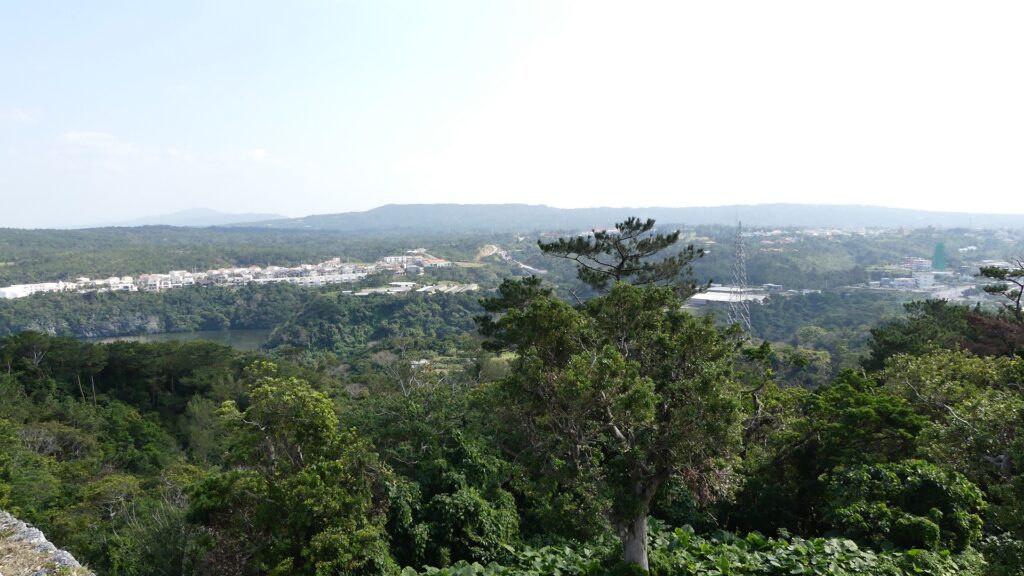
座喜味城は、琉球諸島(現在の沖縄諸島)周辺に300以上築かれた「グスク」を呼ばれた大規模な要塞の一つです。沖縄本島西海岸の近く、高さ120mの丘の上に築かれました。そのため、この城は非常に戦略的な位置にあり、この島と海を広範囲に見渡すことができます。また、この城は誰がいつ築いたのか明確である数少ないグスクの一つなのです。
Zakimi Castle was one of the over 300 large-scale fortresses called “Gusuku” around the Ryukyu Islands (what is now Okinawa Islands). It was located on a 120m high hill near the western coast of the mid Okinawa Island. That’s why the castle had a very strategic location where wide views of the island and sea can be seen. It is also one of the few Gusuku which people know when and who built it.

城の位置~The location of the castle

「按司」と呼ばれた有力な領主の一人、護佐丸が15世紀初頭に最初にこの城を築きました。それ以前は、彼は別のグスク、山田城に住んでおり、後の琉球王国となる中山王国に仕えていました。1416年、中山王国が北山王国を倒した時、彼は多大な貢献をしました。その後、彼は北山(沖縄本島北部)守護職に任命されました。一方彼は新しい本拠地として座喜味城の築城を始めたのです。
One of the powerful lords called “Aji”, Gosamaru first built the castle in the first 15th century. Before that, he lived in another Gusuku called Yamada Castle, and worked under the Chuzan Kingdom, the later Ryukyu Kingdom. He made a significant contribution when the Chuzan Kingdom beat the Hokuzan Kingdom in 1416. After that, he was appointed as the military governor of the Hokuzan Region (the northern part of Okinawa Island), while he started to build Zakimi Castle as his new home base.

今帰仁城、北山王国の首都~Nakijin Castle, the capital of the Hokuzan Kingdom

護佐丸名を揚げる~Gosamaru made his mark

この城の下にある丘は、岩盤ではなく軟弱な地盤でした。しかし護佐丸は、美しい高石垣を伴う強力な城を築くことに成功したのです。この工事により、彼は勇猛な将軍としてだけではなく、優れた築城家としても知られるようになりました。彼は1422年にこの城に移り、18年間在城しました。貿易の統制を含め、この城の周辺地域を支配していました。
The hill under the castle was soft ground, not rocky, but Gosamaru succeeded in building a strong castle with beautiful, high stone walls. This construction made him a great castle builder as well as a brave general. He lived in Zakimi Castle for 18 years since moving to it in 1422. He governed the area around the castle, while controlling the trading near the castle.

座喜味城の石垣~The stone walls of Zakimi Castle

1440年、琉球王国は護佐丸に対して、座喜味城の東にある中城城に移るよう命じました。王国に対抗して力をつけていた別の有力按司、阿麻和利が島の東海岸にある勝連城にあったからです。護佐丸は、現在我々が素晴らしい城跡として見ているように、中城城をも改築したのです。彼はまた、王国の親戚筋にもなり、緊密に連携していました。
In 1440, the king of Ryukyu Kingdom ordered Gosamaru to move to Nakagusuku Castle, located east of Zakimi Castle, as another great Aji, Amawari, who lived in Katsuren Castle located in the eastern coast of the island, grew in strength against the Kingdom. Gosamaru also improved Nakagusuku Castle like we can now see the great ruins of the castle. He also became a relative of the Kingdom to work closely with it.

護佐丸が改築した中城城~Nakagusuku Castle which Gosamaru improved
阿麻和利がいた勝連城~Katsuren Castle which Amawari owned

護佐丸非命に倒れる~Gosamaru dies unnatural death

ところが、護佐丸は王国への反逆者とみなされてしまい、1458年に阿麻和利によって滅ぼされてしまいます。阿麻和利から攻撃されたとき、護佐丸は自身への疑いのことを聞き、嘆き悲しんで、阿麻和利と戦うことなく自ら命を絶ったといいます。阿麻和利が王国と護佐丸を騙したのだと言われていますが、詳細は不明です。発掘によれば、護佐丸が去った後の座喜味城は、16世紀まで使われたとのことです。
However, Gosamaru was considered a rebel against the Kingdom, and beaten by Amawari in 1458. When Amawari attacked, Gosamaru heard the doubt about him, felt very sad, and killed himself without fighting with Amawari. It is said that Amawari deceived the Kingdom and Gosamaru, but the details are uncertain. Zakimi Castle after Gosamaru left, was used until the 16th century, according to the excavation.

座喜味城~Zakimi Castle

特徴~Features

石垣の特徴~Features of stone walls

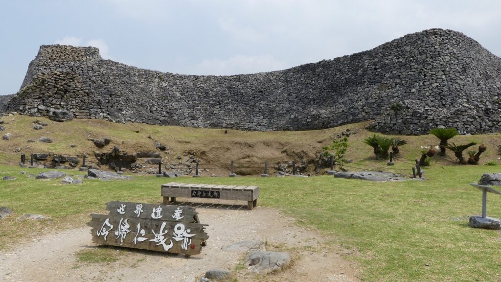
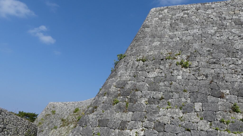
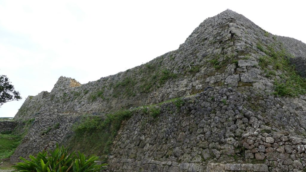
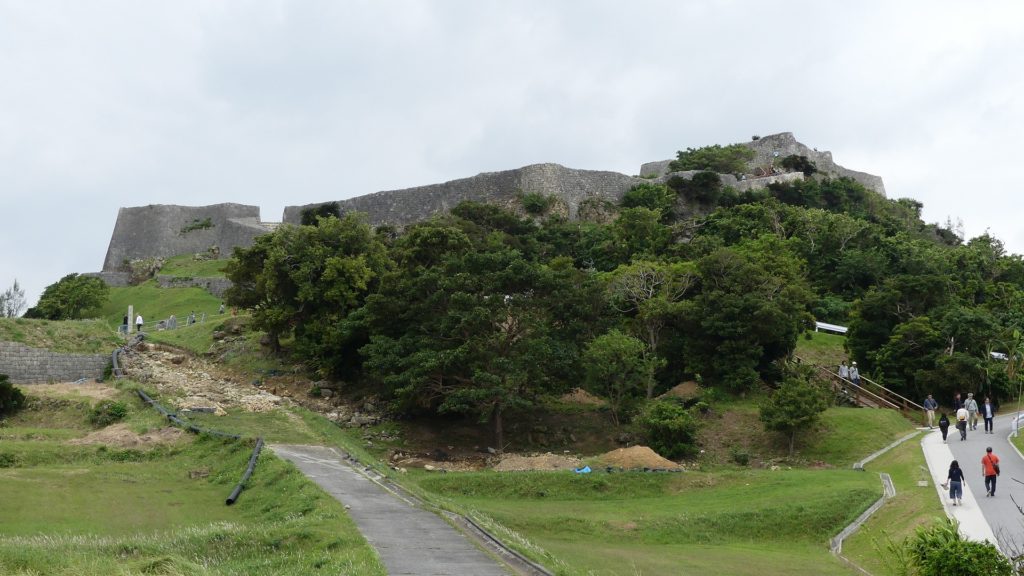
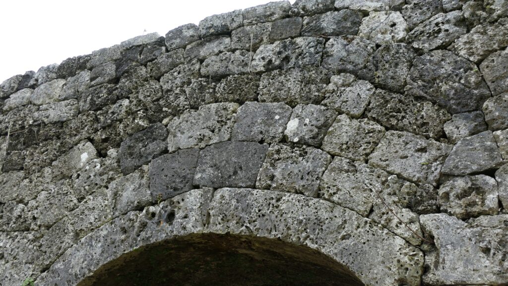
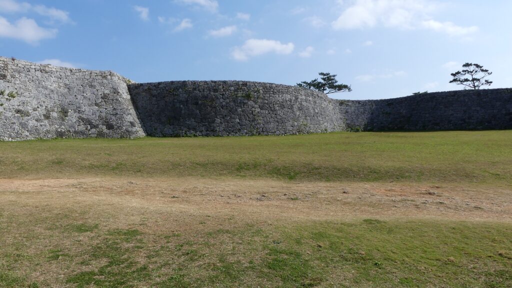
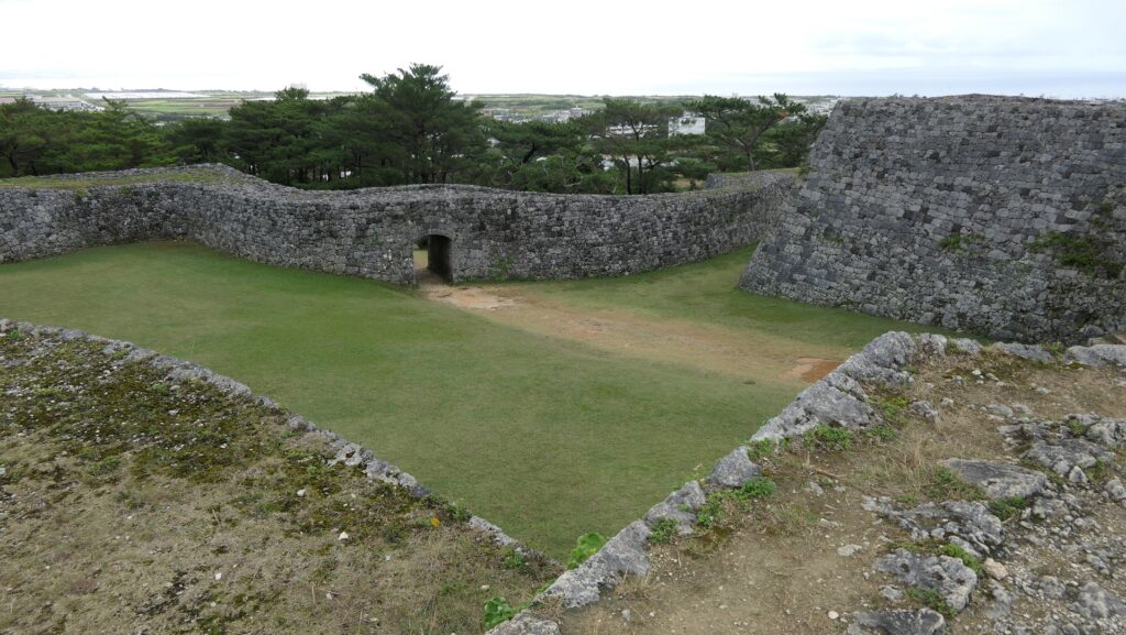
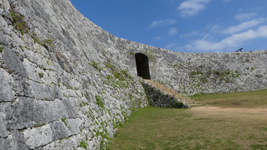
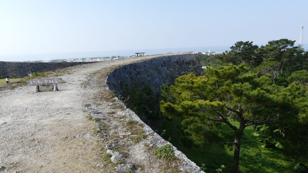
現在、座喜味城跡はよく整備され、また維持されています。この城にはもともと2つの曲輪しかなかったので、場所自体はそんなに広くありません。主には石垣が残っていますが、最高で13mの高さがあり、とても美しく見えます。曲線を描く石垣が、頂点部分でつながり、扇状に広がっています。このような形状は、軟弱な地盤を補い、頂点の部分は見張りや防御地点として使われたと言われています。それぞれの曲輪にはアーチ型の門があり、他の石をつなぎ合わせるために楔形の石が使われています。この方法は珍しい方法で、このため沖縄のグスクの中では、座喜味城の門は最も初期段階のアーチ門であると考えられています。
Now, the ruins of Zakimi Castle are well developed and maintained. The site is not so large, because the castle originally had just two enclosures. The stone walls mainly remain and look very beautiful with at highest 13m height. They are curved walls jointed by their apexes, spreading fan-wise. It is said that such a shape can cover the soft ground, and the apexes could be used as the points for monitoring and protecting. Each enclosure has an arch-shaped gate which uses a keystone connecting other stones. It is a unique method and Zakimi castle gates are thought to be the first case for arch-shaped gates among Okinawa’s Gusuku.

城周辺の航空写真~The aerial photo of around the castle

美しく屈曲している石垣~The beautiful curved stone walls
楔石を使ったアーチ型門~The arch-shaped gate using a keystone
城跡の入口~The entrance of the ruins

二の郭~Second Enclosure

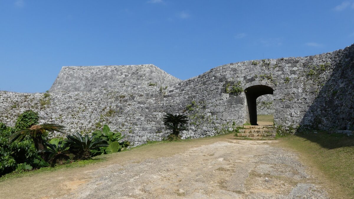
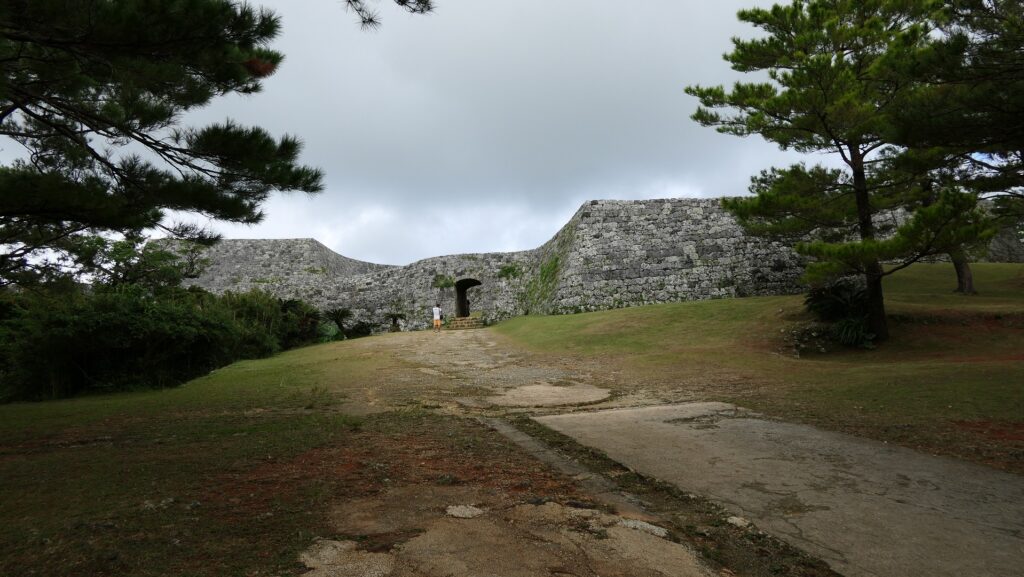
城跡の入口に入って、石垣に囲まれた二の郭の門の方に歩いていきます。このアーチ門は現存しているもので、修復がなされました。郭に入ると、内側から美しい曲線からなる石垣が目に入ります。それから一の郭へと続く石段とアーチ型の門も見えてきます。一の郭の門は一旦破壊され、石段も埋められてしまいますが、両方とも現在では復元されています。
You can enter the entrance of the ruins and walk to the gate of the Second Enclosure, surrounded by the stone walls. Its arch shaped gate is the original and has been repaired. After entering the enclosure, you will see the beautiful curved shape of the stone walls from the inside. You can also see the stone steps to the First Enclosure and its arch shaped gate. The gate was once destroyed, and the steps were buried, but now both have been restored.
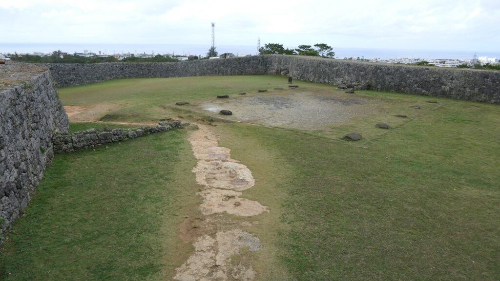
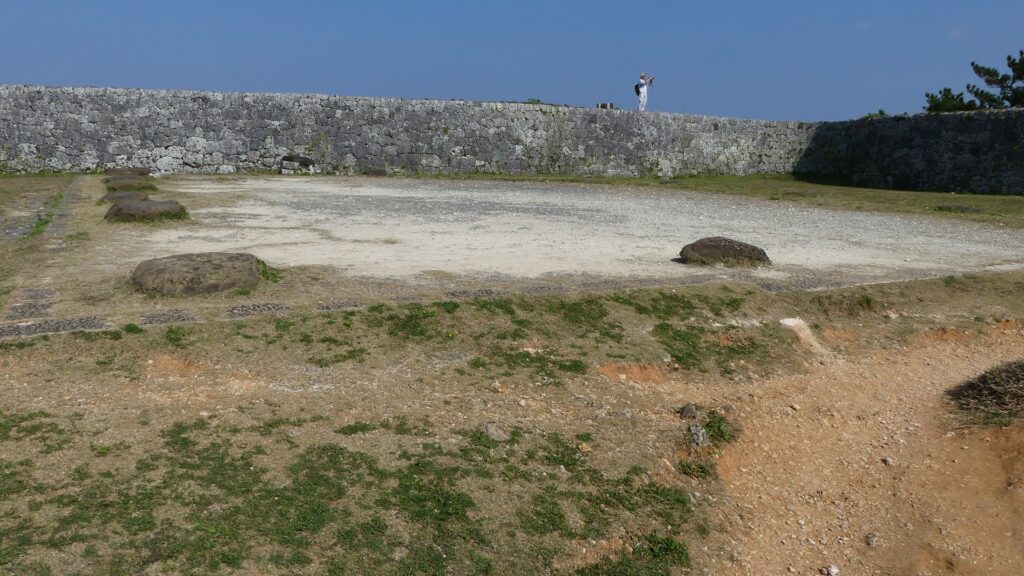
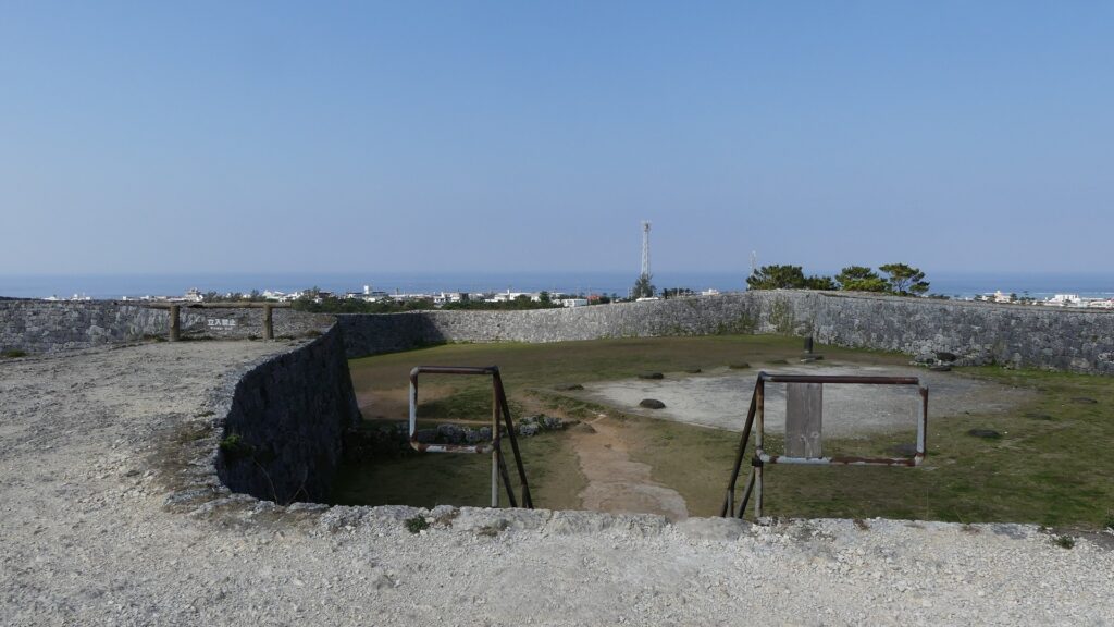
二の郭の入口~The entrance of the Second Enclosure
二の郭の内部~The inside of the Second Enclosure
一の郭から見た二の郭~The Second Enclosure from the First Enclosure
一の郭へ続く門~The gate to the First Enclosure

一の郭~First Enclosure

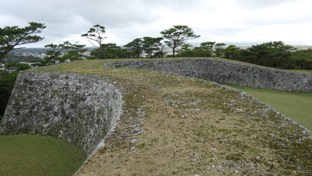
一の郭の内側は、二の郭と似た形ですが、礎石を伴った建物跡があります。もとあった建物は、瓦の破片が見つかっていないため、杮葺きか萱葺きであったようです。一部分の石垣の上には登ることができますので、東の方には島の、西の方には海の素晴らしい景色を眺めることができます。
Inside the First Enclosure, its shape is similar to the Second Enclosure. It has the ruins of buildings with cornerstones. The original buildings seemed to have a shingled or thatched roof, because pieces of roof tiles were not found. You can also go up to part of the top of the stone walls, then you will have a great view of the island on the east, and that of the sea on the west.

一の郭の内部~The inside of the First Enclosure
建物跡~The ruins of the buildings
一の郭からの海の眺め~A view of the sea from the First Enclosure
一の郭からの島の眺め~A view of the island from the First Enclosure

その後~Later History

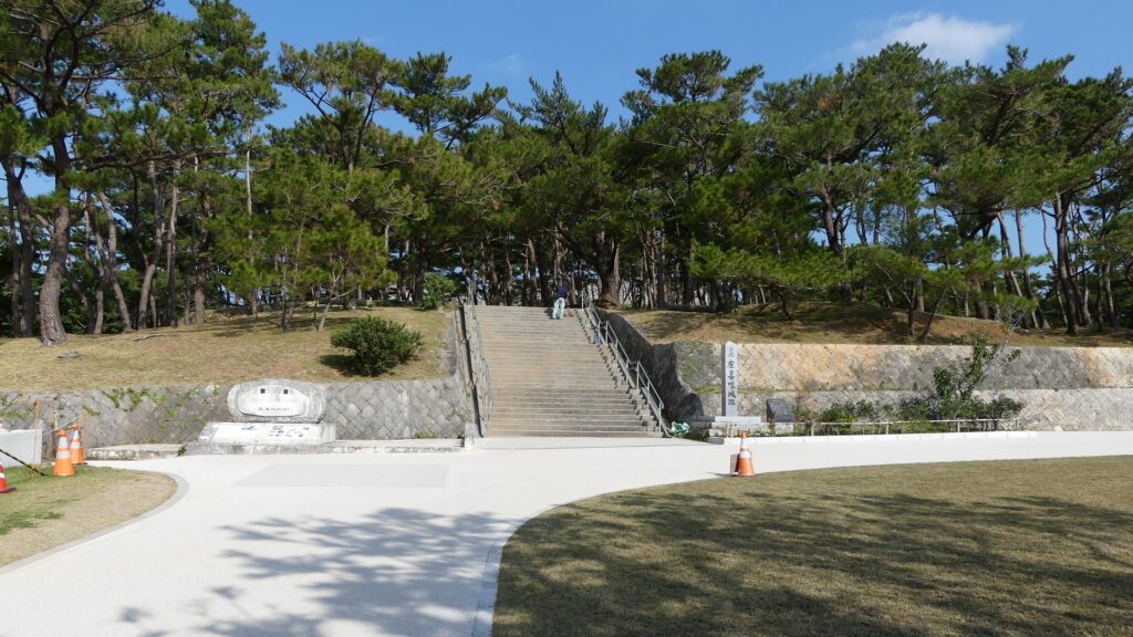
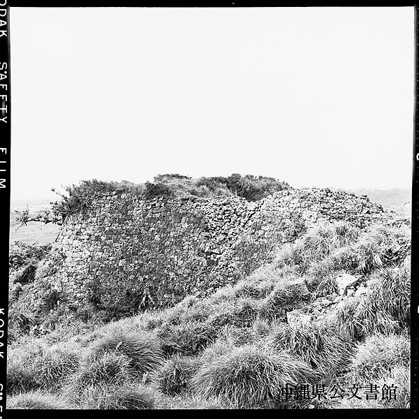
座喜味城は長い間放置されてきました。第二次世界大戦の間、城跡は日本陸軍により高射砲陣地として使われていました。戦後になってさえ、米軍によってレーダー基地として再度利用されたのです。これは城跡がまだ戦略的に重要な場所にあったと言えるのかもしれません。しかし工事により遺跡の一部は破壊されてしましました。1972年の沖縄日本返還の後は、直ちに国の史跡に指定されました。ついには、2000年から琉球王国のグスク及び関連遺産群として世界遺産に登録されています。
Zakimi Castle had been abandoned for a long time. During World War II, the ruins were used by the Japanese Army as the ground for anti-aircraft guns. Even after the war, they were reused by the U.S. Military as a radar station. That might show the ruins still had a strategic location, but part of stone walls were destroyed due to the construction. The ruins were designated as a National Historic Site immediately after the reversion of Okinawa to Japan in 1972. Lastly, they have also been on the World Heritage List as Gusuku Sites and Related Properties of the Kingdom of Ryukyu since 2000.

1957年の座喜味城跡、沖縄県公文書館蔵~The picture of ruins of Zakimi Castle in 1957, owned by Okinawa Prefectural Archives(licensed under Public Domain via Wikimedia Commons)

私の感想~My Impression

初めて座喜味城を訪れたとき、城の石垣が完全に復元、修復されていることに驚きを感じました。この城の美しい曲線状の姿は完ぺきに沖縄の景色にマッチしています。また、城跡のとなりにあるユンタンザミュージアムに行ってみるのもお勧めです。この城のことをもっと知るともに、周辺の地域の歴史や文化を学ぶことができます。
When I saw the ruins of Zakimi Castle for the first time, I was surprised to see the stone walls have been completely restored or repaired. Their beautiful curved appearance perfectly matches the scenery of Okinawa Island. I also recommend you to visit Yuntanza Museum next to the ruins. You can learn more about the castle as well as the history and culture of the area around the castle.

石垣の曲線~The curved stone walls

ここに行くには~How to get There

ここに行くには車がお勧めです。
那覇空港から:
車の場合、那覇空港自動車道に名嘉地ICから入り、西原JCTで沖縄自動車道に合流し、沖縄南ICで降りてください。城跡はそこから30分程かかりますが、城跡周辺に駐車場があります。
I recommend you to visit it by car.
From the Naha Airport:
By car, enter Naha Airport Expressway at the Nakachi IC, join Okinawa Expressway at the Nishihara JCT, and get off the expressway at Okihawa-minami IC. The ruins are about 30 minutes away from the IC. There are parking lots around the ruins.

リンク、参考情報~Links and References

世界遺産座喜味城跡、ユンタンザミュージアム(Yuntanza Museum)
萩原さちこの城さんぽ 第10回 座喜味城(Only Japanese)
・「列島縦断「幻の名城」を訪ねて/山名美和子著」集英社新書(Japanese Book)

182.水城~Mizuki

緑の防衛ラインが今だにくっきりと残っています。
The green defense line still stands prominently.

立地と歴史~Location and History

大宰府を守る防衛線~Difense Line to protect Dazaifu

水城は、663年の朝鮮での白村江の戦いで日本が唐と新羅の連合軍に敗れた直後、国が初めて作った本格的な軍事施設です。それは、連合軍の侵攻から古代日本の地方政府であった「大宰府」を守るための防衛ラインでした。つくられたのは664年で、大野麹智基肄などの古代山城と呼ばれた西日本の軍事施設より以前のことでした。そのため水城は、日本の城のうちの一つとみなされています(その名前自体が水の城です)。
Mizuki was the first national full-scale military facility built immediately after Japan was beaten by the ally of Tang and Silla in the Battle of Baekgang, Korea in 663. It was a defense line to protect the ancient Japanese local government, “Dazaifu” in Kyushu Island from the ally’s invasion. It was first built in 664 before other military facilities in western Japan called ancient mountain castles such as Ono, Kikuchi, and Kii. That’s why Mizuki is regarded as one of the castles of Japan (The name means Water Castle in Japanese).

白村江の戦いの図~The map about the Battle of Baekgang(licensed by Samhanin via Wikimedia Commons)

戦略的な設計~Strategic Design

この防衛ラインは東は四王寺山の麓と、西にあるもう一つの丘との間に設けられており、福岡平野では最も狭い部分に当たり、大宰府政庁の北にありました。幅80m、高さ10mの土塁が1.2kmに渡っていました。そして両側に水堀がありました。この地域の地盤が弱かったので、土塁は丈夫な枝葉の基礎の上に設置されました。この構成により土塁を強固にする方法は「敷そだ」と呼ばれました。土塁自体を強固にするためには、土を突き固める版築という方法が採用されました。水堀は、土塁の下を通る木樋によってつながっていました。その水は内側の堀から外側の堀に流れていました。
The defense line is located between the foot of Shioji-yama mountain on the east and another hill on the west, which is the narrowest part of the Fukuoka Plain, and the north of Dazaifu government. It consisted of earthen walls that were 1.2km long, 80m wide and 10m high. It was surrounded by water moats on both sides. As the earth was weak in that area so the walls were laid on a foundation of strong branches. And this method of making the structure or wall strong was called “Sikisoda”. To make the walls sturdy the workers use to ram soil on the wall and this method was called Rammed earth. The water moats were connected under the earthen walls through wooden water pipes. The water flowed from the inside into the outside part of the moat.

城の位置~The location of the castle

水城に残る土塁~The remaining earthen walls of Mizuki
復元された木樋~The restored wooden water pipe(licensed by Saigen Jiro via Wikimedia Commons)

土塁の幅は戦略的に設計されており、守備兵の矢は土塁の高い位置から放たれ外側に届くが、敵の矢は外側の低い位置から放たれ、内側には届かないようになっていました。歴史家は、朝鮮からの亡命者がこれを設計したと推定しています。
Its width was strategically designed so that when the defender’s arrows shot from the upper part of the wall, it could reach outside but when the enemy shot from lower part outside the moat, it couldn’t reach inside. Historians speculate that this method was designed by Korean refugees.

水城の構造模型~The model of Mizuki(水城館~Mizuki Site Exhibition Hall

交通の要地~Important Point for Traffic

このラインには2つの門があり、それぞれ官道が通っていました。一つは東門から博多港の方に伸びており、もう一つは西門から鴻臚館と呼ばれた中国や朝鮮からの人々をもてなす迎賓館の方に伸びていました。大宰府政庁の出入口としても使われており、この地域の交通や旅行者の出入りを監視していました。
The line had two gates for two government-run roads. One of them went through the East Gate to Hakata Port, and the other went through the West Gate to the guest house called Kouro-kan that was used to host people from China and Korea. It was also used as the entrance of Dazaifu government, and it checked transportation and passengers in and out of that region.

古代官道の推定ルート~The estimated routes of the government-run roads(現地説明板より~From the signboard at the site)

幸いにも、連合軍は日本を攻撃しませんでした。水城は大宰府政庁の道しるべとなりました。多くの人々が訪問客の出迎えや見送りのためにここを使ったのです。
Fortunately, the ally did not attack Japan. Mizuki became a landmark of Dazaifu government. Many people used it to welcome or say good-bye to visitors.

現在水城を通り抜ける道路~The present road through Mizuki

特徴~Features

現在、この辺りを通る人たちの多くは、水城跡をはっきりと見ることができます。なぜなら、この遺跡は緑地帯のように今だにこの一帯に横たわっていて、公道、高速道路、鉄道といった多くの現代の交通網もまたこの遺跡を横切っているからです。この遺跡は緑の林に覆われた土塁として残っているのです。素晴らしいことだと思いませんか。
Now, many people who go through the area around the ruins of Mizuki can clearly see them. This is because the ruins still lay across the area like a green belt, and a lot of modern transportation such as public roads, Expressways and Railways, also go across the ruins. The ruins remain as earthen walls covered with green forests. Isn’t that fantastic?

城周辺の航空写真~The aerial photo of around the castle

土塁周辺を歩く~Waking around Earthen Walls

この土塁からは既に水堀は失われています。そして、ところどころ現代の交通網により寸断されてしまってもいます。しかしながら、土塁の周辺を歩いてみれば、少なくとも高さが違っている構造になっていることはわかると思います。また、JR鹿児島本線により寸断されている箇所では、どのように土塁が積み上げられているかがわかります。The earthen walls have already lost their water moats, and the walls are partly destroyed by the modern transportation. However, when you walk around the walls, you can at least see the different levels of the structure. You can also see how the walls were rammed at the cross section of the walls which are cut through by the JR Kagoshima Line.

低くなっている土塁の外側~The lower outside of the earthen walls
高くなっている土塁の内側~The higher inside of the earthen walls
土塁の断面~The cross section of the walls(taken by ヘンリー3世 from photoAC)

東門周辺~Around East Gate

東門跡では、国道112号線がかつての古代官道のように遺跡を通り抜けています。後になって人々は門が元々あった場所に石碑を作って設置しました。門の礎石はまだ残っていて、遺跡を見に来た人であれば、すぐ見つけられます。また、水城館という展示施設があって、水城の歴史や使われている技術を学ぶことができます。この辺りは土塁の東端に当たるため、山裾の方に登って行って、遺跡の全景を見ることもできます。
At the ruins of the East Gate, the National Route 112 goes through the ruins like the ancient government road. Later on, people made and placed stone structures where the gates use to stand originally. The cornerstones of the gate still exists and anybody who visits the ruins can see them . You can also visit the guest house called Mizuki-kan which exhibits the history and technology of the ruins. The area is near the eastern edge of the earthen walls, so you can walk up to the foot of the mountain and have the whole view of the ruins.

国道112号線~The National Route 112
石碑と土塁~The stone structure and earthen walls
東門の礎石~The cornerstones of the East Gate
水城館~Mizuki-kan
水城の全景~A full view of Mizuki

西門周辺~Around West Gate

西門の跡については、ここもまた地方道路により壊されてしまっています。発掘によれば、西門は3回立て直されています。門はその時代ごとの要請によって、機能が違っており、外交関係が悪いときは関門として機能し、関係がよくなると飾り立てられていたようです。
At the ruins of the West Gate, they are also destroyed by a local road. The excavation found that the gate had been rebuilt three times. It was a functional gate that was built as per requirement. The gate served as a barrier when foreign relations were bad. However, when relations were good it was more decorative.

西門の想像図~The imaginary drawing of the West Gate(大野城市Websiteより引用)

その後~Later History

中世の13世紀頃、門は失われていました。しかし武士たちはモンゴル襲来のときに跡地を陣地として使用したようです。江戸時代には東側の官道は日田街道となり、多くの人々が往来しました。人々は水城を著名は遺跡として認識していました。1953年には国の特別史跡に指定されます。
Around the 13th century of the Middle Ages, the gates had been lost, but warriors seemed to use the ruins as a position against the Mongol Invasion. In the Edo Period, the eastern government road was being turned into Hita Road many people used. The people had already recognized Mizuki as famous ruins. The ruins have been designated as a Special National Historic Site since 1953.

水城関跡、筑前名勝画譜より、江戸時代、国立公文書館蔵~The ruins of Mizuki, from The Picture Book of Famous Sights in Chikuzen Province, in the Edo Period, owned by National Archives of Japan(水城館展示、An exhibition of Mizuki-kan)

私の感想~My Impression

白村江の戦いは、日本の歴史において重要な出来事でした。水城跡は、多くの人々が近くを通るだけで目にすることができる、とても分かりやすい遺跡だと思うのです。歴史の知識があれば、水城がなぜ築かれたか多分わかるでしょう。知識がなくとも、遺跡を見てもっと知りたいと思うかもしれません。水城が永久に守られることを切に望みます。
The battle of baekgang is an important event in the history of Japan. I think that the ruins of Mizuki are very easy to understand for many people, because they can have many chances to see the ruins when they pass by. If they have the knowledge of history, they will probably understand why Mizuki was built easily. Even if not, they may want to learn more about the ruins seeing them. I really hope that Mizuki will be kept forever.

土塁と水城館~The earthen walls and Mizuki-kan

ここに行くには~How to get There

東門跡に行くには:
車では、九州自動車道の大宰府ICから数分のところです。展示施設に駐車場があります。
電車の場合は、西鉄天神大牟田線の下大利駅から歩いて約20分です。
西門跡に行くには:
車では、九州自動車道の大宰府ICから約10分かかります。水城ゆめ広場に駐車場があります。
電車の場合は、JR鹿児島本線の水城駅から歩いて数分のところです。
To the ruins of the East Gate:
By car, it takes few minutes from the Dazaifu IC on Kyushu Expressway. The guest house offers a parking lot.
By train, it takes about 20 minutes on foot from Shimo-ori Station on Nishitetsu Tenjin-Omuta Line.
To the ruins of the West Gate:
By car, it takes about 10 minutes from the Dazaifu IC on Kyushu Expressway.
Mizuki-Yumehiroba Park offers a parking lot.
By train, it takes few minutes on foot from Mizuki Station on JR Kagoshima Line.

リンク、参考情報~Links and References

水城跡、大野城市(Onojo City Website)
水城館、古都大宰府保存協会(Japanese Association Website)