118.Oshi Castle Part1

Tins castle is known for the Battle of Oshi Castle.

Location and History

Narita Clan builds Castle using Marshes between rivers

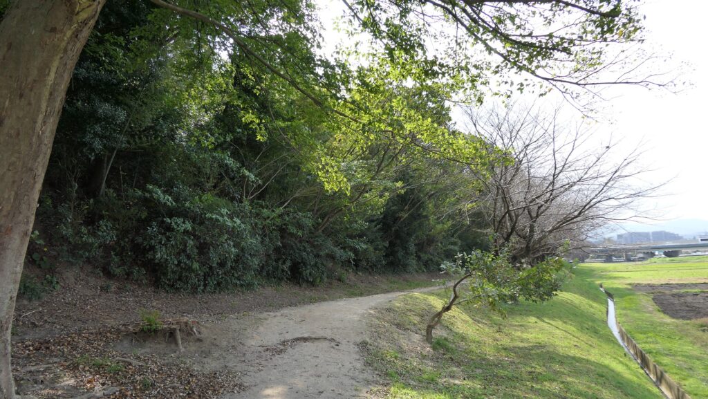
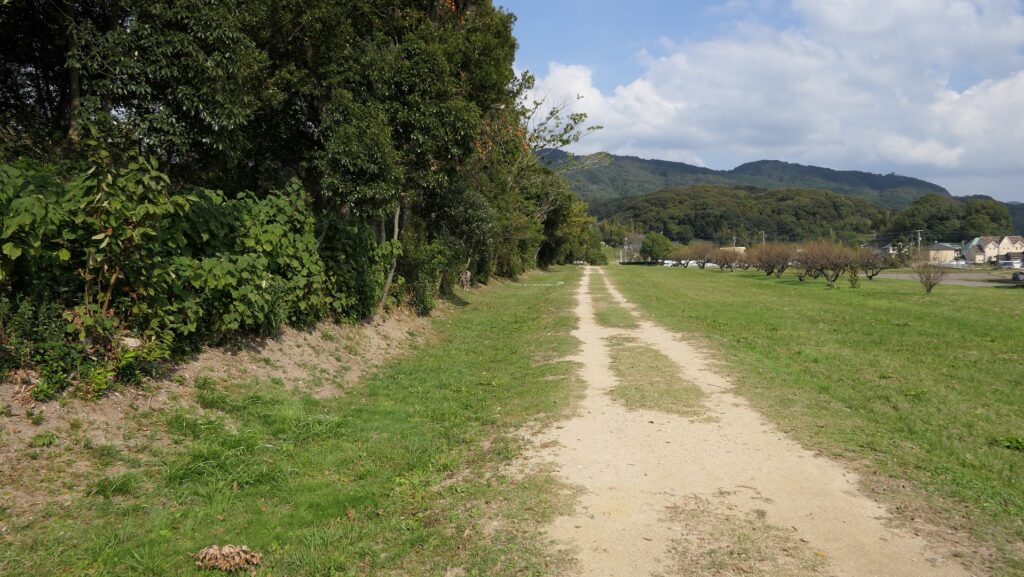
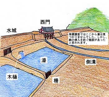
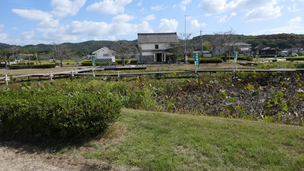
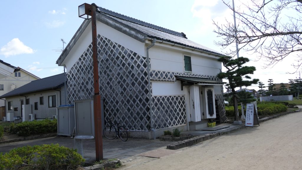
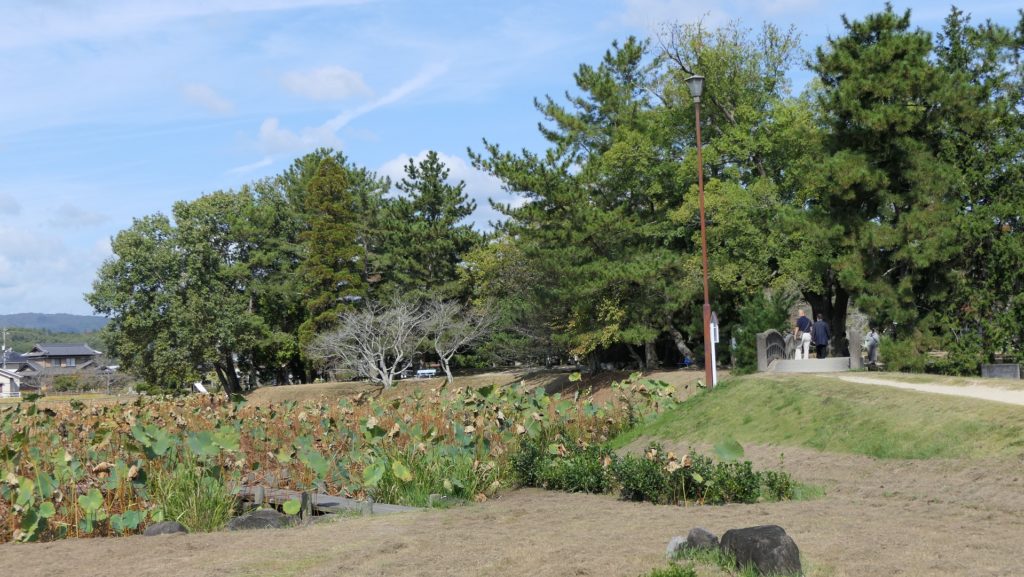
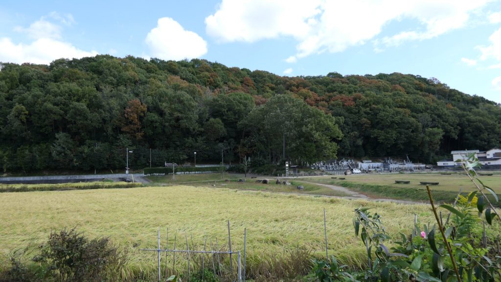
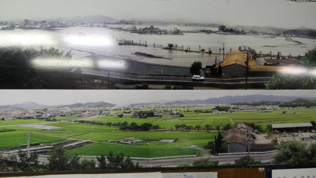
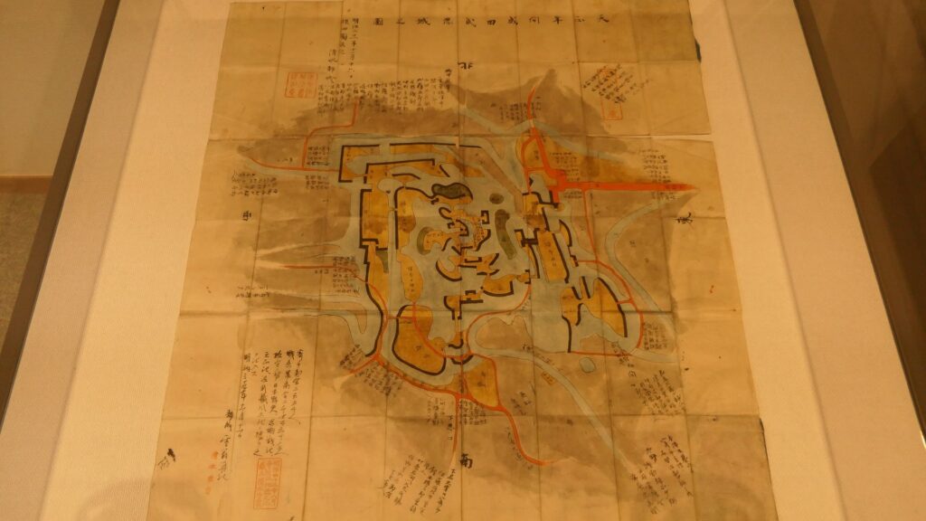
Gyoda City is located in the northern part of Saitama Prefecture, which is sandwiched by two large rivers in the Kanto Region, Tonegawa and Aarakawa Rivers. The land of the city is very flat and has been developed for living comfortably, however, it was marshy and waterlogged in the Middle Ages due to its terrain and flood from the rivers. The Narita Clan governed the area, which was called Oshi, in the 15th and 16th Centuries during the Sengoku Period. It is said that the clan first built Oshi Castle in the late 15th Century. Many battles happened in the Kanto Region at that time, so local lords needed to protect themselves by building strong castles. Some built mountain castles such as Minowa Castle for the Nagano Clan and Kanayama Castle for the Iwamatsu Clan. On the other hand, the Narita Clan’s choice was to build a Water Castle, using the area’s features of islands among the marshes and natural levees along the rivers. The castle’s enclosures were connected by paths on bridges and earthen walls.

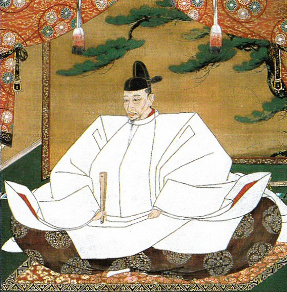
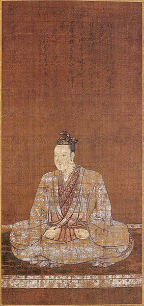
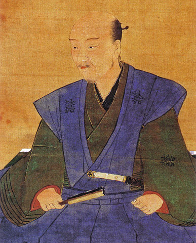
The range of Gyoda City and The location of the castle

The strength of the castle was actually proven when Hideyoshi Toyotomi invaded the Kanto Region to complete his unification of Japan in 1590. The whole region had been governed by the Hojo Clan which the Narita Clan served then. The Hojo Clan ordered their branches including Oshi Castle to gather soldiers to their home base, Odawara Castle to against Hideyoshi. Ujinaga Narita, the lord of Oshi Castle had to leave it for Odawawa, so few defenders were left in the castle, under the castle keeper, Nagachika Narita, Ujinaga’s cousin. Hideyosi attacked the Hojo’s territory with over 200,000 soldiers, sending troops to not only Odawara Castle but also branch castles. For example, Kanayama Castle where a magistrate from the Hojo governed was easily open by the troops. However, the only 500 defenders with 2500 residents in Oshi castle, instructed by Nagachika, never surrendered against over 20,000 attackers.

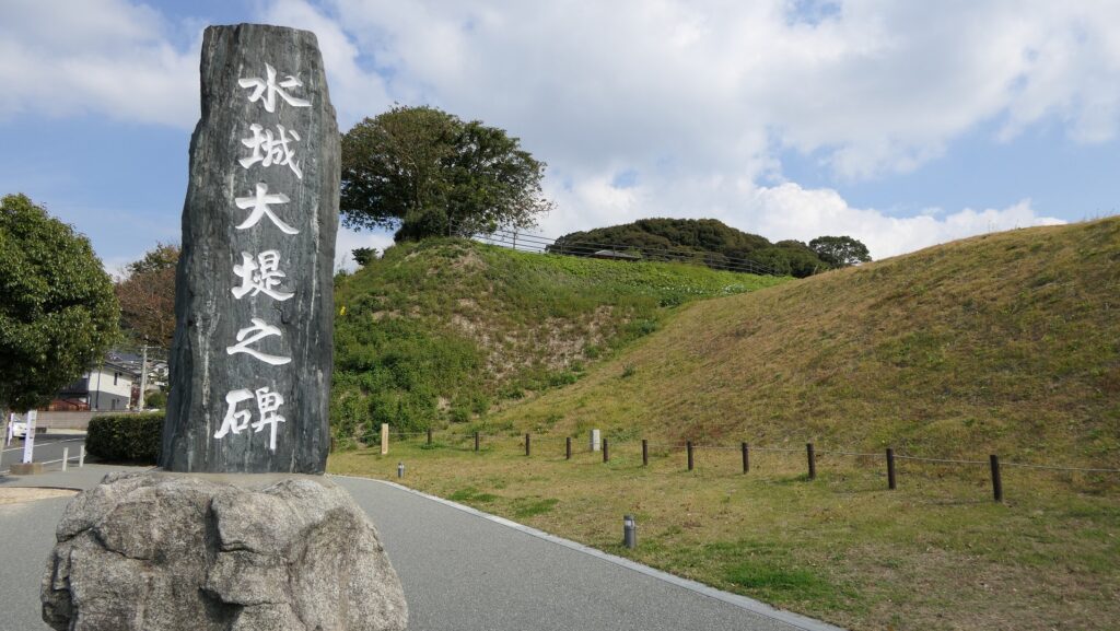
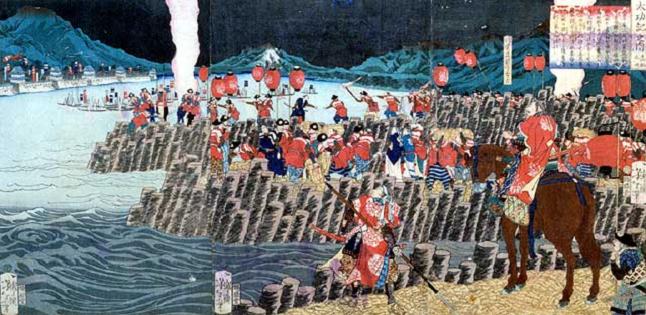
Castle is attacked by Inundation tactics in Battle of Oshi Castle

The Portrait of Hideyoshi Toyotomi, attributed to Mitsunobu Kano, owned by Kodaiji Temple (licensed under Public Domain via Wikimedia Commons)
Odawara Castle

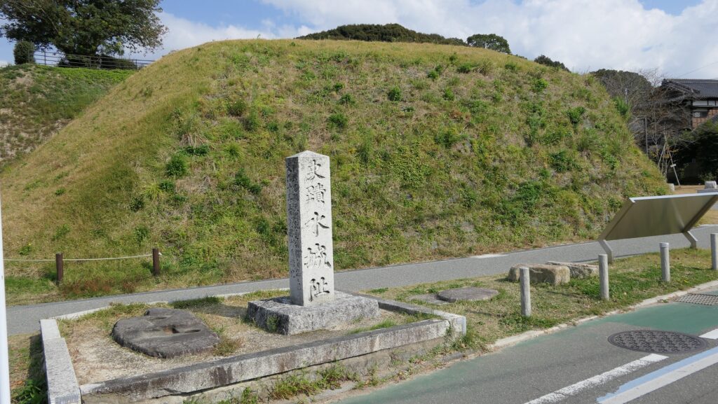
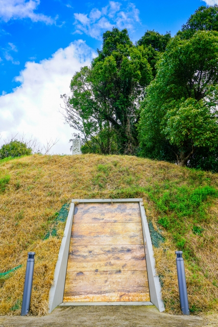
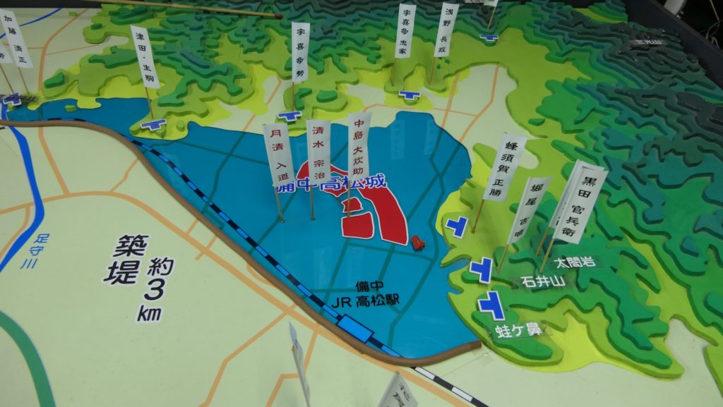
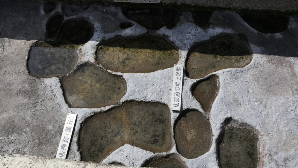
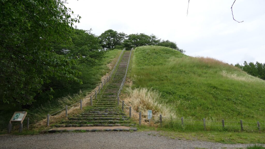
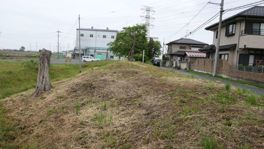
The commander head of the attackers was Mitsunari Ishida, a highly trusted retainer from Hideyoshi, who was also supported by other lords, such as Nagamasa Asano and Masayuki Sanada. Hideyoshi was not there, but he ordered Mitsunari to flood the castle by making banks surrounding it to keep more water. His idea probably came from the geographical features and his successful experience of the Battle of Bicchu-Takamatsu Castle where he did the same way. It is said that Mitsunari put his strong hold on Maruhakayama-Kofun, an Ancient Burial Mound, about 2km away from the castle in the south. His team rapidly built 15 to 25 km banks around the mound in few days to dam water from the rivers. A folk story remains that farmers were asked to bring earth bags to build banks for a high fee.

The portrait of Mitsunari Ishida, owned by Hajime Sugiyama (licensed under Public Domain via Wikimedia Commons)
Maruhakayama Ancient Burial Mound
The partially remaining bank Mitsunari built, called Ishida Tsutsumi

It is uncertain if his attempt was successful according to some records in which the defenders secretly cut part of the banks to drain water drowning some attackers. The fact is that when the supporting lords tried to assault the castle, Hideyoshi ordered them to stop it and continue the inundation. The siege lasted for about a month, however, the castle couldn’t be beaten until the master Hojo surrendered in Odawara Castle. The castle has been nicknamed “a floating castle” of “a turtle castle” which probably originate from what the castle looked like in the siege.

“The illustration of the Narita Clan’s Oshi Castle during the Tensho Era”, it was made by a local historian to consider the Battle of Oshi Castle during the Meiji Era, exhibited by the Gyoda City Local Museum
The Horikiri-bashi Bridge where the bank was cut according to a local tradition

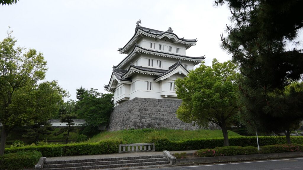
Castle becomes important defense site for Edo

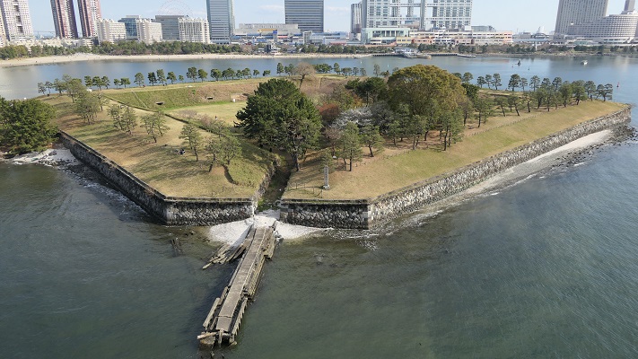
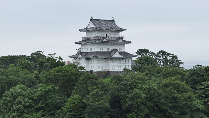
In the Edo Period, Oshi Castle was governed by relatives or hereditary vassals of the shoguns as the Oshi Domain. This was because this castle was located in an important defensive site for Edo Castle, the shogun’s home base in the south. It is said that the Abe Clan, which often became members of shogun’s council of elders, completed the castle. They still used the basic structures of the castle as the island-like enclosures among the moats and marshes. However, they improved the castle’s defense systems more by building the three-level turret (similar to the Main Tower), other turrets and gates. The castle and domain were finally followed by the Okudaira-Matsudaira Clan, whose origin was the son of Nobumasa Okudaira who contributed to Ieyasu Tokugawa, the founder of the shogunate, in the Battle of Nagashino Castle and was married with Ieyasu’s daughter. They were trusted in and ordered by the shogunate to guard the No.3 Shinagawa Battery facing Edo Bay to prepare for possible threat to Western battleships at the end of the Edo Period.

The miniature model of Oshi Castle during the Edo Period, exhibited by the Gyoda City Local Museum
The rebuilt three-level turret of Oshi Castle, it was built in a different position from the original one
The No.3 Shinagawa Battery

To be continued in “Oshi Castle Part2”

182.水城~Mizuki

緑の防衛ラインが今だにくっきりと残っています。
The green defense line still stands prominently.

立地と歴史~Location and History

大宰府を守る防衛線~Difense Line to protect Dazaifu

水城は、663年の朝鮮での白村江の戦いで日本が唐と新羅の連合軍に敗れた直後、国が初めて作った本格的な軍事施設です。それは、連合軍の侵攻から古代日本の地方政府であった「大宰府」を守るための防衛ラインでした。つくられたのは664年で、大野麹智基肄などの古代山城と呼ばれた西日本の軍事施設より以前のことでした。そのため水城は、日本の城のうちの一つとみなされています(その名前自体が水の城です)。
Mizuki was the first national full-scale military facility built immediately after Japan was beaten by the ally of Tang and Silla in the Battle of Baekgang, Korea in 663. It was a defense line to protect the ancient Japanese local government, “Dazaifu” in Kyushu Island from the ally’s invasion. It was first built in 664 before other military facilities in western Japan called ancient mountain castles such as Ono, Kikuchi, and Kii. That’s why Mizuki is regarded as one of the castles of Japan (The name means Water Castle in Japanese).

白村江の戦いの図~The map about the Battle of Baekgang(licensed by Samhanin via Wikimedia Commons)

戦略的な設計~Strategic Design

この防衛ラインは東は四王寺山の麓と、西にあるもう一つの丘との間に設けられており、福岡平野では最も狭い部分に当たり、大宰府政庁の北にありました。幅80m、高さ10mの土塁が1.2kmに渡っていました。そして両側に水堀がありました。この地域の地盤が弱かったので、土塁は丈夫な枝葉の基礎の上に設置されました。この構成により土塁を強固にする方法は「敷そだ」と呼ばれました。土塁自体を強固にするためには、土を突き固める版築という方法が採用されました。水堀は、土塁の下を通る木樋によってつながっていました。その水は内側の堀から外側の堀に流れていました。
The defense line is located between the foot of Shioji-yama mountain on the east and another hill on the west, which is the narrowest part of the Fukuoka Plain, and the north of Dazaifu government. It consisted of earthen walls that were 1.2km long, 80m wide and 10m high. It was surrounded by water moats on both sides. As the earth was weak in that area so the walls were laid on a foundation of strong branches. And this method of making the structure or wall strong was called “Sikisoda”. To make the walls sturdy the workers use to ram soil on the wall and this method was called Rammed earth. The water moats were connected under the earthen walls through wooden water pipes. The water flowed from the inside into the outside part of the moat.

城の位置~The location of the castle

水城に残る土塁~The remaining earthen walls of Mizuki
復元された木樋~The restored wooden water pipe(licensed by Saigen Jiro via Wikimedia Commons)

土塁の幅は戦略的に設計されており、守備兵の矢は土塁の高い位置から放たれ外側に届くが、敵の矢は外側の低い位置から放たれ、内側には届かないようになっていました。歴史家は、朝鮮からの亡命者がこれを設計したと推定しています。
Its width was strategically designed so that when the defender’s arrows shot from the upper part of the wall, it could reach outside but when the enemy shot from lower part outside the moat, it couldn’t reach inside. Historians speculate that this method was designed by Korean refugees.

水城の構造模型~The model of Mizuki(水城館~Mizuki Site Exhibition Hall

交通の要地~Important Point for Traffic

このラインには2つの門があり、それぞれ官道が通っていました。一つは東門から博多港の方に伸びており、もう一つは西門から鴻臚館と呼ばれた中国や朝鮮からの人々をもてなす迎賓館の方に伸びていました。大宰府政庁の出入口としても使われており、この地域の交通や旅行者の出入りを監視していました。
The line had two gates for two government-run roads. One of them went through the East Gate to Hakata Port, and the other went through the West Gate to the guest house called Kouro-kan that was used to host people from China and Korea. It was also used as the entrance of Dazaifu government, and it checked transportation and passengers in and out of that region.

古代官道の推定ルート~The estimated routes of the government-run roads(現地説明板より~From the signboard at the site)

幸いにも、連合軍は日本を攻撃しませんでした。水城は大宰府政庁の道しるべとなりました。多くの人々が訪問客の出迎えや見送りのためにここを使ったのです。
Fortunately, the ally did not attack Japan. Mizuki became a landmark of Dazaifu government. Many people used it to welcome or say good-bye to visitors.

現在水城を通り抜ける道路~The present road through Mizuki

特徴~Features

現在、この辺りを通る人たちの多くは、水城跡をはっきりと見ることができます。なぜなら、この遺跡は緑地帯のように今だにこの一帯に横たわっていて、公道、高速道路、鉄道といった多くの現代の交通網もまたこの遺跡を横切っているからです。この遺跡は緑の林に覆われた土塁として残っているのです。素晴らしいことだと思いませんか。
Now, many people who go through the area around the ruins of Mizuki can clearly see them. This is because the ruins still lay across the area like a green belt, and a lot of modern transportation such as public roads, Expressways and Railways, also go across the ruins. The ruins remain as earthen walls covered with green forests. Isn’t that fantastic?

城周辺の航空写真~The aerial photo of around the castle

土塁周辺を歩く~Waking around Earthen Walls

この土塁からは既に水堀は失われています。そして、ところどころ現代の交通網により寸断されてしまってもいます。しかしながら、土塁の周辺を歩いてみれば、少なくとも高さが違っている構造になっていることはわかると思います。また、JR鹿児島本線により寸断されている箇所では、どのように土塁が積み上げられているかがわかります。The earthen walls have already lost their water moats, and the walls are partly destroyed by the modern transportation. However, when you walk around the walls, you can at least see the different levels of the structure. You can also see how the walls were rammed at the cross section of the walls which are cut through by the JR Kagoshima Line.

低くなっている土塁の外側~The lower outside of the earthen walls
高くなっている土塁の内側~The higher inside of the earthen walls
土塁の断面~The cross section of the walls(taken by ヘンリー3世 from photoAC)

東門周辺~Around East Gate

東門跡では、国道112号線がかつての古代官道のように遺跡を通り抜けています。後になって人々は門が元々あった場所に石碑を作って設置しました。門の礎石はまだ残っていて、遺跡を見に来た人であれば、すぐ見つけられます。また、水城館という展示施設があって、水城の歴史や使われている技術を学ぶことができます。この辺りは土塁の東端に当たるため、山裾の方に登って行って、遺跡の全景を見ることもできます。
At the ruins of the East Gate, the National Route 112 goes through the ruins like the ancient government road. Later on, people made and placed stone structures where the gates use to stand originally. The cornerstones of the gate still exists and anybody who visits the ruins can see them . You can also visit the guest house called Mizuki-kan which exhibits the history and technology of the ruins. The area is near the eastern edge of the earthen walls, so you can walk up to the foot of the mountain and have the whole view of the ruins.

国道112号線~The National Route 112
石碑と土塁~The stone structure and earthen walls
東門の礎石~The cornerstones of the East Gate
水城館~Mizuki-kan
水城の全景~A full view of Mizuki

西門周辺~Around West Gate

西門の跡については、ここもまた地方道路により壊されてしまっています。発掘によれば、西門は3回立て直されています。門はその時代ごとの要請によって、機能が違っており、外交関係が悪いときは関門として機能し、関係がよくなると飾り立てられていたようです。
At the ruins of the West Gate, they are also destroyed by a local road. The excavation found that the gate had been rebuilt three times. It was a functional gate that was built as per requirement. The gate served as a barrier when foreign relations were bad. However, when relations were good it was more decorative.

西門の想像図~The imaginary drawing of the West Gate(大野城市Websiteより引用)

その後~Later History

中世の13世紀頃、門は失われていました。しかし武士たちはモンゴル襲来のときに跡地を陣地として使用したようです。江戸時代には東側の官道は日田街道となり、多くの人々が往来しました。人々は水城を著名は遺跡として認識していました。1953年には国の特別史跡に指定されます。
Around the 13th century of the Middle Ages, the gates had been lost, but warriors seemed to use the ruins as a position against the Mongol Invasion. In the Edo Period, the eastern government road was being turned into Hita Road many people used. The people had already recognized Mizuki as famous ruins. The ruins have been designated as a Special National Historic Site since 1953.

水城関跡、筑前名勝画譜より、江戸時代、国立公文書館蔵~The ruins of Mizuki, from The Picture Book of Famous Sights in Chikuzen Province, in the Edo Period, owned by National Archives of Japan(水城館展示、An exhibition of Mizuki-kan)

私の感想~My Impression

白村江の戦いは、日本の歴史において重要な出来事でした。水城跡は、多くの人々が近くを通るだけで目にすることができる、とても分かりやすい遺跡だと思うのです。歴史の知識があれば、水城がなぜ築かれたか多分わかるでしょう。知識がなくとも、遺跡を見てもっと知りたいと思うかもしれません。水城が永久に守られることを切に望みます。
The battle of baekgang is an important event in the history of Japan. I think that the ruins of Mizuki are very easy to understand for many people, because they can have many chances to see the ruins when they pass by. If they have the knowledge of history, they will probably understand why Mizuki was built easily. Even if not, they may want to learn more about the ruins seeing them. I really hope that Mizuki will be kept forever.

土塁と水城館~The earthen walls and Mizuki-kan

ここに行くには~How to get There

東門跡に行くには:
車では、九州自動車道の大宰府ICから数分のところです。展示施設に駐車場があります。
電車の場合は、西鉄天神大牟田線の下大利駅から歩いて約20分です。
西門跡に行くには:
車では、九州自動車道の大宰府ICから約10分かかります。水城ゆめ広場に駐車場があります。
電車の場合は、JR鹿児島本線の水城駅から歩いて数分のところです。
To the ruins of the East Gate:
By car, it takes few minutes from the Dazaifu IC on Kyushu Expressway. The guest house offers a parking lot.
By train, it takes about 20 minutes on foot from Shimo-ori Station on Nishitetsu Tenjin-Omuta Line.
To the ruins of the West Gate:
By car, it takes about 10 minutes from the Dazaifu IC on Kyushu Expressway.
Mizuki-Yumehiroba Park offers a parking lot.
By train, it takes few minutes on foot from Mizuki Station on JR Kagoshima Line.

リンク、参考情報~Links and References

水城跡、大野城市(Onojo City Website)
水城館、古都大宰府保存協会(Japanese Association Website)

171.備中高松城~Bicchu-Takamatsu Castle

この場所は秀吉の天下統一の出発点となりました。
This place was the start point of Hideyoshi’s unification of Japan.

立地と歴史~Location and History

織田と毛利の最前線~Front line between Oda and Mori

備中高松城は、備中国(現在の岡山県西部)と備前国(岡山県東部)の国境周辺にありました。この城の周辺地は、平坦で、沼地や足守川に囲まれていました。この城は典型的な「水城」で、最初は戦国時代に石川氏によって築かれました。
Bicchu-Takamatsu Castle was located around the boarder between Bicchu Province (the western part of now Okayama Pref.) and Bizen Province (eastern Okayama Pref.). The area around the castle is plain and was surrounded by marshes and the Ashimori-gawa River. The castle was a typical “water castle” and first built by the Ishikawa clan in the “Sengoku” or Warring States Period.

城の位置と備中国の範囲~The location of the castle and the range of Bicchu Province

1582年4月、織田信長は既に備前国を手に入れていましたが、毛利氏が保持していた備中国を攻めようとし、部下の羽柴秀吉(後の天下人豊臣秀吉)を派遣しました。
In April 1582, Nobunaga Oda who had already invaded Bizen Province aimed to invade Bicchu that the Mori clan had, sent his retainer Hideyoshi Hashiba (the later ruler Hideyoshi Toyonomi) there.

豊臣秀吉肖像画、加納光信筆、高台寺蔵~The Portrait of Hideyoshi Toyotomi, attributed to Mitsunobu Kano, ownd by Kodaiji Temple(licensed under Public Domain via Wikimedia Commons)

備中高松城の戦い~Battle of Bicchu-Takamatsu Castle

秀吉は当初は備中高松城を強攻しましたが、それは失敗しました。彼は攻め方を変え、長い堤防を築き、足守川の水を貯めて、城を水攻めにしました。その時、日本は梅雨の季節でした。城は完全に孤立してしまいます。この包囲戦は5月8日に始まり、約1か月続きます。一方で秀吉は、毛利の外交僧である安国寺恵瓊と講和の交渉をしますが、秀吉の講和条件は毛利にとって厳しすぎるものでした。
Hideyoshi at first attacked Bicchu-Takamatsu Castle, but failed. He changed his strategy to flood the castle by building long banks and damming the water from Ashimori-gawa River. It was just the rainy season in Japan at that time. The castle was completely isolated. The siege started on May 8th and lasted for about a month. Meanwhile Hideyoshi negotiated with Mori’s diplomatic priest, Ekei Ankokuji to make a peace treaty, but Hideyoshi’s conditions for the plan was too strict for Mori.

水攻めのジオラマ~The diorama of the flooding the castle(高松城址公園資料館)

秀吉は主君の信長に救援を要請し、交渉を成立させるか、決戦を行おうとしました。ところが、6月2日、信長は秀吉の援軍に向かうはずだった明智光秀に京都で殺されてしまいます。6月3日の夜、光秀から毛利への使者が偶然秀吉により捕らえられたと言われています。秀吉は主君の死を知り、当惑し嘆き悲しみますが、彼の軍師の黒田官兵衛が秀吉を励まし、天下を取る好機であると言ったといいます。秀吉はすぐに決心しました。彼は毛利との条件に妥協し、翌日には講和を結びました。毛利は事件のことを後日知りますが、時すでに遅しでした。秀吉は堤防を破り、周辺を水浸しにしたからです。
Hideyoshi asked his master, Nobunaga for help to finish the negotiation or have a showdown. However, on June 2nd, Nobunaga was killed in Kyoto by Mitsuhide Akechi who should be the reinforcement for Hideyoshi. It is said that the messenger from Mitsuhide to Mori was accidentally caught by Hideyoshi on the night of June 3rd. Hedeyoshi was upset and cried to hear about his master’s death, but his strategist, Kanbe Kuroda encouraged Hideyoshi and said this was the chance to take the power. Hideshori quickly made up his mind. He compromised his conditions with Mori, making the peace plan the next day. Mori knew about the incident after that, but they were too late, because Hideyoshi broke the banks to flood the area around.

明智光秀肖像画、本徳寺蔵~The Portrait of Mitsuhide Akechi, ownd by Hontokuji Temple(licensed under Public Domain via Wikimedia Commons)

そして、彼と1万人以上の兵士は、備中高松城から80km離れた本拠地の姫路城に2、3日で帰還しました。彼は全ての財産を兵士に分け与えました。勇躍した兵士たちは6月13日に光秀を打ち破ります。光秀の天下はたった11日で終わりました。(山崎の戦い)
Then, he and his over 10,000 soldiers turned back to their base Himegi Castle, about 80km from Bicchu-Takamatsu Castle in two or three days. He gave all of his properties to his soldiers. The braved troops defeated Mitsuhide on June 13th. Mitsuhide’s glory was only 11 days. (Battle of Yamazaki)

秀吉の動き~Hideyoshi’s movement

何が真相か~What is the truth?

ある作家は、この話はあまりに出来すぎだと言います。秀吉と毛利との講和の成立があまりに早すぎるというのです。講和条件には城主の清水宗治の死が含まれていました。たった1日でこのような重要な決定がなされ、実行されるものなのでしょうか。その作家は秀吉は事件の発生を予測し、準備を進めたのではないかと推測しています。更には、毛利方の僧侶恵瓊もそれを知っており、秀吉と共謀したのではないかということです。彼らは事の成就を待っていたのです。
A writer says that story was too good to be true. He argued that it was too quickly to make the decision between Hideyoshi and Mori. The conditions included the death of the castle’s lord, Muneharu Shimizu. How could they decide and execute such important matters within one day? He speculates that Hideyoshi had predicted the incident would happen and had prepared for that. In addition, the Mori’s priest Ekei might have known and shared that with Hideyoshi. They were just waiting for the result.

清水宗治の首塚~Muneharu’s grave

また、秀吉の早すぎる移動にも疑いがあります。この事自体は事実です。疑問点は、なぜ疲れ切った前近代の軍隊がこんな事ができたかです。姫路城での財物を含め、移動の準備も予め行っていたに違いないのです。この作家は秀吉は、光秀に信長を討つよう仕向けていたと考えています。
He also had doubts about Hideyoshi’s fastest movement. It is a fact. The question is why the tired pre-modern troops could do this. They must have also prepared for the movement as well as the properties in Himegi. The writer guessed Hideyoshi might lead Mitsuhide to attack Nobunaga.

姫路城~Himeji Castle

特徴~Features

城跡~The ruins of the castle

現在、備中高松城跡は、水上公園として一般に公開されています。実にのどかな雰囲気が漂っていて、資料館ではその歴史を深く学ぶことができます。本丸跡には、宗治の首塚などが残っています。
Now, the ruins of Bicchu-Takamatsu Castle is open to the public as a water park. It has a relaxed atmosphere, and a museum where we can lean more about its history. At the ruins of the Main Enclosure or Honmaru, Muneharu’s grave and so on remain.

水上公園~The water park
高松城址公園資料館~Takamatsu Castle Ruins Park Museum
本丸跡~The ruins of the Main Enclosure

堤防跡~The ruins of the bank

それから、「蛙が鼻」堤と呼ばれる秀吉が築いた堤防跡にも行ってみることをお勧めします。この堤防は約5mの高さと約3kmの長さでした。この堤跡は、堤防の端に当たっており、現在は当時より低くなってしまったように見えます。しかし、実際に見てみることで、堤防がどんなに巨大だったか想像することができるでしょう。
I also recommend you visiting the ruins of the banks Hideyoshi built called “Kawazugahana” bank. The banks had about 5m height and about 3km length. The ruins were just at the edge of the banks, and look lower than in the past, but you can imagine how large the banks were by seeing them.

「蛙が鼻」堤~“Kawazugahana” bank
土俵を埋めた跡~The ruin of buried earth bags
堤跡の遠景~A distant view of the ruins of the bank

その後~Later History

戦いの後、城は宇喜多氏の所有となりました。江戸時代には、城は廃城となってしまいますが、本丸跡地に将軍の旗本が住んでいました。城跡は、1929年に国の史跡に指定されます。1985年には城跡周辺の地域は、豪雨による水害に見舞われますが、城跡は沈まなかったそうです。現代になって、城の立地の確かさが証明されたわけです。
After the battle, the Ukita clan under Hideyoshi took over Bicchu-Takamatsu Castle. In the Edo Period, the castle was abandoned, and a Shogunal retainer lived at the ruins of Honmaru. The ruins were designated as a National Historic Site in 1929. In 1985, the area around the ruins suffered natural flood from harsh weather. However, the ruins never sunk. That prove the good location of the castle in present day.

洪水時(上)と普段(下)の地域の写真~The photo of the area, the upper is when flooding, the lower is usual(高松城址公園資料館)

私の感想~My Impression

秀吉は、彼の主君、信長の身に何かが起こることを予測していたはずです。彼はそれを信長に告げずに、独立の準備を進めたのです。彼もまた戦国武将の一人でした。むしろ驚くのは、恐らくは一部は彼自身が作ったであろう劇的な物語を、ほとんどの日本人が定説として信じていることです。秀吉恐るべし。
I think Hideyoshi must have predicted something would happen to his master, Nobunaga. He didn’t inform that to Nobunaga to prepare for his independence. He was just one of warlords. I’m rather surprised that his dramatic story probably partially made by himself has been believed to be the theory by most of Japanese people. He is incredible!

『高松城水攻築堤の図』、月岡芳年作、19世紀~”Water siege of Takamatsu castle”, attributed to Yoshitoshi Tsukioka, in the 19th century(licensed under Public Domain via Wikimedia Commons)

ここに行くには~How to get There

車で行く場合:山陽自動車道の岡山ICから約10分かかります。城址公園に駐車場があります。
電車で行く場合:JR備中高松駅から歩いて約10分です。
東京、名古屋または大阪から備中高松駅まで:新幹線で岡山駅まで行き、吉備線に乗り換えてください。
If you want to go there by car: It takes about 10 minutes from the Okayama IC on Sanyo Expressway. The park offers a parking lot.
If you want to go there by train: It takes about 10 minutes on foot from JR Bicchu-Takamatsu Station.
From Tokyo, Nagoya, or Osaka to Bicchu-Takamatsu Station: Take the Shinkansen super express and transfer to Kibi local line at Okayama Station.

リンク、参考情報~Links and References

備中高松城址、おかやま観光ネット(Okayama pref. Official Site)
・「秀吉はいつ知ったか/山田風太郎著」ちくま文庫(Japanese Book)
・「よみがえる日本の城5」学研(Japanese Book)