秋田城は、「城柵」と呼ばれた政府の防衛拠点の代表的なもの一つで、古代に中央政府により東北地方の統治のために設置されました。もともと東北地方には、政府の支配に属さない蝦夷と呼ばれる部族の人々が住んでいました。彼らは政府に属す古代の日本民族とは異なる言語を話し、またそのうちの一部はアイヌ民族の始祖になったと言われています。 Akita Castle was one of the representatives of official defense sites called “Josaku” and was placed for the governance of Tohoku Region by the central government in the Ancient Ages. Originally, people belonging to the Emishi tribe ,who were not subject of the government, lived in the north of Tohoku Region . They spoke a different language from that of the ancient Japanese people living under the government, and some of them were also said to be ancestors of the Ainu tribe.
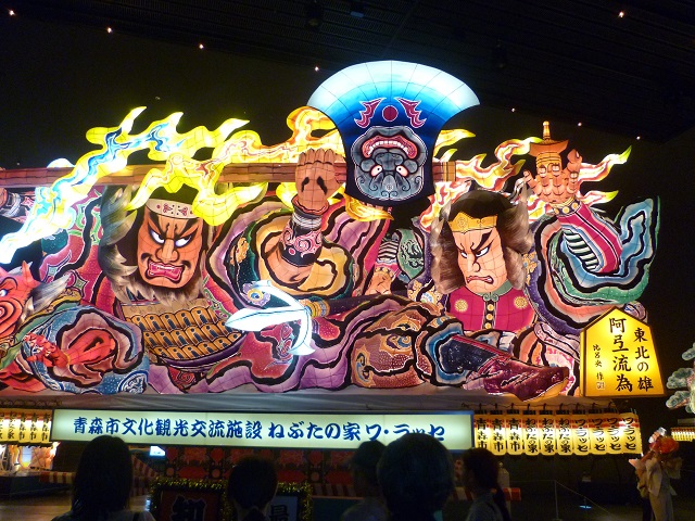
蝦夷の頭領の一人、阿弖流為の出し物、青森ねぶた祭~The attraction of Aterui, one of the leaders of Emishi, in the Aomori Nebuta Festival (Photo by Aaron Cox from Pexels)
政府はその領土を広げるため、支配下の人々を移住させたり、「蝦夷」の人々を臣民として受け入れようとしました。ところが、蝦夷はしばしば政府に反抗しました。城柵は複合的な拠点で、城としての用途だけではなく、統治や全般的な用途の施設もありました。政府は10前後の城柵を築き、秋田城はそれらの中で最北で、出羽国の北部(現在の秋田県)に位置していました。 The government aimed to spread its domain, so it tried to relocate its own people there and to accommodate “Emishi” people as its subjects. However, Emishi often rebelled against the government. Josaku was a complex mix of sites made not only for the use of castles, but also for government purposes and general facilities. The government built around 10 Josaku and Akita Castle was the northernmost site among those Josaku and it was located on the northern part of Dewa Province (what is now known as Akita Prefecture).
主な城柵の位置~The locations of the main Josaku
最北の地で外交も~Even Diplomacy in Northmost land
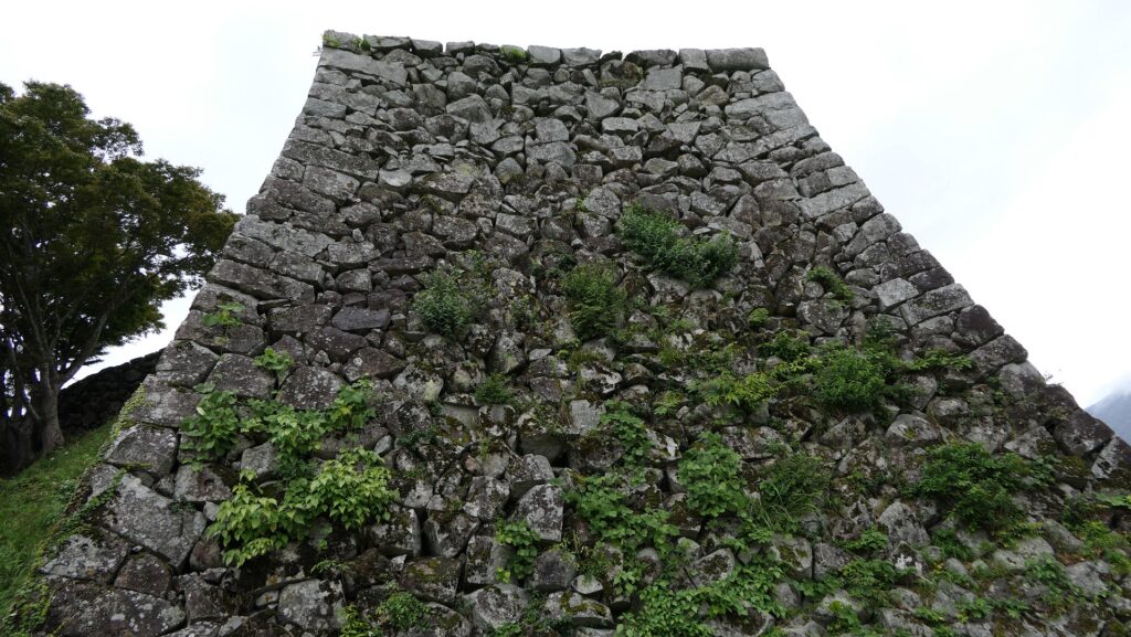
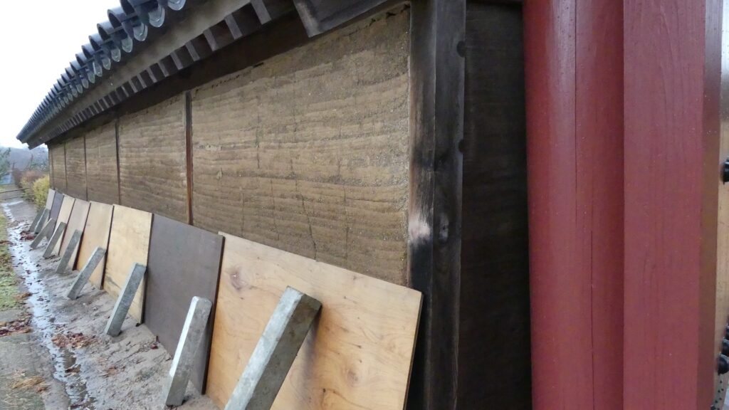
秋田城の起源は、733年に現在の山形県(秋田の南)から移転してきた「出羽柵」という城柵です。この移転は、領土拡大計画の一環でした。760年には秋田城と改称されます。この城は他の城柵と同じように、中心部分に政庁があり、外郭には高さ4mを超える屋根付きの築地塀が巡っており、外周は2km以上ありました。この拠点は出羽国の国府でもあり、アジア大陸にあった渤海国との外交を行う役目も担っていました。 The origin of Akita Castle lies in the Josaku called “Ideha-no-ki” which was moved in 733, from a region where now Yamagata Prefecture (south of Akita) is. This movement was done as a part of expansion plan. Then it was renamed Akita Castle in 760. The castle consisted of the Government Office in the center, and roofed mud walls on the outline, similar to other Josakus, which were over 4m high, and their perimeter was over 2km. The site was also the provincial capital of Dewa Province and had a role in the foreign diplomatic relation with Bohai Kingdom on the Asian continent.
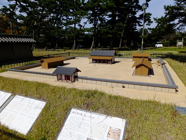
政庁と外郭の範囲を示す現地の模型~The model which shows the ranges of the government office and the outline渤海国の最大領土~The territory of Bohai Kingdom at its peak (licensed by Samhanin via Wikimedia Commons, partly modified)
多くの困難と遺産~Many difficulties and heritage
その期間中、秋田城は多くの災難に見舞われました。例えば830年には、出羽国大地震により大きな被害を受けました。その後、蝦夷の人々による2回の反乱が、878年と939年に起こりました。特に878年の元慶の乱では、城は一時占拠されてしまいます。発掘により、政庁が焼けた跡が実際に発見されました。 During its time, Akita castle faced a lot of adversities. For instance in 830, the castle suffered a heavy loss from the Dewa Great Earthquake. After that, two rebellions by Emishi people happened in 878 and 939 respectively. In particular, during the Gangyo Rebellion in 878, the castle was once captured. Traces of burned Government Office were actually found by the excavation.
現地にある政庁の模型~The model of the Government Office at the site (licensed by 掬茶 via Wikimedia Commons)
この城は10世紀にその歴史的役割を終えたため廃城となりました。しかしながら、城主の官職名「秋田城介」は武士の名誉職として使われ続けました。恐らくもともとの官職が北の地を鎮護するためのものだったからでしょう。 The castle was abandoned by the late 10th century after its historical reason was finished. However, the name of the castle’s lord “Akita-josuke” was used as a warrior’s honorary post, perhaps because the original post had been created for protectors of the northern lands.
安達泰盛、秋田城介で鎌倉幕府の重臣、「蒙古襲来絵詞」より~Yasumori Adachi, the Akita-Josuke and a senior vassal of the Kamakura Shogunate, from “The picture scrolls of the Mongol invasion attempts against Japan” (licensed under Public Domain via Wikimedia Commons)
特徴~Features
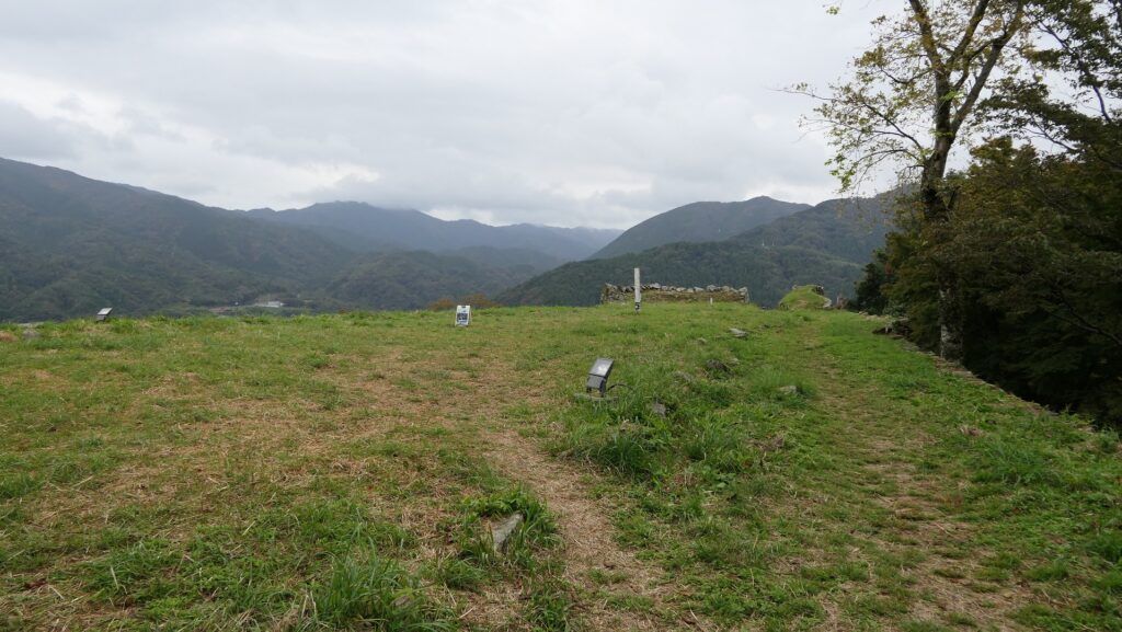
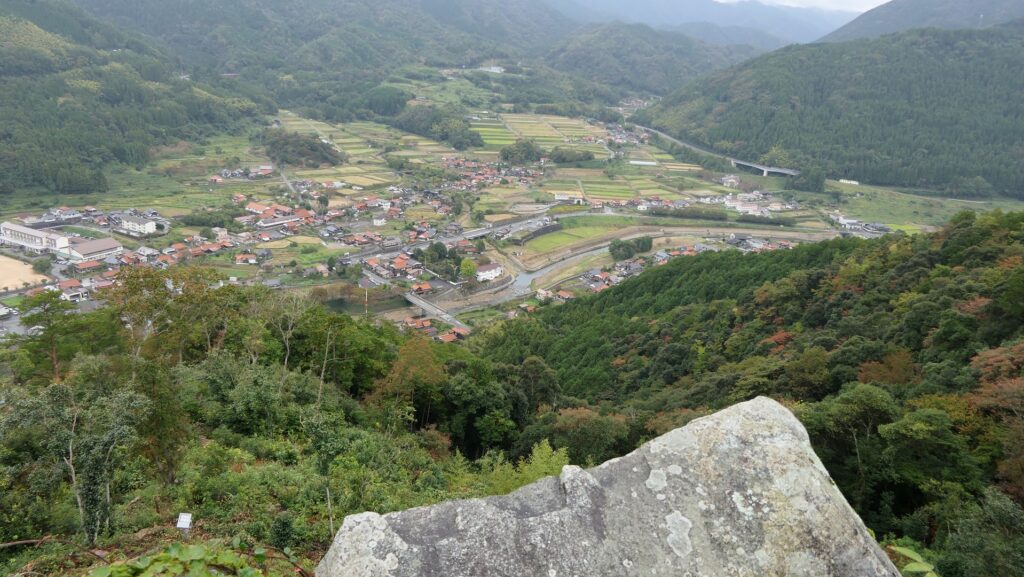
現在、秋田城跡は「高清水公園」という歴史公園として整備されています。更には最近の2016年、秋田城跡歴史資料館がオープンしました。公園でだけでなく、ここでも城について多くのことを学ぶことができます。公園には見ておくべき場所が三つあります。 Now, the ruins of Akita Castle have been developed as a historical park called “Takashimizu Park”. In addition, Akita City History Museum of Akita Fort Ruins opened recently in 2016. You can learn a lot about the castle at the museum as well as in the park. There are three main parts in the park you should check out.
城周辺の航空写真~The aerial photo around the castle
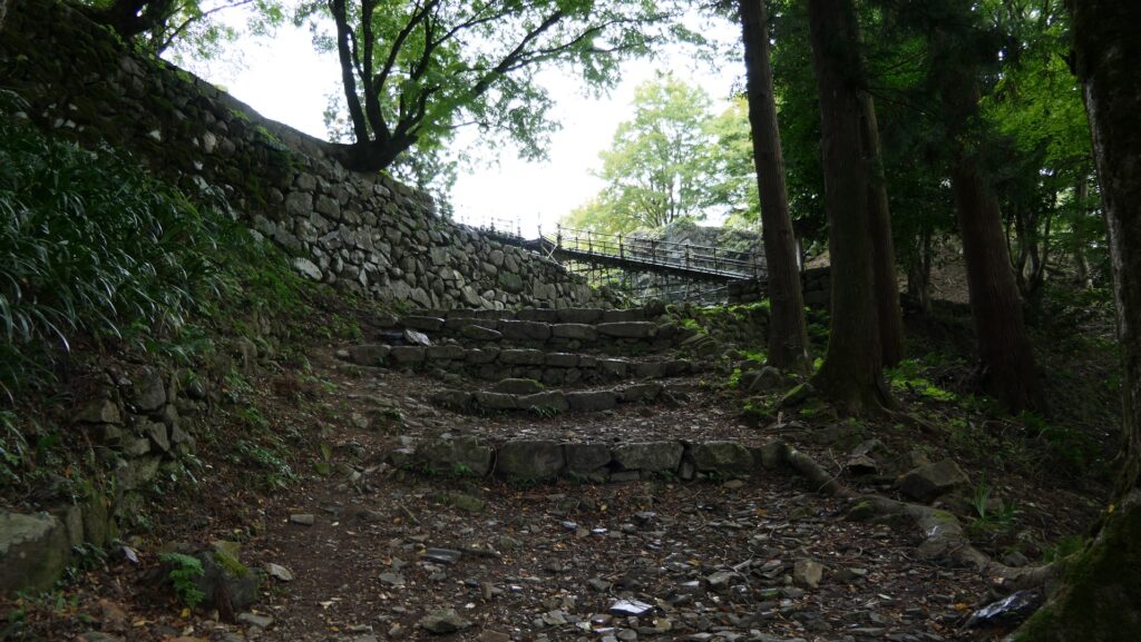
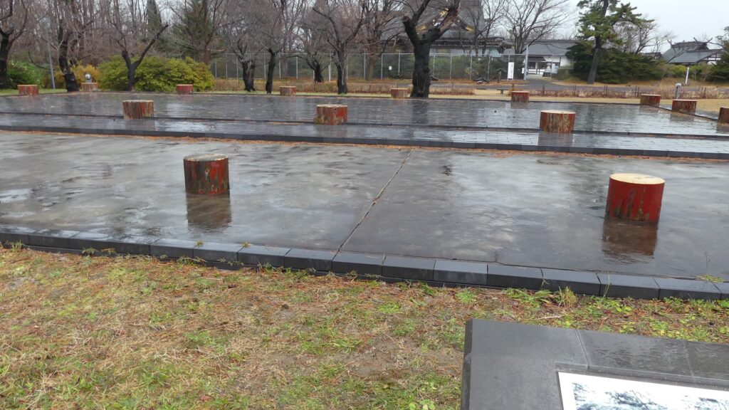
政庁跡~Ruins of Government Office
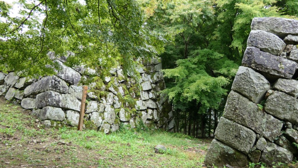
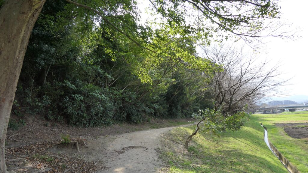
もし車かバスで公園を訪れた場合、駐車場かバス停からは一番近いところにあります。政庁もまた屋根付きの築地塀に囲まれていました。建物のレイアウトは、古代奈良にあった朝廷の建物に準じていました。城跡が発掘された後は、建物の柱の位置が地面の上にわかるようになっています。東門とともに塀の一部も復元されています。残念ながら、西側の部分は道路建設のために破壊されてしまいました。 If you visit the park by car or bus, it is the nearest spot from the parking lot or the bus stop. The government office was also surrounded by roofed mud walls. The layout of its buildings followed the way of the Imperial Palace in ancient Nara. After the ruins were excavated, the positions of the building columns can be seen on the ground. Part of the walls has also been restored with the Eastern Gate. Unfortunately, the western part was destroyed by the construction of the road.
政庁跡~The ruins of the Government Office柱の位置を示した建物跡~The building ruins with their columns’ positions復元された政庁の東門~The restored Eastern Gate of the Government Office
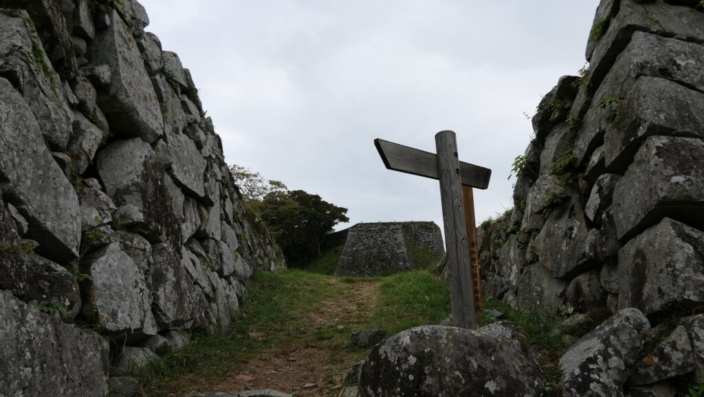
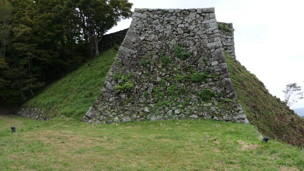
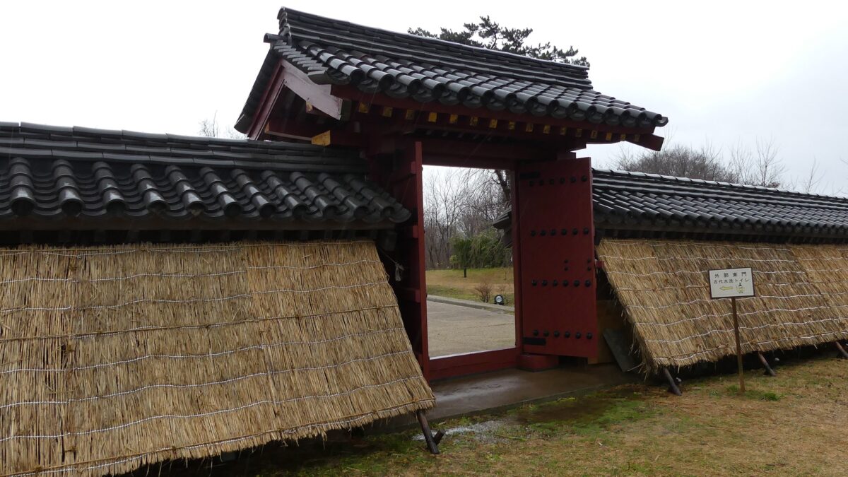
外郭東門~Eastern Gate of Perimeter
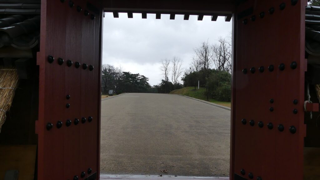
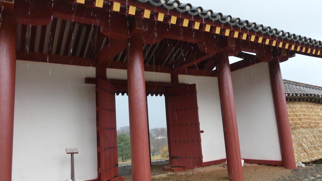
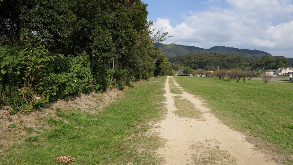
政庁跡からは、12mの幅がある「東大路」という城内道路を歩いて行くことができます。この道路は270m続き、屋根付きの築地塀とともに復元された外郭東門にたどり着きます。この塀は、長さが50mあり、発掘後の研究により外郭の一部として復元されました。双方とも近年元来の工法で、城の初期の状態を想定して作られました。また、塀部分は版築という多層の土を押し固める方法が用いられています。 You can walk on the restored 12m wide inner road called “Higashi-oji” from the government office ruins. This road goes on for 270m, then you will reach the restored eastern gate of the perimeter with the roofed mud walls. These walls, which are about 50m long, are part of the restored perimeter based on the study after excavation. The gate and walls were built in the original way recently, assuming the first appearance of the castle. The walls are also made using a method called Rammed Earth, which refers to compressing many layers of earth.
城内道路~The inner road復元された外郭東門~The restored Perimeter Eastern Gate版築で作られた塀、政庁部分より~The wall made of Rammed Earth from the part of the Government Office
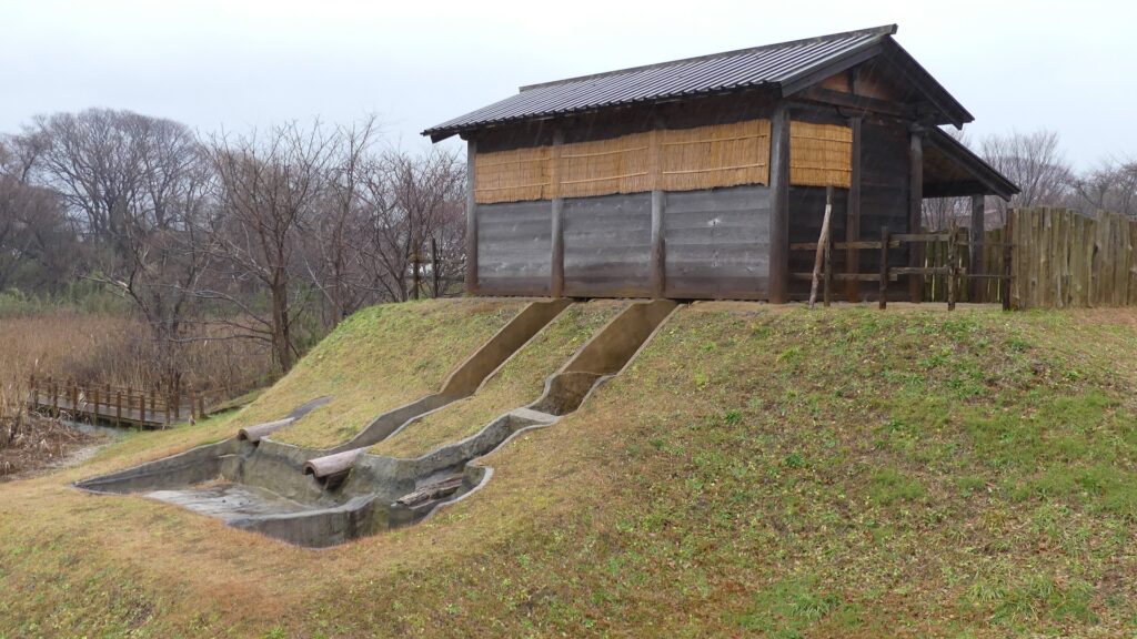
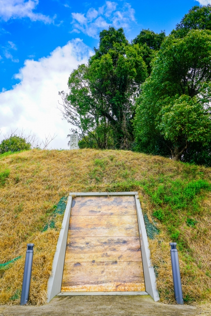
古代水洗トイレ~Ancient flush toilet
この城で最も面白い見物の一つに復元された古代水洗トイレがあります。元からあること自体稀ですが、復元されることも稀です。その上に、もう一つ興味ある事実が遺跡から見つかりました。遺跡からの遺物の中に、豚を食べる人から出る寄生虫の卵があったのです。日本の当時の人たちは豚を食べませんでした。そのため、そのトイレを使った人は外国から、恐らくは渤海か中国から来たに違いないのです。この事実は、古書に書いてあるのと同じように、秋田城と外国との関係を証明しているのです。 One of the most interesting attractions of this castle ruins is the restored ancient flush toilet. The original one was rare, and the restored one is also rare. Moreover, one more interesting fact was found at the ruins. The relics from the ruins include eggs of the parasite which lived in a man who ate pork. Japanese people at that time didn’t eat pork, so the man who used the toilet must have come from a foreign country, probably Bohai or China. The fact proved the relationship between Akita Castle and foreign countries while old documents say the same thing.
中世になって、人々は秋田城のことをまだ覚えていましたが、どこにあったかは誰もわからなくなりました。江戸時代に有名な旅行家の菅江真澄が秋田にしばらく滞在して、辺りを歩き回り、どこに城があったか推測しました。最初の国による近代的調査は1924年に行われ、城の土塁が発見されました。いくつかの調査により、城の場所が特定され、1939年に城跡は国の史跡に指定されました。発掘は1959年以降行われています。更には遺跡が宅地として開発されていたため、行政側も土地の買い上げを始め、歴史公園として整備しました。そのおかげで、私たちは公園で復元された施設を見学できるのです。 In the Middle Ages, people still remembered Akita Castle, but no one was sure where it had been. In the Edo Period, a famous traveler, Masumi Sugae stayed in Akita for a while, walked around the area, and speculated where the castle was. The first modern national research was done in 1924, which discovered the earthen walls for the castle. After the place of the castle had been confirmed by several researches, the ruins were designated as a National Historic Site in 1939. Excavations have been done since 1959. In addition to developing the ruins as a residential area, the officials also started intensive purchase of land to develop them as a historical park. That’s why we can see the developed park with restored items.
1970年代の城周辺の航空写真、宅地化が進んでいました~The aerial photo of the area around the castle in the 1970s, it was becoming a residential area
私の感想~My Impression
私は以前、秋田には、日本の他地域とは違う、アジア大陸の人々に近いDNAを持っている人もいると聞いたことがあります。この話がちょうど秋田城と外国とが関係した説に図らずも一致したことになります。また、この城跡では、日本の歴史の一端を学んだり、見たりするのにいい機会を得られると思います。 I have once heard that some people around Akita may have different DNA from that of other areas in Japan, but similar to people in the Asian continent. I was fascinated as it coincided with the theory of a relationship between Akita Castle and foreign countries. I also think that the ruins of the castle can offer us a good opportunity to learn and see part of Japanese history.
高清水公園にある復元された古代池~The restored Ancient Pond (licensed by 掬茶 via Wikimedia Commons)
ここに行くには~How to get There
車で行く場合は、秋田自動車道の秋田北ICから約15分かかります。秋田城跡歴史資料館脇に駐車場があります。 電車の場合は、JR秋田駅から将軍野線か寺内経由土崎線のバスに乗り、秋田城跡歴史資料館前バス停で降りてください。 If you want to go there by car, it takes about 15 minutes from the Akita-kita IC on Akita Expressway. There is a parking lot beside Akita City History Museum of Akita Fort Ruins. When using train, take the bus on Shogunno Line or Tsuchizaki Line via Terauchi from JR Akita Station, and take off at the Akitajo-ato-rekishi-shiryokan-mae bus stop.
リンク、参考情報~Links and References
・秋田城跡歴史資料館、秋田市(Akita City Official Website) ・「日本の城改訂版第128号」デアゴスティーニジャパン(Japanese Book) ・「蝦夷と城柵の時代」熊谷公男編、吉川弘文館(Japanese Book)
緑の防衛ラインが今だにくっきりと残っています。
The green defense line still stands prominently.
立地と歴史~Location and History
大宰府を守る防衛線~Difense Line to protect Dazaifu
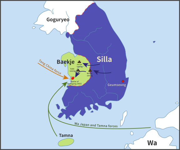
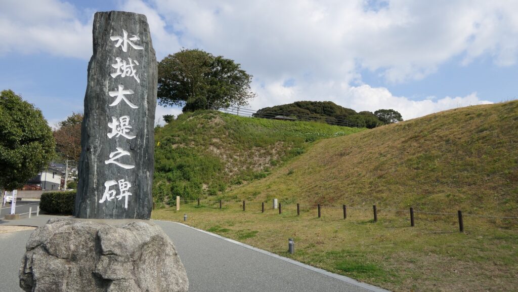
水城は、663年の朝鮮での白村江の戦いで日本が唐と新羅の連合軍に敗れた直後、国が初めて作った本格的な軍事施設です。それは、連合軍の侵攻から古代日本の地方政府であった「大宰府」を守るための防衛ラインでした。つくられたのは664年で、大野、麹智、基肄などの古代山城と呼ばれた西日本の軍事施設より以前のことでした。そのため水城は、日本の城のうちの一つとみなされています(その名前自体が水の城です)。 Mizuki was the first national full-scale military facility built immediately after Japan was beaten by the ally of Tang and Silla in the Battle of Baekgang, Korea in 663. It was a defense line to protect the ancient Japanese local government, “Dazaifu” in Kyushu Island from the ally’s invasion. It was first built in 664 before other military facilities in western Japan called ancient mountain castles such as Ono, Kikuchi, and Kii. That’s why Mizuki is regarded as one of the castles of Japan (The name means Water Castle in Japanese).
白村江の戦いの図~The map about the Battle of Baekgang(licensed by Samhanin via Wikimedia Commons)
戦略的な設計~Strategic Design
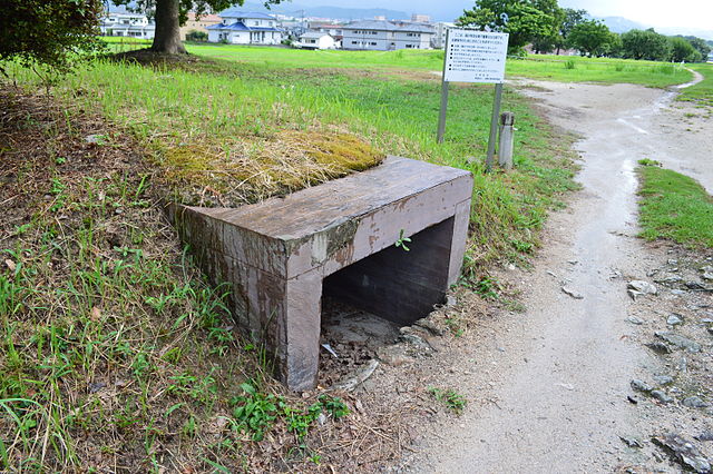
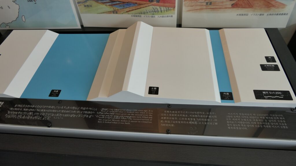
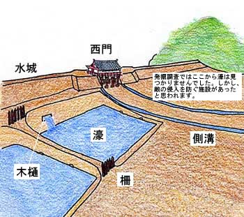
この防衛ラインは東は四王寺山の麓と、西にあるもう一つの丘との間に設けられており、福岡平野では最も狭い部分に当たり、大宰府政庁の北にありました。幅80m、高さ10mの土塁が1.2kmに渡っていました。そして両側に水堀がありました。この地域の地盤が弱かったので、土塁は丈夫な枝葉の基礎の上に設置されました。この構成により土塁を強固にする方法は「敷そだ」と呼ばれました。土塁自体を強固にするためには、土を突き固める版築という方法が採用されました。水堀は、土塁の下を通る木樋によってつながっていました。その水は内側の堀から外側の堀に流れていました。 The defense line is located between the foot of Shioji-yama mountain on the east and another hill on the west, which is the narrowest part of the Fukuoka Plain, and the north of Dazaifu government. It consisted of earthen walls that were 1.2km long, 80m wide and 10m high. It was surrounded by water moats on both sides. As the earth was weak in that area so the walls were laid on a foundation of strong branches. And this method of making the structure or wall strong was called “Sikisoda”. To make the walls sturdy the workers use to ram soil on the wall and this method was called Rammed earth. The water moats were connected under the earthen walls through wooden water pipes. The water flowed from the inside into the outside part of the moat.
城の位置~The location of the castle
水城に残る土塁~The remaining earthen walls of Mizuki復元された木樋~The restored wooden water pipe(licensed by Saigen Jiro via Wikimedia Commons)
土塁の幅は戦略的に設計されており、守備兵の矢は土塁の高い位置から放たれ外側に届くが、敵の矢は外側の低い位置から放たれ、内側には届かないようになっていました。歴史家は、朝鮮からの亡命者がこれを設計したと推定しています。 Its width was strategically designed so that when the defender’s arrows shot from the upper part of the wall, it could reach outside but when the enemy shot from lower part outside the moat, it couldn’t reach inside. Historians speculate that this method was designed by Korean refugees.
水城の構造模型~The model of Mizuki(水城館~Mizuki Site Exhibition Hall)
交通の要地~Important Point for Traffic
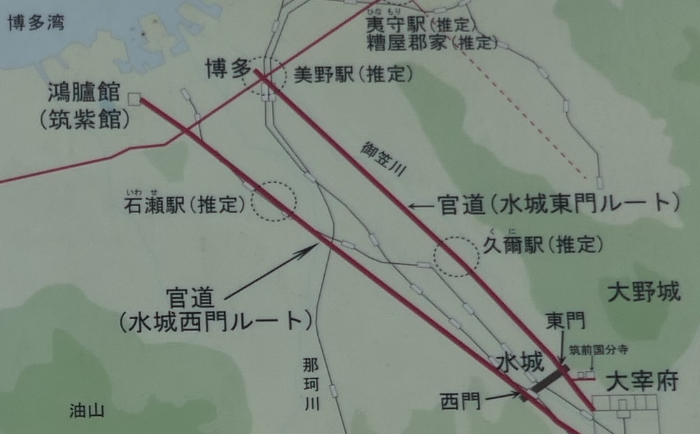
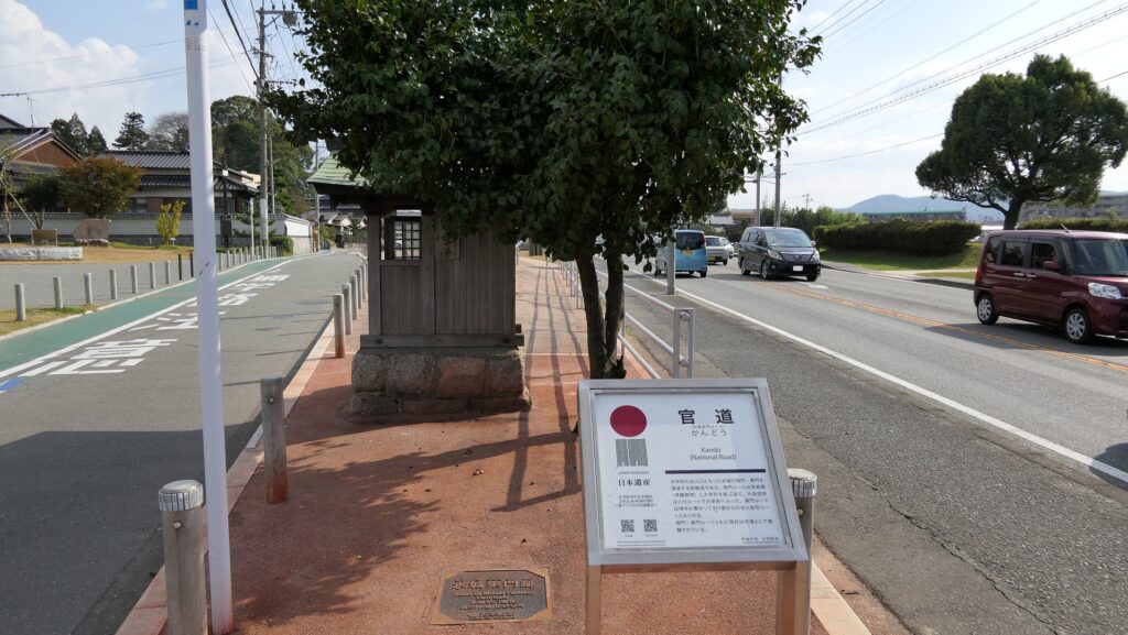
このラインには2つの門があり、それぞれ官道が通っていました。一つは東門から博多港の方に伸びており、もう一つは西門から鴻臚館と呼ばれた中国や朝鮮からの人々をもてなす迎賓館の方に伸びていました。大宰府政庁の出入口としても使われており、この地域の交通や旅行者の出入りを監視していました。 The line had two gates for two government-run roads. One of them went through the East Gate to Hakata Port, and the other went through the West Gate to the guest house called Kouro-kan that was used to host people from China and Korea. It was also used as the entrance of Dazaifu government, and it checked transportation and passengers in and out of that region.
古代官道の推定ルート~The estimated routes of the government-run roads(現地説明板より~From the signboard at the site)
幸いにも、連合軍は日本を攻撃しませんでした。水城は大宰府政庁の道しるべとなりました。多くの人々が訪問客の出迎えや見送りのためにここを使ったのです。 Fortunately, the ally did not attack Japan. Mizuki became a landmark of Dazaifu government. Many people used it to welcome or say good-bye to visitors.
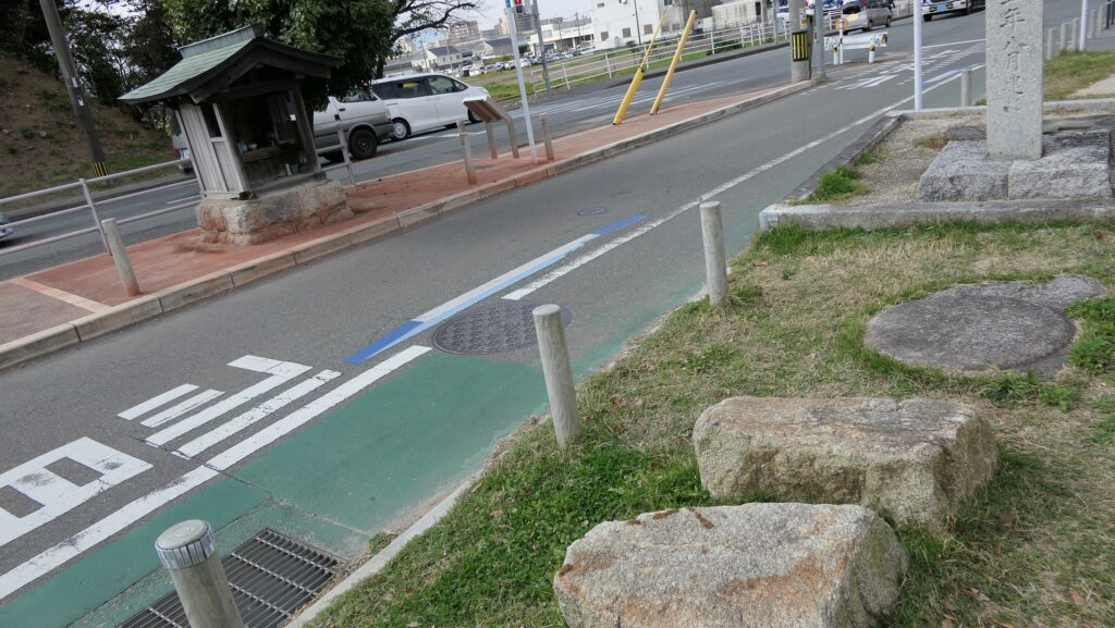
現在水城を通り抜ける道路~The present road through Mizuki
特徴~Features
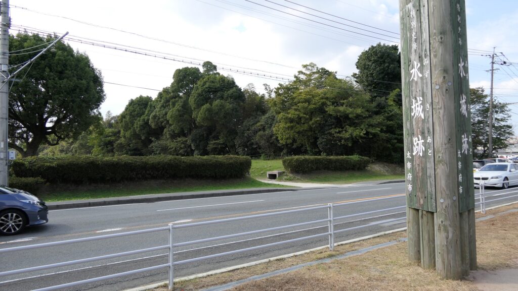
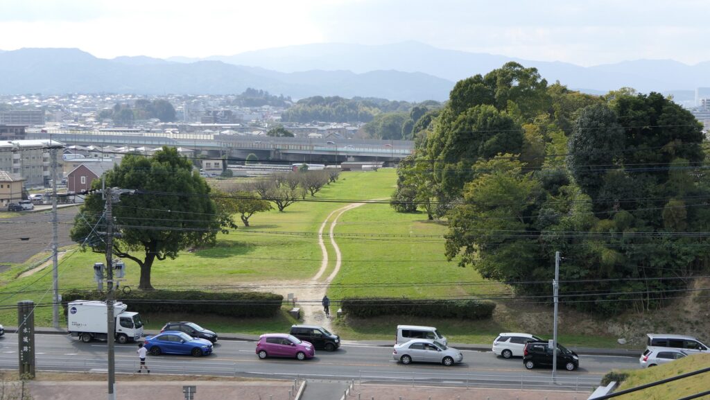
現在、この辺りを通る人たちの多くは、水城跡をはっきりと見ることができます。なぜなら、この遺跡は緑地帯のように今だにこの一帯に横たわっていて、公道、高速道路、鉄道といった多くの現代の交通網もまたこの遺跡を横切っているからです。この遺跡は緑の林に覆われた土塁として残っているのです。素晴らしいことだと思いませんか。 Now, many people who go through the area around the ruins of Mizuki can clearly see them. This is because the ruins still lay across the area like a green belt, and a lot of modern transportation such as public roads, Expressways and Railways, also go across the ruins. The ruins remain as earthen walls covered with green forests. Isn’t that fantastic?
城周辺の航空写真~The aerial photo of around the castle
土塁周辺を歩く~Waking around Earthen Walls
この土塁からは既に水堀は失われています。そして、ところどころ現代の交通網により寸断されてしまってもいます。しかしながら、土塁の周辺を歩いてみれば、少なくとも高さが違っている構造になっていることはわかると思います。また、JR鹿児島本線により寸断されている箇所では、どのように土塁が積み上げられているかがわかります。The earthen walls have already lost their water moats, and the walls are partly destroyed by the modern transportation. However, when you walk around the walls, you can at least see the different levels of the structure. You can also see how the walls were rammed at the cross section of the walls which are cut through by the JR Kagoshima Line.
低くなっている土塁の外側~The lower outside of the earthen walls高くなっている土塁の内側~The higher inside of the earthen walls土塁の断面~The cross section of the walls(taken by ヘンリー3世 from photoAC)
東門周辺~Around East Gate
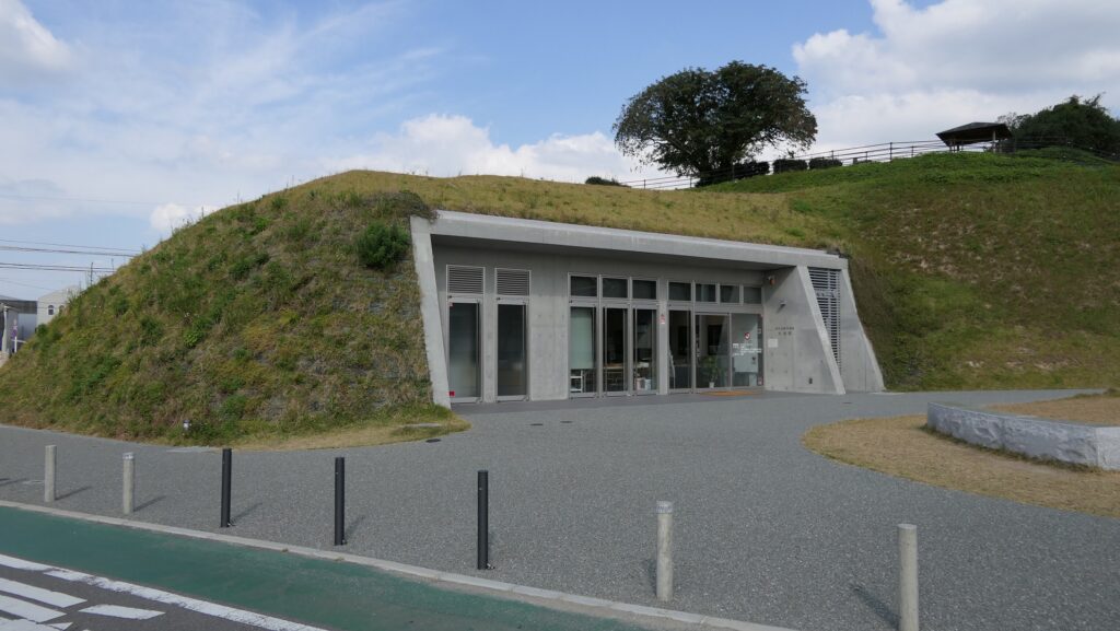
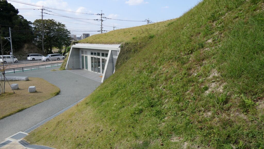
東門跡では、国道112号線がかつての古代官道のように遺跡を通り抜けています。後になって人々は門が元々あった場所に石碑を作って設置しました。門の礎石はまだ残っていて、遺跡を見に来た人であれば、すぐ見つけられます。また、水城館という展示施設があって、水城の歴史や使われている技術を学ぶことができます。この辺りは土塁の東端に当たるため、山裾の方に登って行って、遺跡の全景を見ることもできます。 At the ruins of the East Gate, the National Route 112 goes through the ruins like the ancient government road. Later on, people made and placed stone structures where the gates use to stand originally. The cornerstones of the gate still exists and anybody who visits the ruins can see them . You can also visit the guest house called Mizuki-kan which exhibits the history and technology of the ruins. The area is near the eastern edge of the earthen walls, so you can walk up to the foot of the mountain and have the whole view of the ruins.
国道112号線~The National Route 112石碑と土塁~The stone structure and earthen walls東門の礎石~The cornerstones of the East Gate水城館~Mizuki-kan水城の全景~A full view of Mizuki
西門周辺~Around West Gate
西門の跡については、ここもまた地方道路により壊されてしまっています。発掘によれば、西門は3回立て直されています。門はその時代ごとの要請によって、機能が違っており、外交関係が悪いときは関門として機能し、関係がよくなると飾り立てられていたようです。 At the ruins of the West Gate, they are also destroyed by a local road. The excavation found that the gate had been rebuilt three times. It was a functional gate that was built as per requirement. The gate served as a barrier when foreign relations were bad. However, when relations were good it was more decorative.
西門の想像図~The imaginary drawing of the West Gate(大野城市Websiteより引用)
その後~Later History
中世の13世紀頃、門は失われていました。しかし武士たちはモンゴル襲来のときに跡地を陣地として使用したようです。江戸時代には東側の官道は日田街道となり、多くの人々が往来しました。人々は水城を著名は遺跡として認識していました。1953年には国の特別史跡に指定されます。 Around the 13th century of the Middle Ages, the gates had been lost, but warriors seemed to use the ruins as a position against the Mongol Invasion. In the Edo Period, the eastern government road was being turned into Hita Road many people used. The people had already recognized Mizuki as famous ruins. The ruins have been designated as a Special National Historic Site since 1953.
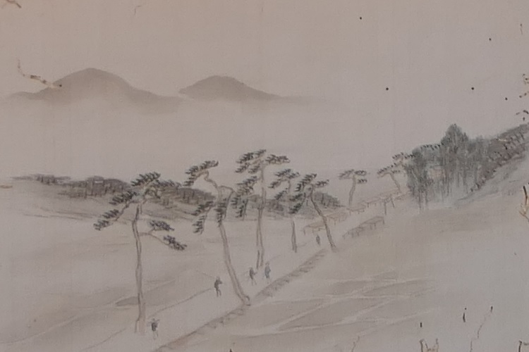
水城関跡、筑前名勝画譜より、江戸時代、国立公文書館蔵~The ruins of Mizuki, from The Picture Book of Famous Sights in Chikuzen Province, in the Edo Period, owned by National Archives of Japan(水城館展示、An exhibition of Mizuki-kan)
私の感想~My Impression
白村江の戦いは、日本の歴史において重要な出来事でした。水城跡は、多くの人々が近くを通るだけで目にすることができる、とても分かりやすい遺跡だと思うのです。歴史の知識があれば、水城がなぜ築かれたか多分わかるでしょう。知識がなくとも、遺跡を見てもっと知りたいと思うかもしれません。水城が永久に守られることを切に望みます。 The battle of baekgang is an important event in the history of Japan. I think that the ruins of Mizuki are very easy to understand for many people, because they can have many chances to see the ruins when they pass by. If they have the knowledge of history, they will probably understand why Mizuki was built easily. Even if not, they may want to learn more about the ruins seeing them. I really hope that Mizuki will be kept forever.
土塁と水城館~The earthen walls and Mizuki-kan
ここに行くには~How to get There
東門跡に行くには: 車では、九州自動車道の大宰府ICから数分のところです。展示施設に駐車場があります。 電車の場合は、西鉄天神大牟田線の下大利駅から歩いて約20分です。 西門跡に行くには: 車では、九州自動車道の大宰府ICから約10分かかります。水城ゆめ広場に駐車場があります。 電車の場合は、JR鹿児島本線の水城駅から歩いて数分のところです。 To the ruins of the East Gate: By car, it takes few minutes from the Dazaifu IC on Kyushu Expressway. The guest house offers a parking lot. By train, it takes about 20 minutes on foot from Shimo-ori Station on Nishitetsu Tenjin-Omuta Line. To the ruins of the West Gate: By car, it takes about 10 minutes from the Dazaifu IC on Kyushu Expressway. Mizuki-Yumehiroba Park offers a parking lot. By train, it takes few minutes on foot from Mizuki Station on JR Kagoshima Line.