74.Iwakuni Castle Part2

Let us try to look into more of the castle.

Later History

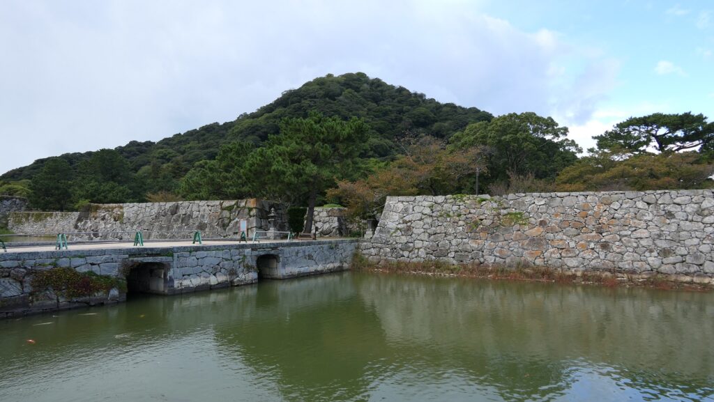
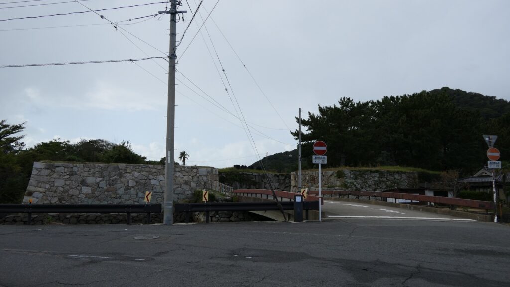
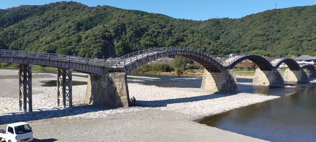
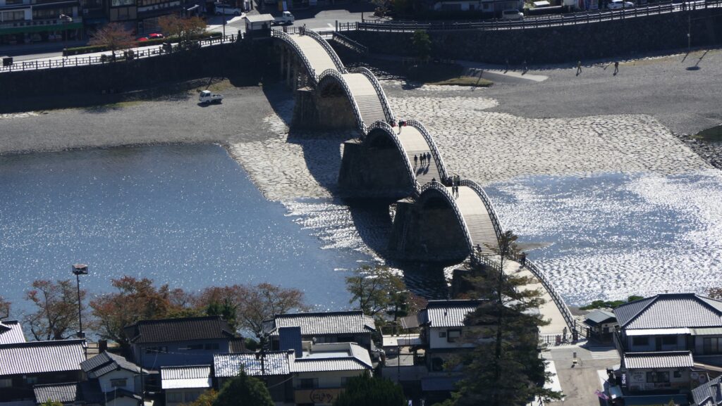
After the Meiji Restoration, the residence at the foot of the mountain was turned into the Kikko Park in 1885. Kintaikyo Bridge survived for 277 years, however it was flown out because of the flood caused by Kezia Typhoon in 1950. People in Iwakuni City restored the bridge in the original method in 1953. It was rebuilt again in 2004 due to deterioration. That’s why it still looks new. It has been designated as a National Scenic Spot since 1922.

The present Kintaikyo bridge

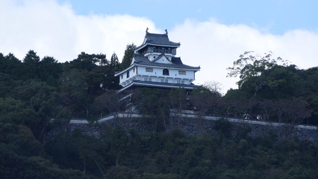
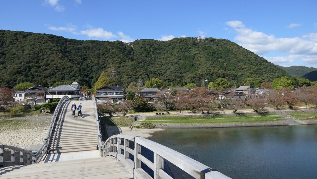
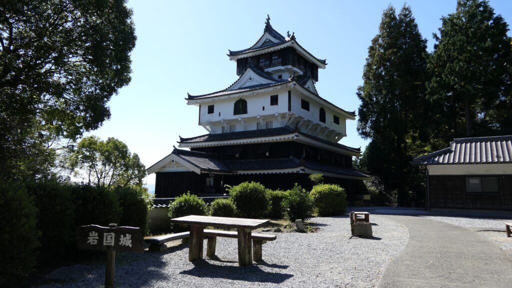
As for Iwakuni Castle, the Main Tower on the mountain was rebuilt in 1963, but its position was moved by about 50m from the original in ordered to be more well seen from the foot with the bridge. The cable car between the foot and the top also opened in 1964 which has been boosting tourism.

The present Main Tower of Iwakuni Castle which can be seen from the foot

Features

From Kintaikyo Bridge to Rebuilt Main Tower

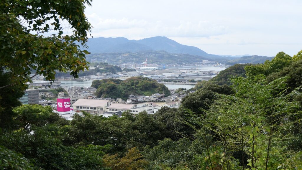
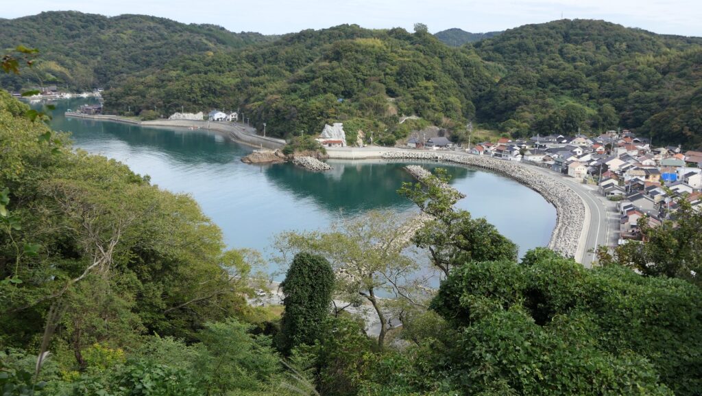
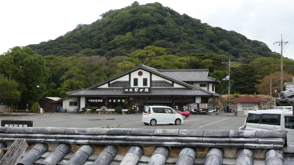
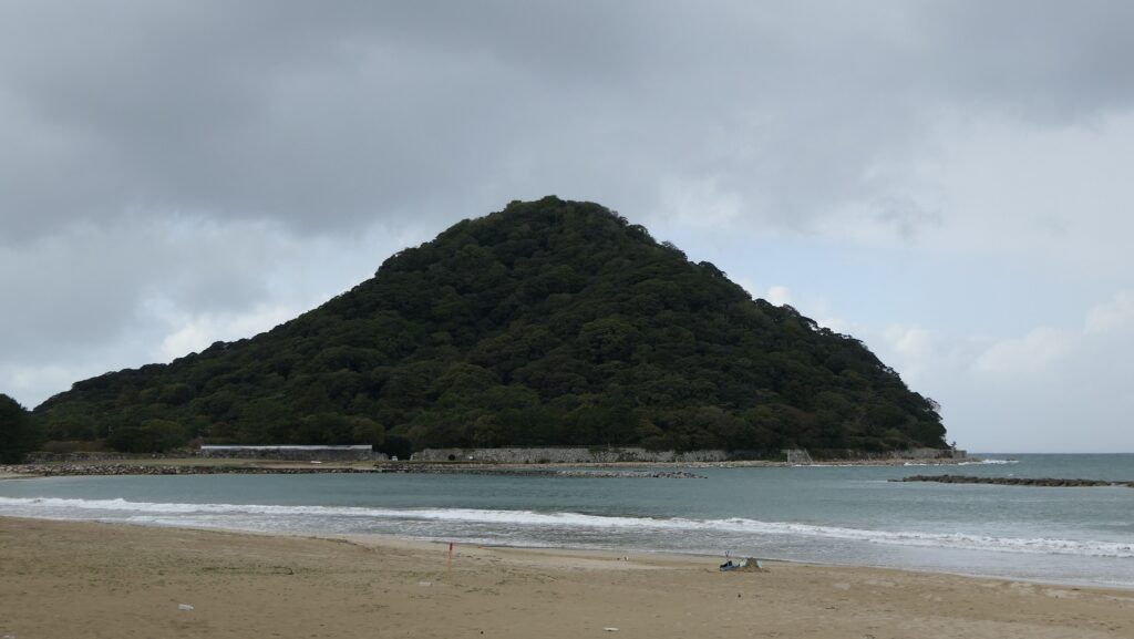
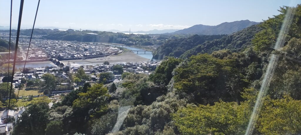
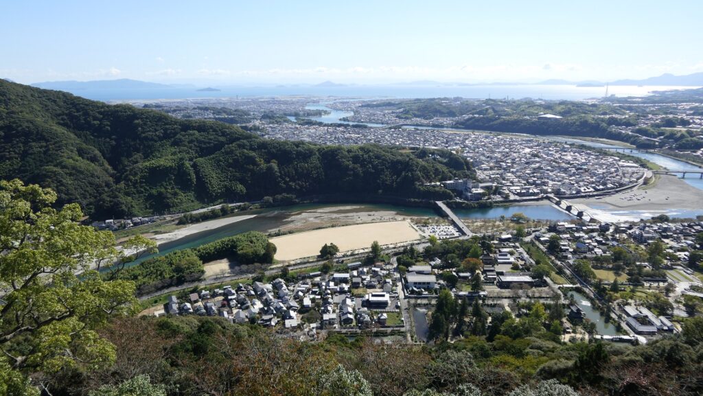
For visitors who visit the area around Iwakuni Castle site today, the castle itself might not be popular for them. They probably want to see and walk across Kintaikyo Bridge first. They can also ride a cable car to the top of the mountain to enjoy the great view of the area including the bridge. Visiting the rebuilt Main Tower may be their third option because they can get a better view of the bridge from the foot. However, if you try to look into more of the castle, you can find new perspectives of it.

Walking across Kintaikyo bridge
A view from the cable car window
A view of Kintaikyo bridge from the top of the mountain

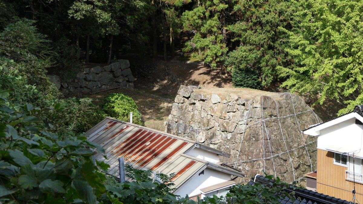
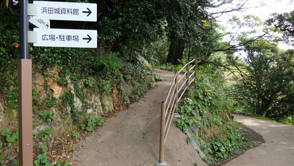
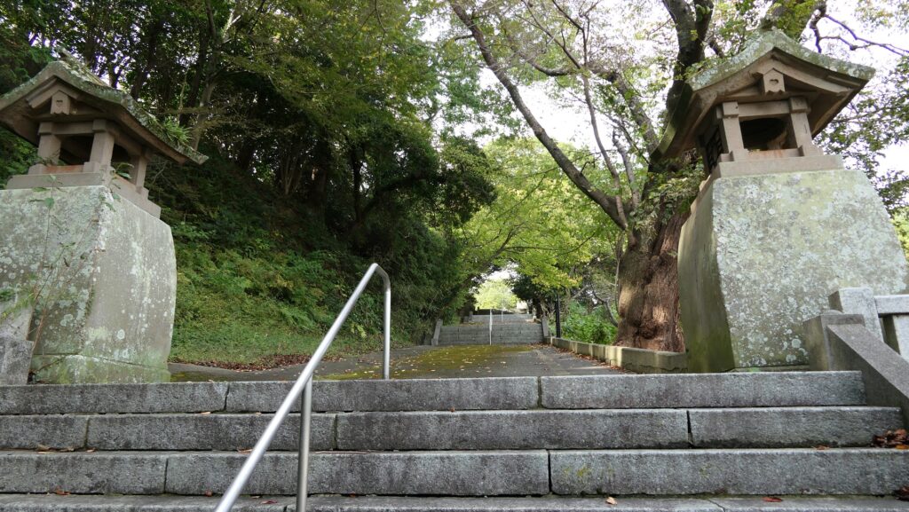
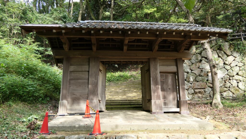
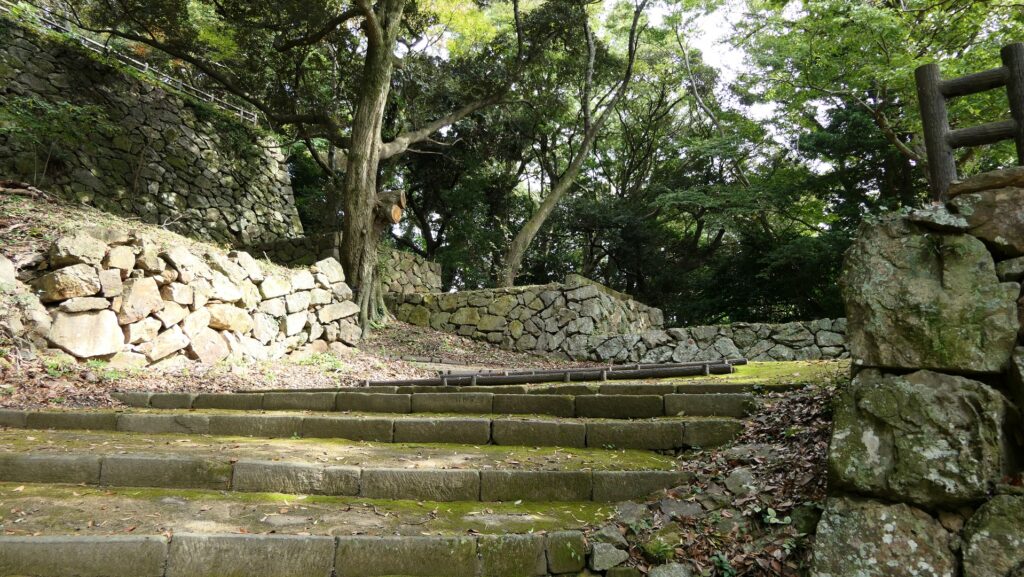
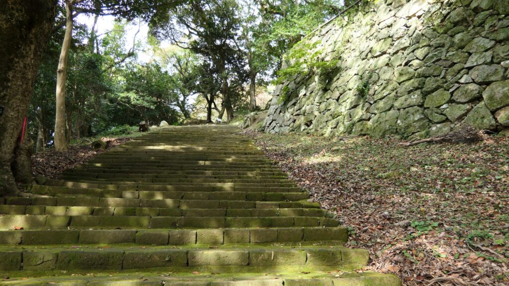
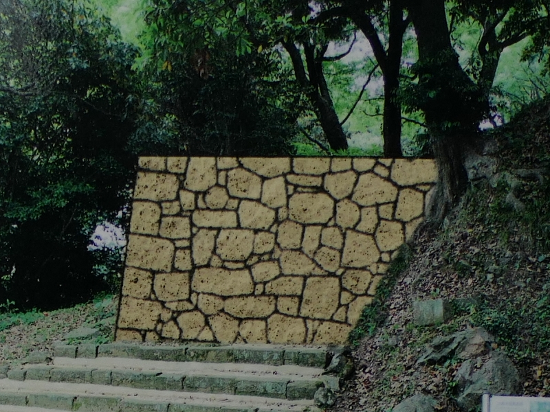
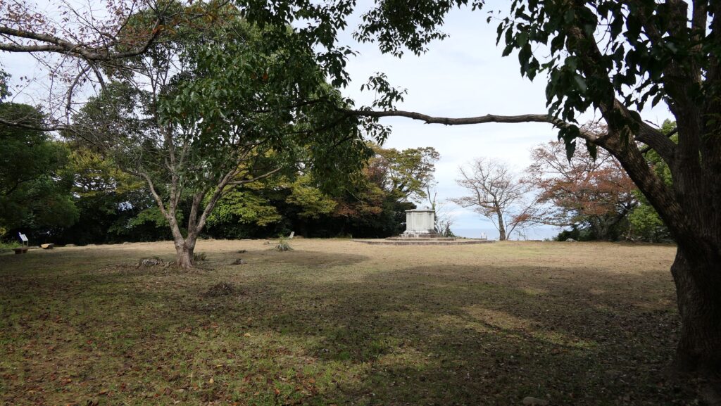
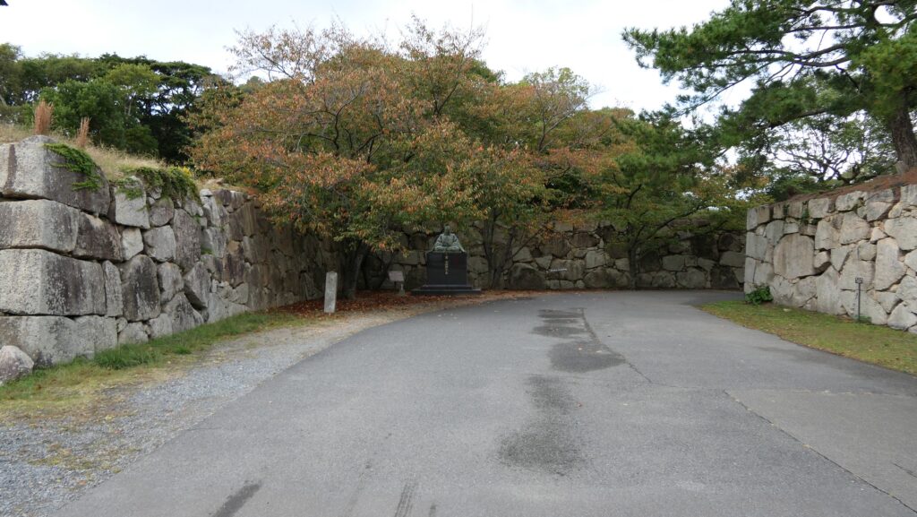
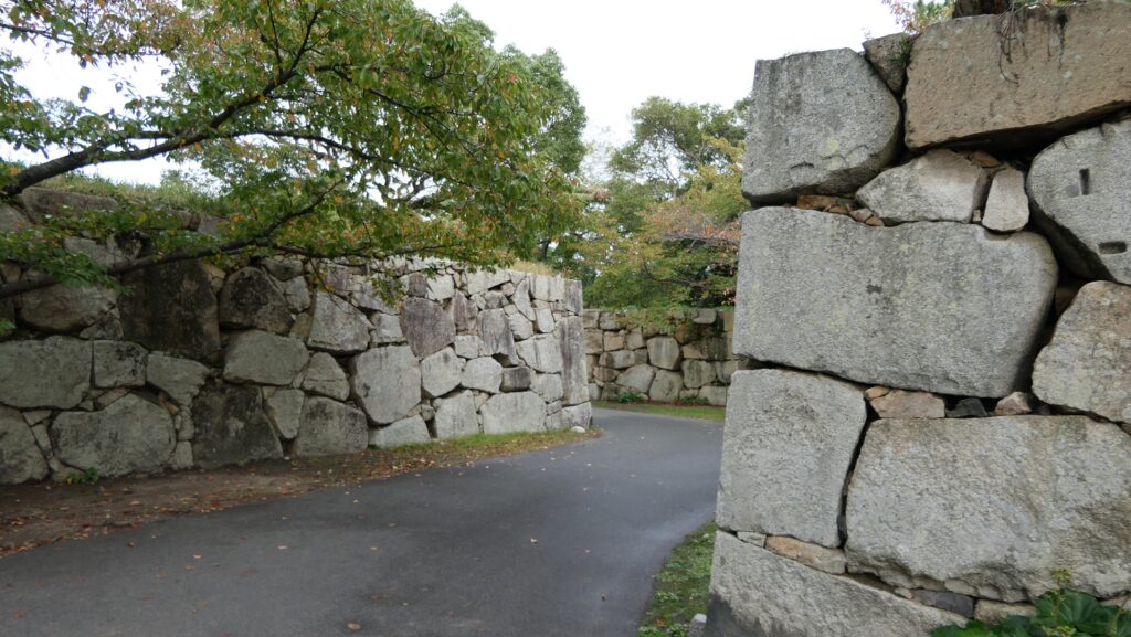
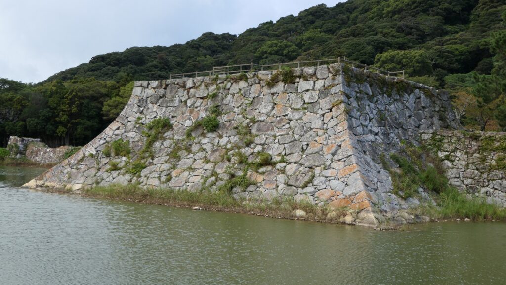
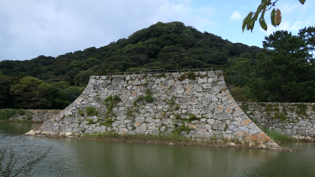
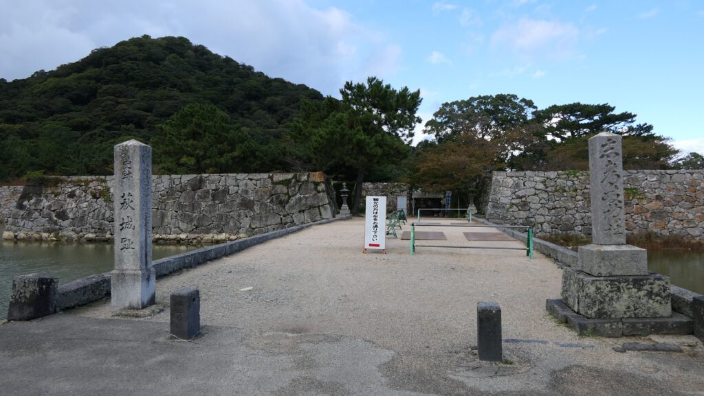
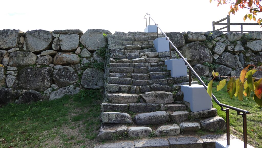
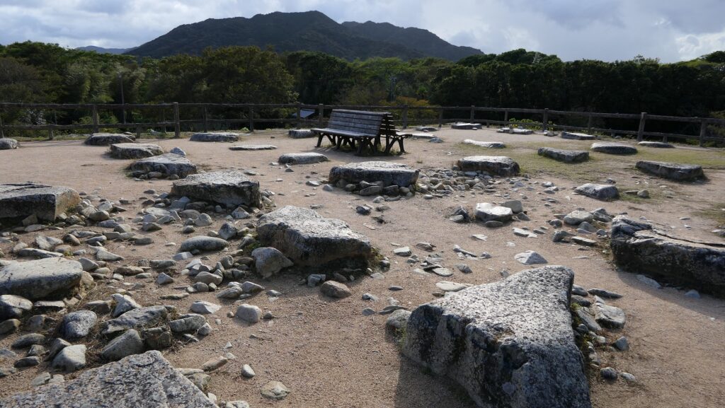
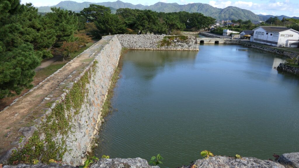
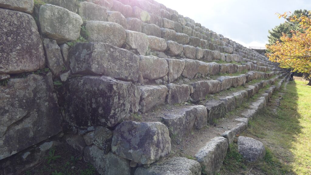
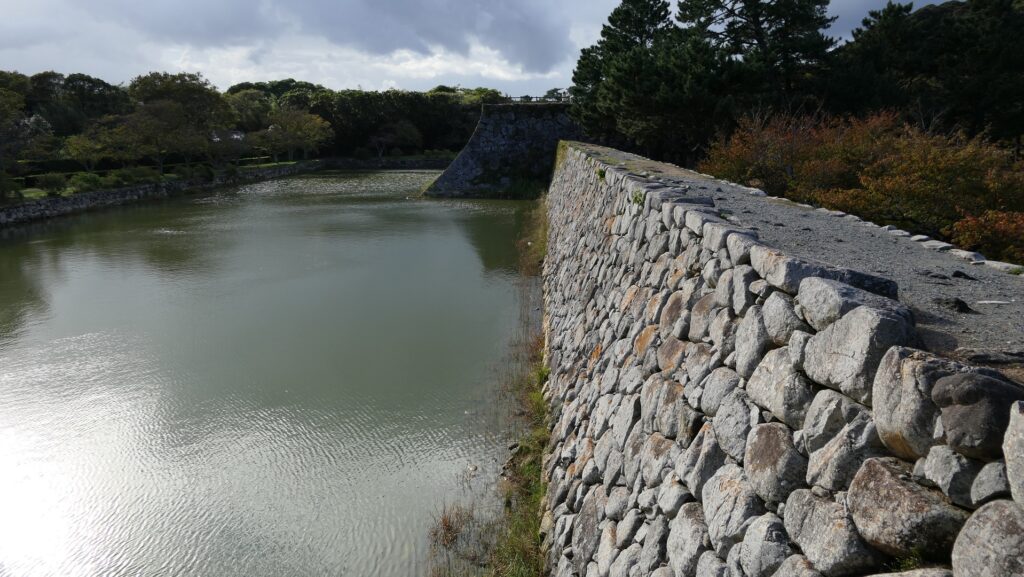
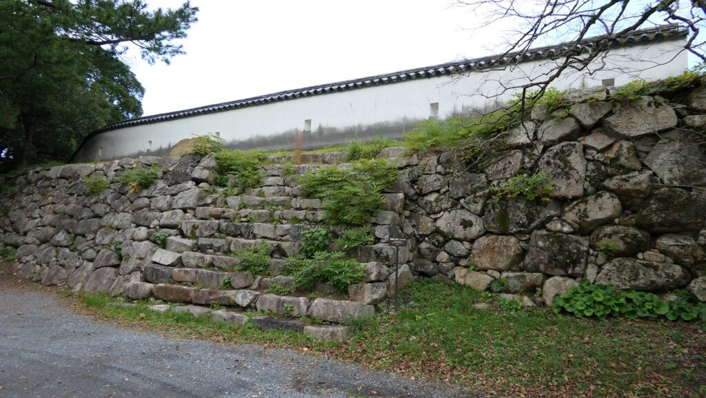
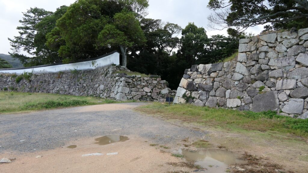
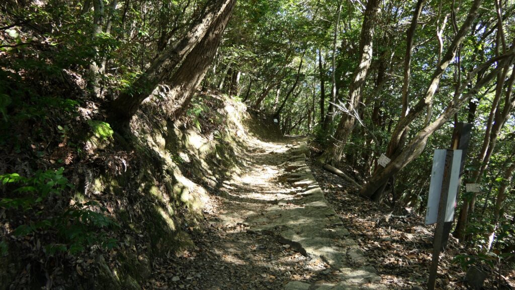
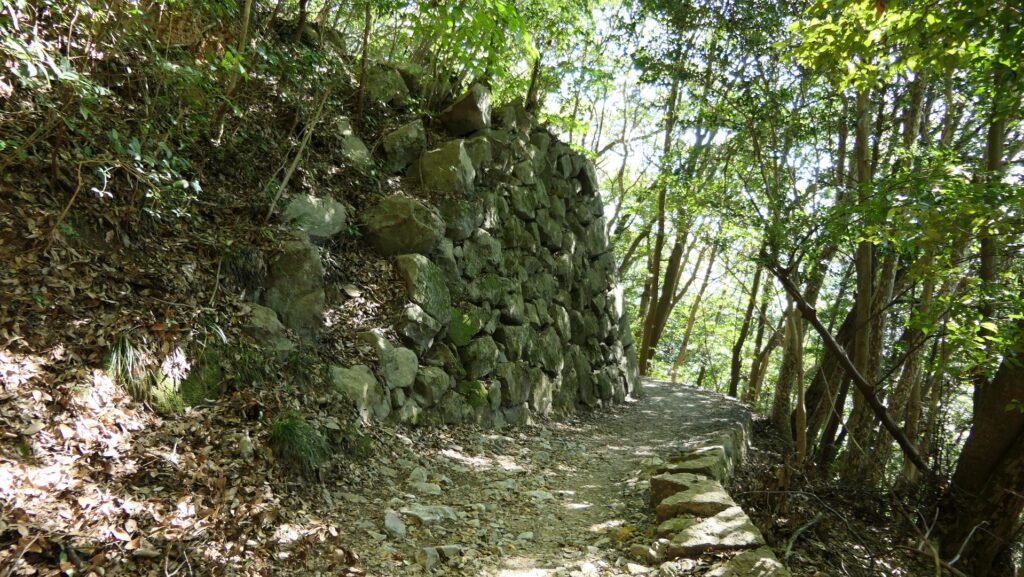
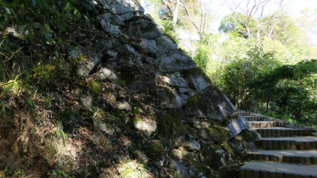
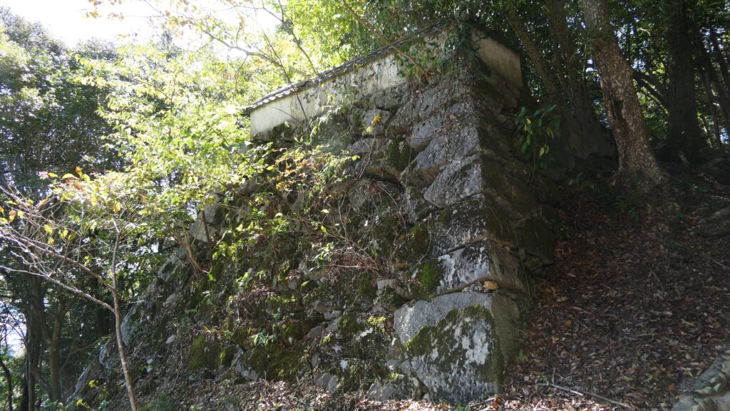
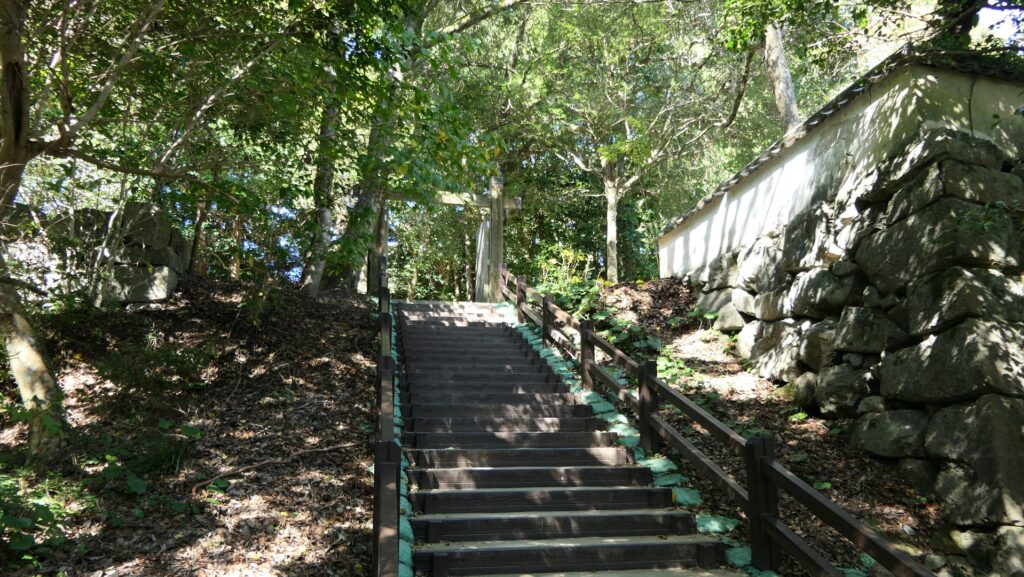
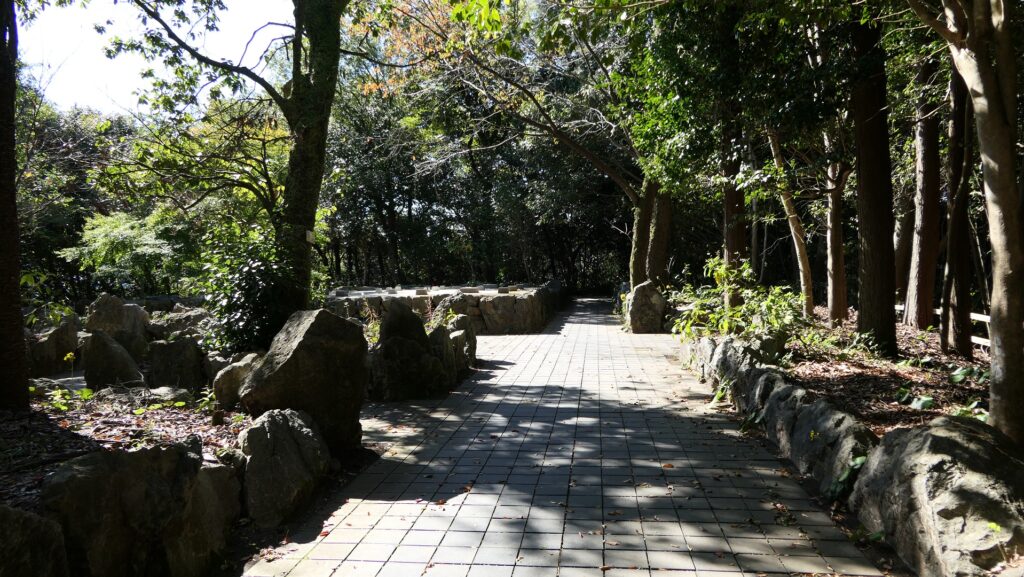
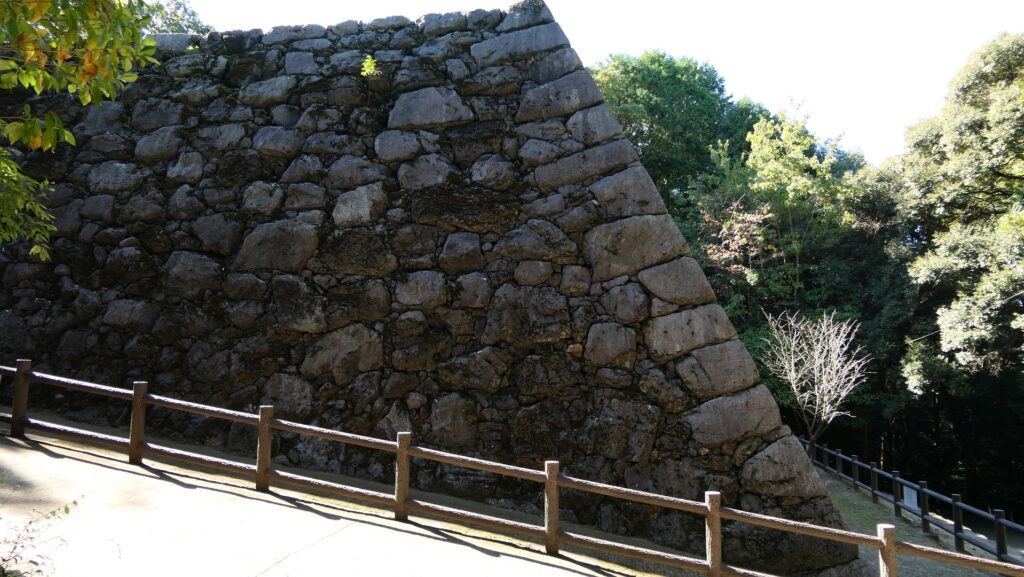
After arriving at the platform of the cable car, you will find the guide plate of the two routes to the castle. The guide plate recommends taking the left road, but I suggest taking the right road. This is because the path on the right leads you the front side of the castle. You will see the edge of the remaining stone walls with triangular stones on the right side of the trail. You can also see the great stone walls of the Second Enclosure on the left. As you go further, the Barbican Enclosure overhangs in front of you. It has a defensive square space called Masugata inside which was the Main Gate of the castle. The inside of the Gate Ruins is the Second Enclosure which is used as a modern rock garden, modified in the present time.

The map around the castle

The guide plate recommends the left wide road
Choosing the right trail this time
The stone walls below the Second Enclosure
The stone walls of the Barbican Enclosure overhangs
Looking up the stone walls
The ruins of the Main Gate
The inside of the Second Enclosure

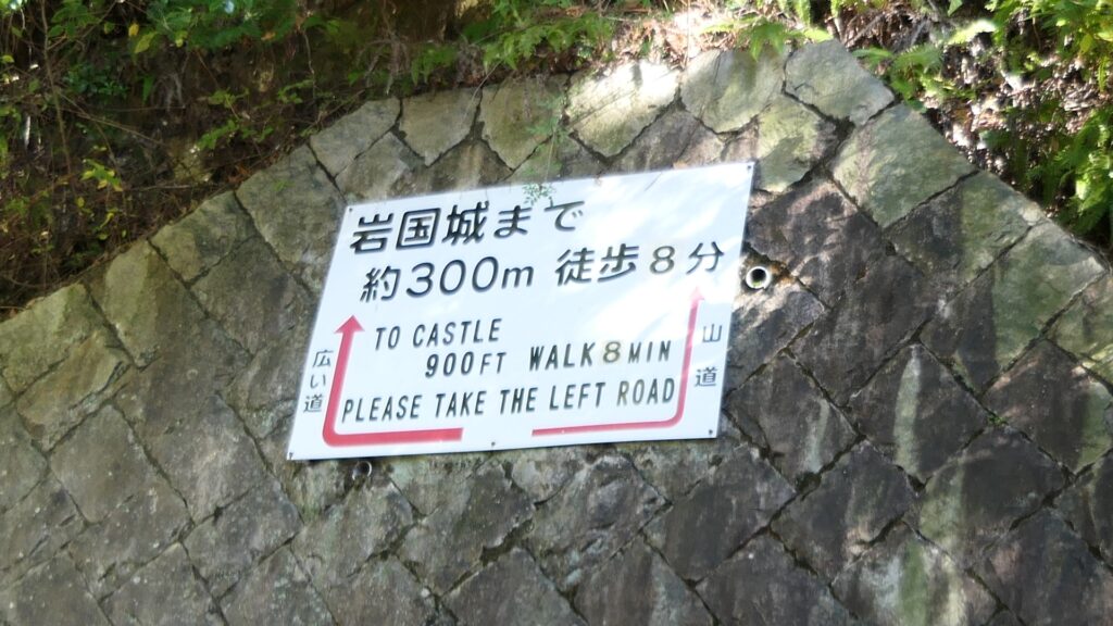
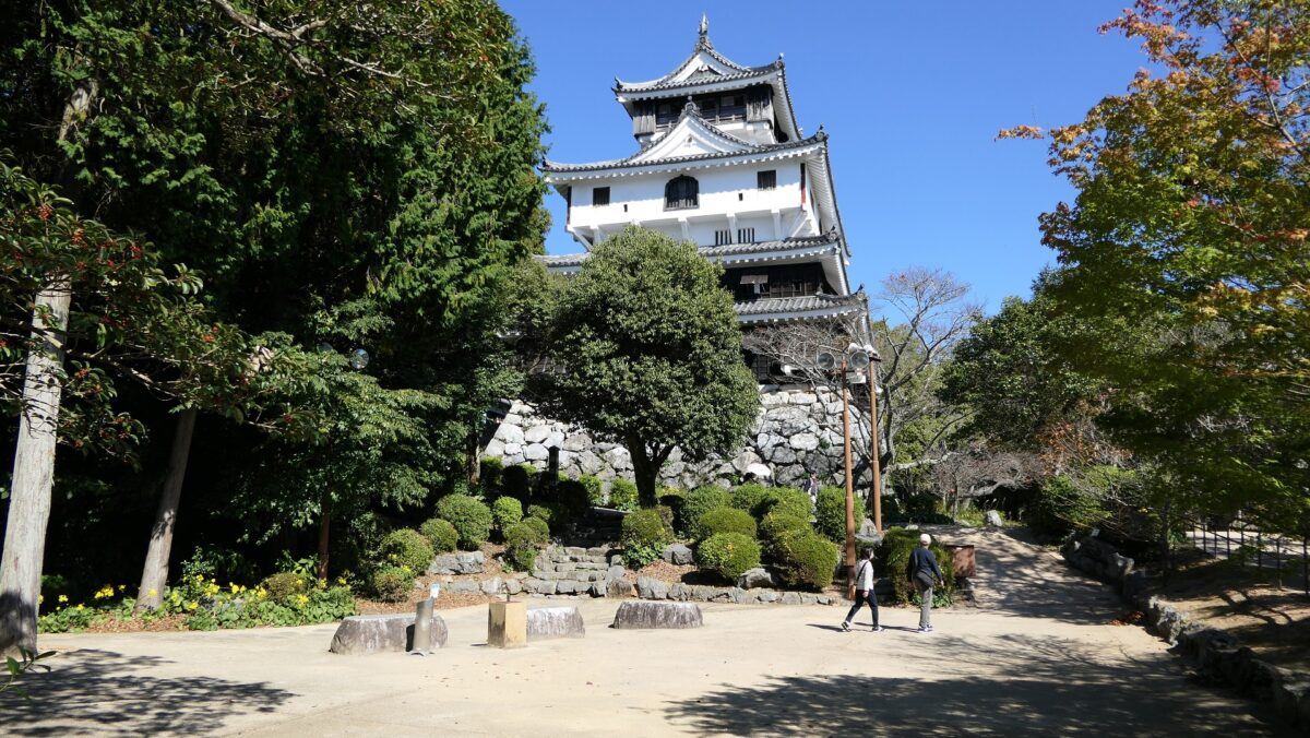
Rebuilt Main Tower and Original Main Tower Base

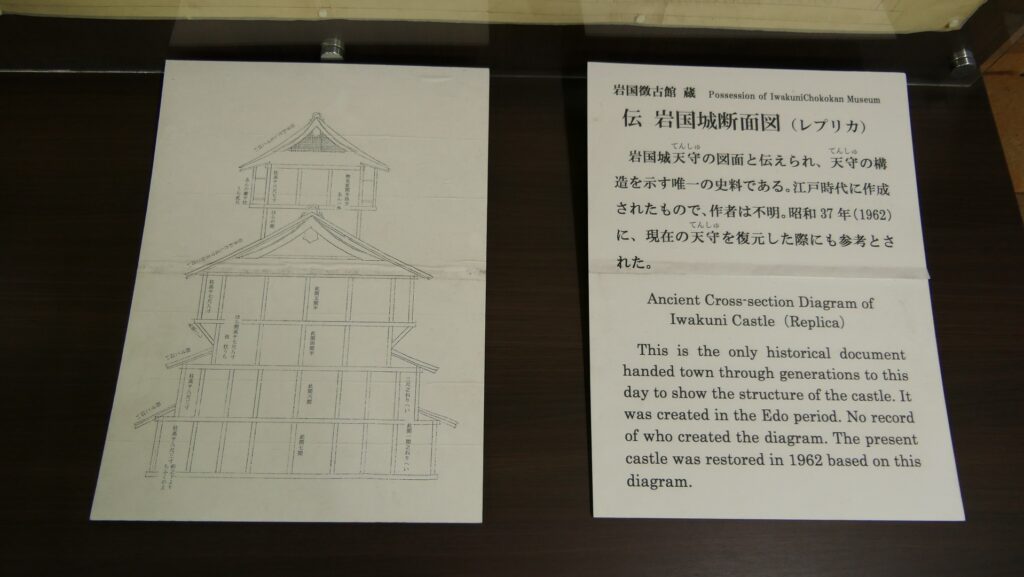
The Main Enclosure is next to the Second Enclosure in the north. The restored Main Tower stands out in front of you. The tower probably has a similar appearance to the original one because its designer used the cross section drawing which was said to come from the original. It has four levels with the third one of which hanging out. This type of Main Towers was rare, called Nanban-zukuri or the Western Style. The tower is actually a modern building which is used as a historical museum and an observation platform. The original stone wall base for the Main Tower was also restored in the original position according to the excavation.

The Main Enclosure including the rebuilt Main Tower seen from the Second Enclosure
A rare Western Style Main Tower
The explanation about the cross section drawing of the Main Tower, exhibited by Iwakuni Castle
A view from the observation platform
The restored original Main Tower base

To be continued in “Iwakuni Castle Part3”
Back to “Iwakuni Castle Part1”

170.Hamada Castle Part2

Introductions for both casual visitors and serious history fans

Later History

After the Meiji Restoration, Hamada Castle Ruins had a little complicated history. The Japanese Army at first owned the ruins but they remained idle, while the remaining Main Tower collapsed due to the Hamada Earthquake in 1872. No buildings survived. After the ruins were sold to the former lord, Matsudaira Clan in 1890, Shimane Prefecture turned them into the Hamada Park in 1903. The route to the Main Enclosure on the top was developed, on the other hand, some stone walls were destroyed for the construction. In 1938, Hamada-Gokoku Shrine was established at the mid slope of the hill. Its approach from the foot was developed.

Hamada-Gokoku Shrine

After World War II, Hamada City, which bought the ruins, planned to improve the park as well as a working area for people. Another route from the foot was developed and some stone walls were repaired by the work. The stone walls had been left after the fire at the end of the Edo Period. However, it was pointed out that their original condition was not considered in the repair. As a result, the ruins were designated as a Prefectural Historic Site of Shimane Prefecture in 1962.

The route to the ruins, which was developed after World War II

Features for General Visitors

Going to Castle Ruins through Hamada-Gokoku Shrine

Today, there are two routes to the ruins of Hamada Castle, houever they are not the original. If you choose the approach to Hamada-Gokoku Shrine as the route, it goes straight to the shrine at the mid slope with stone steps. You can look down Nakanomon Gate Ruins to the right of the way. In fact, the gate was on the original route.

The map around the casltle

The entrance of the approach to Hamada-Gokoku Shrine
The approach to Hamada-Gokoku Shrine
The ruins of Nakanomon Gate seen from the approach

Gate moved from Tsuwano Castle

In the back of the shrine, you will see an old building which looks like a castle gate. However, it is also not original to this castle. When this city was part of the Hamada Prefectural Capital (Hamada Prefecture was later unified with Shimane Prefecture), they moved one of the gates of Tsuwano Castle for its office. The gate was finally moved to the current position in 1967 made as a park attraction.

Going to the back of the shrine
The former Tsuwano Castle Gate
The photo of the gate when it was used for the office

Going to Main Enclosure through Route developed in Meiji Era

You will enter the center of the ruins from the gate, the route becomes likely the original one surrounded by stone walls, but once you turn left, you will see another straight route to the Main Enclosure on the top. Such a layout was hard to believe for a castle because it would have been easier for enemies to attack it. In fact, this route was also developed for the park during the Meiji Era by breaking the stone walls of the Barbican Enclosure beside the Main Enclosure. That’s why visitors have easy access at the top.

Going the center of the ruins
The route becomes straight again
The image of the original stone walls of the Barbican Enclosure, from the signboard at the site
Part of “the illustration of Hamada Castle Stone Walls”, from the signboard at the site, adding the red arrow as the current route and the red circles as the broken stone walls

Main Enclosure becomes Park Square

The inside of the Main Enclosure is a square now where you can see views such as the Hamada city area and Tonoura Cove. You can also see some remaining stone walls around and the rest seemed to have collapsed due to the earthquake back in 1872.

The inside of the Main Enclosure
The Hamada city area seen from the Main Enclosure
Tonoura Cove seen from the Main Enclosure
The partially remaining stone walls of the Main Enclosure

To be continued in “Hamada Castle Part3”
Back to “Hamada Castle Part1”

75.Hagi Castle Part2

There are so many historical attractions in the castle and town.

Features

Going to Main Enclosure through Second Enclosure

Today, Hagi City has a lot of historical attractions. It is said you can even use its old map of the Edo Period when you visit the city. If you want to visit the center of the castle ruins at first by car, you can use the parking lot for visitors in front of the Second Enclosure. The area around it was the Middle Moat in the past, which was buried by the dug up soil when the Hagi Canal was built nearby in 1924. That’s why the Southern Gate Ruins of the Second Enclosure is the north of it and the remaining Asa Mori Clan Residence in the Third Enclosure is the south of it.

The map around the castle

The area around the parking lot
The remaining Asa Mori Clan Residence
The Southern Gate Ruins of the Second Enclosure
The Hagi Canal near the center of the castle

The Sothern Gate had doubled defensive square spaces surrounded by turrets and stone walls. You can now see their shapes by the remaining stone walls. There are Hagi ware shops and tea rooms inside the gate ruins because the Second Enclosure is divided by private sections.

The doubled defensive square spaces
The statue of Terumoto Mori in the gate ruins
A Hagi ware shop in the Second Enclosure

Beautiful Main Tower Stone Wall Base

You will soon reach the Main Enclosure which has no remaining buildings, but its stone walls and the Inner Moat are still intact. In particular, the stone wall base for the Main Tower, which has corner lines like the Slope of a Folding Fan, looks very beautiful with the background of Shizuki Mountain. The base is about 10m high, and the Main Tower was said be nearly 20m, so the total was about 30m.

The Main Enclosure
The stone wall base for the Main Tower
The base with the background of Shizuki Mountain
Another old photo of the Main Tower, in the Meiji Period (licensed under Public Domain via Wikimedia Commons)

You can see Large Scale of Each Item in Main Enclosure

The Main Enclosure has become part of Shizuki Park. You can enter it by going across the Gokurakubashi Bridge over the Inner Moat and passing the Main Enclosure Inner Gate Ruins. The shape of its interior is square but there is the Shizukiyama Shrine established in the Meiji Era and some buildings, such as tea rooms, which were moved from another area to the park. You can walk up to the top of the Main Tower base. You will see a lot of stone foundations on it and you can imagine how large the tower was.

The Main Enclosure Inner Gate Ruins
Going to the top of the Main Tower stone wall base
The stone foundations on the base
A view of around the gate from the Main Tower base

You should also check out Gangi, the wide stone steps which are not very conspicuous but have a significant role in history. They are between the gate and the base. This is said to be one of the widest Gangi among Japanese castles. Mud walls were built on these stone walls so that defenders could counterattack through the walls using the steps if enemies would attack the castle.

The wide stone steps
The top of the stone walls above the steps, the mud walls were built on it
The stone walls at the front

Castle even protests Seashore

I also recommend seeing the castle from the eastern side, for example, the Kikugahama Beach, by going out from the Eastern Gate Ruins of the Second Enclosure. The scenery of the beach with Shizukiyama Mountain is beautiful. Also, if you look at the foot of the mountain, you will find long stone walls still lie along the foot. There were as many as five turrets between mud walls on them in the past.

The Eastern Gate Ruins of the Second Enclosure.
A view of Shizukiyama Mountain from the Kikugahama Beach
The long stone walls built along the seashore

There are now partly restored mud walls. You can also get close to the stone walls and go out to the seashore from the Shioiri-mon Gate Ruins.

The restored mud walls
The Shioiri-mon Gate Ruins
The seashore outside the gate ruins

To be continued in “Hagi Castle Part3”
Back to “Hagi Castle Part1”

error: Content is protected !!