125.小机城 その3

この城跡は道路工事があってから有名になりました。

特徴、見どころ

分断されている出丸

実は、この城跡は一部分、第三京浜道路によって破壊され、分断されています。西ノ曲輪の入口近くからは、その道路越しに出丸のうちの一つが見えます。そこに行くには、道路下のトンネルを通る必要があります。出丸の頂上は、富士仙元(ふじせんげん)という富士塚となっていて、江戸時代に富士山を信仰するために作られました。それ以前は、櫓台だったのかもしれません。城跡から一歩外に出ると、すぐに元の市街地に戻ります。

城周辺の地図

城跡を分断している第三京浜道路
トンネルをくぐり、階段を登ります
出丸にある富士仙元
城跡を出るとすぐ市街地です

その後

小机城が廃城となった後、地元の人たちは、この城跡を城山と呼んできました。この城についての研究は、早くも江戸時代に始まりました。しかし、この城跡が史跡として認知されるようになったのは、皮肉にも1963年に第三京浜道路の建設により、その一部が破壊されたときからなのです。それをきっかけに、横浜市は1977年に小机城址市民の森を設立し、城跡を保護することにしました。現在、城が当時はどのような姿だったのか関心が持たれています。

小机城跡と第三京浜道路

私の感想

小机城は、少ない兵力でどのように城を守るかがわかる、よい事例だと思います。もし秀吉が攻めてきたときに小机城で戦いが起こっていたならば、山中城八王子城のように一日で落城することはなかったと思うのです。

西ノ曲輪前の大空堀

ここに行くには

公園には駐車場がないので、城跡を訪れる際は電車を使われることをお勧めします。
JR横浜線の小机駅から歩いて約15分かかります。

小机駅
小机駅ホームから見える城跡

横浜上麻生道路(神奈川県道12号線)が駅の近くを通っています。小机駅前交差点を右に曲がり、通りをまっすぐ進んでください。そして、小机辻交差点を右に曲がります。

小机辻交差点を右に

再びまっすぐ進み、踏切を渡り、そこから最初の交差点を左に曲がってください。

踏切を渡ります
すぐに左に曲がります

住宅街の道路を進み、右側の電柱に城跡への道しるべが見える所で右に曲がります。そのうちに城跡の入口に到着します。

電柱の道しるべ(赤円内)が見えたら右に曲がります
城跡の入口

リンク、参考情報

小机城址ガイドマップ、港北観光協会
・「歴史群像149号、戦国の城 武蔵小机城」学研
・「日本の城改訂版第126号」デアゴスティーニジャパン

これで終わります。ありがとうございました。
「小机城その1」に戻ります。
「小机城その2」に戻ります。

125.Kozukue Castle Part2

Another world in Yokohama City

Features

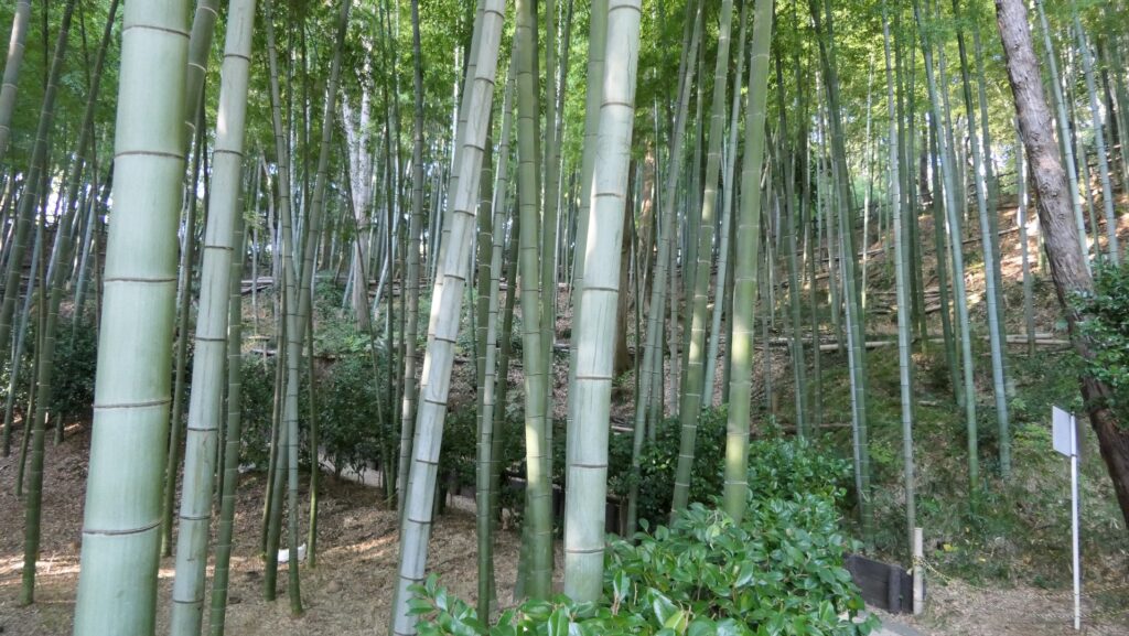
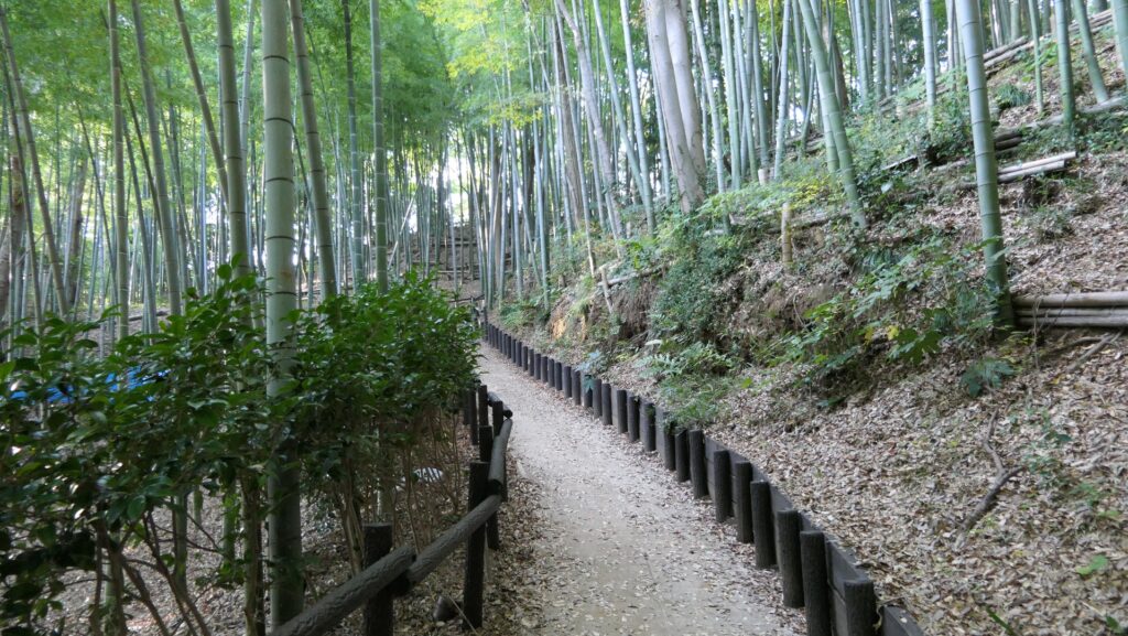
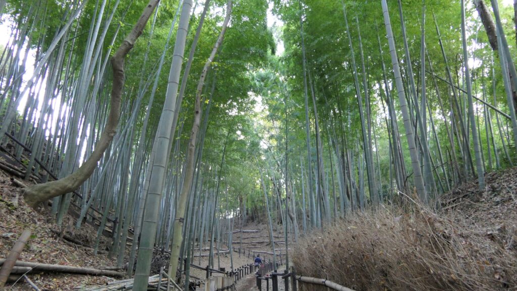
Ruins planted with Bamboo Forest

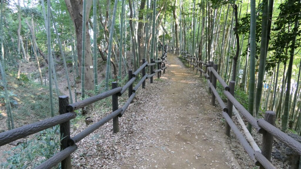
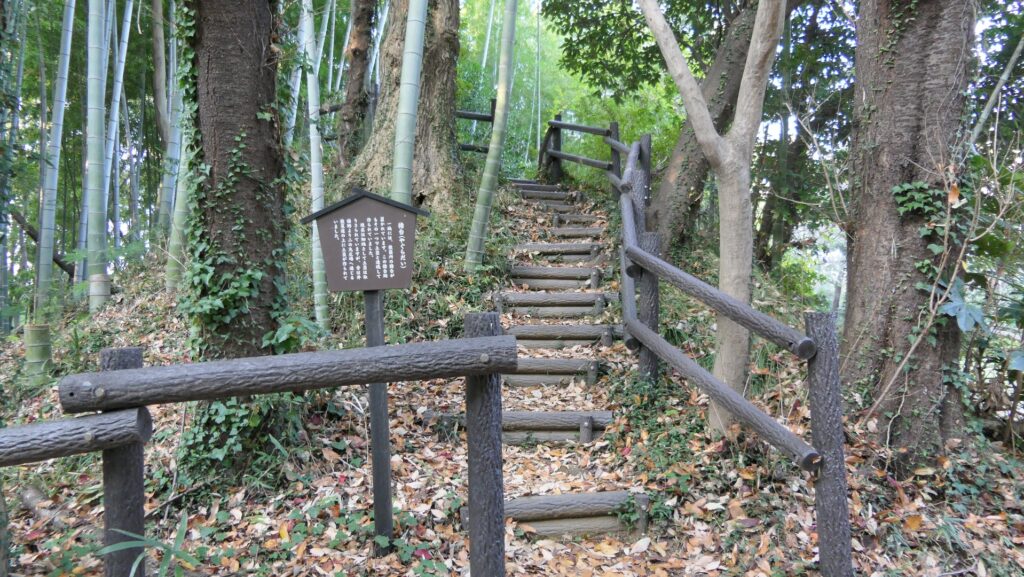
Today, the ruins of Kozukue Castle are preserved by Yokohama City as a park called the Kozukue Castle Ruins Forest. Yokohama City has the largest population among the cities in Japan except for Tokyo Special Ward, with about 3.8 million citizens. Even the hilly area around the ruins is covered with lots of modern facilities, office buildings and residences. However, once you walk into the ruins, you may feel like you are in another world. The hill for the ruins is basically planted with a beautiful and well-maintained bamboo forest. The foundation of the castle also remains under the forest.

The bamboo forest on the ruins
The location map at the site

The map around the castle

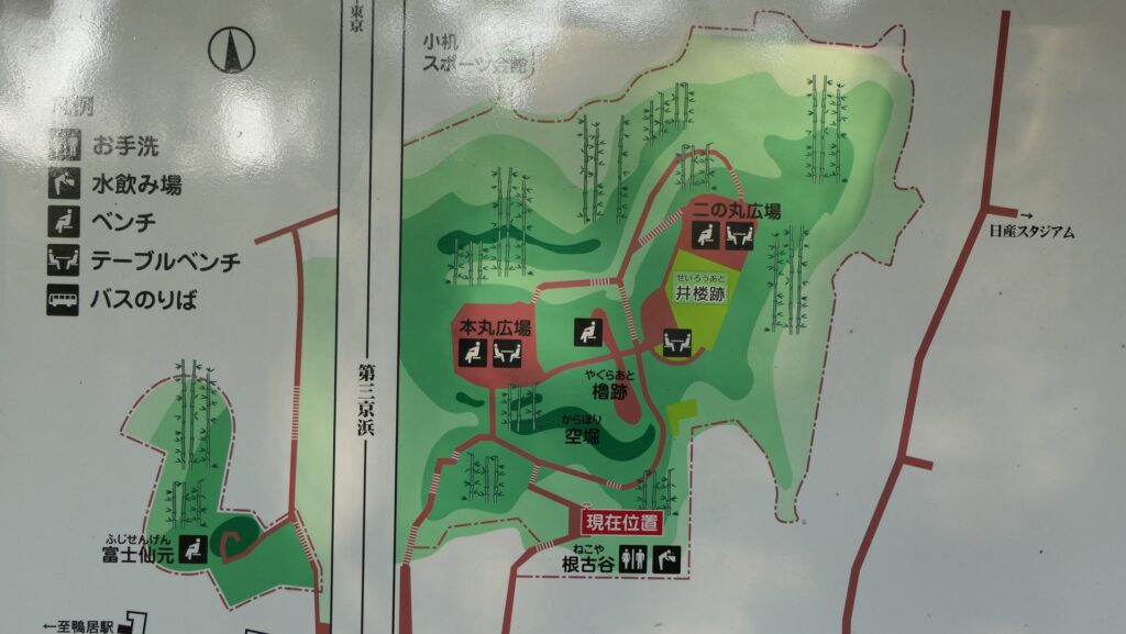
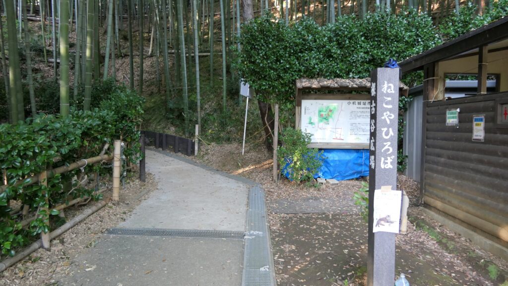
You can climb up on the well-developed trail from the foot of the hill called Nekoya.

The foot of the hill
Climbing on the trail

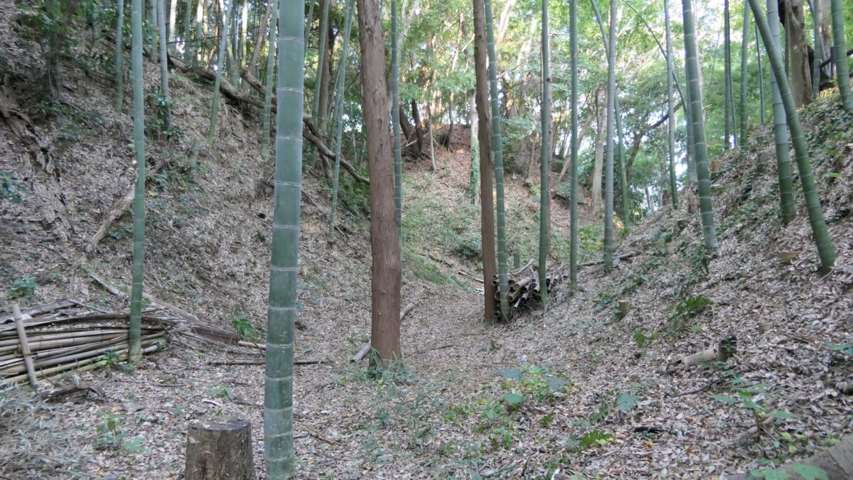
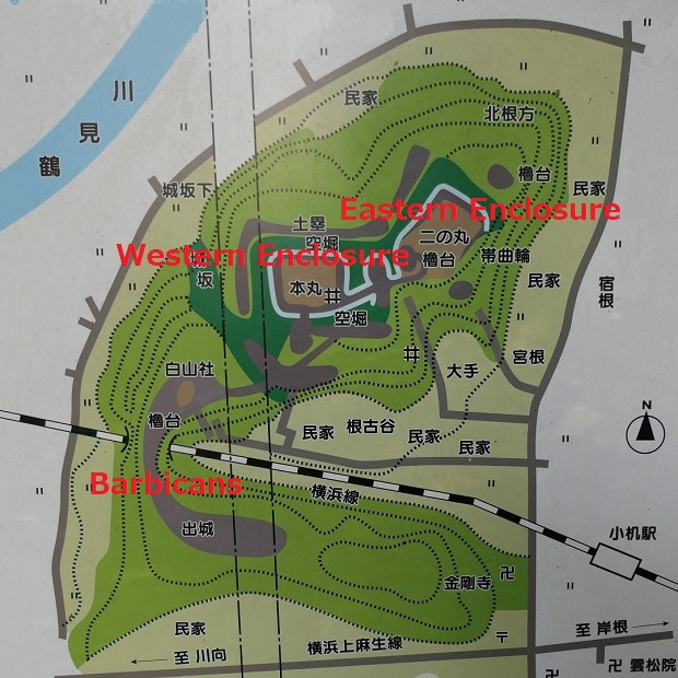
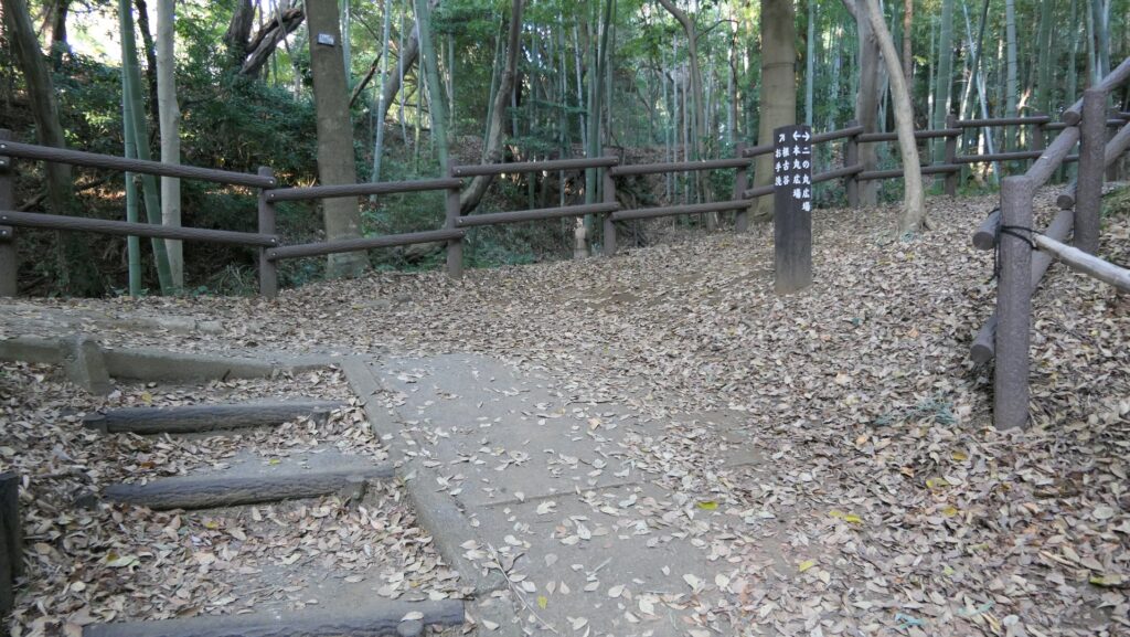
Large-scale Dry Moat

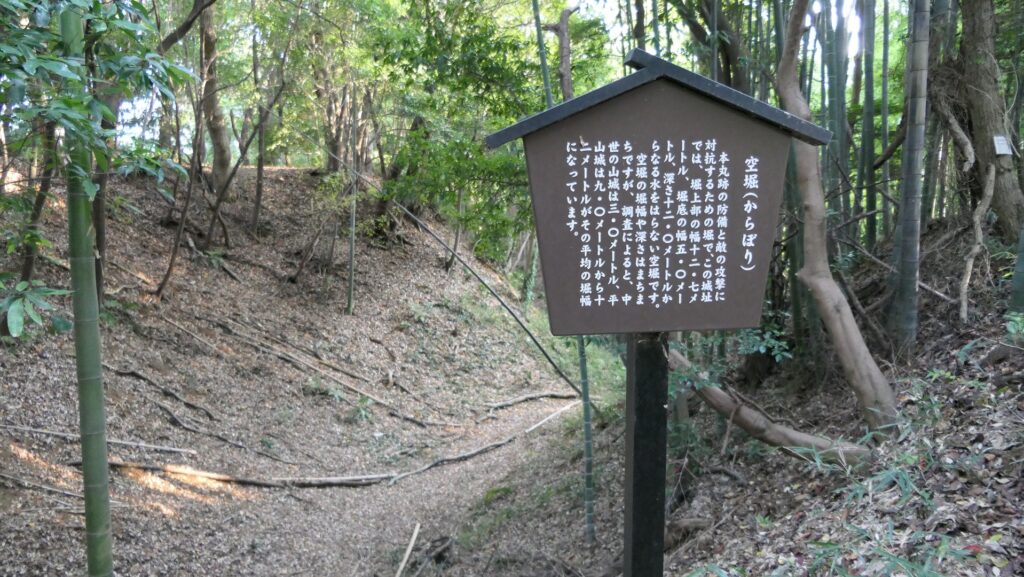
You will soon reach the top of the outer earthen walls and see the large-scale dry moat in front of the enclosures. This dry moat is still about 13m in width and about 12m in depth. It must have been much deeper in the past. When the excavation team recently dug the bottom of another dry moat in the castle at over 2m, they still could not find its original bottom.

The large dry moat
Looking at the bottom of the moat

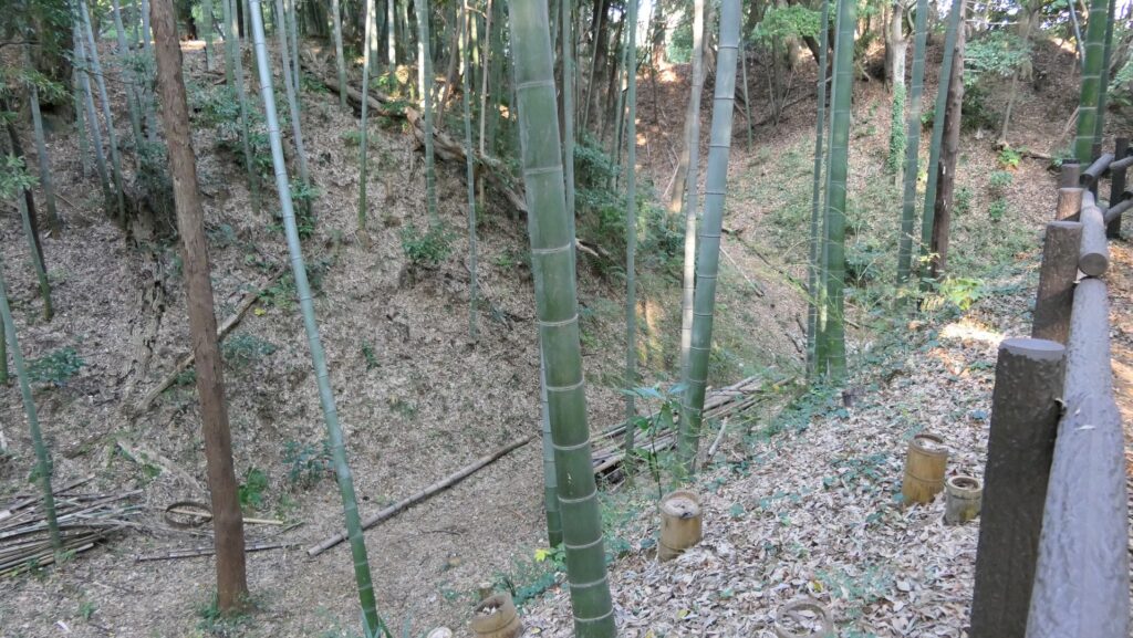
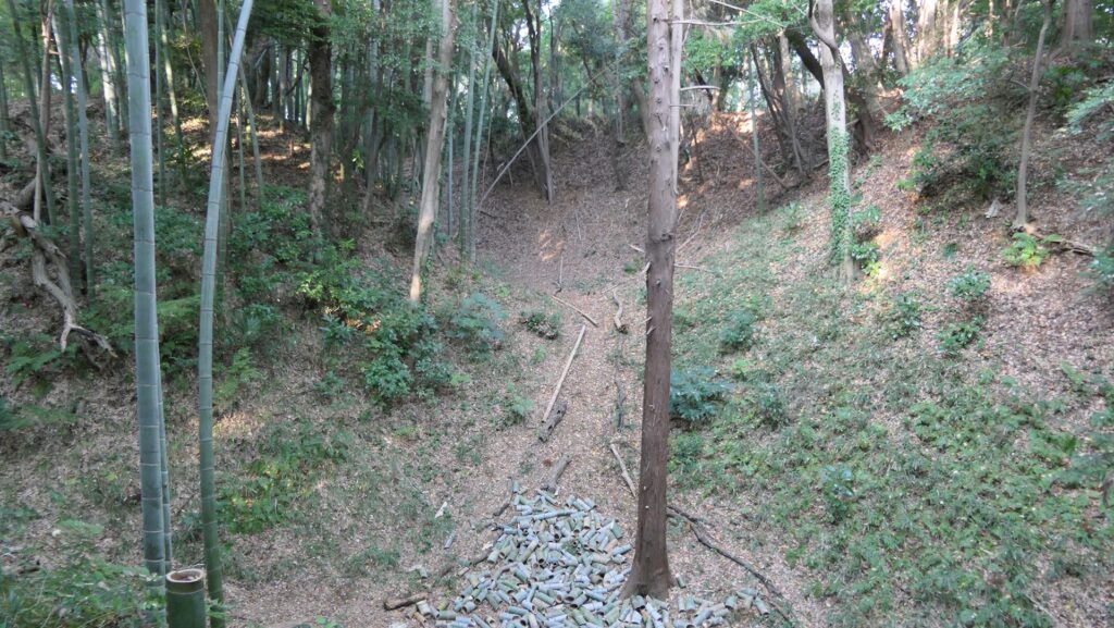
The trail goes on the outer earthen walls at the same level as the top of the moat, but you can also go down to the bottom from some points where the slope of the moat is gentle. If you stand at the bottom looking up, you might find another perspective of the castle.

The trail going on the outer earthen walls
One of the points where you can go down to the bottom of the moat
The bottom of the dry moat

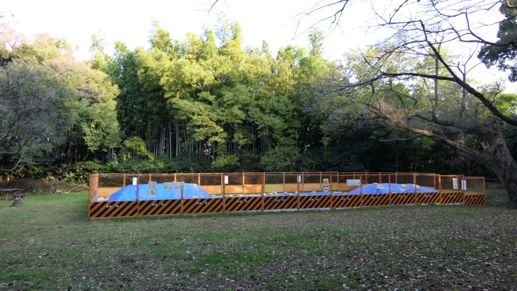
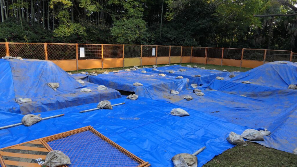
Eastern Enclosure under Excavation

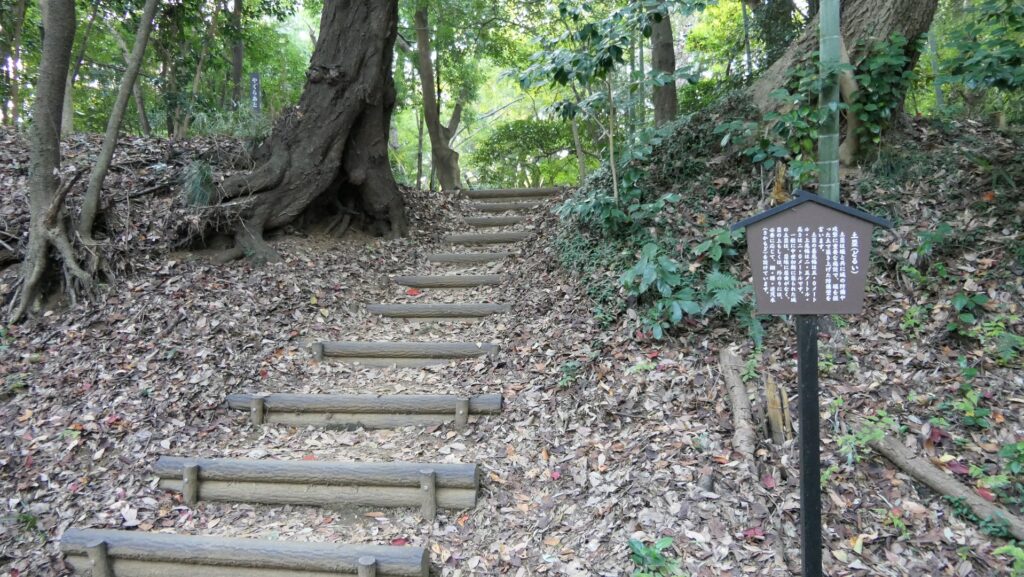
If you walk around the outer earthen walls to the right, you will reach the Eastern Enclosure which is also called the Second Enclosure at the site. The excavation is also ongoing at the center of the enclosure, where some buildings were built in the past.

The center of the Eastern Enclosure
The excavation site

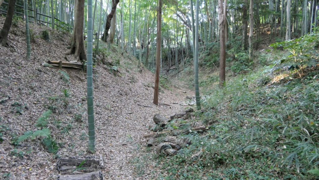
You can also climb up to the high turret earthen base at the edge of the enclosure, where you can look down the dry moat around it from the top.

Climbing up to the turret base
A view of the dry moat around the enclosure from the base

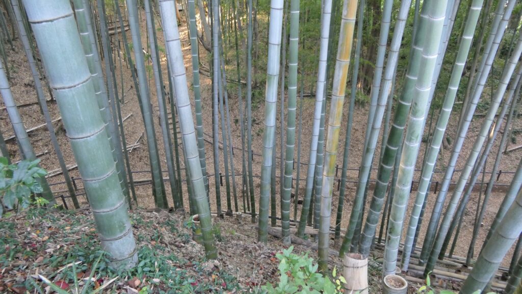
The trail around the enclosure goes to the bottom of the moat. You will find the beautiful bamboo forest around the enclosure again when you walk on the trail.

The trail on the bottom of the moat
The wonderful bamboo forest

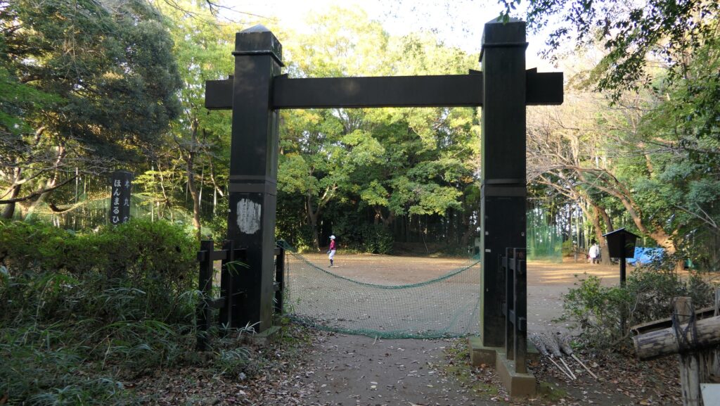
Western Enclosure used as Sports Square

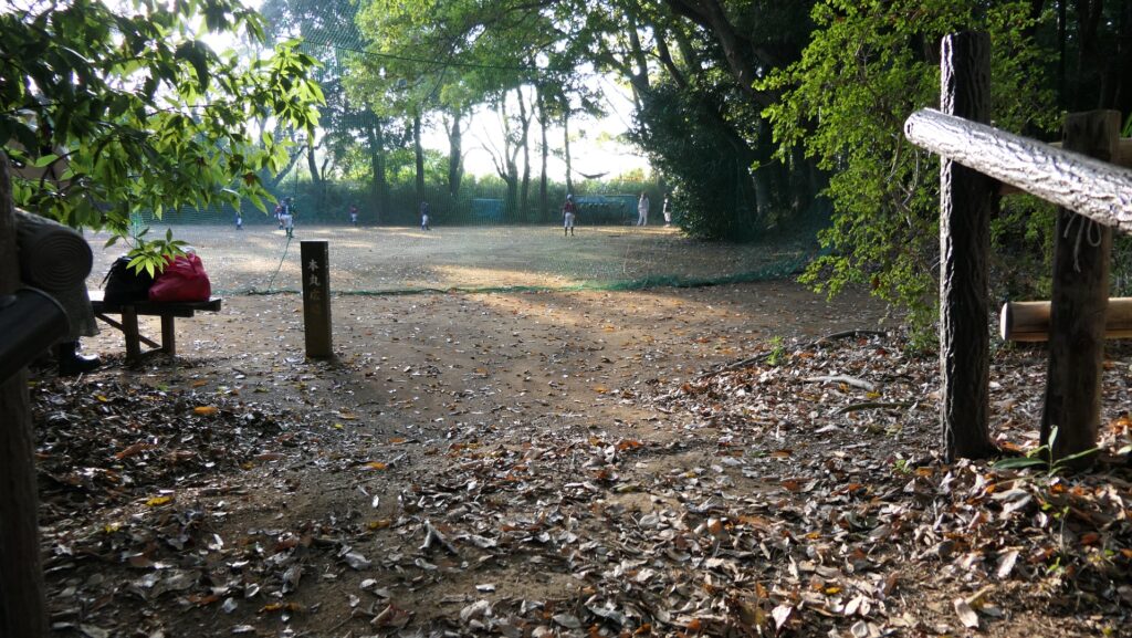
If you walk around the outer earthen walls to the left or walk over the Connecting Enclosure from the Eastern Enclosure, you will reach the Western Enclosure which is also called the Main Enclosure at the site. The inside of it is a flat square, so it is used for sports like baseball now. An altered gate called Kabuki-mon was built at the entrance of it to look like the Main Enclosure. However, in fact, historians have been arguing for over 150 years if this enclosure was really the main one. Some of them think the Eastern Enclosure was main. The excavation may find the correct answer in the future.

You can go there by turning left at the first intersection
Or walking over the Connecting Enclosure from the Second Enclosure
The Western Enclosure
The altered gate

To be continued in “Kozukue Castle Part3”
Back to “Kozukue Castle Part1”

125.小机城 その2

横浜市の別世界

特徴、見どころ

竹林に覆われた城跡

今日、小机城跡は横浜市によって、小机城址市民の森という公園として保存されています。横浜市は、東京23区を除くと、日本で最も人口が大きい都市で、約380万人の市民が暮らしています。城跡の周りの丘陵地帯でさえ、近代的施設、ビル、住居がひしめいています。ところが、城跡に一歩踏み入れると、そこはまるで別世界のようです。城跡がある丘陵はおおむね、美しく且つよく整備された竹林に覆われています。城の基礎部分は、この竹林の下に残っているのです。

城跡の竹林
公園の案内図

城周辺の地図

根古谷と呼ばれる丘の麓からよく整備された通路を登って行くことができます。

丘の麓部分「根古谷」
通路を登っていきます

広大な空堀

やがて、外郭の土塁の頂上に着くと、曲輪群の手前にある大規模な空堀が見えてきます。この空堀は、今でも約13mの幅と12mの深さがあります。かつてはもっと深かったに違いありません。発掘調査のチームがこの城の他の空堀の底を2m以上掘っても、元々の堀の底には到達しなかったそうです。

大空堀
空堀の底を見下ろす

通路は、空堀の最も高い位置にあたる外郭土塁の上を進んでいますが、堀の傾斜が緩やかになっているところがいくつかあり、そこから堀の底に降りていくこともできます。堀の底に立って上を見上げてみると、この城の新たな一面が見えてくるようです。

土塁の上を進む通路
空堀の底に降りていける場所
空堀の底

発掘中の東ノ曲輪

城跡の正面から見て外郭土塁を右側の方に歩いて行くと、東ノ曲輪に着きます。この曲輪は現地では「二の丸」と表記しています。この曲輪の中央部分では発掘調査が続けられていて、かつてはいくつか建物がありました。

東ノ曲輪の中心部
発掘現場

この曲輪の端で高くなっている土造りの櫓台に登ってみると、そこから曲輪の周りの空堀を見下ろすことができます。

櫓台に登っていきます
櫓台から見える曲輪の周りの空堀

この曲輪周辺の通路は、その空堀の底を通っていて、そこを歩いてみると、この曲輪の周りも美しい竹林によって覆われていることがわかるでしょう。

空堀の底を通る通路
素晴らしい竹林

スポーツ広場となっている西ノ曲輪

正面から外郭土塁を左側に回っていくか、東ノ曲輪からつなぎの曲輪を超えていくと、西ノ曲輪に至ります。この曲輪も現地では「本丸」と称されています。この曲輪の中は広場になっていて、現在では野球などスポーツをするために使われています。この曲輪の入口には、本丸らしく見えるように、模擬的に冠木門が建てられています。しかし実は、歴史家たちは150年以上もこの曲輪が本当に本丸なのか議論しているのです。一部の歴史家は、東ノ曲輪こそが本丸であると主張しています。将来、発掘が進めば、本当のことがわかるかもしれません。

最初に登った通路を左に曲がるか
東ノ曲輪からつなぎの曲輪を超えていきます
西ノ曲輪
模擬的に建てられた冠木門

「小机城その3」に続きます。
「小机城その1」に戻ります。