Features
Introduction
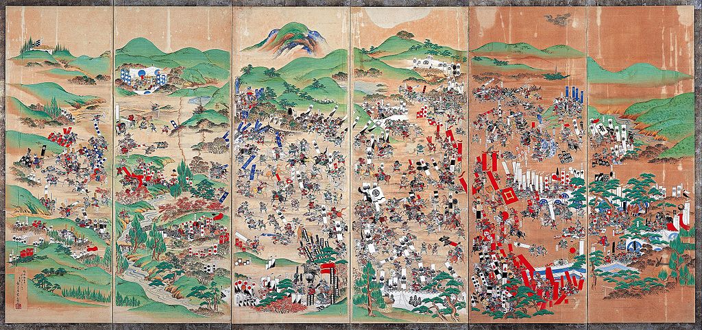
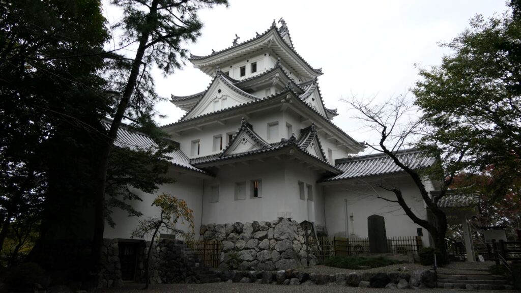
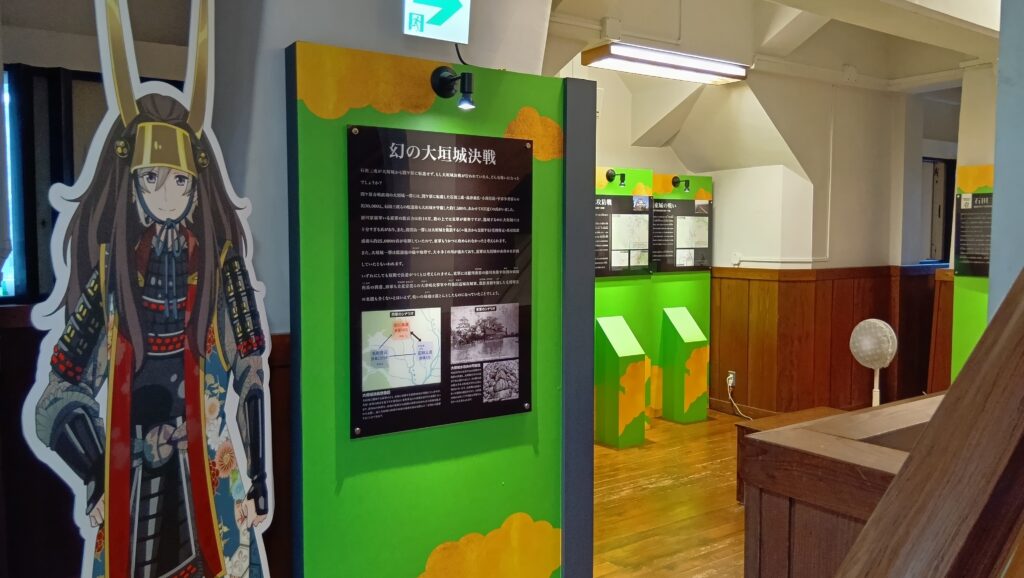
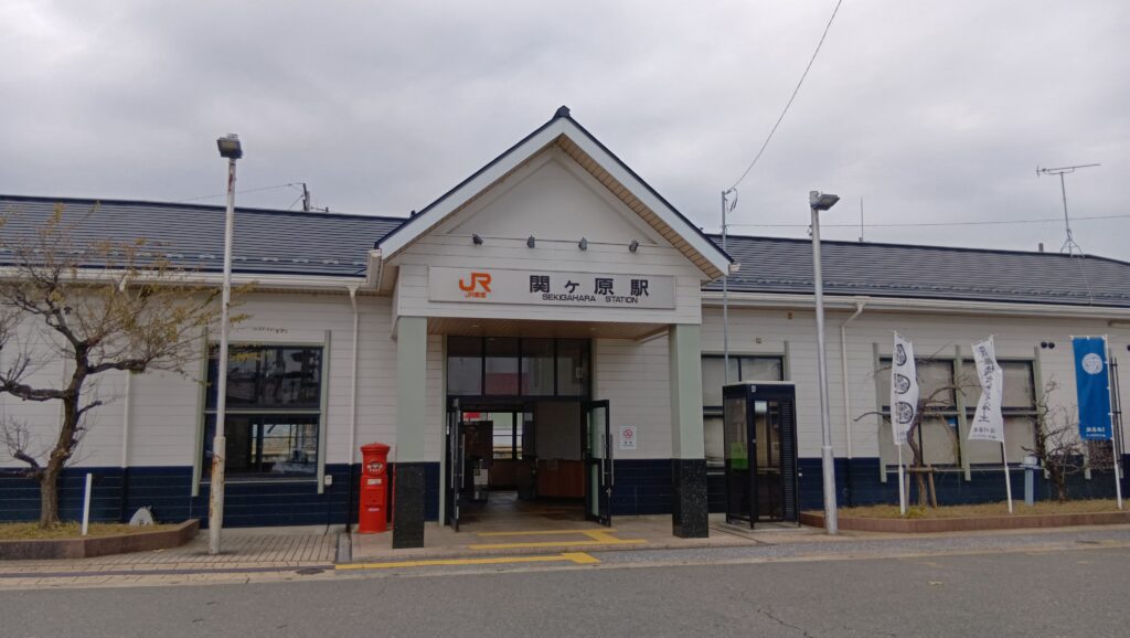
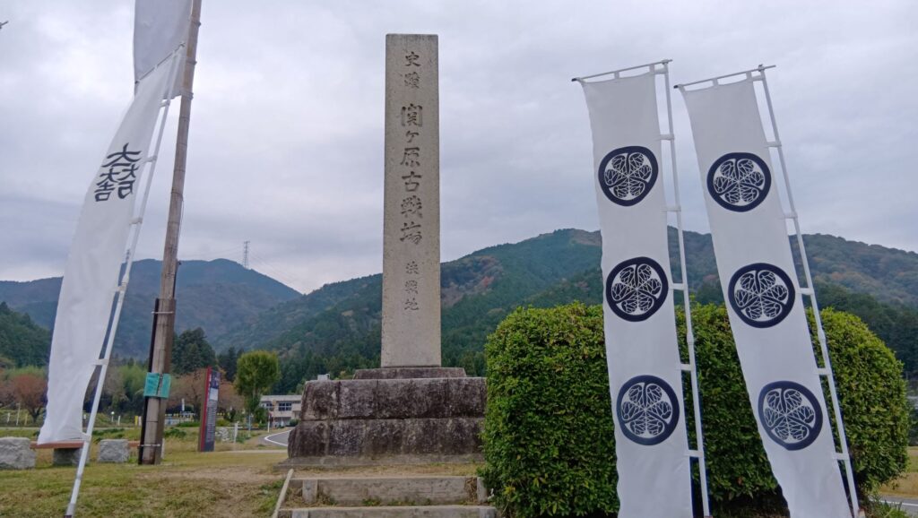
This article will describe how we visit the ruins of the encampments for the battle of Sekigahara (mainly of the Western Allies). We will finally go to the ruins of Matsuoyama Castle where Hideaki Kobayakawa was positioned. In addition, as for the encampments of the Western Allies, we will visit them not only based on the defacto theory but also based on the new theories. Ogaki Castle may be a good starting point because the battle happened just after Mitsunari Ishida left the castle. You can see some exhibitions of him and the Sekigahara Battle in its restored main tower which has become a historical museum. Sekigahara Station is just few minutes from Ogaki Station.
Tour to Encampments of Western Allies based on Defacto Theory
It will be easy for visitors to visit the encampments based on the defacto theory because there are lots of information boards (also written in English). “Sekigahara Historical Landmark Tour” map, provided by the Sekigahara tourist association secretariat, will also help you. The following link is available in English.
(https://www.sekigahara1600.com/download/file/20200109155151.pdf)
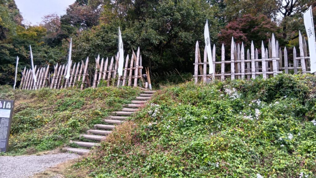
So, let us first go to the encampment of Mitsunari Ishida on Sasaoyama Mountain, based on the defacto theory.
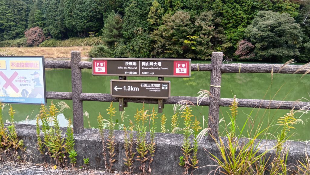
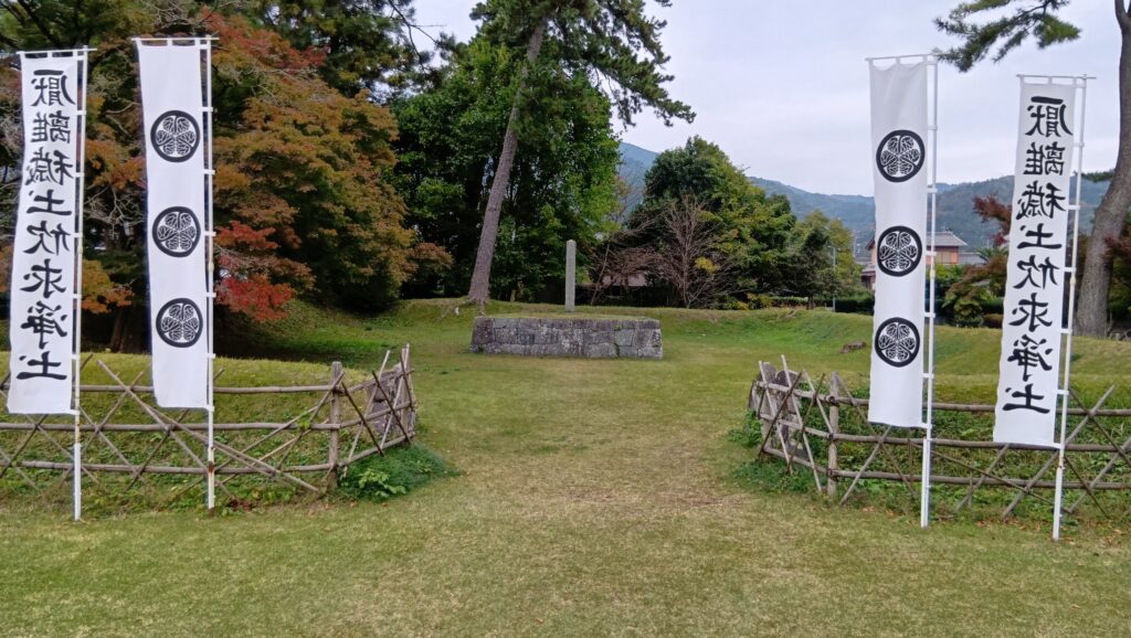
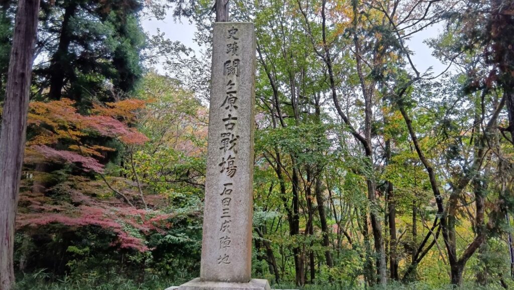
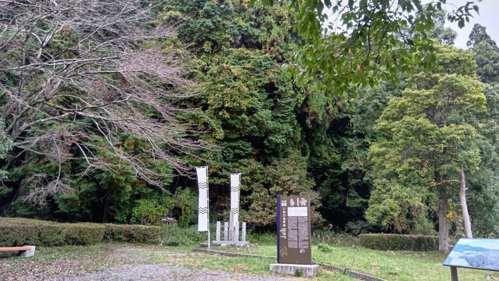
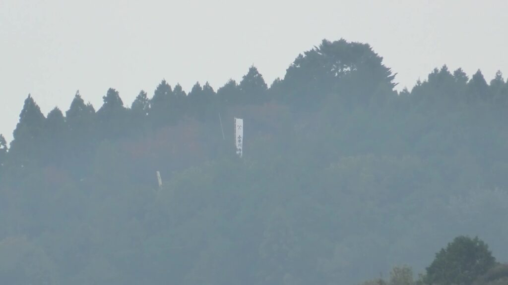
It may be better to go towards the Battle Site Memorial before reaching the mountain because you can find it easily. You can see the mountain where the flag of Mitsunari’s encampment stands.
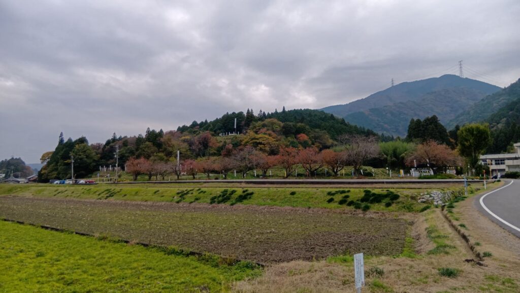
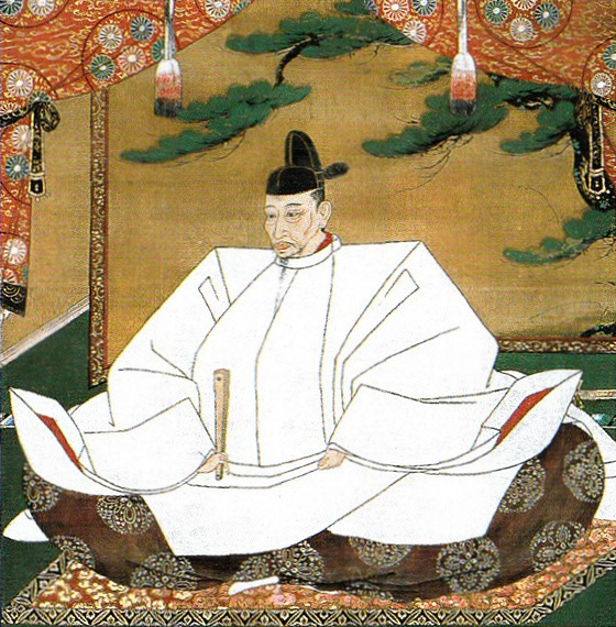
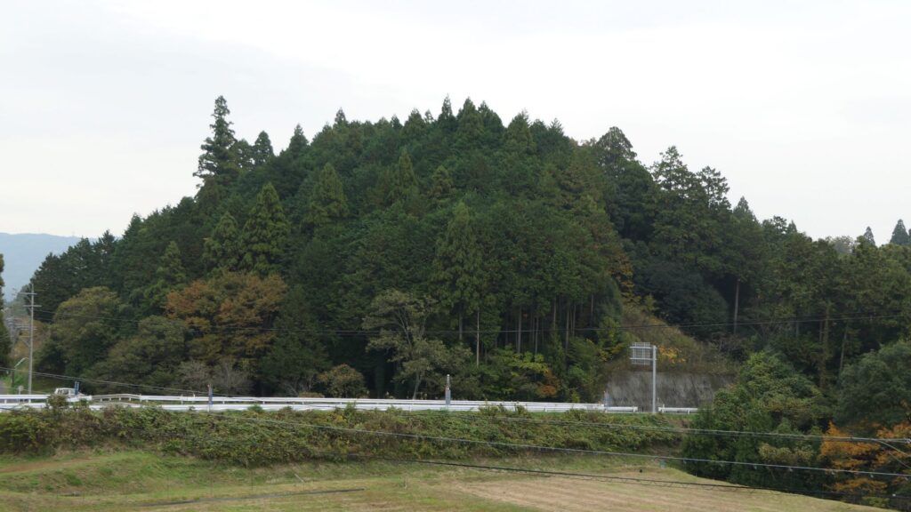
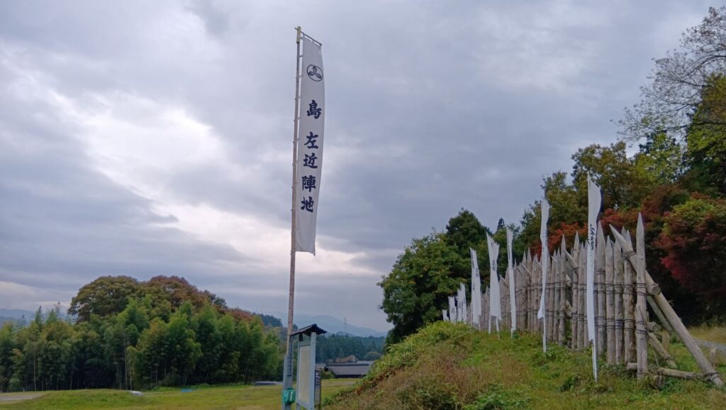
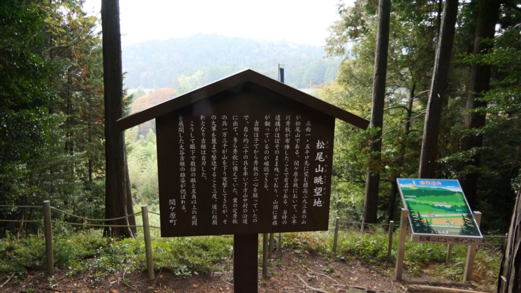
If you reach the foot of the mountain, you will eventually see that it was the encampment of Shima Sakon who was Mitsunari’s senior vassal. In fact, there is no evidence which proves that the mountain was certainly their encampments. The current historical sites were designated by the officials during the Meiji Era, probably based on the local traditions of the Edo Period. However, the top of the mountain looks suitable for the stronghold. You can see a panoramic view from the top, including Nangusan Mountain on the left, where Hiroie Kikkawa was positioned, and Matsuoyama Mountain on the right, where Hideaki was positioned. If Mitsunari would have been on the top, he would have been able to see any suspicious actions by the lord.
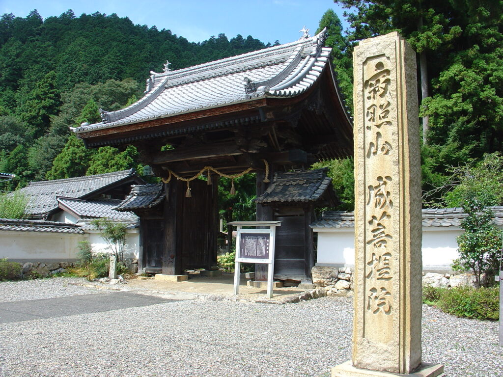
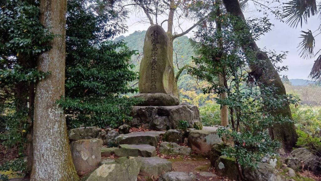
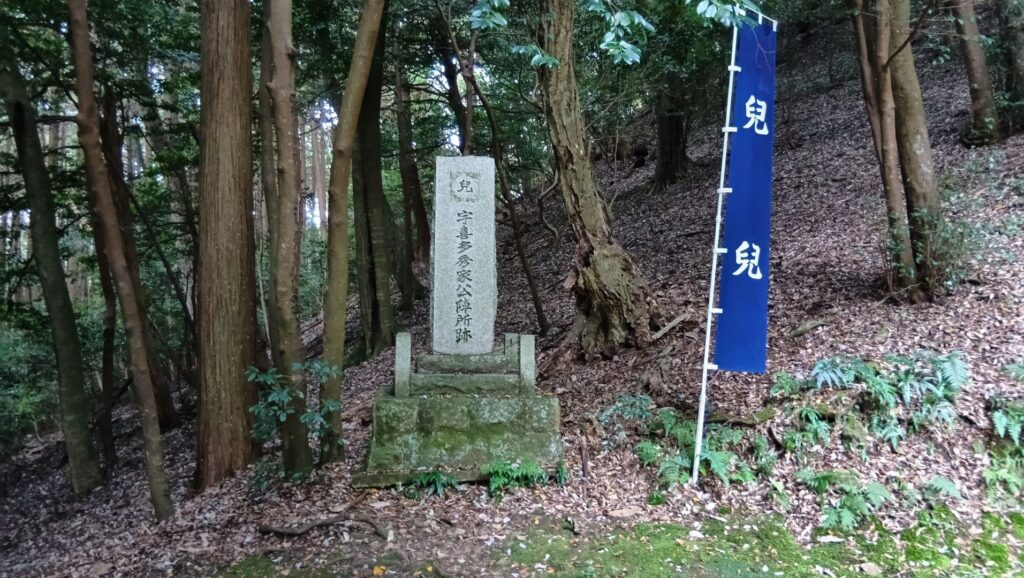
Our next target will be the grave site of Yoshitsugu Otani, after passing the encampments of other lords of the Western Allies, such as Yoshihiro Shimazu, Yukinaga Konishi, and Hideie Ukita. You need to walk for few kilometers to reach the target. However, some soldiers who joined the battle testified that the lords were positioned together in the range of only few hundreds of meters. This is another mystery that his often debated by historians and experts.
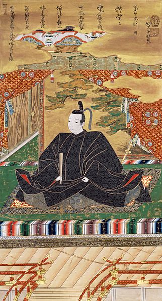
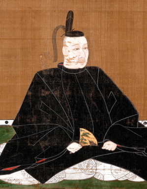
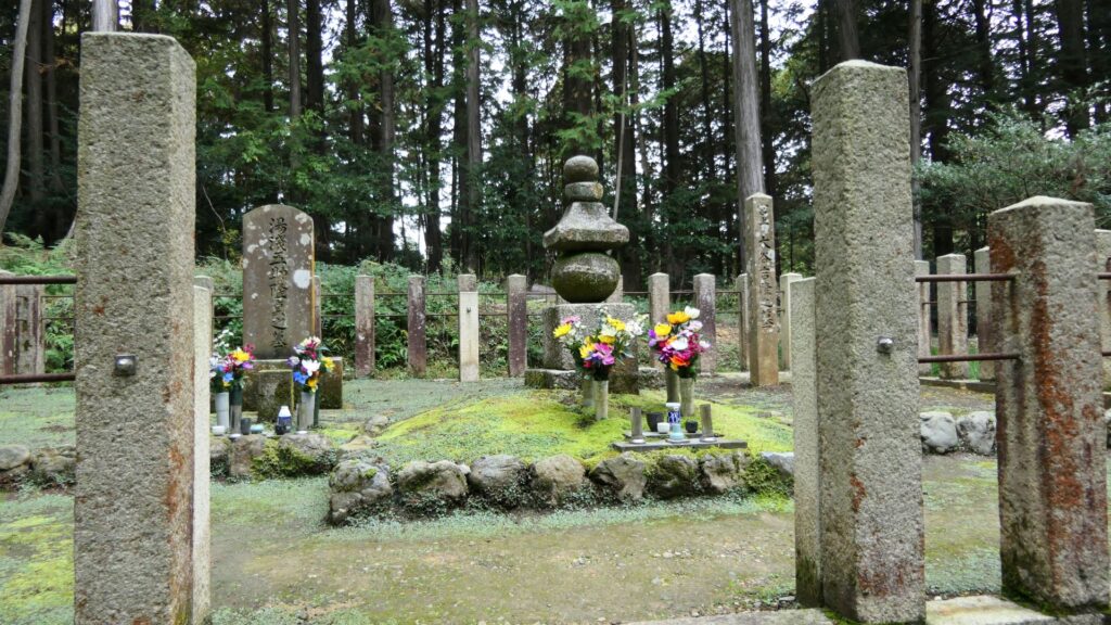
You will eventually enter the Yamanaka area (which directly means “mountain area”), not like the Sekigahara field. There are actually some ruins of encampments, made by soil, which Yoshitsugu might have built. His grave is in the area, which is said that his retainer originally buried his head there. Takatora Todo, who had been his enemy, heard about it and developed the grave as we can see now. There are always offerings (such as flowers) in front of the grave, from his fans. This is probably because of his episodes in the battle. Yoshitsugu joined the Western Allies because of his friendship with Mitsunari but was defeated by the betrayal of Hideaki (according to the defacto theory).
Tour to the Encampments of the Western Allies based on New Theories
Let us next go to the encampment of Yoshitsugu Otani from his grave nearby.
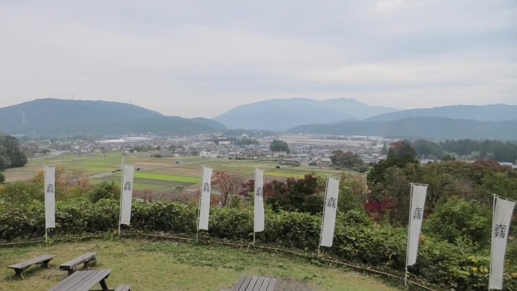
His encampment has been designated based on the defacto theory while a new theory says it was, in fact, that of the Shimazu troops. By the way, there is the view spot of Matsuoyama Mountain near the encampment as well. You can see the flag of Hideaki’s encampment from that spot. I think the view is one of the reasons why Yoshitsugu’s encampment was designated nearby in the defacto theory. The theory says Yoshitsugu was positioned in order to better monitor the betrayal of Hideaki. On the other hand, in the new theory, Yoshitsugu was actually in the Sekigahara field, so another lord was expected to use the encampment instead of him.
We will next go to the encampment of Mitsunari Ishida, based on the new theory, after climbing down the mountain area. If you walk on the Old Nakasendo Road, you will eventually see a hill up ahead, which is the encampment, called “Jigai-ga-oka”. The hill is also a historical site of Jinshin War during the Ancient Time, called “Jigai-mine-no-sanbon-sugi” which means “The three cedars on Suicide Hill”. A tradition says as followed:
Prince Otomo was defeated by Prince Oama during the war and killed himself in another place. People around the hill, who loved him, got his head and buried in the hill. The three cedars are said to be the mark, which you can visit and see.


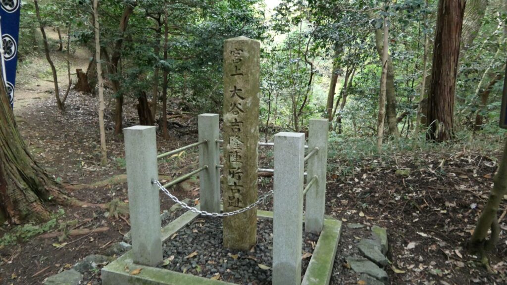
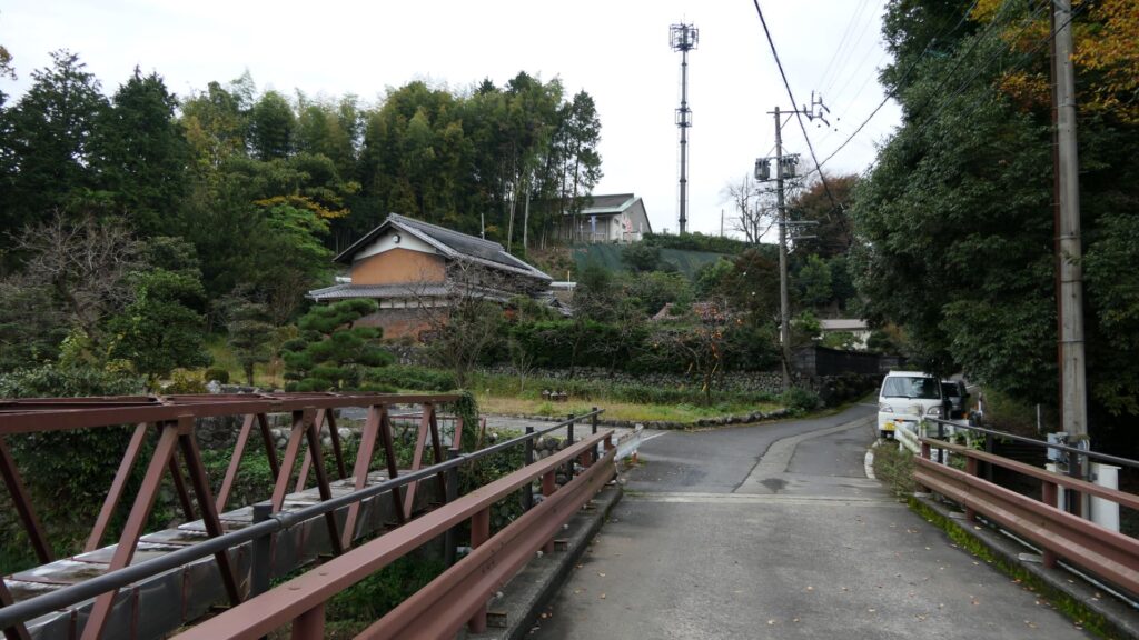
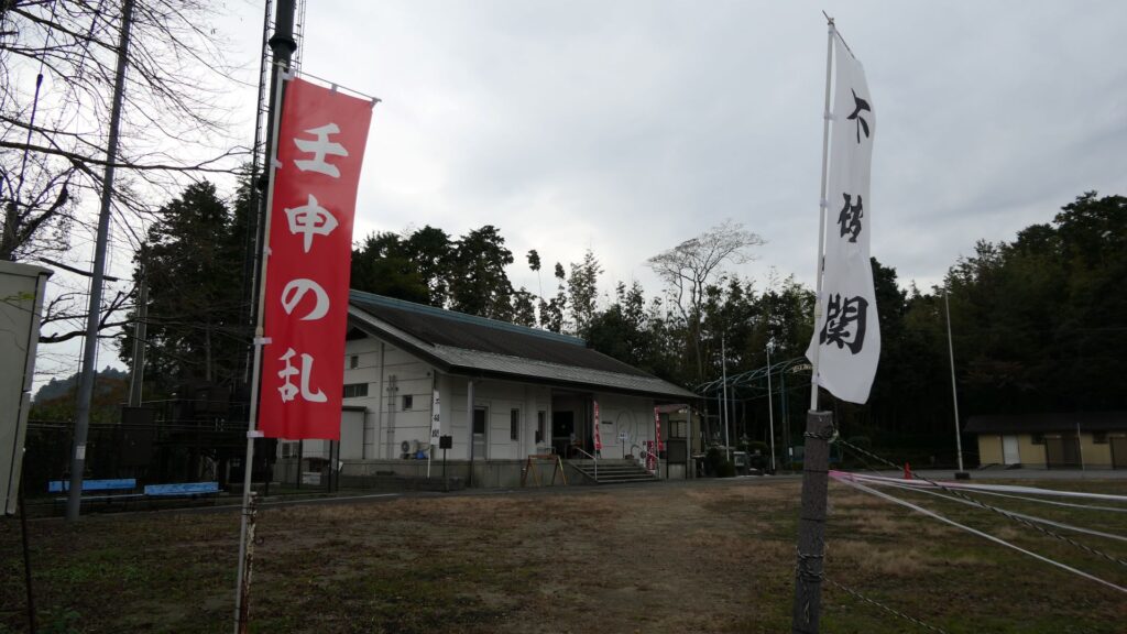
There is one more spot regarding both the Sekigahara Battle and the Jinshin War, after going on the road over Fujikogawa River. You can find Fuwanoseki Museum, which are the ruins of Fuwanoseki (which means Fuwa Gateway). The new theory says this spot was the encampment of Yoshitsugu Otani. In the Jinshin War, the gateway was the border between the forces of Otomo (the west) and Oama (the east). In the Sekigahara Battle, Sekigahara (which directly means “gateway field”) was that of the Western and Eastern Allies.
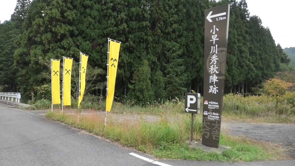
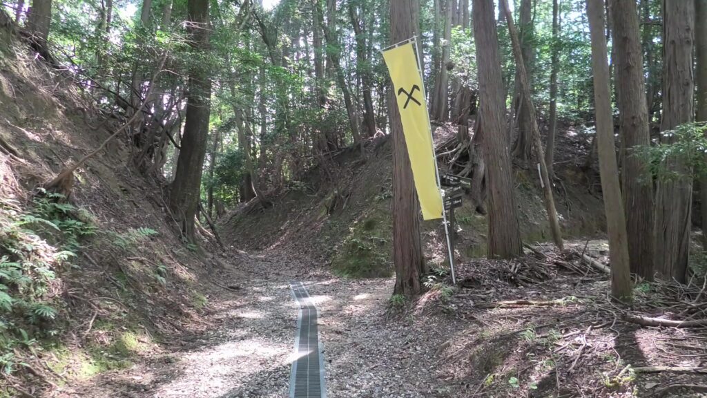
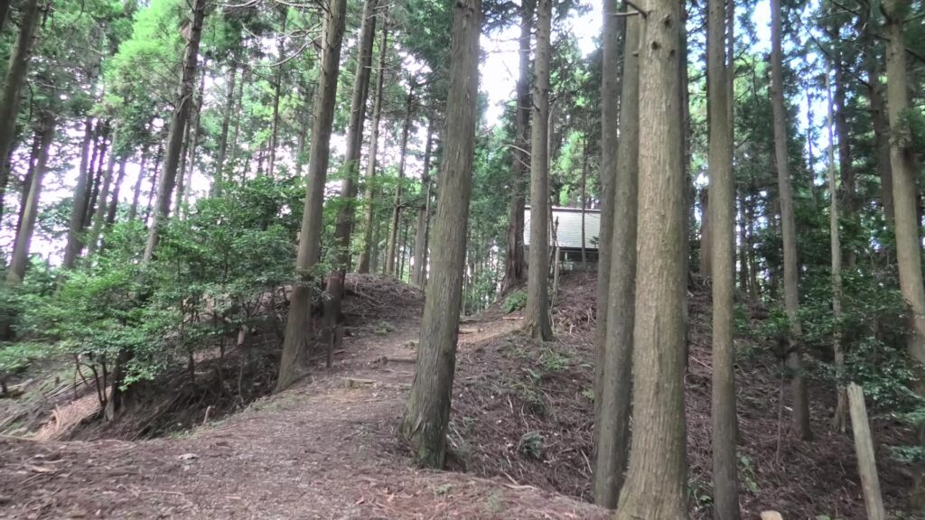
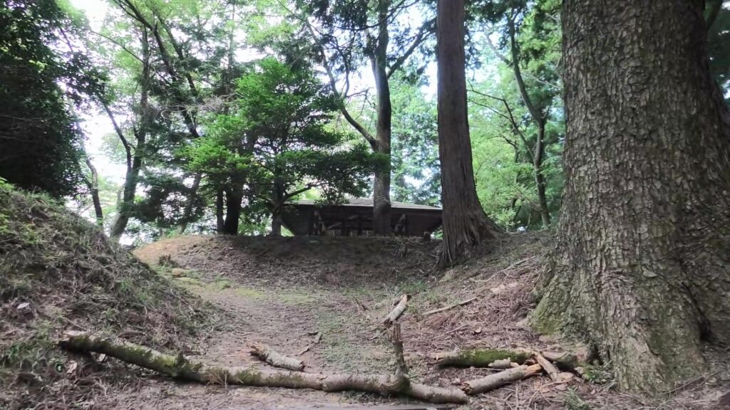
We will get closer to Matsuoyama Mountain. There are lots of flags of the Kobayakawa Clan at its entrance. It has a nice atmosphere.
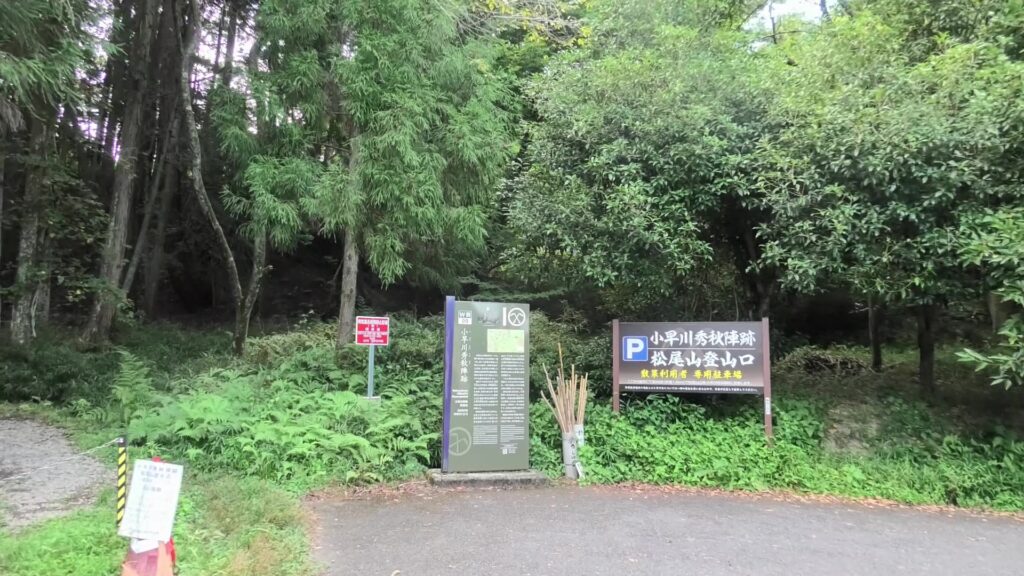
Going to Matsuoyama Mountain
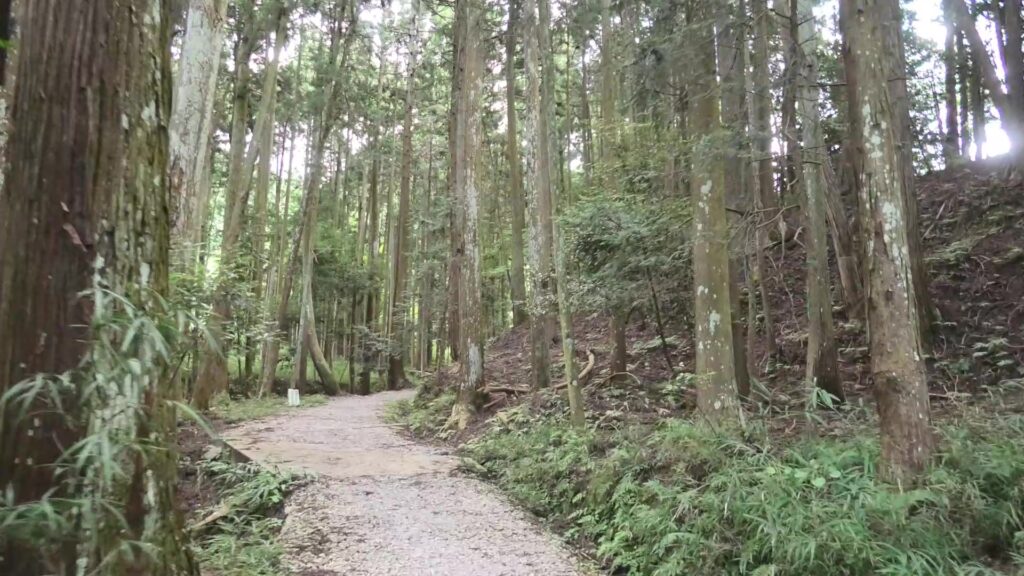
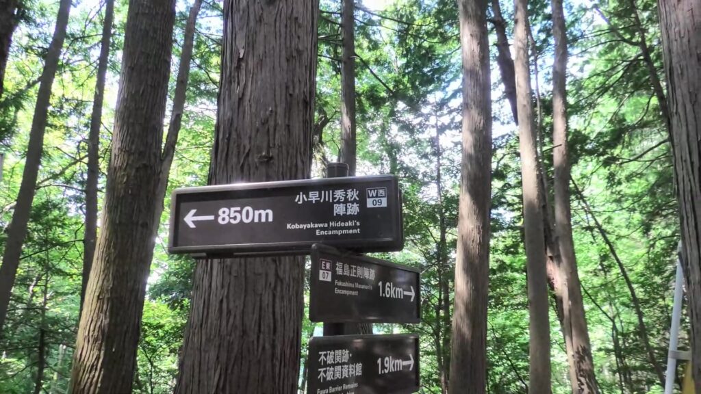
Matsuoyama Mountain is 293m above sea level and about 200m above the foot of the mountain. If you drive your car, you can park it at the foot. The trail to the top is part of Tokai Natural Trail, which has been well developed. The number of Hideaki’s troops were said to be about 8,000 to 15,000. They were probably stationed from the foot all the way to the top. If the Toi-deppo story is true, the soldiers at the foot would have been able to hear it.
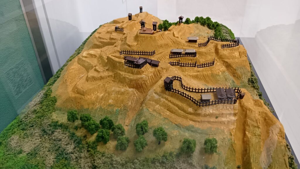
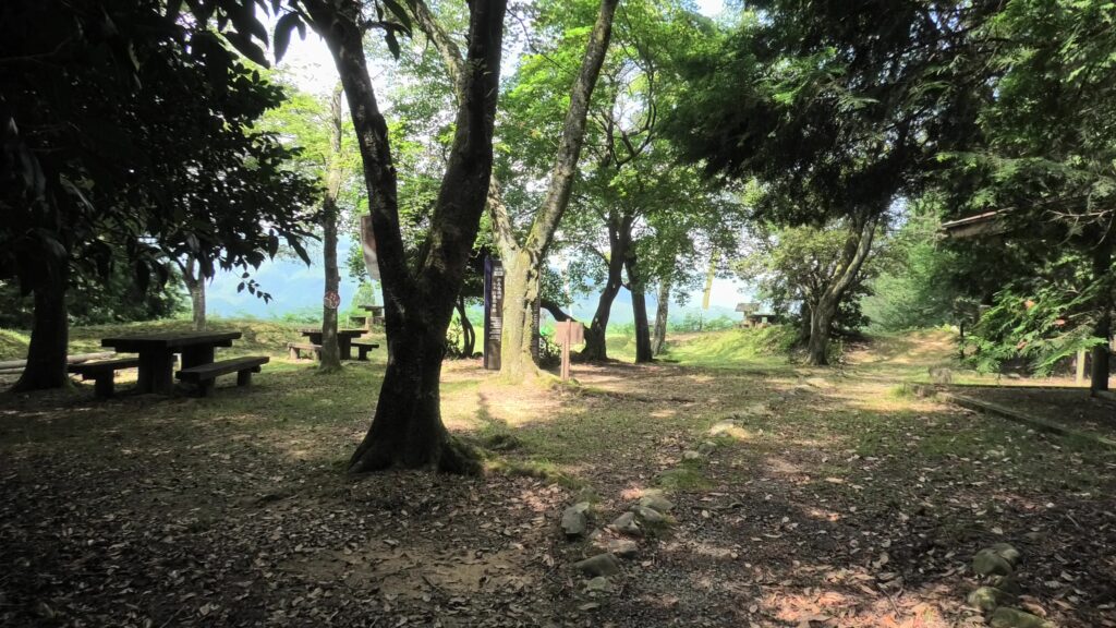
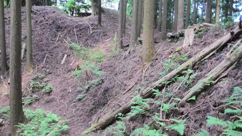
Matsuoyama Castle is often called the encampment of Hideaki Kobayakawa, in fact, it was a full-scale castle. It had the main enclosure on the top and several other enclosures on its ridges. They were surrounded by earthen walls one by one and were divided by dry moats from each other. It also had ditches on the ridges and vertical moats on the slopes in order to prevent enemies from invading it. The castle was mostly fortified by the Western Allies just before the Sekigahara Battle. It was done using natural terrain and construction with soil.
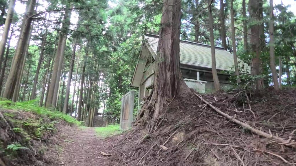
& Folklore Museum
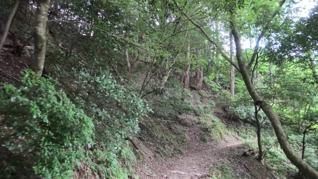
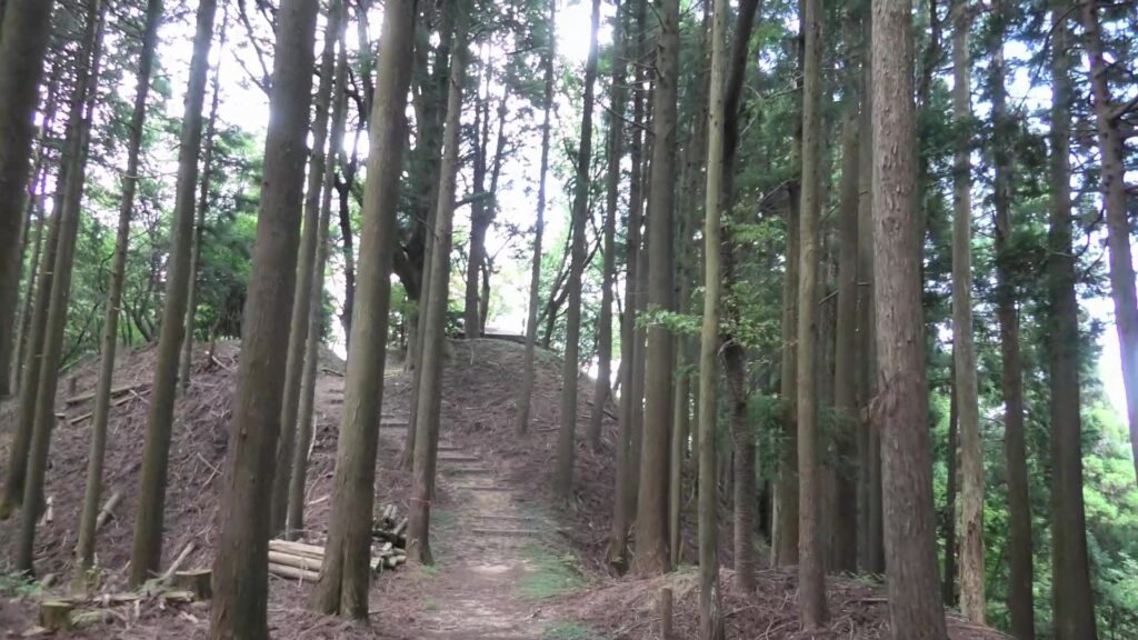
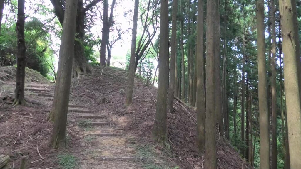
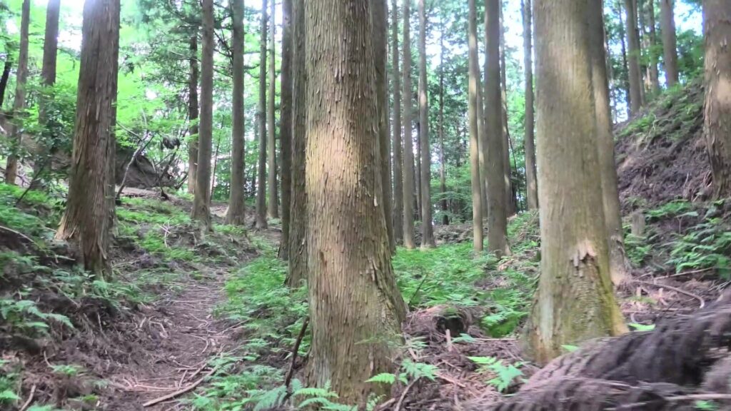
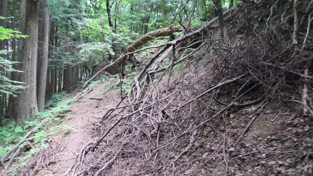
The trail looks like a well-developed forest road before turning into a fork. There is a sign which says 850m to the top. As you get close to the top, the trail goes beside a ridge which was the eastern enclosure of the castle. If you were an enemy back then, you would have been attacked by the defenders above.
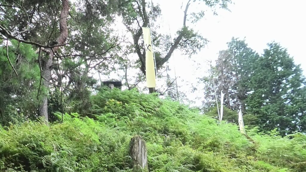
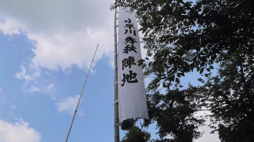
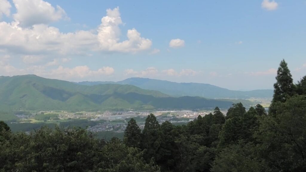
You will eventually see several flags standing on the main enclosure of the top above. One of them is that of Hideaki Kobayakawa’s encampment, which you saw from the view spot of Matsuoyama Mountain. The view from the top is so nice that you will be encouraged to stop and stare for a while. It would have been the view of Kobayakawa according to the defacto theory.
Is it a Castle or is it an Encampment?
Let us check out if Matsuoyama Castle is worth for a full-scale castle at the site. In fact, the opposite side of the trail we climbed looks more fortified, according to the pamphlet of Matsuoyama Castle. (unfortunately, the pamphlet is only available in Japanese)
We will enter the castle from the side.
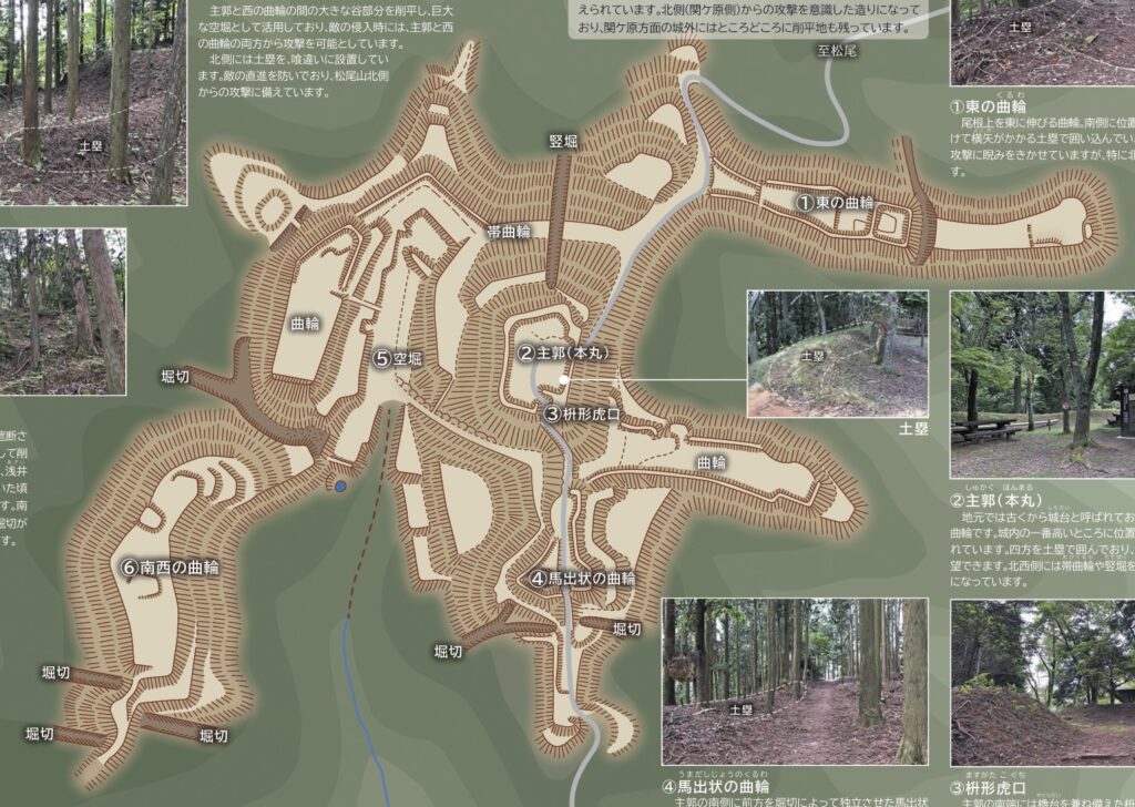
The path of the entrance gets narrower by being cut by the ditches on both sides. You will next pass an enclosure like a position, which is called the enclosure like Umadashi (the position which sticks out from the gate).
The path gets narrower again and wind towards the main enclosure. The entrance of the main enclosure is a square, surrounded by earthen walls, which is generally called Masugata. The route you walked on right now may be the front of the castle, where Hideaki might have also been at.
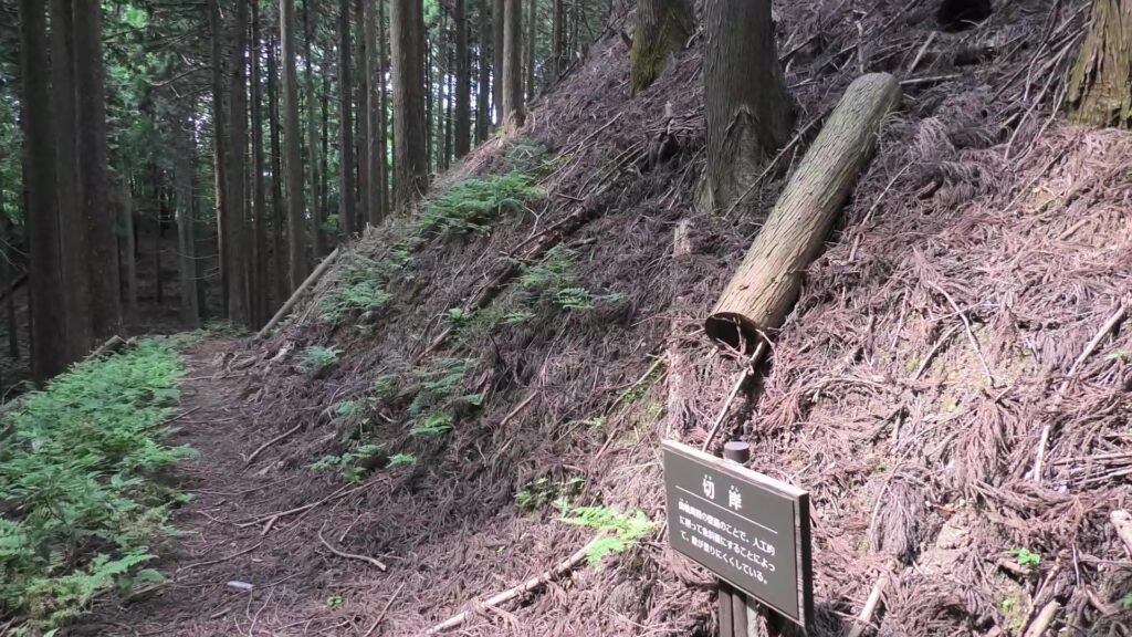
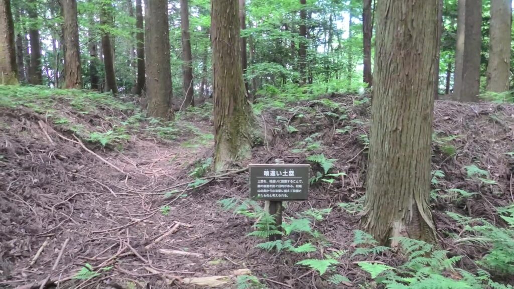
You can also walk down to the dry moats surrounding the main enclosure, from the front of the Masugata system. You will see the vertical cliffs on the slopes of the enclosure, which were artificially cut for defense, on the way to the moats. The bottom of the moats looks spacious tough it is covered with trees and grass now. Historians speculate that it was used as passages or stations for soldiers. The moats also have earthen walls like normal enclosures have.
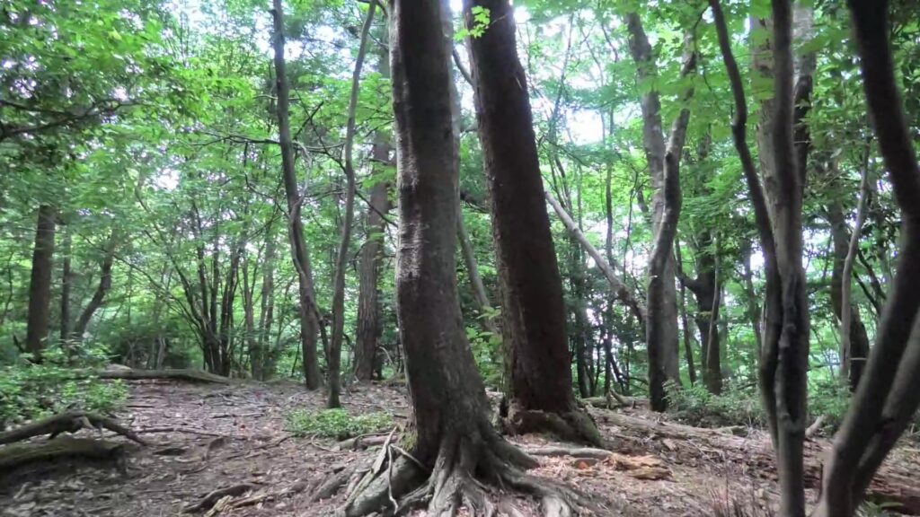
Finally, we will climb another enclosure on a hill, the opposite of the main enclosure. The top of the enclosure is leveled, probably in order to accommodate soldiers in the past. Overall, Matsuoyama Castle must have been a large basement for the Sekigahara Battle. I have confirmed that it was not only a simple encampment but also a full-scale castle.
My Impression
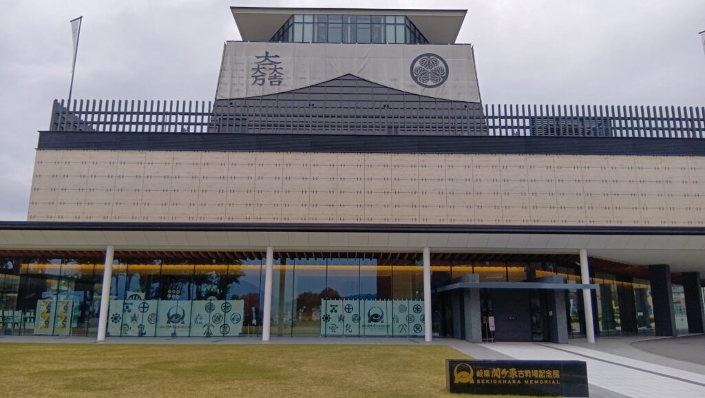
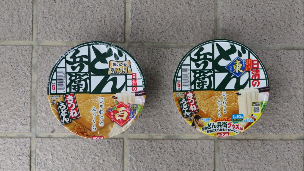
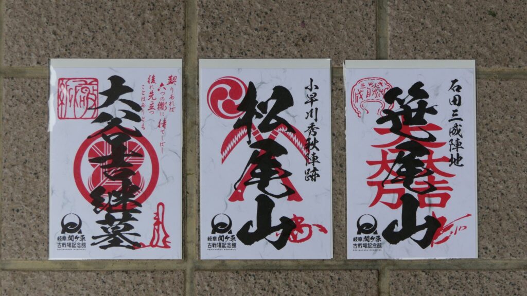
After visiting the Sekigahara area, I think it still has a mysterious vibe and can accept adventurous spirits with many theories. In addition, I also learned that the area has a long history including the gateway and battle between eastern and western Japan since the ancient time. In fact, the battle between them still continues today in the category of noodles. You can buy two types of instant noodles for eastern and western Japan there at the souvenir shop. Gifu Sekigahara Battlefield Memorial Museum is a very popular spot for visitors where you can learn about the battle and buy other souvenirs. You can also get Goshuin stamps (you can stamp a piece of paper to commemorate your experience) of the encampments you visited there; However, you will need to show the pictures to the counter staff as evidence.
That’s all. Thank you.