13.Shirakawa-Komine Castle Part1

An epochal event happened to the castle in 1627 when Nagashige Niwa came there as the founder of the Shirakawa Domain. Nagashige was a son of Nagahide Niwa who was in charge of building Azuchi Castle, the fist modernized castle in Japan, under Nobunaga Oda. He was a master of castle constructions by following the know-how and connection from his father.

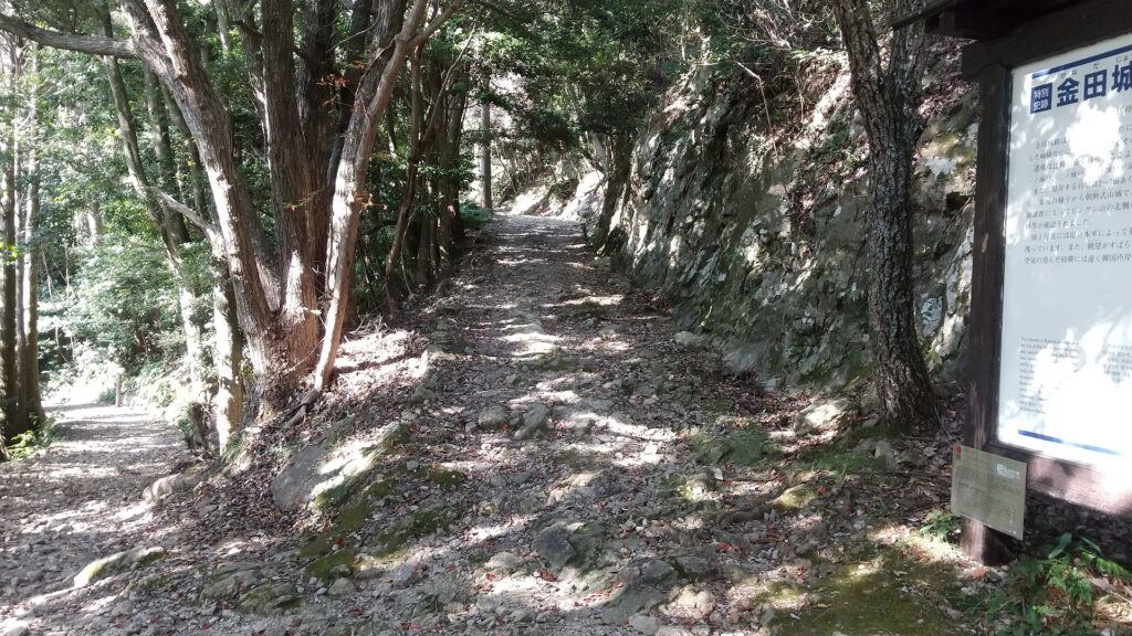
Location and History

Yuki Clan builds Caste as their Branch

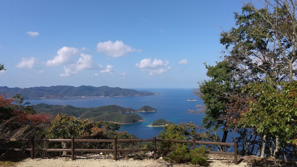
The Shirakawa area, which is modern day Shirakawa City, has been the entrance of the Tohoku Region. There was a famous barrier called Shirakawa-no-seki (meaning the Shirakawa Barrier) in the area during the Ancient Times. Shirakawa-Komine Castle was first built by the Yuki Clan during the 14th Century and simply called Komine (meaning small mountain) Castle. The clan had lived in another castle called Shirakawa Castle. They originally came from the Kanto Region to the south and settled there during the 13th Century. Komine Castle was built on a hill beside Abukuma River as their branch castle to protect their home. Komine Castle would later become more popular and also be called Shirakawa Castle. To avoid confusion, historians and officials classify them and call the second Shirakawa Castle, Shirakawa-Komine Castle.

The range of Shirakawa City and the location of the castle

The ruins of the Shirakawa Barrier
The ruins of Shirakawa Castle
The ruins of Shirakawa-Komine Castle

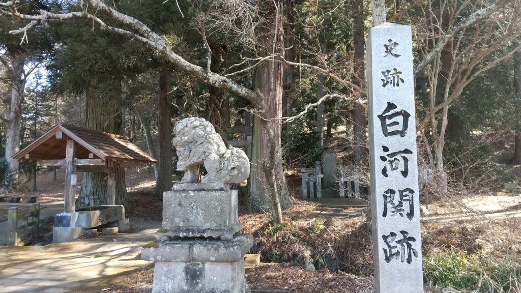
Nagashige Niwa greatly modernizes Castle

The Yuki Clan was unfortunately fired by the ruler, Hideyoshi Toyotomi during his unification of Japan at the end of the 16th Century. After that, Shirakawa-Komine Castle was followed by the Uesugi and the Gamo Clans as their branch. It was said that the basic structures of the castle were built by them but were still mostly made of soil. An epochal event happened to the castle in 1627 when Nagashige Niwa came there as the founder of the Shirakawa Domain. Nagashige was a son of Nagahide Niwa who was in charge of building Azuchi Castle, the fist modernized castle in Japan, under Nobunaga Oda. Nagashige joined the Western Alliance in the decisive battles in 1600 when he was a lord in the Hokuriku Region, against the Eastern Alliance which won and established the Tokugawa Shogunate. That’s why Nagashige was once fired by the shogunate. However, he was appointed as an independent lord again in 1603. One of the reasons may be that he was a master of castle constructions by following the know-how and connection from his father.

The portrait of Nagashige Niwa, owned by Dairinji Temple (licensed under Public Domain via Wikimedia Commons)
The portrait of Nagahide Niwa, from the database of Historiographical Institute, the University of Tokyo (licensed under Public Domain via Wikimedia Commons)
The imaginary drawing of Azuchi Castle, exhibited by Gifu Castle

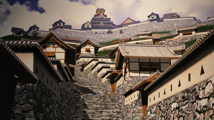
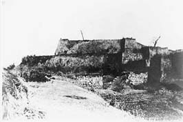
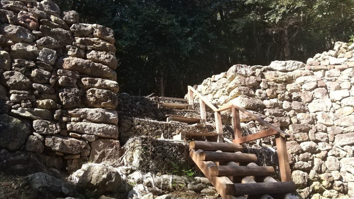
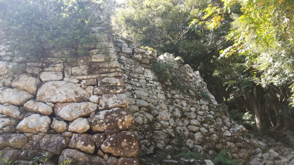
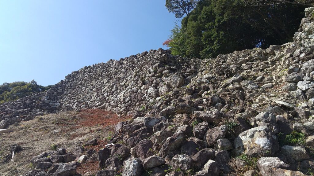
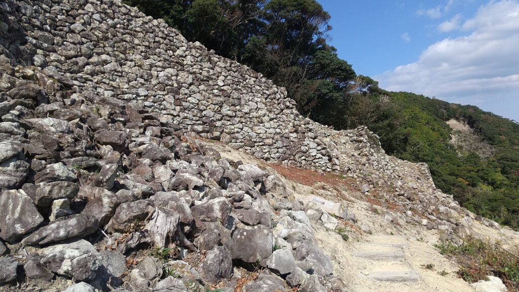
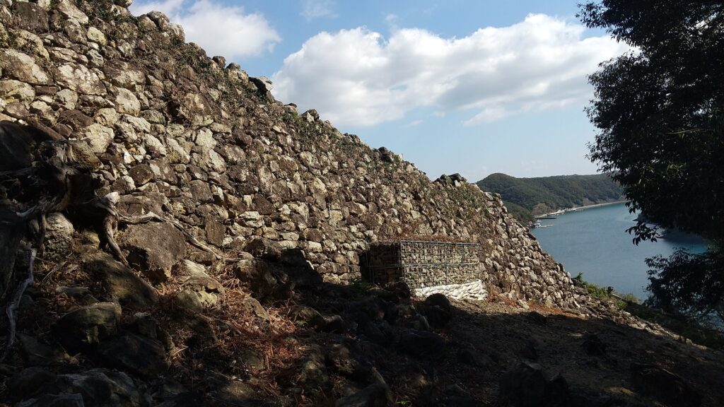
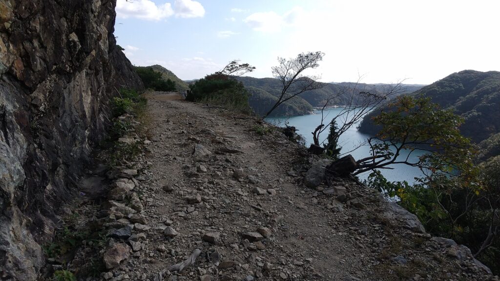
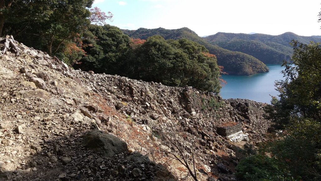
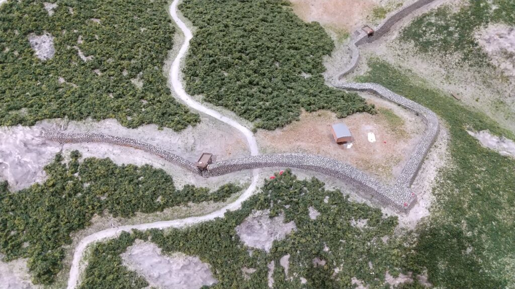
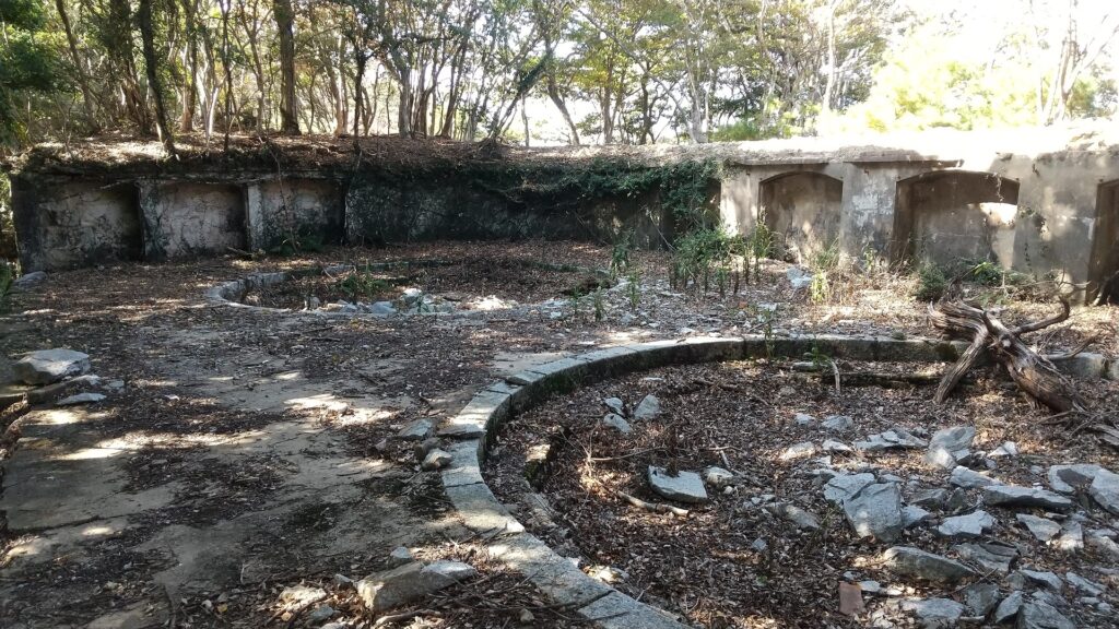
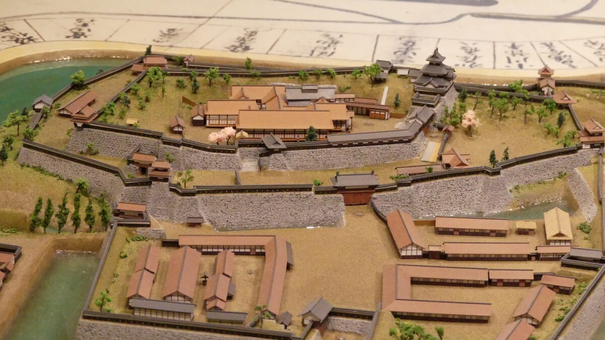
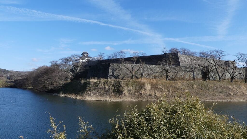
Nagashige renovated the castle as his home between 1629 to 1632. The shogunate also expected him to build a strong castle to monitor many non-hereditary feudal lords in the Tohoku Region to the north. Nagashige built stone walls, water moats, turrets and residences on the existing castle. He also changed the flow of the Abukuma River from the west to the north to make the castle more spacious and more defensive from that direction. The three-level turret was built at the northeastern corner of the main enclosure to monitor the Oshu Road to the north, too. It was 14m high and the symbol of the castle. It was also called the Main Tower in the first stage of the castle, but eventually stopped. This was probably done after the Main Tower of Edo Castle, the shogun’s home, was burned down in 1657 and not rebuilt. The Shirakawa Domain might have considered the relationship with the shogun.

The miniature model of Shirakawa-Komine Castle, exhibited by Komine-jo Castle History Museum
The Abukuma River flowing north of the castle
The restored three-level turret of Shirakawa-Komine Castle

Sadanobu Matsudaira starts Reform

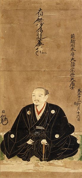
The castle and the domain were followed by several hereditary feudal lord families such as the Sakakibara, Honda, Matsudaira (Okudaira), and Matsudaira (Yuki) Clans. The Tohoku Region including the Shirakawa area was not fertile at that time, often suffering damages from cold weather, droughts, and floods. Therefore, the Shirakawa domain was always having financial problems. In 1783, Sadanobu Matsudaira (Hisamatsu) became the lord and started to reform the government. His basic policies were to simplify lives and save money. He encouraged academics and military arts to the warriors, and more production to the farmers. In particular, his social policies were excellent. For example, he saved farmers even in the Tenmei Great famine during the 1780’s and supported their infants. He finally became the head of the members of the shogun’s council of elders in 1787 to lead Kansei Reforms in the central government. He also made detailed drawings of the castle buildings which would later give us an unexpected fortune.

The self-portrait of Sadanobu Matsudaira (licensed under Public Domain via Wikimedia Commons)
Sadanobu also opened Nanko (meaning South Lake) Park for people

Castle falls in Battle of Shirakawaguchi

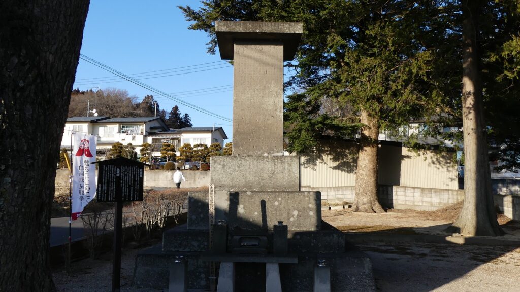
The Abe Clan finally followed the domain in 1823. However, Masato Abe, who was involved in the central government, but was punished due to his policy’s failure in 1866. As a result, the Shirakawa area was like terra nullius (officially owned by the shogunate), which would bring a big misfortune to the castle. In 1868 during the Meiji Restoration, the new government, which defeated the shogunate, and many domains in the Tohoku Region, which still supported the shogunate, confronted each other, known as the Boshin War. The new government army’s first target was the Shirakawa area, the entrance of the region. The alliance of the Tohoku domains had to protect the area and Shirakawa-Komine Castle together.

The photo of Masato Abe, the last lord of the castle (licensed under Public Domain via Wikimedia Commons)

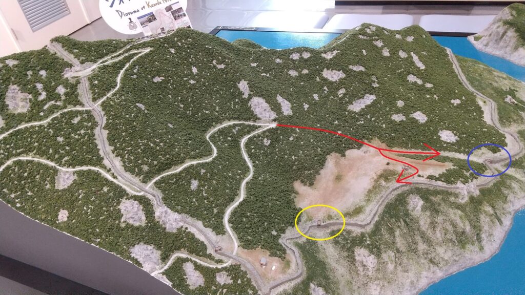
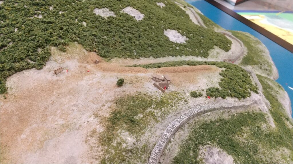
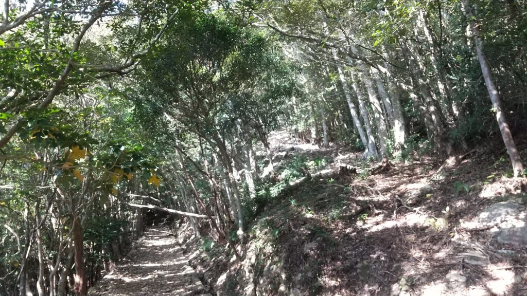
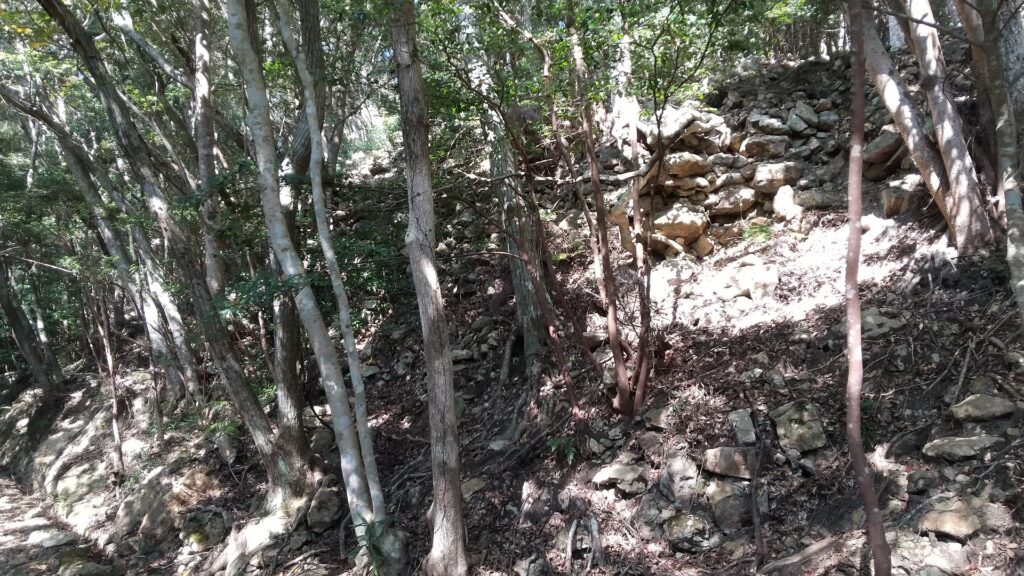
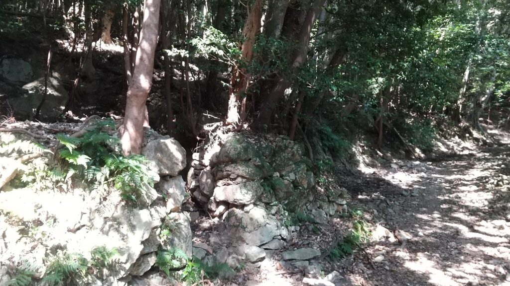
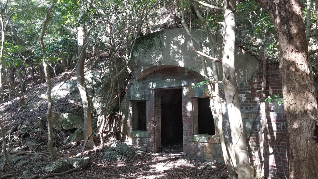
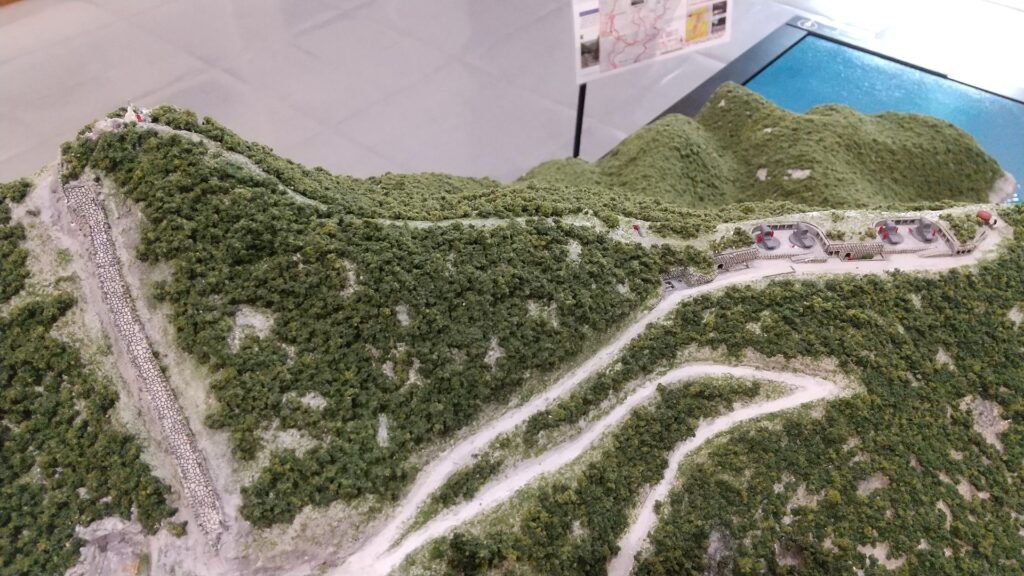
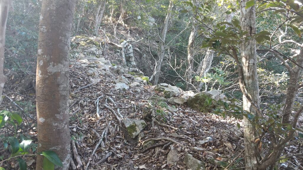
However, the castle had weak points to the south, the direction from which the army was coming. There were three hills (Inari, Tateishi, and Raijin Mountains) around 1km from the castle, which could be used for cannons to target it. In addition, the new government army were equipped with more advanced guns than the alliance troops. The alliance was also undisciplined without excellent commanders. On the 1st of May, the Battle of Shirakawa-guchi occurred. The army occupied these hills and fired at the troops and the castle. The alliance was eventually defeated and the castle was captured in only one day. Many of the castle buildings including the three-level turret were also burned down. After that, the alliance tried to get the castle back several times but failed each time. One of the reasons may be the strong defense of the castle to the north which the alliance withdrew to and was striking back from.

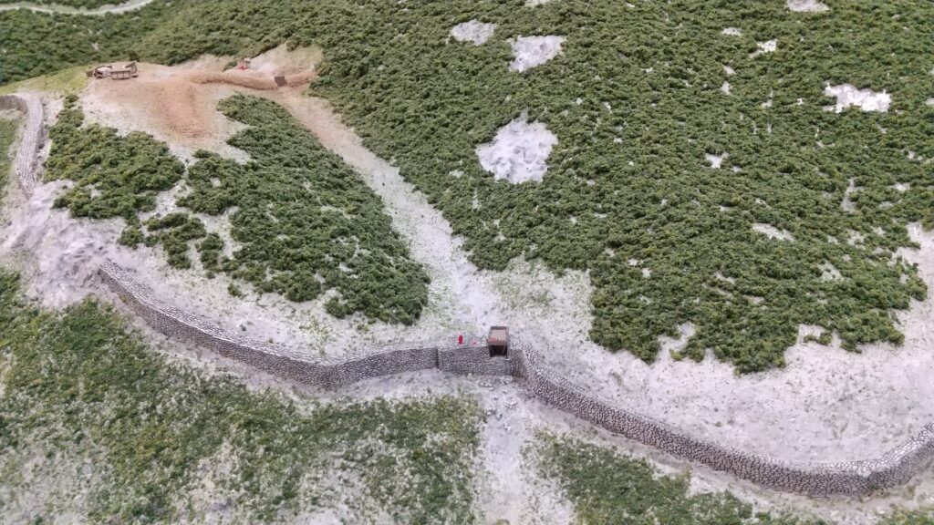
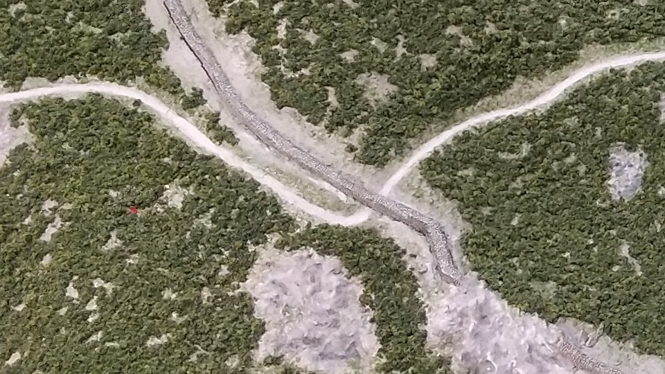
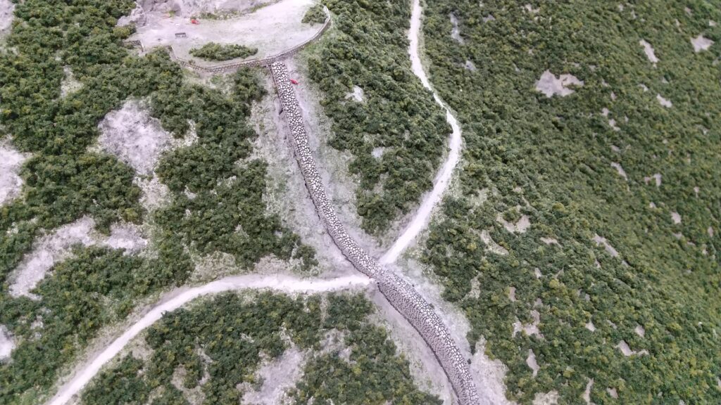
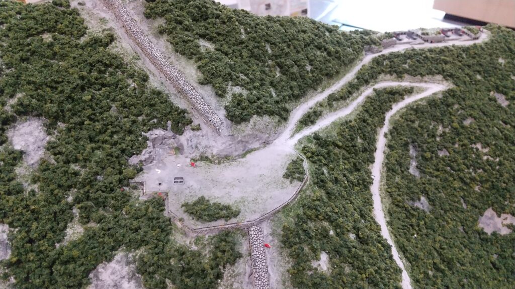
The relief map around the castle

The monument of the Battle of Shirakawa-guchi at the site
The destroyed Shirakawa-Komine Castle (licensed under Public Domain via Wikimedia Commons)

To be continued in “Shirakawa-Komine Castle Part2”

186.Kaneda Castle Patr3

There are branch paths from the first turning point of the main hiking course to other attractions of the castle ruins. The paths are not the former military road and are a little rougher than it. However, it is worth to visit.

Features

Three Gate Ruins

There are branch paths from the first turning point of the main hiking course to other attractions of the castle ruins. The paths are not the former military road and are a little rougher than it. These are not as popular as the military road. However, it is worth to visit. If you walk down the path for a while, you will be at the junction of another path to the first and second gate ruins, and the other path to the third gate ruins.

The map around the castle

The path from the first switchback

The junction is near a hill called Bingushi Mountain where the ruins of other buildings were discovered. These buildings are thought to have been used as barracks for the Sakimori soldiers.

The diorama of Kaneda Castle Ruins, exhibited by the sightseeing information center Fureaidokoro Tsushima, adding the branch paths (the red lines), and the places of the second gate (marked by the blue circle) and the third gate (marked by the yellow circle)
The path to the ruins of the first and the second gates
The path to the ruins of the third gate
Around the Bingushi Mountain, you can see a rest station on the left
Around the Bingushi Mountain on the diorama

The three gates were built using stones at the eastern side as castle and water gates near the seaside. The stones used in the castle are mainly natural while part of the stones of the first gate are rectangular- processed. However, it is said that they were piled by the Tsushima Domain during the Edo Period to guard the coast. They’ve been restored and repaired so that visitors can see them as if they used to look.

Around the second gate on the diorama
The second gate ruins seen from above
The second gate ruins seen from the bottom
The first gate ruins
The types of the stones were different in the upper and lower parts of the first gate
Going to the third gate ruins after once returning the junction
The third gate ruins

Wonderful Stone Walls along Sea

After you visit the third gate ruins, you can return by the same route or by another path though the southeast stone fortress. If you take the latter, you will see the great long stone walls of the eastern side on the right and beautiful Aso Bay on the left. Please watch your step as the path is partially unstable.

Going towards the southeast stone fortress
There are great stone walls along the sea
They are spectacular long stone walls!

The southeast stone fortress is really great, too! The corner of the fortress was protruded outward to build a salient with enhanced defense in preparation for an enemy’s attack. It looks like a Gusuku (Okinawan castle) or a small Great Wall of China. If you walk up along the fortress, you will return to the route you passed.

The southeast stone fortress
The edge of the fortress
It’s a good contract of the fortress and the sea
Around the southeast fortress on the diorama

Later History

People alway knew about Kaneda Castle because it had been recorded in the Nihon-shoki chronicles, however, they didn’t know about where it was as it had been abandoned too early to remember. For example, trade with Korea was done at a shrine near the first gate during the Middle Ages and the Tsushima Domain used the gate during the Edo Period, but they didn’t notice it was a ancient mountain castle. There is no telling how the Imperial Japanese Army treated it. Historians discovered the ruins on the mountain in the Taisho Era (1910-1925) and they finally confirmed it as Kaneda Castle after World War II. As a result, the ruins were designated as a National Special Historic Site in 1982.

The ruins of Kaneishi Castle, the home of the Tsushima Domain

My Impression

I was very surprised to see that the Joyama Mountain has become dual historical sites of the ancient times and modern times. Both sites show us there were strained relations with foreign countries at those times. Other than that, Tsushima also had dramatic events such as during the Mongolian Invasions and the invasion of Korea by Hideyoshi Toyotomi. On the other hand, there were also peaceful relationships such as with the Korean Envoys. We can now see many tourists visiting Tsushima from Korea recently, too. There is no need to say which is better.

The figures of the Korean Envoys, exhibited by Kokura Castle Tower

How to get There

I recommend using a car to get there. It takes about 20 minutes from Tsushima Airport or about 30 minutes from Izuhara Port. There is a small parking lot at the starting point of the hiking course.

The Izuhara Port
The small parking lot at the starting point of the hiking course

That’s all. Thank you.
Back to “Kaneda Castle Part1”
Back to “Kaneda Castle Part2”

186.Kaneda Castle Patr2

Today, the ruins of Kaneda Castle have become part of the popular hiking course on the Joyama Mountain. The course has been well maintained because it is based on the military road that the Imperial Japanese Amy developed over 100 years ago. The road was built for the constructions of Joyama Batteries on the top area to prepare for the Russo-Japanese War.

Features

Hiking Course as Fomer Military Road

Today, the ruins of Kaneda Castle have become part of the popular hiking course on the Joyama Mountain. Visitors first drive to the starting point of the course via the Prefectural Road 24, which branches off into a forest road. The hiking course has been well maintained because it is based on the military road that the Imperial Japanese Amy developed over 100 years ago. The road was built for the constructions of Joyama Batteries on the top area to prepare for the Russo-Japanese War.

The map around the castle

The starting point of the hiking course

It was constructed largely on the slopes to make it gentle so that carriages could carry materials. That’s why the road crossed the circular stone walls of Kaneda Castle several times. The constructions resulted in the stone walls partially being destroyed. The reasons for it may have been that the walls were unknown for the castle and the constructions were the priority at that time.

The diorama of Kaneda Castle Ruins, the white line shows the hiking course and the gray line shows the stone walls, exhibited by the sightseeing information center Fureaidokoro Tsushima

Road crosses over Stone Walls several times

There are a few switchbacks in this hiking course that interest with the stone walls. If you walk up the road for a while, you will see a great view of Aso Bay before meeting the first crossover point with the stone walls.

Walking up the hiking course
You will see the Aso Bay

This point is the southern side of the castle, so you can see the stone walls going down on the east to the southeast stone fortress, which is amazing scenery as well.

The stone walls go down to the southeast stone fortress
The first intersection of the road and the stone walls on the diorama, the south gate is on the left and the building is on the right of the point

There are also the ruins of the south gate on the west of the point, which were recently discovered in 2003. They have stone paving and foundations which were probably for gate buildings. The ruins of a building with dug-standing pillars were also found near the gate, which might have been used as a guardhouse.

The ruins of the south gate
You can see the building ruins on the left of the stone walls

You will meet the second intersection with the wall after the first switchback. The stone walls climb the ridge at that point. The road also goes with the walls in parallel for a short time. It is surprising to see how well the walls were built, so long, on such a steep mountain over 1350 years ago!

The first switchback
The hiking course on the left and the stone walls on the right
Looking up at the stone walls from the hiking course
The second intersection on the diorama

At the third crossover point, you will see not only stone walls but also something like a gate structure. It might be the ruins of a drainage system.

The remaining stone walls at the third intersection
The remaining structure like a gate
The third intersection on the diorama

The fourth crossover point mostly consists of the ruins of a military facility, so you can only see few remaining stone walls of the castle above. The top of the mountain will be soon.

The ruins of the military facility at the fourth intersection
You can see few remaining stone walls above
The fourth intersection on the diorama

Battery Ruins, Stone Walls and Panoramic Views on Top

You will first reach the ruins of the batteries below the top. About 100 years ago, there were four 28-inch howitzers at this site, with their gun barrels facing the bay to the west. There are only their huge platforms remaining now where you can even understand their scales.

The ruins of the batteries
The Aso Bay which the batteries once faced
The mountain top on the left and the batteries on the right, on the diorama

You can also climb the ridge to the top, which is the same as the western line of Kaneda Castle. Therefore, you will see some remaining stones of the castle walls on the way.

The ridge going towards the top
You can see some remaining stone walls on the way

At the summit, there’s very limited space, so it might be difficult to stay long, but this spot offers breath-taking, panoramic views of Aso Bay.

A view from the top

To be continued in “Kaneda Castle Part3”
Back to “Kaneda Castle Part1”