8.仙台城(Sendai Castle)

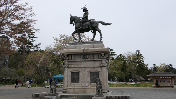
本丸の伊達政宗像(The statue of Masamune Date at Honmaru area)

Location and History

仙台は日本の東北地方で最大の都市であるとともに、宮城県の県庁所在地でもあります。仙台の歴史は、仙台城と共に始まりました。この城の創始者、伊達政宗は若く偉大な戦国大名だったのですが、徳川幕府が天下を制してからは従わざるをえませんでした。仙台城は、正宗が居住する城として、3つの候補地から将軍徳川家康によって選ばれたと言われています。
Sendai is the biggest city in Tohoku district of Japan, and the prefectural capital of Miyagi pref. The city started its history with the Sendai castle. The founder of the castle, Masamune Date was a great young warlord, but he had to follow the Tokugawa Shogunate after its unification of the whole country. It is said the Sendai castle was designated for Date to settle from three options by the shogun Ieyasu Tokugawa.
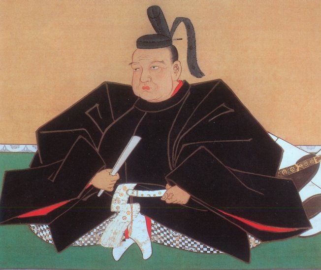
伊達政宗像、仙台市博物館蔵(The picture of Masamune Date owned by Sendai City Museum)licensed under Public Domain via Wikimedia Commons

実のところ、戦乱が終息した当時において、新しい城を平地ではなく山の上に設置するというのは大変稀なことだったのです。その中でも本丸エリアの防御力は特に強力でした。本丸の東側は垂直の崖であり、南は川の渓谷に、西は深い山になっていました。北側だけがアクセス可能でしたが、多くの構造物や仕掛けにより敵の攻撃から守られていました。なぜ家康が正宗にこのような強力な城を作らせたのか、明確な理由はわかっていません。
Actually, it was very rare for a new castle to be on a mountain area instead of a plain area at that time when the war was over. The main enclosure “Honmaru” area was strong defensively. Its east side had a vertical cliff, south was a river valley, and west was a deep mountain. Only the north side was accessible, but many structures and devices were set on this side to prevent enemies from attacking. No one can clearly explain why Tokugawa let Date build the strong castle.

城周辺の段彩陰影図(The transparent color shaded relief map around the castle)


というのも、幕府は通常、大名が強力な陣地に立てこもって反乱を起こすようなことは望まないからです。結果的には、仙台藩の2代目藩主は平地である二の丸に移っていきました。そこに二の丸御殿を築いてからは、居住するにも政治を行うにも便利になりました。
Because the shogunate usually didn’t want to have lords get labeled based on a strong site, eventually, the second generation of the feudal domain of Sendai moved to the plain area called “Ninomaru”. After the construction of the Ninomaru main hall, they were able to live and govern conveniently.
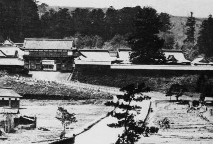
二の丸の古写真(An old picture of Ninomaru)licensed by katana 213 via Wikimedia Commons

Features

それでは、本丸エリアの北側を歩いて登ってみましょう。最初に大手門跡に立ってみます。そこには特大の門があったのですが、1945年の仙台空襲により焼失してしまいました。現在では、戦後に再建された大手門の脇櫓だけを見ることができます。
Let’s walk up the north side of the Honmaru area. At first, you can try standing on the ruin of the main entrance “Otemon” where a very large scale gate building was located until it was burned down by the Sendai air raid in 1945. The side turret building of the Otemon we can see now was rebuilt after the war.

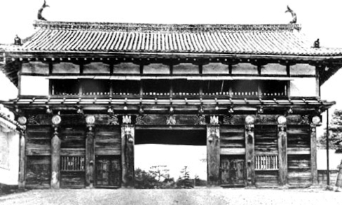
大手門跡(The ruin of Otemon)
大手門の古写真、1938年(An old picture of Otemon in 1938)licensed under Public Domain via Wikimedia Commons
再建された大手門脇櫓(The rebuilt side turret of Otemon)

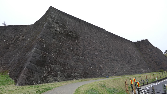
そこから本丸に向かっていくには、急で曲がりくねった道を登っていき、もう一つの門「中の門」を通り過ぎなければなりません。その後、行く手を遮るような高く広い本丸石垣が立ちはだかっているのにびっくりするかもしれません。
Then, you have to climb up a steep and winding road with passing through the ruin of another gate called “Nakanomon” to head towards Honmaru. After that, you may be surprised to see the tall and wide stone walls of Honmaru stand in your way.

中の門跡(The ruin of Nakanomon)
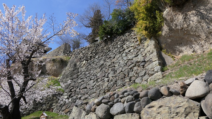
本丸北石垣(The north stone walls of Honmaru)

過去にはこの石垣の上には、3基の3階櫓が建っていて、攻撃側を迎え撃てるようにしていました。ついには、最後の門である「詰の門」から入れば本丸に到着します。
In the past, three of three story turrets were on the stone walls that would be tough for attackers. Finally, entering the last gate “Tsumenomon”, you will reach Honmaru.
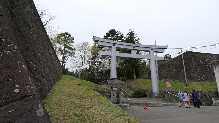
詰の門跡(The ruin of Tsumenomon)
本丸御殿跡(The ruin of Honmaru main hall)
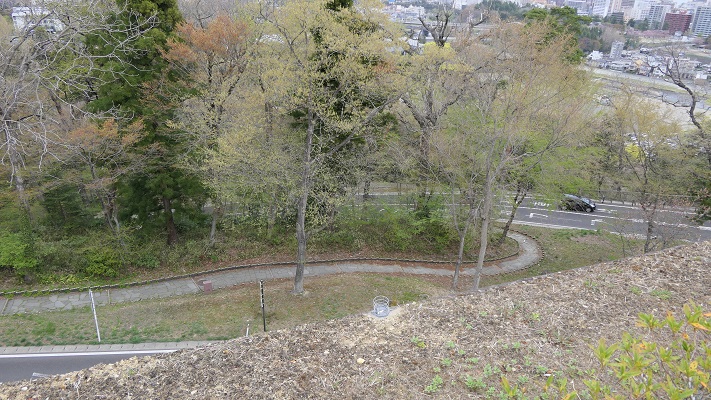
本丸北石垣から見下ろした眺め(A view looking down from the north stone walls of Honmaru

本丸北側の地図(The map of north side of Honmaru)
(マーカーをクリックして地点の名前を確認してください。)
(Please click a marker, and check the name of the point.)


Later Life

明治維新後、日本陸軍の第2師団が司令部をこの城に置き、その時に元あった建物の大半は撤去されてしまいました。第二次世界大戦後は、米軍がこの地区に駐留していました。日本の独立回復後は、本丸地区は仙台市と護国神社が分け合い、二の丸地区は東北大学が使用しています。行政は今、発掘の成果に基づき、どうやって城跡を整備していけるのか慎重に検討しています。
After the Meiji restoration, the headquarters of the Japanese army 2nd division was located in the castle with most of original buildings being demolished. After the World War II, the US army occupied the area then. After the restoration of sovereignty, the Honmaru area is divided by Sendai city and the Gokoku shrine, and the Ninomaru area is used for the Touhoku University. Officials are now considering how they can improve the castle ruins carefully with the achievement of excavations.
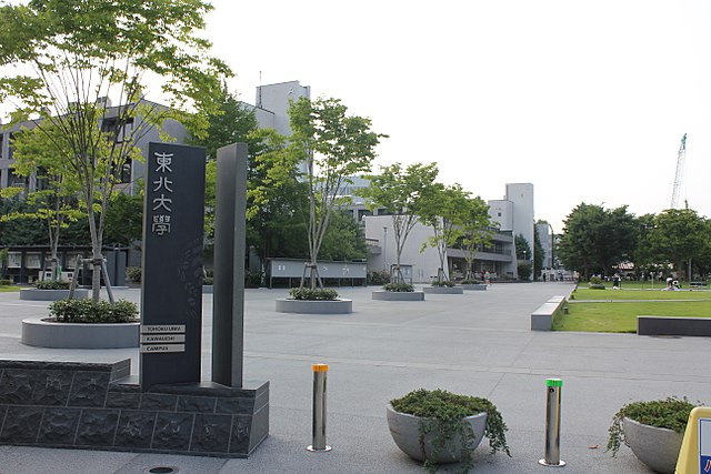
二の丸地区にある東北大学(Tohoku University on Ninomaru area)licensed by XIIIfromTOKYO via Wikimedia Commons

My impression

今現在、仙台駅からバスや車を使って本丸地区に行くのはとても簡単です。そこでは、素晴らしい景色や伊達政宗の銅像を見ることができます。でも、当方としてはそれだけでは仙台の町や城を知るには不十分だと思います。1時間程かかりますが、仙台駅から城跡まで歩いてみてはいかがでしょう。
Now, it is very easy for anyone to access the Honmaru area from the Sendai station by bus or car, there you can see the great view and the bronze statue of Date. But I think that is not enough to know about the Sendai town and castle. I recommend walking from the station to the castle ruins of about one hour.
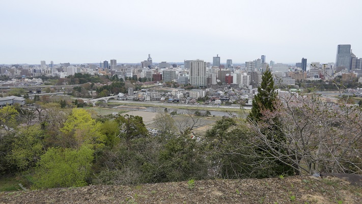
本丸地区からの仙台の街並み(A view of Sendai town from Honmaru area)

仙台駅の北側にあるパルコ・ビルディングの反対側から始まるクリスロードをまっすぐ進んでください。この通りは何百件もの店舗からなるアーケードになっていて、買い物も楽しむことができます。
Go straight to the Clisroad which starts from the opposite side of the Parco building near north side of the station. The road is an arcade with hundreds of shops, you can also enjoy shopping there.
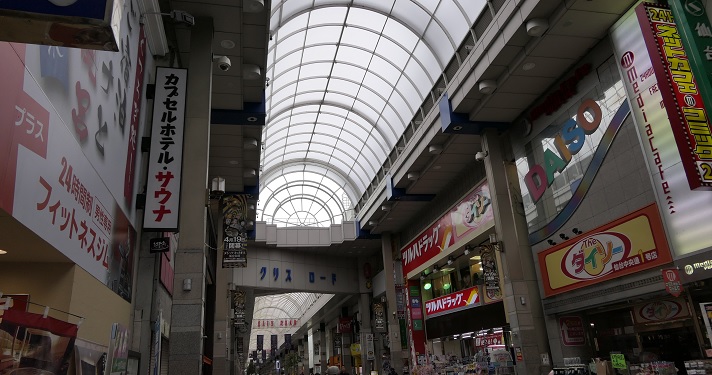
クリスロード(The Crisroad)

そのまま進むと、広瀬川にかかる大橋に着きます。そこを渡れば大手門跡に到着です。参考として、城跡の近くにある地下鉄東西線の国際センター駅から歩くこともできます。
It will lead you to the Ohashi Bridge across the Hirose River. You will reach the ruin of Otemon. In addition, you can also walk from the International Center station on the Tozai subway line near the ruin.
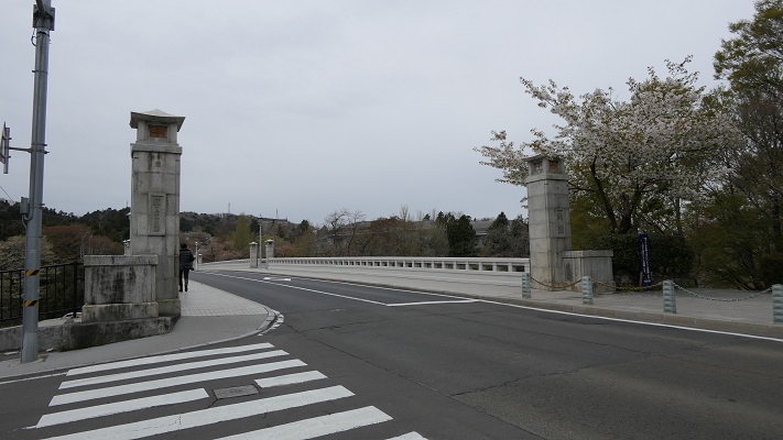
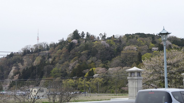
大橋(The Ohashi bridge)
大橋から見た本丸地区(A view of Honmaru area from Ohashi bridge)

赤い線がお勧めルートです(The red line shows the recommended route)


How to get There

仙台駅からバスで行きたい場合:西口バス乗り場から出ているループル仙台バスに乗ってください。(ピーク時には15~20分毎)
国際センター駅から歩きたい場合:仙台駅から地下鉄東西線に乗り換えてください。
東京から仙台駅まで:東北新幹線に乗ってください。
If you want to go there by bus from Sendai station: Take the Loople-Sendai bus that comes every 15 or 20 minutes at the top of the hour at the west entrance bus pool.
If you wish to walk there from the International Center station: Take the Tozai subway line from the Sendai station.
From Tokyo to Sendai st.: Take the Tohoku Shinkansen super express.

27.上田城(Ueda Castle)

Location and History

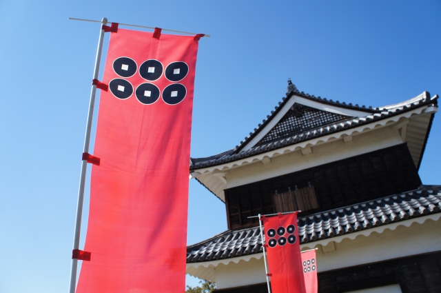
上田城は、長野県上田市の最も有名なシンボルの一つです。この城は真田氏によって築城されました。城に向かう道すがら、真田の旗印である「六文銭」(三途の川の渡し賃の意味)がたくさん目に入ってきます。
The Ueda castle is one of the most famous symbols of Ueda city in Nagano prefecture. The castle was founded by the Sanada clan. You can see a lot of Sanada’s flag of “Rokumonsen” (six one-mon coins), which is the fee for crossing the Styx, which is beside the castle.

「六文銭」旗印と上田城(The flag of “Rokumonsen” and Ueda Castle)taken by 松波庄九郎 from photo AC

戦国時代後期の大名、真田昌幸が1583年に最初に上田城を築きました。彼は、真田一族の独立を意図し、後に幕府を開くことになる徳川氏に反抗しました。徳川は2回この真田の城を攻めたのですが、真田は負けませんでした。特に、1600年の天下分け目の合戦の中で行われた2回目の戦いがよく知られています。それ以来、真田とこの城が有名になったのです。徳川は激怒し、天下を取った後この城を完全に破壊させました。
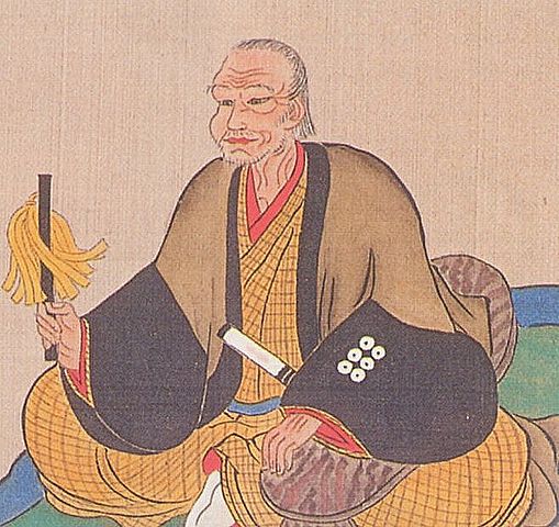
Masayuki Sanada, a lord in the late Civil war period first built Ueda castle in 1583. He aimed to make his clan more independent against the Tokugawa clan which would become the Shogunate. Tokugawa attacked the Sanada castle twice, but they couldn’t be defeated. The second one was particularly a well-known battle among the fateful battles in 1600. That had made Sanada and this castle famous from then on. However, Tokugawa was so angry that they ordered to have the castle completely destroyed after the clan came to power.

真田昌幸像、個人蔵(The picture of Masayuki Sanada, privately owned)licensed under Public Domain, via Wikimedia Commons

結果的として実は、真田の城がどんなだったかはわからないのです。江戸時代になって、仙石忠政が上田藩の藩主として移封されてきたとき、城の再建を許可されました。忠政は真田の城を再現しようとしたのですが、それを果たす前に亡くなってしまいました。今、私たちが目にしているのは、忠政によって残された土木建築の一部なのです。
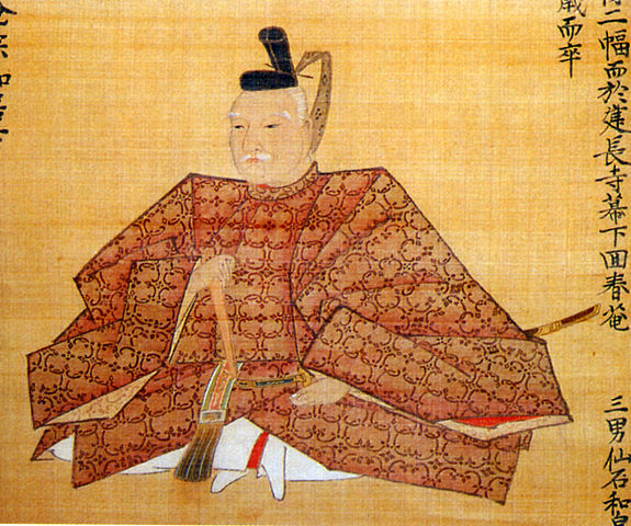
As a result, in fact, the structure of Sanada’s castle is uncertain. In the Edo period, when Tadamasa Sengoku was transferred to the lord of the feudal domain of Ueda, he was allowed to rebuild the castle. He tried to recreate the Sanada castle, but he died before it had done. Now we can see part of the remaining buildings and constructions made by Sengoku.

仙石忠政像、上田市立博物館蔵(The picture of Tadamasa Sengoku, owned by Ueda City Museum)licensed under Public Domain, via Wikimedia Commons

Features

現在、「本丸」とそこにある3棟の「櫓」の建物、そして「二の丸」が残っています。本丸は高く盛られていて、北・東・西の三方向を水堀と二の丸によって囲まれています。過去においては、その三方向の外側が更に川と湿地帯よって守られていました。
Now, the main enclosure “Honmaru” with the buildings of three turrets “Yagura” and the second enclosure “Ninomaru” remains. Honmaru is highly elevated and it is surrounded by a water moat and Ninomaru in north, east and west directions. In the past, the outside of the three directions were also protected by rivers and waterlogged areas.

最新の城周辺地図(The latest map around the castle)


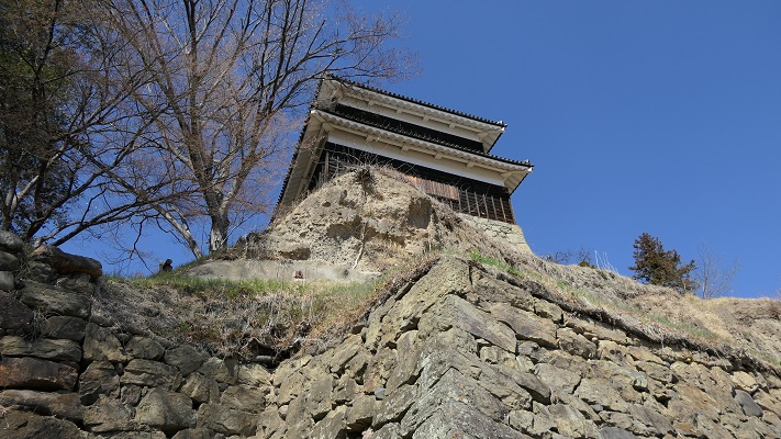
本丸の南の方は、急崖による天然の要害になっていて、現在でも見ることができます。更には、「尼ヶ淵」という今は干上がっている沼沢があり、崖に沿って流れている千曲川につながっていました。それも障壁だったのです。
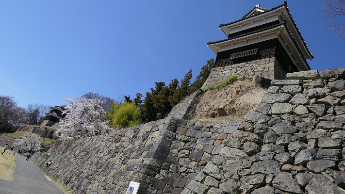
The south of it has natural hazard with a steep cliff which can be seen today. In addition, a pool called “Amagafuchi” which drys up now, connected to the Chikuma River that flows alongside the cliff. it was another hazard.

本丸の南面(The south side of Honmaru)

(’19-9-10 追記 added)
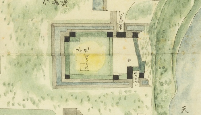
上田城に天守があったかどうかははっきりしません。「武家事記」という古書では初期の上田城のことを「天守も無き小城」と述べている一方、江戸時代の寛政年間の古地図には「御天守跡」との記載があります。よって歴史家の意見は分かれていました。しかし最近になって本丸の辺りから、天守で使われたような金箔瓦が出土したのです。現在、多くの歴史家は天守か、それに準ずる豪華な櫓があったのではないかと考えています。
It is uncertain whether Ueda Castle had the keep “Tenshu” or not. While an old book “Buke-Jiki” calls the early castle “A small castle even without the Tenshu”, another old map in the Kanei Eea, Edo peried records “The ruin of the Tenshu”. So historians’ opinion remained devided. But, recently an old roof tile with gold leaf that might have been used for Tenshu was excavated from the Honmaru area. Now, many historians think the castle had the Tenshu or a similar luxury turret “Yagura”.

「御天守跡」の記載がある古地図「上田城構之図」部分(The part of the old map called “Ueda-Jo-Kamae-no-Zu” recording “The ruin of the Tenshu”)、協力:上田市マルチメディア情報センター

Later Life

明治維新の後、2つの櫓が売られていき、遊郭の建物として使用されました。最悪の時には、たった一つの櫓(西櫓)を残すのみとなり、他は撤去されてしまいました。
After the Meiji restoration, two of those turrets were sold and used as Geisha houses. At the worst time, only one turret (the West Yagura) remained and the others were removed.

西櫓(The West Yagura)

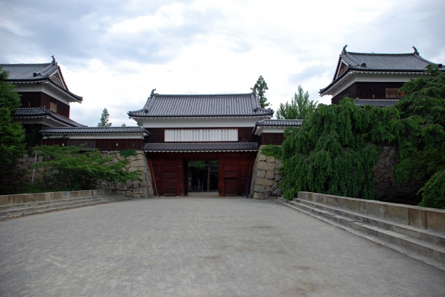
第二次世界大戦後、市民たちは売られた2つの櫓を買い戻すことに成功し、元あった場所に据え付け直しました(北櫓と南櫓)。最近になって、東虎口櫓門と袖塀が忠実に復元され、北と南の櫓をつなぎました。この辺りの外観が、昔ながらの姿に正確に再現されたことで、絶好の写真スポットになっています。
After the World War II, citizens were successful to get the bought turrets back and placed them to their original positions (the North and South Yagura). Recently, the East entrance gate and side walls were rebuilt in the original way connecting the north and south Yagura. Their appearance has become an accurate representation of the past, and has become a good photo spot.

東虎口櫓門と南北櫓(The East Entrance between the North and South Yagura)taken by チャコ from photo AC

My Impression

先ほど申し上げました通り、真田の城そのものは現在見ることはできません。しかし、後に続いた城主仙石忠政は、英雄である真田にちなんで築城できないかどうかと考えたのではないでしょうか。だから真田の城の思想は、忠政の城に引き継がれていると思うのです。それが正しければ、今現在存在する城を見て、真田の城がどうあったかというのも理解できるはずです。
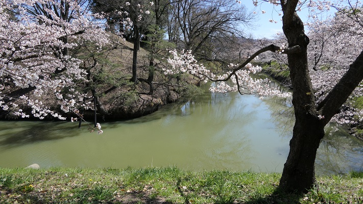
As mentioned above, we can’t see the structure of Sanada’s castle. But I imagine that the following lord Sengoku was wondering if he could build his castle after the brave Sanada. So I think the idea behind Sanada’s castle could led to the castle by Sengoku. If that was true, we can understand how Sanada created their castle by examining the castle now.

忠政が掘り起こした本丸の水堀(The water moat at Honmaru that Sengoku dug up once again)

この城は、高低差、自然の要害、人口の構築物をうまく使って、少ない兵で敵から守れるようコンパクトに作られたのだと言えます。
I can say the castle was made compact to prevent enemies with a small number of soldiers, using different elevations, natural hazard, and artificial structures.

本丸から二の丸を見下ろす(A view looking down Ninomaru from Honmaru)

南面の崖に行ってみて、崖の崩壊を防ぐため各時代に作られた様々な石垣を見てみるのもおすすめです。
I recommend you see the south side cliff where you can also find many kinds of stone walls to prevent the cliff from collapsing in different times.

南面の様々な石垣(The different kinds of stone walls on the south side)

How to get There

上田駅から歩いて15分くらいです。
東京から上田までは、直通の北陸新幹線があります。
It takes about 15 minutes on foot from the Ueda train station.
There is a direct train from Tokyo to Ueda via the Hokuriku Shinkansen super express.

Links and References

上田城・上田城跡公園~信州上田観光協会(Uedajo Castle~Ueda City Tourism Association)