Location and History
Iemasa Hachisuka built Castle
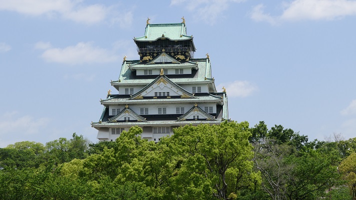
Tokushima Castle was located in what is the modern day Tokushima City. The prefectural capital of Tokushima Prefecture is Tokushima City. The old name for Tokushima Prefecture was called Awa Province, where the Chosokabe Clan and the ruler, Hideyoshi Toyotomi battled in the late 16th Century during the Sengoku Period. Hideyoshi finally won and he gave the province to his senior vassal, Iemasa Hachisuka in 1585. Iemasa first lived in one of the major mountain castles, called Ichinomiya Castle, but he soon moved to another place in 1586, building a new castle named Tokushima Castle.
The location of the castle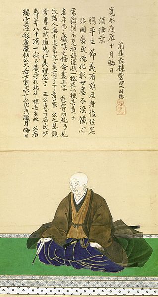
building network of sea transportation
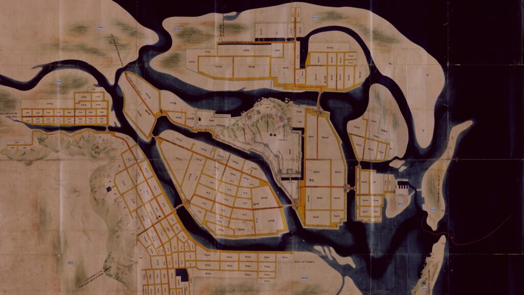
Tokushima Castle was built on Inoyama Mountain which was 62m high on a sandbank called Inotsu. The sandbank was among the delta of Yoshino-gawa River, the largest river in Shikoku Island. The place where the castle was built was not spacious for the lord of the province. It was said that Hideyoshi suggested that the castle should be built at that place. So why did he instruct Iemasa to build the castle at such a place? Historians speculate that Hideyoshi tried to build the network of sea transportation with his home base, Osaka Castle. Tokushima was renamed by Inotsu and had a location which was capable of controling the sea lanes such as Kii Channel. The area was the entrance to Osaka Bay in which Osaka Castle was facing. The network consisted of both navy and merchant fleets. Another possible reason was that The Hachisuka Clan still had to send their retainers to branch castles called the Awa Nine Castles against the resistances of Chosokabe. That meant Hachisuka’s home base didn’t need a large space.
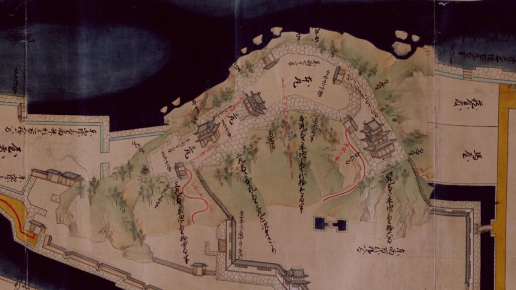
Center of Castle was once on Mountain
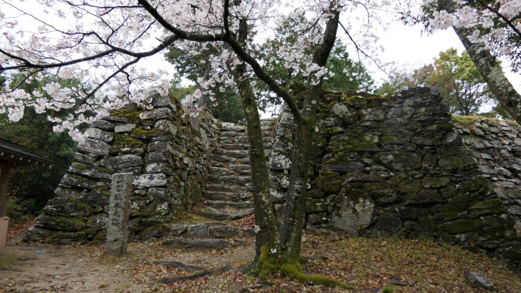
Inoyama was a dogleg mountain which extended from the east to the west. The Main Enclosure was on the highest, the largest and rounded part of the mountain, which was thought to have the first Main Tower and the first Main Hall for the lord. However, the Main Tower was scraped about 30 years after its foundation for some unknown reasons and rebuilt in the Eastern Second Enclosure of the lower eastern part of the mountain. This was a very rare case because most castles had their Main Tower at the highest point of the mountain. There’s only one other castle that had a similar case, which was Mito Castle. However, its reason was more obvious. Its main reason was that it was small and inconvenient. The western part of the mountain also had the Western Second Enclosure and the Western Third Enclosure that protected the Main Enclosure. These enclosures on the mountain got surrounded by stone walls one by one. On the other hand, the plain area on the sandbank in the south of the mountain was not fully developed. Experts speculate that there were probably two main halls instead of one primary hall on the mountain. This secondary hall on the plain area was used as the home of the lord and its warriors. Tokushima Castle was specifically designed for battles that took place during the first generation of its existence.
Center of Castle moves to plain area
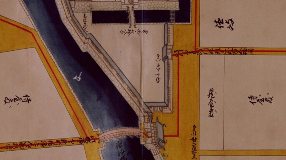
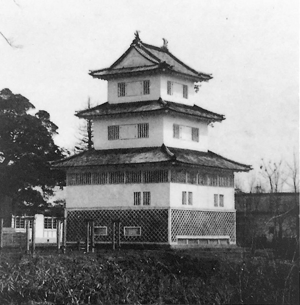
After the Tokugawa Shogunate defeated the Toyotomi Clan in 1615, the governance of the shogunate finally became stable. The Hachisuka Clan was also able to spread their territory by adding the Awaji Province through supporting the shogunate. Due to the long period of peace, The nine branch castles were eventually abandoned. As a result, the retainers gathered in Tokushima Castle which needed to be reconstructed. The large scale of the Main Hall for the lord was rebuilt on the plain area and became the center of the castle. It was also surrounded by stone walls with several turrets, and fences called Byobu-bei along with the Inner Moat and the Terashima-gawa River. The southern side of it had the Kuro-mon Gate as its main gate with the three-story turret called Taiko-yagura next to it, which looked like the main tower. In addition, there was also the Miki Enclosure in the south of the Main Hall with the front gate called Washi-no-mon. Many of the rivers around the castle were also reclaimed and turned into the warriors’ residences and the castle town. The Hachisuka Clan lived in the castle until the end of the Edo Period.