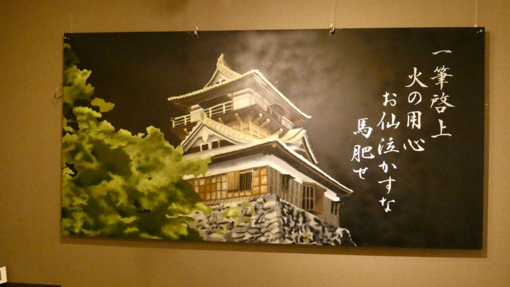
立地と歴史(家康が3回住んだ城)
イントロダクション
今回は、現在の静岡市にある、駿府城をご紹介します。大御所・徳川家康の城、それから竹千代だった子ども時代にも人質で過ごしていた場所としても知られています。実は家康はあと一回、豊臣秀吉の配下になったときにも、駿府城に住んでいたのです。つまり3回住んだ城ということです。一回目のときは今川氏の城で、二回目に家康自身の城になったのですが、このときまでの城の姿は謎に満ちているのです。それに大御所時代に築かれた巨大な天守は、短期間で燃えてしまい、日本最大と言われる天守台も明治期に壊されてしまいました。しかし近年発掘調査が行われ、明らかになりつつあります。この記事では、家康が住んでいた3つの時代毎に、駿府城の歴史と謎をご説明したいと思います。家康後の歴史もあります。
今回の内容を趣向を変えて、Youtube にも投稿しています。よろしかったらご覧ください。
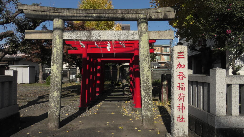
竹千代がいた今川氏の城
室町時代に駿河国守護だった今川氏が、いつ本拠地を駿府に置いたのかははっきりしません。しかし四代目の範政が、将軍・足利義教を「府中」に迎えているので、これ以降本拠であったことは確実です。駿府は、南を駿河湾、残り三方を山に囲まれていて、鎌倉のような地形になっています。要所には支城が築かれて、防御を固めていました。しかし、本拠にあった今川館(いまがわやかた)は、堀や土塁に囲まれてはいるものの、京都の公方亭のような華やかな建物だったと考えられています。今川氏の全盛期には、駿府は日本有数の平和で繁栄した街だったからです。
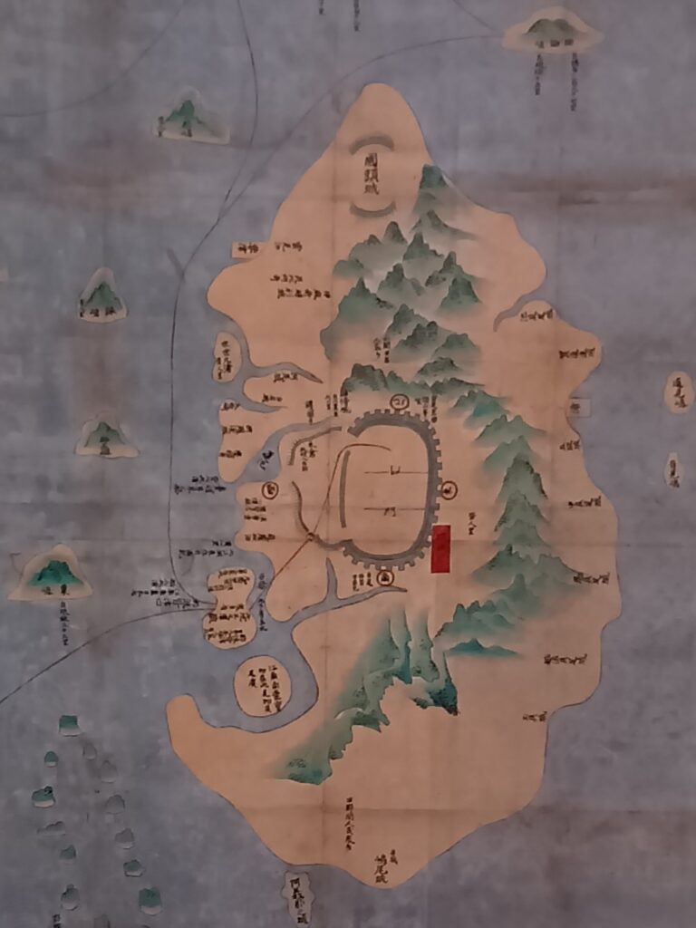
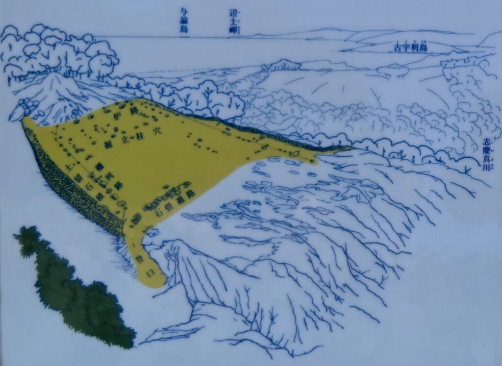
駿河国の範囲と駿府城の位置 城周辺の起伏地図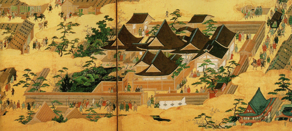
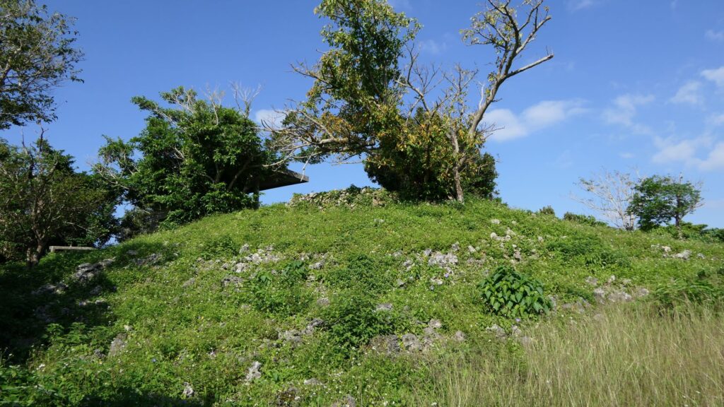
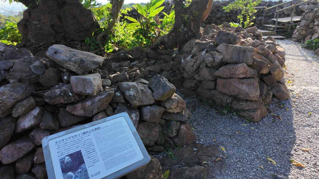
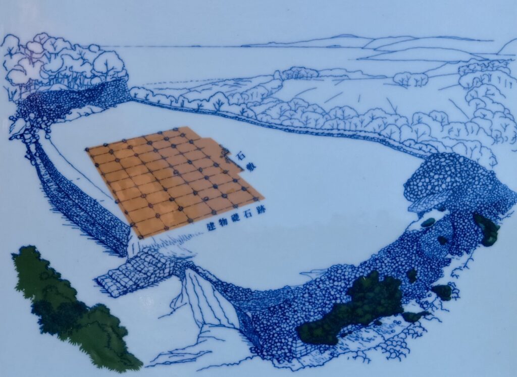
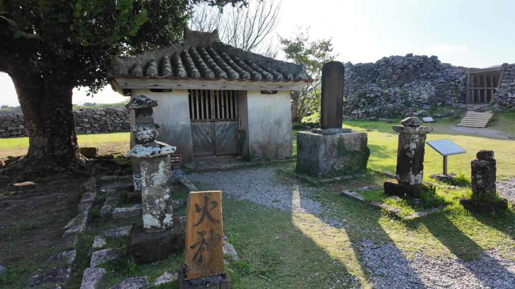
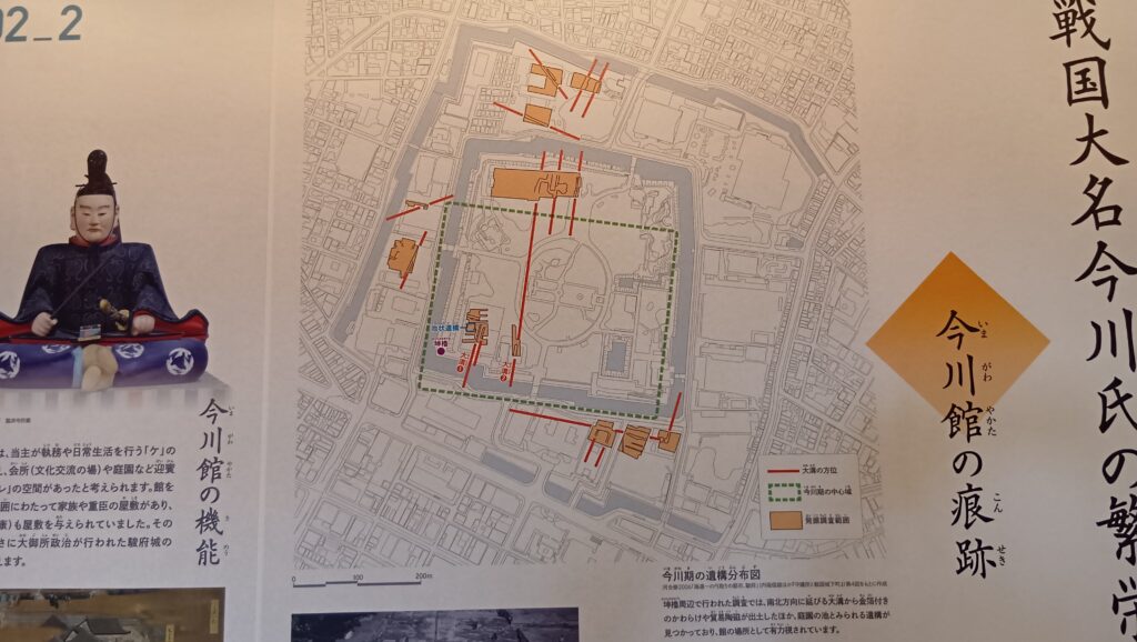
その今川館があった場所ははっきりとはわかっていません。現在残る本丸辺りだろうとも思えますが、城は後世かなり改変されてしまっているからです。発掘調査で発見された遺構や、文献資料などから、本丸・二の丸の範囲にあったことは確実なのですが、もっと絞れば、二の丸坤櫓辺りだろうとする意見があります。この辺が城内では標高が高く、富士山を望むような建物の配置になっていたと推定されるからです。この近くには、室町時代以来と思われる「四足御門」という名前の門が江戸時代までありました。
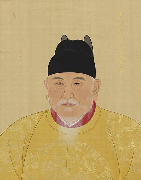
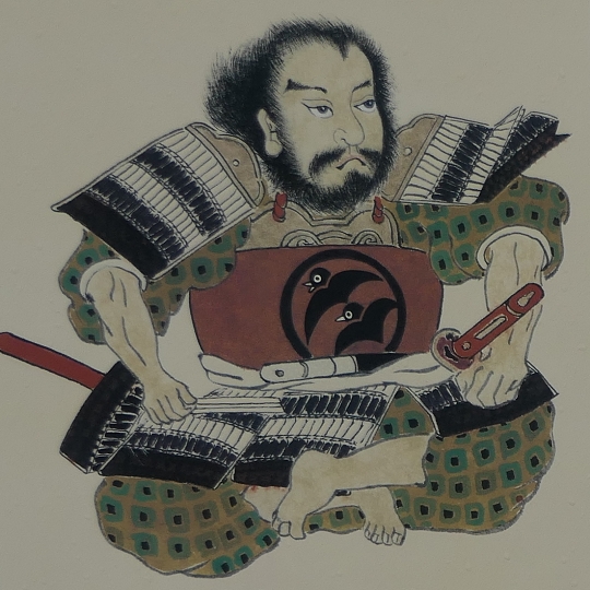
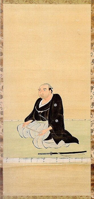
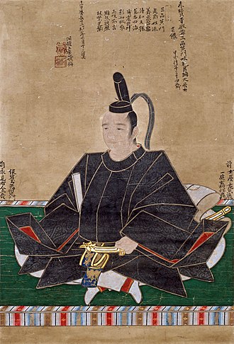
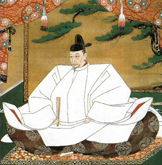
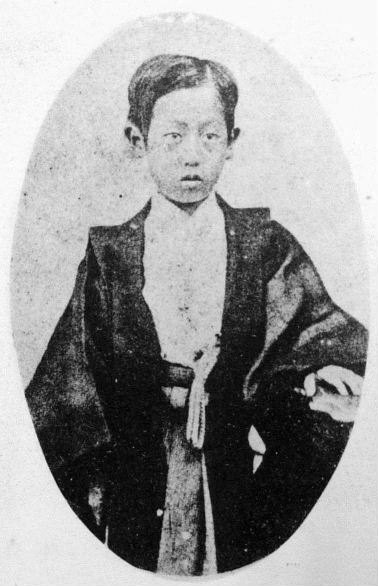
1549年(天文18年)、11代当主・今川義元の下、全盛期だった駿府城に、8歳の竹千代こと家康が、松平氏の人質としてやってきました。これまでこの「人質」時代は、家康の一生のなかで忍耐のときと捉えられてきましたが、実際には制限はあっても充実した生活を送っていたようです。有名な安倍川の石合戦のエピソードのほか、この頃から鷹狩りをしていました。そして今川氏からも配下の中で優遇され、元服後に義元から一字をもらって「元康」と名乗り、妻も義元の姪と言われる築山殿でした。更に「軍師」である太原雪斎から直接教育を受けました。家康は、今川氏の重臣となるよう期待されていたのでしょう。1560年(永禄3年)、桶狭間の戦いの前には、今川氏の拠点、大高城に兵糧を運び入れる働きをしました。ところが、大将の義元が織田信長に討ち取られてしまったのです。家康はこれをきっかけに独立大名となります。
義元を失った今川氏は、凋落の道を辿ります。北は武田信玄、西は家康から圧迫を受け、1568年(永禄11年)ついに信玄は駿河侵攻を開始しました。後継ぎの今川氏真はそれに対峙しようとしますが、重臣の離反が相次ぎ、一戦も交えずに、西の掛川城に退去しました。駿府には武田軍が攻め込み、当時の駿府城・今川館も炎上しました。一つの時代が終わったことを象徴する出来事でした。
豊臣大名・家康の城
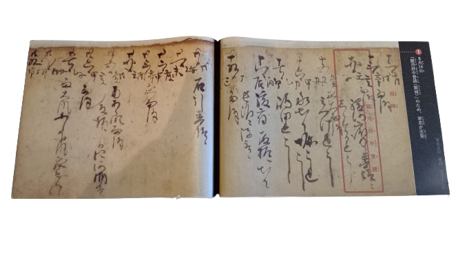
織田信長が本能寺の変で倒れた後、家康は5か国を領有する大大名になっていました。当時の本拠地は浜松城でした。1584年(天正12年)には、天下人となる羽柴秀吉に小牧・長久手の戦いで対峙しました。その翌年(1585年、天正13年)、家康は駿府に本拠地を移しました。これは拡大した領国範囲に対応したものと言えますが、秀吉との再度の戦いに備えたものとも考えられます。その範囲は現在の本丸・二の丸程度でした。家臣の松平家忠の日記には、その築城過程が記録されています。築城は天正13年7月に始まり、翌年12月に家康が入城しました(下記補足1)。このときの城の姿は、それまでの浜松城などと同様、土造りの城であったと想定されています。家康は、本格的な石垣を築く技術や職人集団を持っていなかったのです。1587年、天正15年2月に城は一旦完成しました(「家忠日記」「当代記」)。
(補足1)「駿河府中普請」のため、家忠が出張(「家忠日記」天正十三年八月十四日付)「御かまへ二のくるわ堀(二の丸の堀)普請候」(同天正十五年二月五日付)「殿様今日駿へ御座候由候」(同天正十五年十二月四日付)
ところが、それと同時に新たな工事の準備が始まりました。石垣の工事でした(下記補足2)。その直前、1586年、天正14年10月、家康が上洛し秀吉に臣従していました。それを境に始まったのです。「石垣の城」を築かなかった家康に、豊臣政権が関与したことが記録上からも伺えます(下記補足3)。更には、「てんしゅ(天守)の材木を準備したという記録も見られます(下記補足4)。しかし記録からでは、石垣や天守の規模はわかりません。
(補足2)「城普請出来候、石とり候(「家忠日記」天正十七年二月付)」「来一日より駿河御城御普請候由、酒左衛門督(酒井忠次)より申来候」(同天正十五年九月十七日付)
(補足3)「てんしゅの才木てつたい普請あたり候」(「家忠日記」天正十六年五月十二日付)
(補足4)「駿河府中の石垣の普請あり、去る去る年より、事始めあると雖も、上方不快の間、指て事行ず。いま、秀吉公入魂せしめたまい、普請宜々、出来の間、浜松より北の方をも引越し給う。」(「当代記」天正十五年丁亥二月付)
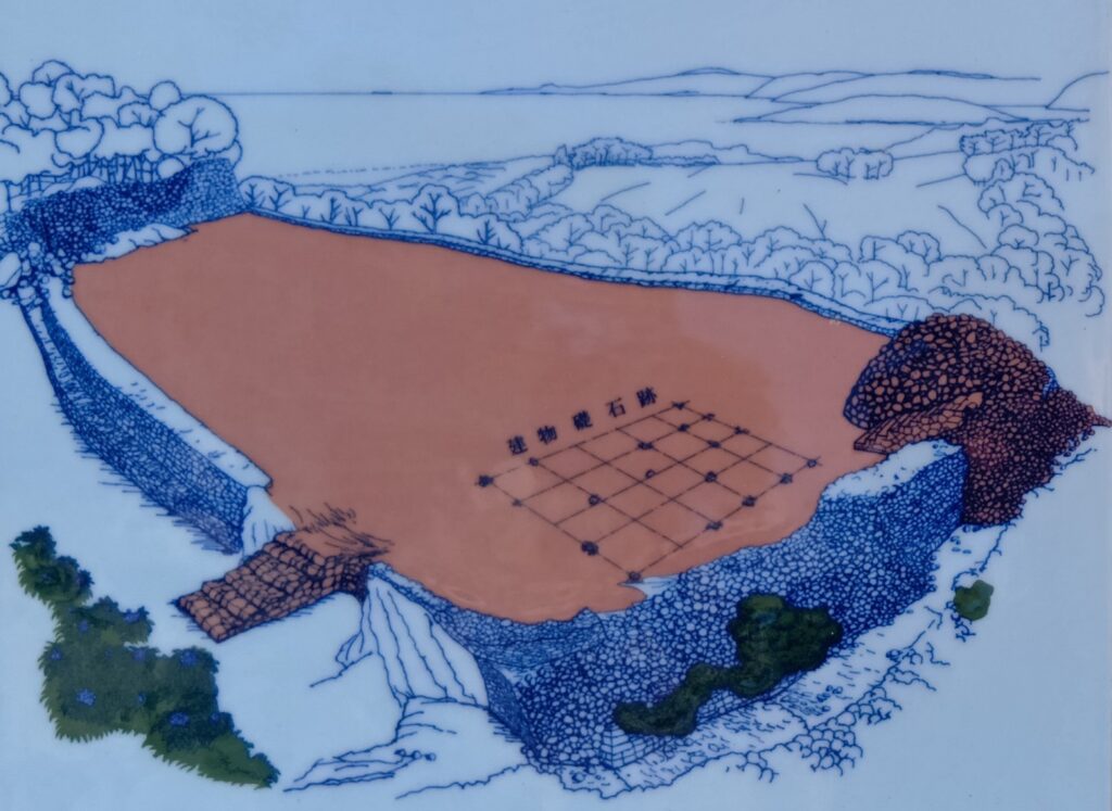
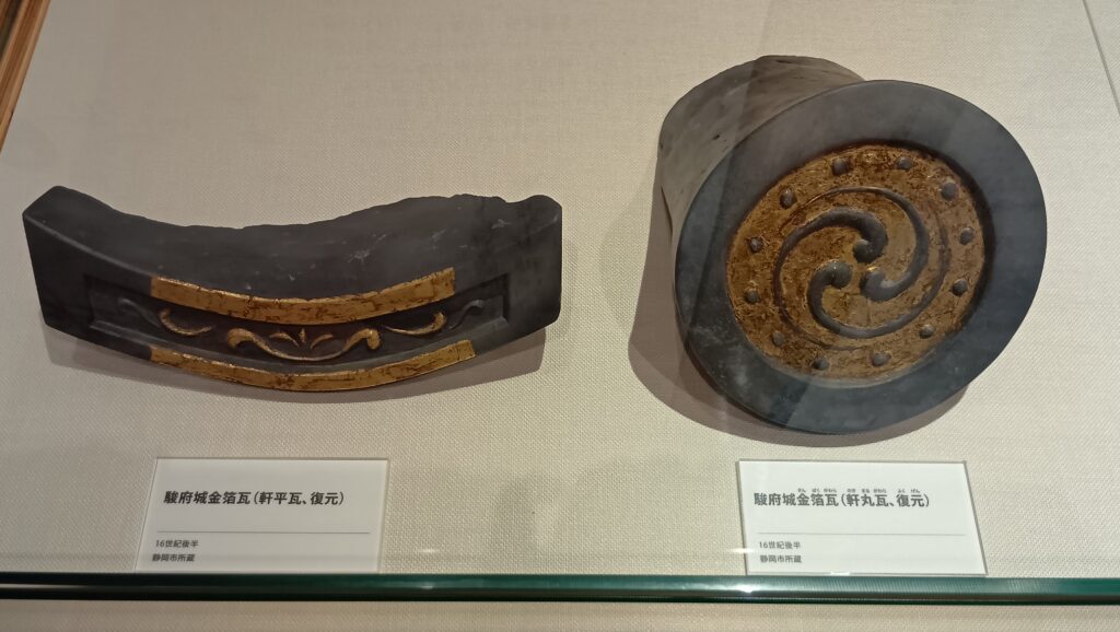
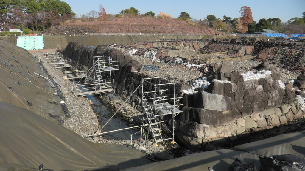
2016年、大御所時代の天守台の発掘調査が行われましたが、その下から天正時代の当時としては巨大な天守台と、大量の廃棄された金箔瓦が発見されました。天守台の大きさは秀吉の大坂城をもしのぎ、天下人クラスのものでした。そのため、当初は家康が築いたものとはされず、家康が関東に移った後駿府に来た、中村一氏のときに築かれたのではないかとされました。一氏は秀吉の家臣(当時は秀次家老)だったので、秀吉の肩入れで築かれたということです。関東周辺には、秀吉の家臣による総石垣・金箔瓦の天守がいくつも築かれ、家康包囲網ともいうべき城郭ネットワークが構成されました。駿府城もその一つと考えられたのです。見つかった金箔瓦は一か所に廃棄されていて、家康が再度城を築くときに意図的に壊されたとも言えるのです。
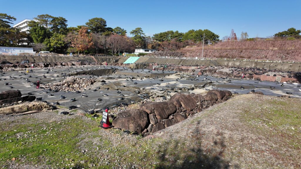
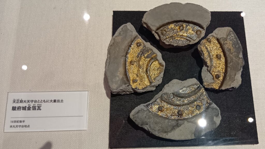

ところがまた事態は一変します。2019年に天守台に付随する小天守台が発見されたのです。これは家康家臣の記録の一つ「小傳主(小天守)を築く」と一致するということになったのです(下記補足5)。にわかにこの巨大天守は家康が築いたという可能性が出てきたのです。学者の中には、この時期に家康が独力で石垣・天守を築く能力を身に着けたと考える人もいます。しかし一方で、一連の石垣・天守工事は小田原合戦準備のため短期間で終わっていて、その間にこれだけのものを築けたのかという疑問もあります。また、家康が関東に移った当初の江戸城はとても質素で、豪華な石垣や天守は関ヶ原合戦の後と考えられているので、それとの整合性はどうなのでしょうか。それから見つかった金箔瓦は、織田系・豊臣系両方の特徴を示していて、独自性が感じられます。このことは家康築城説に有利なのかもしれません。発掘調査は2020年に終了しましたが、今後の研究成果が期待されます。
(補足5)「小傳主てつたい普請當候」(「家忠日記」天正十七年二月十一日付)
天下人・大御所の城
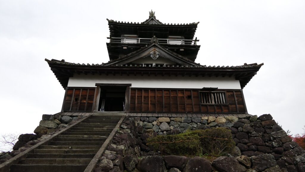
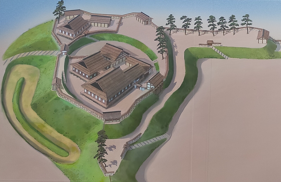
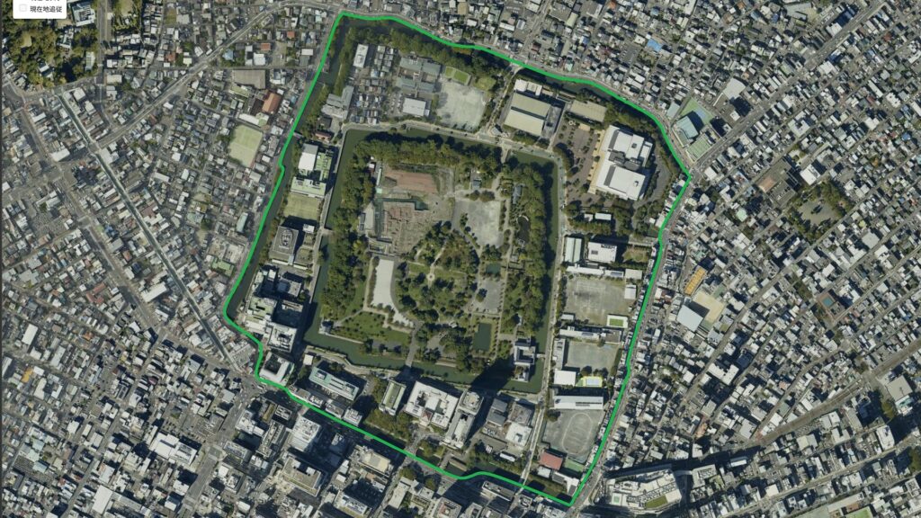
関ヶ原合戦の勝利、征夷大将軍就任により天下人となった家康は、1605年(慶長10年)早くも将軍職を後継ぎの秀忠に譲りました。その隠居城となったのが駿府城です。馴染みのある地で余生を楽しむという感じも受けますが、実際には自由な立場で天下の政権運営を行うためでした。家康は将軍時代、ほとんど上方の伏見城にいたので、江戸との中間点で、両方目配せができる場所を選んだのでしょう。また、大坂城の豊臣方が西国大名とともに江戸を攻める場合、防衛線にもなりうる拠点でした。1607年(慶長12年)、天下普請により新たな築城が始まりました。その範囲は、現在の三の丸が追加される形と考えられますが、中身は大改修となりました。三の丸のラインが二の丸以内とずれているのは、城下から見て、富士山と天守が同時に視界に入る仕掛けと言われます。慶長12年中にほぼ完成していましたが、12月22日、本丸・天守が全焼してしまいました。これは奥女中の火の不始末が原因とされますが、火事は度々起きていて、豊臣方の策謀ではないかという説もあります。再建工事が直ちに開始され、翌1608年、慶長13年8月14日に家康が入城しています。
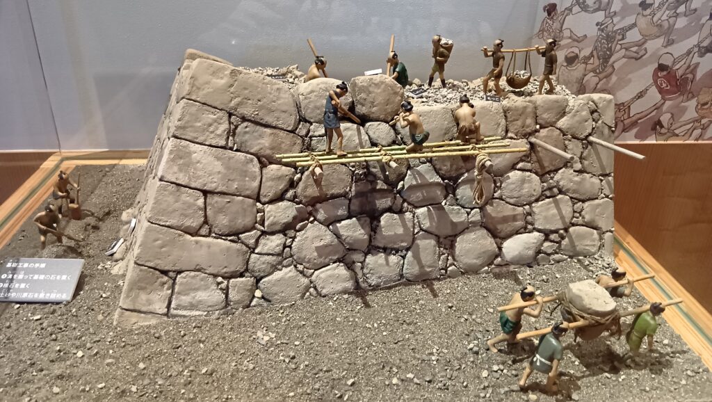
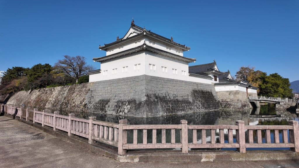
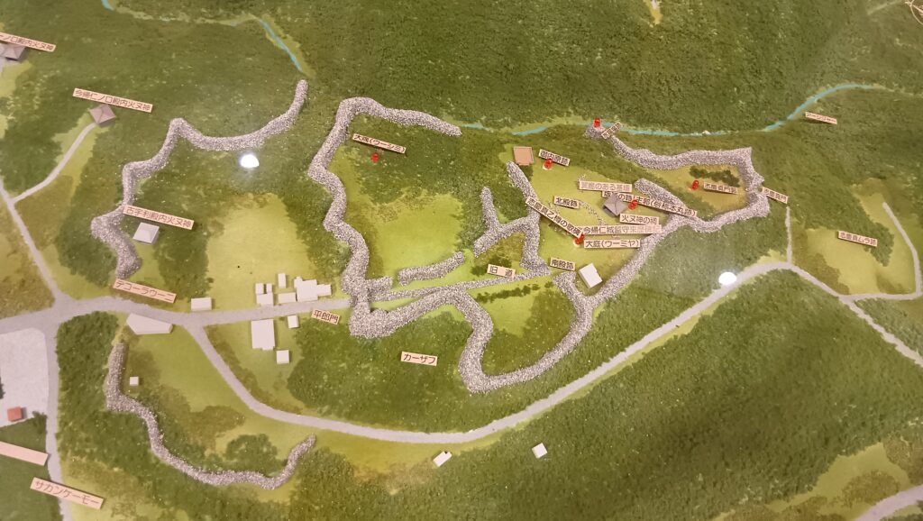
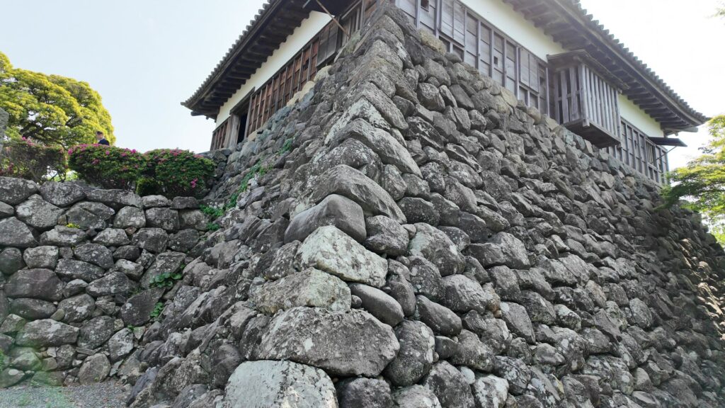
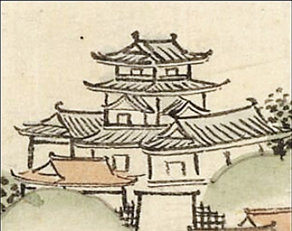
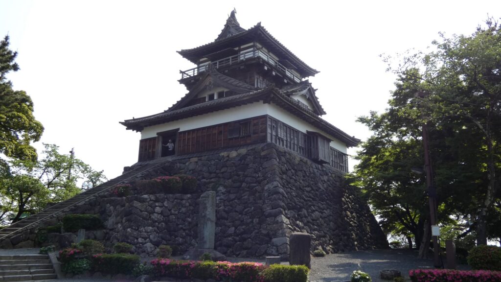
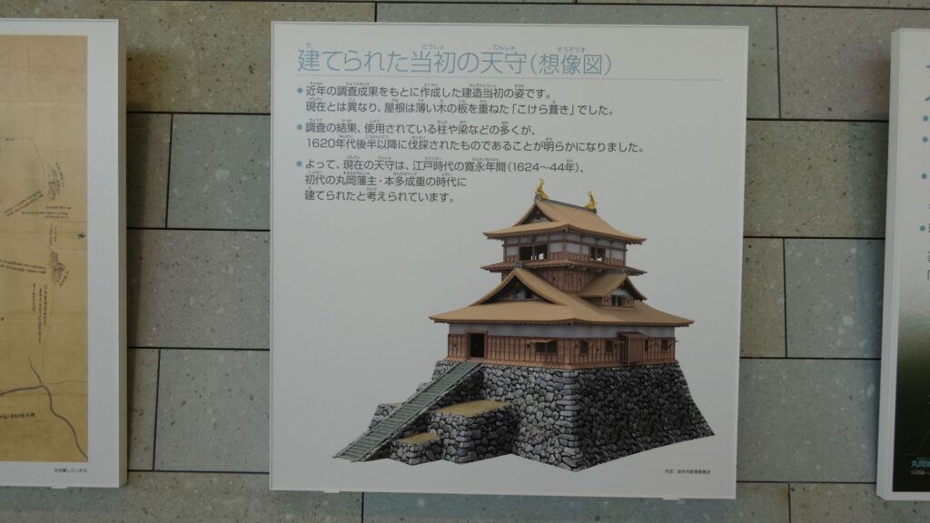
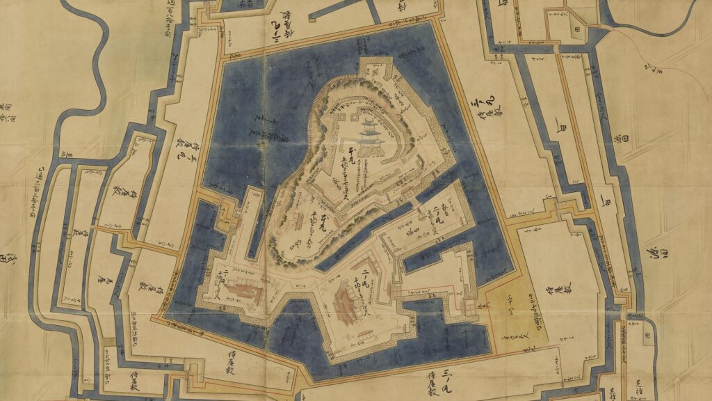
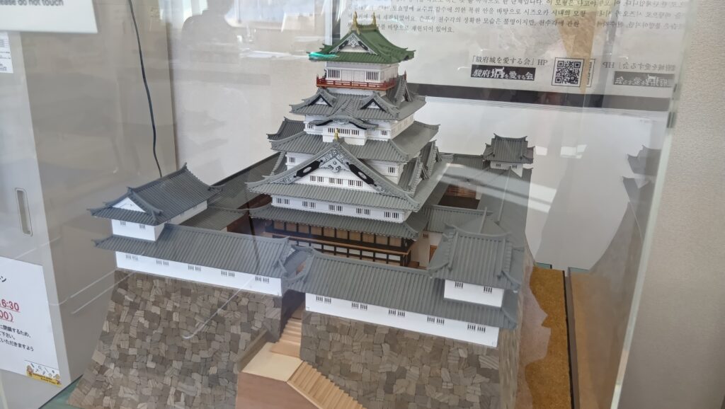
城の中で際立つのは、まず天守台です。2016年からの発掘調査の結果、一番下の部分(基底部)で東西約63m、南北約69m、という日本最大規模であったことがわかりました。残っている記録(陸軍実測図)によると、最も高い部分(天端)でも東西約48m、南北約50mで、最盛期の江戸城・大坂城をしのぐものでした。また、天守は天守台一杯に築かれたのではなく、周りを櫓と渡櫓が囲み、中心部に天守が立つという珍しいスタイルでした(環立式)。天守の建物は6重7階で、高さは約33mありました。屋根には貴重な銅瓦(+金属瓦)が用いられていました(家康時代の江戸城も銅瓦を使用)。ただしどんな外観だったかは、詳細な設計図がなく、短期間で焼失したため(1610年完成、1635年焼失)、よくわかっていません。いくつか絵図が残されていますが、異なった描き方をされています。今後の研究の進展が待たれます。
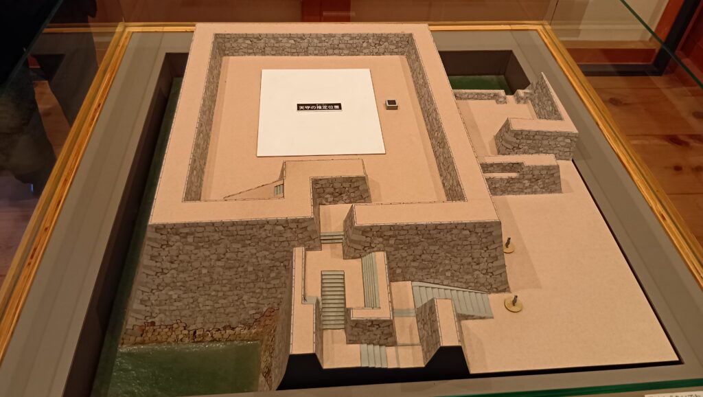
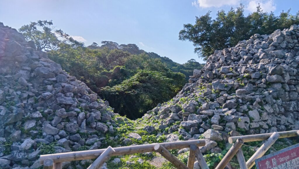
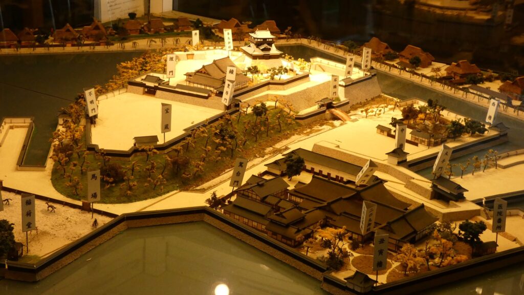
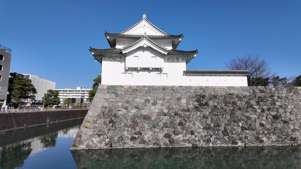
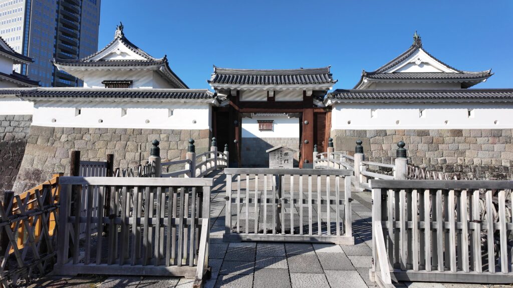
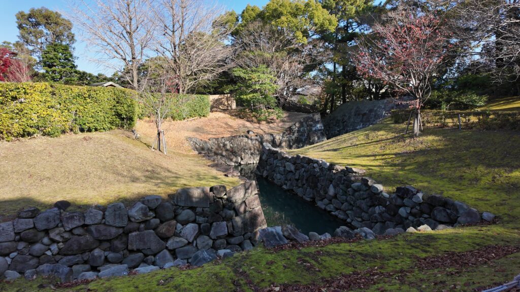
城全体ですが、平城であっても三重の堀で囲まれ、戦いに備えていました。西側の方が標高が高く攻められやすいため、防御が厳重でした。三の丸西側には門がなく、二の丸西側の清水御門は上げ下ろしができる跳ね橋だったようです。坤櫓のような櫓も厳重に守りを固めていました。他の方角にある門も、大鉄砲等も破壊されにくい、内枡形構造となっていました。そのうちの一つ、東御門が現在復元されています。その他、城内を仕切るための仕切石垣も採用されていました。駿府城独特のものとしては、本丸堀と二の丸堀をつなぐ水路が作られ、堀の水位を保てるようになっていました。また、天守台には、全国的に珍しい井戸が設けられ、籠城にも備えていました。
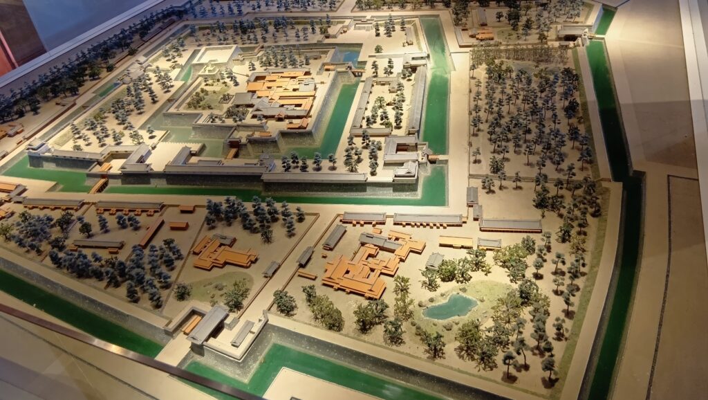
一方で大御所・家康がいた駿府城は、日本の政治の中心地の一つになりました。家康が生活し、政務を執ったのは本丸御殿です。本田正純などが側近として仕え、江戸の秀忠と分担して二元政治を行っていました。そのうち軍事・外交に関しては家康が取り仕切っていたため、駿府には、諸大名だけでなく、外国使節も訪れ、日本の首都機能の一翼を担うような都市になりました。1609年(慶長14年)からは、家康十男・頼宜が駿府城主になり、家康と一緒に過ごしました。1614年(慶長19年)、大坂の陣のきっかけとなった方広寺鐘銘事件が起こり、家康が、弁明のために駿府城に来た片桐且元には面会せず、後から来た大蔵卿には面会することで、豊臣方の分断を図ったというエピソードは有名です。家康は、大坂冬・夏の陣とも駿府城から出陣し、豊臣氏を滅ぼした翌年(1616年、元和2年)に亡くなった場所も駿府城でした。
その後
徳川頼宜は、1619年(元和5年)に和歌山に移っていきました。その後、秀忠の三男・忠長が駿府城主になりますが(1624年、寛永元年)、兄の3代将軍・家光により改易されました(1632年、寛永9年)。以降は幕府直轄になり、城代が置かれました。城外には城を警備する加番も置かれました。幕府の「聖地」を守るお役目です。1634年(寛永11年)には家光の宿泊所として使われましたが、翌年の火災で天守・御殿・櫓などが全焼、天守は再建されませんでした。その後も地震などで度々被害があり、将軍の上洛もなくなったことで、本丸御殿などの規模は縮小していきました。
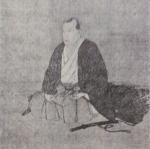
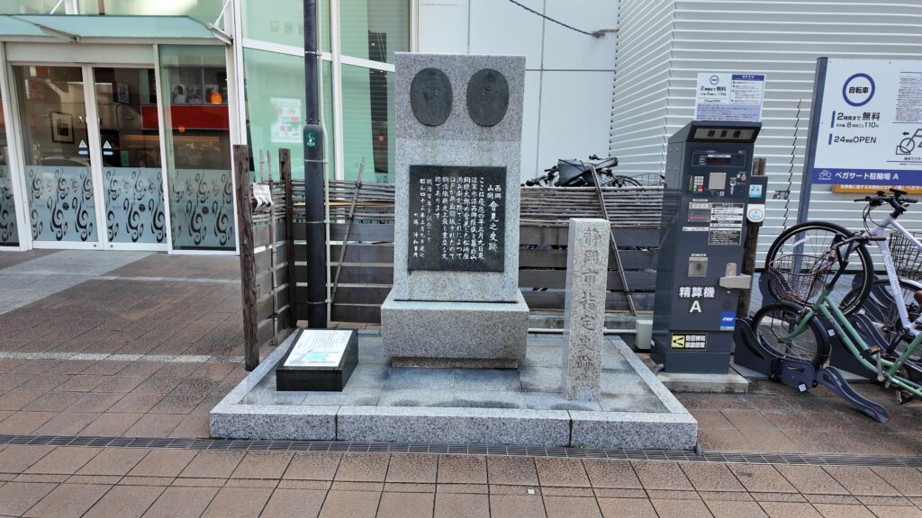
そして幕末の動乱を迎えたとき、駿府城は再び注目を浴びました。鳥羽・伏見の戦いの後、新政府の東征軍が組織され、江戸に向かって行軍してきたのです。そのときは江戸の「最後の将軍」徳川慶喜は恭順の方針であり、名古屋城を擁する尾張藩も新政府に付いていました。最期の駿府城代・本多正納(まさもり)は城を開け渡ざるをえませんでした。1868年、慶応4年3月、新政府の拠点となった駿府に、慶喜・勝海舟の使者として山岡鉄舟がやってきました。彼は、新政府参謀の西郷隆盛と面会し、江戸開城の条件交渉を行いました。それが有名な勝・西郷会見につながったのです。江戸開城が成ると、慶喜を継いだ徳川家達(いえさと)が駿府藩主として駿府城に入城しました。家康の子孫がまた戻ってきたのです(廃藩置県後は東京に移住)。慶喜も水戸謹慎後は、駿府改め静岡に移住し、1897年(明治30年)まで暮らしました。
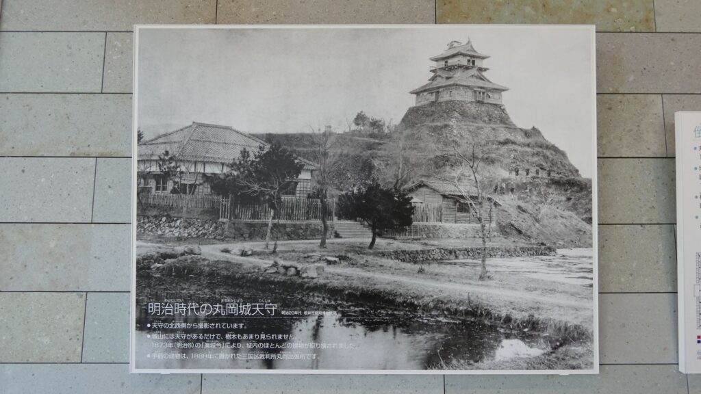
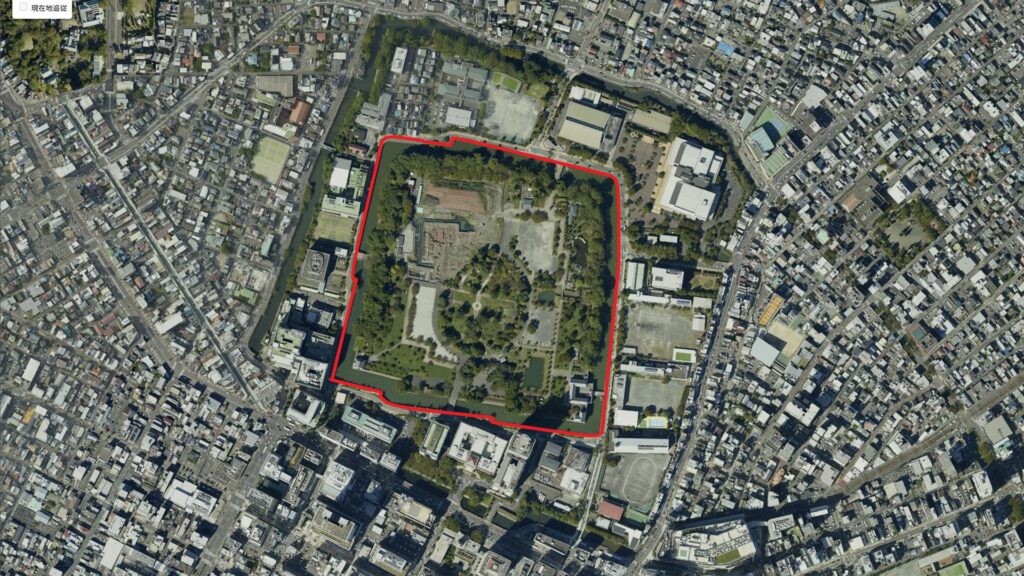
明治時代になると、城は陸軍が管轄していましたが、建物は売却され、城内は荒れ果てていきました。三の丸の部分は市街地化しました。1889年(明治22年)になってようやく「廃城」扱いになり静岡市に払下げされましたが、その使い道は陸軍の誘致でした。1896年(明治29年)にはついに天守台が崩され、本丸堀が埋められました。二の丸以内が歩兵第34連隊の敷地になったのです。戦後は都市公園「駿府公園」として再出発しますが、堀の埋め立てや石垣の破壊が続いていました。1975年(昭和50年)から発掘調査が行われ、それから史跡として注目されるようになります。その到達点として、1996年(平成8年)東御門・巽櫓復元、2014年(平成26年)の坤櫓の復元があります。公園の名前も2012年(平成24年)に「駿府城公園」に変更されています。