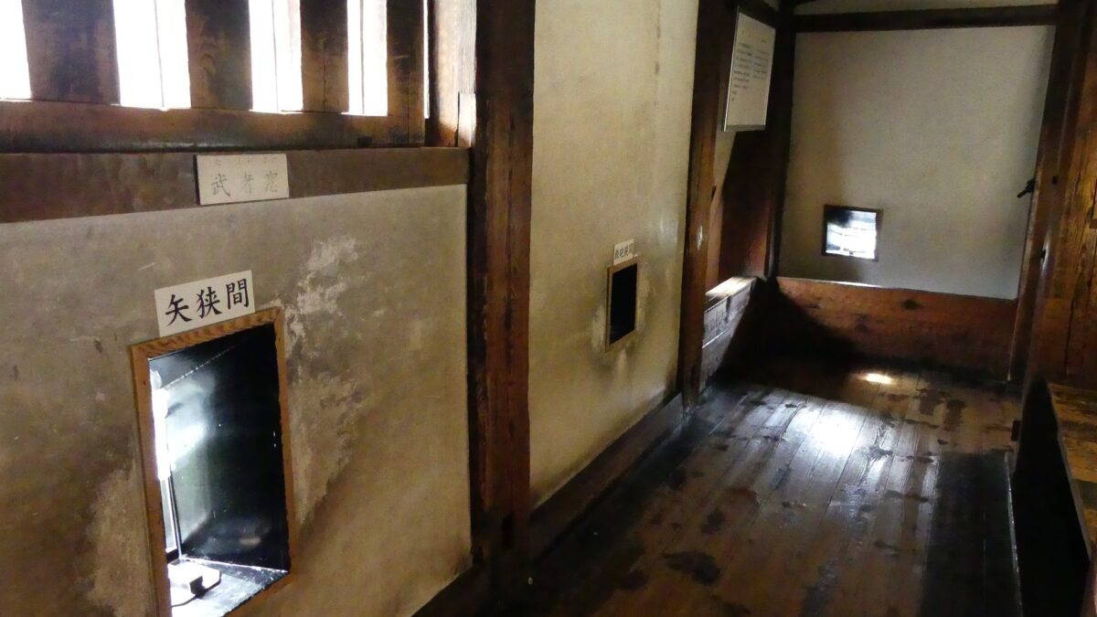
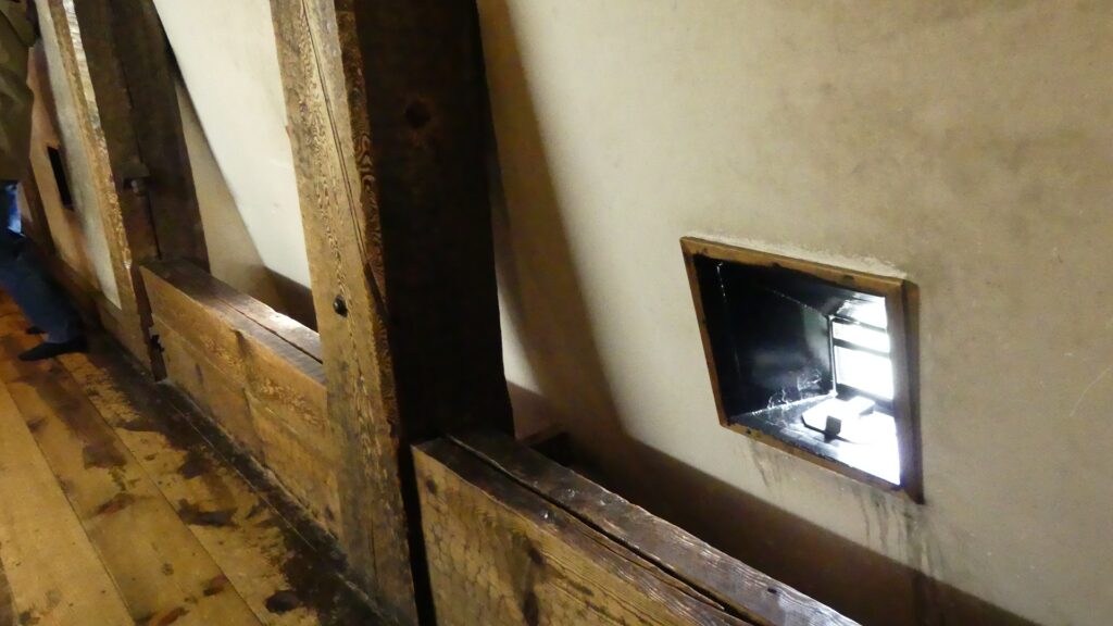
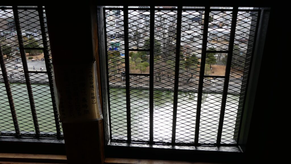
There are defense systems along the passage of the first floor of the Main Tower- machicolations, loopholes (for guns and arrows), and lattice windows. For instance, as many as 117 loopholes were built in this tower. They are the genuine article!
Features
Supporting Systems of Main Tower
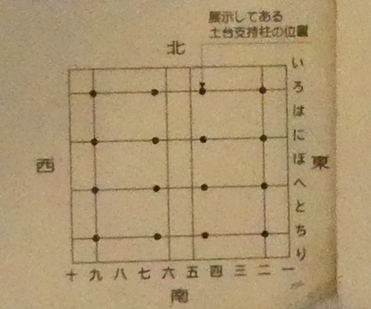
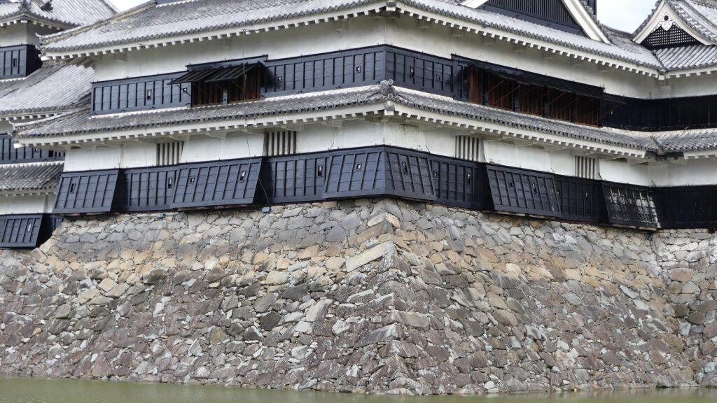
You can enter the tower after entering the main enclosure through Kuro-mon (the black gate). It weighs about 1,000 tons on the unstable ground at its base, so 16 thick wooden “main support pillars” stand inside the stone wall base and a ladder-type support foundation was laid across the top of them.
The Kuro-mon gateThe entrance of the Main TowerOne of the 16 main support pillars was preplaced and is exhibited in the first floor The layout of the 16 main support pillars, exhibited in the first floorThe illustration of the internal structure of the Main Tower (its lower part), exhibited in the first floor
Interior for Fighting
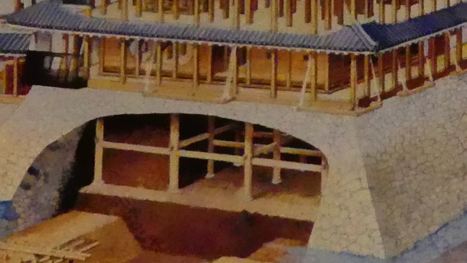
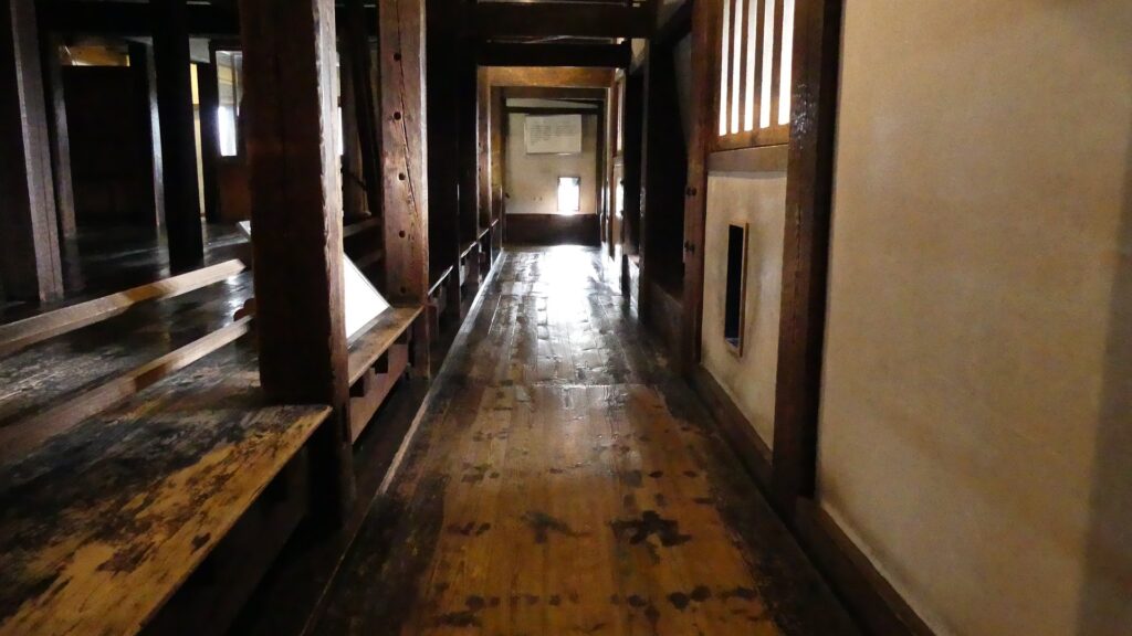
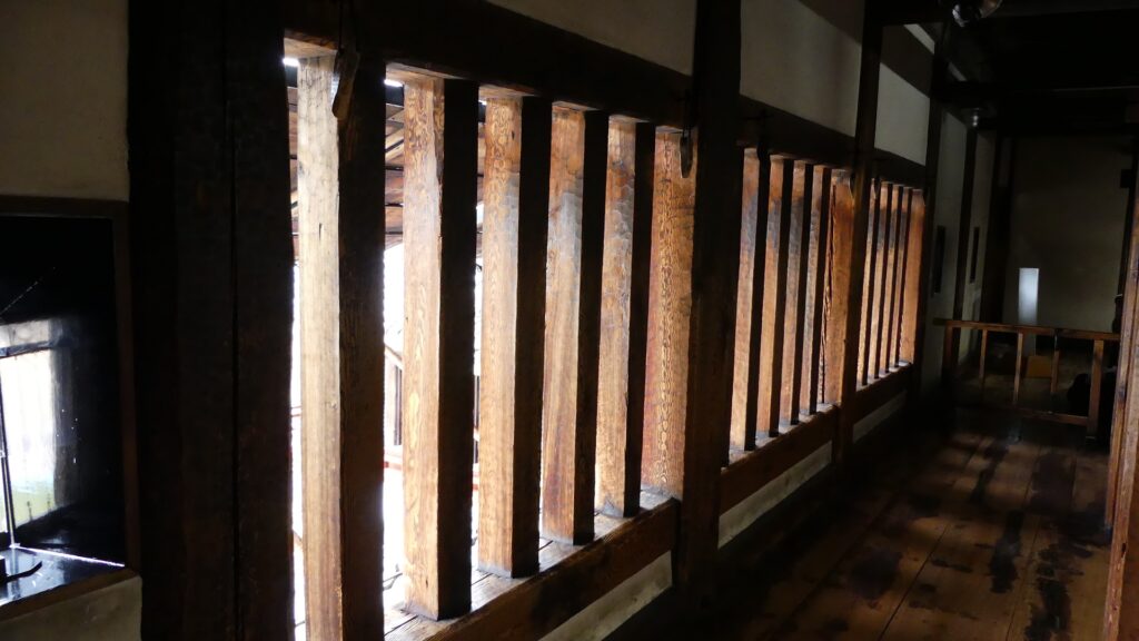
If you go into the first floor, you will see lots of other columns supporting the tower. The floor is separated into the central room, called “Moya”, and the surrounding defense passage, called “Musha-bashiri (directly means “warriors running”). The central room was used as storage and elevated about 50cm above the main passage. This is because the support foundation was doubled-up in this area.
The first floor (the central room)The first floor (the defense passage), the central room on the left is elevated
There are defense systems along the passage – machicolations (devices for dropping stones), loopholes (for guns and arrows), and lattice windows. For instance, as many as 117 loopholes were built in this tower. They are the genuine article!
The defense systems on the first floorA machicolation called “Ishiotoshi”The first floor (the first level) seen from the outside
You can climb the steep steps to the next floor. The second floor is similar to the first one but brighter due to its wide latticed and non-latticed windows. It was used as a waiting place for warriors during an emergency. It is now used as Matsumoto Castle Gun Museum.
The wide latticed window on the second floorThe interior of the second floorAn exhibition of the Matsumoto Castle Gun Museum
Each Floor has Unique Feature
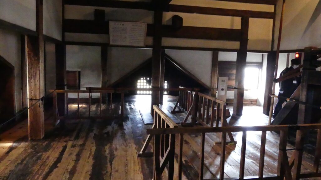
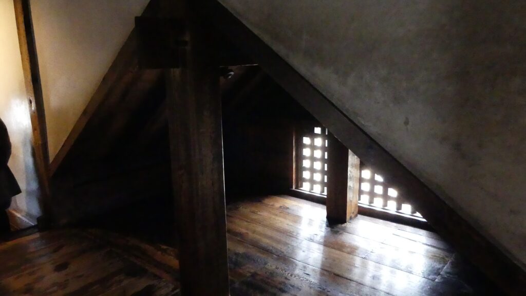
In contrast, the third floor is dark because it is an attic with no windows. It is thought to have been used mainly for storage.
The third floor
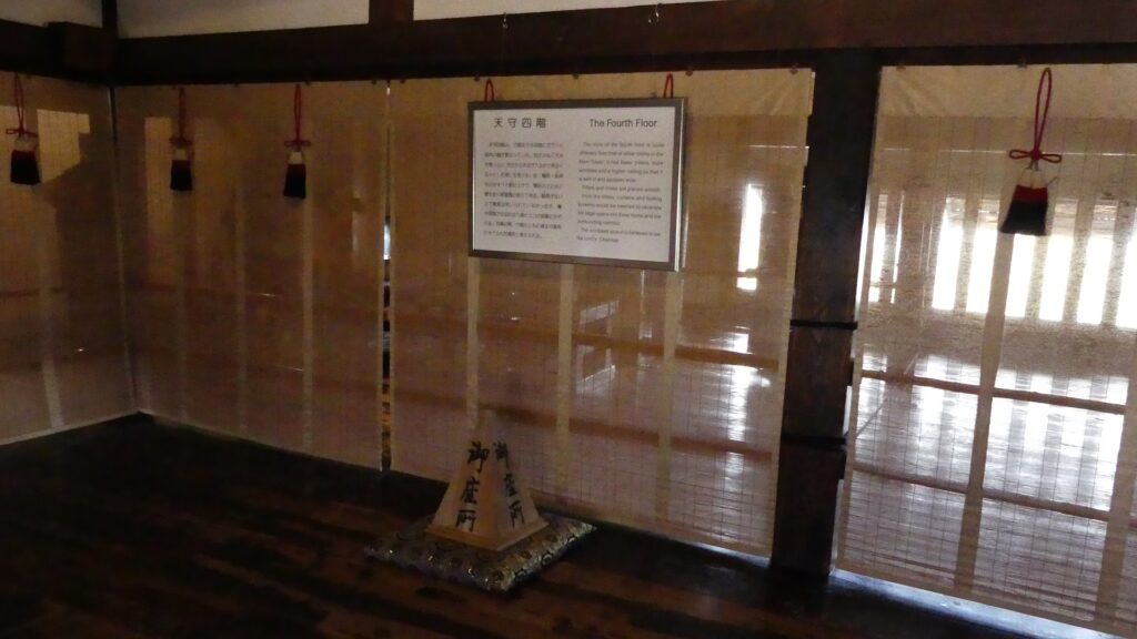
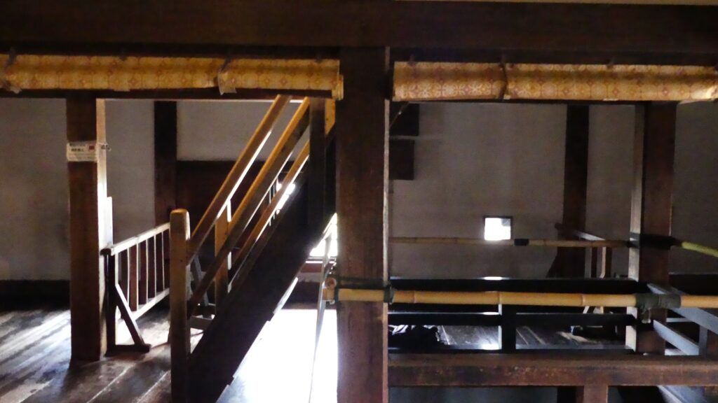
The fourth floor is also different from the others. It has fewer columns, high ceilings, and good lighting, so it is believed to have been the lord’s chamber. The steps from the fourth to the fifth are the steepest probably because of the high ceiling. Please be careful. (Taking photographs of the steps is prohibited in the tower, probably for safety and crowded-flow reasons.)
The fourth floorA side view of the steps to the fifth floor
The fifth floor looks interesting because the back sides of the gables are visible in all directions. It was used as a conference room for the senior vassals.
The fifth floorThe back side of a gableThe fifth floor (the fourth level) seen from the outside
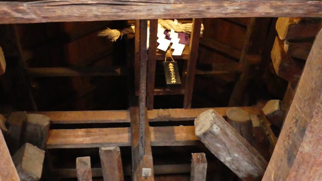
You will finally arrive at the top floor (6th), 22m above the ground. It was planned to have a veranda, but the plan was changed and the walls were built on there outside of the veranda. You can see the line where the veranda was intended to start on the floor. You can also see views of the outside through the wired windows between the walls. It was used as the headquarters of the lord during battle. If you look up at the underside of the roof, you will find the Nijurokuyashin god, which is believed to have saved this tower during the great fire during the Edo Period, worshiped on it.
The top floorThe part which was supposed to be a veranda A view through the wired windowsThe Nijurokuyashin god, worshiped on the underside of the roof
Later History
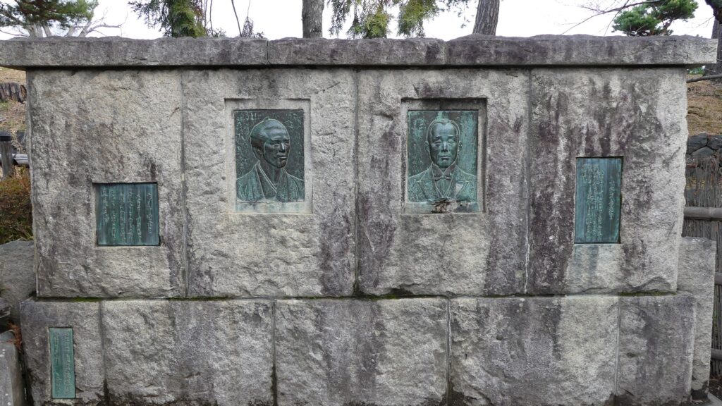
After the Meiji restoration, all of the castle buildings, excluding the Main Tower, were removed, and finally the tower was sold possible for scrap. Ryozo Ichikawa, a social campaigner came out, and asked the buyer to suspend the destruction of the tower. After that, he collected money by holding an exhibition and giving a detailed explanation in order to get it back, and was successful in the end. However, that was not enough for the tower. Such a large and old building is needed to do continuous maintenance to preserve it in the long term. In the middle of the Meiji Era, The tower began to lean at about six degrees due to the decay of the central columns, and bats began to live in it. Another savior, school head, Unari Kobayashi worked hard to repair the castle. At last, the tower was designated as a National Tangible Cultural Property in 1952. In addition, other primary gates of the castle, such as Kuro-mon and Taiko-mon have been restored. Matsumoto City is considering restoring the main gate as well.
The monument of Ryozo Ichikawa (on the left) and Unari Kobayashi (on the right), at the inside of the main enclosureThe photo of the Main Tower during the Meiji Era, owned by Matsumoto Castle Management Bureau (licensed under public domain via Wikimedia Commons)
My Impression
In conclusion, we can’t be completely sure exactly when and how the Main Tower was built. The history presented in this article is based on the official opinion of Matsumoto City. Some speculate that the Inui small main tower was first built, then, it was modified when the large main tower was added later because it looks like the newer multi-storied type. Others think that the large main tower originally had a different appearance from now, with the veranda on the top and more gables, and modified later. I think it is exciting for history fans to wonder which of these is the truth.
the Inui small main tower is on the leftThe interior of the Inui small main tower, many logs are used for the tower, which is one possible explanation for the theory that the tower was first built
How to get There
If you want to visit there by car, it is about a 20-minute drive away from Matsumoto IC on the Nagano Expressway. There are few parking lots around the castle. By public transportation, it takes about 15 minutes on foot from Matsumoto Station. From Tokyo to the station: get Hokuriku Shinkansen bullet train and transfer to the Shinonoi Line at Nagano Station. Or take the limited express Azusa at Shinjuku Station.