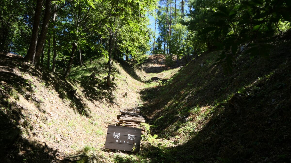
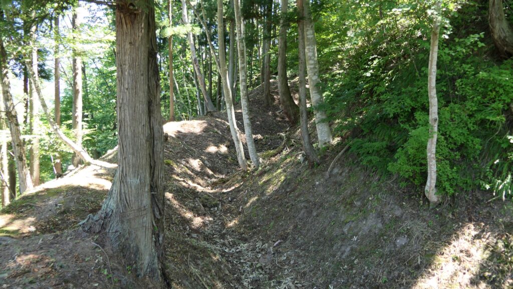
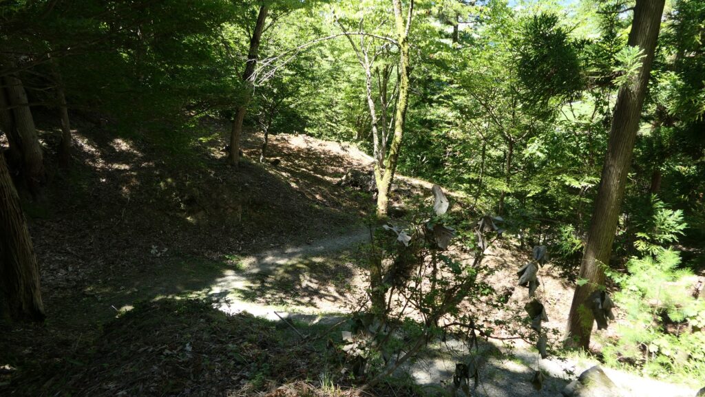
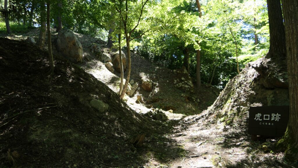
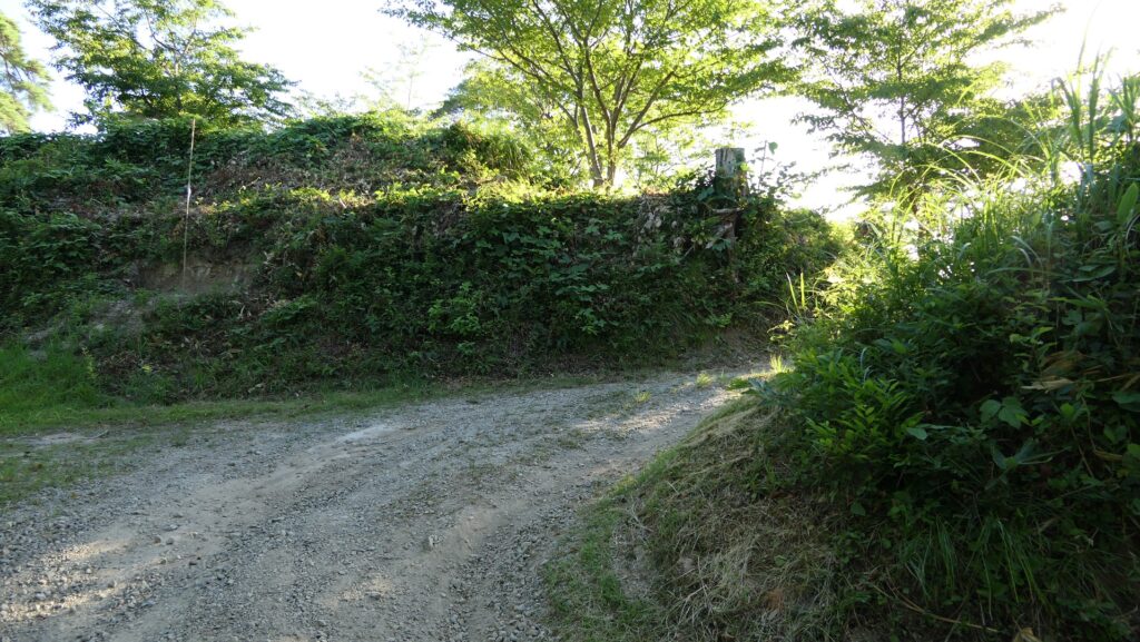
The trail to the Main Enclosure turns left or right, and then, a horizontal moat goes along it on the left. The other right side are vertical cliffs. That means the enemies were able to attack the enclosure only on this trail and the defenders would be able to focus on the spot.
Features
Main Enclosure is protected by Moats and Cliffs
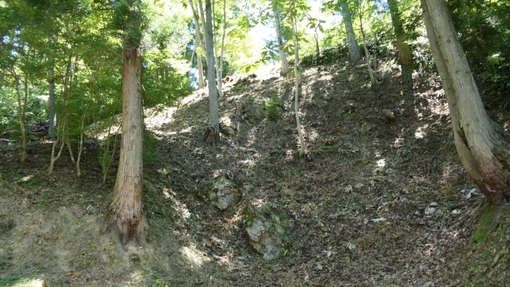
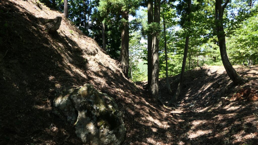
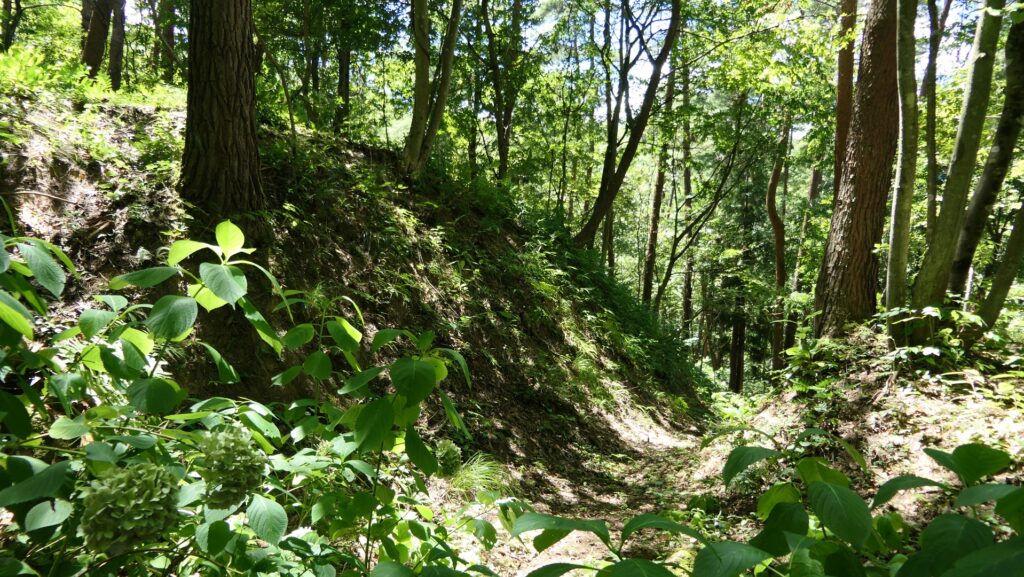
Going back to the forest road, you can also climb to the Main Enclosure on the top of Iwasaki Mountain. If you walk straight up on the trail, you will see a huge scale of vertical moat designed to avoid enemies from moving freely parallel to the right.
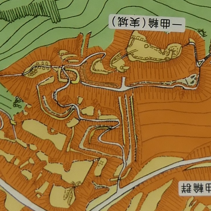
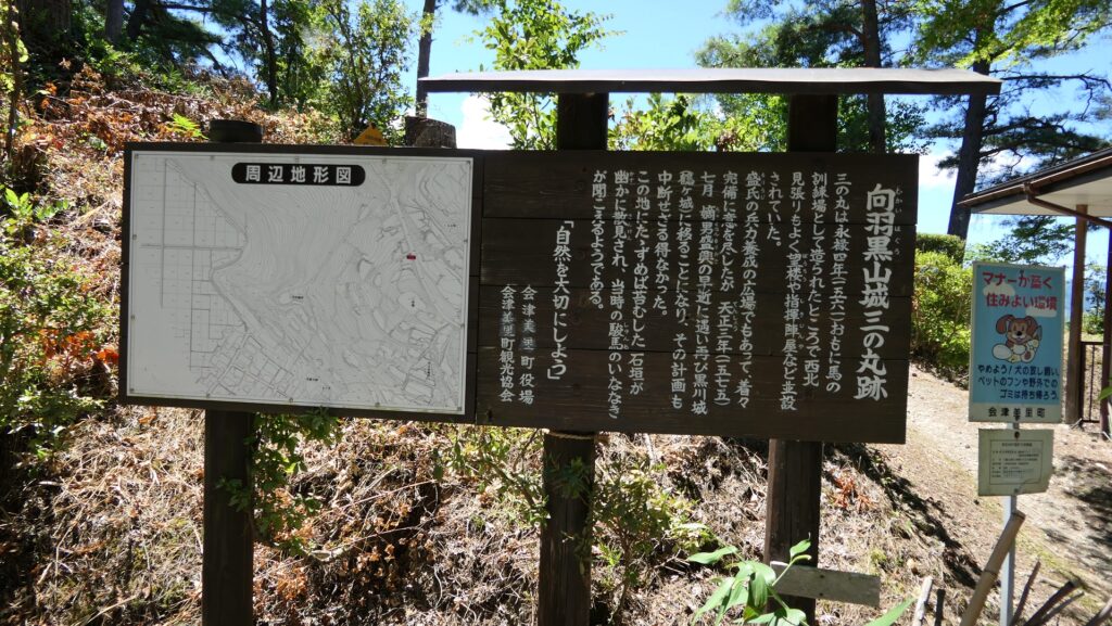
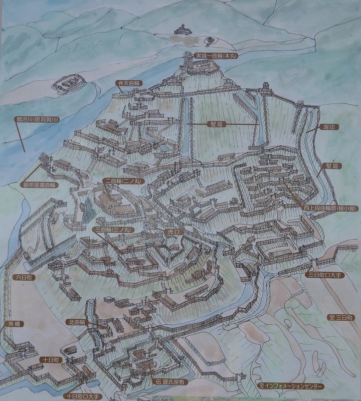
The map around the castle
The trail to the Main EnclosureThe trail on the left and the vertical moat on the rightThe vertical moat beside the trail
The trail turns left or right, and then, a horizontal moat goes along it on the left. The other right side are vertical cliffs. That means the enemies were able to attack the enclosure only on this trail and the defenders would be able to focus on the spot.
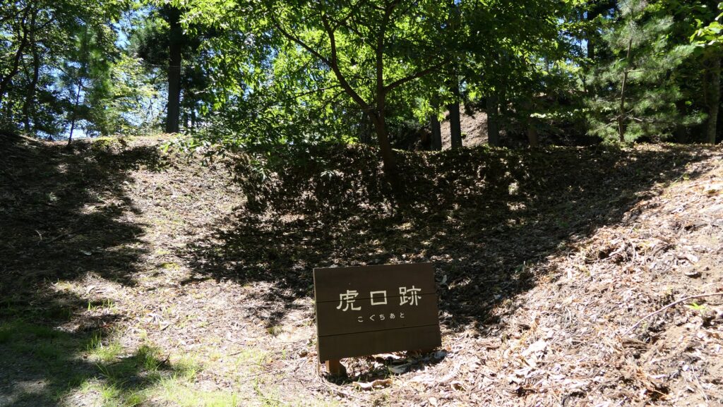
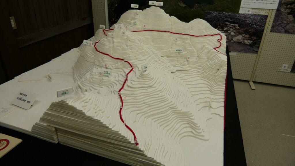
The layout of the Main Enclosure, the white part is the trail, the yellow part shows enclosures or bottoms of the moats, and the orange part is cliffs, exhibited by the Mukai-Haguro GalleryThe trail goes up while curvingThe horizontal moat left of the trailThe vertical cliffs right of the trail
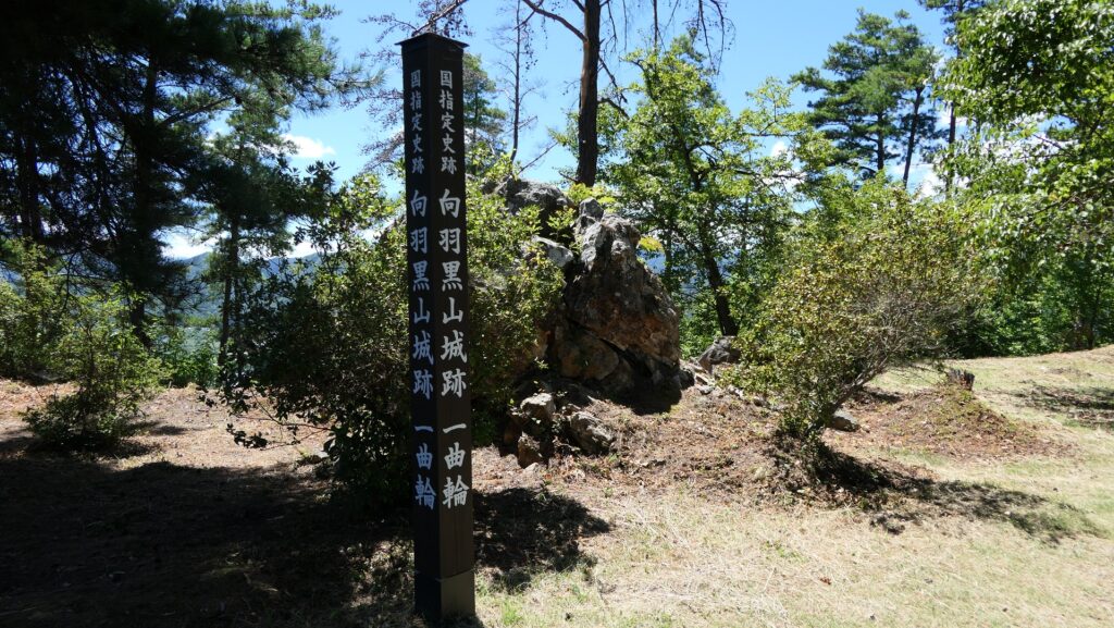
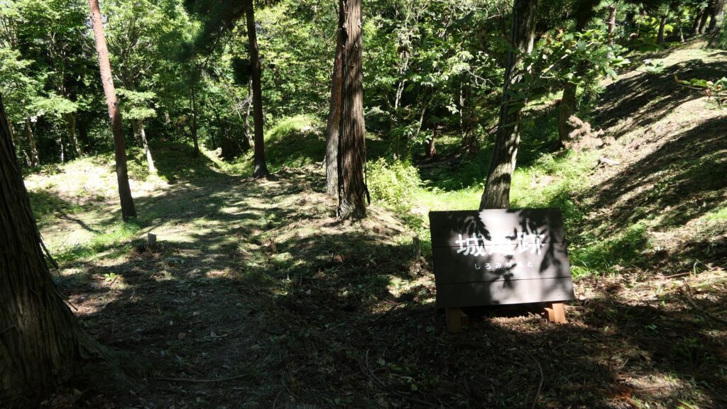
Final place of Final Castle
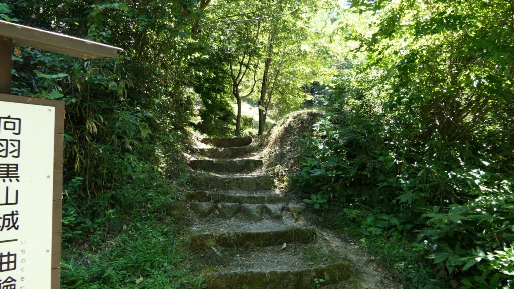
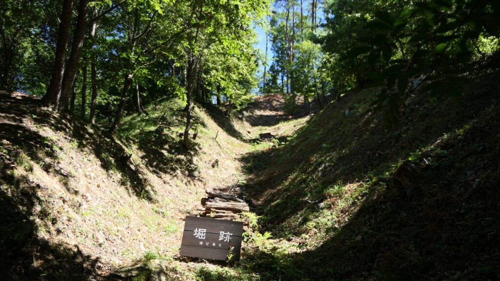
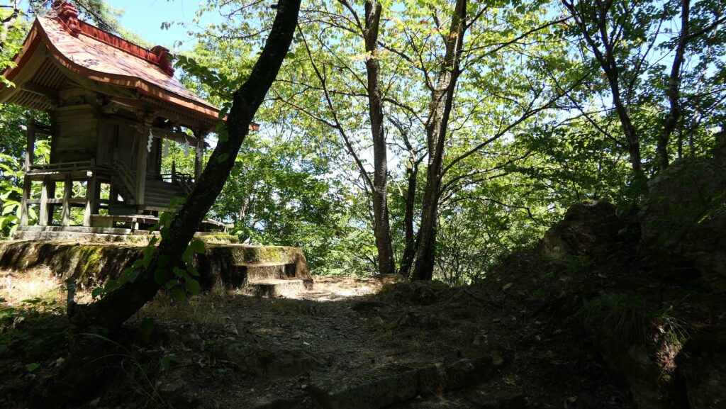
The trail goes in a zigzagged pattern and reaches the Main Enclosure. It is also protected by other alternating gate, earthen walls and dry moats like the Second Enclosure, but smaller and had steeper terrain, so it can be seen as the final place of the final castle.
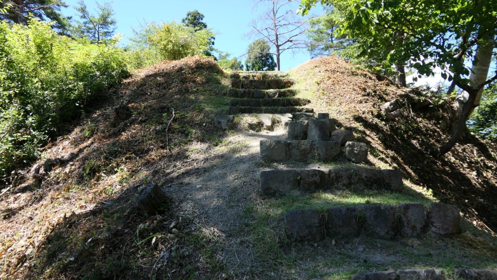
The zigzagged trailThe entrance ruins of the Main EnclosureThe Main Enclosure is surrounded by dry moats and earthen walls as wellGoing to the topThe top of the Main EnclosureA view from the enclosure
Later History
The mountain, where Mukai-Haguroyama Castle was built, was first designated as a natural park in 1953 and the forest road was developed on the mountain in 1964. As for the castle ruins, they were first designated as a historic site of Hongo Town (at that time) in 1974. The excavations of the ruins have been done since 1982. As a result, they were finally designated as a National Historic Site in 2001.
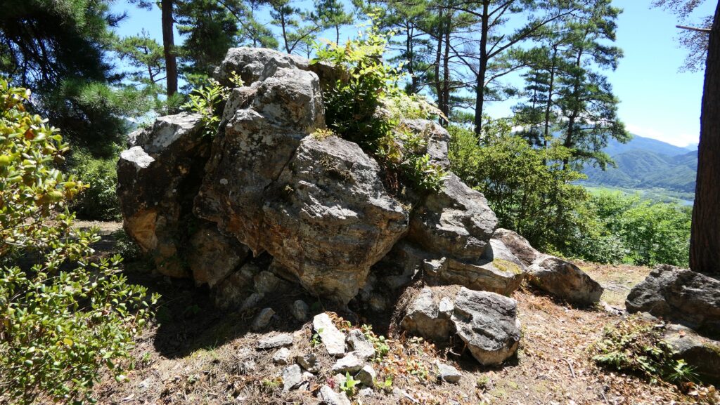
There is a huge rock on the Main Enclosure, which was partially cut to provide stone materials
My Impression
I visited the ruins of Mukai-Haguroyama Castle twice. During my first visit, I just found the castle ruins simply becoming the natural park. However, in my second visit, I was advised at the Mukai-Haguro Gallery in advance, so that I was able to see the major spots of the castle easily. In my experiences, I would like Aizu-Misato Town, the current owner of the ruins to install a streamline path for walking from the foot to the top which would make visitors better understand what the castle looked like.
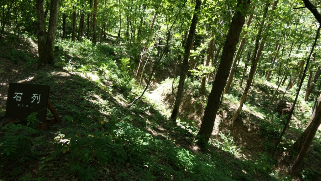
there are many paths in the Third Enclosure, like a maze
How to get There
If you want to visit there by car, it is about a 15-minute drive away from Nitsuru smart IC or a 20-minute drive away from Aizuwakamatsu IC on the Banetsu Expressway. There are several parking lots for each spot of the ruins. By public transportation, it takes about 20 minutes on foot to get the northern entrance of the park from JR Aizu-Hongo Station. From Tokyo to the station: take the Tohoku Shinkansen super express, transfer to the Banetsu-sai Line at Koriyama Station, and transfer to the Tadami Line at Aizuwakamatsu Station.
The ruins of Mukai-Haguroyama Castle have been developed as part of the expansive Hakuho-zan Park including three mountains. The ruins are on one of which, Iwasaki-yama Mountain, which is 50 hectares in size.
Features
Part of expansive Natural Park
Today, the ruins of Mukai-Haguroyama Castle have been developed as part of the Hakuho-zan Park. The park is an expansive natural park which is 112 hectares in size, including three mountains, Kannon-yama, Haguro-yama, and Iwasaki-yama. The castle ruins are on the Iwasaki-yama Mountain, which is 50 hectares in size. The ruins are also huge and mixed with the park’s other facilities like adventure playgrounds, promenades, and arbors.
The map around the Hakuho-zan Park
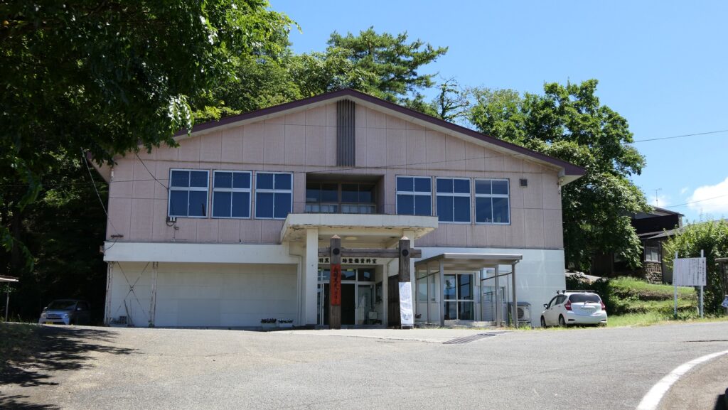
Therefore, it may be difficult for visitors to go around all of the ruins without proper instructions. It is recommended to visit the guidance facility called Mukai-Haguro Gallery in advance to get the information of the ruins. Please make sure that the facility is open only on weekends and holidays from mid-April to mid-December. In addition, please check if the ruins are open or not, for example, in cases of bears being found. Anyway, let me introduce the summary of the ruins.
The Mukai-Haguro Gallery
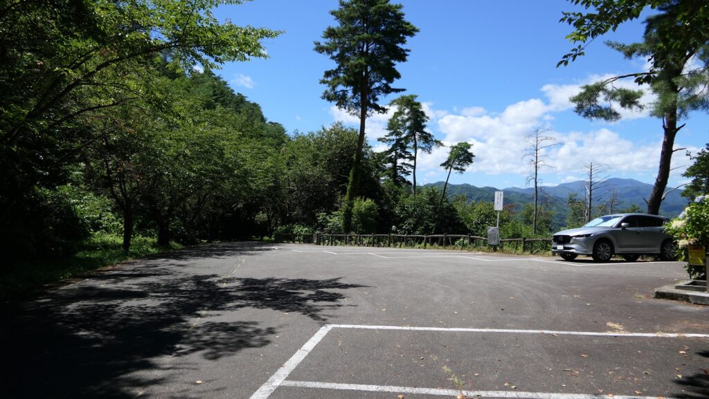
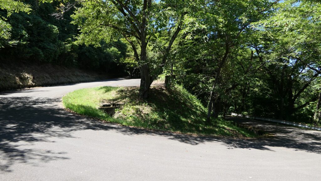
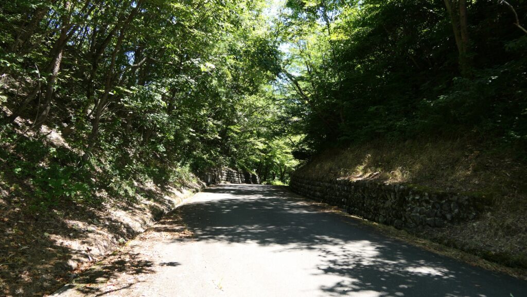
If you enter the park from the north beside the Mukai-Haguro Gallery, you can go on the paved forest road over Kannon-yama and Haguro-yama Mountains to the castle ruins on Iwasaki-yama Mountain in the back even by car. However, please be careful when passing each other because the road is very narrow.
The map around the castle
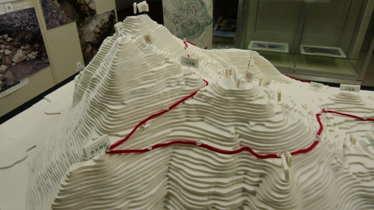
The forest roag though the parkThe diorama of the castle ruins, exhibited by the Mukai-Haguro Gallery, the red line shows the forest road
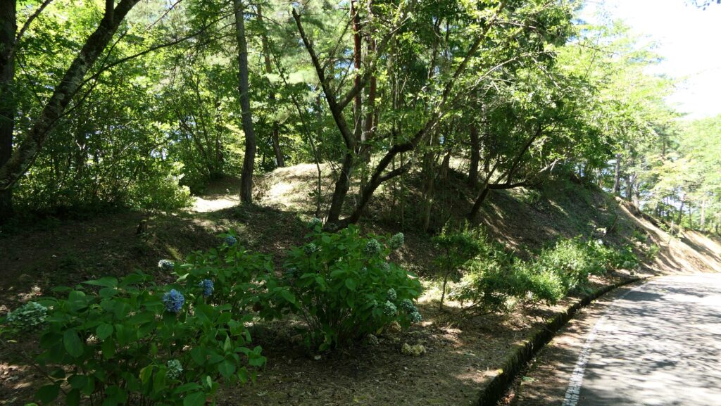
Large Third Enclosure
If you manage to find the administration building of the park on the right, it is around the Third Enclosure of the castle. The enclosure is spacious which was said to be used as a riding ground for horses. Its thick earthen walls and deep dry moats are still there. There are also the Northern Enclosure and the ruins of Moriuji Ashina’s residence across the road.
Around the administration buildingThe Third EnclosureThe earthen walls of the Third EnclosureThe dry moats of the Third Enclosure
Next, you can go up the road and you will find Ochayaba (meaning the Tea House) Enclosure on the left, which is a viewing spot. It is said that Moriuji held tea ceremonies there.
The Tea House EnclosureA view from the enclosure
Second Enclosure as Center of Castle
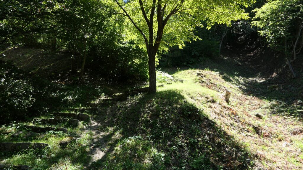
If you go further and turn right along the road, while seeing Benten Enclosure on the left, you will be between the Second Enclosure on the right and the Main Enclosure on the left. In fact, the road at the spot is the bottom of the former ditch dividing them.
Going on the forest roadThe Benten EnclosureThe former ditch between the Main and Second EnclosuresThe left ridge is the Main Enclosure and the right one is the Second Enclosure, according to the diorama
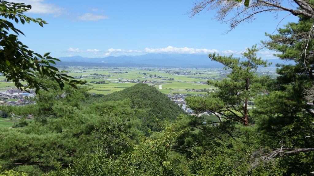
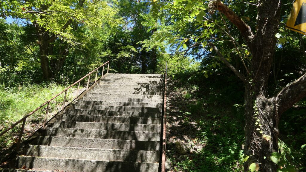
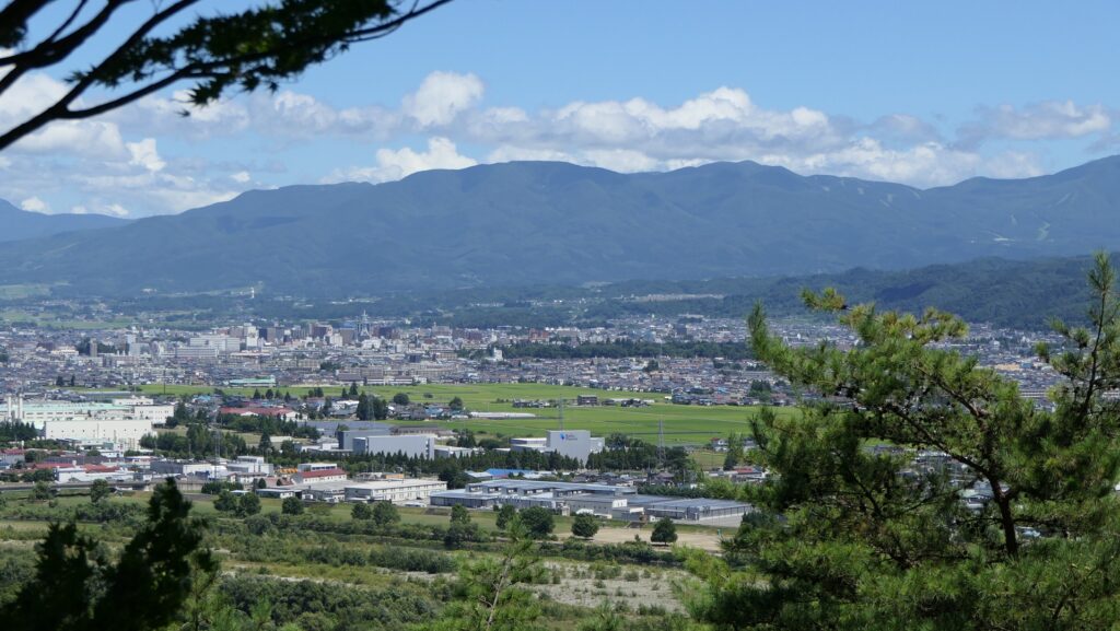
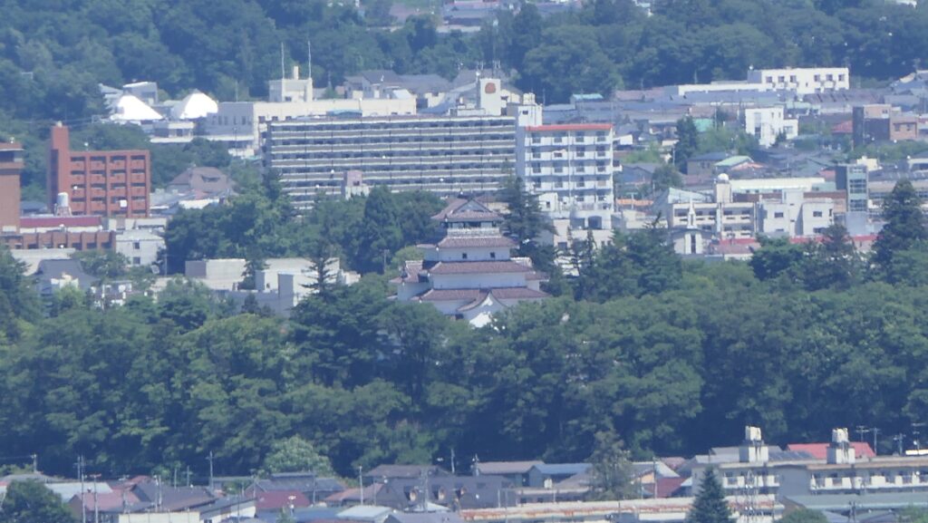
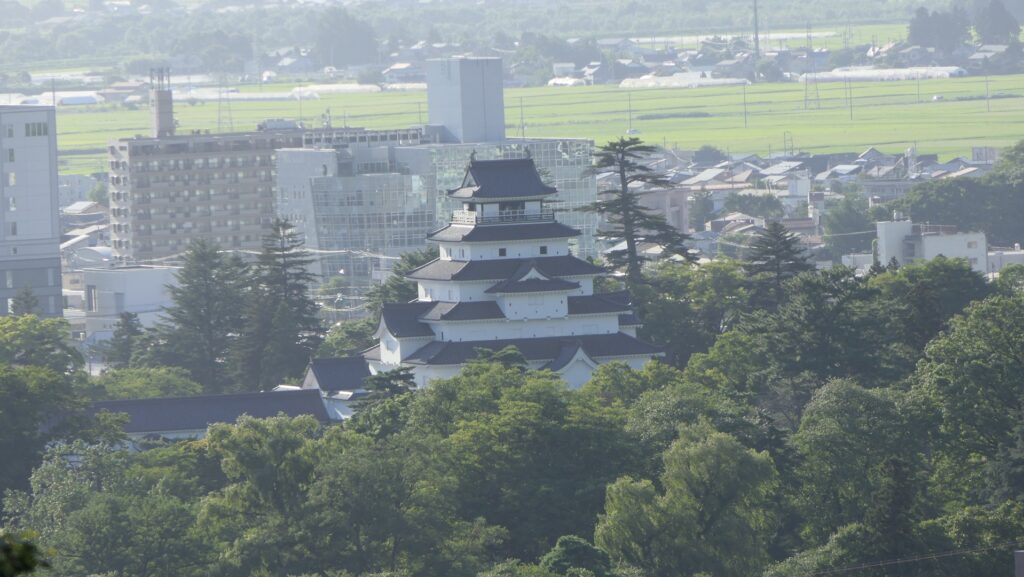
The Second Enclosure is on the top of a ridge which was thought to have been the center of the castle as it was larger and has a better view than the Main Enclosure. In addition, the Waterwell Enclosure is just below it. You can climb to the top and understand these points while seeing a great view of the Aizu Basin and Wakamatsu (the former Kurokawa) Castle
Climbing to the top of the Second EnclosureThe top of the Second EnclosureA view from the enclosureYou can see Wakamatsu Castle in the view
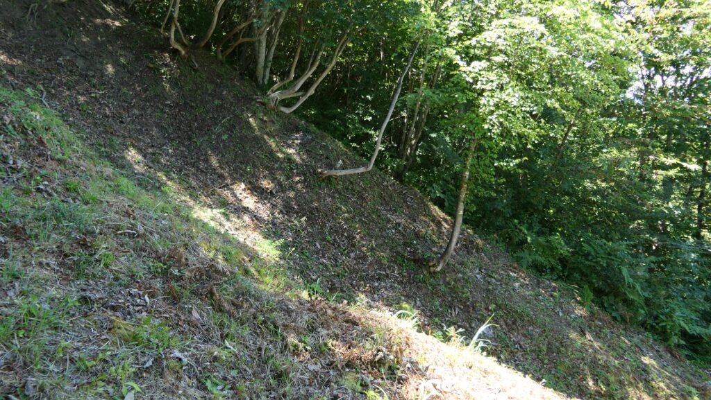
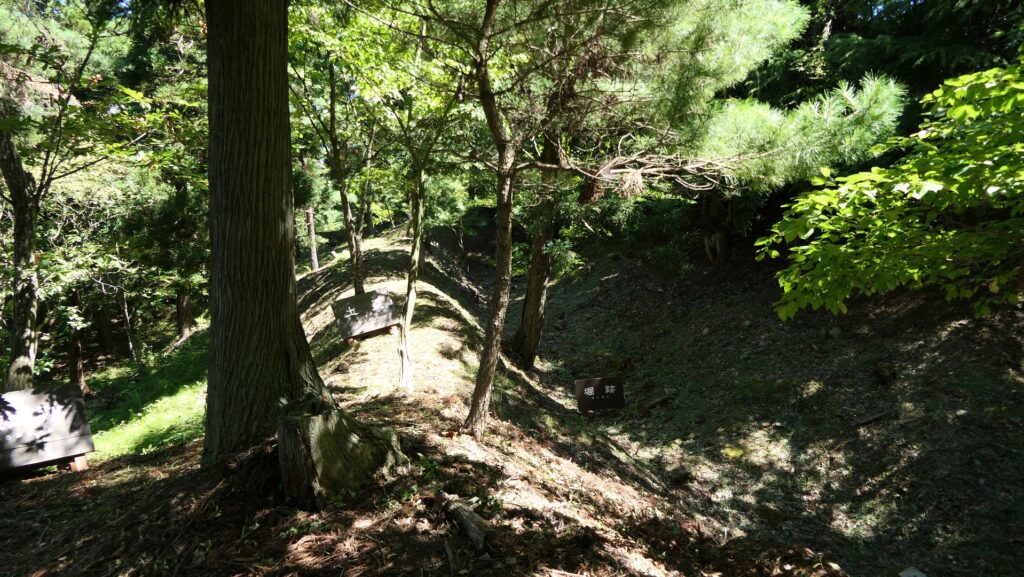
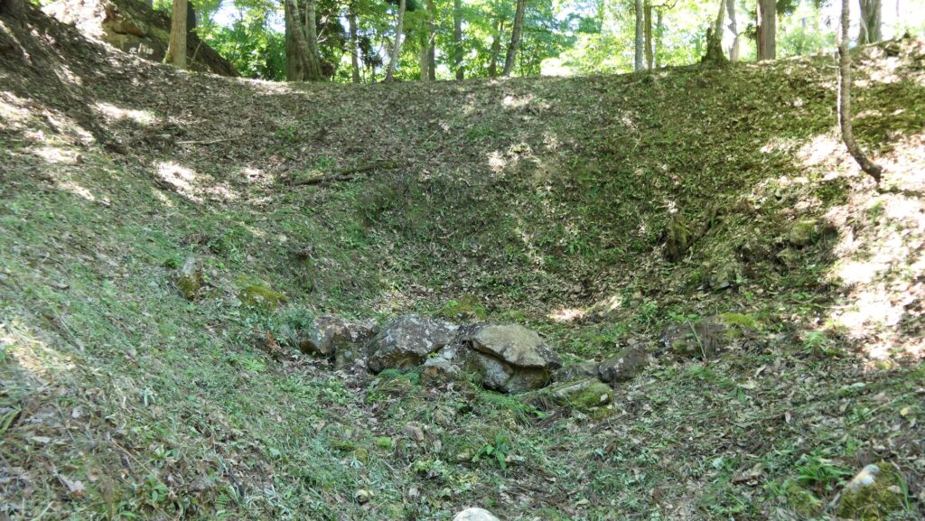
If you climb down and walk around the enclosure, you will see the essence of the castle. It is mostly soil-made structures all around. For example, the enclosure is surrounded by earthen walls and dry moats which are partially supported by stone mounds. The entrance of the enclosure consists of alternating earthen walls which also use large stones. However, these stones mostly collapsed. The original path through the castle is also made looking like another dry moat.
The earthen walls and dry moats surrounding the Second EnclosureThe dry moats are partially supported by the stone moundsThe ruins of the entrance to the enclosureThere are some large stones lying around, which were probably used for the entranceThe ruins of the original path
Moriuji Ashina. who became a great warlord, retired, transferred the headship of the family to his son and started the construction of a new castle as his retreat, which would be Mukai-Haguroyama Castle.
Location and History
Origin of Castle’s name
Mukai-Haguroyama Castle was located in the Aizu area of the modern day Fukushima Prefecture. Regarding castles and ruins, the area is much more known for Wakamatsu Castle which was the home base of the Aizu Domain during the Edo Period. However, the castle had been called Kurokawa Castle when the Ashina Clan owned it and the clan had a much larger Mukai-Haguroyama Castle than Kurokawa Castle at that time. The mountain that Mukai-Haguroyama Castle was built on was originally called Iwasaki Mountain, so the castle was first called Iwasaki Castle as well. Alternatively, the mountain was called Mukai-Haguroyama Mountain, which means the mountain opposite of Haguroyama Mountain. These two mountains actually look like they are standing in a row, so the castle was eventually called Mukai-Haguroyama Castle sometime later.
Wakamatsu Castle seen from Odayama Castle RuinsMukai-Haguroyama (or Iwasaki) Mountain on the left and Haguroyama Mountain on the right, seen from Odayama Castle Ruins
Ashina Clan settles in Aizu area
The Ashina Clan originally came from the Sawara Clan, a branch family of the Miura Clan, which was a senior vassal family of the Kamakura Shogunate in the early Middle Ages, which was based in Miura Peninsula of Sagami Province (now Kanagawa Pref.). After Yoritomo Minamoto, the founder of the shogunate invaded the Tohoku Region in 1189, the Sawara Clan got a territory in the Aizu area for their contributions. Some of the clan settled in the area and renamed their family names, such as the Inawashiro, Kitada, and Shingu Clans. In the early 14th Century when the Ashikaga Shogunate was established, the Ashina Clan, another branch family of the Sawara Clan, was active in the Tohoku Region including the Aizu area, who called itself “the Aizu Governor”. As a result, the clan moved their home base from Ashina in Miura Peninsula to the Aizu area and built a new hall called Otakaki-no-tate in the middle of the century, which would later be known as Kurokawa Castle.
The location of the castle and the birthplace of the Ashina Clan
However, the Ashina Clan was not able to govern the area easily because the other relatives of the Sawara Clan and other local clans did not obey the Ashina Clan just with its authority. The Ashina Clan needed to force them to obey the clan by force, otherwise it had to defeat them. For example, the Ashina Clan battled and defeated the Kitada and Shingu Clans. All of which, including the Ashina Clan, came from the same Sawara Clan. Another relative, the Inawashiro Clan became a senior vassal of the Ashina Clan after they fought with each other. The Ashina Clan also needed to prevent great lords outside the Aizu Area, such as the Date, Nikaido, and Satake Clans from invasion of the area. The lords of the Ashina Clan usually lived in Kurokawa Castle in the plain Aizu Basin. They also built Odayama Castle on Odayama Mountain beside the basin, about 1.5km away from Kurokawa Castle, as a final place for emergencies. Such a combination can also be seen in the cases of other clans over the whole country during the Sengoku Period. Odayama Castle was also used as their ancestors’ graveyard.
The relief map around Kurokawa Castle
The ruins of Odayama Castle (its Main Gate)The ruins of the Ashina Clan’s graveyard
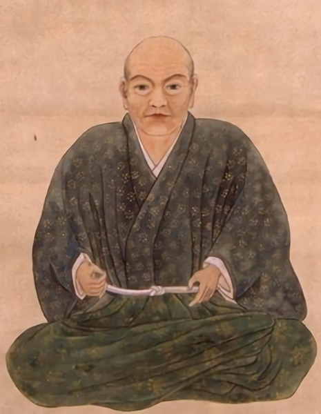
Moriuji Ashina builds Mukai-Haguroyama Castle as his Retreat
The Ashina Clan’s power reached its peak when Moriuji Ashina, the lord of the clan at that time, reigned in the middle of the 16th Century. His government of the Aizu area became stable and he also had diplomatic relationships with other great warlords in Japan, like Kenshin Uesugi, Shingen Takeda, and Masamune Date, which meant he became a great warlord as well. What he did next was retire and transfer the headship of the family to his son and start the construction of a new castle in 1861 as his retreat and the replacement for Odayama Castle, about 5km away from Kurokawa Castle in the south, which would be Mukai-Haguroyama Castle. However, the castle was too large for the retreat and the replacement, in fact, Moriuji still had the real power of the clan and the castle looked like a new home base for the clan. The construction lasted for 8 years until 1568, which resulted in one of the largest mountain castles in the Tohoku Region. The castle was built using soil, which was a typical method of building castles in eastern Japan, and had uncountable enclosures protected by structures using and processing natural terrain, such as deep dry moats, thick earthen walls and artificial vertical cliffs.
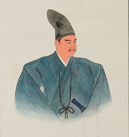
The portrait of Moriuji Ashina, from the database of Historiographical Institute, the University of Tokyo (licensed under Public Domain via Wikimedia Commons)The imaginary drawing of Mukai-Haguroyama Castle, from the signboard at the site
Castle is abandoned after being followed by Several Loads
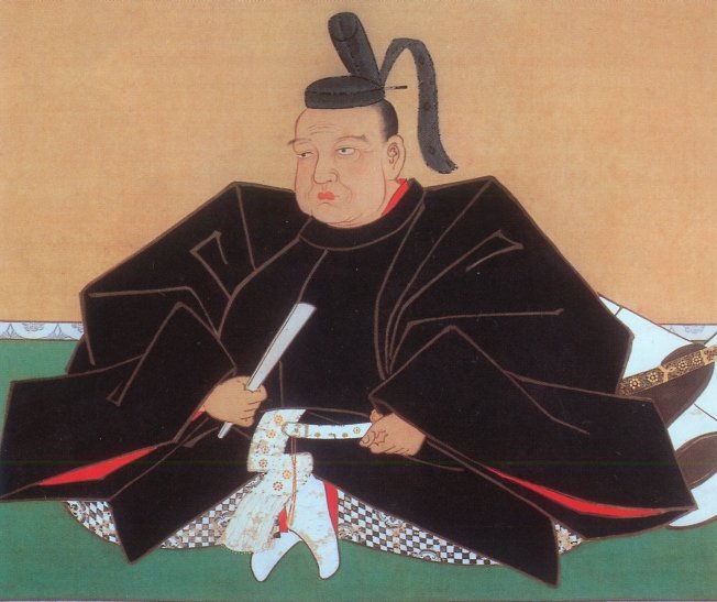
The Ashina Clan’s power decreased after Moriuji died in 1580 as his successors died young. Because of that, the clan and its senior vassals had to accommodate their new lord from a great warlord outside to maintain their territory. The candidates were ones from the Satake Clan and the Date Clan. As a result, they concluded that the successor would come from the Satake Clan, named Yoshihiro Ashina in 1587. However, this event caused a split in the clan, into the faction in power and the other supporting Date. In 1589, Masamune Date started to invade Ashina’s territory. Yoshihiro tried to repel the invasion, but many of his senior vassals, including the relative Inawashiro Clan, supported the Date’s side or left him. He was defeated by Masamune in the battle of Suriagehara and escaped form the Aizu area to his parents’ home. This battle resulted in Kurokawa Castle, the home base of the Ashina Clan being captured by Masamune and the clan’s destruction.
The portrait of Masamune Date, owned by Sendai City Museum, (licensed under Public Domain via Wikimedia Commons)
Mukai-Haguroyama Castle was followed by Masamune Ujisato Gamo, and Kagekatsu Uesugi like they used Kurokawa Castle (renamed to Wakamatsu Castle). This was because they still needed to use it as a final castle for emergencies like a battle. However, the castle was eventually abandoned after Kagekatsu was transferred to Yonezawa Castle in 1601 due to the defeat in the decisive battle in 1600 against Ieyasu Tokugawa who would be the founder of the Tokugawa Shogunate.
The portrait of Ujisato Gamo, owned by Aizu Wakamatsu Library (licensed under Public Domain via Wikimedia Commons)The portrait of Kagekatsu Uesugi, owned by Uesugi Shrine (licensed under Public Domain via Wikimedia Commons)The ruins of Mukai-Haguroyama Castle