Features
You can see Castle from Station
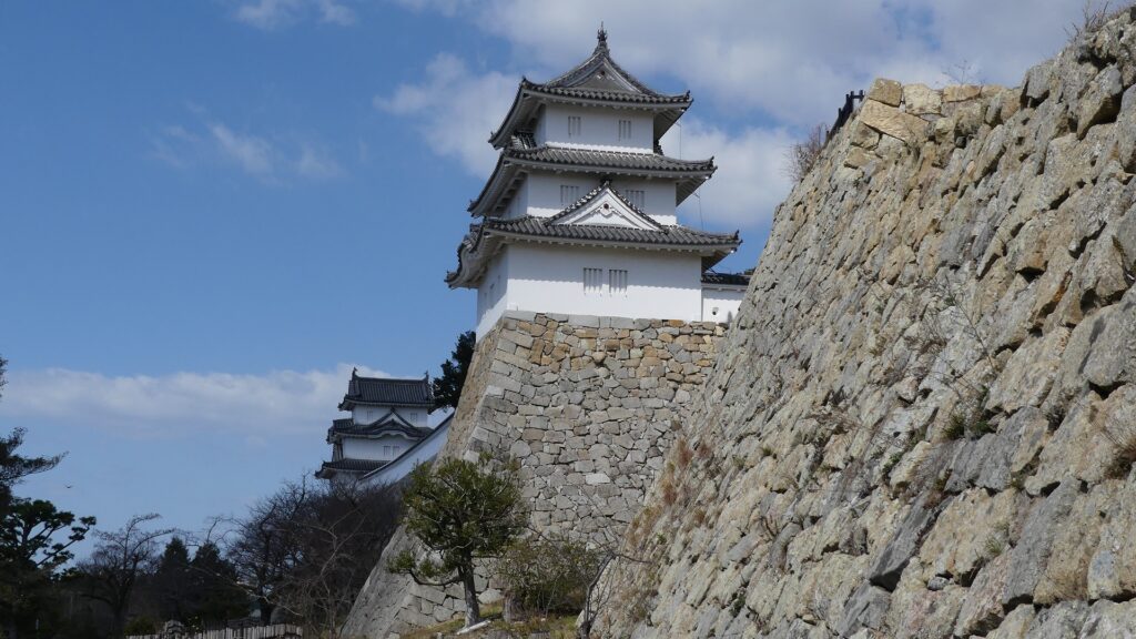
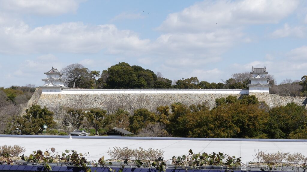
If you visit the ruins of Akashi Castle by train, you will see evidence of what was a very sturdy castle from your first step on the platform of Akashi Station. You will see the two remaining three-story turrets called Hitsujisaru Turret (on the left) and Tatsumi Turret (on the right) connected by the plaster wall on the hill. How wonderful they are!
Around the Main Gate
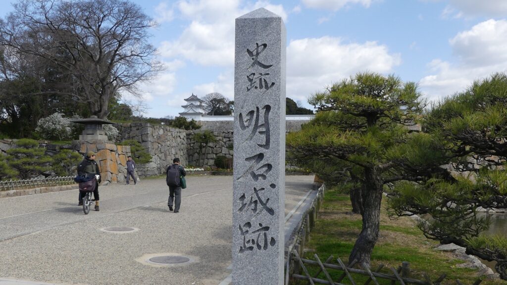
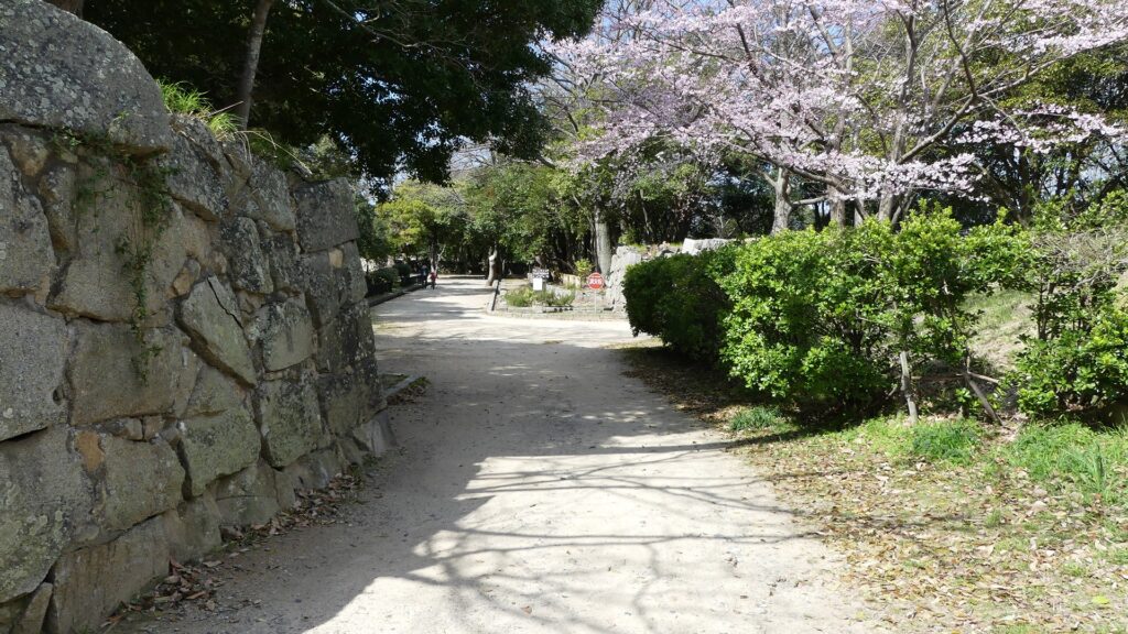
The ruins of the castle have been developed as part of Akashi Park, inclusive of the inside of the Middle Moat. The front entrance of the park was the Main Gate of the castle. Its stone walls remain forming the square space inside called “Masugata”. The plain area is used as a relaxing zone and facilities such as the stadium which was once the Main Hall for the lord.
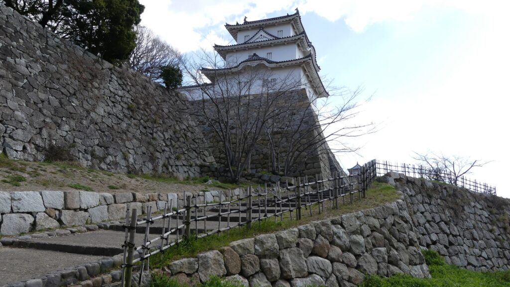
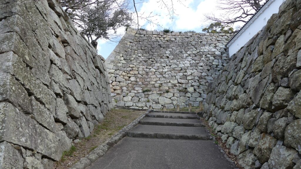
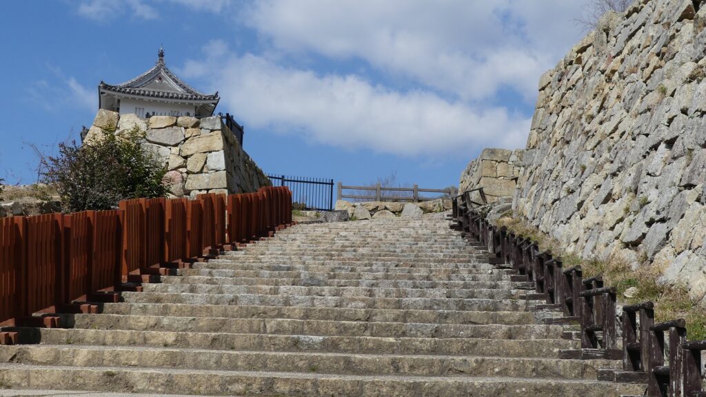
Defense to protect Main Enclosure
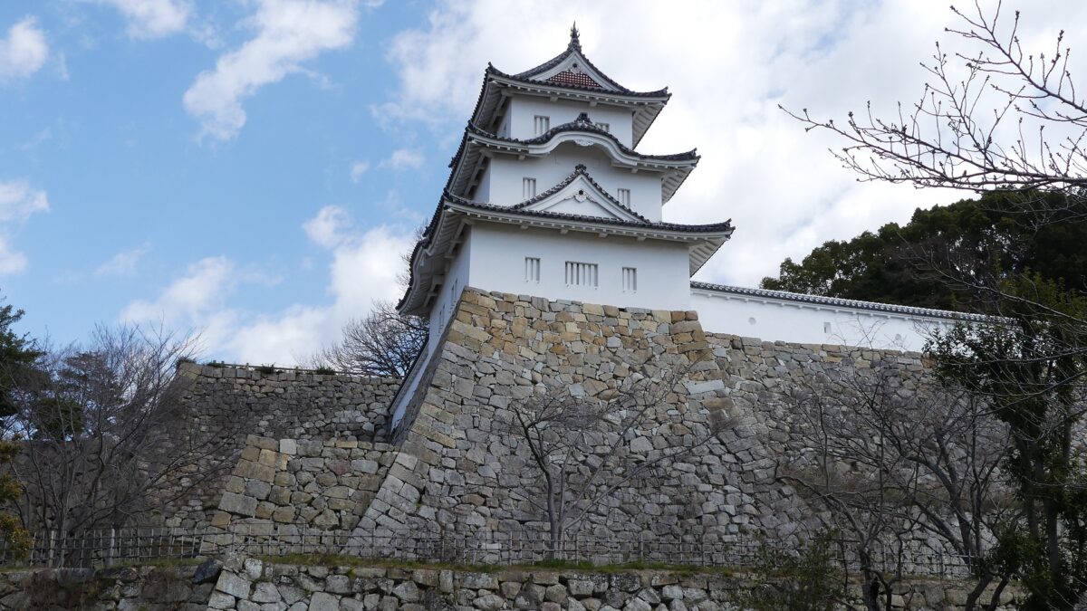
Hitsujisaru Turret of the Main Enclosure stands on the high stone walls in front of you. You can walk up on the stairways towards the turret and reach under the turret and the stone wall base for the Main Tower. However, you can’t enter the enclosure directly. You have to enter it from the back side by going through the Inari Enclosure under it. Enemies would be counterattacked from the Main Enclosure before reaching it.

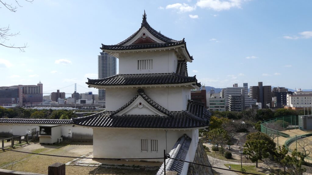
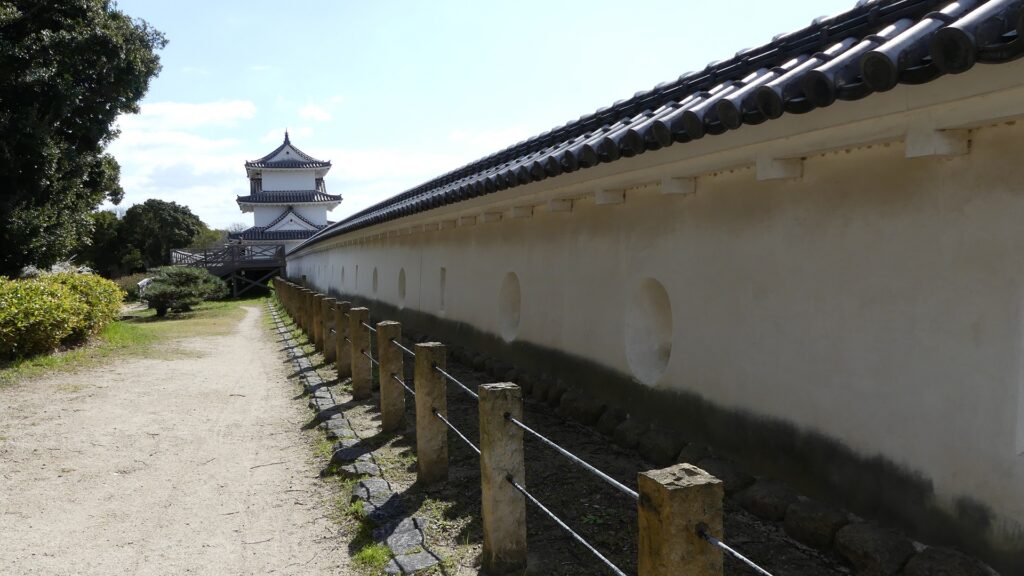
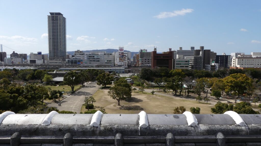
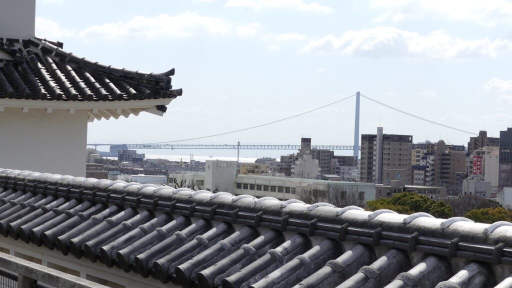
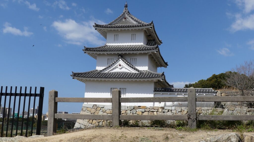
Inside of Main Enclosure
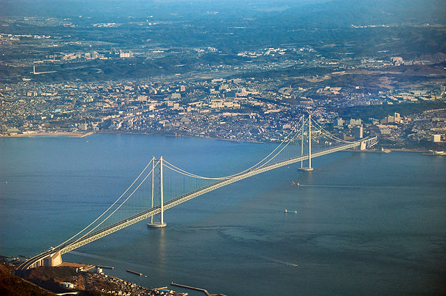
Inside the Main Enclosure, you can see the two remaining turrets close by. They are two out of the twelve remaining three-story turrets in the castles of Japan. The plaster wall between the turrets was restored recently. You can also see a great city view from the observation platform at the middle of the wall. The Akashi-Kaikyo Bridge can also be seen over Tatsumi Turret.
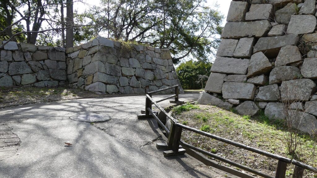
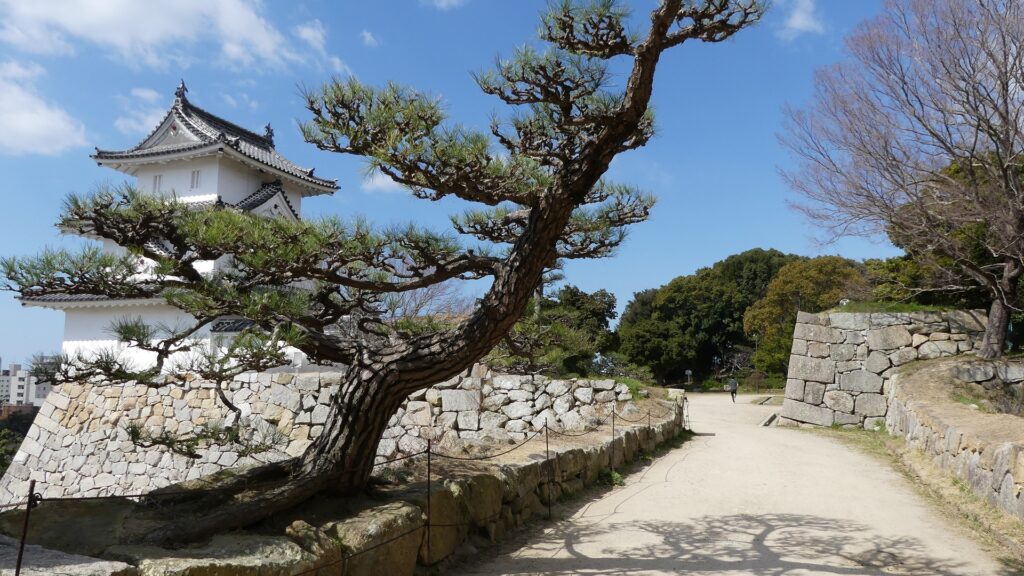
Second and East Enclosures to support Main Enclosure
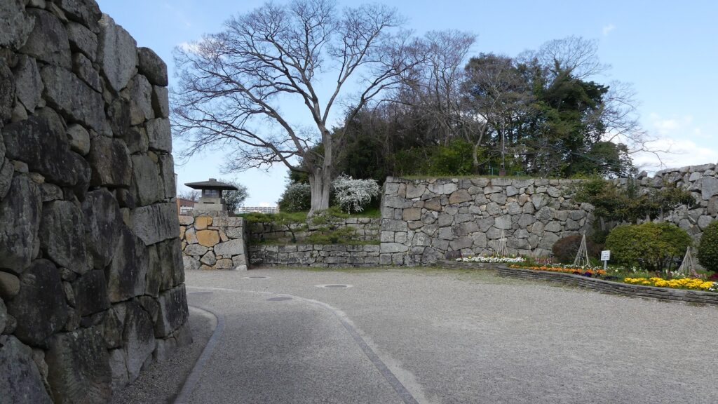
The Second Enclosure is the other connecting point to the Main Enclosure. It now has no buildings, but its stone walls and its entrance surrounded by the walls remain in good condition. You can see the good looking Tatsumi Turret in the Main Enclosure from the Second Enclosure. The East Enclosure is next to the Second Enclosure and another entrance of the park.
To be continued in “Akashi Castle Part3”
Back to “Akashi Castle Part1”