Features
From Parking lot to Main portion of Castle
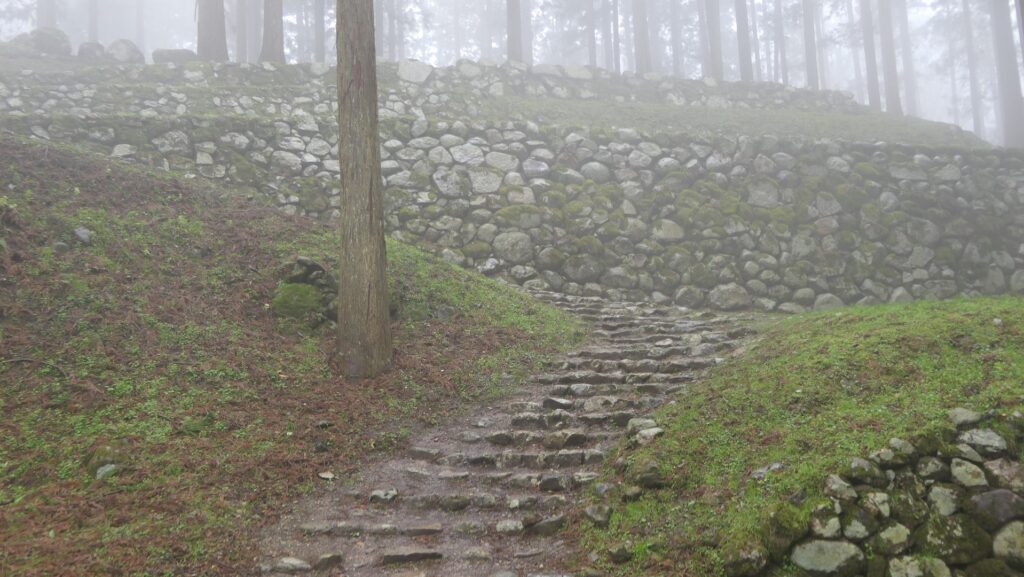
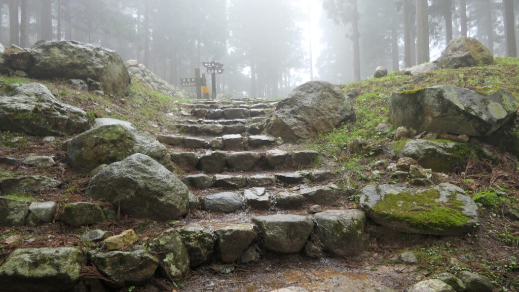
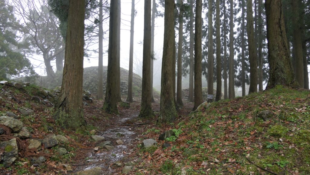
Today, you can access the main portion of the ruins of Nanao Castle directly by car. The ruins, however, don’t have castle buildings now, but their foundation remains intact. There is a parking lot on one of the enclosures under the Cho Residence. You can walk on the well developed trail to the Main Enclosure from the parking lot.
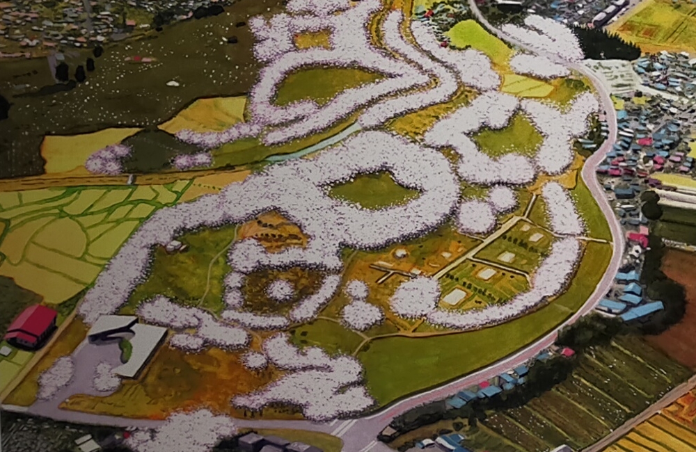
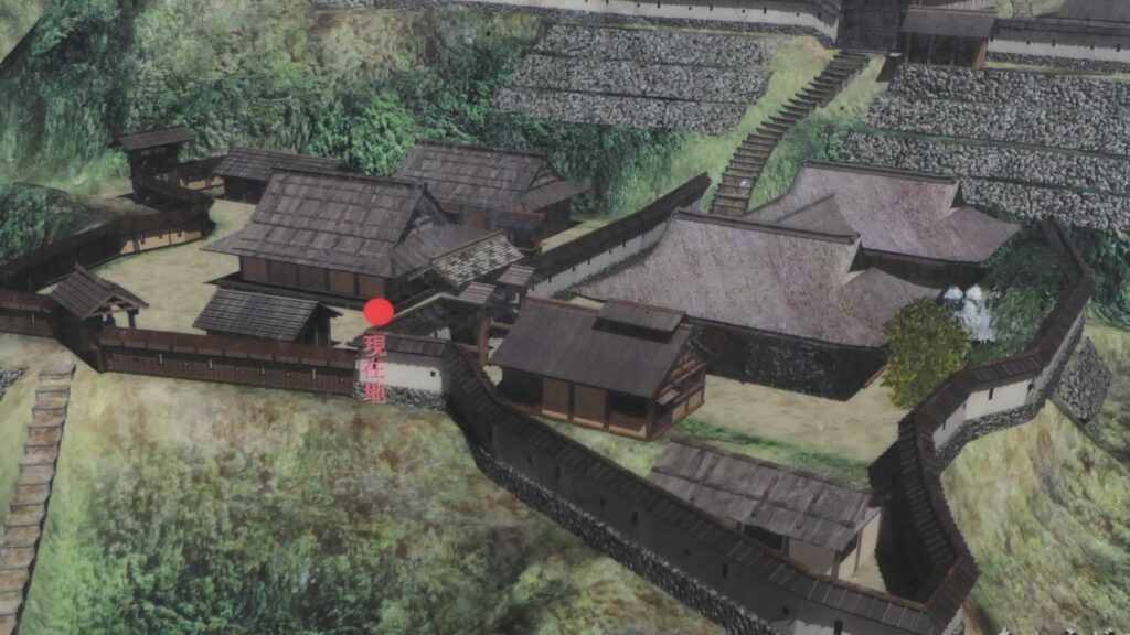
The map around the castle
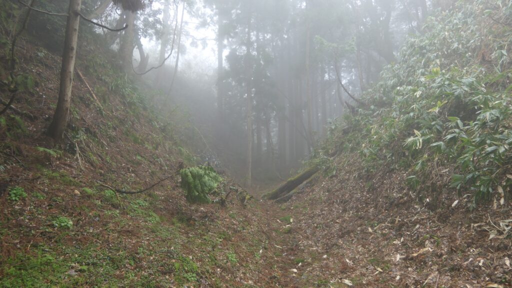
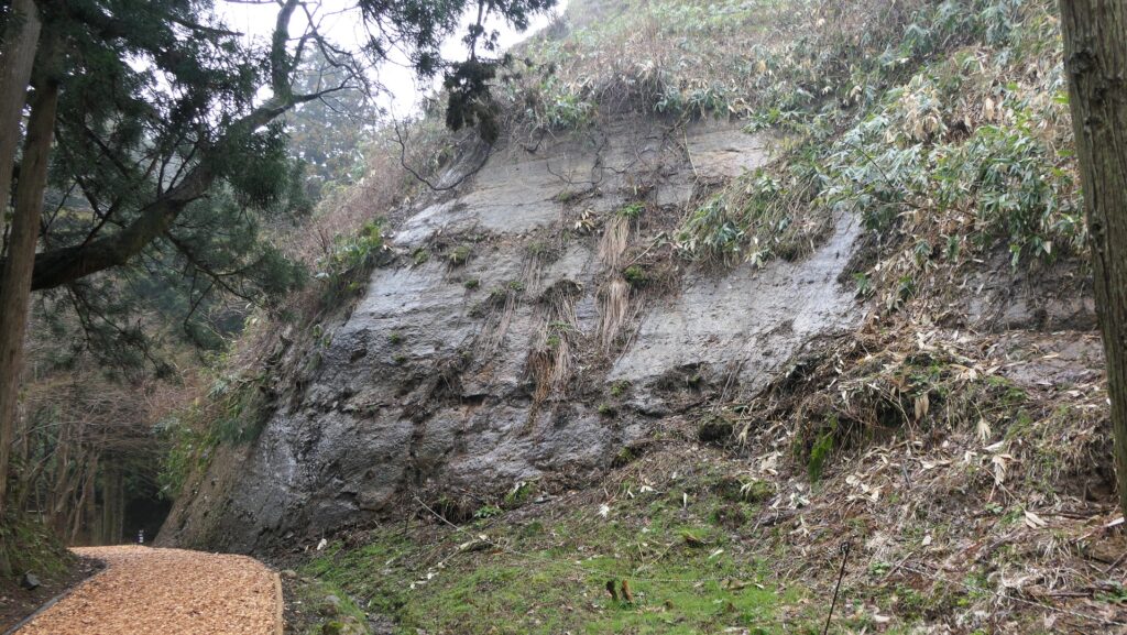
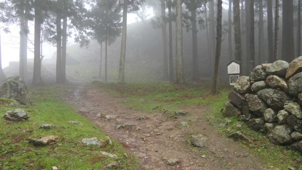
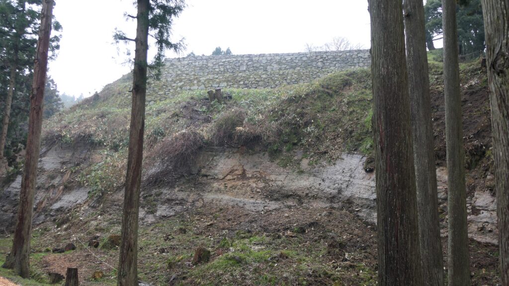
You can also see the large deep ditch called Horikiri between the Main Enclosure and the Cho Residence followed by the vertically cut cliff called Kirigishi of the Main Enclosure along the trail. They are, however, artificial.
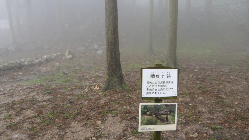
You will first reach the Chodo-maru which was the place where weapons were prepared under the Sakura Riding Ground. The original Main Route also reached the Chodo-maru in the past.
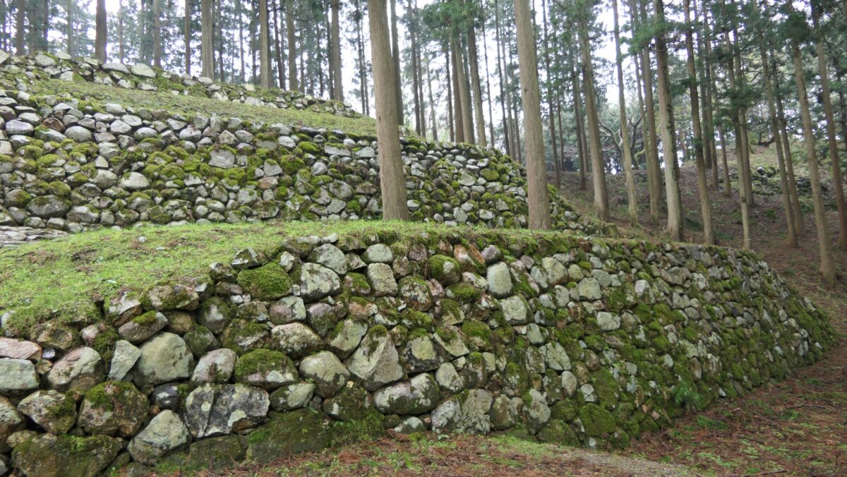
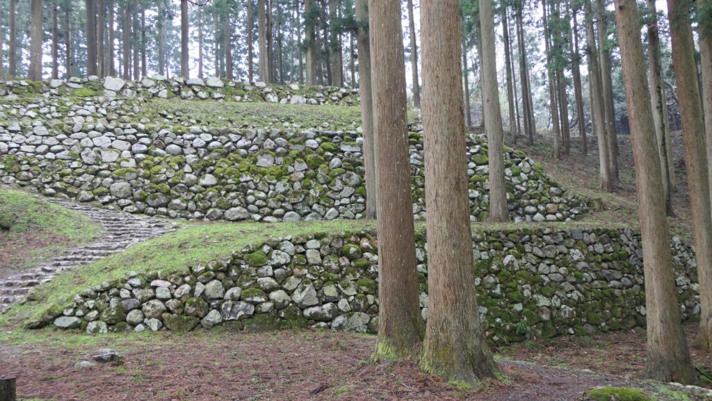
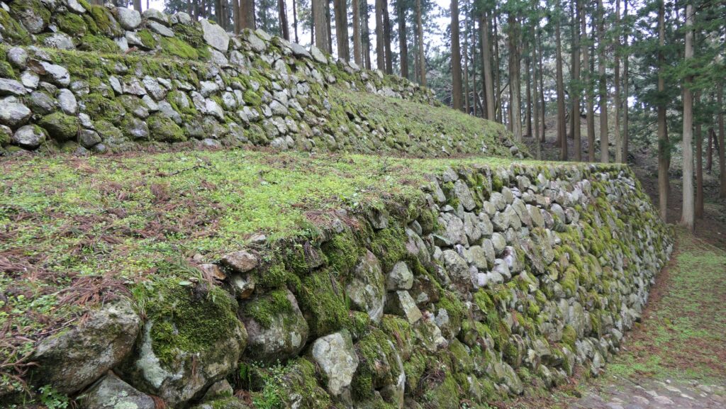
Wonderful stone walls
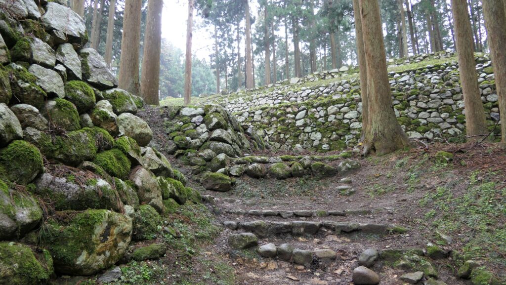
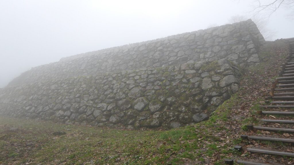
Next, you will see the large five-tier stone walls piled up naturally called Nozura-zumi when you walk up to the Sakura Riding Ground. The stone walls look beautiful because of the moss that covers it. They were built by Toshiie Maeda and are one of the highlights of the castle.
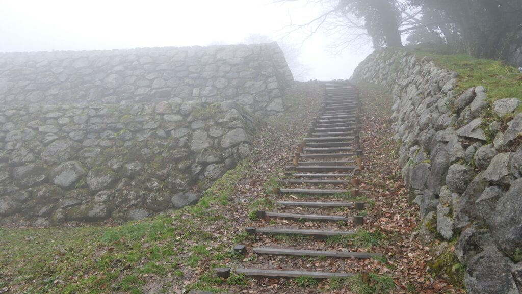
From the front of the Sakura Riding Ground, you can go straight to the Main Enclosure through the Yusa Residence. However, this route was not original. It was said to have been built when the Shiroyama Shrine was established on the enclosure about 80 years ago. Thanks to that, you can also see the great three-tier stone walls of the enclosure which is close by.
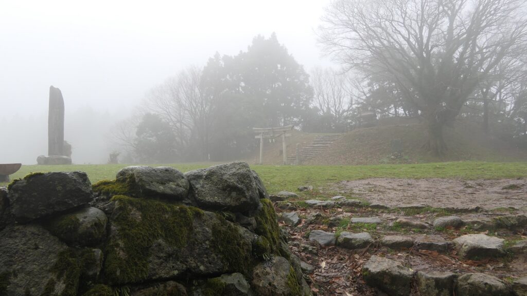
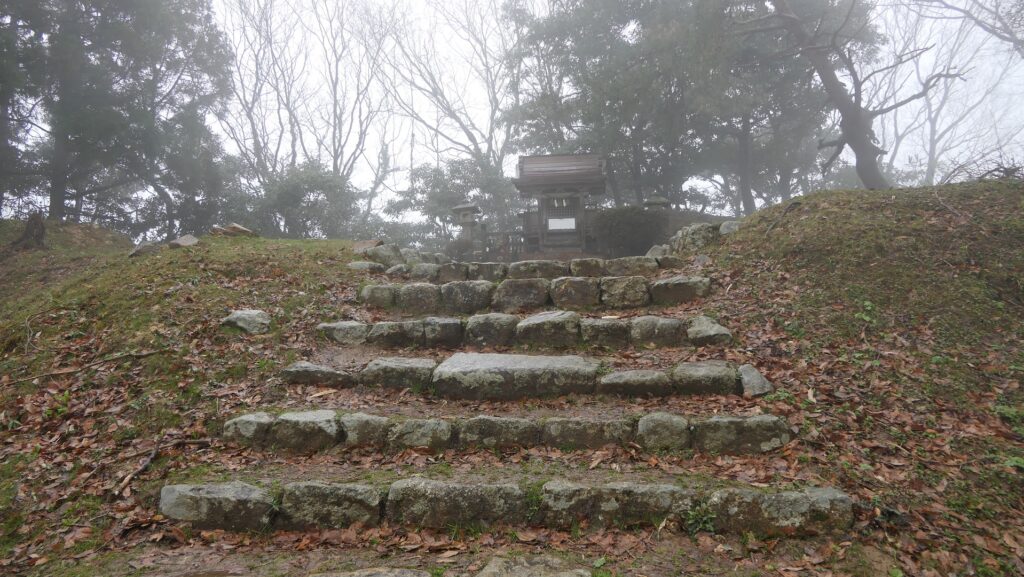
Main Enclosure was well protected
The enclosure was protected well by the stone walls and the vertically cut cliff in the past. The original route zigzagged and went around the back of the enclosure, guarded by the other square space called Soto-Masugata which was put on the outside of the enclosure.
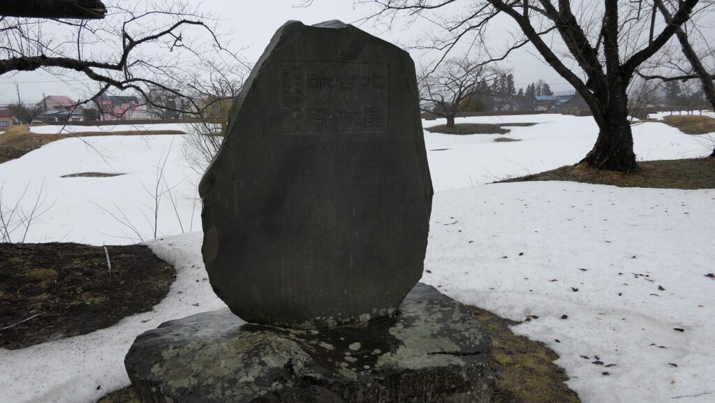
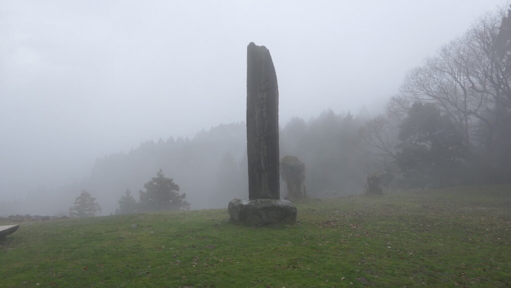
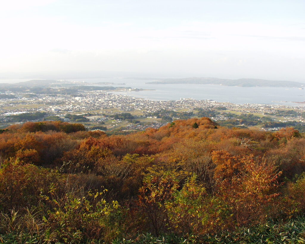
The inside of the Main Enclosure is basically empty and the monument of the castle remains standing. The shrine is on the ruins of the Main Tower. The tower is thought to have a cypress bark roof or shingled roof, because no roof tiles were ever found during the excavation. The view from the enclosure is amazing. If the weather is nice, you will be able to see the whole view of Nanao City along the Nanao Bay and Noto Peninsula.
To be continued in “Nanao Castle Part3”
Back to “Nanao Castle Part1”