Features
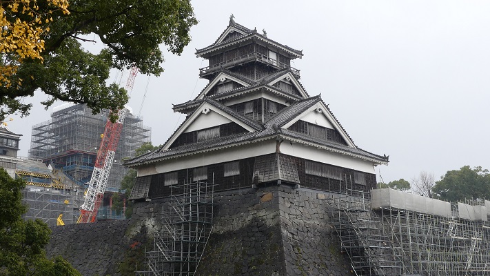
Main Enclosure still looks like Castle
Today, the ruins of Kagoshima Castle are used like that the Main Enclosure as the Kagoshima Prefectural Center for Historical Material called Reimeikan, the Second Enclosure as other public facilities, and Shiroyama Mountain as the Shiroyama Park. In particular, the Main Enclosure still looks like a castle today because its stone walls are still intact and its front gate was recently restored. If you stand in front of the enclosure, you may feel its pride as the home base of the Shimazu Clan.
The aerial photo around the castle
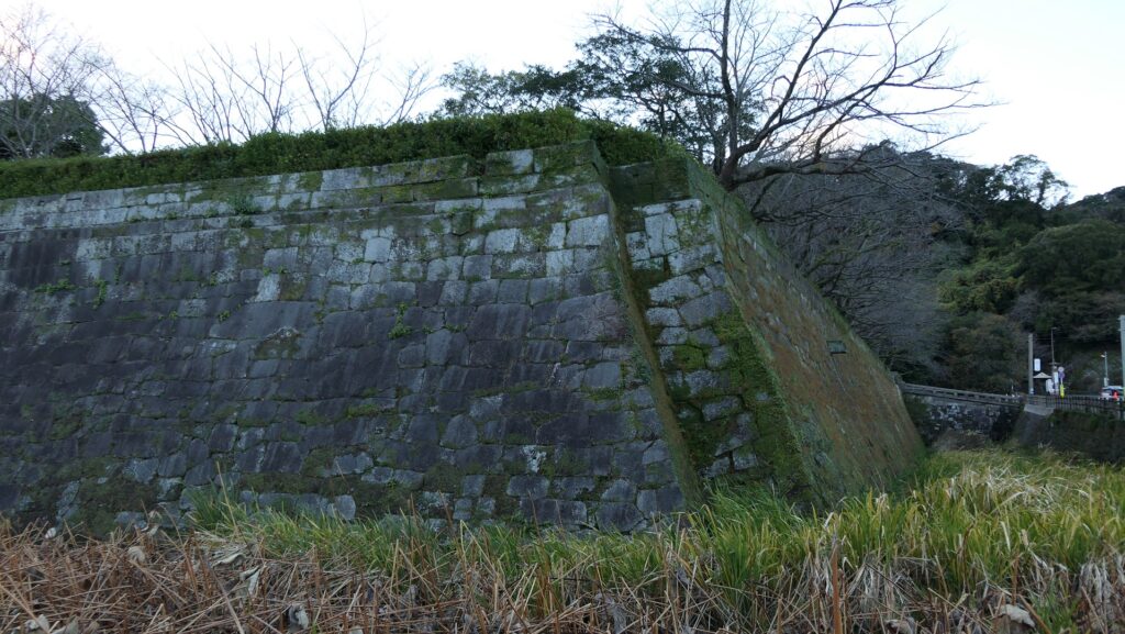
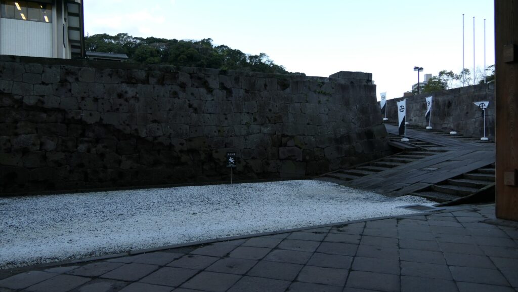
The stone walls, which are still surrounded by the water moat, are piled precisely by using well processed stones in a method called Kirikomi-hagi. An interesting thing about them is that their one corner has an internal angle of two walls, called Irisumi. This is because the corner faces the northeastern side which was thought to be an unlucky direction, called Kimon or the Devil’s Gate. People who built the castle considered that the specially built corner could prevent misfortunes from the direction.

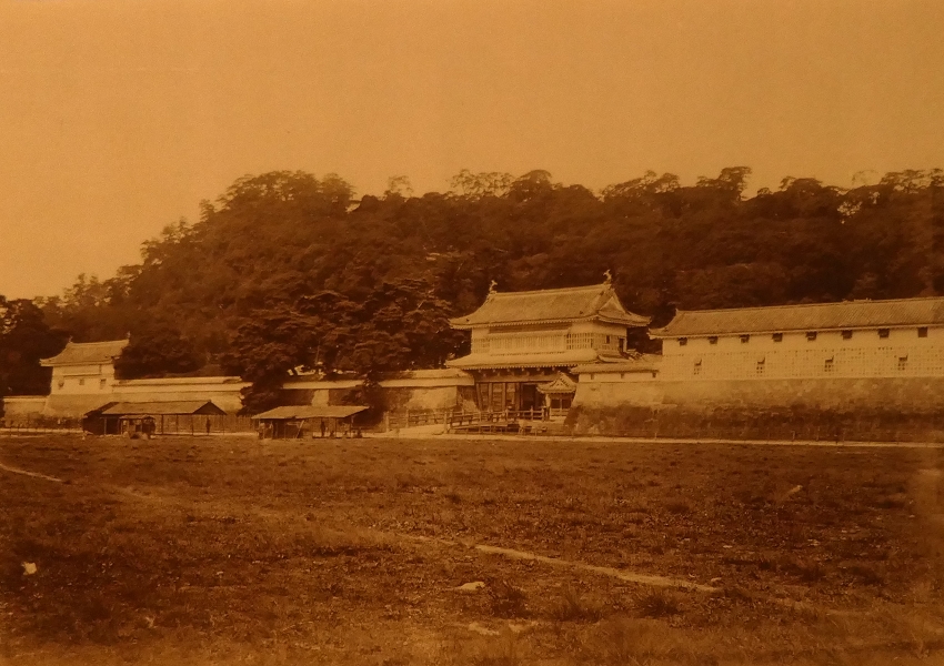
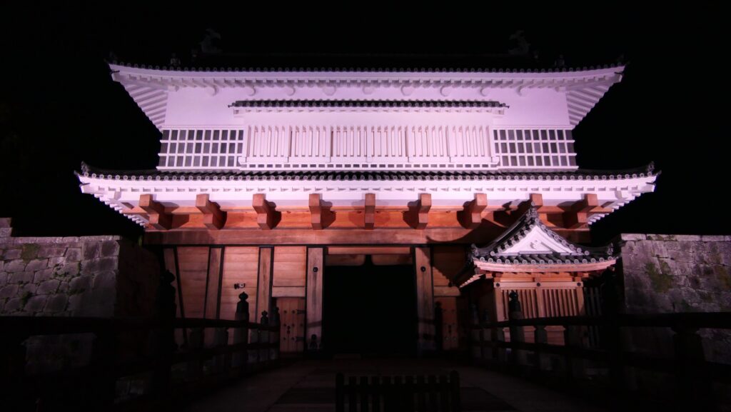
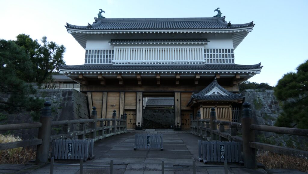
The front gate called Goro-mon stands out between the stone walls. It has been said it is one of the largest castle gates in Japan, with its height and width of about 20m. it was restored using wood in April 2020, after 147 years since it had been burned down in 1873, based on its old photos and the remaining stone foundations.
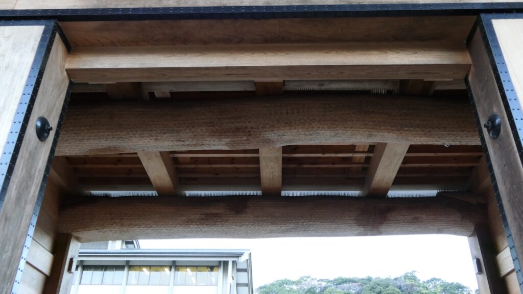
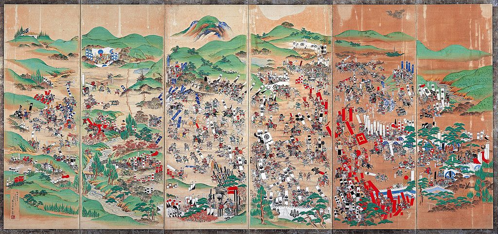
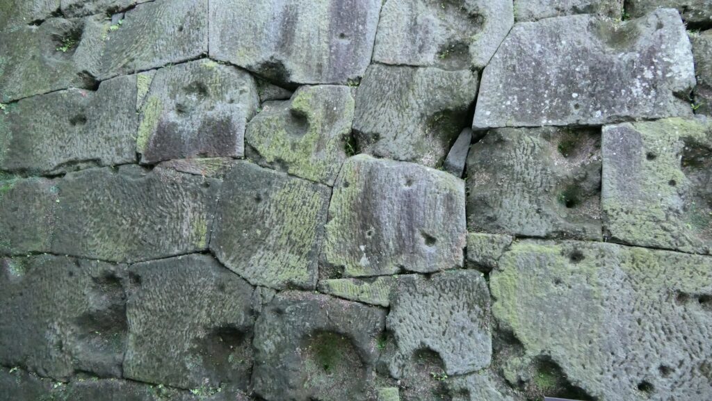
You can enter the gate by going across the original stone bridge over the moat in front of it. Other stone walls stand inside the gate and you will need to turn right and walk on the zigzagged steps or slopes to reach the center of the enclosure. You can see an uncountable number of dents on the stone walls, which were traces of gun shot by the government army in Seinan War. They make us understand how severe the attack of the army was.
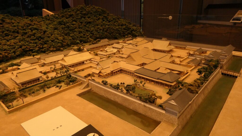
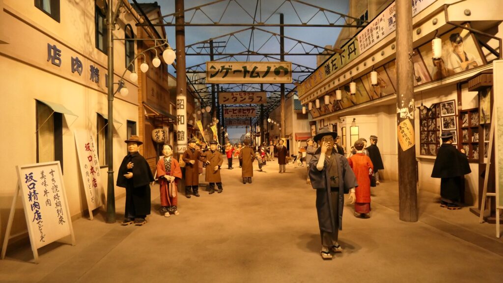
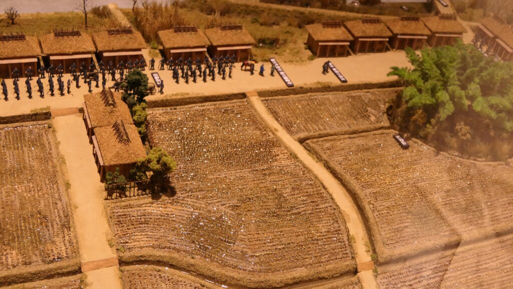
Wonderful exhibitions in Reimeikan Museum
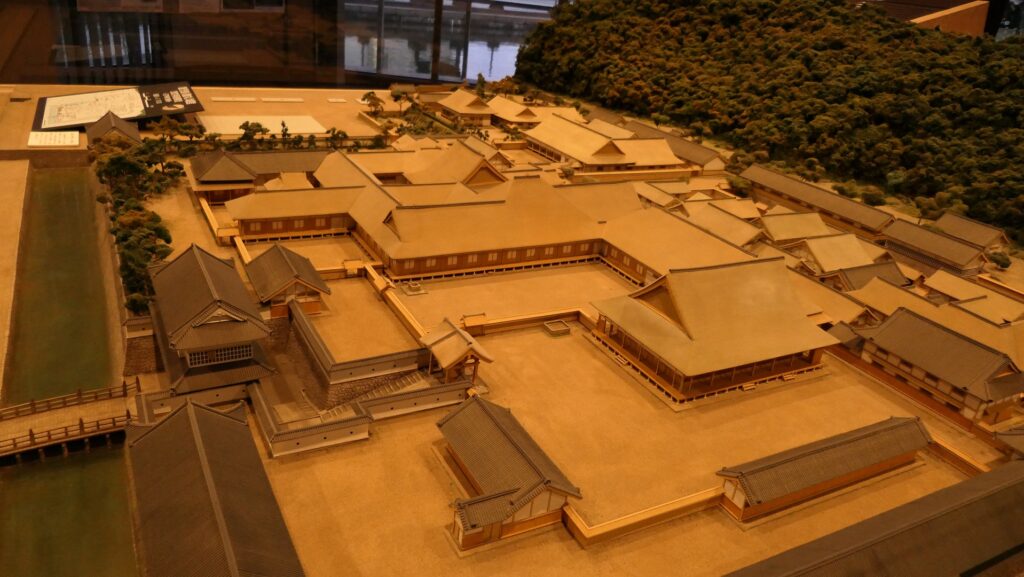
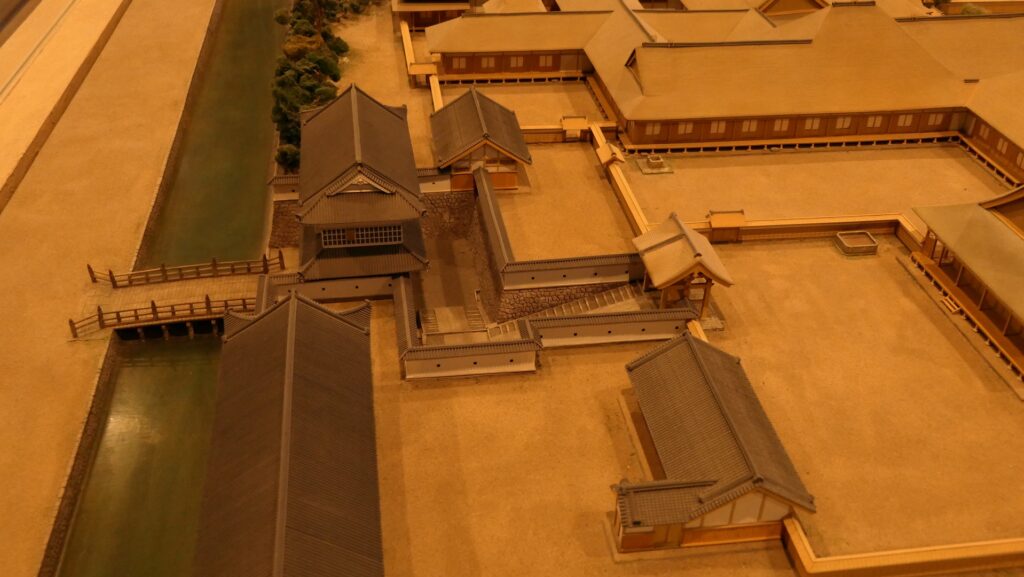
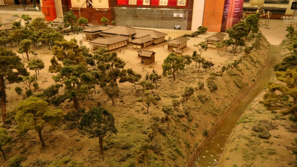
The Reimeikan is an excellent historical museum, which has huge amounts of historical, folk and art items regarding the Kagoshima Prefecture. You can learn about the history including the castle and culture of the prefecture inside. There may be too many items to see in one day. I also recommend seeing very well designed miniature models of historical buildings such as Kagoshima Castle, Shibushi Castle (a local castle in the prefecture) and Izumi Outer Castle.

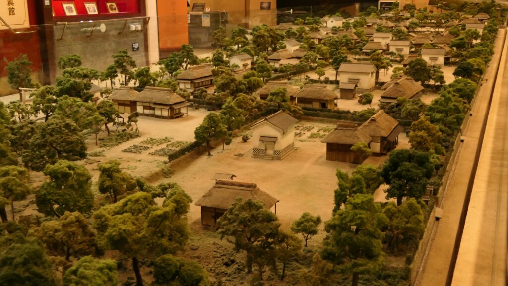
There are also many dioramas of historical events which helps visitors understand more easily. I hope these good activities of the museum will continue to become more popular.
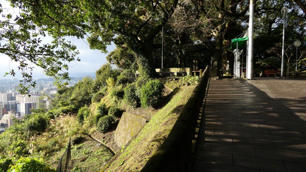
Shiroyama Mountain like natural park
The Shiroyama Park on Shiroyama Mountain behind the Main Enclosure is easy to go to because the mountain is not so high at only 107m above sea level. You can go up a trail like walking to the top which look like a natural park rather than a historical site. This could be because the Satsuma Domain rarely used the mountain as part of the castle and banned people from entering it during the Edo Period. You can only see the trace of enclosures, which are surrounded by earthen walls, coming from the Kamiyama Clan’s mountain castle before the Shimazu Clan.


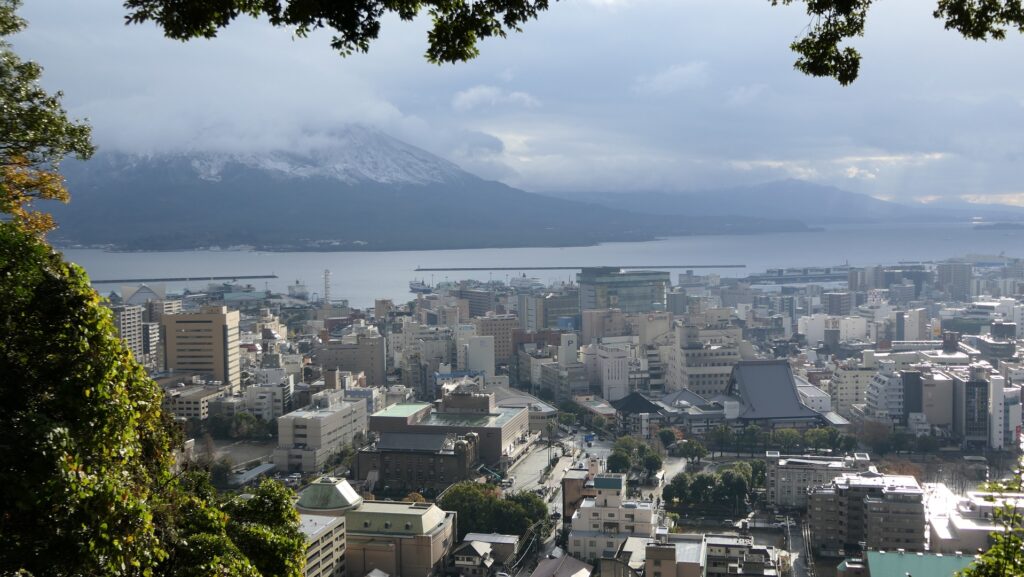
Anyway, the top is a very popular view spot of Sakurajima (an active volcano island) and Kagoshima city area, where you can also enjoy the view.
To be continued in “Kagoshima Castle Part3”
Back to “Kagoshima Castle Part1”