23.小田原城~Odawara Castle

この城には2つの顔があります。
This castle has two faces.

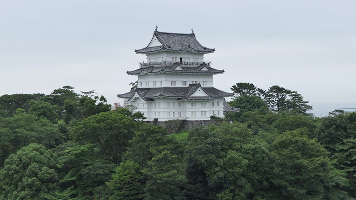
八幡山古郭から見た復興天守~The reconstructed Tenshu keep from Hachimanyama-Kokaku (old castle)

立地と歴史~Location and History

小田原城は大まかに、「八幡山古郭」と呼ばれる古い西側の部分と、通常「小田原城」と呼ばれている新しい東側部分に分けられます。新しい方は、JR線から簡単にアクセスでき、小田原駅の南側にあります。この城は最初は中世に大森氏により築かれたと言われています。
Odawara Castle can roughly be divided into an older western part called “Hachimanyama-Kokaku” and a new eastern part, which we now usually call “Odawara Castle”. The new part can be easily accessed by JR railways, and is located the south of Odawara Station. It is said that the castle was first built by the Omori clan in the Middle Ages.
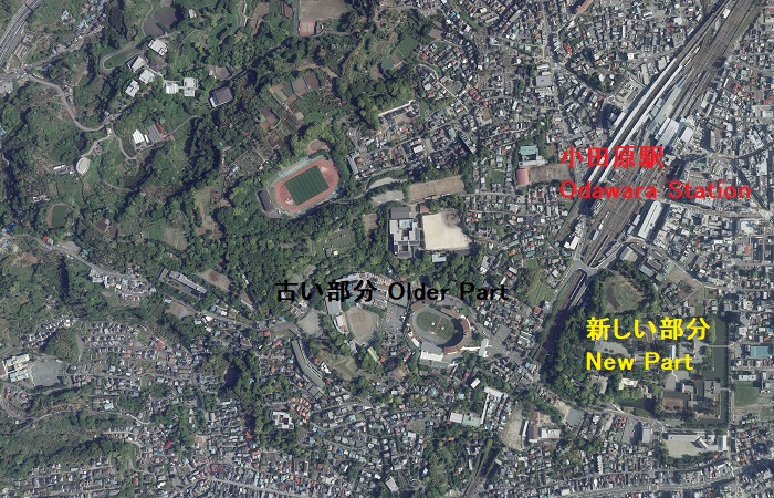
小田原中心部の航空写真~The aerial photo of the central Odawara(国土交通省航空写真に加筆)

また、北条早雲が伊豆国(現在の静岡県東部地方)から来て大森氏から城を奪ったとも言いますが、詳細は不明です。戦国時代には、北条氏がこの城を本拠地として使いました。新しい部分の方に館を構え、古い部分の方は籠城するときに使われたようです。
It is also said that Soun Hojo from Izu Province (now the eastern part of Shizuoka Pref.) seized it from the Omori, but these details are uncertain. During the Warring States Period, the Hojo clan utilized the castle as their home base. It seems they lived in the hall in the new part and used the older part for besieged.
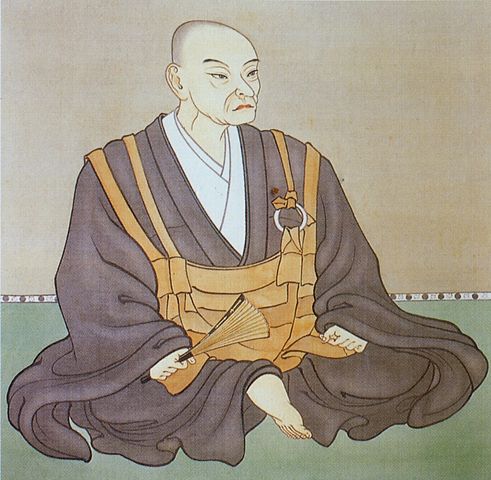
北条早雲肖像画の複製、小田原城天守閣蔵~The replica of the portrait of Soun Hojo, owned by Odawara Castle(licensed under Public Domain via Wikimedia Commons)

この城は3回籠城戦を経験しました。まず上杉謙信、次には武田信玄によるものです。2人ともよくその強さを知られた戦国大名ですが、北条は両方とも城を守り切ることに成功しました。最後の3回目は、天下人の豊臣秀吉による名高い1590年の小田原征伐と呼ばれる戦いです。
The castle was besieged three times. First, by Kenshin Uesugi. Second, by Shingen Takeda. While both are well known strong warlords, the Hojo were successful in defending the castle both times. The third and last one was the famous Siege of Odawara in 1590 by the ruler Hideyoshi Toyotomi.
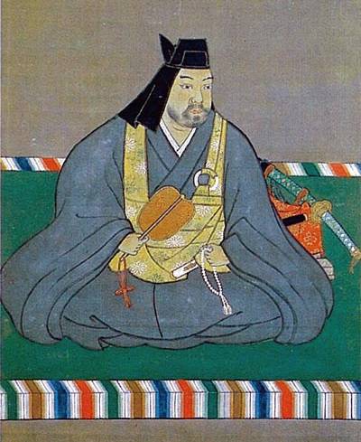
上杉謙信肖像画~The portrait of Kenshin Uesugi(licensed under Public Domain via Wikimedia Commons)

北条は秀吉と戦いたくありませんでした。この戦いが始まったのは、秀吉が決定した北条と真田の領地の取り決めを、北条が破ったからだと言われています。しかしある歴史家は、秀吉は最初から北条と戦って排除するために騙したのだと主張しています。私は、その方が妥当と思います。
Hojo didn’t want to fight with Hideyoshi. It is said that the battle started with Hojo defying Hideyoshi’s decision of the territories of Hojo and Sanada. However, a historian argues that Hideyoshi tried to fight and exclude Hojo from the first, then deceived them. I’d rather prefer the later.
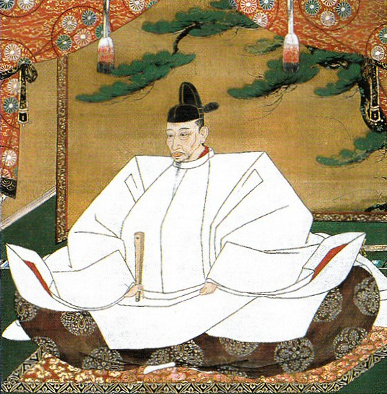
豊臣秀吉肖像画、加納光信筆、高台寺蔵~The Portrait of Hideyoshi Toyotomi, attributed to Mitsunobu Kano, owned by Kodaiji Temple(licensed under Public Domain via Wikimedia Commons)

どちらにしろ、戦いの前に北条は城下町を含む城全体を、巨大な土塁と空堀で囲みました。これを「総構え」といいます。その外周は約9kmあり、一部は二重三重に囲まれていました。秀吉は、20万以上の軍勢をもって3ヶ月間城を取り囲みました。
Anyway, before the battle, Hojo surrounded the whole area including the castle town by huge earthen walls and trenches called “So-gamae”. Their perimeter was about 9 km and part of them were doubled or tripled. Hideyoshi laid siege to the castle with over 200,000 soldiers for three months.

赤い線は総構え土塁の推定ライン~The red line shows the estimated line of So-gamae earthen walls

籠城している間に、ほとんどの北条の支城は落城しました。多くの歴史家は北条は成す術がなかったと言います。一方では、秀吉側は一兵たりとも小田原城の中には侵入できなかったのです。事実、秀吉自身がこの戦いの後、彼の大坂城でこの城を真似ています。この戦いに参加した多くの他の大名も同様でした。
During the siege, most of Hojo’s branch castles were captured. Many historians say there was nothing for Hojo to do. On the other hand, any soldier on Hideyoshi side was not able to invade the inside of Odawara Castle. In fact, Hideyoshi himself emulated the castle for his Osaka Castle after the battle. Many other lords who joined the battle did so too.
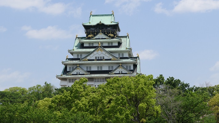
大坂城~Osaka Castle

北条は、秀吉に降伏した後改易となりました。しかし秀吉は味方に対しても過酷でした。彼は徳川家康に対して、領地に戻ることなくそのまま北条の領地に移るよう命令しました。織田信雄もまた移封を拒んだため改易となります。江戸時代には、城の領域は新しい部分だけに縮小し、小田原藩に属しました。
Hojo got fired after he surrendered to Hideyoshi, who was also cruel to his supporters. He ordered Ieyasu Tokugawa to directly move to Hojo’s territory without returning home. Nobukatsu Oda was also fired because he rejected his transfer. In the Edo Period, the castle was reduced to the new area belonging to Odawara Domain.

相模国小田原城絵図部分、江戸時代~Part of the illustration of Odawara Castle in Sagami Province, in the Edo Period(出典:国立公文書館)

特徴~Features

現在、小田原駅の東口からは、JRの線路に沿って小田原城の本丸まで近道で行くことができます。もし時間があれば、正面の方に向かって、それからお城端通りを右に曲がってください。その内に二の丸に着きますが、ここは最近整備計画が完了したところです。
Now, from the east entrance of Odawara Station, you can take a shortcut directly to the Honmaru enclosure of Odawara Castle along the JR railways. If you have time, I recommend going towards the front, then turn right on Oshirobata Street. You will reach the Ninomaru enclosure where the development project was done recently.

城周辺の地図~The map of around the castle

城への登城ルートが再現されていて、復元された馬出門と銅門を通ります。これらは、古写真や図面などを基に復元されました。
The original route to the castle has been recreated with the restored Umafdashi-mon Gate and Akagane-mon Gate. They were restored based on old photographs, drawings and so on.

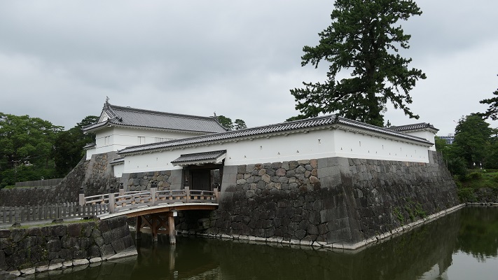
馬出門~Umafdashi-mon Gate
銅門~Akagane-mon Gate

そこから更に登っていくと、常盤木門を通り過ぎて天守に到着します。両方とも昭和時代に外観復元されたものです。
You can go up further and arrive at the Tenshu keep passing through the Tokiwagi-mon Gate. Both of them were apparently restored in the Showa Era.
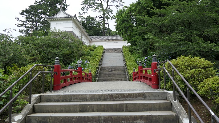
本丸に向かいます~Going to Honmaru enclosure
常盤木門~Tokiwagi-mon Gate

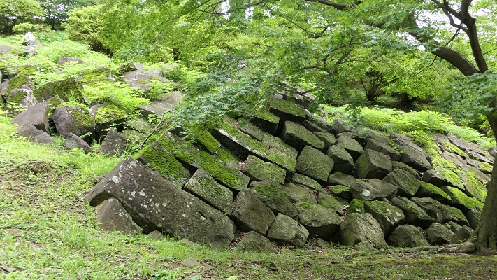
天守は博物館としても使われています。左後方から戻ってくると、1923年の関東大震災で崩れたままになっている本丸石垣も見ることができます。
Tenshu is also used as a museum. If you return taking the left back route, you can also see abandoned stones which collapsed from Honmaru stone walls when Great Kanto Earthquakes in 1923 happened.
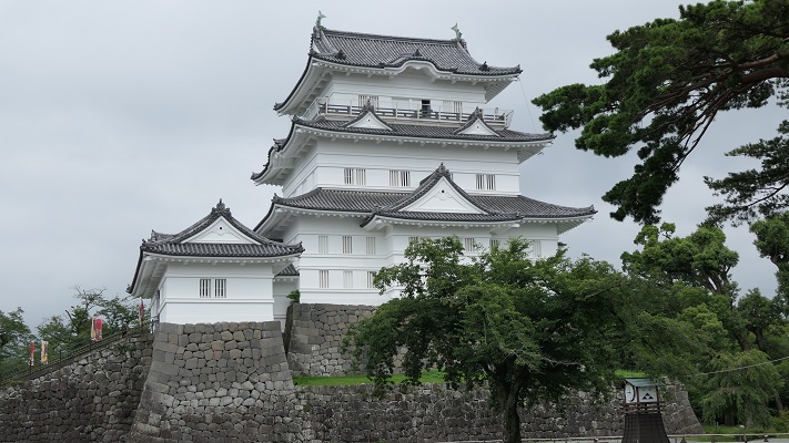
外観復元天守~The apparently restored Tenshu keep
崩れた石垣~The collapsing stone walls

古い方の小田原城にご興味があるのでしたら、近くにいくつか遺跡があります。
If you interested in the older part of Odawara Castle, there are few ruins near it.

古城周辺の地図~The map of around the old castle

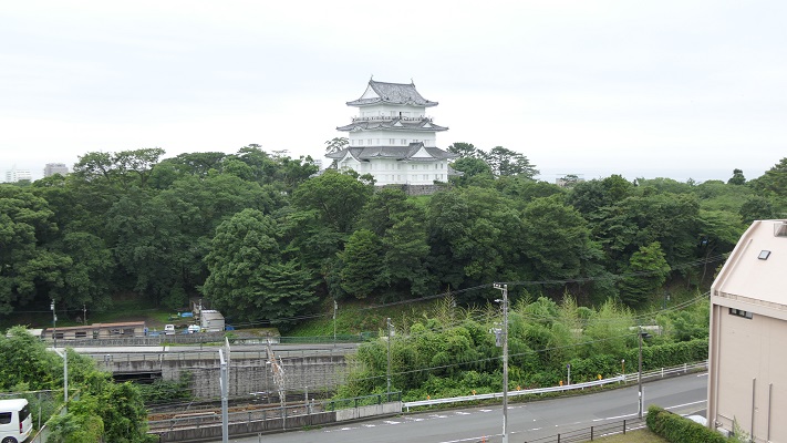
・八幡山古郭東曲輪:ここは古城の端に当たりました。最近整備されて一般公開されています。ちょっと地味に見えますが、ここからは海を背景に天守の写真を撮ることができます。ここはちょうど線路を挟んで天守の反対側にあるからです。
・The Eastern Enclosure of Hachimanyama-Kokaku: It was the edge of the old castle. It has been developed recently and open to the public. It still seems to be simple, but you can take a picture of Tenshu with the background of the sea because of its location being just the opposite of Tensh across from the railways.
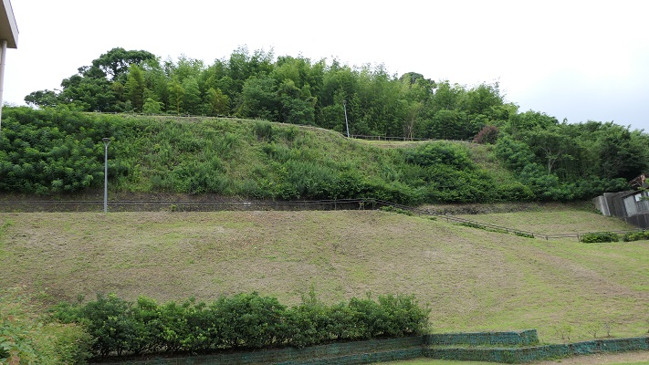
八幡山古郭東曲輪~The Eastern Enclosure of Hachimanyama-Kokaku
曲輪からの眺め~A view from the enclosure

・小峰大堀切:ここは「総構え」の数少ない遺構の一つです。この遺構のうち、「東堀」は約170mの長さがあり、一部曲がりくねっています。堀の底を歩いて通り抜けできるので、大きさを実感できます。小田原城下全体をこのような壮大な仕掛けで取り囲んでいたのです。
・Komine large-scale trenches: They are a few remaining ruins of “So-gamae”. Out of them, The East Moat “Higashi-bori” is about 170m long and partly zigzagged. You can walk through the bottom of the trench and feel how large it is. Imagine such huge structures surrounded the whole of Odarwara City!
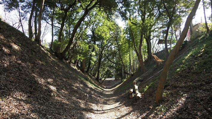
東堀大堀切~Higashi-bori large-scale trench
曲がりくねった部分~The zigzaged part

・三の丸外郭新堀土塁:こちらは2012年から公開されている場所です。第二次世界大戦前まで皇族の閑院宮家の別荘でした。戦後になって、小田原市がある機関から購入しました。ここからは、小田原周辺の山や海を一望に見渡せます。秀吉が本陣を置いていた石垣山城も見えます。
・Sannomaru outline Shinbori earthen walls: They have been open since 2012. The ground was used for the second house of the Imperial Family Kaninnomiya before World War II. After the war, Odawara City bought it from an institution. You will have a great view of mountains and the sea around Odawara including the ruins of Ishigakiyama Castle where Hideyoshi built his stronghold.

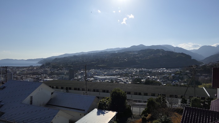
三の丸外郭新堀土塁~Sannnomru outline Shinbori earthen walls
土塁からの眺め~A view from the earthen walls

その後~Later Life

明治維新後、ほとんどの城の建物は撤去されました。明治中期には、城跡は御用邸の一つとして使われましたが、関東大震災で壊滅してしまいます。その後、小田原城址公園として整備されました。天守は1960年に再建されますが、それまでは天守台の上に観覧車がありました。
After the Meiji Restoration, most of the castle buildings were demolished. In the mid Meiji Period, the ruins of the castle were used as one of the Imperial Villas, but the Great Kanto Earthquakes broke all of them. After that, they were developed as Odawara Castle Park. Tenshu keep was rebuilt in 1960 after a Ferris wheel was installed on the Tenshu base.

天守台の上の観覧車、1950年代~The Ferris wheel on the Tenshu base, in the 1950s(小田原市Websiteより引用)

私の感想~My Impression

日本語には「小田原評定」という比喩表現があり、延々結論が出ない会合のことを指します。北条は3ヶ月の間降伏するか否か逡巡していたと思われたのでしょう。ところがこの表現は、この戦いから100年以上後の江戸時代の軍記物により最初に広まったのです。滅びた北条は反論できません。
In Japanese, there is a figurative expression called “Odawara Hyojo” which means an inconclusive conference. People think Hojo wondered if they should surrender or not during the three month siege. However, the expression first spread more than 100 years after the battle in war chronicles of the Edo Period. The defeated Hojo couldn’t argue that.
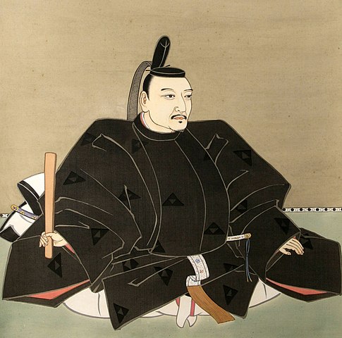
北条氏政肖像画、北条氏四代目当主、小田原城天守閣蔵~The portrait of Ujimasa Hojo, the forth head of the Hojo clan, owned by Odawara Castle(licensed under Public Domain via Wikimedia Commons)

守備側の主な2つの選択肢としては、援軍を待つか、攻撃側を撃退するかでしょう。私は、北条は同盟を結んでいた伊達政宗の援軍を待っていたのだと思います。しかし、正宗はついには秀吉に臣従してしまい、一方秀吉を撃退することも不可能でした。残ったのはいかに降伏するかです。実際、北条の降伏とその条件を交渉する使者が行き来していました。その条件は、北条は一部の領地を維持できるものであったと言われています。北条はそれを受け入れましたが、最終的には再び騙されてしまったのです。
The two major options for defenders are to wait for reinforces or to repel the attackers. I think that Hojo was waiting for Masamune Date who was once their ally, but finally served Hideyoshi as a vassal. The other option, beating Hideyoshi back was impossible. The rest was how they surrendered. Indeed, some messengers suggested Hojo surrender and negotiate conditions. It is said that the condition might allow Hojo to keep part of their territory. Hojo accepted that, but they were deceived again in the end.
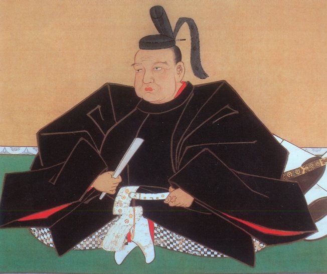
伊達政宗像、仙台市博物館蔵(The picture of Masamune Date owned by Sendai City Museum)licensed under Public Domain via Wikimedia Commons

ここに行くには~How to get There

新しい方の「小田原城」または八幡山古郭東曲輪に行くには:
電車の場合は、小田原駅から徒歩で約10分です。車の場合は、西湘バイパス小田原ICから約5分です。小田原城址公園周辺に私営の駐車場があります。
小峰大堀切または三の丸外郭新堀土塁に行くには:
電車の場合は、小田原駅から徒歩で約20~30分です。車の場合は、小田原厚木道路荻窪ICから約5分です。遺跡近くの城山公園に駐車可能です。
To the new “Odawara Castle” or The Eastern Enclosure of Hachimanyama-Kokaku:
When using train, it takes about 10 minutes on foot from Odawara Station. When using car, it takes about 5 minutes from the Odawara IC on Seishou Bypass. There are private parking lots around Odawara Castle Park.
To Komine large-scale trenches or Sannomaru outline Shinbori earthen walls:
When using train, it takes about 20 to 30 minutes on foot from Odawara Station. When using car, it takes about 5 minutes from the Ogikubo IC on Odawara-Atsugi Road. You can park at the Shiroyama Park near the ruins.

リンク、参考情報~Links and Refernces

【公式】小田原城 難攻不落の城~【Official】Odawara Castle Immortal Castle
小田原市、まち歩きパンフレットOdawara City, Town walk brochure
小田原城街歩きガイド(Only Japanese)
・「北条氏滅亡と秀吉の策謀、森田善明著」洋泉社(Japanese Book)
・「よみがえる日本の城2」学研(Japanese Book)

189.鞠智城~Kikuchi Castle

It was mysterious, but its achievement took root.
この城は不思議な存在でしたが、その成果は地域に根付きました。

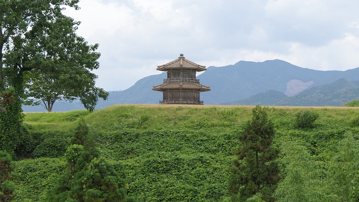
外郭から見た復元された鼓楼~The view of the restored drum tower from the outline

立地と歴史~Location and History

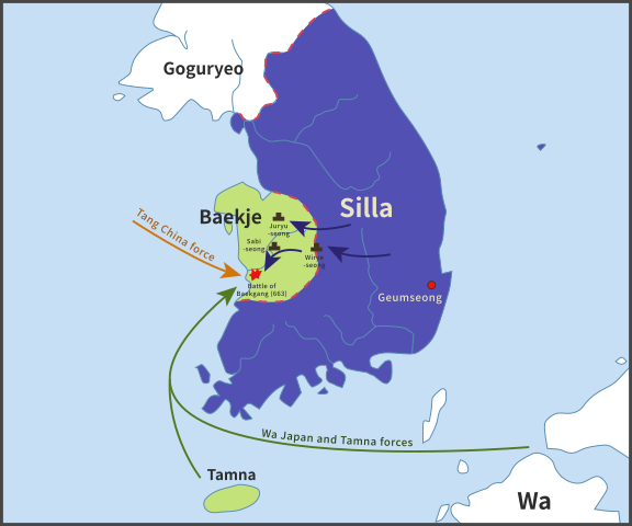
鞠智城は西日本における古代山城の一つです。663年の朝鮮での白村江の戦いの後、朝廷によって築かれました。日本は百済国を助けようとしたのですが、唐と新羅の連合軍に敗れてしまったのです。天智天皇は連合軍の日本への侵攻を恐れ、山城の建設を命じ、それは百済からの難民の力を借りて行われました。そのため、これらの城は「朝鮮式山城」とも呼ばれています。
Kikuchi Castle was one of ancient mountain castles in western Japan. It was built by the Imperial Court after the Battle of Baekgang, Korea in 663. Japan tried to help Baekje, but was beaten by the ally of Tang and Silla. Emperor Tenchi was scared of invasion by the alley, so he ordered to build these castles with the help from the refugees from Baekje. That’s why these castles are also called “Korean style mountain castles”.

白村江の戦いの図~The map about the Battle of Baekgang(licensed by Samhanin via Wikimedia Commons)

鞠智城は、九州地方で記録されている5つの山城のうちの一つです。その他は、大野城、水城、基肄城、金田城です。これらの城は侵攻があった場合に想定される進路に沿って置かれました。しかしながら、鞠智城については少し変なのです。大野城が近くにある大宰府政庁からは60kmも離れていて、もう一つの想定攻撃路である有明湾からも30km離れていました。この城は補給基地であったとか、やはり有明での攻撃に備えたものだという人もいます。ある歴史家は、百済からの難民の収容施設だったのではないかと言っています。なぜならこの周辺地域は、百済との貿易や文化面で関わりがあったからです。事実、この遺跡の貯水池跡から百済観音像が発見されました。加えて、この場所は他の古代山城と比べて低い位置にあり、居住にも適していました。
Kikuchi Castle was one of the five recorded ones in Kyushu region. The others were Ono, Mizuki, Kii, and Kaneda. They had their locations on the way or alongside of expected routes for the invasion. However Kikuchi was a little strange. It was about 60 km away from the Dazaifu government, near Ono Castle, and nearly 30 km from Ariake Bay, another possible attack route. Some speculate it could have been a supply base or preparation for an attack on Ariake. A historian says that the castle could nave been an accommodation for refugees from Baekje, because the area around the castle had been related to Baekje’s in trading and culture. Indeed, a Baekje Buddha statue was excavated from the ruins of the water reservoir. In addition, this site is lower than other ancient mountains castles that made it livable for people.

九州地方の5つの記録された古代山城の位置~The location of five recorded ancient mountain castles in Kyushu region

その後侵攻の危機は去ったのですが、この城は10世紀まで約200年に渡って使われました。この城の歴史の後半においては、軍事拠点、政庁、それに倉庫として使われたようなのです。城の周辺地域は肥沃になり、貿易でも繁栄しました。城が廃城となって約300年後、菊池氏が日本の武士団の頭領となり、侵攻してきた蒙古軍と戦いました。
Despite the crisis of the invasion being resolved, the castle was used for about 200 years until the10th century. In the later stages of its life, it seemed to be an army base, government office, and storage. The area around the castle became fertile and prosperous with trading. About 300 years after the castle was abandoned, the Kikuchi clan fought with the Mongolian Invasion as the leader of Japanese warriors.

菊池武房、「蒙古襲来絵詞」より~Takefusa Kikuchi from “The picture scrolls of the Mongol invasion attempts against Japan”(licensed under Public Domain via Wikimedia Commons)

特徴~Features

近世の城が持つイメージとは違い、この城の主な構造物は、外周が3.5kmに及ぶ外郭部分です。そこには4つの門があり、その間には版築による土塁が続いていました。
Unlike the image of early modern age castles, the main structure of the castle is outlined with a perimeter about 3.5 km long. It had four gates and walls between them were made from rammed earth.

城周辺の地図~The normal map around the castle

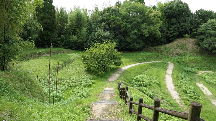
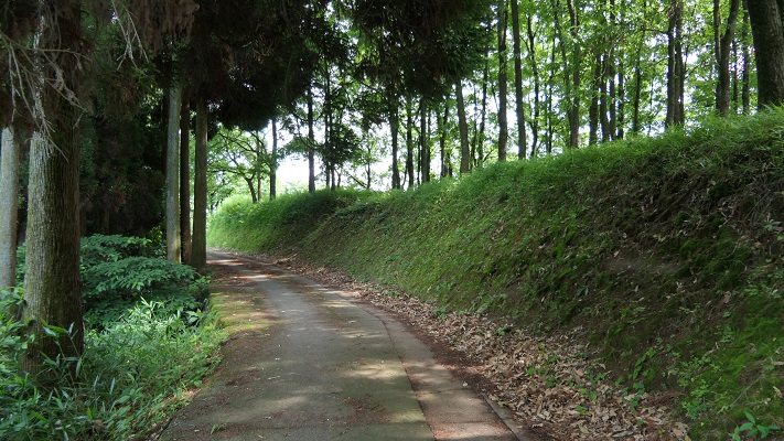
外郭土塁の一部~Part of the earthen walls on the oitline

外郭沿いの歩道は現在トレッキングコースになっています。門跡を一つ一つたどっていくことで、城がどのくらいの大きさだったのかがわかります。
The path along the outline is now used for trekking. You can see the ruins of the gates one by one, and feel how large the castle was.

歩道は外郭の土塁に沿っています~The path goes alongside the earthen walls on the outline

駐車場から一番近いのは深迫門で、通用門として使われたとみられます。
The nearest one from the parking lot is Fukasako Gate which could have been used as the side entrance.

深迫門跡~The ruins of Fukasako Gate

次に現れるのは堀切門で、ここが正門だったようです。
The next comes Horikiri Gate which could have been the main entrance.

堀切門跡~The ruins of Horikiri Gate

池の尾門というもう一つの門跡まで見て回ることができます。
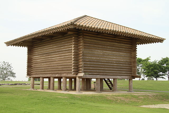
外郭の内側には、恐らく鼓楼として使われたであろう三層の塔があり、最近発掘の成果により復元されました。この塔は平面が八角形でした。これは百済から取り入れた様式であり、古代日本ではとても珍しいものです。
You can go ane see another ruins of gate called Ikenoo Gate.
Inside of the outline, the three-layer tower, probably used as the drum tower, has been restored recently with the success of excavation. This tower is octagonal which came from the Baekje style, making it very unique to ancient Japan.

復元された鼓楼~The restored drum tower

兵舎や倉庫といった別種の建物も復元されています。
Other types of buildings such as barracks and warehouses have also been restored.

復元された兵舎~The restored barrack(licensed by 小池隆 via Wikimedea Commons)
復元された倉庫~The restored warehouse(licensed by 小池隆 via Wikimedea Commons)

その後~Later Life

10世紀に廃城となった後、城跡は畠となりました。それもこの地域の繁栄を表しているのかもしれません。この地域が最初に遺跡として調査されたのは1937年のことでした。1967年から2010年に渡っては32回も発掘が行われました。それ以来、研究者はシンポジウムを開催し、この城についての議論を深めています。城跡は歴史公園「鞠智城」として整備されており、鼓楼などの建物が復元されています。
After being abandoned in the 10th century, the ruins of the castle were turned into a farm. That might have shown the prosperity of this area. This area was first researched as ruins in 1937. It was excavated 32times between 1967 and 2010. Since then, while researchers have held symposiums and debated issues with the castle, the ruins has been developed as a historical park called “Kikuchi Castle”. Several buildings such as the drum tower have been restored.

1970年代の城跡周辺の航空写真~The aeriel photo of the area around the castle ruins in the 1970s

最近の城跡周辺の航空写真~The recent aerial photo around the castle ruins

今でもまだ畠が少し残っています~Few farm still remains now

私の感想~My Impression

この城跡は西側に面しているため、晴れた日の夕方には美しい夕日を見ることができます。それは絶好の写真スポットでもあります。私としては、公園の中央にある復元建物を見るだけではなく、歩道に沿った門の跡も見て回っていただきたいです。もっとこの城のことが理解できるでしょう。できたら岡山県の鬼ノ城のように門の一つでも復元されたらと思います。そうすれば世界中から観光客を呼び寄せることも可能かもしれません。
As the ruins face the west direction, you can see the beautiful sunset on a sunny evening. It can also be a good photo spot. I recommend visiting the restored buildings at the center of the park as well as the ruins of the castle’s gate ruins along the sidewalk to know more about the castle. I hope a gate might someday be restored, like Ki-no-Jo in Okayama Prefecture. That way, the castle may attract many people from around the world.

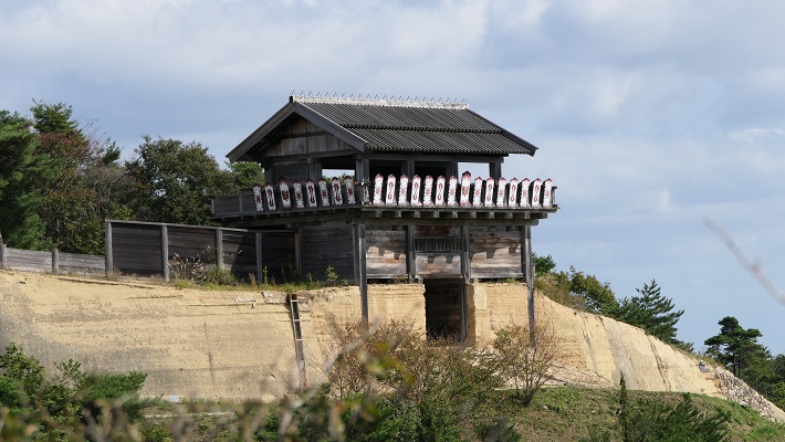
復元された鬼ノ城の西門~The restored Western Gate of Ki-no-Jo

ここに行くには~How to get There

ここに行くには車がお勧めです。九州自動車道植木ICから約20分、熊本空港から約40分かかります。歴史公園に駐車場があります。
I recommend using a car to get there. It takes about 20 minutes from the Ueki IC on Kyushu Expressway, or about 40minutes from Kumamoto Airport. The park offers a parking lot.

リンク、参考情報~Links and References

歴史公園鞠智城・温故創生館(Only Japanese?)
・「古代山城「くくちのき(鞠智城)」九州王朝再興の夢舞台」松見正宣著、文芸社(Japanese Book)
・「古代山城 鞠智城を考える―2009年東京シンポジウムの記録」笹山晴生監修、山川出版社(Japanese Book)

120.菅谷館(Sugaya Hall)

この城は、伝説と現実の間(はざま)にあります。
This castle is between legend and reality.

現在の菅谷館本郭の入り口(The present entrance of Sugaya Hall Hon-Kuruwa)

Location and History

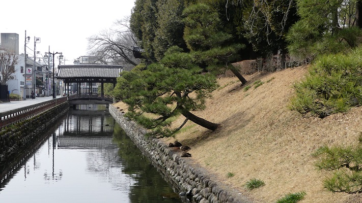
「菅谷館」という名前には少し説明が必要です。「館」という用語は、この場合には「中世初期の武士の館」を指します。通常は、平地の上に土塁か柵を伴う館が堀で囲まれている構成でした。例としては足利氏館が挙げられるでしょう。
The name “Sugaya Hall” needs a small explanation. The term “hall” means ”warrior’s hall in the early Middle Ages” in this case. It usually consists of a hall with earthen walls or fences, and a surrounding moat on a plain, for example, like the Ashikaga clan hall.

足利氏館跡(Ashikaga Clan Hall Ruins)

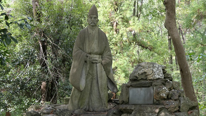
菅谷館には、鎌倉幕府の重臣であった畠山重忠について、当時ここに住んでいたという地元の言い伝えがあります。古い記録である「吾妻鏡」にも彼が菅谷館に住んでいたという記載があります。そのためこの遺跡が菅谷「館」と呼ばれ、ここに重忠の像が立っているのです。
Sugaya Hall has a local tale about Shigetada Hatakeyama, a senior vassal of the Kamakura Shogunate, living there at that time. An old document called “Aduma-Kagami” also says he lived in Sugaya Hall. That’s why these ruins are called Sugaya “Hall” and the statue of Hatakeyama is standing on the ruins.

畠山重忠像(The statue of Shigetada Hatakeyama)

しかしながら、この遺跡の外観はそのような説明と違っています。明らかに戦国時代の城跡に見えるのです。その時代の古書もまたこの城を「館」ではなく、菅谷「城」と記しています。加えて、発掘の結果からも戦国時代の1500年前後に使われたことが判明しています。つまるところ、「菅谷館」という名前は、行政側による伝説と現実との間での妥協の産物のようなのです。
However, the appearance of the ruins is different from such descriptions. They look like the ruins of a castle in the Warring States Period obviously. Old documents in the period also call them Sugaya “Castle”, not “Hall”. In addition, the result of excavation says the castle was used around 1500 in the Warring States Period. Overall, the name “Sugaya Hall” seems to come from a kind of compromise between legend and reality by the officials.

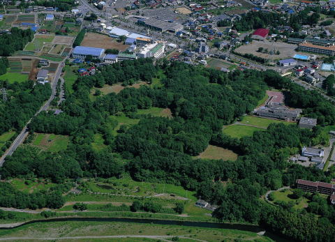
菅谷館跡全景(The whole view of Sugaya Castle Ruins)~埼玉県立嵐山史跡の博物館ウェブサイトより引用

いずれにせよ、この城は1488年の「須賀谷原の戦い」のような戦国大名が戦いを繰り広げた重要な地域にありました。戦国大名の一つ、扇谷上杉氏がその戦いのため菅谷古城を再興したこと、しかし敗れてその城に幽閉されたことが記録されています。他の文書にはその約100年後には北条氏がこの城を使っていたとあります。つまり、この城は何度か使われたり放棄されたりしたようなのです。
Anyway, the castle was in the important area where warlords battled each other such as “The battle of Sugayahara” in 1488. Records say that one of the warlords, the Ogigayatsu Uesugi clan, restored the old Sugaya Castle for the battle, but they were defeated and kept under arrest in the castle. Another document says that the Hojo clan used the castle about 100 years later. After all, the castle seemed to be used and abandoned several times.

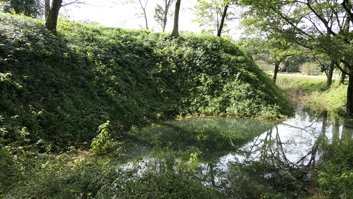
二の郭前の堀(The moat in front of Ni-no-Kuruwa)

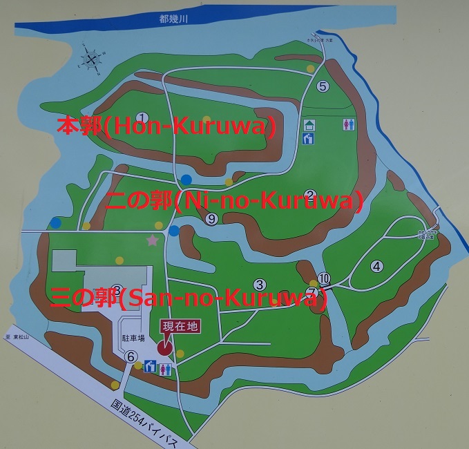
菅谷城は現在の埼玉県西部にあたる場所の低台地上にあり、近くには中世の主要街道である鎌倉街道が通っていました。中心の本郭は、背後を都幾川に、両側を自然の渓谷により守られていました。本郭の入り口は厳重に防御され、二の郭、三の郭などいくつかの郭が本郭の前に広がっていました。
Sugaya Castle is located on a low plateau in what is now the western part of Saitama pref. where the Kamakura road, a main road in the Middle Ages was passing nearby. The main enclosure, “Hon-Kuruwa”, was protected by the Tokigawa river behind it and natural valleys both sides. The entrance of Hon-Kuruwa is strictly guarded and several enclosures including “Ni-no-Kuruwa” and “San-no-Kuruwa” spread out in front of Hon-Kuruwa.

菅谷館跡の地図(The map of Sugaya Hall Ruins)~現地案内板写真に追記

Features

菅谷館跡には建物はありませんが、基礎は残っており、よい状態で保存されています。基礎は全て土造りであり、戦国時代の東国においてはそれが一般的な方法でした。
The ruins of Sugaya Castle retain their foundation but with no buildings. The foundation is well preserved, and is all made from soil which is a typical method of building castles in eastern Japan in the Warring States Period.

菅谷館跡の土塁(An earthen wall of Sugaya Hall Ruins)

一例として、本郭を見てみましょう。この郭は、重忠の館があったと考えられています。それが事実なら、後から城の中心部分として強化されたはずです。
Let’s look at Hon-Kuruwa for instance. This enclosure is thought to be Hatakeyama’s hall. If it’s true, it must have been strengthened as the center of the castle later.

菅谷館跡の地図、アルファベットは以下の写真を撮った位置(The map of Sugaya Hall Ruins, Alfabetic characters show the points pictures below were taken)~現地案内板写真に追記

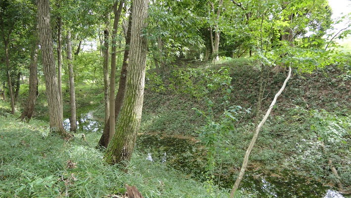
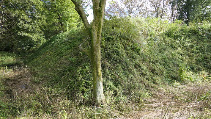
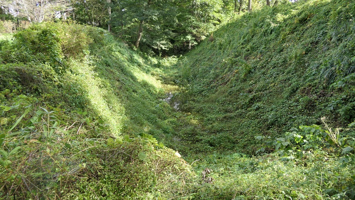
本郭は、高い土塁と深い空堀に囲まれています。これにより、防御側は敵の攻撃から守りやすくなります。「虎口」と呼ばれる入り口は狭くなっており、そこに至る進路はジグザグに作られていて、敵がまっすぐ内部に入れないようになっています。
Hon-Kuruwa is surrounded by a high earthen wall and deep dry moat. That makes it easier for defenders to protect them from an enemy’s attack. Its entrance, called “Koguchi”, is narrow and the route to it is made zigzagged so that attackers are unable to enter inside directly.

A.本郭の土塁と空堀(The earthen wall and dry moat of Hon-Kuruwa)
B.本郭の入り口(The entrance of Hon-Kuruwa)

更には、この土塁は部分的に意図的に突き出ています。これにより防御側はその部分から敵の正面と側面両方を攻撃することができます。このような構造は「出桝型土塁」と言われます。これは戦国時代においては、他の構造と組み合わせることで、高度な城の防御システムとなりました。よって一部の歴史家は、北条氏が城を改修したのだろうと推定しています。
In addition, the wall is partly stuck out on purpose. This allows defenders to attack from the sticking point to an enemy’s front and sides. Such a structure is called a “Dematsu” shaped earthen wall. It is an advanced system when combined with other defensive features for castles in the Warring States Period. So some historians speculate Hojo might have improved the castle.

C.出桝型土塁(The “Dematsu” shaped earthen wall)
D.本郭の内部(The inside of Hon-Kuruwa)
E.二の郭の入り口、最も高くなっている(The entrance of Ni-no-Kruwa, the highest point)

Later Life

この城は戦国時代の終り頃から長い間放置されていたようです。それ以来、城跡は民間の所有となり、畠山重忠の遺産であると思われてきました。約100年前の大正時代に初めてここが調査されたとき、重忠の像が建てられます。1973年になって遺跡が国の史跡に指定され、2008年には「比企城館跡群」の一つに改めて指定されました。
The castle seemed to be abandoned for a long time since sometime at the end of the Warring States Period. Since then, the ruins were private owned and thought of as Hatakeyama’s heritage. His statue was built when the ruins were first investigated in the Taisho Era about 100 years ago. In 1973, the ruins were designated as a National Historic Site, then were newly designated one of the “Hiki Castles Ruins” in 2008.

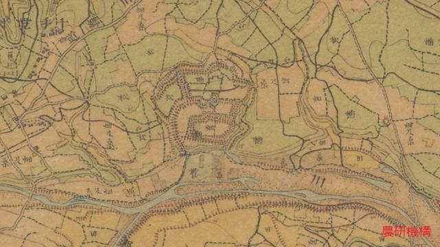
明治初期の城跡周辺の地図、土塁が残り畑・林となっていた(The map around the ruins in the early Meiji Era, there was a field and woods)

My Impression

関東地方の戦国大名は必要な数だけ城を作りました。その城がいらなくなったときは、速やかに廃城としました。一方、廃城となった城を再利用したいときは、その城を再建または増築しました。結果として城を廃城とするときは、完全には破壊しませんでした。代わりに一部を壊すか、建物だけを撤去しました。恐らくそれが効率的で、且つ再利用しやすかったからでしょう。それで菅谷館(城)の基礎がよく残ったと思うのです。
Warlords in the Kanto region built castles as many as they needed. When they didn’t need the castles, they immediately abandoned the castles. On the other hand, when warlords wanted to reuse abandoned castles, they restored or improved the castles. As a result, when warlords abandoned castles, they didn’t completely destroy the castles. Instead, they often destroyed part of the castles, or just remove their buildings. Probably it could be because it is more efficient and easy to reuse. I think that’s why the foundation of Sugaya Hall (Castle) remains well.

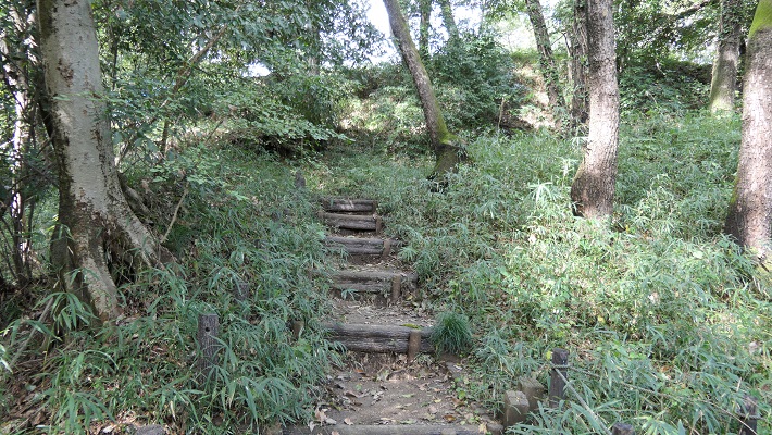
本郭の裏手(The back of Hon-Kuruwa)

今、城跡の三の郭には嵐山史跡の博物館があります。そこでは比企城館跡群(菅谷館、杉山城、松山城、小倉城)の歴史や出土品を展示しています。そこで歴史を学んでまず菅谷館に行ってみましょう。その他の内、杉山城はここからわずか5キロのところにあります。両方行ってみるのもよいでしょう。
There is the Ranzan Historical Museum on San-no-Kuruwa of the ruins now. It shows the exhibition of history and the excavation about Hiki Castle Ruins including Sugaya Hall, Sugiyama, Matsuyama and Ogura Castles. Let’s look into their history and visit Sugaya Hall first. Out of the others, Sugiyama Castle ruins is only about 5 km from there. So, how about visit the set of them.

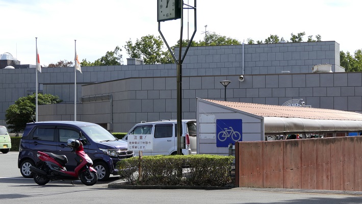
嵐山史跡の博物館(the Ranzan Historical Museum)

比企城館跡群の4つの城(The four castles of Hiki Castle Ruins)


How to get There

車を使う場合、遺跡は関越自動車道の嵐山小川ICの近くです。嵐山史跡の博物館に駐車場があります。
電車を使う場合は、東武東上線の武蔵嵐山駅から歩いて約15分です。
東京から武蔵嵐山駅まで:池袋駅から東武東上線に乗ってください。
When using car, the ruins is near Ranzan-Ogawa IC on Kan-Etsu Expressway. Ranzan Historical Museum offers a parking lot.
When using train, it takes about 15 minutes on foot from Musashi-Ranzan Station on Tobu Tojo line.
From Tokyo to Musashi-Ranzan Station: Take the train on Tobu Tojo line from Ikebukuro Station.

Links and References

埼玉県立 嵐山史跡の博物館(the Ranzan Historical Museum)