The home base of the Ii Clan, a senior vassal of the shogunate
Location and History
Shogunate sent Ii Clan to Important Military Base
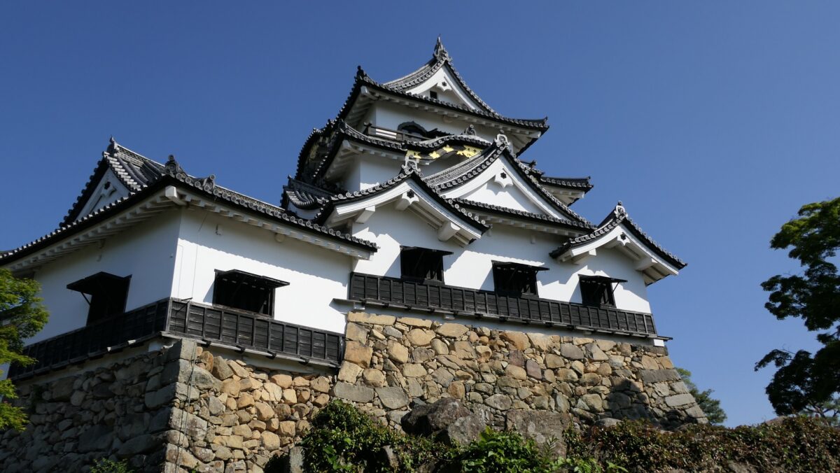
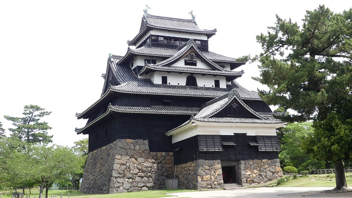
Hikone Castle is located near Biwa Lake in Shiga Prefecture and considered as one of the most popular historical sites in Japan. It has its Main Tower which is one of the twelve remaining and the five national-treasure Main Towers in Japan. It also has five castle buildings which are designated as Important Cultural Properties. The main portion of the castle also remains in a good condition with the buildings above, stone walls, and other structures. Because of it, the castle site has been designated as a National Special Historic Site since 1956.
The remaining Main Tower of Hikone Castle, as a National TraesureThe Western Enclosure Three-level Turret of Hikone Castle, as an Important Cultural Property
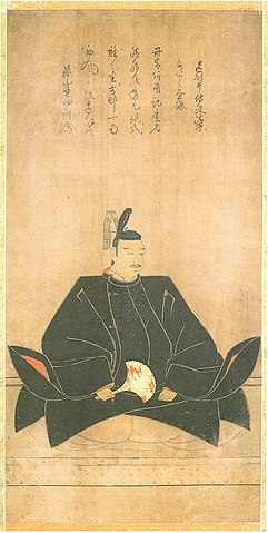
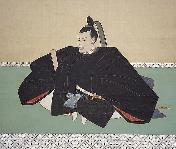
After the Battle of Sekigahara between Ieyasu Tokugawa and Mitsunari Ishida in 1600, Ieyasu got the power as the ruler of Japan. Ieyasu promoted his senior vassal, Naomasa Ii to the lord of the territory beside Biwa Lake, which Mitsuanri had owned. Naomasa first lived a mountain castle called Sawayama Castle Mitsunari lived. However, Naomasa thought it was not enough because he needed a stronger and more convenient castle. The Toyotomi Clan was still at Osaka Castle and there were many lords in western Japan, who thought their master was Toyotomi, not Tokugawa. They might have gotten together and attacked the Tokugawa Shogunate which Ieyasu established in eastern Japan. Naomasa’s territory was located in the area which could avoid the attack to eastern Japan.
The location of the castle
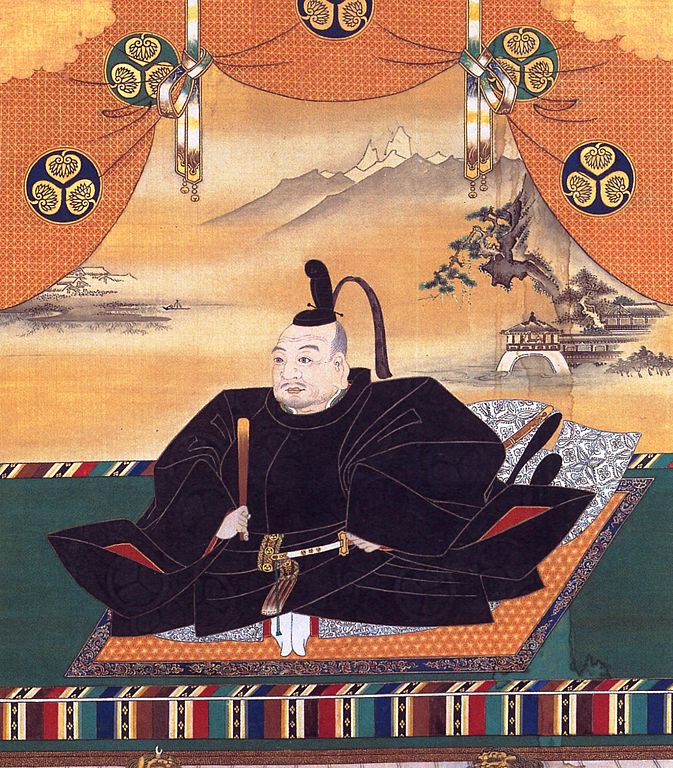
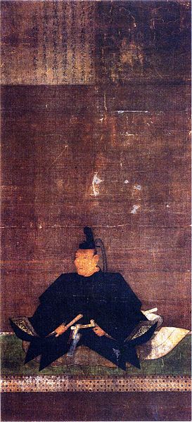
The portrait of Naomasa Ii, owned by Hikone Castle Museum (licensed under Public Domain via Wikimedia Commons)
Castle is built as Construction Order by Shogunate
After Naomasa died in 1602, his young son, Naotsugu conducted the new castle’s location with Ieyasu. They finally decided to build it on a low mountain at 50m high near Biwa Lake, which would be called Hikone Castle. The castle was built as a construction order by the shogunate with help of over 10 other lords. In order to hurry to complete the construction, they used waste materials from other abandoned castles like Sawayama Castle. However, the construction continued long since 1603, as the scale of castle was huge.
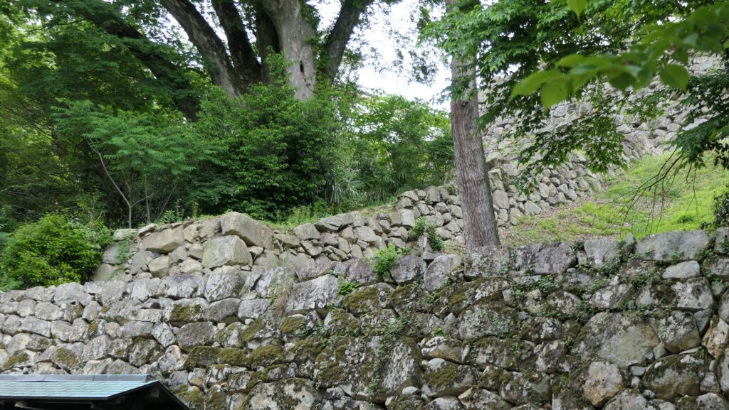
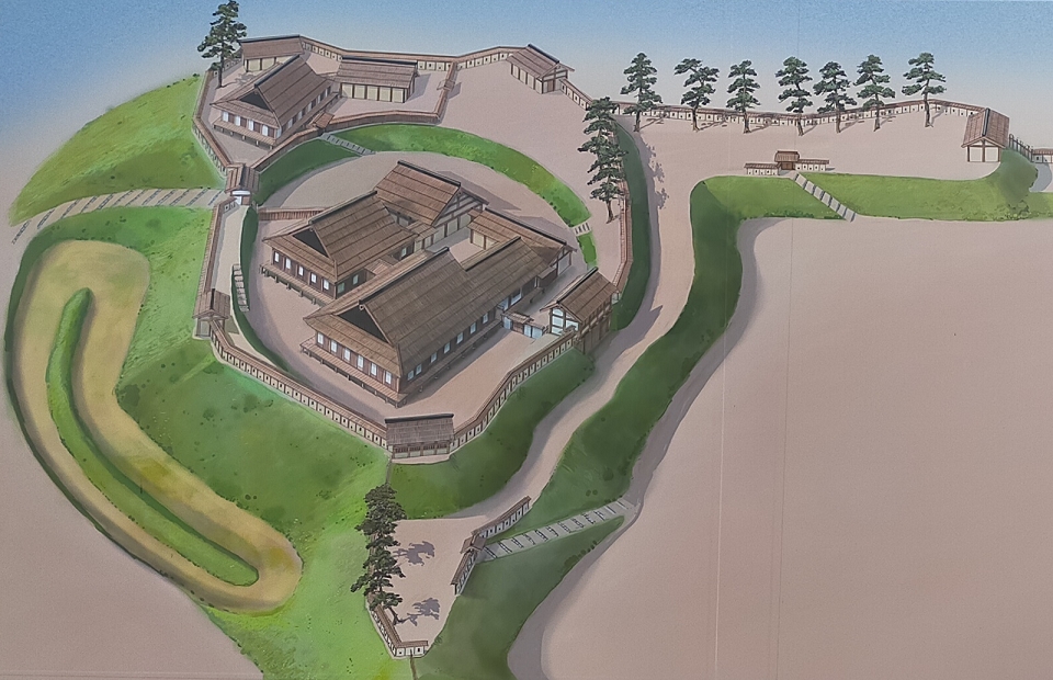
Hikone Castle was built from the top to the foot of the mountain
The Main Tower, Main Hall and other turrets were built together, surrounded by stone walls, on the ridge of mountain to make it easy to protect. Deep ditches were dug around both edges of the ridge to avoid enemies’ invasions to the center of the castle. Moreover, five long-line stone walls were built along the slopes of the mountain to prevent the enemies from moving smoothly.
The main portion of the castle on the mountain, from the signboard at the siteThe large ditch in front of the Taiko-yagura TurretThe long-line stone walls behind the Main Gate
The mountain was surrounded by tripled water moats and the Main Gate was built behind them. The gate was open to the southwest direction towards Osaka Castle where the Toyotomi Clan lived. Seri-kawa River flowed out of the moats in this direction, so it could have been the forth moat.
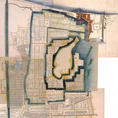
The illustration of Hikone Castle and Town, exhibited by Hikone Castle MuseumThe past Main Gate drawn in the signboard at the siteThe present Main Gate Ruins
It becomes Castle for Peaceful Time
The castle was completed in 1622, about twenty years after its launch. However, the situation dramatically changed in 1615 during the construction. The Tokugawa Shogunate defeated the Toyotomi Clan in that year. After that, the construction was done only by the Hikone Domain building houses for living and government. As a result, the new Main Hall for the lord was built at the foot of the mountain on the opposite side of the Main Gate. The gate to the hall was called the Front Gate just like a new Main Gate. The castle town was also developed around the castle. They were either connected to Biwa Lake through waterways or ponds for water transportation.
The restored Main HallThe present Front Gate Ruins
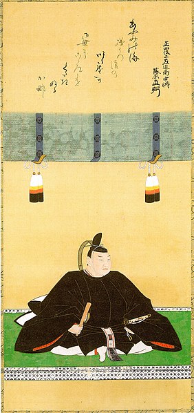
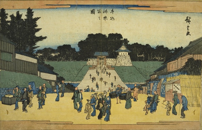
Fortunately, no battles happened at Hikone Castle throughout the peaceful Edo Period. The lord of the castle, Ii Clan also played an important role in the central government as the head of hereditary feudal lords. Out of ten, five heads of the shogun’s council of elders came from the Ii Clan and it happened once in 265 years during that period. The most famous one is definitely Naosuke Ii at the end of the Edo Period. He decided to open more doors to foreign countries by signing the Treaty of Amity and Commerce between the US and Japan in 1858. However, he was unfortunately assassinated by the opposite Ronin outside the Sakurada-mon Gate of Edo Castle in 1860. This incident decreased the power and authority of the Tokugawa Shogunate and would be a trigger of the Meiji Restoration.
The portrait of Naosuke Ii, owned by Hikone Castle Museum (licensed under Public Domain via Wikimedia Commons)The Sakurada-mon Gate of Edo Castle
Home base of Ieyasu Tokugawa after his independence
Hamamatsu Castle was located in the center of Totoumi Province, which is now Hamamatsu City in the western part of Shizuoka Prefecture. The castle is known for the place where young Ieyasu Tokugawa, who would be the founder of the Tokugawa Shogunate, lived. This is one of the reasons why the castle is also called “Shusse Castle” which literally means “Success Castle”. The former Hamamatsu Castle was called Hikuma Castle which was built on a hill near the branch of Tenryu-gawa River. It is uncertain who first built it around the 15th Century. In the first 16th Century during the Sengoku Period, the Imagawa Clan, a great warlord which was based in Suruga Province (now the central part of Shizuoka Prefecture) owned the castle.
The range of Totomi Province and the location of the castle
The Portrait of Ieyasu Tokugawa, attributed to Tanyu Kano, owned by Osaka Castle Museum (licensed under Public Domain via Wikimedia Commons)
Ieyasu was originally based in Mikawa Province, the west of Totoumi, and worked under the Imagawa Clan. When the power of Imagawa decreased, Ieyasu got independent and aimed to invade Totoumi Province. In 1568, he succeeded in capturing Hikuma Castle to govern the province. However, this castle was not enough for Ieyasu, as he needed to prepare for possible battles with the Takeda Clan who invaded Suruga Province next to Totoumi. Ieyasu extended the castle to another hill in the west direction, renaming it Hamamatsu Castle. Hamamatsu Castle had several enclosures on the hill, and the old Hikema Castle became part of it. It is thought that these enclosures were made of soil with shingle-roofed buildings in them. This was because Ieyasu still didn’t have advanced techniques and craftsmen for building castles like Azuchi Castle which belonged to Nobunaga Oda, Ieyasu’s ally.
The relief map around the castle
The imaginary drawing of Hamamatsu Castle in Ieyasu’s periodThe imaginary drawing of Azuchi Castle, exhibited by Gifu Castle Museum
One of Battlefields for Battle of Mikatagahara
The most impressive event for Ieyasu living in Hamamatsu Castle was the Battle of Mikatagahara in 1573. Shingen Takeda, one of the greatest warlords, invaded the territories of Ieyasu and Nobunaga and captured several Ieyasu’s branch castles such as Futamata Castle. Shingen lured Ieyasu in the castle to the field of Mikatagahara by demonstrating his troops around the castle. Ieyasu fell into Shingen’s trap and was totally defeated. He could somehow turn back to Hamamatsu Castle to survive. Shingen’s troops eventually withdrew after he died of disease in the next year. There have been some traditions about Ieyasu’s actions after his defeat. One says Ieyasu made the castle’s gates open when Shingen’s troops pursued. The troops doubted it and they thought it might be a trap, then withdrew. Another says Ieyasu made a fabric bridge over a deep valley called Saigagake and counterattacked Shingen’s troops to make them fall into the valley. However, it is unclear whether they really happened or not.
The portrait of Shingen Takeda, owned by Jimyo-in, in the 16th century (licensed under Public Domain via Wikimedia Commons)The diorama of Ieyasu’s troops withdrawing from the battlefield. exhibited by the Saigagake MuseumThe Saigagake Valley Ruins
Yoshiharu Horio improves Castle
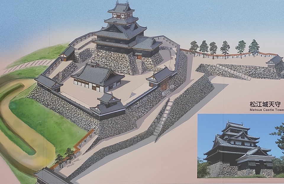
After Ieyasu was transferred to Edo Castle (located in now Tokyo) by the ruler, Hideyoshi Toyoyomi in 1590, Yoshiharu Horio, who worked under Hideyoshi, governed the castle. He improved the castle by building stone walls and the Main Tower in the Main Tower Enclosure on the top. The remaining stone walls and stone wall base for the tower were built by him. However, it is quite unknown what the Main Tower looked like because there is no record for it. Only some roof tiles and the well for the tower were excavated. Historians speculate the tower might have looked like the remaining Main Tower of Matsue Castle which was built by the Horio Clan after they were transferred from Hamamatsu in 1600. Both stone wall bases for the towers were similar, so the clan might have used the design plans of Hamamatsu Castle when they built Matsue Castle.
The portrait of Yoshiharu Horio, owned by Shunkoin Temple (licensed under Public Domain via Wikimedia Commons)The imaginary drawing of Hamamatsu Castle in Yoshiharu’s periodThe Main Tower of Matsue Castle
Promotional track for hereditary feudal lords
Ieyasu got the power and founded the Tokugawa Shogunate at the beginning of the 17th Century. Since then, Hamamatsu Castle had been owned by nine hereditary feudal lord families during the Edo Period. The lords of the castle were often promoted to important roles of the shogunate such as a shogun’s council of elders. This is another reason the castle is called “the Success Castle”. For example, Tadakuni Mizuno, the lord of Karatsu Castle in the first 19th Century, applied to be the lord of Hamamatsu Castle. As a result, he succeeded to both owning the castle and imposing the Tenpo Reforms as the head of the shogun’s council of elders. As for the castle itself, the main tower had eventually been lost, only the Main Tower Gate remained on the top as the symbol of the castle. The center of it was moved to the Second Enclosure beside the hill, which had the Main Hall for the lord to govern the Hamamatsu Domain around the castle.
The portrait of Tadakuni Mizuno, owned by Tokyo Metropolitan University (licensed under Public Domain via Wikimedia Commons)Karatsu CastleThe imaginary drawing of Hamamatsu Castle in the Edo Period
この城は、東京の輪郭を生み出しました。
This castle created the outline of Tokyo.
外郭の概要~Overview of Gaikaku
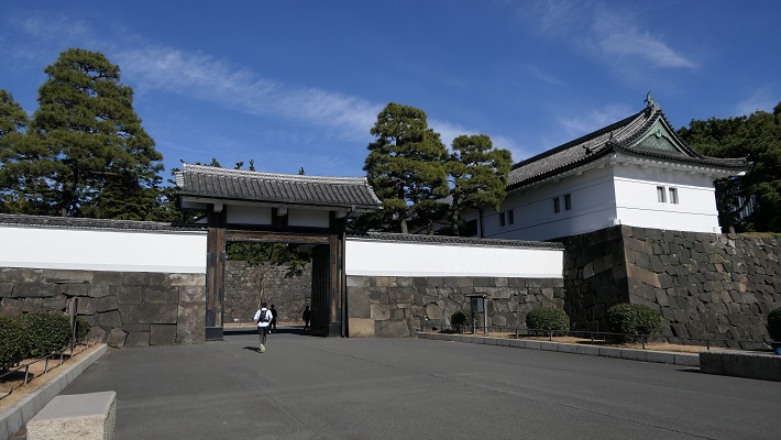
江戸城の外郭は、外堀に囲まれた区域であり、その外周は約16kmあり、市街地をも含んでいました。見附と呼ばれる大型の門と橋が、約50セット堀と主要街道の交差点に置かれていて、民衆と交通を監視していました。これらの施設は明治維新後にほとんど撤去されてしまいます。そのためほとんどの人たちは東京に城があったことなど気付きません。それでは、東京にある外郭の痕跡を巡ってみましょう。 The outline of Edo Castle called Gaikaku was the surrounding area from the outer moat whose perimeter was about 16 km, including even the city area. About 50 sets of large gates and bridges called Mitsuke were placed at the intersections of the moat and major roads to check people and transportation. These facilities were mostly demolished after the Meiji Restoration. So most people don’t realize there was a castle in Tokyo. Then, let me introduce the traces of Gaikaku in Tokyo.
江戸城の外郭ライン、ラインの色は以下のセクション毎に分かれています~The line of Edo Castle’s Gaikaku, the color of the line is linked to each section below
隅田川エリア~Sumida-gawa River Area
江戸時代の初め、隅田川は外堀の一部として認識されていました。そのため幕府は、日光街道上の千住大橋を除いて、この川に橋を架けることを禁じていました。1657年の明暦大火の後は、江戸の安全確保と都市化のため、他の橋も架けられるようになりました。 At the beginning of the Edo Period, Sumida-gawa River was regarded as part of the outer moats. Because of it, the Shogunate banned bridges from being built on the river excluding Senju-Ohashi Bridge on Nikko Road. After the great fire of Meireki in 1657, more bridges were built on the river for the increase of safety and urbanization of Edo City.
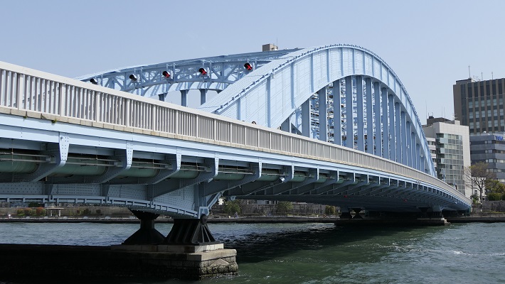
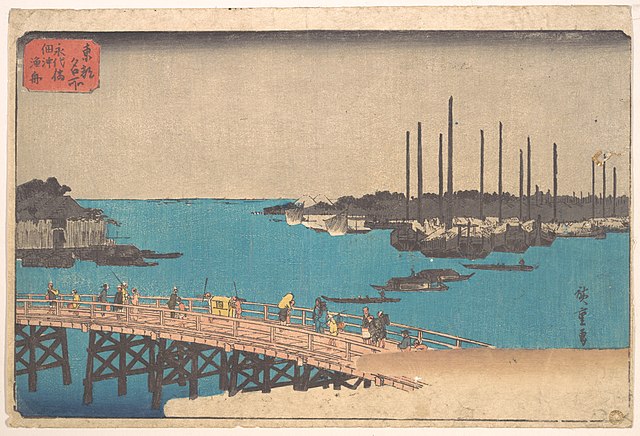
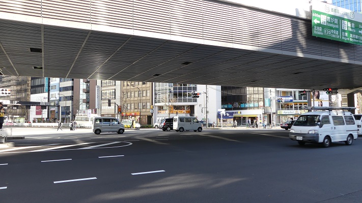
隅田川に架かる永代橋~Eitai-bashi Bridge over Smida-gawa River
隅田川エリアのライン~The line of Sumida-gawa River Area
永代橋~Eitai-bashi Bridge:
隅田川に架けられた4番目の橋です。現在の橋は、1923年の関東大震災の火災により失われた後、1926年に再建されたものです。すでにそれから100年近く経過しており、重要文化財に指定されています。 It is the forth bridge on Sumida-gawa River. The present bridge was rebuilt in 1926, after it was destroyed by the fire in the Great Kanto earthquake in 1923. It is nearly 100 years old, and has become an Important Cultural Property.
現在の永代橋~The present Eitai-bashi Bridge歌川広重「東都名所」より「永代橋佃沖漁舟」、江戸時代~”Eitai-bashi Bridge and fishing boats off Tsukuda Island” from the series “Famous Places in the Eastern Capital” attributed to Hiroshige Utagawa in the Edo Period(licensed under Public Domain via Wikimeidia Commons)
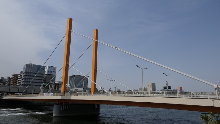
新大橋~Shin-Ohashi Bridge:
こちらは3番目に架けられた橋です。先代の橋は関東大震災を生き延びました。現在の橋は1977年に架け替えられたものです。江戸時代のこの橋は、歌川広重の有名な浮世絵に描かれたことで知られています。 It is the third bridge on the river. The former bridge survived the Great Kanto earthquake. The present one replaced it in 1977. The bridge in the Edo Period is known for being drawn in a famous Ukiyoe Painting by Hiroshige Utagawa.
現在の新大橋~The present Shin-Ohashi Bridge歌川広重「名所江戸百景」より「大橋あたけの夕立」、江戸時代~”Sudden shower over Shin-Ohashi Bridge and Atake” from the series “100 Famous Views of Edo” attributed to Hiroshige Utagawa in the Edo Period(licensed under Public Domain via Wikimeidia Commons)
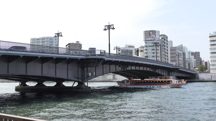
両国橋~Ryogoku-bashi Bridge:
2番目に架けられた橋です。この橋の周りは歓楽街になりました。江戸時代から夏にはこの辺で花火の催しが開かれています。近くにはまた外堀の一部である神田川の河口があります。 The second bridge on the river. The area around the bridge became a place of amusement. Fireworks displays have been also held around in the summer since the Edo Period. There is the estuary of Kanda-gawa River nearby which is another part of the outer moats.
現在の両国橋~The present Ryogoku-bashi Bridge葛飾北斎「富嶽三十六景」より「御厩川岸より両国橋夕陽見」、江戸時代~”Sunset across Ryogoku Bridge from the Bank of Sumida River at Onmayagashi” from the series “Thirty-six Views of Mount Fuji” attributed to Hokusai Katsushika in the Edo Period(licensed under Public Domain via Wikimedia Commons)
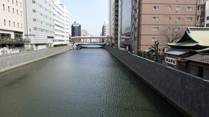
神田川エリア~Kanda-gawa River Area
「神田川」という名前は明らかに川です。ところが、この川は完全に人口物で、堀や運河として使われました。江戸時代初期に、幕府の下で伊達氏が本郷台地を掘り進んで造りだしたのです。幕府は川に沿って必要な施設を設置していました。掘削で出た残土は、下町周辺の埋め立てに使われました。 The name “Kanda-gawa” clearly shows a river (“gawa” means river.). However, the river is completely artificial, and was used as a moat and canal. In the first Edo Period, the Date clan under the Shogunate created it to cut across Hongo plateau. The Shogunate set facilities they needed along the river. The waste soil from the digging was used to reclaim the sea around downtown.
神田川~Kanda-gawa River
神田川エリアのライン~The line of Kanda-gawa River Area
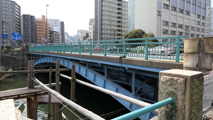
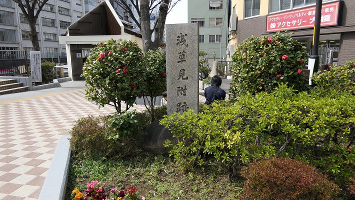
浅草橋門跡~Asakusa-bashi Gate Ruins:
この門は川と浅草を通る日光街道の交差点に築かれました。しかし明治維新後間もなく撤去されました。そのため、何らかの記念碑でもなければ、そこに何があったかはわかりません。 This gate was built at the intersection of the river and Nikko Road passing Asakusa. But it was removed soon after the Meiji Restoration, so we can’t see what was seen in the past without some kind of monument.
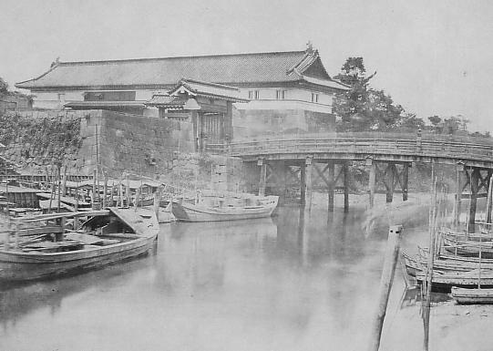
現在の浅草橋~The present Asakusa-bashi Bridge記念碑のみがあります~There is just a monument浅草橋門の古写真~The old photo of Asakusa-bashi Gate(licensed under Public Domain via Wikimedia Commons)
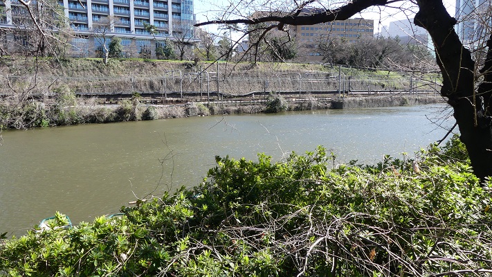
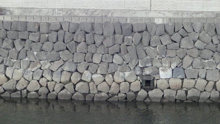
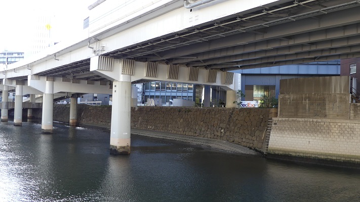
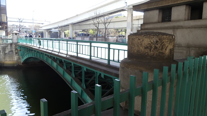
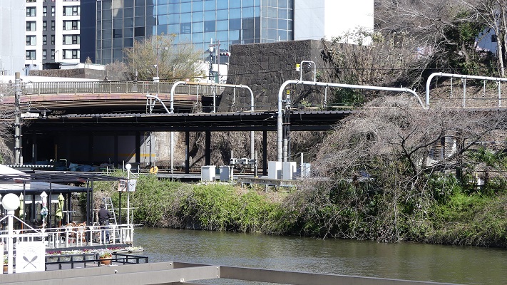
仙台堀~The Sendai Moat:
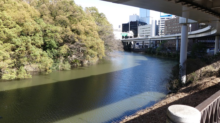
「仙台」という名前は伊達氏が仙台を拠点としていたことに由来します。JR御茶ノ水駅近くの橋からは深くえぐられた川の一部を見ることができます。JR中央線はその谷に沿って走っています。 The name “Sendai” derived of the Date clan from Sendai. You can see the part of the river being cut deeply from the bridge near JR Ocha-no-Mizu Station. JR Chuo line goes along the valley.
現在の仙台堀~The present Sendai Moat
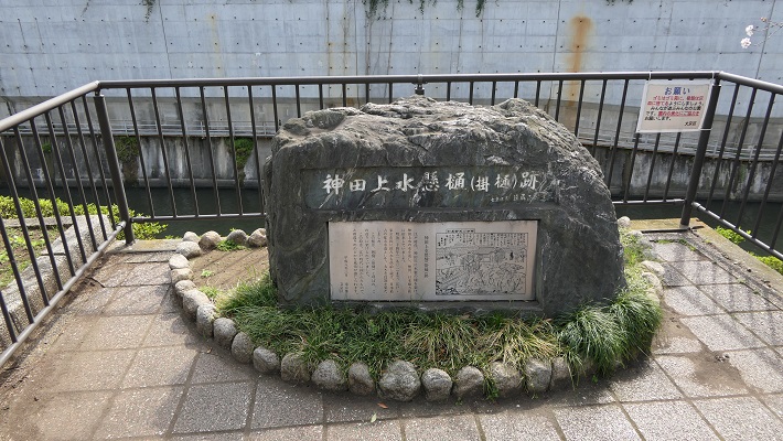
水道橋跡~The Water Bridge Ruins
かつて神田上水がこの水道橋によって川を横断していました。井の頭池を水源として江戸市街に給水していました。この周辺の街と、近くにある「水道橋」駅の名前はここから来ています。 Kanda water supply went across the river using the Water Bridge. It came from Inokashira Pond to feed Edo City. The names of the town around and the station nearby “Suido-bashi” comes from the bridge.
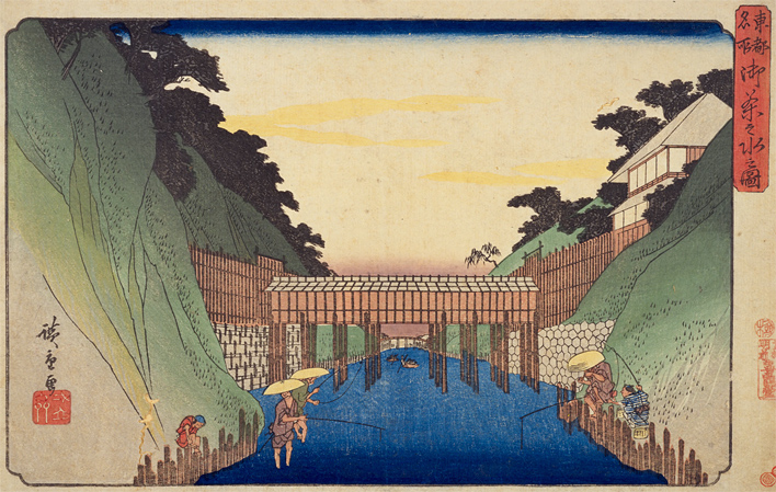
水道橋の記念碑~The monument of Water Bridge記念碑周辺の風景~A view around the monument歌川広重「東都名所」より「御茶之水之図」、江戸時代~”The picture of Ocha-no-Mizu” from the series “Famous Places in the Eastern Capital” attributed to Hiroshige Utagawa in the Edo Period(出典:国立国会図書館)
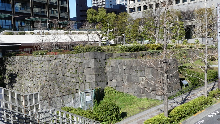
外堀の西側部分~The western part of the outer moats
この部分は1638年までに江戸城建設の総仕上げとして築かれました。自然の谷の地形を利用しています。城の中心を砲撃から守ることを意図し、堀の内側に土塁を積み上げ、外側よりも高くなるようにしています。 This part was built to finalize the construction of the Edo Castle by 1638. It used a natural valley terrain. It aimed to protect the center of the castle from a cannon attack outside by setting the inside of the moat much higher with earthen walls than the outside.
弁慶濠~Benkei-bori Moat
外堀の西側部分のライン~The line of The western part of the outer moats
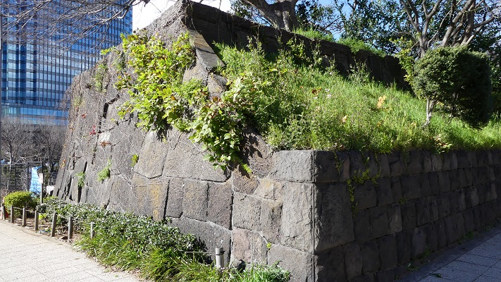
牛込門跡~Ushigome-mon Gate Ruins:
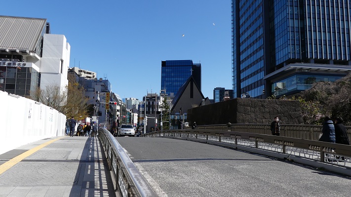
門の両側の石垣が現存しています。門跡の周辺は現在JR飯田橋駅として利用されています。門跡の反対側は神楽坂になっていて、外堀は谷底に位置しているのがわかります。牛込濠と呼ばれるその堀は、門跡の西側にほぼそのまま残っており、とても広大に見えます。 The stone walls from both sides of the gate remain. The area around the ruins are now used for JR Iida-bashi Station. The opposite of the ruins is Kagura-zaka slope, so you can see the outer moat located in the bottom of the valley. The moat called “Ushigome-bori” in the west of the ruins remain like it was, and looks very spacious.
牛込門跡~Ushigome Gate Ruins歌川広重「牛込神楽坂之図」、江戸時代~”The picture of Ushigome and Kagurazaka” attributed to Hiroshige Utagawa in the Edo Period(出典:国立国会図書館)牛込濠~Ushigome-bori Moat
市ヶ谷門跡~Ichigaya-mon Gate Ruins:
石垣がいくらか残っており、外側から堀を渡って門に伸びる土橋も残っています。周辺はまたJR市ヶ谷駅の一部として使われています。 There are some remaining stones, and the earthen bridge from outside to the gate across the moat remains. The area around is also part of the for JR Ichigaya Station.
市ヶ谷門跡~Ichigaya-mon Gate Ruins市ヶ谷門の古写真~The old photo of Ichigaya-mon Gate(licensed under Public Domain via Wikimedia Commons)
四谷門跡~Yotsuya-mon Gate Ruins:
門の片側の石垣が残っていますが、周辺の堀は既に埋められています。一例として、門跡西側の以前堀だったところは上智大学のグラウンドとして使われています。広大な敷地を眺めながら、内側の土塁の上を歩くことができます。 There are some remaining stone walls on one side of the gate, but outer moats around are already filled. For example, the former moat in the west of the ruins is used as the ground for Jochi University. You can walk on the inside earthen walls and enjoy a view of the spacey area.
残っている石垣~The remaining stone walls四谷門の古写真~The old photo of Yotsuya-mon Gate(licensed under Public Domain via Wikimedia Commons)上智大学のグラウンド~The ground for Jochi University
外堀が失われたエリア~The lost outer moat area
東京の都心では、いくつかの理由で外堀は既に失われています。現在では外堀通りとして自動車道になっています。過去にはどんな景観だったのか想像するのは困難です。 In the center of the Tokyo city area, the outer moat was already lost for several reasons. It is now used as the Sotobori (means onter moat) Street for automobiles. It is difficult for us to understand what can be seen in the past.
外堀通り、ビル街の谷間のようです~Sotobori Street, just like a valley among the buildings
外堀が失われたエリアのライン~The line of the lost outer moat area
赤坂門跡~Akasaka-mon Gate Ruins:
門の石垣の一部が、赤坂見附(幕府の施設であった名前と同じ)交差点の近くに残っています。「弁慶濠」と呼ばれる現存堀が門の西側にあります。そこから続く「溜池」堀は失われています。 Part of the stone walls for the gate remain near the Akasaka Mitsuke (same as the Shogunate facility’s name) Intersection. A remaining moat called “Benkei-bori” is in the west of the gate. The following moat called “Tame-ike” has lost.
赤坂門跡~Akasaka-mon Gate Ruins
「溜池」交差点~The Tame-ike Intersection:
堀の名前が交差点の名前として残っています。溜池とは貯水池の意味です。江戸時代の初期には、江戸の人々は川をせき止め、飲料水として使っていたようです。 The name of the moat remains for the intersection. Tame-ike means reservoir. At the beginning of the Edo Period, people in Edo City seemed to dam a river, and use it for drinking water.
溜池交差点~Tame-ike Intersection
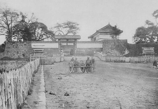
呉服橋交差点~The Gofuku-bashi Intersection:
この交差点は東京駅の近くにあります。ここには外堀と「呉服橋」という橋と呉服橋門がありました。今現在、これらの痕跡は何もありません。 The intersection is near Tokyo Station. There was an outer moat, a bridge called “Gofuku-bashi” and Gofuku-bashi Gate. They have completely removed it. We can’t see any trace of them now.
呉服橋交差点~Gohuku-bashi Intersection呉服橋門の古写真~The old photo of Gofukubashi-mon Gate(licensed under Public Domain via Wikimedia Commons)
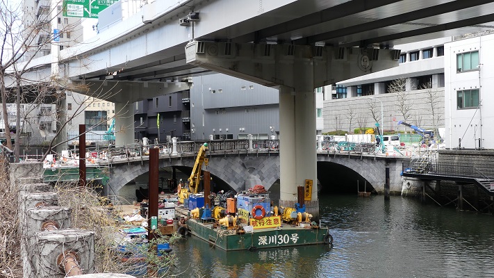
日本橋川エリア~Nihonbashi-gawa River area
ここは外堀の最後の、または最初の部分です。この箇所は江戸城の内堀の近くです。ここから外堀が市街の外側に向かって渦巻き状に伸びているので、堀を逆に辿っていくこともできます。日本橋川もまた人工川であり、元々あった川のルートを変えるために作られました。この川の上流は、平川という元あった川と同じようです。 It is the last part of the outer moats, or the first part. The part is near the inner moat of Edo Castle. We can see the outer moats spiral towards the outside of the city, so you can trace the moats backward. Nihonbashi-gawa River is also artificial and was built to change the routes of original rivers. The upper stream of the river might be the same as the original river called Hirakawa River.
日本橋川沿いの石垣~The stone walls along Nihonbashi-gawa River
日本橋川エリア~Nihonbashi-gawa River area
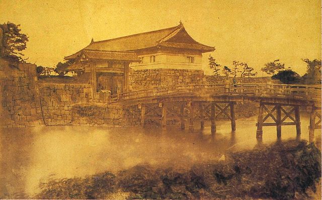
常盤橋門跡~Tokiwabashi-mon Gate Ruins:
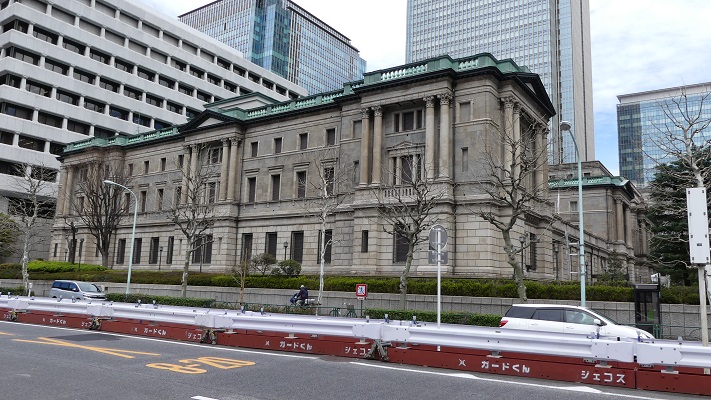
この門の石垣がよく残っています。そのため国の史跡に指定されています。堀を渡って門に至る石橋は、明治時代に門の他の石を使って築かれたものです。近くには日本銀行旧館の建物があり、こちらは重要文化財に指定されています。 The stone walls of the gate remain well. That’s why they have been designated as a National Historic Site. The stone bridge across the moat to the gate was built using other stones from the gate in the Meiji Era. You can also see the old building for Bank of Japan nearby, designated as an Important Cultural Property.
常盤橋門跡の石橋~The stone bridge of Tokiwabashi-mon Ruins常盤橋門の古写真~The old photo of Tokiwabashi-mon Gate(licensed under Public Domain via Wikimedia Commons)日本銀行旧館~The old building for Bank of Japan
一ツ橋門跡~Hitotsubashi-mon Gate Ruins:
この門と堀周辺の石垣が残っています。江戸時代後半に、将軍の一族である一橋家の屋敷がこの門内にありました。 There are some remaining stone walls for the gate and the moat around. The hall for the Shogun’s relative called Hitotsu-bashi clan was inside the gate in the late Edo Period.
現在の一ツ橋門と残っている石垣~The present Hitotsubashi-Bridge and remaining stone walls堀周辺の現存石垣~The remaining stone walls around the moat
雉子橋門跡~Kijibashi-mon Gate Ruins:
ここが外堀の終点に当たります。ここから内堀が近くに見えます。日本橋川は更に上流から流れてきています。その上流を辿っていくと外堀の違う地点、小石川門の近くに到達します。実はこの上流の部分は一旦幕府によって埋められますが、明治時代になって水上交通の便ため、掘り返されました。 This is the edge of the outer moats. You can see the inner moat nearby. The river flows from a much upper area. You can follow that the upper stream and you’ll reach another spot of the outer moat near Koishi-kawa Gate. In fact, the upper stream was once filled by the Shogunate, but was dug again for water transportation in the Meiji Era.
現在の雉子橋~The present Kijibashi-Bridge
私の感想~My Impression
外堀の全てを辿ってくには1日では足りないでしょう。ですので、少しずつ部分的に訪れてみるのもよいでしょう。どちらにしても行ってみれば、江戸城はインフラ、文化、商業などの面で東京の中心につながっていることが実感できます。 It will need more than one day trip to trace all of the outer moats, so you can visit part of them one by one. Anyway, after visiting them, you can realize that Edo Castle has been the center of Tokyo in infrastructure, culture, business and so on.
牛込門跡と飯田橋駅~Ushigome-mon Gate Ruins and Iidabashi Station