68.備中松山城~Bicchu-Matsuyama Castle

強力な城が山の上に健在です。
The strong castle still remains on the mountain.

立地と歴史~Location and History

山の上に広がった城~Castle spread over Mountain

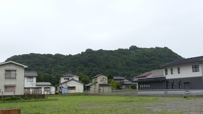
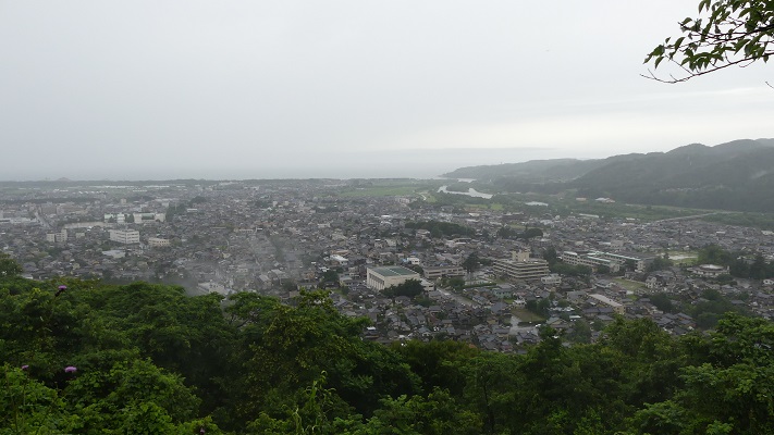
備中松山(現在の高梁市)は備中国の中心に位置していました(現在の岡山県西部)。中世の初期から多くの領主たちがこの地を重要視し、その帰趨をめぐって互いに争ってきました。
Bicchu-Matsuyama (what is now Takahashi City) was located in the center of Bicchu Province (the western part of now Okayama Prefecture). Many lords considered this area important and battled each other over it since the first Middle Ages.

城の位置と備中国の範囲~The location of the castle and the range of Bicchu Province

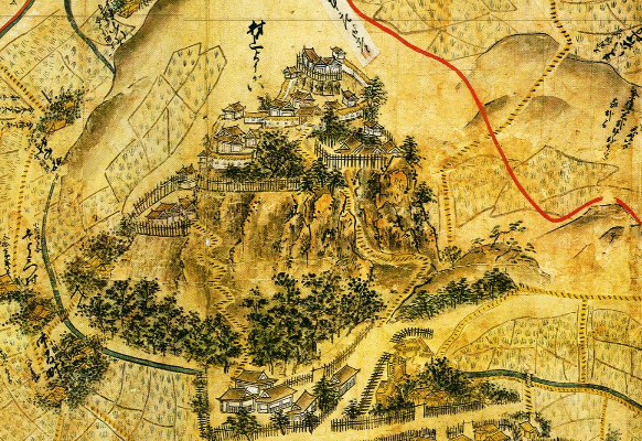
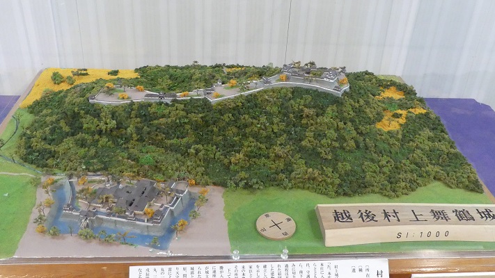
備中松山城は最初、臥牛山という4つの峰を持つ山の上に築かれました。初期の城は、大松山という奥の峰に築かれ、そして他の峰にも広がっていきました。私たちが通常備中松山城といっているものは、小松山と呼ばれる手前から二番目の峰に築かれています。
Bicchu-Matsuyama Castle was first built on a mountain called Gagyu-san which has four peaks on it. The first castle was on the back peak called Omatsuyama, then it was spread to the other peaks. What we generally call Bicchu-Matsuyama Castle is on the second peak from the front called Komatsuyama.

城周辺の起伏地図~The relief map around the castle

めまぐるしく変わる城主~Lords were changed several times

戦国時代には、三村氏が主にこの城を確保していました。1561年に、毛利氏の配下であった三村家親が尼子氏からこの城を奪ったのです。それ以来、城をめぐって幾重にも戦いがありました。家親の息子、元親は毛利に反旗を翻し、織田信長と同盟を結びました。しかし1575年毛利氏によって滅ぼされてしまいます。それまでには、小松山がこの城の中心地になっていました。
In the “Sengoku” or Warring States Period, the Mimura Clan mainly held the castle. Iechika Mimura under the Mori clan took away the castle from the Amago clan in 1561. Since then, several battles happened over the castle. Iechika’s son, Motochika formed an alliance with Nobunaga Oda against Mori, but was lastly beaten by Mori in 1575. The Komatsuyama peak became the center of the castle until then.

三村氏の家紋「剣片喰」~The family crest of the Mimura Clan(licensed under Public Domain via Wikimedia Commons)

その後、この城は毛利の重要拠点でしたが、1600年の関ヶ原の戦いにおける毛利の敗戦により、徳川幕府に奪われてしまいます。城は一旦放棄されますが、江戸時代になって小堀、水谷といった大名が城と城下町を統治しました。城は再び修理され、拡張され、そして完成したのです。
After that, the castle was an important site for Mori, but it was taken by the Tokugawa Shogunate in 1600 due to Mori’s loss in the battle of Sekigahara. The castle seemed to be once in ruin. In the Edo Period, several lords such as the Kobori and the Mizunoya clans governed the castle and castle town. They repaired, improved, and completed the castle again.

城主の一人、水谷勝隆肖像画、高梁市歴史美術館蔵~The Portrait of Katsutaka Mizunoya, one of the lords, ownd by Takahashi City History Museum(licensed under Public Domain via Wikimedia Commons)

山裾に御殿~Hall on Foot of the Mountain

大名たちは通常山の麓にある御根小屋と呼ばれた御殿に住んでいました。政治を行うのに便利だったからです。江戸時代後半には、人々は麓にある御殿を「御城」と呼び始め、山の上にある方を「御山城」としていました。
They usually lived in the main hall called Onegoya on the foot of the mountain, because it was convenient for governance. In the late Edo Period, people started to refer to the hall on the foot as “the Castle” than the castle on the mountain as “the Mountain Castle”.

備中国松山城絵図部分、江戸時代~Part of the illustration of Bicchu-matsuyama Castle in Bicchu Province, in the Edo Period(出典:国立公文書館)

特徴~Features

城への道のり~Route to the Castle
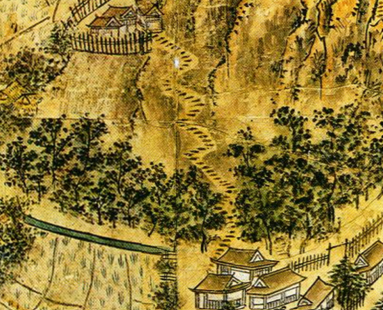
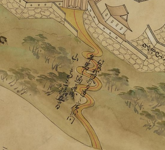
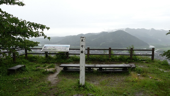
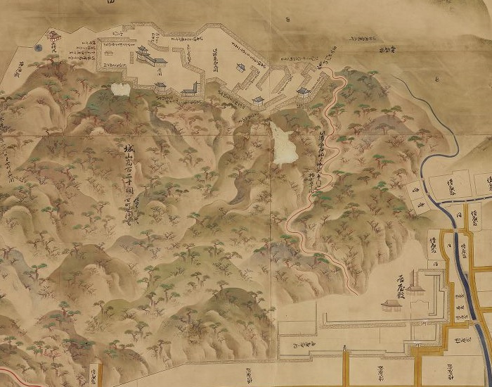
城周辺の地図~The map around the castle

(自分でそこしか行っていないため、今回は小松山の峰にある備中松山城の主要部分のみご紹介します。)
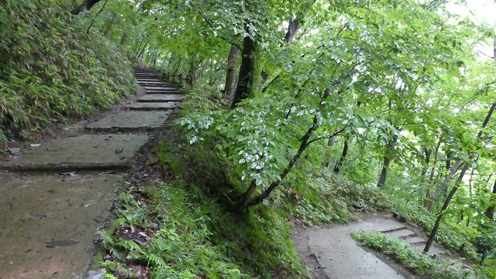
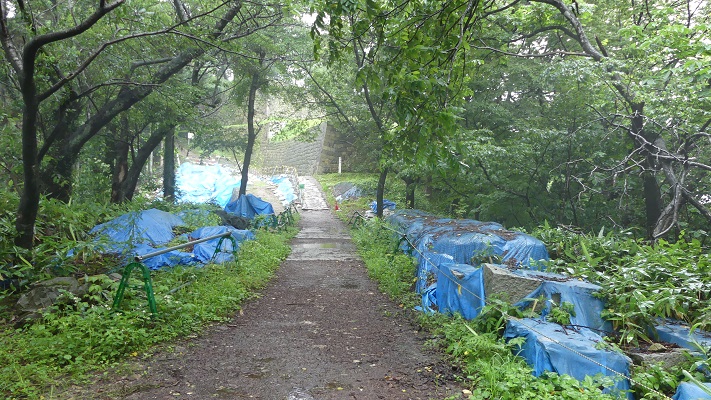
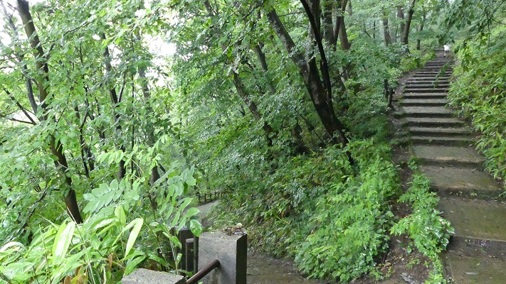
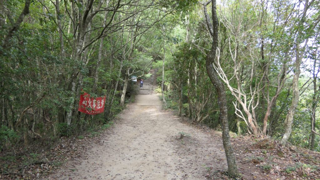
車で備中松山城に行かれる場合は、山を登る途中の駐車場に車を停めなければいけません。そして、そこからシャトルバスに乗り換えるか歩くのです。シャトルバスは、一番手前の峰、前山近くのふいご峠まで行きます。そこからは誰しもが城まで歩くことになります。中太鼓櫓跡を通って、約30分の道のりです。
( I will introduce only the main part of Bicchu-Matsuyama Castle on Komatsuyama peak, because I have only been there.) If you drive to Bicchu-Matsuyama Castle, you have to park at the parking lot half-way up the mountain. Then, you will transfer to the shuttle bus or walk. The shuttle bus goes to Fuigo Pass near the front peak called Maeyama. Everyone has to climb up from the pass to the castle. it takes about 30 minutes on foot going through the ruins of Nakadaiko Turret.

中太鼓櫓跡~The ruins of Nakadaiko Turret
城に至る山道~The trail to the castle

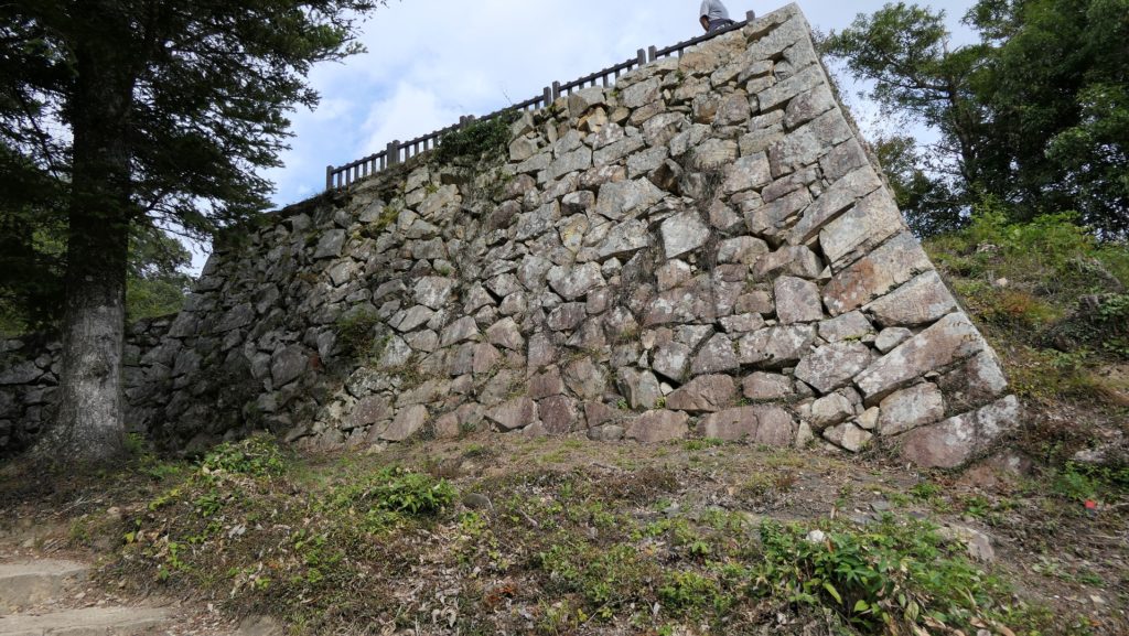
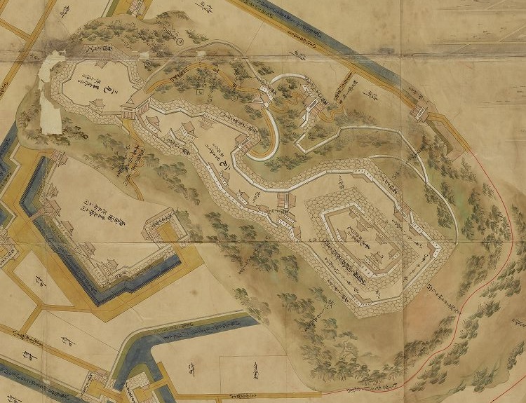
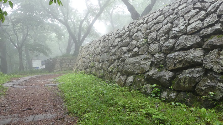
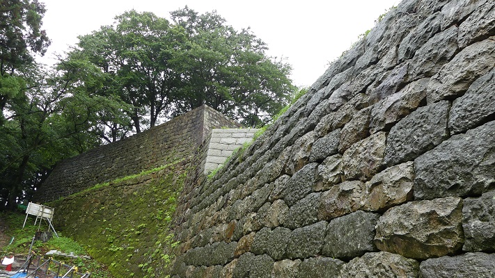
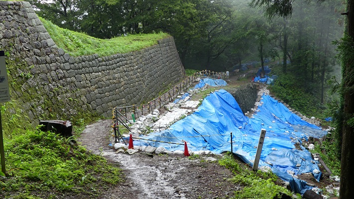
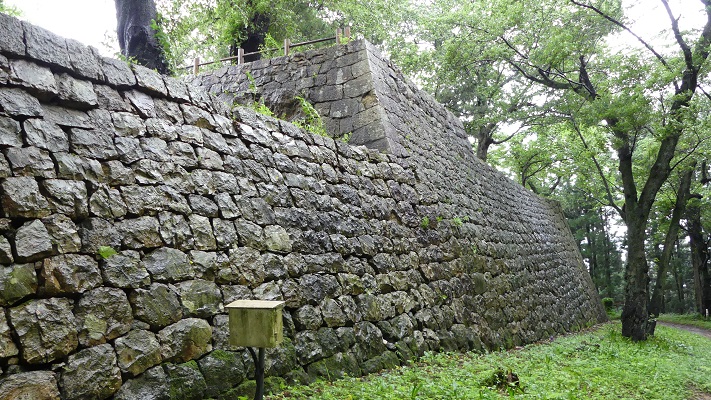
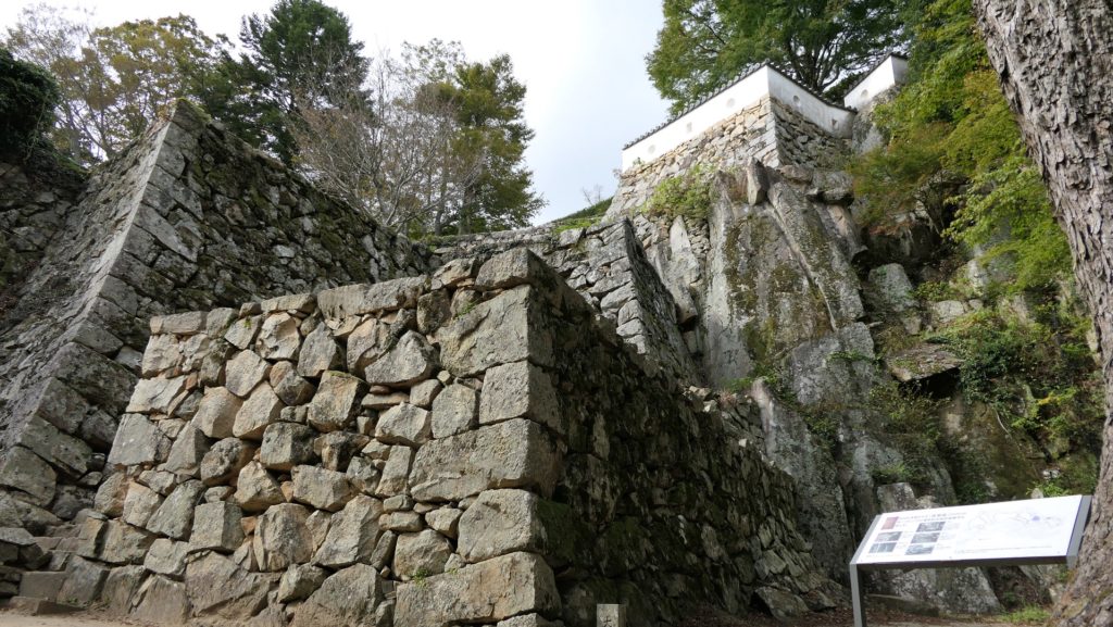
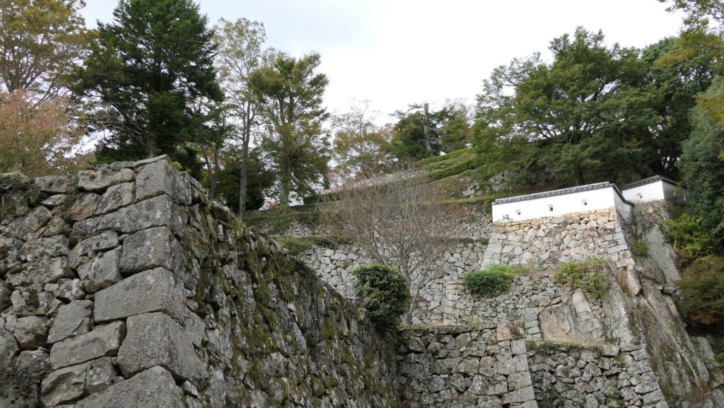
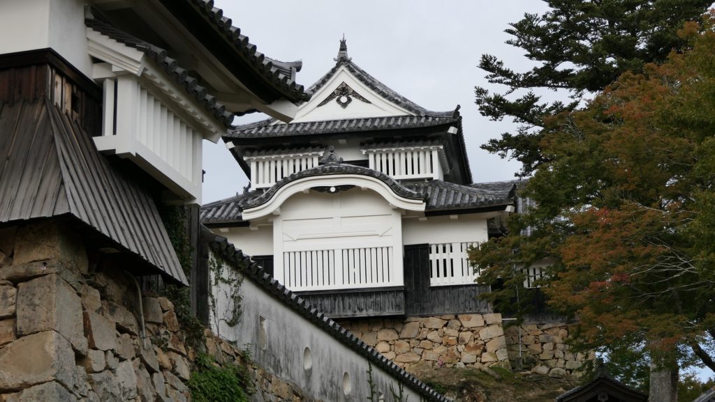
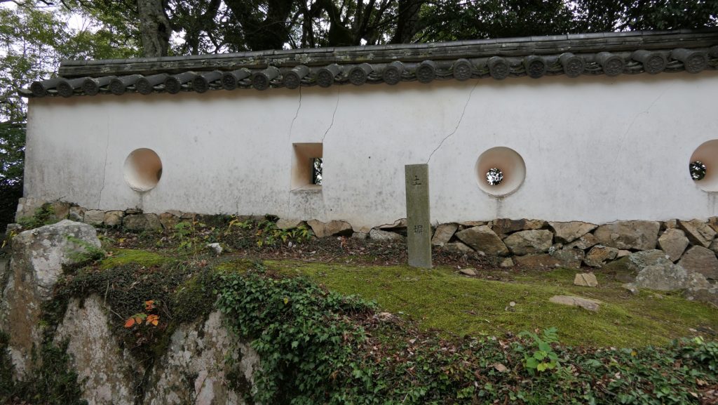
素晴らしい石垣~Wonderful stone walls

城周辺の航空写真~The aerial photo of around the castle

石垣と自然石の組み合わせに驚かれるかもしれませんが、そこは三の丸の入口である大手門の跡になります。三の丸からは、二の丸へと続く、折れ曲がり且つ石垣に囲まれた通路が続きます。これも壮観です。二の丸に至ると、いよいよ本丸が見えてきます。
You may be surprised to see the combination of stone walls and natural stones. It’s the ruins of the Main or Ote-mon Gate which is the entrance of the Third Enclosure or “Sannomaru”. From the Sannomaru, you will also see the route to the Second Enclosure or “Ninomaru” zigzagged and surrounded by stone walls. It also looks great. In the Ninomaru, you can finally see the Main Enclosure or “Honmaru”.

大手門跡~The ruins of the Main or Ote-mon Gate
二の丸に続く通路~The route to the Second Enclosure
二の丸から見た本丸~The Main Enclosure from the Second Enclosure

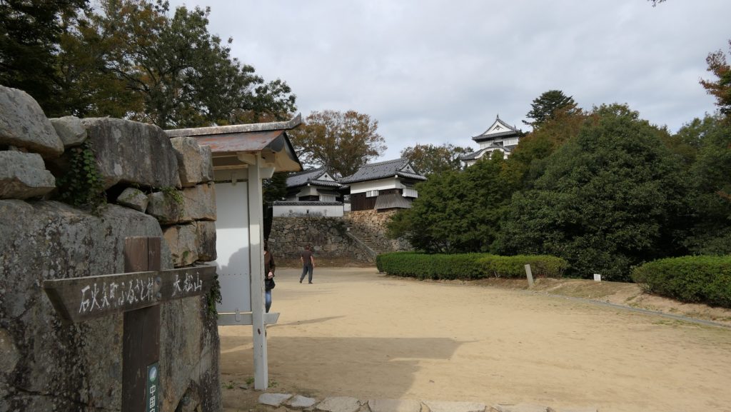
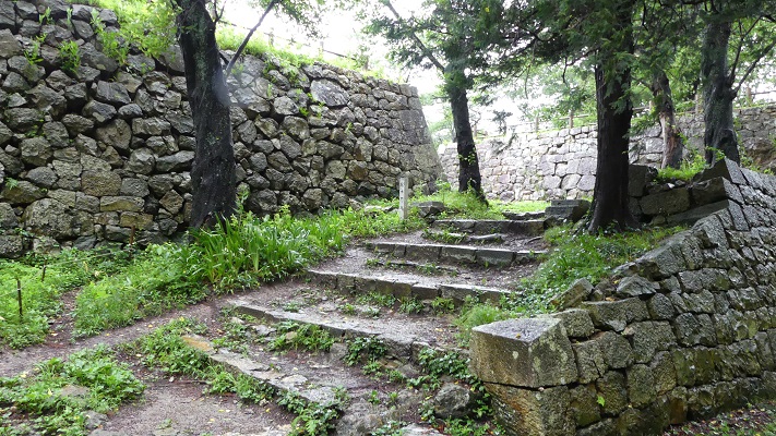
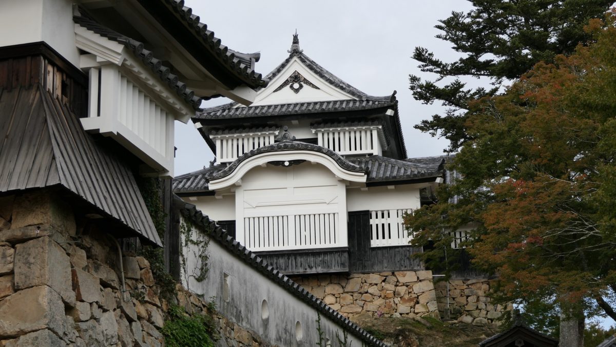
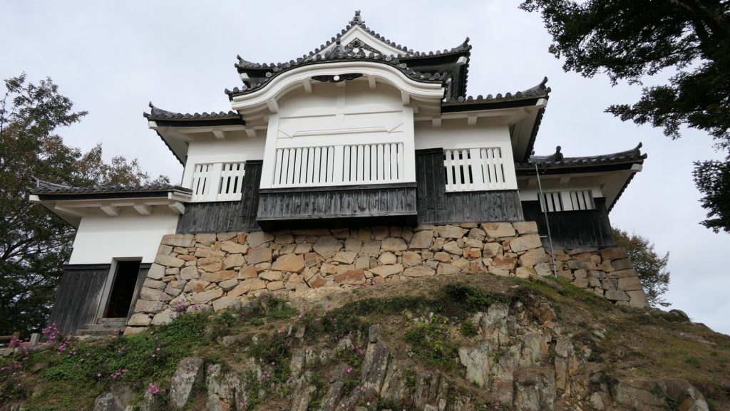
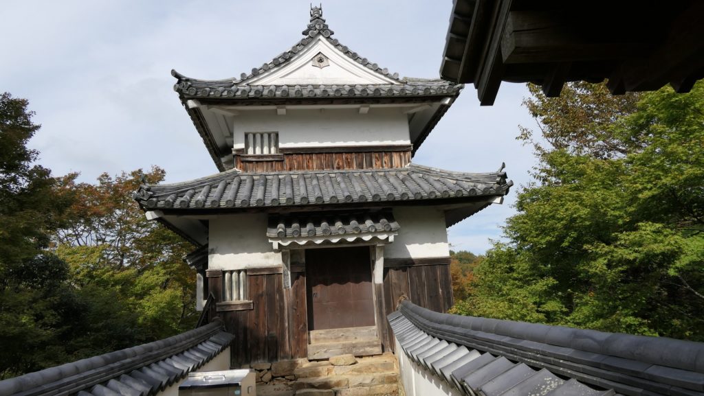
本丸と天守~Main Enclosure and Main Tower

本丸には天守と3基の櫓があります。天守は、日本で12ある現存天守の内の一つで、山城の中では唯一のものです。2階建てで高さは11mありますが、12天守の中では最小です。しかし、ごつごつした岩山とよくマッチして重厚に見えます。
Honmaru has the Main Tower or “Tenshu” and three turrets. The Tenshu is one of the 12 remaining ones in Japan and the only one on mountain castles. It is two stories and 11m high which is the smallest one among the 12 Tenshu. However, it matches the rocky top of the mountain and looks heavy.

本丸~The Main Enclosure
天守~The Main Tower

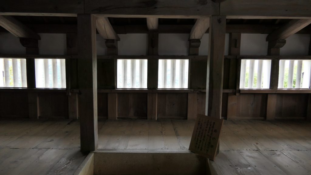
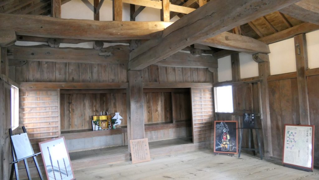
櫓は2階建てのものが一つと、単層のものが二つあります。よく調和しています。天守の中には入ることができ、内部は簡素で実用的です。1階には、囲炉裏と城主のための装束部屋があります。2階には神棚があり、一説には最後の時を迎える時のために準備されたものといいます。頂上からの眺めがよいことは言うまでもありません。
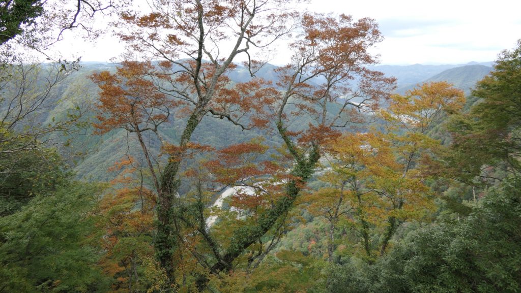
The turrets are also a two story one and two single story ones. They have a good valance. You can enter Tenshu. The inside of it is simple and practical. There is a fireplace and a dressing room for the lord at the first floor. The second floor has a Shinto altar. It is said that they were prepared for the lord’s last battle. Of course, the views from the top are very good!

天守の正面~The front of the Main Tower
天守1階~The first floor
天守2階~The second floor
本丸奥にある二階櫓~The two story turret at the back of the Main Enclosure
本丸からの眺め~A view from the Main Enclosure

その後~Later History

明治維新後、備中松山城は廃城となり、御根小屋の建物は撤去されましたが、山上の建物はなるがままにされました。そして、荒廃していきます。昭和初期になって、教師であった信野友春が城跡を調査し、結果を刊行しました。そのことにより、高梁町が城の保存に動き出したのです。ついに1956年には重要文化財に指定されました。
After the Meiji Restoration, Bicchu-Matsuyama Castle was abandoned and the buildings in Onegoya were demolished, but the buildings on the mountain were left as it would be. As a result, they were in ruin again. In the first Showa Era, a teacher, Tomonaru Shinano investigated the castle and reported to the public. Because of it, Takahashi Town started to preserve the castle. It was lastly designated as an Important Cultural Property in 1956.

三の丸の土塀も重要文化財です~The Important Cultural Property also includes this earthen walls at the Third Enclosure

私の感想~My Impression

たくさんの人たちが山上の見事な城を維持するために大変な努力を払ってきたことに驚きました。いつの日か(山麓から山の全ての峰までの)全城域を巡ってみたいです。
It is surprising to know that many people have made great efforts to keep such a great castle on the mountain. I hope I can visit the whole castle area (from the foot to all the peaks of the mountain) someday.

大松山城跡~The castle ruins of Omatsuyama peak(taken by あけび from photoAC)

ここに行くには~How to get There

シャトルバス乗り場近くの駐車場まで:
車で行かれる場合は、山陽自動車道賀陽ICから約30分かかります。
バスで行かれる場合は、備中高梁駅から約10分かかります。
東京、名古屋または大阪から備中高梁駅まで:新幹線で岡山駅まで行き、伯備線に乗り換えてください。
To the parking lot near the shuttle bus terminal:
If you want to go there by car, it takes about 30 minutes from the Kayo IC on Sanyo Expressway.
If you want to go there by bus, it takes about 10 minutes from Bicchu-Takahashi Station.
From Tokyo, Nagoya, or Osaka to Bicchu-Takahashi Station: Take the Shinkansen super express and transfer to Hakubi local line at Okayama Station.

リンク、参考情報~Links and References

備中松山城、高梁市公式ホームページ(Takahashi City Website)
・「歴史街道スペシャル、名城を歩く22、備中松山城」PHP研究所(Japanese Book)
・「よみがえる日本の城5」学研(Japanese Book)

131.村上城~Murakami Castle

戦国時代のこの城の姿を伝える絵図が残っています。
A drawing shows the castle’s appearance in the Warring States.

本丸の出櫓跡の石垣~The stone walls of De-Yagura ruins at Honmaru

立地と歴史~Location and History

村上城は、「臥牛山」という牛が臥せている形をした山にありました。この場所は、新潟県の北部にある村上市に所属しています。この城がいつ最初に築かれたかははっきりしません。戦国時代には本荘氏がこの城を所有していて、当時は本荘城と呼ばれていました。
Murakami Castle was located on a mountain called “Gagyu-San” which means a mountain which looks like a cow laying down. The place belongs to Murakami City in the northern part of Niigata Pref. It is uncertain when castle was first built. In the Warring States Period, the Honjo clan owned the castle which was then called Honjo Castle.

臥牛山~Mt. Gagyu-San

本荘繁長は、越後国(現在の新潟県)の有力戦国大名の上杉謙信に従っていました。ある時彼は独立を志し、謙信に反逆しました。謙信は無敵の武将とされており、城を取り囲みました。しかしこの城も難攻不落であり、約1年間耐え忍びました。ついには双方和睦を結びました。繁長はその後は上杉氏に献身的に仕え、十五里ヶ原の戦いでは最上氏を打ち破りました。ところが天下人の豊臣秀吉から、命令に背いたかどにより改易となってしまいます。
Shigenaga Honjo was under the great warlord in Echigo Province (what was now Niigata Pref.), Kenshin Uesugi. He once tried to be independent and rebelled against Kenshin. Kenshin who is considered invincible, surrounded the castle, but the castle which was also impregnable, stood for about a year. They finally made peace with each other. After that, Shigenaga was devoted to Uesugi. He defeated the Mogami clan in the battle of Jugorigahara. However, he was fired by the ruler Hideyoshi Toyotomi due to breaking Hideyoshi’s order.

本庄繁長の浮世絵、歌川国芳作、江戸時代~The woodblock print of Shigenaga Honjo, attributed to Kuniyoshi Utagawa, the Edo Period(licensed under Public Domain via Wikimedeia Commons)

上杉氏は1598年に東北地方に移されるのですが、その移封の直前に領地の絵図面を作成し、新しい領地の方に持っていき、現在まで保管しています。そのうちの一つが越後国瀬波郡絵図です。村上城はこの絵図の中で「村上要害」(要害は砦といった意味)として描かれています。その絵図はこの城の戦国時代終わり頃の姿を伝えています。わが国の貴重な文物とされています。
Uesugi clan was transferred to the Tohoku region in 1598, but they created drawings of their territory just before the transfer, brought them to their new territory, and have kept them until now. One of them is called the drawing of Senami District in Echigo Province. Murakami Castle is in the drawing as “Murakami Yogai” (Yogai means stronghold). The drawing shows the appearance of the castle at the end of the Warring States Period. It is considered a very valuable material for the country.

「越後国瀬波郡絵図」に描かれた村上要害~Murakami Yogai from “the drawing of Senami District in Echigo Province”(村上市websiteより引用)

この絵図によれば、この城には天守はなく、石垣も白壁もなく、ただ柵に囲まれた土塁の曲輪の上に館があるだけです。それは、当時の東日本においては典型的な地方の城のスタイルでした。本荘氏の後は、村上、松平、そして内藤氏といった氏族がこの城を支配しました。この城は彼らの下で近代化されました。天守が山の頂に築かれ、多くの石垣も築かれ、城の範囲は山麓まで広がりました。江戸時代に描かれた「越後国村上城之絵図」を見るとそれがわかります。この城が中世と近世の間にどのように変わったのかがはっきりと見て取れます。
According to the drawing, the castle had no Tenshu, no stone walls and no plaster walls, just had halls on earthen enclosures surrounded by fences. That was a typical local castle style in eastern Japan at that time.
After Honjo clan, several clans like Murakami, Matsudaira, and Naito governed the castle. The castle was modernized under their governance. The Tenshu keep was built on the top of the mountain, a lot of stone walls were also built, and the range of the castle was spread to the foot of the mountain. “The illustration of Murakami Castle in Echigo Province” in the Edo Period shows them. We can clearly see how the castle had changed between the Middle and Modern Ages.

「越後国村上城之絵図」部分、江戸時代~Part of “The illustration of Murakami Castle in Echigo Province”,the Edo Period(出典:国立公文書館)

明治維新の間、村上藩の武士たちは新政府につくか旧幕府につくか逡巡していました。旧幕府側の支持者たちは城を退去し、東北地方の同志に合流すると決め、自ら城に放火してしまいました。
During the Meiji Restoration, warriors of the Murakami Domain were wondering if they should support the New Government or the former Shogunate. When the supporters of former Shogunate decided to withdraw the castle and join supporters in Tohoku region, they burn the castle by themselves.

村上市郷土資料館にある城の模型~The miniature model of the castle at Murakami History Museum

特徴~Features

それでは入口から城跡に向けて登ってみましょう。山道は「七曲り道」と呼ばれていて、曲がりくねった山道といった意味です。
Let’s climb up to the castle ruins from the entrance. The trail is called “Nanamagari-Michi” which means a winding trail.

山道の入り口~The entrance of the trail

道の傾斜が緩やかになっているので、登りやすくなっています。実は、この道の由来は戦国時代にさかのぼると言われています。
That makes it easier for visitors to climb because the trail becomes more gentle. In fact, this trail can be traced back to the Warring States Period.

七曲り道~The trail called Nanamagari-Michi

それは、先ほどの「越後国瀬波郡絵図」と「越後国村上城之絵図」両方に、恐らくは同じ場所であろう所に、似たような山道が描かれているからです。何か素晴らしく感じます。そうなってくると、敵が簡単に城を攻撃できてしまうのではないかとも感じます。歴史家によると、敵がこのような曲がりくねった道を登るときは、側面を防御側に見せてしまうため、かえって防御側に有利になるということです。
Becase you can see the similar trail at probably the same place in both of “the drawing of Senami Distinct” and “the illustration of Murakami Castle”. It’s amazing. You may ask that enemies might attack the castle easily. Some historian suggest that attackers will have their sides facing the defenders when climbing such a winding trail. It can be advantageous for the defenders.

「越後国瀬波郡絵図」の山道部分~The trail part of “the drawing of Senami District in Echigo Province”
越後国村上城之絵図」の山道部分~The trail part of the drawing of Senami Distinct”

約15分ほどで山の上にある三の丸四つ門跡に到着します。
It will take about 15 minutes to reach the ruins of “Yottsu” gate at “Sannomaru” enclosure on the mountain.

四つ門跡~The ruins of “Yottsu” gate

本丸の方に行くには、狭い二の丸を通らねばなりません。
You can head towards “Honmaru” enclosure passing through narrow “Ninomaru”.

二の丸の通り道~The route on Ninomaru

今に残る多くの石垣が見られます。全ての石垣は江戸時代に作られたものです。
A lot of remaining stone walls are there. They were all built in the Edo Period.

本丸の石垣~The stone walls at Honmaru

山の一部は現在発掘中です。戦国時代の遺跡が見つかるのではないかと言われています。
Part of the mountain is now under excavation. It is said that the ruins in the Warring States Period might be found.

本丸の発掘されている部分~The part of Honmaru being under excavation

そうするうちに、山の頂にある天守台に到着します。そこからは村上市全域が一望できます。
You will soon reach the Tenshu base at the top of the mountain, and can see the whole view of Murakami City.

本丸の入り口~The entrance of Honmaru
天守跡~The ruins of Tenshu
山上からの村上市の眺望~A view of Murakami City from the top

その後~Later Life

明治維新後、領主だった内藤氏は城の残りの建物と一部の石垣の売却を申し出て許されました。その後、藩士の子孫たちは城跡を維持してきました。1960年には県の史跡に指定され、1993年には国の史跡にもなりました。
After the Meiji restoration, the lord Naito applied for and was allowed to sell the rest of the buildings and part of the stone walls in the castle. After that, the descendants of the warriors has kept the ruins. They are designated as a Prefectural Historic Site in 1960. They also became a National Historic Site in 1993.

本丸の石垣~The stone walls at Honmaru

私の感想~My Impression

地元の人たちが「七曲り道」の山道を日頃の運動のために登ったり下ったりしているのを見ました。どうやら毎日頂上まで登って戻ってくるという感じでした。会ったときはお互いにあいさつをしていました。かつては戦いのために作られた古の道は、現在人々の健康やコミュニケーションのために使われているのです。素晴らしいことです。
I saw that local people were climbing up or down the trail “Nanamagari-Michi” for daily exercise. They seemed to reach the top and turn back everyday. They were also saying hello each other. the traditional trail, which was built for battle, is now used for people’s health and comminication. It’s amazing.

今は市民のための七曲り道~Nanamagari-Michi now for citizens

ここに行くには~How to get There

JR村上駅から歩いて30分近くかかります。
東京から村上駅まで:
上越新幹線に乗り、新潟駅でJR白新線に乗り換えてください。
車で行く場合:日本海東北自動車道村上瀬波温泉ICから10分以内、または村上駅から約5分。
城跡には駐車場はありますが、小さいのでよく満車になります。そのときは近くの村上市役所か村上郷土資料館に駐車してください。
It takes nearly 30 minutes From JR Murakami station to get there on foot.
From Tokyo to Murakami st.:
Take the Joetsu Shinkansen superexpress to Nigata station, and transfer for JR Hakushin line.
If you want to go there by car: It takes within 10 minutes from the Murakami-Senamionsen IC on Nihonkai-Tohoku Expressway, or about 5 minutes from Murakami station.
The ruins have a parking lot. But it’s small and can often be full. In that case, you can park at the Murakami City Hall or Murakami History Museum nearby.

リンク、参考情報~Links and References

鮭、酒、人情(なさけ)むらかみ~Murakami city tourism association
ビジュアル再現 村上城(Only Japanese)
・「甲信越の名城を歩く 新潟編」吉川弘文館(Japanese Book)