166.宇陀松山城~Udamatsuyama Castle

杉林に囲まれた城跡
The castle ruins surrounded by a cedar forest

立地と歴史~Location and History

大和三城の一つ~One of Three Greatest Castles in Yamato Province

宇陀松山城は奈良県の北西部、宇陀市にありました。宇陀市は、林業と古い町並みで知られています。大阪市から車で約1時間ほどの場所です。宇陀松山城は最初は「城山」という473mの高さの山の上に、秋山氏によって築かれました。
Uda-Matsuyama Castle was located in Uda City in the north east part of Nana Prefecture. Uda City is known for its forest industry and old town. The city is approximately one hour by car from Osaka City. The Uda-Matsuyama Castle was first built on a 473m high mountain called “Shiroyama” by the Akiyama Clan.

城の位置~The location of the castle

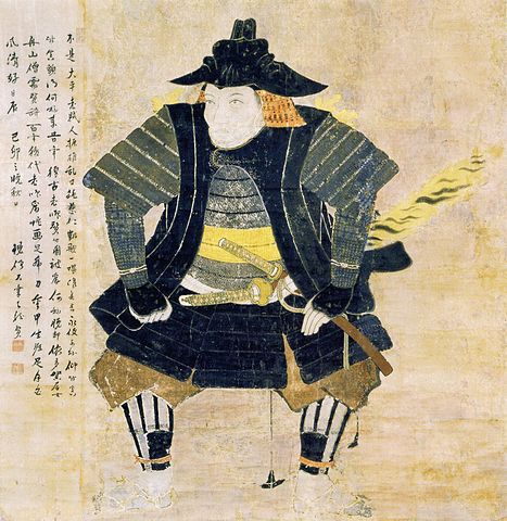
1585年、豊臣秀長が大和国(現在の奈良県)の統治を始めたとき、彼自身は大和郡山城を居城としていました。一方で、彼は家臣を、支城である高取城と宇陀松山城に派遣しました。その家臣のうち、主には多賀秀種が宇陀松山城を拡張しました。秀種は大和国の東部に領地を持っていて、東にある伊勢国との国境の防衛のため、城を用いていました。
In 1585, when Hidenaga Toyotomi started to govern Yamato Province (what is now Nana Prefecture), he lived in Yamato-Koriyama Castle, while he sent his retainers to Takatori and Uda Matsuyama Castles as his branch castles. Among the retainers was Hidetane Taga, who mainly developed the Uda Matsuyama Castle. Hidetane was granted the eastern part of the province with the intention to use the castle to prepare for the defense of the border between Yamato and Ise Province from the east.

多賀秀種肖像画、石川県立歴史博物館蔵、The portrait of Hidetane Taga, owned by Ishikawa Prefectural History Museum (licensed under Public Domain via Wikimedia Commons)

多賀秀種が城を改修~Hidetane Taga improves Castle

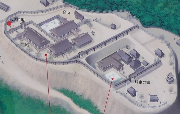
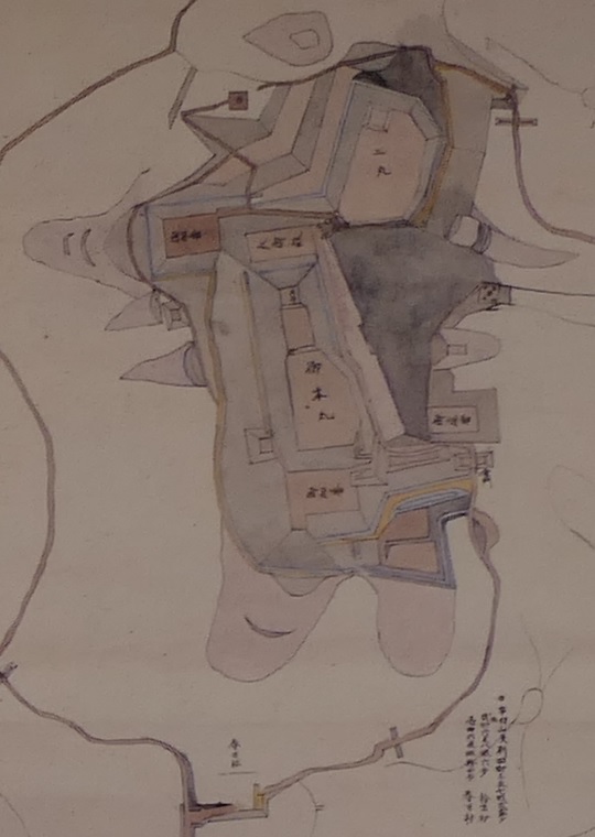
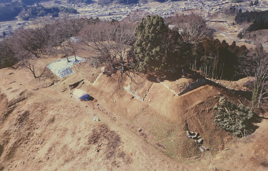
秀種は、この城を近世的なスタイルに変えました。城はいくつかの部分に分けられていました。御殿があった「本丸」と天守があった「天守郭」が山頂にありました。天守は、郭の大きさからすると2階か3階建てだったと考えられています。郭周辺の土壌から発掘により多賀氏の家紋が入った瓦が発見されています。
Hidetane changed the castle to an early modern style. The castle was divided into several sections: the Main Enclosure or “Honmaru” with the Main Hall, and Tenshu Enclosure with the Main Tower or “Tenshu” on the top of the mountain. The Main Tower is thought to be two or three stories based on the scale of the enclosure. The roof tiles with Taga Clan’s family crest were found by the excavation of the land around the enclosure.

家紋が入った瓦~A rooftile with the clan’s family crest (宇陀市パンプレットより引用)

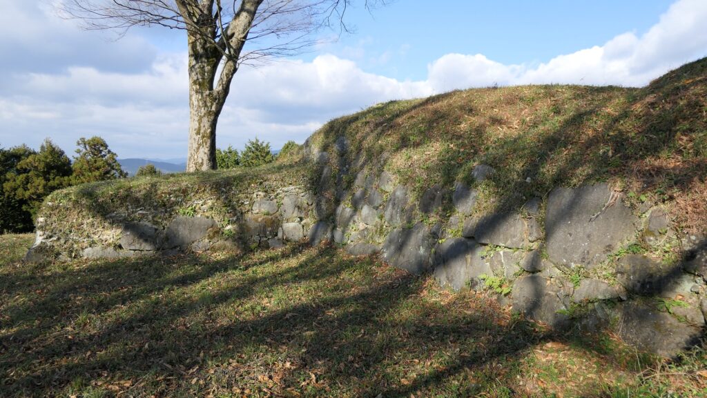
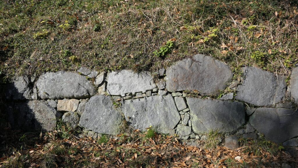
「二の丸」や「帯郭」などの他の郭は、城の中心を取り囲んでいました。城の主要部の基礎部分は全て石垣造りで、多くの櫓が立ち並んでいました。城の出入り口である「虎口」は、櫓門や屈曲した通路によって厳重に守られていました。
Other enclosures such as the Second Enclosure or “Ninomaru” and the Belt Enclosure or “Obi-kuruwa” surrounded the center of the castle. The foundation of this main portion was all made of stone walls where a lot of turrets stood. The entrances to the castle called “Koguchi” were guarded strictly by turret gates and zigzagged routes.

阿紀山城図、1593年 、「阿紀山城」は宇陀松山城の古名、現地案内板より~The illustration of Akiyama Castle, in 1593, “Akiyama Castle” is the old name of Udamatsuyama Castle, from the signboard at the site

城は破壊された~Castle is Destroyed

1600年、広島城を治めていた有名な福島正則の弟、福島高晴が、多賀秀種の代わりとして、徳川幕府により宇陀松山城に送られてきました。彼は城を改修するとともに、城下町を整備しました。ところが、1615年に彼は幕府により、幕府に反抗していた豊臣氏を支援した疑いから改易となってしまいます。
In 1600, Takaharu Fukushima, the little brother of the famous lord, Masanori Fukusima who governed Hiroshima Castle, was sent to Uda Matsuyama Castle instead of Hidetane Taga by the Tokugawa Shogunate. He also improved the castle and the castle town, however, in 1615, he was fired by the Shogunate due to suspicions about his support of the Toyotomi Clan who was against the Shogunate.

福島高晴の兄、福島正則肖像画、東京国立博物館蔵~The portrait of Masanori Fukushima, the big brother of Takaharu Fukushima, owned by the Tokyo National Museum (licensed under Public Domain via Wikimedia Commons)

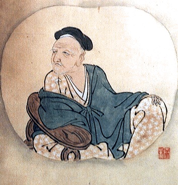
その結果、城は完全に破壊されることになり、建物と石垣は撤去され、通路は埋められました。執行者の一人、小堀政一の手紙が残っていて、作業は進んでいるものの、作業者が足りないということが書かれています。
As a result, the castle was completely destroyed removing the buildings and stone walls and burying the routes. A letter written by one of the executors, Masakazu Kobori, remains and says that he was destroying the castle, but lacked enough workers.

小堀政一肖像画、頼久寺蔵、The portrait of Masakazu Kobori, owned by Raikyu-ji Temple (licensed under Public Domain via Wikimedia Commons)

特徴~Features

杉林の中を進む~Going through Cedar Forest

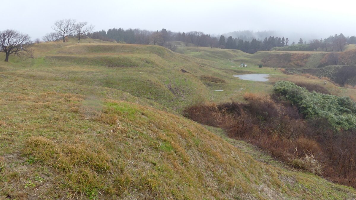
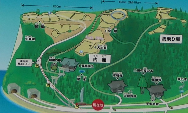
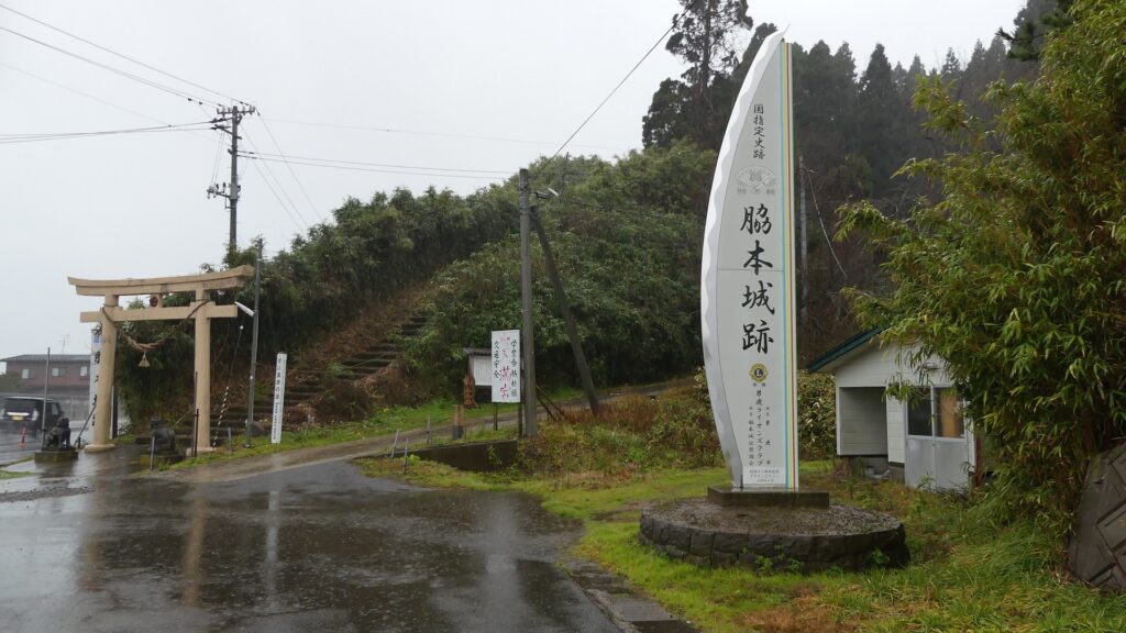
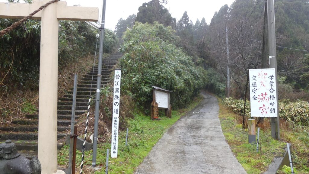
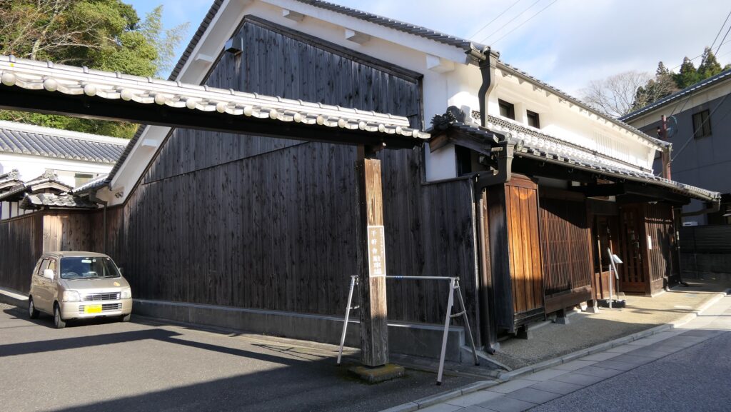
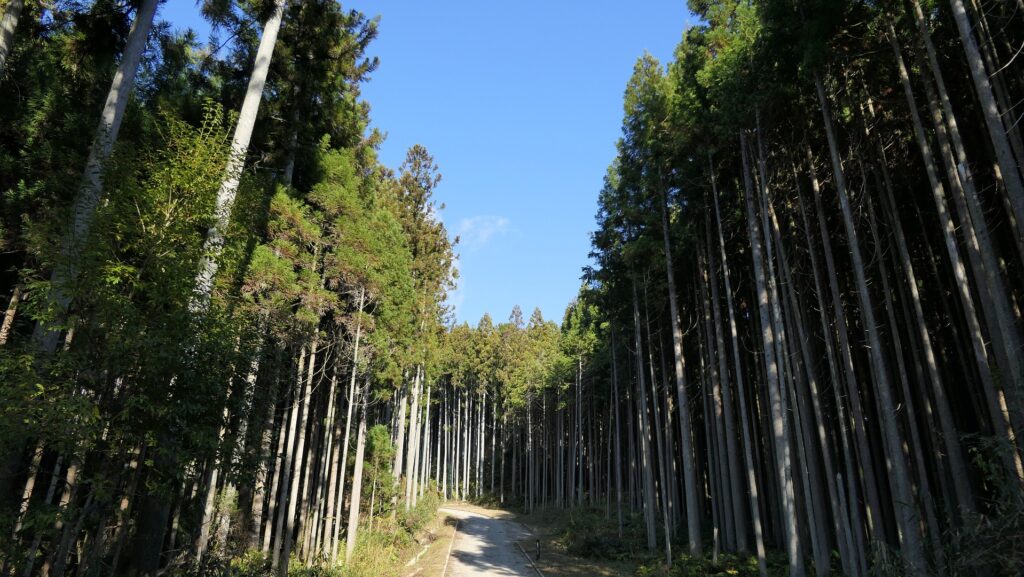
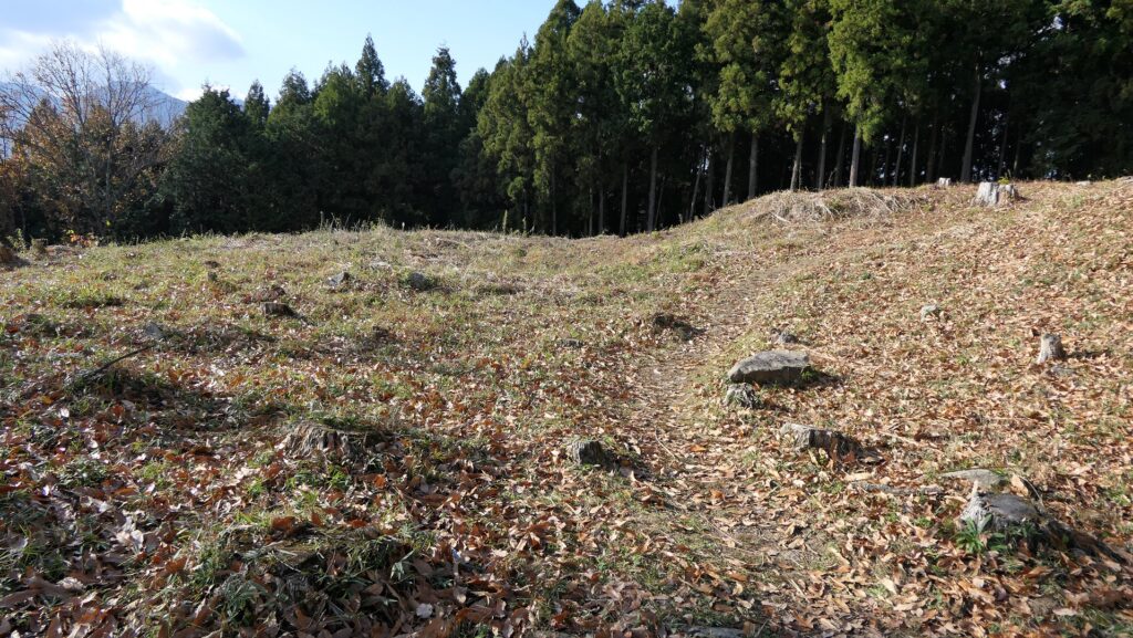
以前観光客は宇陀松山城跡へは、市街地にある城の正門であった春日門跡から行くことができました。ところが、2018年の豪雨災害により「大手道」が閉鎖されており、通ることができません(2021年4月現在)。代わりに、まちづくりセンター「千軒舎」の脇道を通って行くことができます。もしかすると、城跡に向かっているのか疑問に思うかもしれません。美しく、よく手入れが行き届いた杉林が見えてくるからです。
Previously, visitors could visit the ruins of Uda-Matsuyama Castle from the Kasuga Gate Ruins in the town area which was the front gate of the castle. However, visitors can no longer do so because the Main Route or “Ote-michi” to the castle is closed (as of January 2021) due to a storm disaster in 2018. Instead, visitors can go through the side road beside the Town Planning Center called “Sengensha”. You may not be sure you are going to the ruins of a castle, as you will see a beautiful, well-maintained cedar forest.

まちづくりセンター「千軒舎」~The Town Planning Center “Sengensha”
杉林に囲まれた通路~The route surrounded by the cedar forest

わずかに残る遺跡~Few remaining Ruins

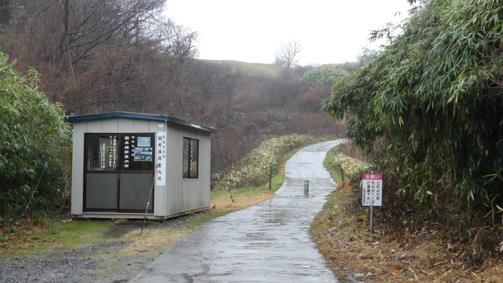
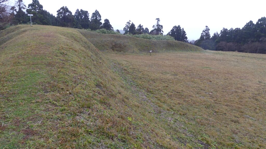
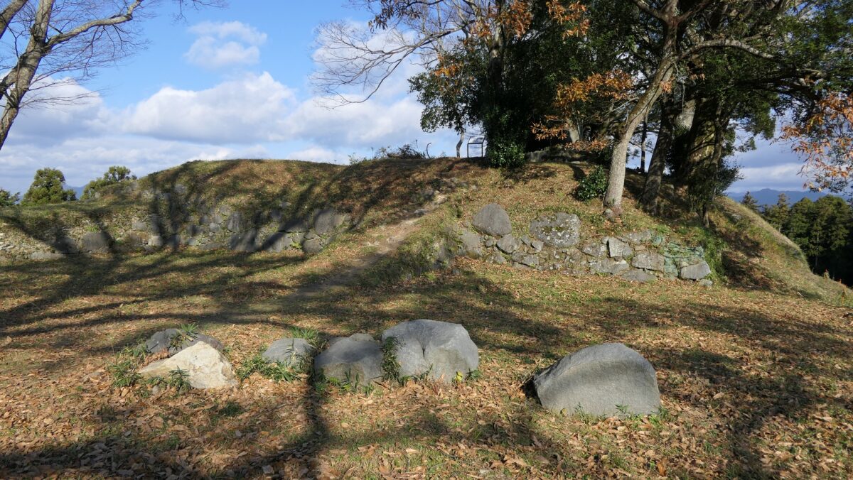
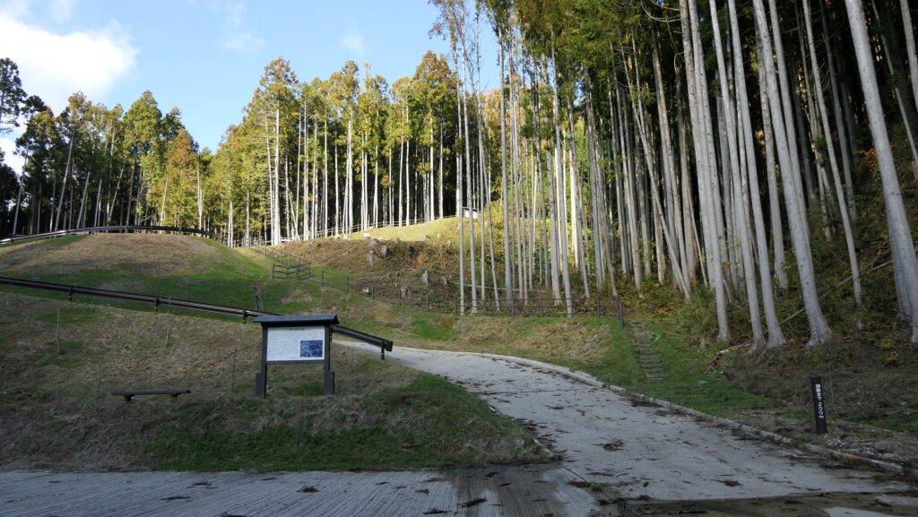
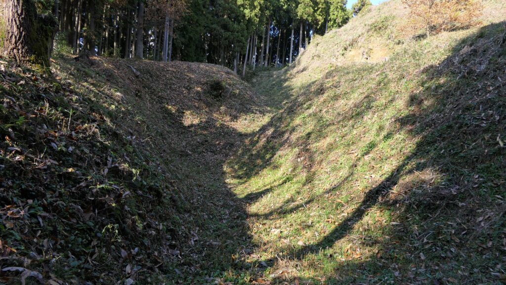
約10分間登っていくと、城跡の入口に着きます。そこから山道をあと数分を登らねばなりませんが、そうするうちに空堀と櫓門跡が見えてきます。この門は「雀門」と呼ばれ、「桝形」という四角い空間がありました。桝形は、典型的な防御構造で、その四角い空間は櫓や石垣に囲まれていました。敵は、強力な防御の下を屈曲した通路をくぐり抜けねばなりません。
After about a 10-minute climb, you will reach the entrance of the ruins. You have to climb another trail for a few minutes, then you will see the ruins of a dry moat and one of the turret gates. This gate was called “Suzume-mon” which had a square space called “Masugata”. Masugata refers to a typical defensive structure where the square space is surrounded by turrets and stone walls. Enemies have to survive through a zigzagged route under the strong defense.

城跡の入口~The entrance of the castle ruins
山道を進みます~Going on the trail
空堀~The dry moat
雀門跡~The ruins of Suzume-mon Gate

城の中心部分~Center of Castle

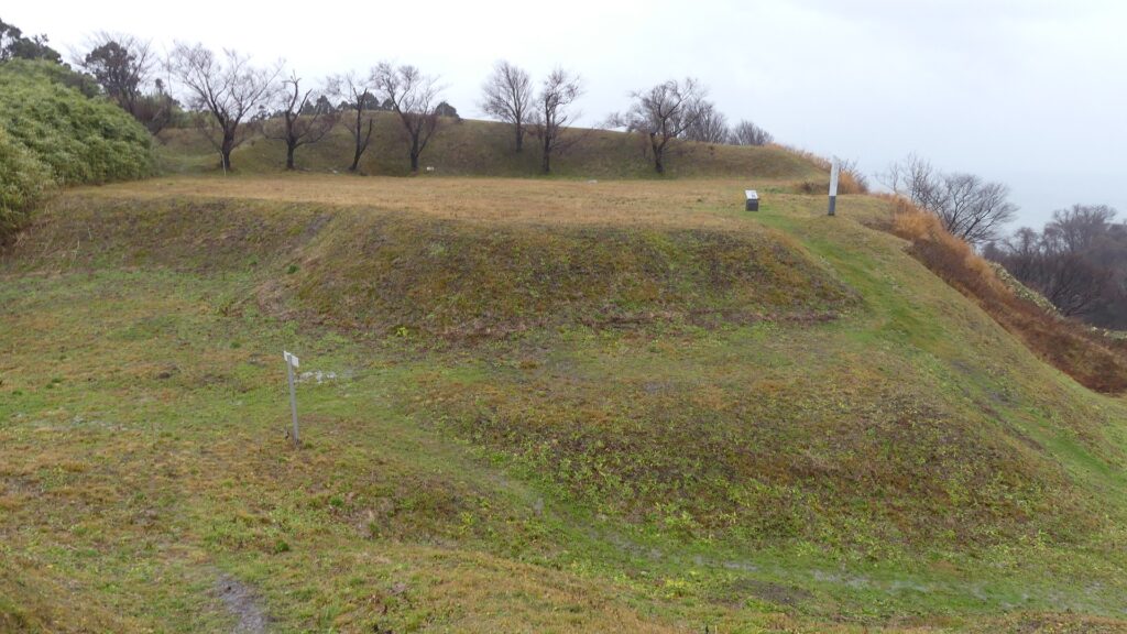
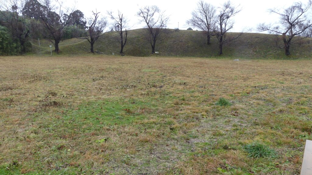
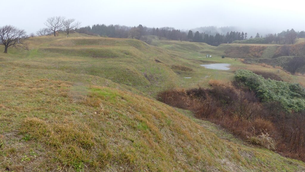
この城跡は、杉林によって隠されていて、少し変わった雰囲気があります。門を過ぎた後は、本丸に至るジグザグの道をまた進んでいきます。その道上にまた虎口郭門がありましたが、現在は何の痕跡もありません。本丸は、この城では最も広い郭です。ここには5つの棟を持つ御殿があり、また櫓や石垣に囲まれていました。
These ruins have a bit of a unique atmosphere, hidden from view by the cedar forest. After passing through the gate, you also have to go on another zigzagged route to reach the Main Enclosure. There was also the Entrance Enclosure Gate on the route, but there is no trace of it now. The Main Enclosure is the largest enclosure of the castle. It had the Main Hall with five houses and was also surrounded by turrets and stone walls.

城周辺の航空写真~The aerial photo around the castle

虎口郭門があったと思われる場所~The place where the Entrance Enclosure Gate seemed to be there
本丸~The Main Enclosure

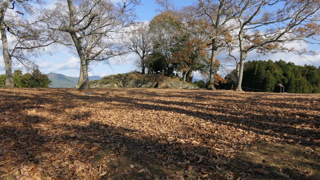
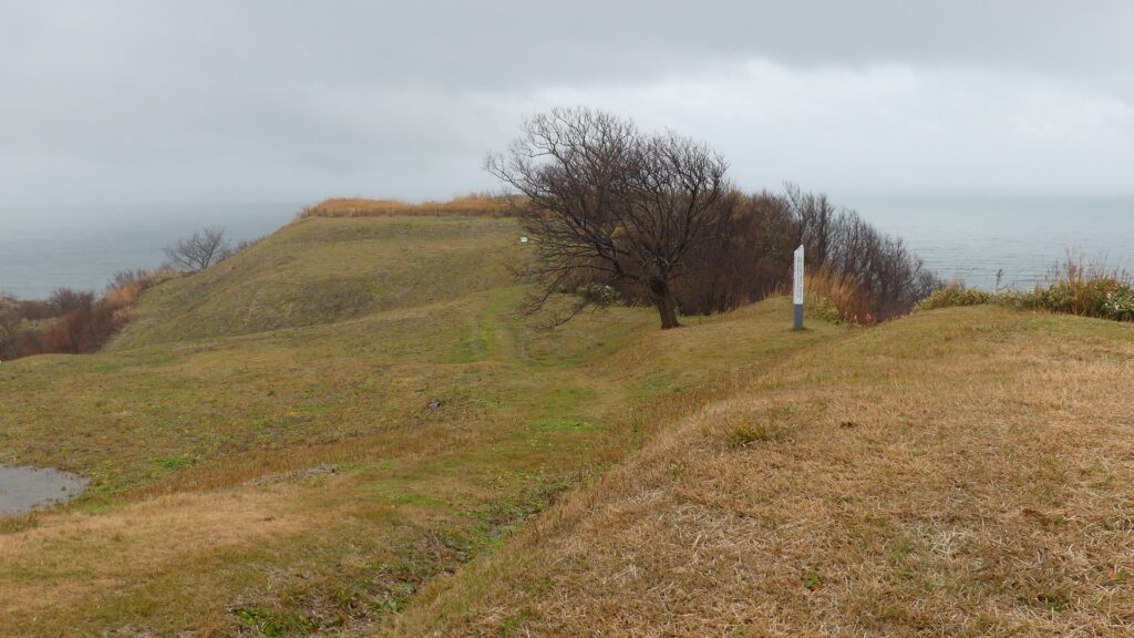
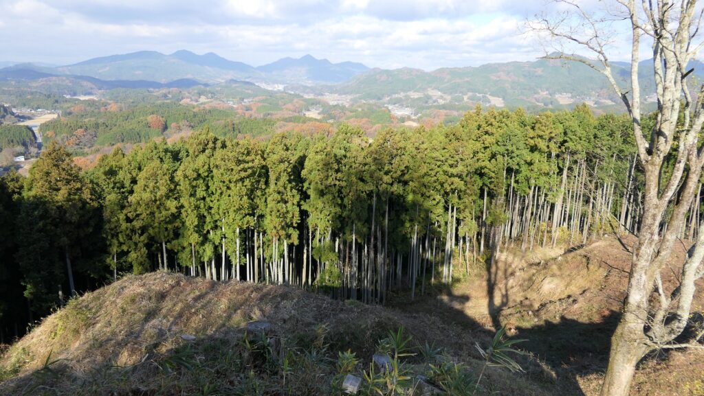
天守郭は、本丸の隣りにあります。ここは山の頂点であり、天守がかつて立っていた天守台石垣の一部分がまだ残っています。頂上からは、杉林に囲まれた他の郭や、遥か彼方の他の山々が見えます。
Tenshu Enclosure is next to the Main Enclosure. It is the highest spot of the mountain and parts of the base of the stone walls still remains where the Main Tower once was. You can now see other enclosures surrounded by the cedar forest and other mountains far away from the top.

天守郭~Tenshu Enclosure
天守郭全景、現地案内板より~A whole view of Tenshu Enclosure, from the signboard at the site
山頂からの眺め~A view from the top

その後~Later History

宇陀松山城が破壊された後、織田氏がこの地域を治めましたが、城下町の辺りの館に住んでいました。また、春日門跡を修繕して館の門として使用しました。幕府は最終的には織田氏を他の所に移し、直接この地域を統治します。城下町は、商業の町として繁栄を続けました。
After the Uda-Matsuyama Castle was destroyed, the Oda Clan governed this area, but the clan lived in the hall around the castle town. They also repaired and used the Kasuga Gate Ruins as their hall’s gate. The Shogunate lastly governed the area after it transferred the Oda Clan to another place. The castle town continued to prosper as a commercial town.

春日門跡~The ruins of Kasuga-mon Gate (licensed by Saigen Jiro via Wikimedia Commons)

1995年、宇陀市は城跡の発掘と研究を始めました。その結果、城には山の上に石垣を使った豪華な建物があったことがわかったのです。発掘の成果により、城跡は2006年に国の史跡に指定されました。
Uda City started to excavate and study the ruins of the castle in 1995. It found out that the castle was built using stone walls and had luxurious buildings on the mountain. The ruins were designated as a National Historic Site in 2006 due to the achievement of the excavation.

私の感想~My Impression

発掘や研究の方法は年々進化しています。現在建物がなくても城の建物がどのようなものであったか推測できるのです。今回の訪問と宇陀松山城についての研究により、私は過去にこのような立派な城があったことに本当に驚きました。
The methods of excavation and study have been improving. They have made it possible to speculate what buildings in a castle looked like even if there are no buildings now. From my visit and research about the Uda-Matsuyma Castle, I was actually surprised to learn that there was such a great castle in the past

天守郭の石垣~The stone walls of Tenshu Enclosure

更には、ある城が残るかどうかは、ほんの小さなことで違ってきてしまうことも知りました。宇陀松山城の場合、高晴がもう少し長く持ちこたえていれば、城跡は高取城のように少なくとも石垣くらいはまともに残っていたと思うのです。
In addition, I also learned that whether something of a castle can remain or not is sometimes based on very small things. In the case of the Uda-Matsuyama Castle, if Takaharu survived a little longer, the ruins of the castle would include at least with decent stone walls like Takatori Castle.

発掘された雀門跡周辺の石垣~The excavated stone walls around the ruins of Suzume-mon Gate

ここに行くには~How to get There

車で行かれる場合は、南阪奈道路の葛城ICから約40分かかります。まちづくりセンターに駐車場があります。
電車の場合は、近鉄大阪線の榛原駅から大宇陀行きのバスに乗って、終点で降りてください。
If you wish to visit there by car, it takes about 40 minutes from the Katsuragi IC on Minami-Hanna Road. There is a parking lot at the Town Planning Center.
When using the train, take the bus for Ouda from Haibara Station on Kintetsu Osaka Line, and get off at the last stop.

リンク、参考情報~Links and References

宇陀松山城跡、宇陀市(Uda City Official Website)
・鬼面百相、史跡宇陀松山城出土資料展パンフレット(Japanese Pamphlet)
・「日本の城改訂版第120号」デアゴスティーニジャパン(Japanese Book)

106.脇本城~Wakimoto Castle

安東氏が最盛期のときの城
The castle when the Ando clan was its peak

立地と歴史~Location and History

舟運で繁栄した出羽国~Dewa Province Prospering by Ships

近代以前、大量輸送は船によって行われましたが、海上での航海は危険でした。船が十分発達していなかったからです。日本の場合、中世においては、商業船は主には太平洋ではなく、瀬戸内海や日本海などの内海を航行していました。そのため、当時は内海沿いの大きな港をもつ地域が繫栄しました。出羽国(現在の秋田、山形県を合わせた範囲)はそのような地域でした。
Before the Modern times, mass transportation was done by ships, but sailing on ocean could be dangerous because ships were not developed enough. In the case of Japan, in the Middle Ages, merchant ships sailed mainly on islands seas, such as the Seto Island Sea and the Japan Sea, not on the Pacific Ocean. For this reason, areas with a large port along the island seas prospered at that time.
Dewa Province (combining what is now Akita and Yamagata Prefectures) was one such areas.

1860年代の日本古来の弁財船~Traditional Japanese junks in 1860s (licensed under Public Domain via Wikimedia Commons)

秋田で力をつけた安東氏~Ando Clan has power at Akita

安東氏は、北出羽(大体今の秋田県)を根拠地として海上交通を支配して大きな勢力となりました。戦国時代(日本中の地方大名が覇権をめぐって争った時代)には安東氏は、檜山安東氏と湊安東氏の2つのグループに分かれていました。檜山安東氏は北秋田にあった檜山城に住み、湊安東氏は南秋田にあった湊城を拠点としていました。
The Ando Clans had a great power to manage the marine transportation based in the north Dewa (roughly now Akita Prefecture). In the “Sengoku” Period- a period when local clans around Japan were fighting for control over all of the country- the Ando Clans was divided into two groups namely the Hiyama-Ando Clan and the Minato-Ando Clan. The Hiyama-Ando Clan lived in Hiyama Castle which was located on the northern part of Akita, while the Minato-Ando Clan lived in Minato Castle located on the southern part of Akita.

城の位置~The location of the castle

安東愛季は、最初は檜山安東氏の総領でしたが、湊安東氏に固有の跡継ぎがいなかったため、取り込むことに成功しました。彼は、秋田全域を統治することで最も有力な戦国大名の一人になったのです・
Chikasue Ando was at first the lord of the Hiyama-Ando, but was able to take over the Minato-Ando as it didn’t have its own successor. As a result, he ruled over the entire Akita and became known as one of the greatest warlords.

安東愛季の肖像画、東北大学附属図書館蔵~The portrait of Chikasue Ando, owned by Tohoku University Library (licensed under Public Domain via Wikimedia Commons)

安東愛季が脇本城を拡張~Chikasue Ando develops Wakimoto Castle

愛季は1577年、彼の本拠地を檜山城と湊城の間にある城に移しました。彼が選んだ城が脇本城だったのです。この城は最初は15世紀に築かれたと言われていますが、その後愛季が東日本では有数の規模の山城にまで拡張しました(約150ヘクタール)。この城は、男鹿半島の根元にある100mの高さの丘の上に築かれ、重要な商業港であった土崎湊の近くでもありました。また、主要道路の「天下道」が城の中を通っているため、非常に戦略的な立地であり、城の領主は完全に交通を制御することができました。
Chikasue moved his home base to a castle located between Hiyama and Minato Castles in 1577. The castle that he chose was the Wakimoto Castle. The castle is said to be first built in the 15th century, then Chikasue developed the castle as one of the largest mountain castles in eastern Japan (about 150 hectare). The castle was located on a 100m high hill in the connecting part of Oga Peninsula, near an important trading port called Tsuchizaki-minato. This location proved to be very strategic as a main road called “Tenga-michi” ran between the two sides of the castle giving the Lord full control over transportation.

遺跡の全体図、現地案内板より~The whole map of the ruins, from the signboard at the site

愛季は支配者として絶頂期にあって、領土を拡張する一方、織田信長といった外の有力戦国大名とは手紙や贈り物により親交を深めました。ところが、1587年の戦いのさ中、彼は突然の病に倒れ、亡くなってしまいます。彼の息子、実季は湊城に住み、最終的には1602年に徳川幕府により関東地方に移されてしまいました。脇本城はそれから廃城となってしまったようです。
Chikasue was at the peak of his career as an administrator expanding his territory and building relationship with other great warlords such as Nobunaga Oda by sending letters and gifts. However, during a battle in 1587 he suddenly fell ill and died. His son, Sanesue lived in Minato Castle and was lastly transferred to Kanto Region by the Tokugawa Shogunate in 1602. Wakimoto Castle seemed to be abandoned since then.

安東実季木造、羽賀寺蔵~The wooden statue of Sanesue Ando, owned by Haga-ji Temple (licensed under Public Domain via Wikimedia Commons)

特徴~Features

城跡へ登っていく~Walking up to Castle Ruins

現在、脇本城跡は今もって非常に広大であり、5つの地区に分けられています。しかしながら、5つの地区全てが等しく整備されているわけではありません。そこで、私の訪問時には、一番整備されている「内館」1箇所を見学しました。ここは城の中心部分であり、現在はより整備されていて、観光客が訪れやすいようになっています。
Now, the ruins of Wakimoto Castle are still very large, and they are divided into five areas. However, not all the 5 areas have been developed equally. So, when I visited, I covered the one that was most developed which is “Uchidate”. This was the main portion of the castle, and now is further developed for tourists to visit easily.

城周辺の航空写真~The aerial photo of around the castle

城跡の入口は国道101号線沿いにあります。車で来られた方のために駐車場があります。そこから城跡への道を登っていく必要がありますが、それはかつてからある「天下道」の一部分です。更に進んで城跡の案内所を過ぎると、丘の頂上部分が見えてきます。
The entrance of the ruins is alongside National Route 101. You can park at a parking lot if you are driving. Then, you need to walk up the road to the ruins which was part of the old road, “Tenga-michi”. When you go farther passing through the guide house of the ruins, you will see the top of the hill.

城跡の入口~The entrance of the castle ruins
残っている「天下道」~The remaining “Tenga-michi” road
案内所を越えて頂上へ~Passing the guide house to the top

生鼻崎周辺~Around Oihana-saki Cape

基本的に、戦国時代の東日本では、城の基礎部分は土造りでした。城跡には建物はありませんが、土塁、空堀、虎口などが残っています。丘の頂上に登ってみると、左手(西の方角)には、海に突き出ている「生鼻崎」という岬の上にたくさんの曲輪があるのがわかります。それらの曲輪は岬の先端に向かって列を作って並んでいます。実はかつてはもっと多くの曲輪が岬と共に海に伸びていたのですが、江戸時代の地震のときに崩壊してしまいました。歴史家はこれらの曲輪は安東氏の家臣の屋敷地として使われたのではないかとしています。岬の先端では、日本海の荒々しい姿が見えます。
Basically, the foundations of the castles, in eastern Japan during the Sengoku Period, were made out of soil. The ruins have no buildings, instead they have earthen walls, dry moats, entrances, etc. When you climb on top of the hill, you will see a lot of enclosures on a cape called “Oibana-saki”, sticking out to the sea on the left on the west direction. You can see that these enclosures are in lines towards the top of the cape. In fact, there were many more enclosures with the cape spread to the sea in the past, but they collapsed when an earthquake happened in the Edo Period. Historians speculate that they were used for the Ando clan’s retainers’ houses. At the top of the cape, you can also have a wild view of the Japan Sea.

内館地区の地図、現地案内板に注記~The map of Uchidate Area, from the signboard at the site, adding notes
岬に伸びる曲輪~The enclosures spreading to the cape
生鼻崎周辺の想像図、現地案内板より~The imaginary drawing around Oibana-saki Cape, from the signboard at the site
日本海の眺め~A view of the Japan Sea

城の中心部分~Center of Castle

道の反対側の東の方向には、空堀に囲まれたもっと大きな曲輪があります。この辺りが、城の中心地であったと考えられます。歴史家は、北側には別々の目的で作られた2つの建物があったと推定しています。一つは公式の儀式で使われた「主殿」という建物で、もう一つはお客をもてなす「会所」という建物です。
There are two larger enclosures surrounded by dry moats on the opposite side of the route on the east direction. They are supposed to be the center of the castle. Historians also speculate that two buildings on the northern side were used for other purposes. For example one of them was used as the building for the public ceremonies called “Shuden’ and the other for hosting the guests called “Kaisho”.

城の中心部分~The center of the castle
空堀~The dry moat
北側の曲輪~The north enclosure
中心部の想像図、現地案内板より~The imaginary drawing around the center, from the signboard at the site

もう一つの南側の曲輪は高くて太い土塁に囲まれており、これもまたとても大きいものです。ここには城主の館があったと考えられています。愛季が住んでいたのでしょうか。この曲輪からは、海岸線とかつては城下町であった街並みの素晴らしい景色が望めます。
The other southern enclosure is surrounded by high thick earthen walls, and it is also very large one. This is thought to be used as the house of the lord. I wonder if Chikasue lived in it. From the enclosure, you can also have a great view of the coast line and the town which was once the castle town.

土塁に囲まれた南側の曲輪~The south enclosure surrounded by the earthen walls
海岸線の景色~A view of the coast line

その後~Later History

江戸時代の1804年、有名な旅行家の菅江真澄が脇本城の城跡を訪れています。彼は日記に城跡のことを記録し、スケッチも残しました。1993年からは調査が行われており、この城が非常に大きな規模であったことがわかりました。そのため、城跡は2004年に国の史跡に指定されました。
In 1804 of the Edo Period, a famous traveler, Masumi Sugae visited the ruins of Wakimoto Castle. He recorded the ruins on his diary and left his sketches of them. Investigations have been done since 1993 and it was found out that the castle had a huge scale. Because of it, the ruins were designated as a National Historic Site in 2004.

菅江真澄の脇本城のスケッチ、現地案内板より~One of Sugae’s sketches for Wakimoto Castle, from the signboard at the site

私の感想~My Impression

私が脇本城跡に行ったときは、ひどい天気でした。更に「内館」地区しか行っていません。それでもこの城跡が大変な規模だということは言えます。もし晴れた日に十分時間が取れれば、もっと城跡を満喫できると思います。他の有名な城に比べてこの城の研究は始まったばかりです。この城から新たな発見がもたらされるのが楽しみです。
When I visited the ruins of Wakimoto Castle, the weather was very bad. In addition, I saw only one area called “Uchidate”, but I was able to witness the large scale of the ruins. If you have enough time to visit the ruins in a fine day, you can enjoy them more! I think the study for the castle have just started compared with other famous castles. I will be looking forward to seeing the new discovery from the castle.

岬側からの城跡の風景~A view of the castle ruins from the cape

ここに行くには~How to get There

車で行く場合:秋田自動車道昭和男鹿ICから約30分かかります。城跡の入口に駐車場があります。
電車の場合、JR男鹿線脇本駅から城跡まで歩いて約30分かかります。
東京から脇本駅まで:新幹線に乗り、秋田駅で男鹿線に乗り換えてください。
If you want to go there by car: It takes about 30 minutes from the Showa-Oga IC on Akita Expressway. There is a parking lot at the entrance of the ruins.
By train, It takes about 30 minutes from Wakimoto Station on JR Oga line to the ruins on foot.
From Tokyo to Wakimoto Station: Take the Shinkansen super express and transfer to Oga line at Akita Station.

リンク、参考情報~Links and References

脇本城跡、男鹿市観光協会(Oga city tourism association)
・「日本の城改訂版第150号」デアゴスティーニジャパン(Japanese Book)
・「土崎港(秋田港)の「みなと文化」/渡辺英夫」(Japanese Paper)