196.Sadowara Castle Part1

The castle symbolized the Ito Clan’s success and failure.

Location and History

Ito Clan from eastern Japan builds Castle

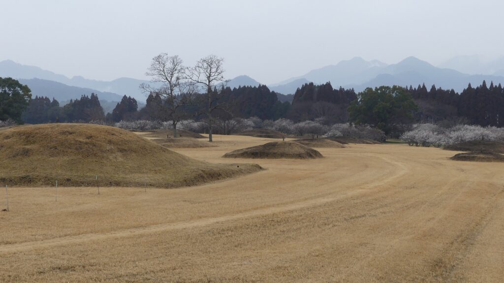
Miyazaki Prefecture is located in the eastern part of the Kyushu Region, which is known for its agriculture. Because of its long from the north to the south and its face is the direction of sunrise, therefore, it’s suitable for farming. Almost all the area of the prefecture was called Hyuga Province, which means the province facing the sun. It is easy to see the province had been fertile since the Ancient Times. There has actually been the popular Saitobaru Burial Mounds which were built between the 4th and 7th Centuries in the central part of the prefecture. The province also had the legend of the first Emperor Jinmu coming from there, going to the east, in order to establish Yamato Imperial Court.

Saitobaru Burial Mounds

The range of Miyazaki Prefecture and the location of the castles

Sadowara Castle was the one which once became the center of Hyuga Province and the home base of the Ito Clan. The clan originated from the Kudo Clan and called themselves a land name of Ito when they settled in Ito, the eastern part of Izu Peninsula, eastern Japan in the 12th Century. Since the Kamakura Shogunate was established at the end of the century, some of the warriors were sent by the shogunate to local areas to govern them. A branch of the Ito Clan, which was sent to Hyuga Province, was one of them. The Tajima-Ito Clan, which was named after the settlement, was said to have first built the castle in the 14th Century.

The range of Izu Peninsula (inside the blue line) and the location of Sadowara Castle

Top of Ito 48 Castles

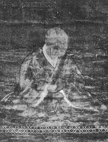
Meanwhile, another person from the core family of the Ito Clan was also sent by the Ashikaga Shogunate to Hyuga Province in the same century to govern the area during the Northern and Southern Courts period. Both Ito Clans were eventually unified and became a strong warlord based in Sadowara Castle. During the Sengoku Period between the 15th and 16th Centuries, the clan often fought against the Shimazu Clan from the south over Hyuga Province. The lord of the clan at that time, Yoshisuke Ito was so aggressive that he was able to capture Obi Castle, a major one in the southern Hyuga Province in 1569. He was just at his peak, having owned 48 castles in the province, in which Sadowara Castle was at the top. Its castle town prospered like the provincial capital and it was called Little Kyoto in Kyushu.

The portrait of Yoshisuke Ito, from the Sakai City History Volume 1 (licensed under Public Domain via Wikimedia Commons)
The ruins of Obi Castle

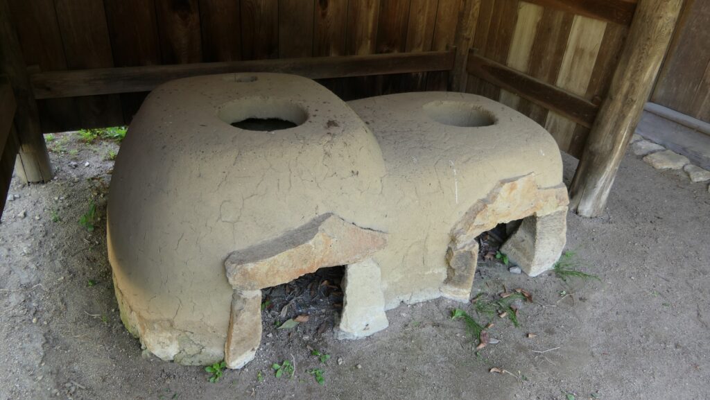
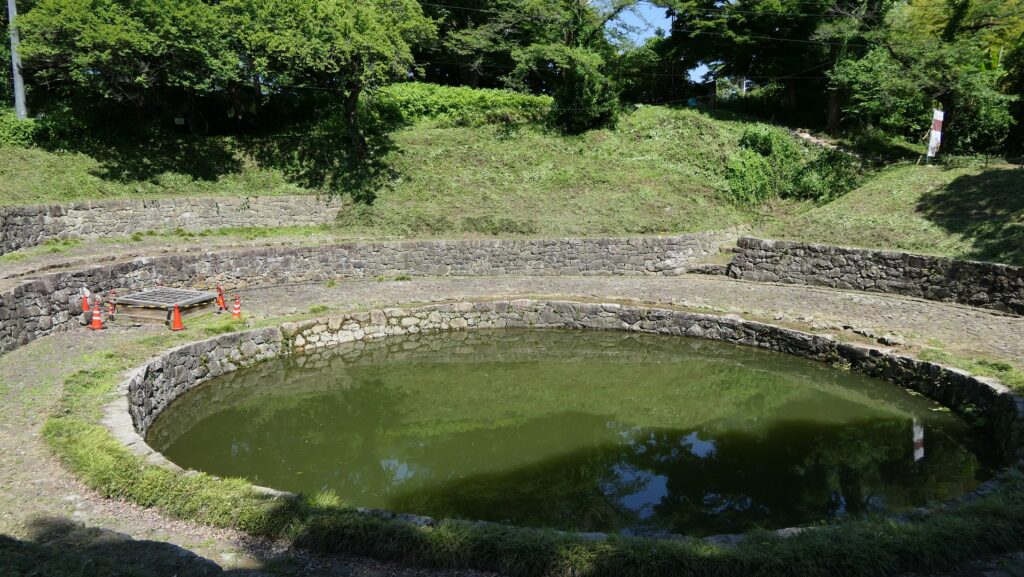
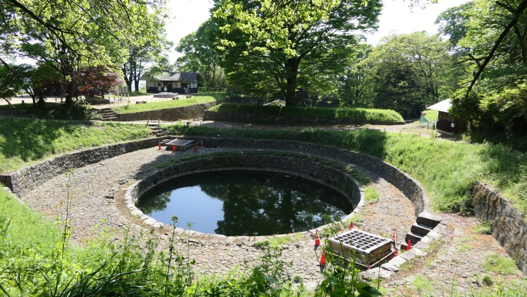
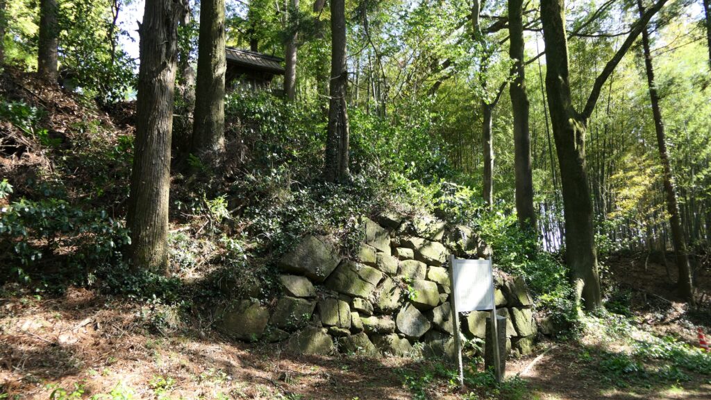
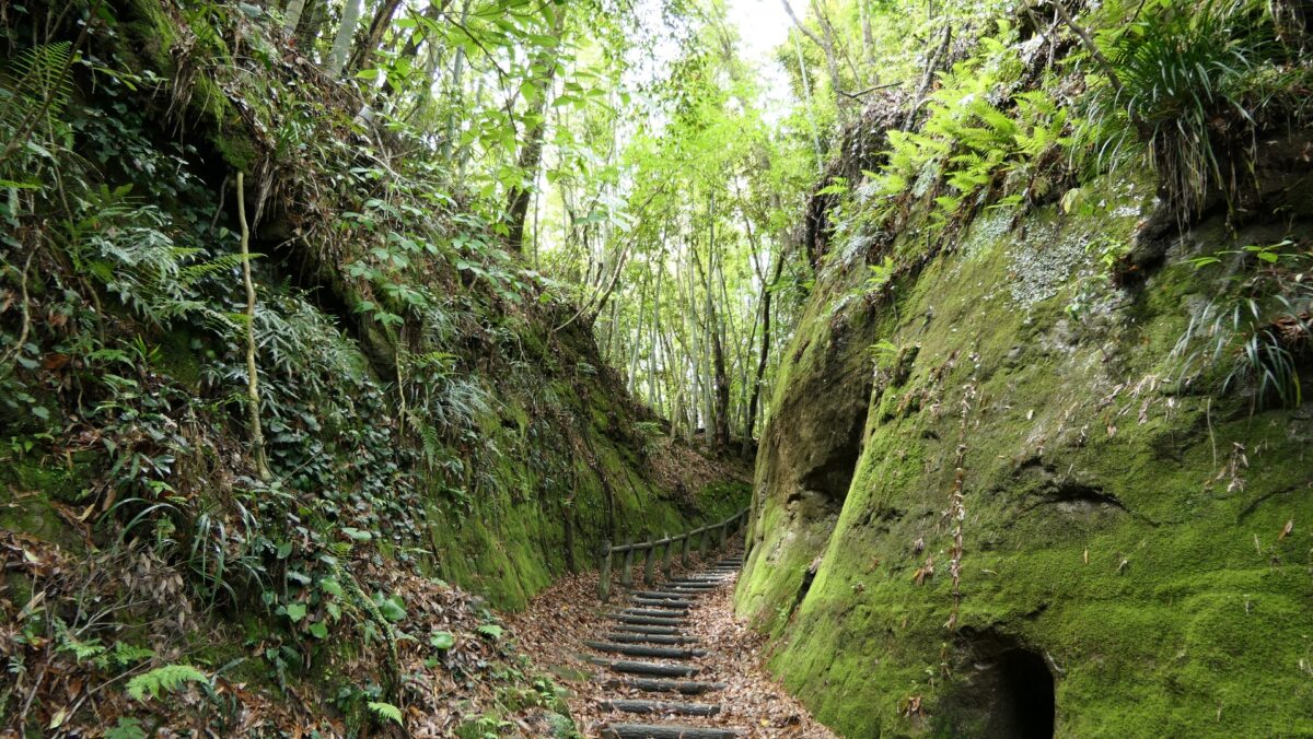
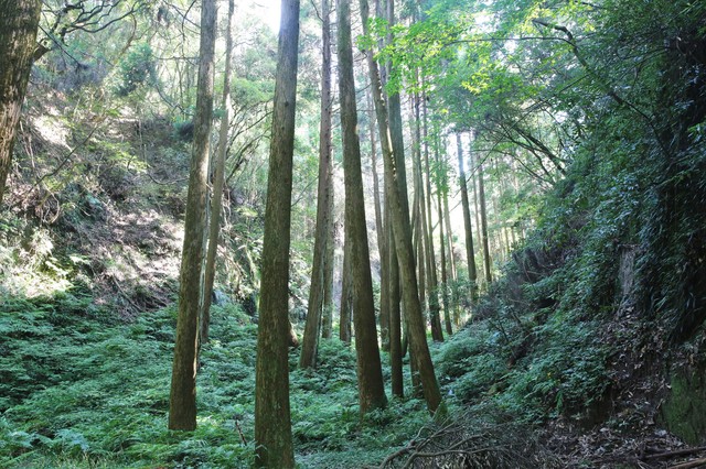
Sadowara Castle is basically considered one of the Southern Kyushu type castles which were built on the Shirasu Plateau looking like a mountain or a hill in the area. The plateau has been made from volcanic ash caused by ancient eruptions. Its soil is fragile and can easily collapse to form cliffs. Warriors in the area often used this nature to build their castles because it was easy for them to process natural terrain for strong defensive systems. For example, they built deep dry moats, high walls under enclosures, and narrow defensive gates by cutting the soil. Some popular examples of them were Chiran, Obi and Sadowara Castles.

The Main Route of Sadowara Castle
The dry moat of Chiran Castle (licensed by PIXTA)

Castle is captured by Shimazu Clan due to Collapse of Ito

Yoshisuke Ito’s glory didn’t last long, however. He was losing the Ito 48 Castles one by one, triggered by the lost of the Battle of Kizakihara against the Shimazu Clan in 1573. The Shimazu’s force and the Ito’s deterioration also made his retainers alienate him more and more. He wondered if he could be besieged in Sadowara Castle, but the situation didn’t allow him to do so, but he was forced to leave the castle. He escaped from Hyuga Province with his family and few vassals to Bungo Province in the north, where his ally, Sorin Otomo governed. This was called the Collapse of Ito. They had finally lost all that they had and eventually became wanderers. Yoshisuke died while drifting in 1585 before his son, Suketake returned to Obi Castle in Hyuga Province in 1588 by serving his new master, the ruler, Hideyoshi Toyotomi.

The portrait of Sorin Otomo, owned by Zuihoin (licensed under Public Domain via Wikimedia Commons)
The portrait of Suketake Ito, owned by the board of education of Nichinan City (licensed under Public Domain via Wikimedia Commons)

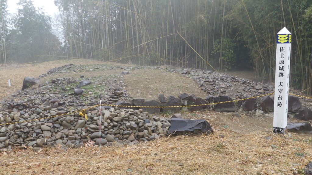
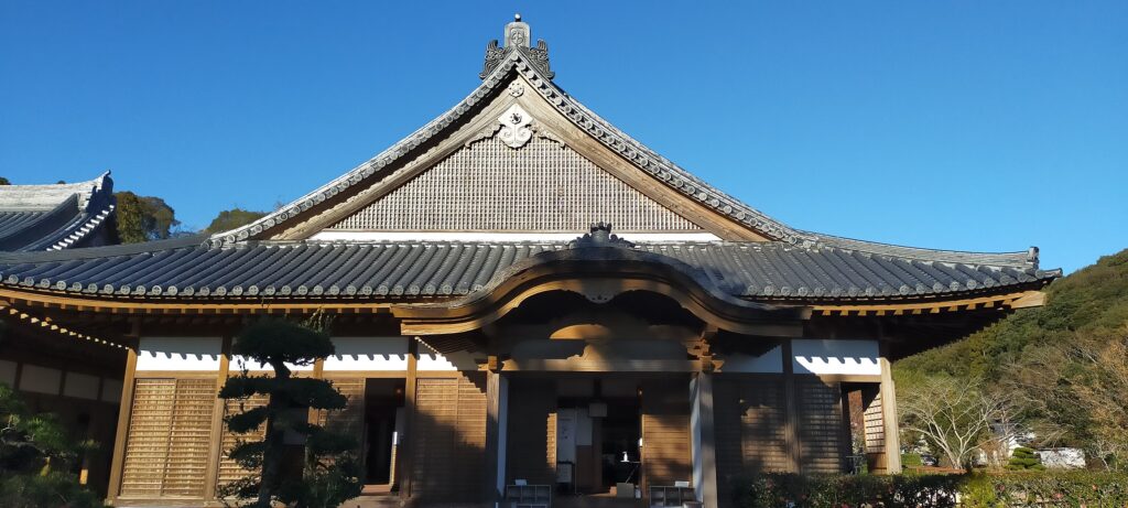
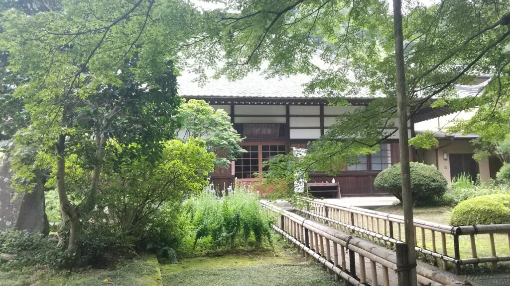
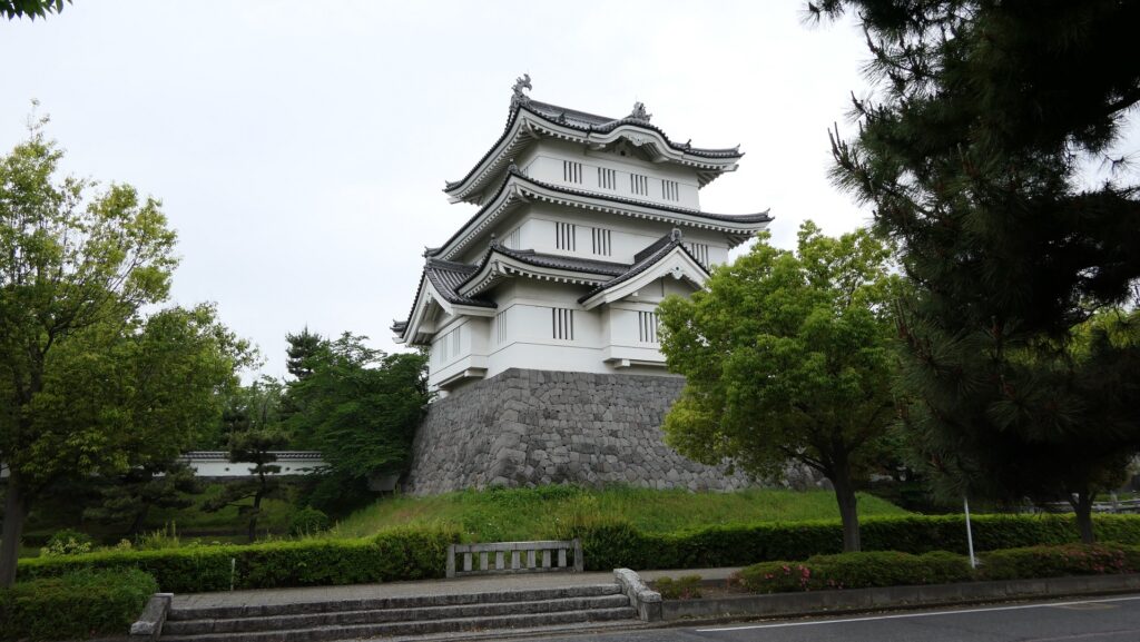
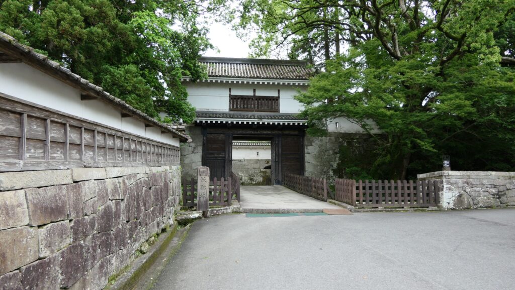
Sadowara Castle was eventually owned by the Shimazu Clan. The clan might have improved the castle by building the Main Tower on the top, but It has not been confirmed yet. The Main Tower is said to be the one which was located in the southernmost place in Japan. After the lord of the castle, Toyohisa Shimazu was killed in the battle of Sekigahara in 1600, the castle was followed by the Tokugawa Shogunate and Mochihisa Shimazu whose successors governed it until the end of the Edo Period as the Sadowara Domain. Mochihisa’s son, Tadaoki abandoned the castle on the mountain and moved it to the foot where the Main Hall was built. This was because maintaining the castle on the Shirasu Plateau was too difficult and the hall on the plain land was convenient for the government during the peaceful Edo Period.

The ruins of the Main Tower base of Sadowara Castle
The portrait of Mochihisa Shimazu, from the database of Historiographical Institute The University of Tokyo (licensed under Public Domain via Wikimedia Commons)
The restored Main Hall at the foot as an historical museum

To be continued in “Sadowara Castle Part2”

196.佐土原城 その1

伊東氏の栄光と凋落を象徴する城

立地と歴史

九州に送られた伊東氏が築城

宮崎県は九州地方の東側にあり、農業県として知られています。南北に長い形をしていて、日が出る方角に向かっています。そのため、農業に向いているといえるでしょう。宮崎県のほどんどのエリアは、かつては日向国(ひゅうがのくに)とよばれていました。まさに日が向く国という意味です。古代より肥沃であったことが容易に想像できます。県の中央部には、4世紀から7世紀の間に築造された西都原(さいとばる)古墳群があります。また、この国から初代天皇となる神武天皇が東征を行い、大和朝廷を設立したいう神話もあります。

宮崎県の範囲と城の位置

西都原古墳群

佐土原城は、日向国の中央部にあった城の一つで、伊東氏の本拠地でした。伊東氏はもとは工藤氏の出で、12世紀に東日本の伊豆半島東部に定住したときに、土地の名前を苗字としました。その世紀の末に鎌倉幕府が設立されて以来、武士たちは幕府により地方に領地を与えられ、その統治のために各地に送られました。伊東氏の支族も同様に日向国に出向きました。行った土地の名前に由来した田島伊東氏が、14世紀に佐土原城を最初に築いたと言われています。

伊豆半島の範囲(青線内)と城の位置

伊東四十八城の頂点

その間、時代は南北朝時代となり、足利幕府は地方支配のために改めて、伊東氏本家から武士を送り込みました。2系統の伊東氏はやがて統合し、佐土原城を本拠として強力な戦国大名に成長しました。15世紀から16世紀の戦国時代の間、伊東氏は南から進出してきた島津氏と日向国をめぐって戦いを繰り広げました。当時の当主であった伊東義祐(よしすけ)は相当攻撃的で、1569年に南日向の主要な城である飫肥城を陥落させました(島津氏の依頼による将軍家の仲裁にも耳を貸さなかったそうです)。この時点が彼の絶頂期であり、日向国に48もの城を有していました(伊東四十八城と称されます)。そして、その頂点に佐土原城があったのです。城下町は国府のように繁栄し、九州の小京都とも言われました(義祐は高位の官位を取得し、京風の文化や町割りを導入しました)。

伊東義祐肖像画、「堺市史 第七巻」より (licensed under Public Domain via Wikimedia Commons)
飫肥城跡

佐土原城は基本的に、南九州型城郭の一つとされています。このタイプの城は、この地方で山あるは丘のように見えるシラス台地上に築かれました。シラス台地は、古代の大噴火によって噴出した火山灰によって形作られています。その土壌はもろく、容易に崩れて崖を形成します。この地域の武士たちは、よくこの性質を利用して城を築きました。自然の地形を加工すれば、容易に強固な防御システムを構築することができたからです。例えば、深い空堀、曲輪下に高く立ちはだかる壁、狭く防御に優れた門などが土を加工して作られたのです。このような城の代表例として、知覧城、飫肥城、そして佐土原城が挙げられます。

佐土原城の大手口
知覧城の空堀 (licensed by PIXTA)

伊東崩れにより城は島津氏のものに

しかし、伊東義祐の栄光は長く続きませんでした。1573年の島津氏との木崎原の戦いでの敗戦をきっかけに、義祐は伊東四十八城を一つ一つ失っていきました。島津の勢いと伊東の凋落は、次々に部将たちの離反を招きました。彼は佐土原城に籠って抗戦できないか思案しましたが、状況はそれさえも許しませんでした。彼は城を後にせざるをえず、家族とわずかな供回りとともに日向国から北の、同盟者の大友宗麟が治める豊後国に逃れていきました。この出来事は「伊東崩れ(または豊後落ち)」と呼ばれました。彼らはついには全てを失い、やがて漂泊者となりました(大友宗麟が伊東救援を名目に島津氏と戦った耳川の戦いに大敗したことで居場所を失いました)。義祐は1585年に放浪の途中で亡くなってしまいますが、息子の祐兵(すけたけ)は天下人の豊臣秀吉に仕え、1588年には日向国の飫肥城への帰還を果たします。

大友宗麟肖像画、瑞峯院蔵 (licensed under Public Domain via Wikimedia Commons)
伊東祐兵の肖像画、日南市教育委員会所蔵 (licensed under Public Domain via Wikimedia Commons)

佐土原城は必然的に島津氏のものとなりました。島津氏の下で城が改修され、頂上に天守が作られたとされていますが、いまだ事実としては確定していません。天守があったとしたら、日本最南端の天守であったろうと言われています。1600年に、城主であった島津豊久が関ヶ原の戦いで戦死してしまった後は、城は一旦幕府直轄となり、その後は島津以久(もちひさ)とその後継者が佐土原藩として江戸時代末まで統治しました。持久の息子、忠興(ただおき)は山上の城を廃し、山麓に御殿を築き、そちらに移りました。シラス台地にある城を維持するのは大変な困難を伴い、平地にある館の方が平和な江戸時代における統治に適していたからです。

佐土原城の天守台跡
島津以久の肖像画、東京大学史料編纂所データベースより (licensed under Public Domain via Wikimedia Commons)
歴史資料館として復元された山麓の御殿

「佐土原城その2」に続きます。

17.Kanayama Castle Part3

This castle might have become more popular.

Features

Living and Religious places in Castle

The enclosures on the upper tiers were used as another pivot point as well as a place for living. The team found traces of kitchen stoves and a well, which were restored with a hut on the Southern Upper Tier Enclosure at the same time as the stone walls. The Southern Enclosure on the top of the tiers is used as the rest house, which is another viewing spot.

The map of the main portion of the castle

The restored hut on the Southern Upper Tier Enclosure
The restored kitchen stoves in the hut
The Southern Enclosure and the rest house on it
A view from the Southern Enclosure

To reach the Main Enclosure on the top of the mountain, you will pass and see a larger pond being covered with stone mounds as well, called Hi-no-ike or the Sun Pond. This is actually not a reservoir but a well, which had been famous as a holy place since the Ancient Times before the castle was built. That’s why people in the castle used it for religious services.

The Sun Pond
The Sun Pond viewed from above

Main Enclosure is used as Shrine

Around the top of the mountain is the Main, Second, Third Enclosures, but you can not access the two of the latter because they are privately owned. You will eventually go to the Main Enclosure on the top, which is now used as Nitta Shrine. As for the castle ruins, you can walk around the enclosure, called Musha-bashiri or the Defense Passage, and see the partially remaining original stone walls which are also uncertain as to who first built them.

The Second Enclosure is not allowed to enter
Nitta Shrine in the Main Enclosure
A view from the Main Enclosure
The remaining stone walls behind the Main Enclosure
The Defense Passage around the Main Enclosure

Later History

After Kanayama Castle was abandoned, the Tokugawa Shogunate banned people from entering its mountain area to provide Matsutake mushroom to the shoguns during the Edo period. In fact, the Matsutake produced at the mountain was served to the Imperial Families until 1964.

A view of the Eastern hiking course, there are still Japanese red pines that could provide Matsutake mushroom, but they can’t produce it now because of aging

The shogunate also conserved the former area of the Nitta Manor by building religious facilities such as Serada Toshogu Shrine, Kinryuji and Daikoin Temples as they had declared the shoguns were a branch of the Nita Clan, which meant they were descendants of the Minamoto Clan. Even the shogunate needed the authority to govern the whole country. As for castle ruins, Kanayama Castle ruins were designated as a National Historic Site in 1934. Ota City has been excavating and developing them as a historical site since 1995.

Serada Toshogu Shrine
Kinryuji Temple
Daikoin Temple

My Impression

When the Yura Clan was banished from Kanayama Castle, only the lord’s mother, Myoinni was against the idea of Hojo Clan keeping the castle. Even after she gave it up, she joined Maeda’s troops to attack the Hojo Clan in 1590 when she was already 77 years old. That caused the Yura Clan to survive while the Hojo Clan to decline in the end. I guess if she and the Yura Clan could still stay in the strong Kanayama Castle even with only a few defenders, there might have been a dramatic event at the castle when Hideyoshi invaded the Kanto Region like Nagachika Narita fought with Mitsunari Ishida at Oshi Castle.

The ruins of Ushiku Castle  (licensed by Monado via Wikimedia Commons)
The ruins of Oshi Castle

How to get There

I recommend using a car when you visit the castle ruins because there are no buses that go directly to the ruins available. It is about a 10-minute drive away from Ota-Kiryu IC on the Kita-Kanto Expressway. There are several parking lots at the foot, halfway up, and at the top of the mountain.
If you want to use public transportation, it takes around 1 hour from Ota Station. It would be better to take a taxi from the station.
From Tokyo to Ota Station: Take the JR Ueno-Tokyo Line from Tokyo Station and transfer to the Ryomo limited express on the Tobu Isesaki Line at Kitasenju Station.

That’s all. Thank you.
Back to “Kanayama Castle Part1”
Back to “Kanayama Castle Part2”