29.Matsumoto Castle Part1

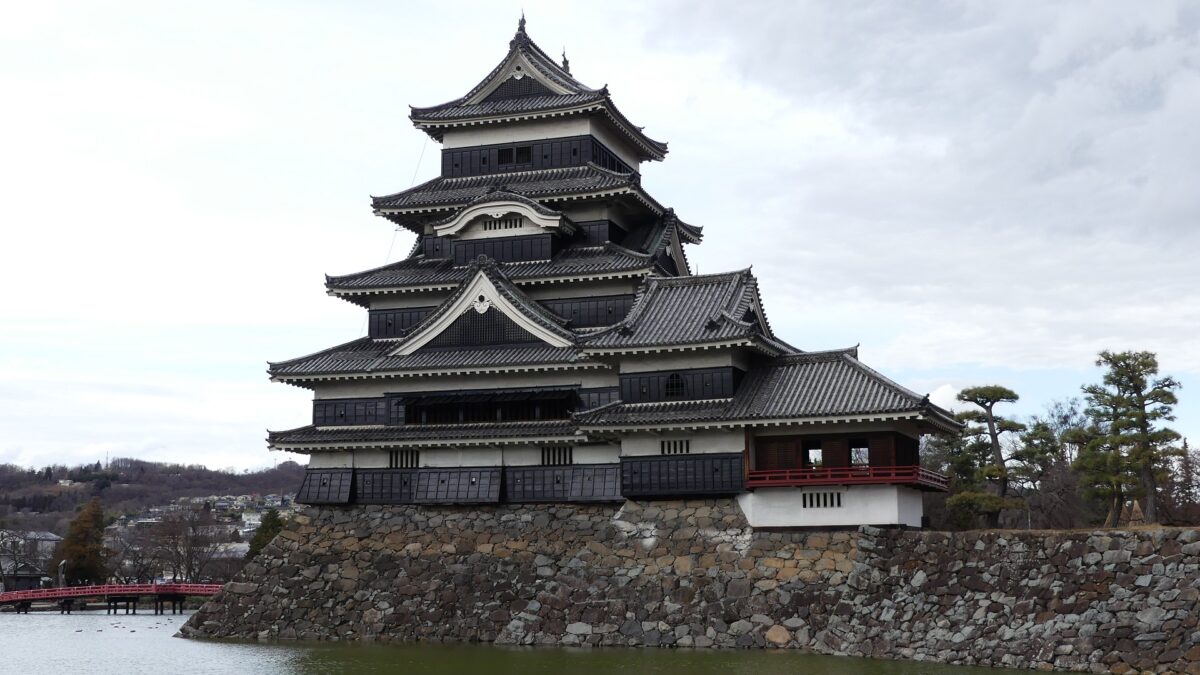
Matsumoto Castle is located in Matsumoto City, Nagano Prefecture, which is known for its wonderful remaining five-level Main Tower. Matsumoto Basin, in which the city is located, has also been known for abundant springs flowing from the surrounding mountains since Ancient Times (we can still see many wells in the city area).

Location and History

Ogasawara Clan is driven away from Castle, but is waiting for their long-cherished plan to revive

Matsumoto Castle is located in Matsumoto City, Nagano Prefecture, which is known for its wonderful remaining five-level Main Tower. Matsumoto Basin, in which the city is located, has also been known for abundant springs flowing from the surrounding mountains since Ancient Times (we can still see many wells in the city area). That’s why the area was originally called “Fukase” or “Fukashi” which seem to have meant “waters running deep”. The Ogasawara Clan, which became the governor of Shinano Province (now Nagano Pref.), was based in this area during the Middle Ages. Many battles occurred during the Sengoku Period, and Ukon Shimadate, who was a retainer of the clan, built Fukashi Castle (the former Matsumoto Castle) in 1504 to protect the clan’s home, Hayashi Castle. However, they were driven away by the Takeda Clan in 1550, following the Siege of Fukashi.

The range of Matsumoto City and the location of the castle
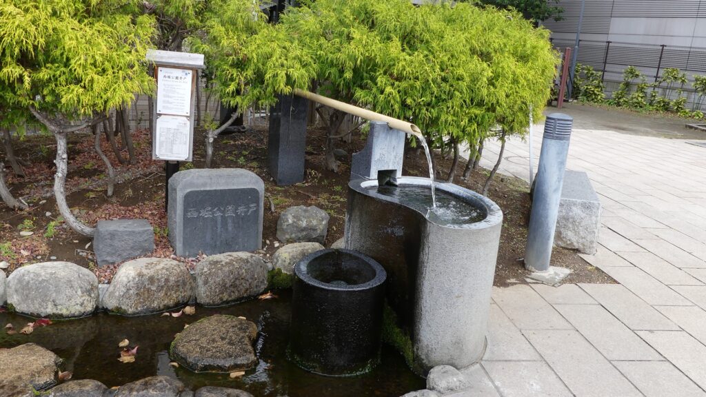
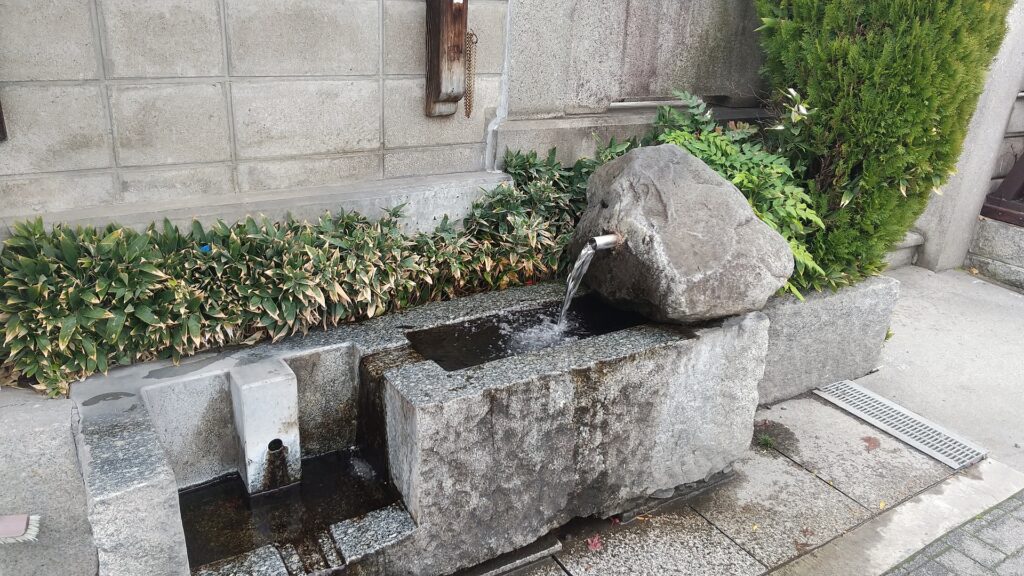
A well in the city area (at Nishibori Park)
Another well maybe naneless

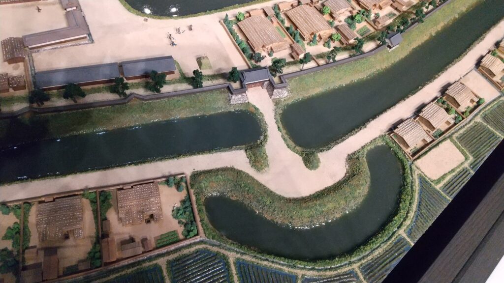
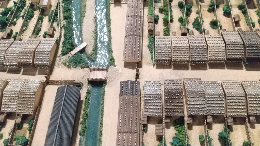
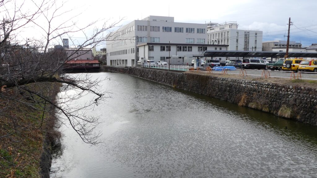
The Takeda Clan fortified Fukashi Castle to be a defensive stronghold even on the flat lands of the basin. The clan had the castle surrounded by tripled water moats. The lands inside the moats were called (from the center) the main, second, and third enclosures. The flow of the Metoba River was diverted to run alongside the outer moat, which made the castle more defensive. The clan also improved the gates of the castle by adding Umadashi systems in front of them. The system refers to a small round enclosure connected by a narrow path to the gate. It was a defense system created and frequently used by the clan. It was said that the basic structures of the castle was completed by the Takeda Clan. However, the castle was still basically made of soil at this point.
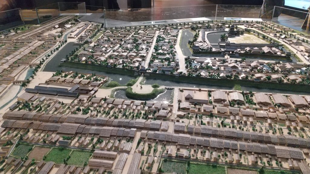
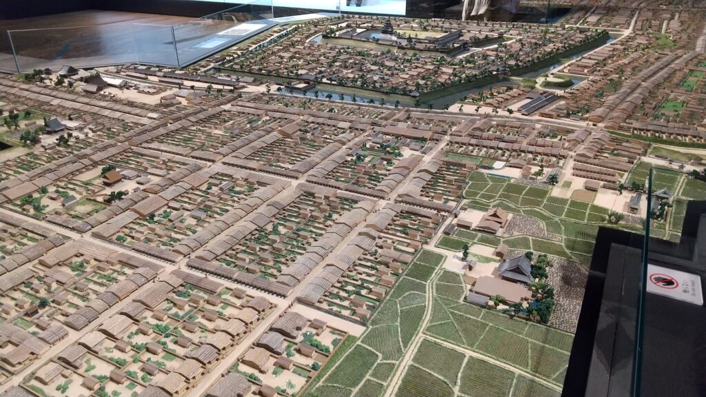
The miniature model of Matsumoto Castle during the Edo Period, exhibited by Matsumoto City Museum
The few remaining outer moat of the eastern part of the castle
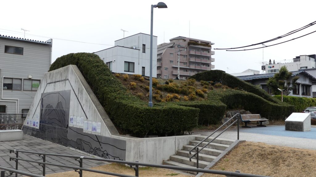
The few remaining earthen walls inside the outer moat, at Nishibori-dorui (the western moat earthen walls) Park
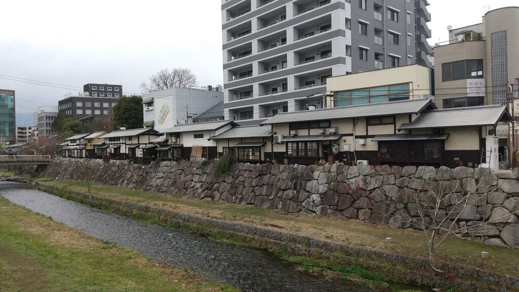
The Metoba River
One of the Umadashi systems in the miniature model above, however, they were all removed at the site

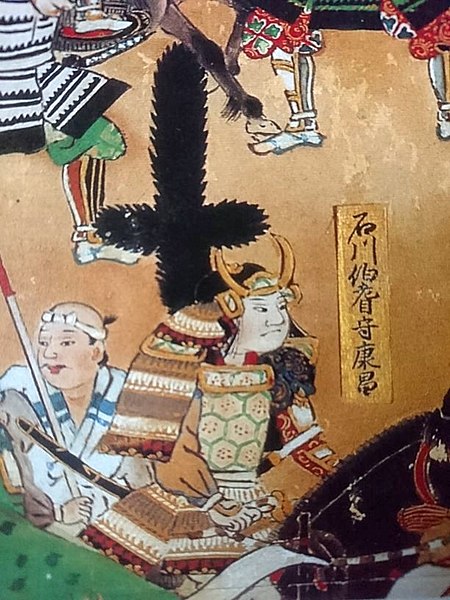
A chance for the Ogasawara Clan to revive suddenly came in 1582 when Nobunaga Oda defeated the Takeda Clan before he was also killed by Mitsuhide Akechi in the Honnoji Incident. Sadayoshi Ogasawara who served Ieyasu Tokugawa returned to Fukashi Castle the following year – for the first time in 33 years, his clan held the castle. He renamed the castle Matsumoto to celebrate the event. The new name was said to come from waiting (matsu) for his long-cherished plan (hon-kai, the Chinese symbol for “hon” is also pronounced “moto”). However, the situation rapidly changed. He and his master, Ieyasu were transferred to the Kanto Region in 1590 by the ruler, Hideyoshi Toyotomi. Hideyoshi gave the castle to Kazumasa Ishikawa who had been a senior vassal of Ieyasu but was acquired by Hideyoshi.

The family crest of the Ogasawara Clan, called Sankaibishi (triple diamonds) (licensed by Minamoto at fr.wikipedia via Wikimedia Commons)
Kazumasa Ishikawa, drawn in the folding screens of “the Battle of Nagashino” (licensed under Public Domain via Wikimedia Commons)

Ishikawa Clan modernizes Castle by building Main Tower

Kazumasa started to modernize the castle using advanced techniques favoured by Hideyoshi, which was continued by his son, Yasunaga after Kazumasa’s death in 1592. Yasunaga built stone walls surrounding each enclosures, including the five-level Main Tower inside the main enclosure. He also replaced the Umadashi system of major gates with the Masugata system. The system refers to a defensive square space surrounded by stone walls and gated buildings. The gates were called Ote-mon (main gate) for the third enclosure, Taiko-mon (drum gate) for the second enclosure, and Kuro-mon (black gate) for the main enclosure. They were completed in 1594. However, local people suffered because of these rapid construction projects. A local legend says that when a worker, who had carried a huge stone for the Taiko-mon Gate, complained about it, Yasunaga heard about it and immediately executed him. Since then, the stone has been called Genba-ishi(stone). Genba was the name of Yasunaga’s official position.

The map around the castle
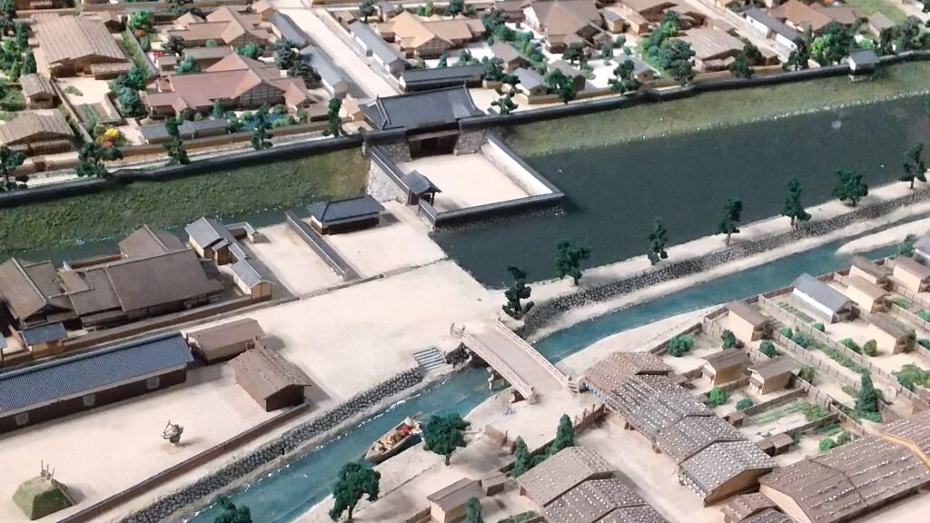
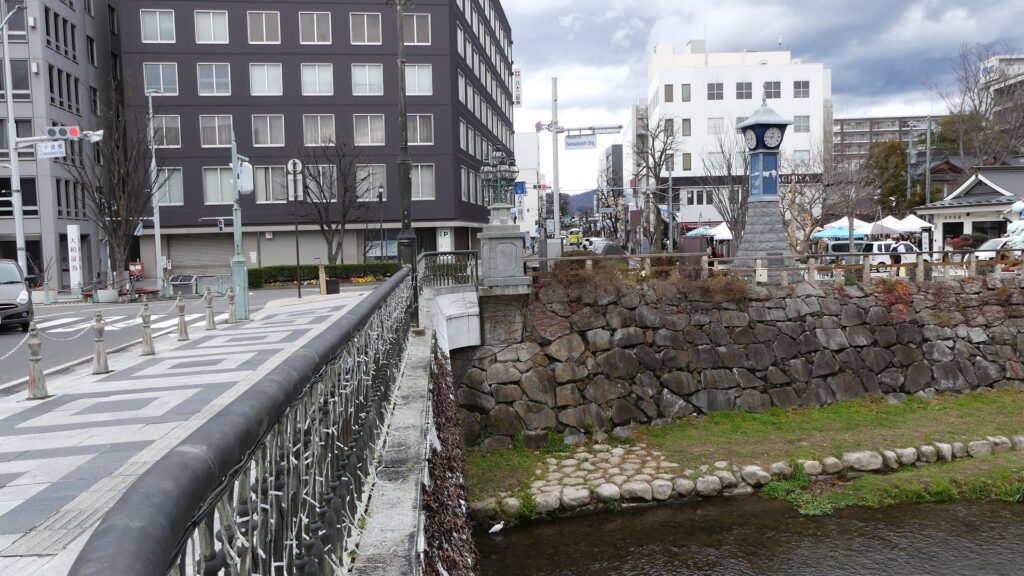
The main gate in the miniature model above, Metoba River is in front of it
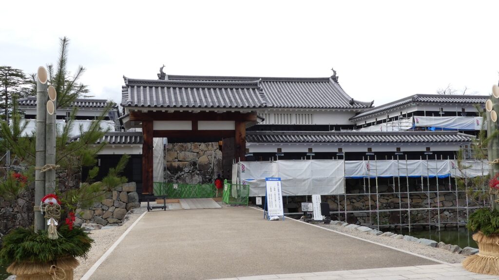
The current main gate ruins
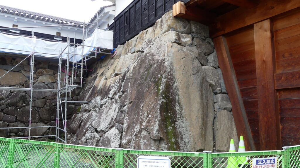
The restored Taiko-mon Gate
The Genba-ishi stone in the gate
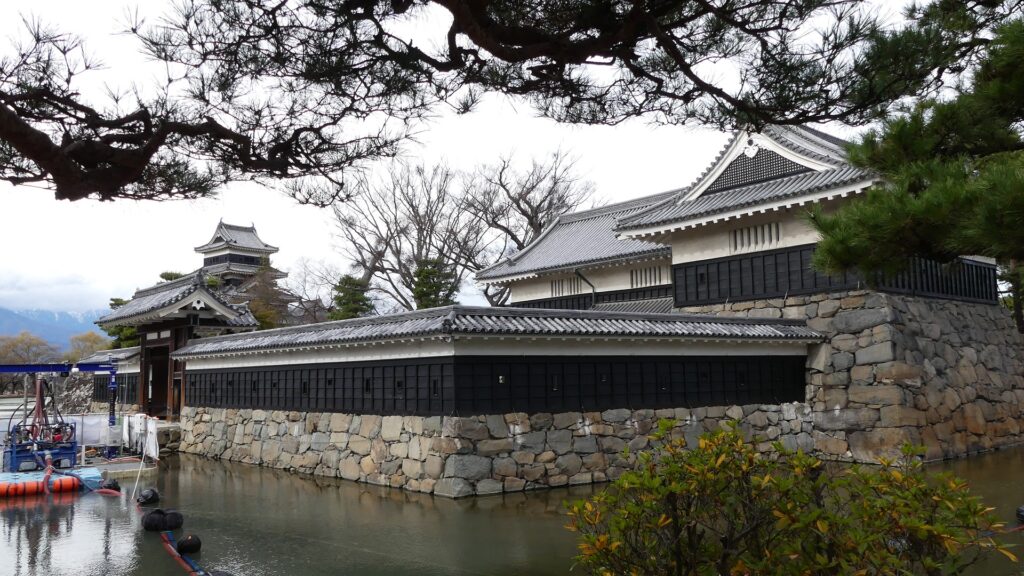
The restored Kuro-mon Gate

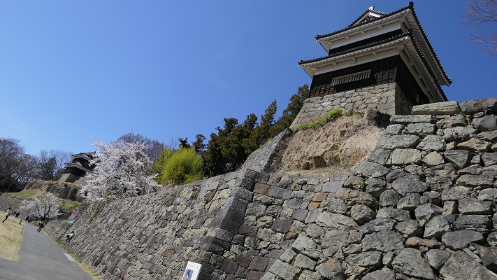
The castle buildings were allowed to use roof tiles with gold leaf with the special permission of Hideyoshi. Such permission was only given to Hideyoshi’s relatives and trusted senior vassals. Other castles of the trusted vassals, which also used the golden roof tiles, were built around Ieyasu’s Kanto Region in places such as Komoro, Ueda, Kofu, Numata, and Sumpu Castle. These castles (including Matsumoto) formed the anti-Ieyasu network to monitor and threaten him. Yasumasa somehow survived even when Ieyasu gained power after Hideyoshi’s death (the golden roof tiles were then scraped). However, he was finally removed by Ieyasu in 1613. The reasons for this remain unclear, but it was possibly Ieyasu’s revenge against the Ishikawa Clan which had abandoned him.

The castles of anti-Ieyasu network
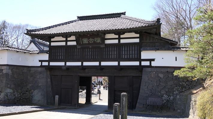
The ruins of Komoro Castle
The ruins of Ueda Castle
The ruins of Kofu Castle
The ruins of Numata Castle
The ruins of Sunpu Castle

Castle is completed with building Tsukimi Turret

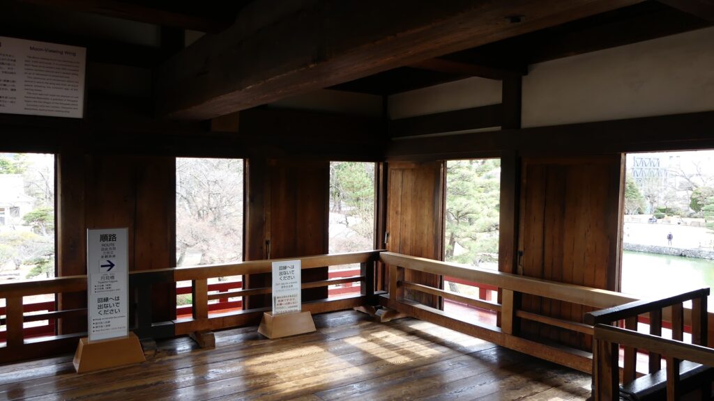
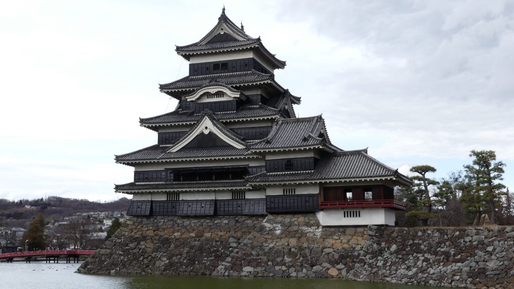
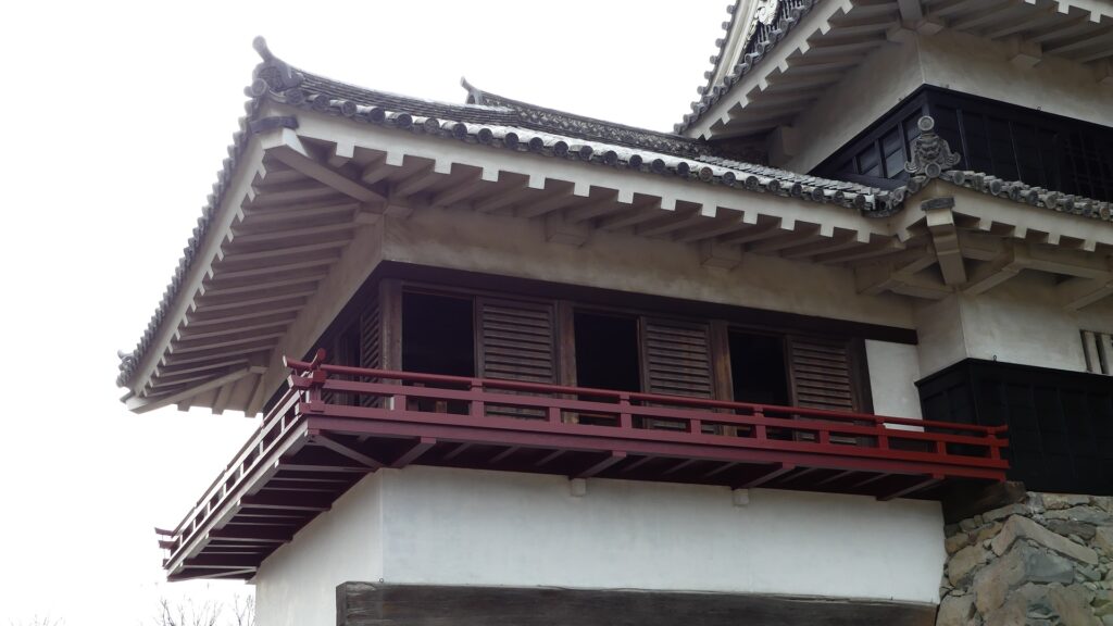
After that, the Ogasawara Clan returned to the castle again but were soon transferred to Akashi Castle in 1617. The castle and the area around it, called the Matsumoto Domain, were followed by the shogun’s relatives and several hereditary feudal lords during the Edo Period. There were also a few important subsequent events for the castle. One of them occurred when Naomasa Matsudaira lived there. He heard about a plan of the shogun, Iemitsu Tokugawa, to visit the castle (though it would be canceled later) and added a new turret called Tsukimi (seeing the moon) Yagura to the Main Tower in 1634. So far, the tower had entirely been designed with battles in mind. This turret, however, was completely built for entertainment. The tower became what we see now, influenced by different tastes.
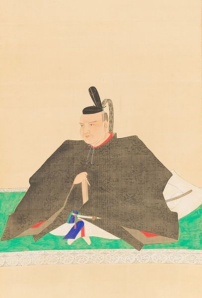
The portrait of Naomasa Matsudaira, owned by Gesshoji Temple (licensed under Public Domain via Wikimedia Commons)
The Tsukimi Turret (appearance)
The Tsukimi Turret (interior)
The Main Tower with the Tsukimi Turret on the right

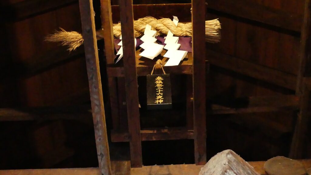
The second occurred during the great fire of Matsumoto in 1727. The Main Hall next to the tower was burned down by the fire; the tower itself fortunately survived. People thought that a god called Nijurokuyashin (the god of the 26th night moon), which was worshiped in the tower, had saved it. In addition, the castle town prospered as the intersection of the Zenkoji Road (from north to south) and the Nomugi Road (from east to west). The town also had many guardhouses to make sure to prevent enemies from reaching the castle easily.
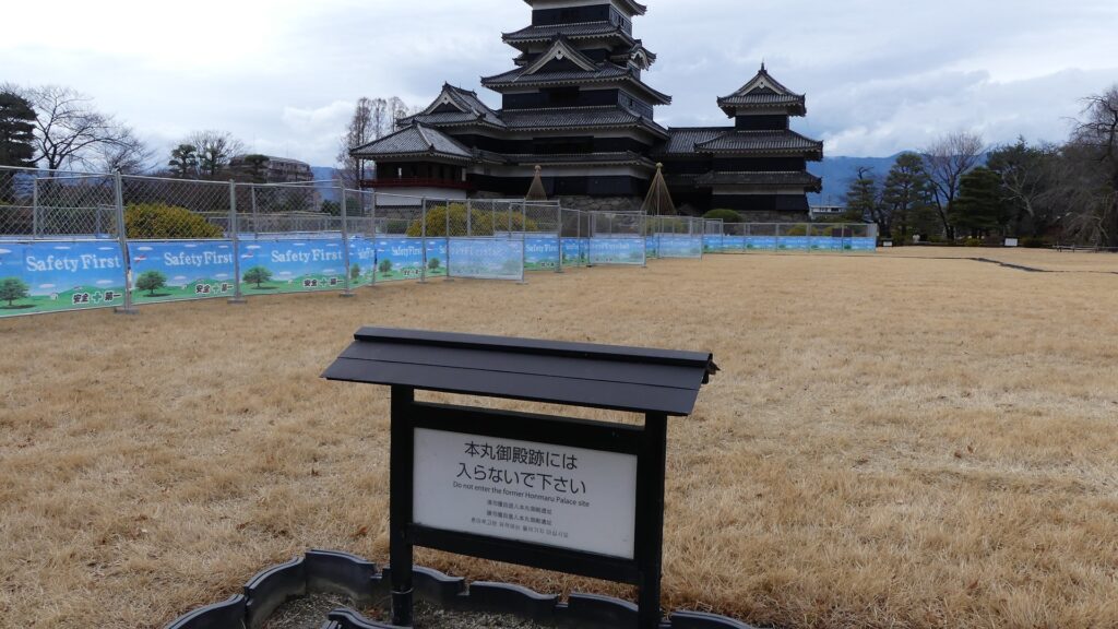
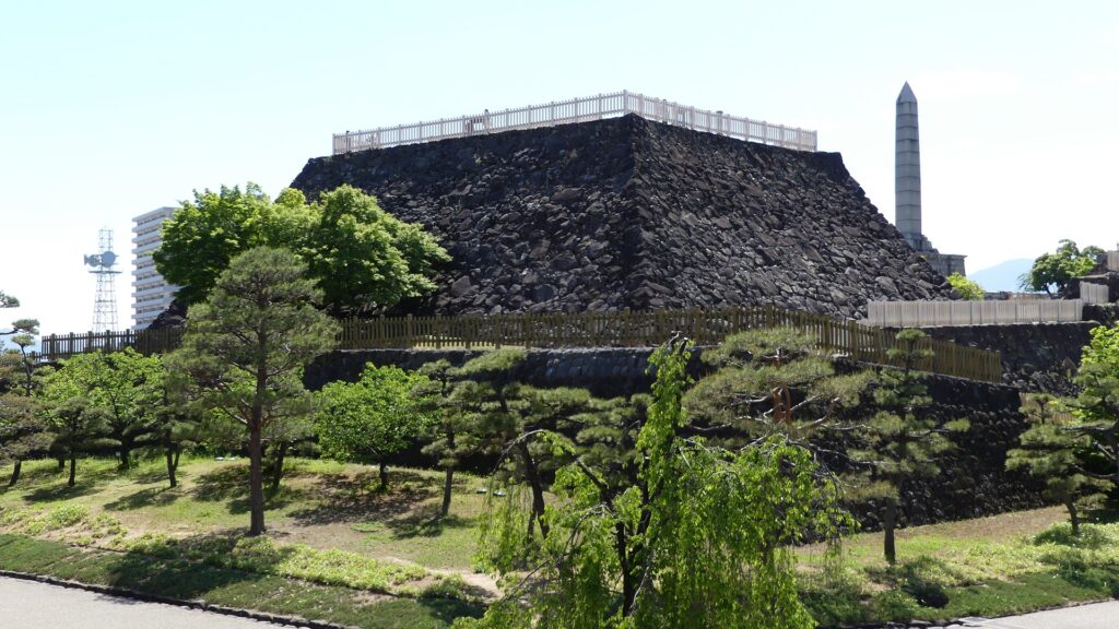
The ruins of the main enclosure main hall
The Nijurokuyashin God, which is still worshiped in the tower
The castle town in the miniature model above
A guardhouse in the model

To be continued in “Matsumoto Castle Part2”

29.松本城 その1

松本城は長野県松本市にある城で、現存する素晴らしい5層天守により有名です。城が位置する松本盆地は古代より、周辺の山々から流れてきた豊かな水が湧き出る地としても知られていて、現代の市街地でも多くの現役の井戸を目にすることができます。

立地と歴史

小笠原氏が追放され、帰還するという本懐を待ち続けた城

松本城は長野県松本市にある城で、現存する素晴らしい5層天守により有名です。城が位置する松本盆地は古代より、周辺の山々から流れてきた豊かな水が湧き出る地としても知られていて、現代の市街地でも多くの現役の井戸を目にすることができます。そのため、この地はもともと「深瀬(ふかせ)」または「深志(ふかし)」と呼ばれていました。「深く流れる水」という意味だったようです。中世の頃には、信濃国(現在の長野県)の守護であった小笠原氏がこの地を本拠地としていました。多くの戦いが起こった戦国時代には、小笠原氏の家臣、島立右近(しまだてうこん)が1504年に、主君の本拠地・林城防衛のために、深志城を築城しました。これが松本城の前身となります。ところが1550年に、武田氏により城は落城し、小笠原一派は追放されてしまいました。

松本市の範囲と城の位置

市街地にある井戸(西堀公園井戸)
こちらは名も無き井戸か

武田氏は深志城を強化し、盆地の平地部分にある城であっても、強力な防御拠点にしようとしました。まず、城を三重の水堀で囲みました。堀に囲まれた曲輪部分は、真ん中から順に、本丸、二の丸、三の丸とされました。加えて、女鳥羽川(めどばがわ)の流路が、総堀(一番外側の堀)に沿うように変えられ、城の防御力はますます高まりました。武田氏はまた、城の門を改良し、前面に馬出しを加えました。馬出しとは、小さな丸い曲輪で、狭い通路によって門とつながっていました。これは、武田氏が開発し、頻繁に使われた防御システムです。城の基本的な構造は、武田氏によって完成されたと言われています。しかしこの時点では、城は基本的には土造りでした。

江戸時代の松本城の模型、松本市立博物館にて展示、三重の堀に囲まれています
城の東側にわずかに残る総堀
わずかに残る総堀の内側にあった土塁(西総堀土塁公園)
女鳥羽川
上記模型にある馬出し、現在では全て撤去されています

小笠原氏が戻ってくる機会が1582年に突然やってきました。織田信長が武田氏を滅ぼし、またその信長も本本能寺の変で明智光秀に殺されてしまったのです。その当時徳川家康に仕えていた小笠原貞慶(おがさわらさだよし)はその翌年、33年ぶりに城に帰還したのです。貞慶はそれを祝して、城の名前を「松本」と変えました。その名前は、「本(もと)懐」を「待つ(松)」というところから付けられたと言われています。しかし、状況はまた急激に変わりました。1590年には天下人の豊臣秀吉により、貞慶は主君の家康とともに、関東地方に移封となりました。秀吉は松本城を、家康の重臣であり、秀吉の下に出奔した石川数正(いしかわかずまさ)に与えました。

小笠原氏の家紋、三階菱  (licensed by Minamoto at fr.wikipedia via Wikimedia Commons)
「長篠合戦図屏風」に描かれた石川数正  (licensed under Public Domain via Wikimedia Commons)

石川氏が天守を築き城を近代化

数正は、秀吉によって好まれた先進技術によって城の近代化を始めました。1592年に数正が亡くなってからは、子の康長(やすなが)が引き継ぎました。康長は曲輪群を石垣で囲み、本丸には5層の天守を築きました。彼はまた、主要な門の馬出しを桝形に置き替えました。桝形とは、石垣や門の建物に囲まれた、四角い防御スペースのことを言います。これらの門は、三の丸の大手門、二の丸の太鼓門、本丸の黒門のことです。城の工事は1594年に完成しました。しかし、この工事は突貫で行われたため、民衆には苦痛を与えました。地元の言い伝えによれば、太鼓門に使われる巨石を運んでいた人夫が不満を言ったところ、康長はそれを聞き、直ちにその人夫の首を刎ねたそうです。それ以来、その石は玄蕃石(げんばいし)と呼ばれるようになりました。「玄蕃」とは康長の官職名でした。

城周辺の地図

上記模型にある大手門、手前は女鳥羽川
現在の大手門跡
復元された太鼓門
太鼓門にある玄蕃石
復元された黒門

城の建物には、秀吉の特別な許可により、金箔を貼った屋根瓦が使われました。この許可は、秀吉の親族か、信頼のある重臣にのみに与えられました。その重臣たちの城にも金箔瓦が使われていて、小諸城上田城甲府城沼田城駿府城など家康がいた関東地方周辺に配置されました。松本城を含むこれらの城は、家康包囲網を形成し、家康を監視し、且つ脅威を与えていました。康長は、秀吉の死後に家康が天下を取ったときも、家康に味方することで何とか生き残りました(金箔瓦は当然廃棄されました)。ところが、1613年に彼はついに家康によって改易されました。その理由ははっきりしないのですが、可能性として、家康は石川氏が彼の下を去ったことに報復したという面もあったでしょう。

家康包囲網の城

小諸城跡
上田城跡
甲府城跡
沼田城跡
駿府城跡

月見櫓建設により天守が完成

その後、小笠原氏が再度松本城に復帰するのですが、1617年にはまた明石城に転封となりました。城とその周辺地域は松本藩となりますが、江戸時代の間、いくつもの親藩や譜代大名によって引き継がれました。その間、城に関する重要な出来事がいくつかありました。その一つが松平直政(まつだいらなおまさ)が城を治めたときに起こりました。彼は、将軍の徳川家光が松本城に立ち寄るという計画を聞き(その後取りやめとなりますが)、1634年に新しく月見櫓を天守に付け加えました。それまでは天守は全く戦を想定して作られていました。しかし、月見櫓は完全に娯楽のために築かれたものです。これによって天守は、違った趣の建物が融合した、現在の姿になりました。

松平直政肖像画、月照寺蔵  (licensed under Public Domain via Wikimedia Commons)
月見櫓(外観)
月見櫓(内部)
月見櫓(右側)を従えた松本城天守

二番目の出来事は、1727年の松本大火のときです。大火により、天守となりの本丸御殿は焼けてしまいましたが、天守そのものは幸運にも無事でした。人々は、中に祀られていた二十六夜神(にじゅうろくやしん)が天守を救ったのだと考えました。また城下町は、南北を貫く善光寺街道と東西を走る野麦街道が交差する場所として、大いに繁栄しました。城下町には多くの番所があり、もし敵が攻めてきたときには容易に城に近づけないようになっていました。

本丸御殿跡
現在も天守に祀られている二十六夜神
上記模型の松本城城下町
上記模型の番所部分

「松本城その2」に続きます。

186.Kaneda Castle Patr3

There are branch paths from the first turning point of the main hiking course to other attractions of the castle ruins. The paths are not the former military road and are a little rougher than it. However, it is worth to visit.

Features

Three Gate Ruins

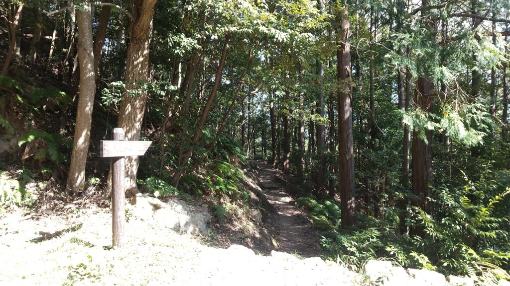
There are branch paths from the first turning point of the main hiking course to other attractions of the castle ruins. The paths are not the former military road and are a little rougher than it. These are not as popular as the military road. However, it is worth to visit. If you walk down the path for a while, you will be at the junction of another path to the first and second gate ruins, and the other path to the third gate ruins.

The map around the castle

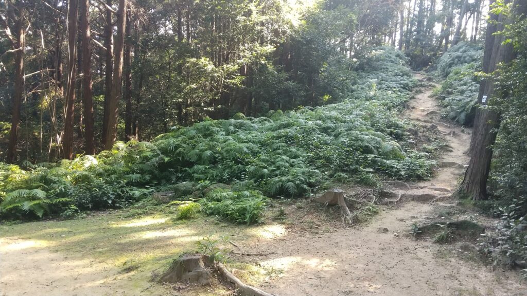
The path from the first switchback

The junction is near a hill called Bingushi Mountain where the ruins of other buildings were discovered. These buildings are thought to have been used as barracks for the Sakimori soldiers.

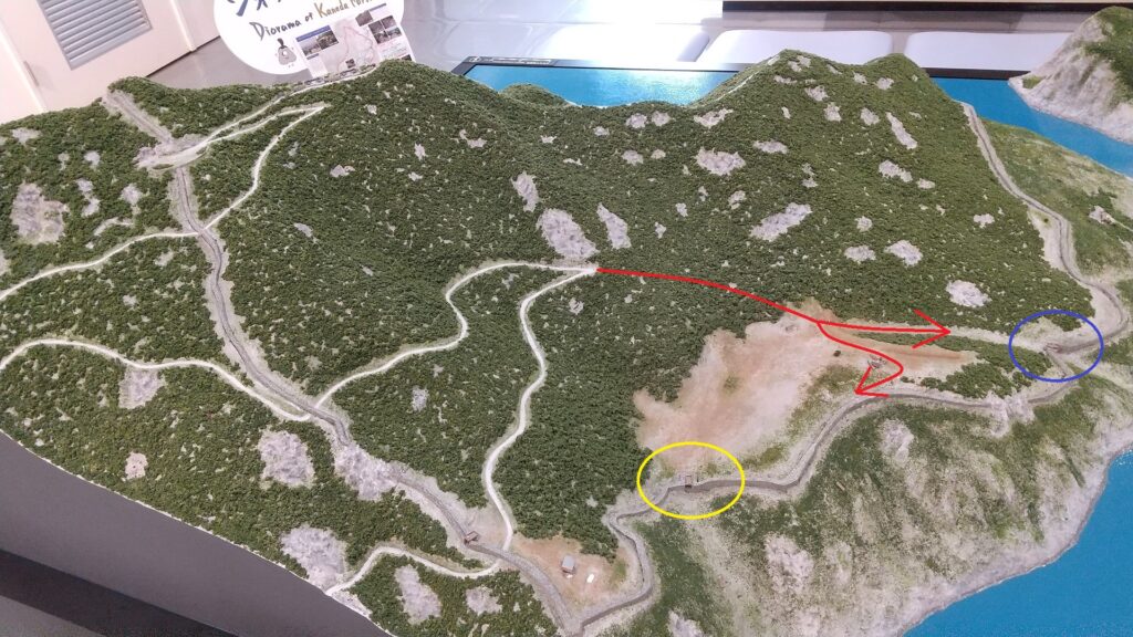
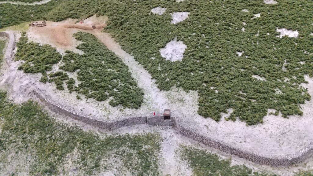
The diorama of Kaneda Castle Ruins, exhibited by the sightseeing information center Fureaidokoro Tsushima, adding the branch paths (the red lines), and the places of the second gate (marked by the blue circle) and the third gate (marked by the yellow circle)
The path to the ruins of the first and the second gates
The path to the ruins of the third gate
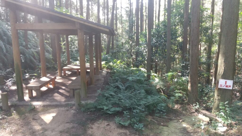
Around the Bingushi Mountain, you can see a rest station on the left
Around the Bingushi Mountain on the diorama

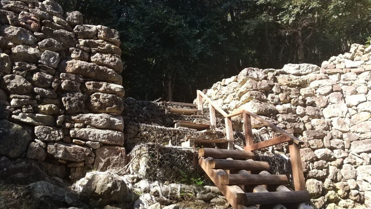
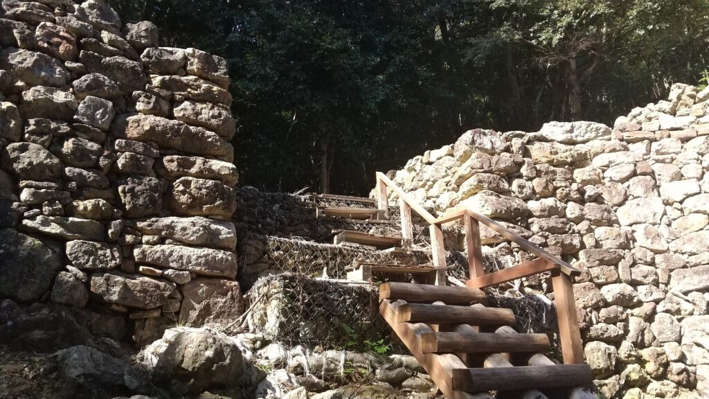
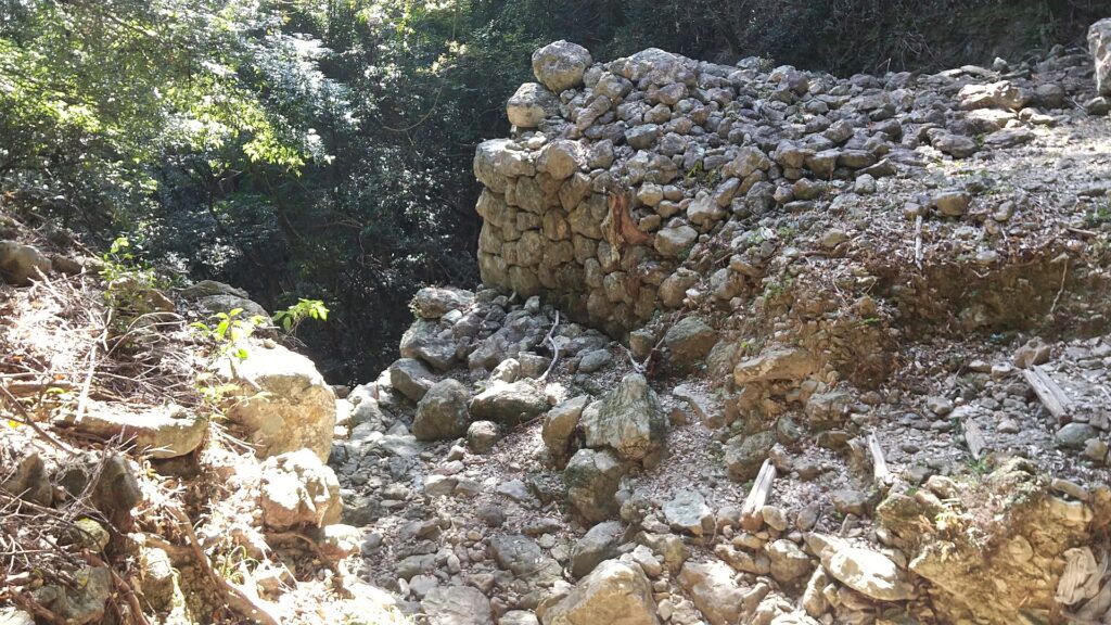
The three gates were built using stones at the eastern side as castle and water gates near the seaside. The stones used in the castle are mainly natural while part of the stones of the first gate are rectangular- processed. However, it is said that they were piled by the Tsushima Domain during the Edo Period to guard the coast. They’ve been restored and repaired so that visitors can see them as if they used to look.

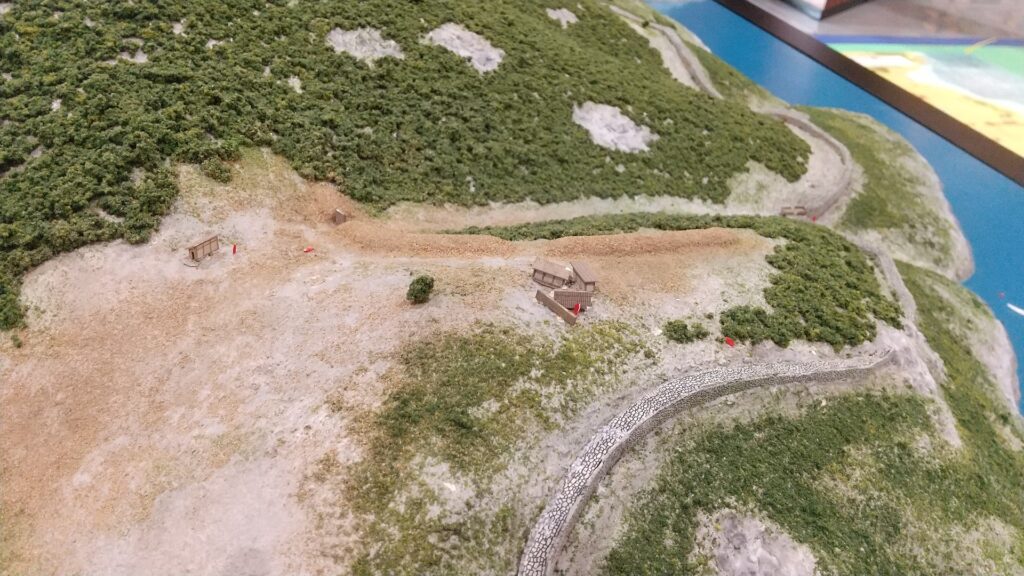
Around the second gate on the diorama
The second gate ruins seen from above
The second gate ruins seen from the bottom
The first gate ruins
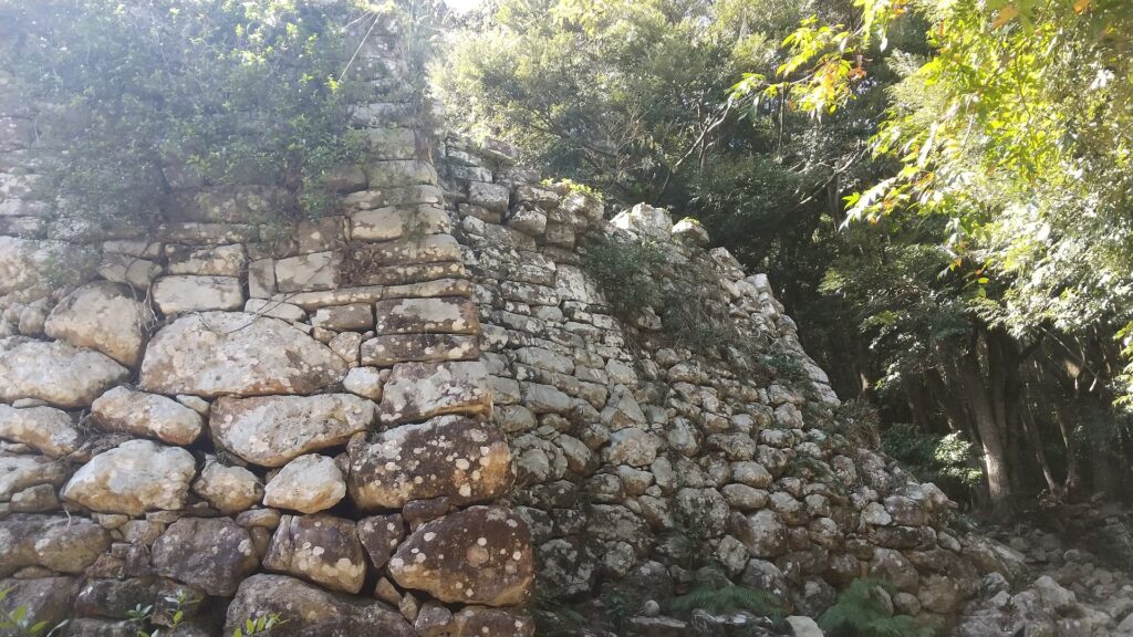
The types of the stones were different in the upper and lower parts of the first gate
Going to the third gate ruins after once returning the junction
The third gate ruins

Wonderful Stone Walls along Sea

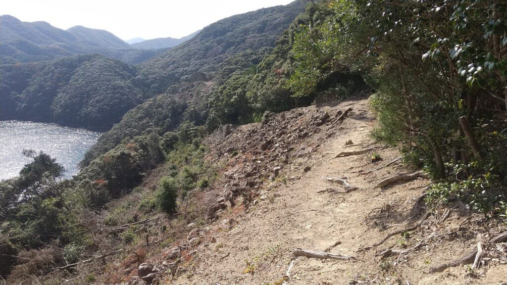
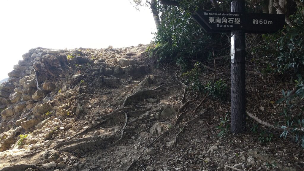
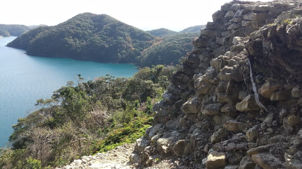
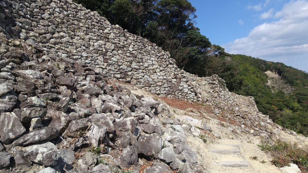
After you visit the third gate ruins, you can return by the same route or by another path though the southeast stone fortress. If you take the latter, you will see the great long stone walls of the eastern side on the right and beautiful Aso Bay on the left. Please watch your step as the path is partially unstable.

Going towards the southeast stone fortress
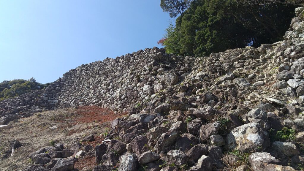
There are great stone walls along the sea
They are spectacular long stone walls!

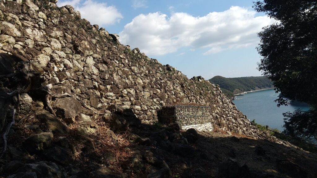
The southeast stone fortress is really great, too! The corner of the fortress was protruded outward to build a salient with enhanced defense in preparation for an enemy’s attack. It looks like a Gusuku (Okinawan castle) or a small Great Wall of China. If you walk up along the fortress, you will return to the route you passed.

The southeast stone fortress
The edge of the fortress
It’s a good contract of the fortress and the sea
Around the southeast fortress on the diorama

Later History

People alway knew about Kaneda Castle because it had been recorded in the Nihon-shoki chronicles, however, they didn’t know about where it was as it had been abandoned too early to remember. For example, trade with Korea was done at a shrine near the first gate during the Middle Ages and the Tsushima Domain used the gate during the Edo Period, but they didn’t notice it was a ancient mountain castle. There is no telling how the Imperial Japanese Army treated it. Historians discovered the ruins on the mountain in the Taisho Era (1910-1925) and they finally confirmed it as Kaneda Castle after World War II. As a result, the ruins were designated as a National Special Historic Site in 1982.

The ruins of Kaneishi Castle, the home of the Tsushima Domain

My Impression

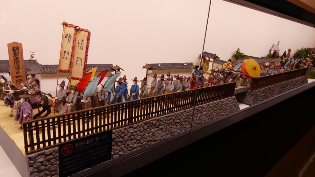
I was very surprised to see that the Joyama Mountain has become dual historical sites of the ancient times and modern times. Both sites show us there were strained relations with foreign countries at those times. Other than that, Tsushima also had dramatic events such as during the Mongolian Invasions and the invasion of Korea by Hideyoshi Toyotomi. On the other hand, there were also peaceful relationships such as with the Korean Envoys. We can now see many tourists visiting Tsushima from Korea recently, too. There is no need to say which is better.

The figures of the Korean Envoys, exhibited by Kokura Castle Tower

How to get There

I recommend using a car to get there. It takes about 20 minutes from Tsushima Airport or about 30 minutes from Izuhara Port. There is a small parking lot at the starting point of the hiking course.

The Izuhara Port
The small parking lot at the starting point of the hiking course

That’s all. Thank you.
Back to “Kaneda Castle Part1”
Back to “Kaneda Castle Part2”