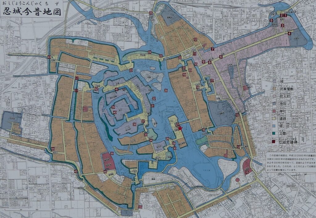
Let’s walk with the location map laying over the previous and current city areas.
Features
Castle Ruins mostly being turned into City Area
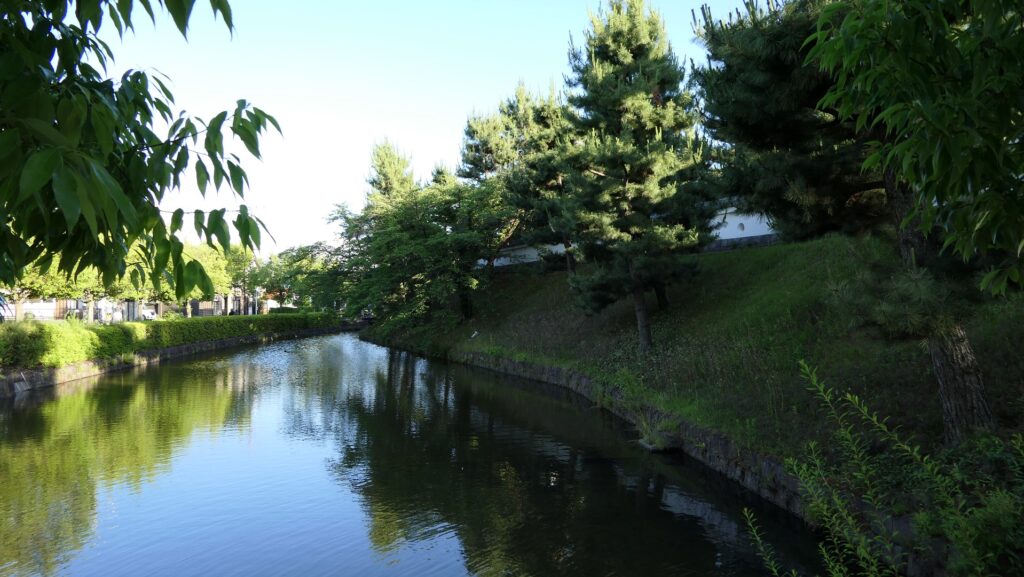
Today, there are only few remaining items of the original Oshi Castle because most of its lands and moats were turned into a city area. Part of the earthen walls and the Inner Moat surrounding the Main Enclosure remains or was restored with the rebuilt Three-level Turret looking like a Main Tower. Part of the Outer Moat, little far from the Main Enclosure in the south, remains as the Water Castle Garden. The other moats were filled and the other enclosures were flattened for building modern buildings and transportation. However, if you use the location map laying over the previous and current city areas, which Gyoda City provided, you can walk by following the original routes to the center of the castle. Some stone monuments of the original buildings will guide you see where your own location is in the past.
The aerial map around the castle
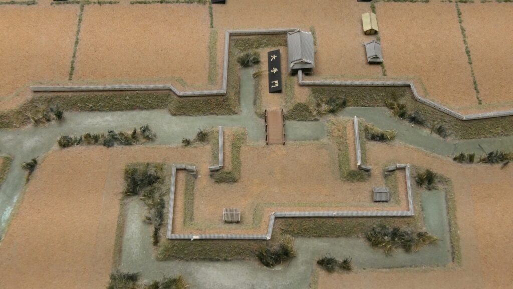
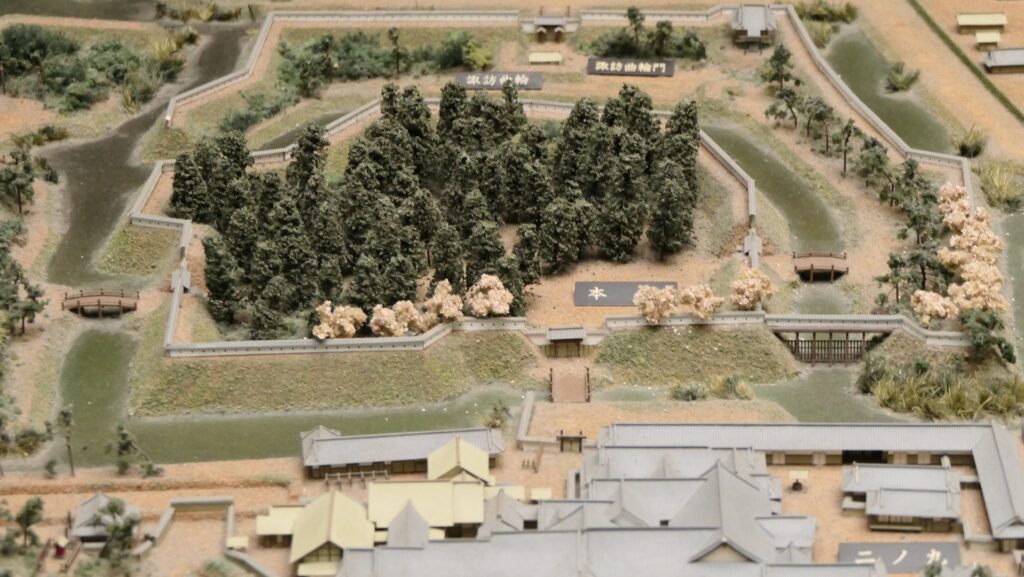
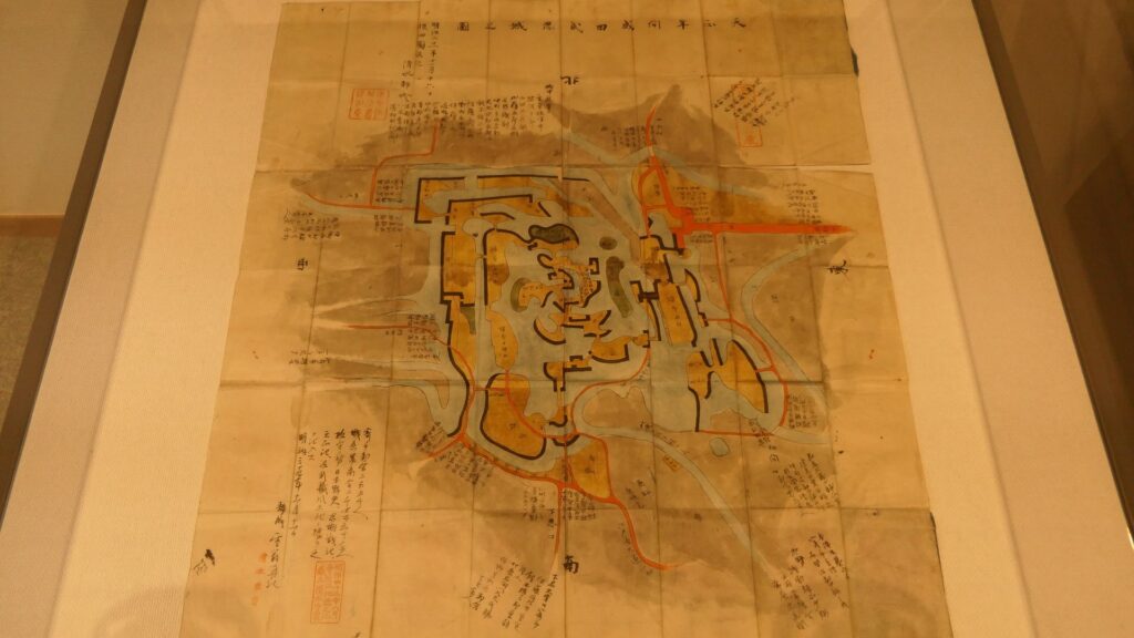
The earthen walls and water moat of the Main EnclosureThe Water Castle GardenThe location map laying over the previous and current city areas, The water moats of the castle is light blue colored, from the signboard at the siteThe place where the Main Gate was builtThe monument of the Main Gate RuinsThe part of the Main Gate in the miniature model of the castle, exhibited by the Gyoda City Local Museum
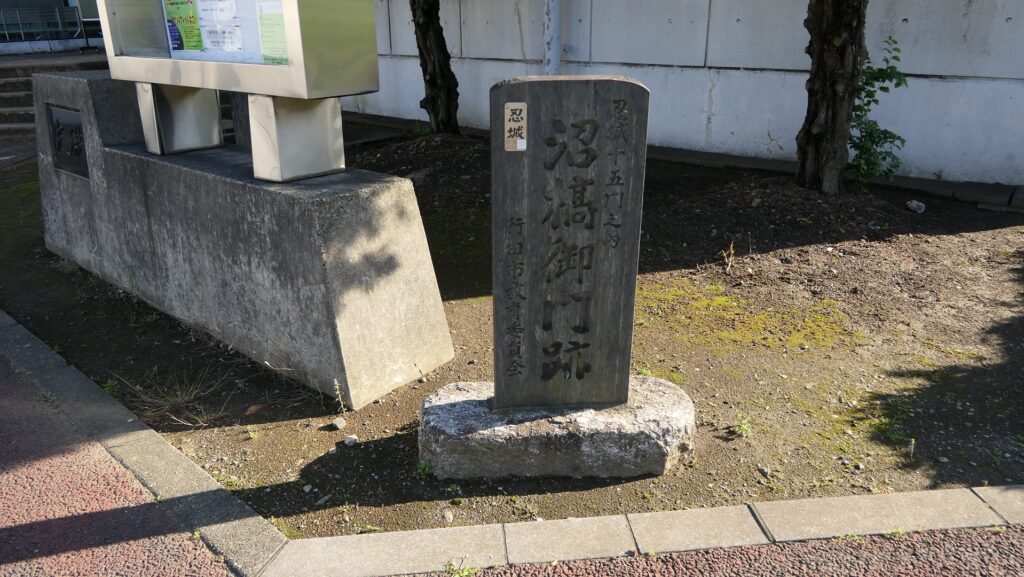
Starting from Main Gate Ruins
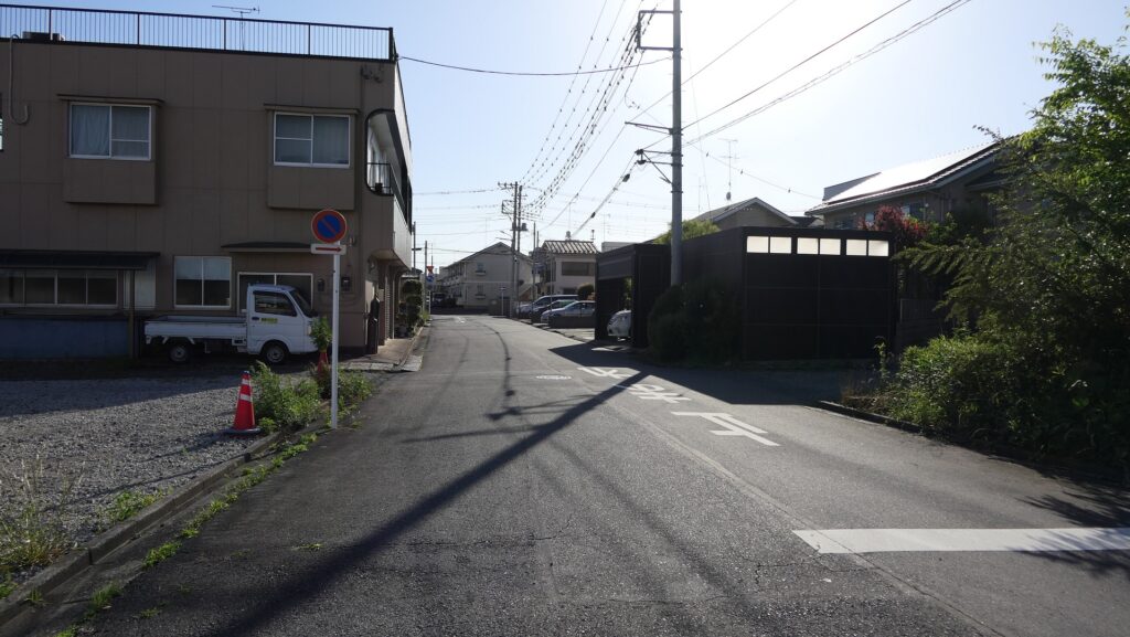
For example, if you want to go to the Main Enclosure from the Main Gate Ruins on the original route, you would need to pass five enclosures like an island through very narrow paths over the moats. You can now follow the present routes similar to the original ones, which are now among modern residential areas.
The map around the castle, the broken red line shows the route from the Main Gate to the Main Enclosure, which is nearly original
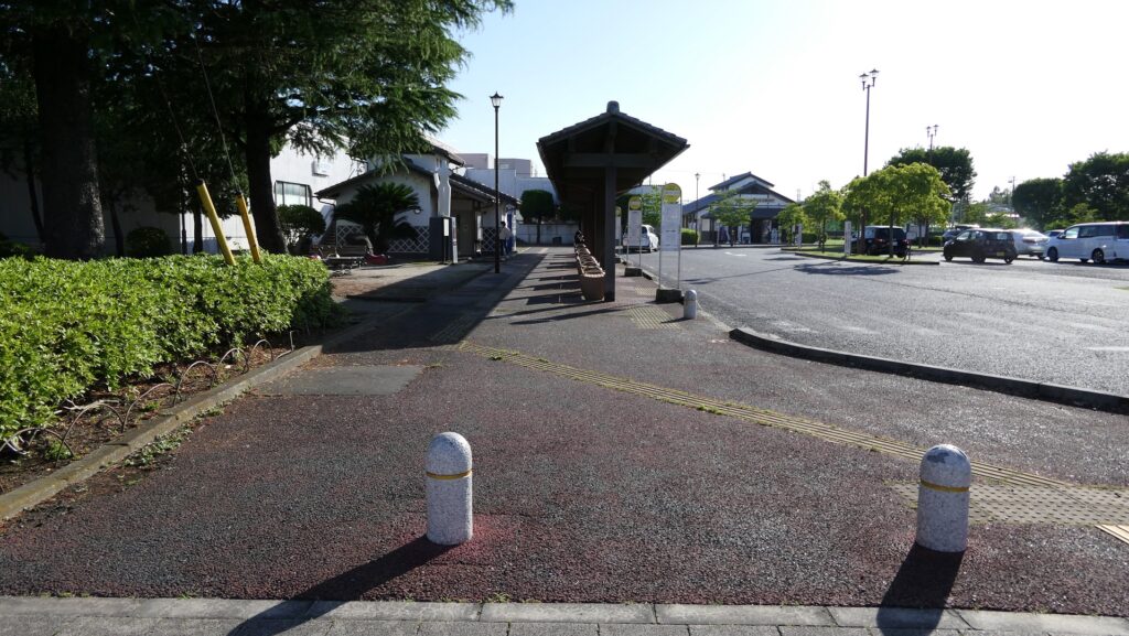
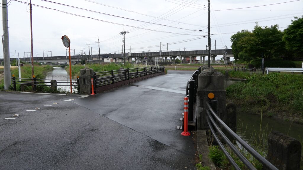
For instance, the promenade of Oshi Castle Bus Terminal is the trace of one of the narrow paths, which is an unbelievable change.
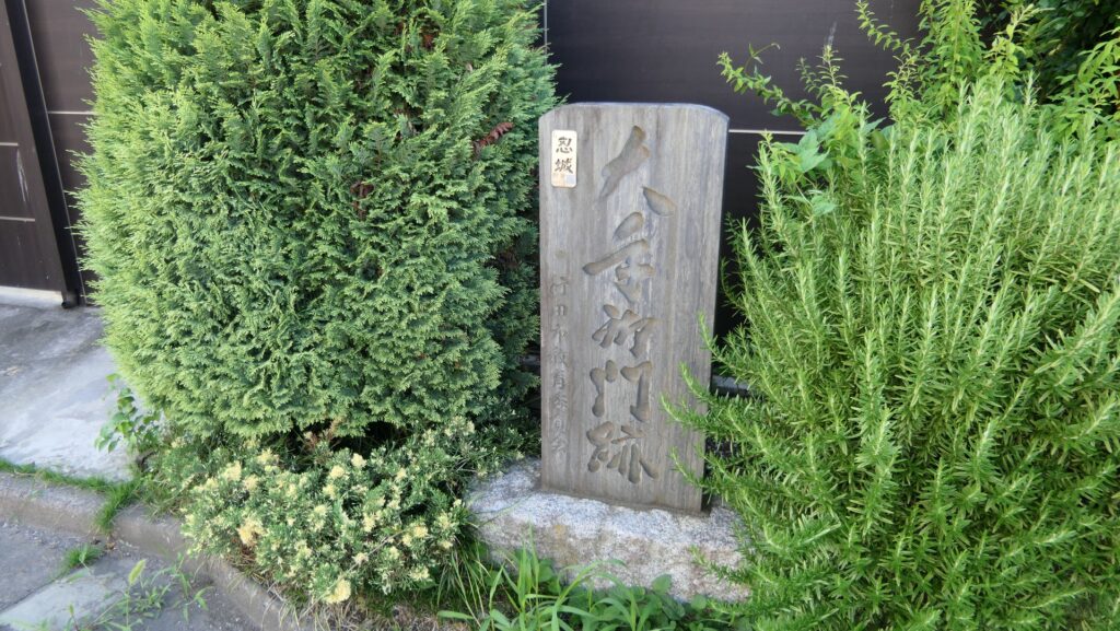
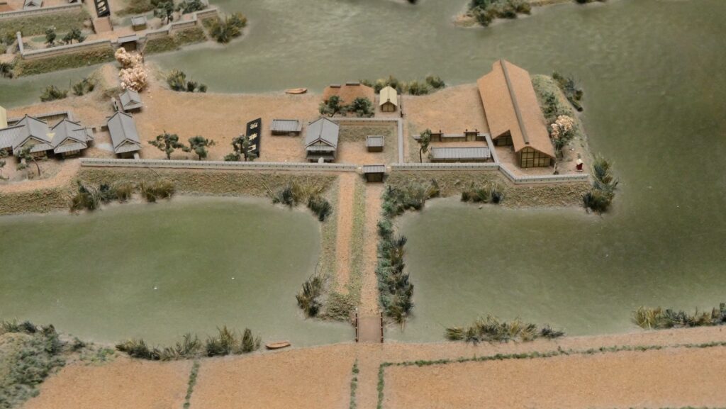
The promenade of the bus terminal, which was the narrow path over the moatThe monument of Numahashi-mon Gate Ruins is over thereThe part of Numahashi-mon Gate in the miniature model
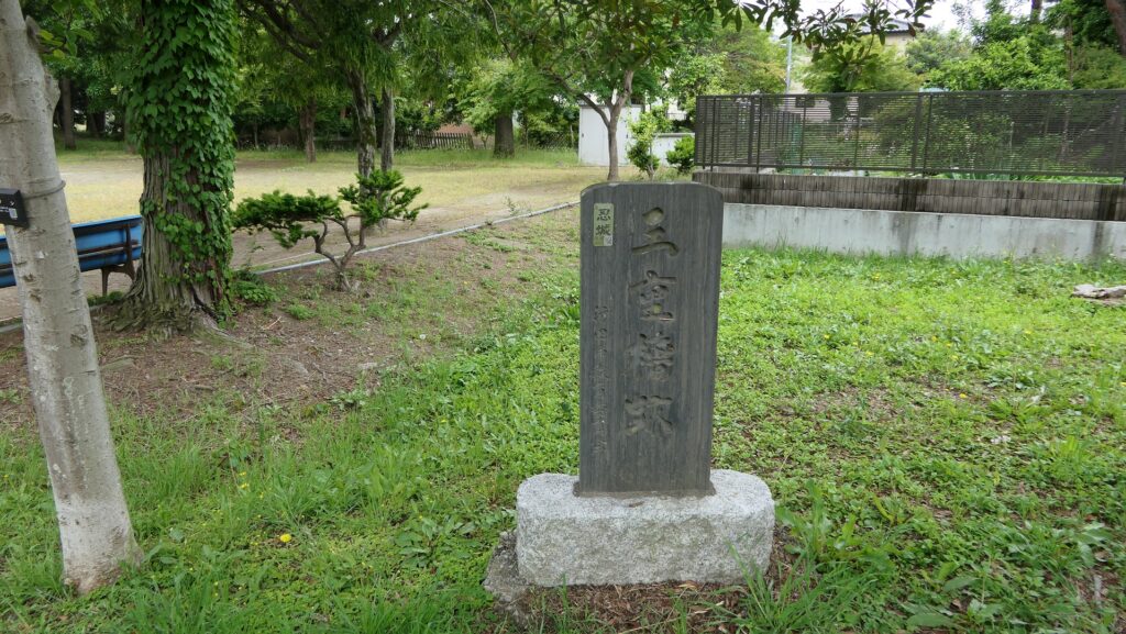
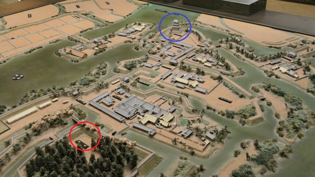
You can also find the stone monument of the original Three-level Turret on the way, so you will understand the original one was in the different place from the rebuilt one in the Main Enclosure.
The monument of the ruins of the original three-level turretThe original three-level turret is in the blue circle, the current three-level turret is in the red circle, in the miniature model
Past and Present of Main and Second Enclosures
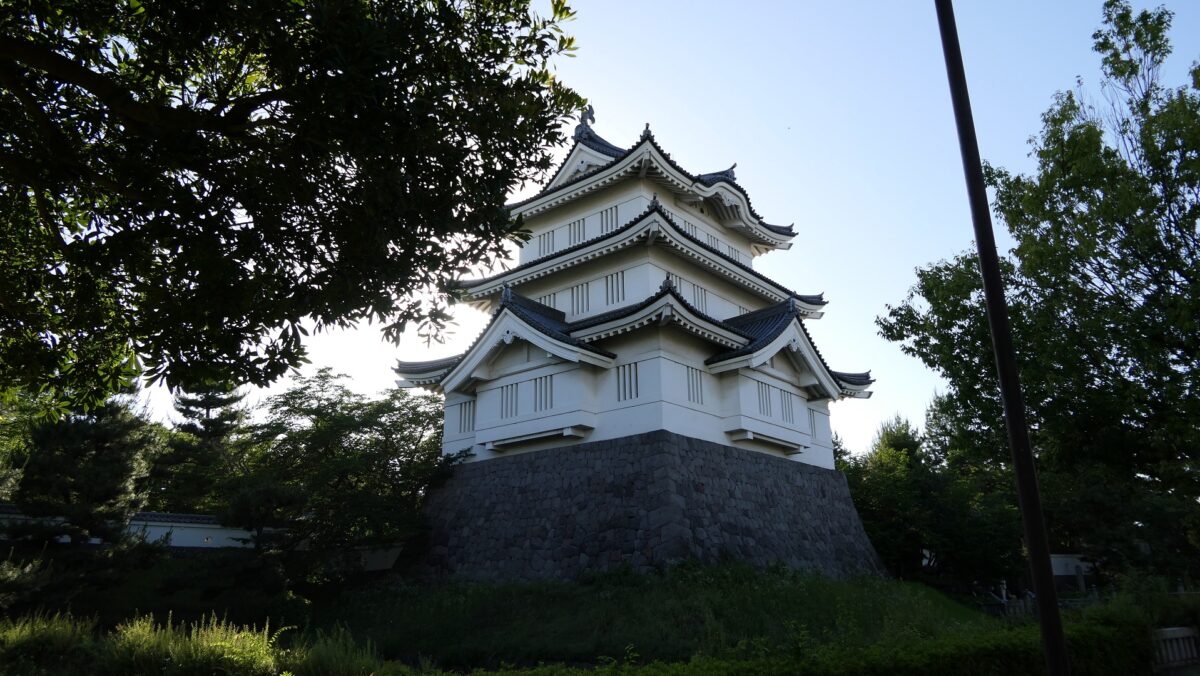
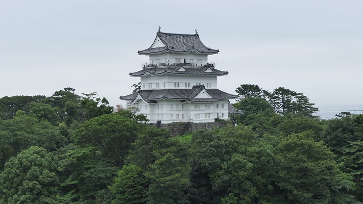
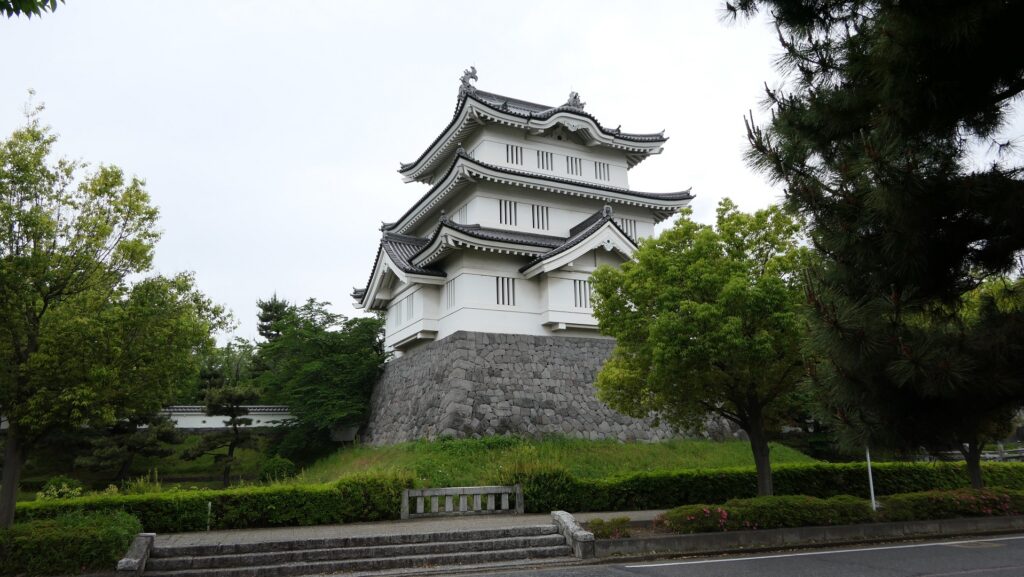
In fact, the Main Enclosure had been used as the Main Hall for Ieyasu Tokugawa, the founder of the Tokugawa Shogunate, during his hunt tour at the marshland around the castle. This enclosure eventually became an empty space surrounded by its earthen walls and the Inner Moat even during the Edo Period. The Main Enclosure is now being used as the Gyoda City Local Museum including the rebuilt turret, which exhibits the history of the castle and the city, and has become the landmark of the city.
The part of the Main Enclosure in the miniature modelThe rebuilt three-level turret in the Main Enclosure
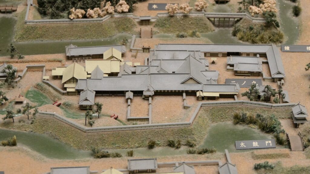
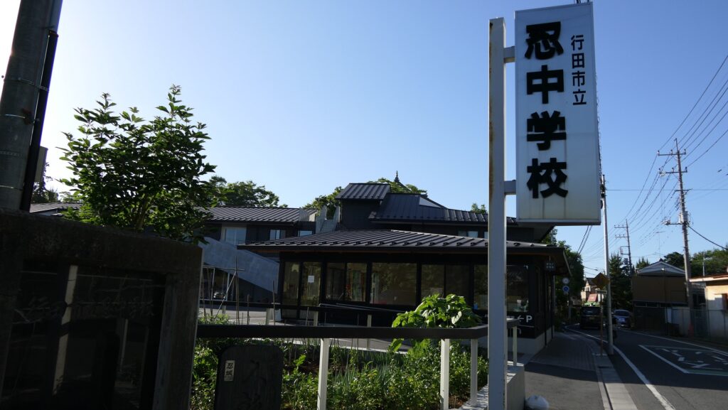
The Main Hall for the lord of the Oshi Domain was built in the Second Enclosure across from the Main Enclosure, which is being used as Gyoda Secondary School.
The part of the Second Enclosure in the miniature modelThe secondary school in the Second Enclosure
Tins castle is known for the Battle of Oshi Castle.
Location and History
Narita Clan builds Castle using Marshes between rivers
Gyoda City is located in the northern part of Saitama Prefecture, which is sandwiched by two large rivers in the Kanto Region, Tonegawa and Aarakawa Rivers. The land of the city is very flat and has been developed for living comfortably, however, it was marshy and waterlogged in the Middle Ages due to its terrain and flood from the rivers. The Narita Clan governed the area, which was called Oshi, in the 15th and 16th Centuries during the Sengoku Period. It is said that the clan first built Oshi Castle in the late 15th Century. Many battles happened in the Kanto Region at that time, so local lords needed to protect themselves by building strong castles. Some built mountain castles such as Minowa Castle for the Nagano Clan and Kanayama Castle for the Iwamatsu Clan. On the other hand, the Narita Clan’s choice was to build a Water Castle, using the area’s features of islands among the marshes and natural levees along the rivers. The castle’s enclosures were connected by paths on bridges and earthen walls.
The range of Gyoda City and The location of the castle
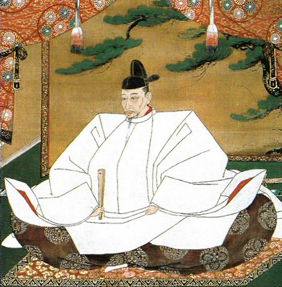
The strength of the castle was actually proven when Hideyoshi Toyotomi invaded the Kanto Region to complete his unification of Japan in 1590. The whole region had been governed by the Hojo Clan which the Narita Clan served then. The Hojo Clan ordered their branches including Oshi Castle to gather soldiers to their home base, Odawara Castle to against Hideyoshi. Ujinaga Narita, the lord of Oshi Castle had to leave it for Odawawa, so few defenders were left in the castle, under the castle keeper, Nagachika Narita, Ujinaga’s cousin. Hideyosi attacked the Hojo’s territory with over 200,000 soldiers, sending troops to not only Odawara Castle but also branch castles. For example, Kanayama Castle where a magistrate from the Hojo governed was easily open by the troops. However, the only 500 defenders with 2500 residents in Oshi castle, instructed by Nagachika, never surrendered against over 20,000 attackers.
Castle is attacked by Inundation tactics in Battle of Oshi Castle
The Portrait of Hideyoshi Toyotomi, attributed to Mitsunobu Kano, owned by Kodaiji Temple (licensed under Public Domain via Wikimedia Commons)Odawara Castle
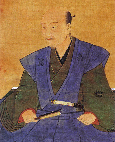
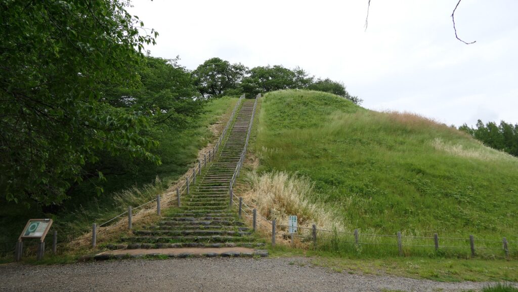
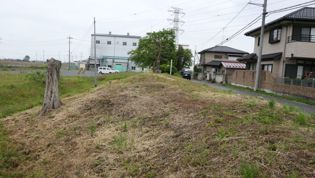
The commander head of the attackers was Mitsunari Ishida, a highly trusted retainer from Hideyoshi, who was also supported by other lords, such as Nagamasa Asano and Masayuki Sanada. Hideyoshi was not there, but he ordered Mitsunari to flood the castle by making banks surrounding it to keep more water. His idea probably came from the geographical features and his successful experience of the Battle of Bicchu-Takamatsu Castle where he did the same way. It is said that Mitsunari put his strong hold on Maruhakayama-Kofun, an Ancient Burial Mound, about 2km away from the castle in the south. His team rapidly built 15 to 25 km banks around the mound in few days to dam water from the rivers. A folk story remains that farmers were asked to bring earth bags to build banks for a high fee.
The portrait of Mitsunari Ishida, owned by Hajime Sugiyama (licensed under Public Domain via Wikimedia Commons)Maruhakayama Ancient Burial MoundThe partially remaining bank Mitsunari built, called Ishida Tsutsumi
It is uncertain if his attempt was successful according to some records in which the defenders secretly cut part of the banks to drain water drowning some attackers. The fact is that when the supporting lords tried to assault the castle, Hideyoshi ordered them to stop it and continue the inundation. The siege lasted for about a month, however, the castle couldn’t be beaten until the master Hojo surrendered in Odawara Castle. The castle has been nicknamed “a floating castle” of “a turtle castle” which probably originate from what the castle looked like in the siege.
“The illustration of the Narita Clan’s Oshi Castle during the Tensho Era”, it was made by a local historian to consider the Battle of Oshi Castle during the Meiji Era, exhibited by the Gyoda City Local MuseumThe Horikiri-bashi Bridge where the bank was cut according to a local tradition
Castle becomes important defense site for Edo
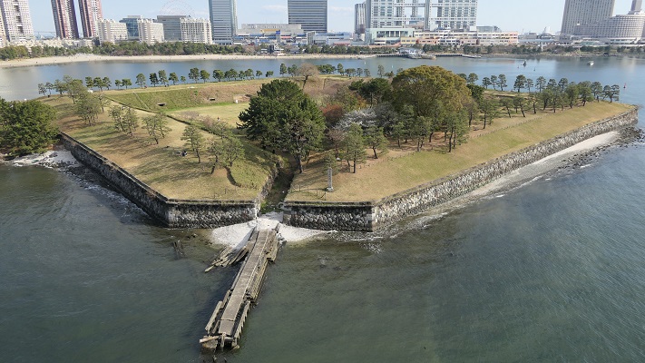
In the Edo Period, Oshi Castle was governed by relatives or hereditary vassals of the shoguns as the Oshi Domain. This was because this castle was located in an important defensive site for Edo Castle, the shogun’s home base in the south. It is said that the Abe Clan, which often became members of shogun’s council of elders, completed the castle. They still used the basic structures of the castle as the island-like enclosures among the moats and marshes. However, they improved the castle’s defense systems more by building the three-level turret (similar to the Main Tower), other turrets and gates. The castle and domain were finally followed by the Okudaira-Matsudaira Clan, whose origin was the son of Nobumasa Okudaira who contributed to Ieyasu Tokugawa, the founder of the shogunate, in the Battle of Nagashino Castle and was married with Ieyasu’s daughter. They were trusted in and ordered by the shogunate to guard the No.3 Shinagawa Battery facing Edo Bay to prepare for possible threat to Western battleships at the end of the Edo Period.
The miniature model of Oshi Castle during the Edo Period, exhibited by the Gyoda City Local MuseumThe rebuilt three-level turret of Oshi Castle, it was built in a different position from the original oneThe No.3 Shinagawa Battery