A castle basically made using earthen walls and water moats
Location and History
Center of Ecchu Province
Toyama City started as the castle town of Toyama Castle and is the capital of Toyama Prefecture. The castle was first built by the Jinbo Clan in the first half of the 16th Century. It was in a flat area in the center of Ecchu Province, what is now Toyama Pref. The area was also the intersection of two of the major roads, the Hokuriku, and Hida Roads. It might have been dangerous to build a castle in such a place at that time. Many battles happened during this time, later known as the Sengoku Period. Warlords in the province usually lived in mountain castles like Masuyama Castle to protect themselves. In the case of Toyama Castle, it was protected by the Jintsu-gawa River and water moats surrounding the castle.
The location of the castle
The ruins of Masuyama Castle
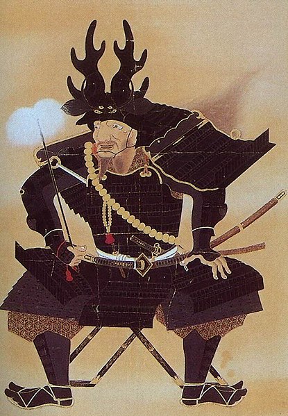
Narimasa Sassa unifies Ecchu Province
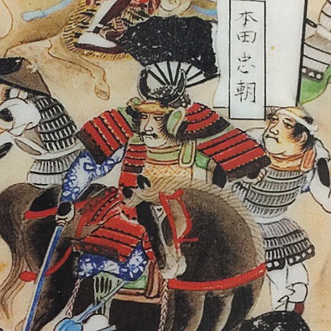
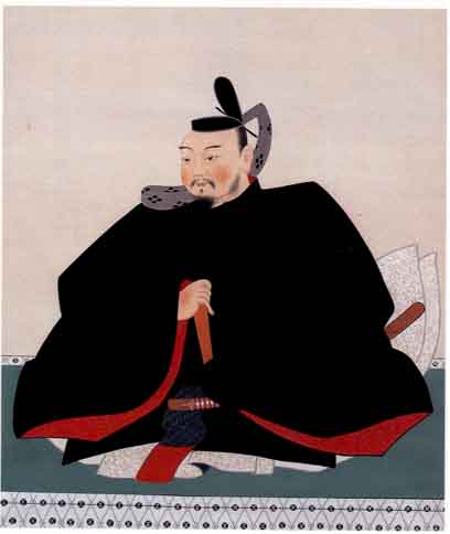
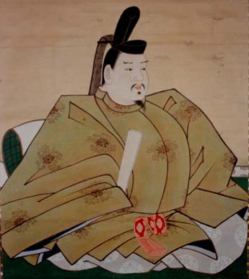
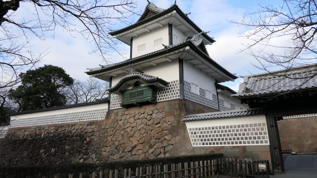
Many warlords such as the Uesugi Clan, the Ikkoshu Sect, and the Oda Clan battled over Toyama Castle. Narimasa Sassa finally took over the castle and governed the whole Ecchu Province in 1582. However, he was against the ruler, Hideyoshi Toyotomi. Hideyoshi attacked the Ecchu Province in 1585. The castle was destroyed for the first time, after Narimasa surrendered to Hideyoshi in the same year. Hideyoshi gave Ecchu Province to Toshinaga Maeda who would be the founder of the Kaga Domain in the Edo Period. In 1605, Toshinaga handed over the head of the domain to his successor, and moved from Kanazawa Castle, the home base of the domain, to Toyama Castle for retirement. He had the power to govern the domain because the successor was still young. He rebuilt Toyama Castle as his new home base.
The portrait of Narimasa Sassa, owned by Toyama Municipal Folk Museum (licensed under Public Domain via Wikimedia Commons)The portrait of Toshinaga Maeda, owned by Uozu Museum of History and Folklore (licensed under Public Domain via Wikimedia Commons)Kanazawa Castle
Toshinaga Maeda completes Castle
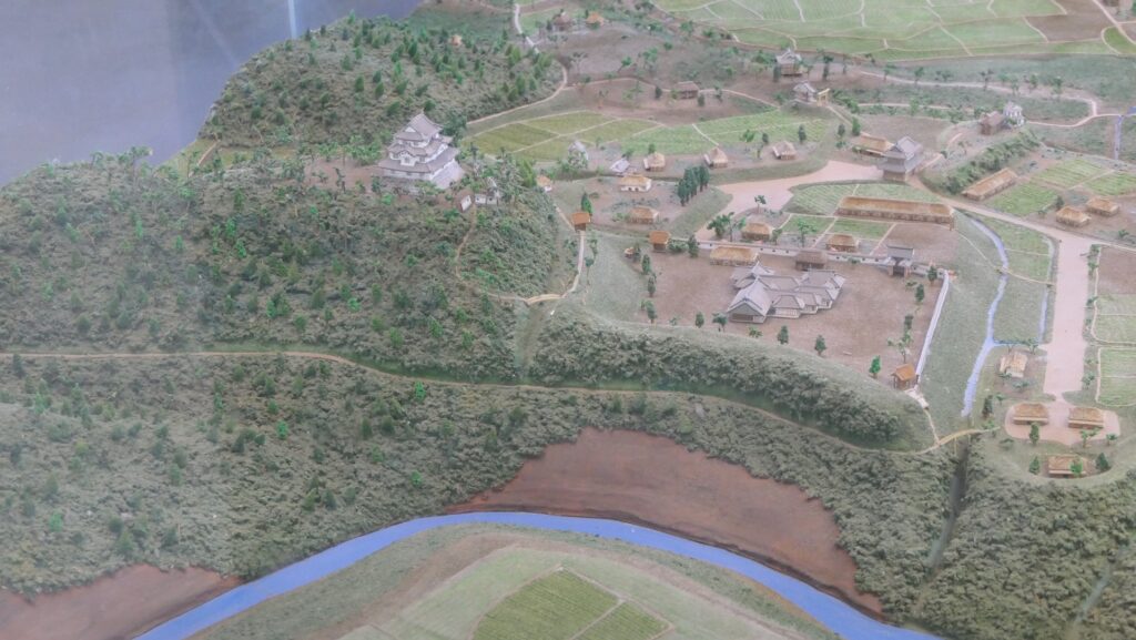
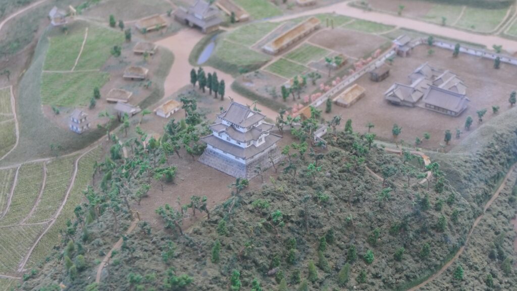
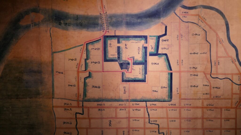
It is said that Toshinaga completed the structure of Toyama Castle. The large Jintsu-gawa River flowed in the north of the Main Enclosure as a natural hazard. A floating bridge was built over the river, which would later become popular among the people. There was the Second Enclosure in the south, the Eastern Barbican Enclosure in the east, and the Western Enclosure in the west of the Main Enclosure to protect it. Each enclosure was independent. The enclosures were surrounded by a water moat. They were only connected to the Main Enclosure by an earthen bridge. These enclosures were basically made using earthen walls. They were partly covered with stone walls around the three main gates such as the front gate of the Main Enclosure. It is also thought the Main Hall was in the Main Enclosure and some turrets were built on the stone walls of the gates. The largest Third Enclosure was on the south of all other enclosures, which was used as the warriors’ houses. However, the castle was destroyed a second time when it was unfortunately burnt by an accidental fire in 1609 before Toshinaga had to move to Takaoka Castle.
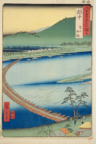
The illustration of old Toyama Castle in Ecchu Province, owned by Kanazawa City Tanagawa Library, exhibited by Toyama Municipal Folk Museum”Floating bridge in Toyama, Ecchu Province” from the series “Famous Places in the Sixty-odd Provinces” attributed to Hiroshige Utagawa in the Edo Period (licensed under Public Domain via Wikimedia Commons)The ruins of Takaoka Castle
Home Base of Toyama Domain
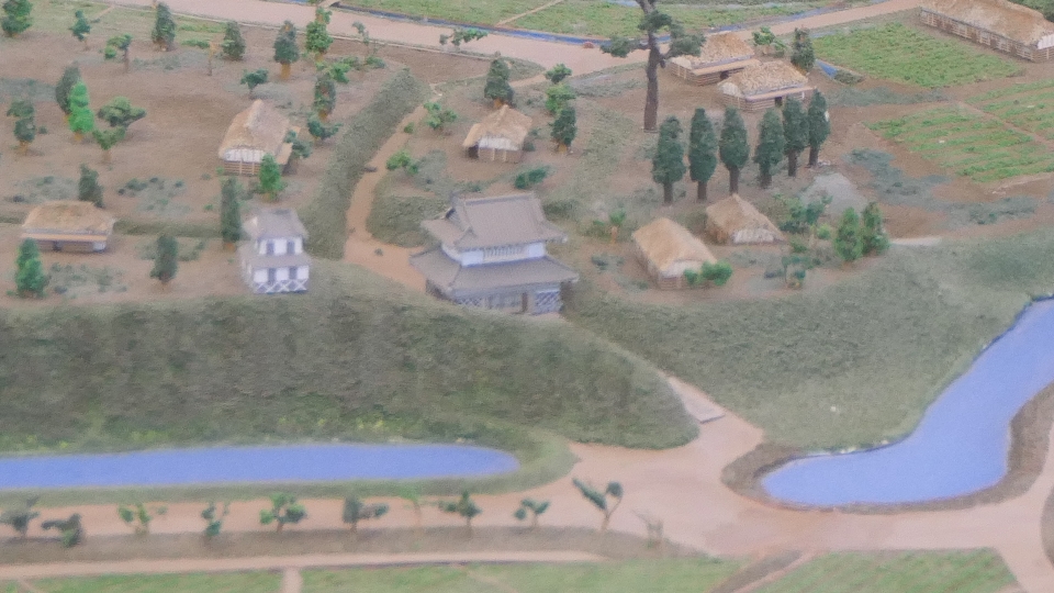
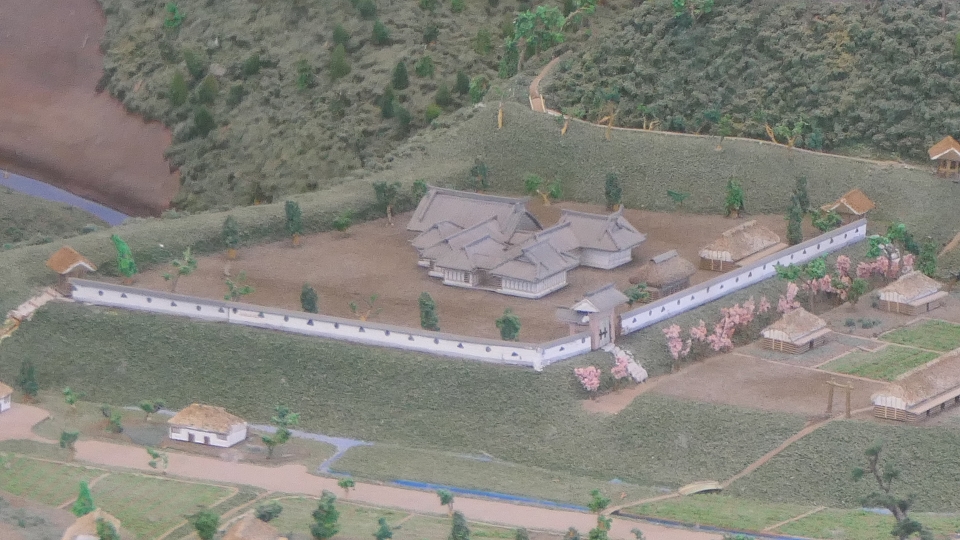
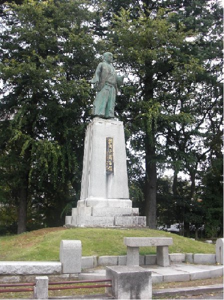
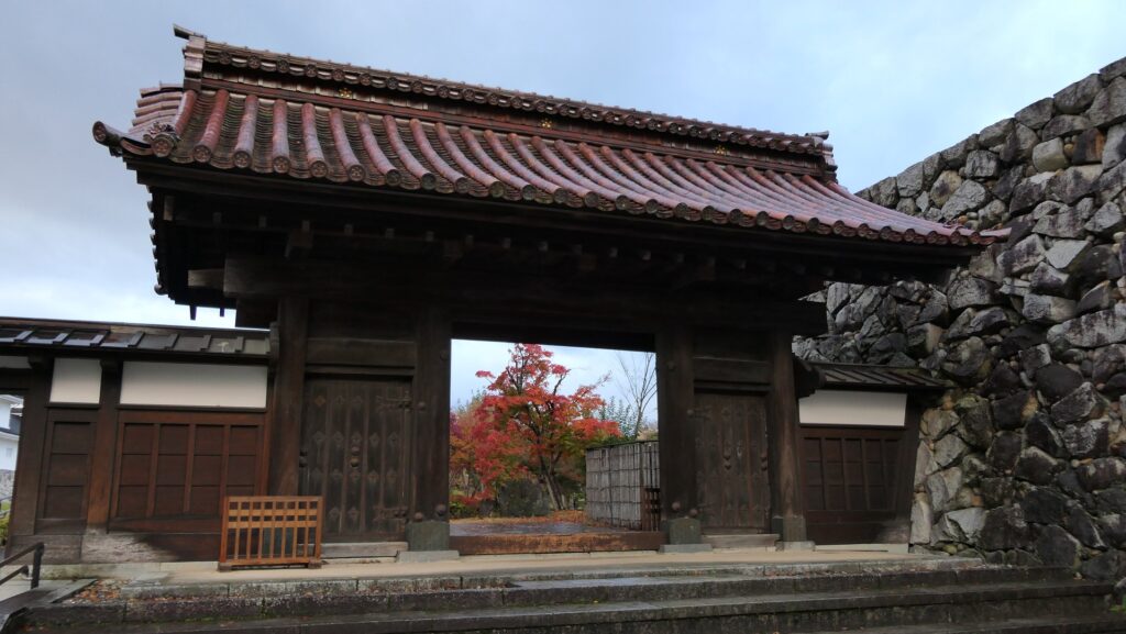
In 1639, Toshinaga’s nephew, called Toshitsugu Maeda, was allowed to establish a subsidiary domain called the Toyama Domain. He once thought he could build a new castle but decided to repair and reuse Toyama Castle due to a financial issue. Instead, he built the outermost earthen walls and water moats to protect the castle town. Toshitsugu’s son, Masatoshi, promoted industries, especially a patent medicine. The success of the medicine resulted in the drug sellers of Toyama being known in the whole country. The domain also planned to build the Main Tower but gave up because of a financial issue again. Instead, they built the Chitose Hall in the Eastern Barbican Enclosure to sometimes allow to people to enter it for festivals. In addition, the castle suffered damage from fires, floods, and earthquakes again and again throughout the Edo Period. The domain struggled to restore or repair it. Simple earthen walls and water moats might have protected the castle from many of the disasters and made it easier to restore and maintain.
The statue of Masatoshi Maeda in Toyama Castle Park (licensed by Miyuki Meinaka via Wikimedia Commons)The remaining front gate of the Chitose Hall
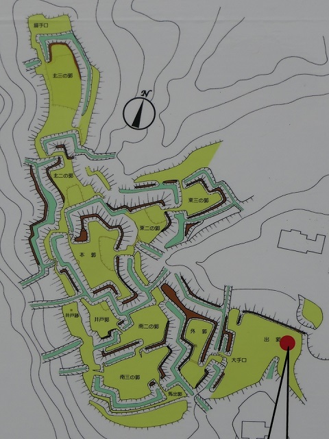
Castle layout researchers focus on Sugiyama Castle.
Features
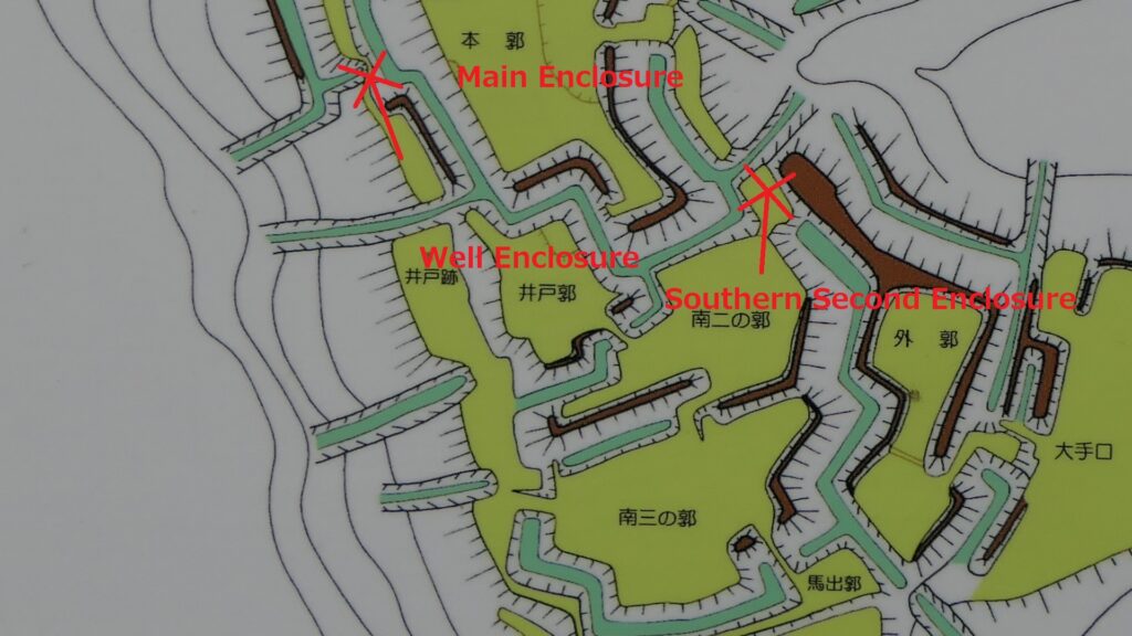
Main Enclosure, Center of Castle
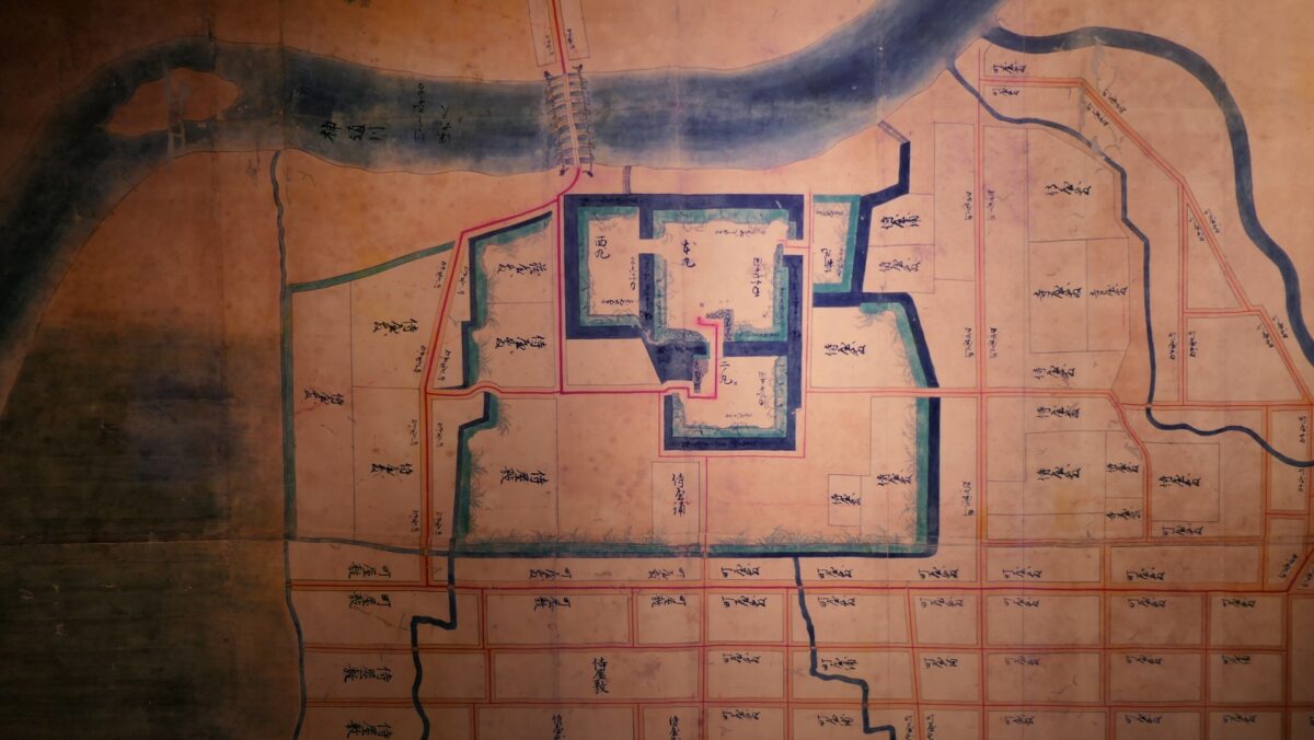
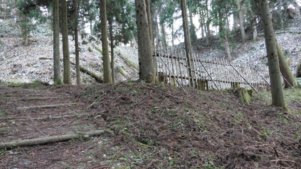
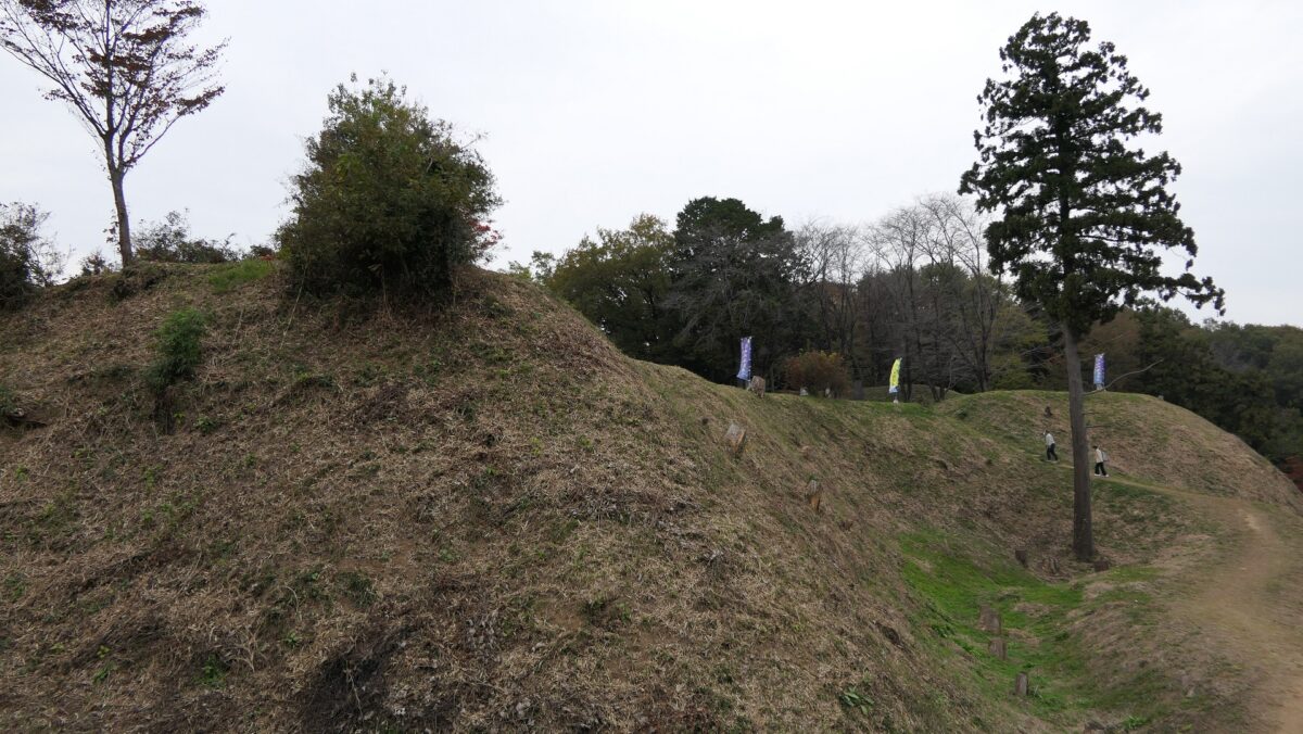
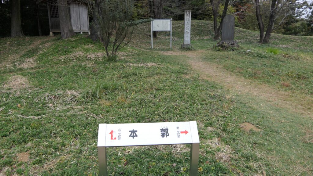
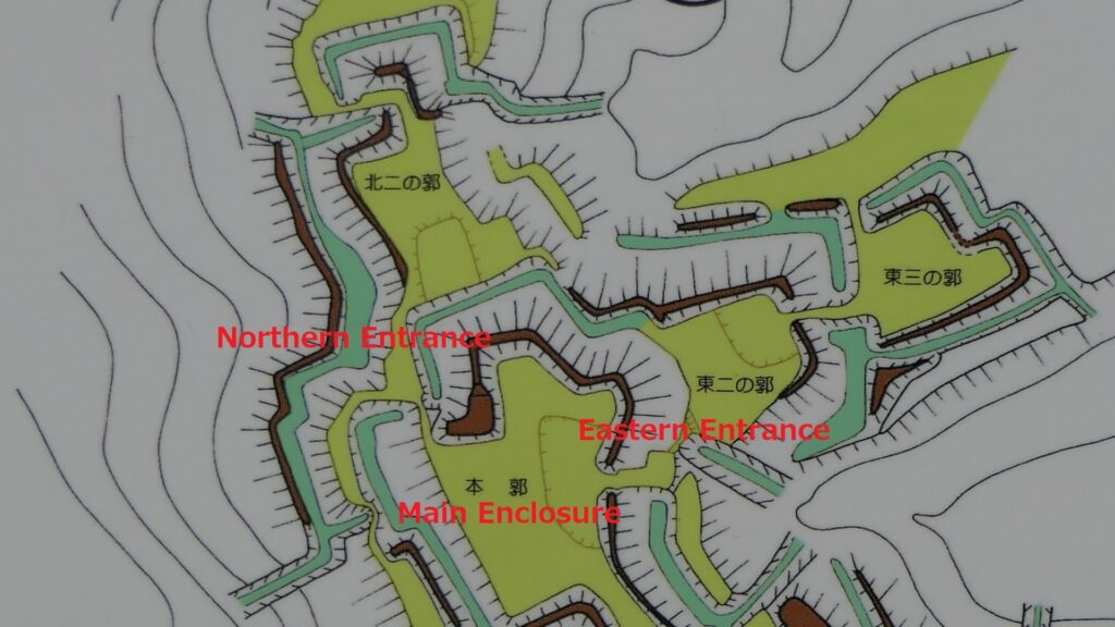
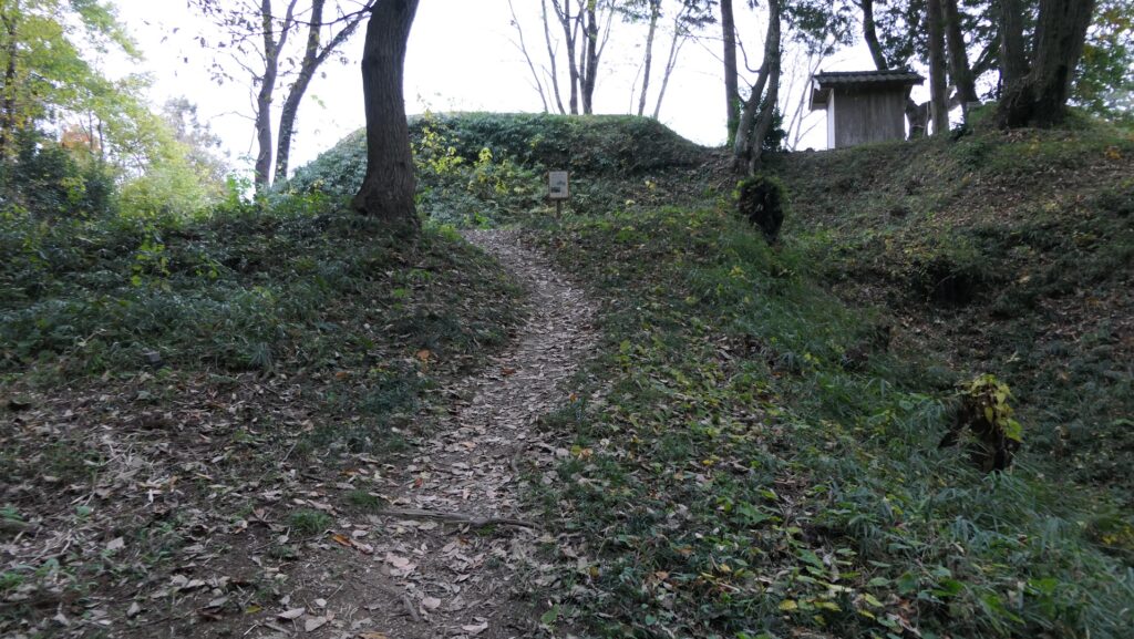
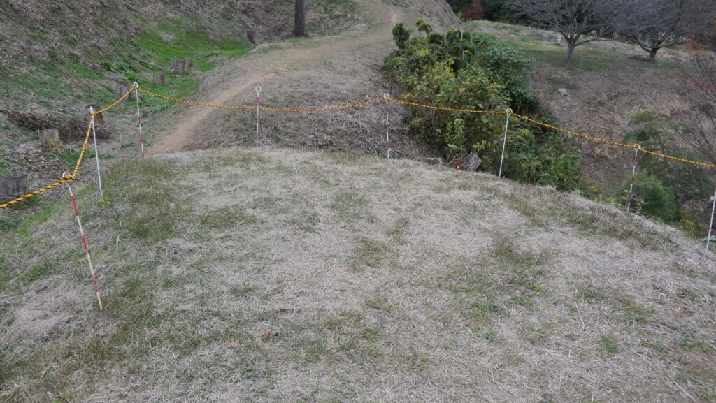
The Main Enclosure is the largest and highest one in the castle. It has three entrances in the south, north and east. The north and east ones were also strictly protected by other enclosures and dry moats like you simulated in the south. The lord of the castle would be able examine the situation in all directions clearly and give the appropriate instructions.
The Main EnclosureThe locations of the Main Enclosure and the northern and eastern enclosuresThe Northern Entrance of the Main EnclosureThe Eastern Entrance of the Main EnclosureThe eastern enclosures seen from the Main Enclosure
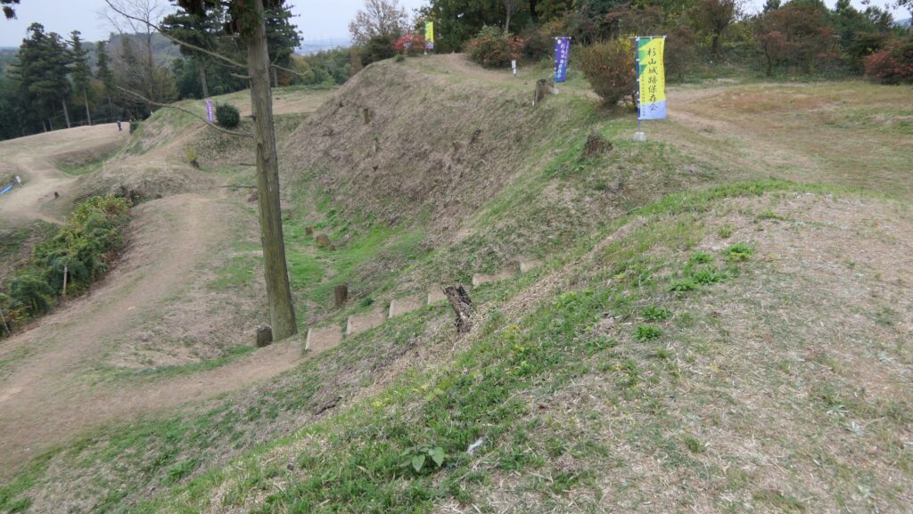
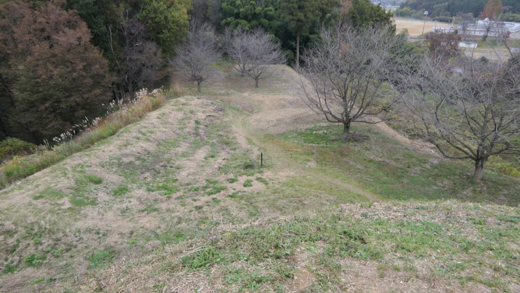
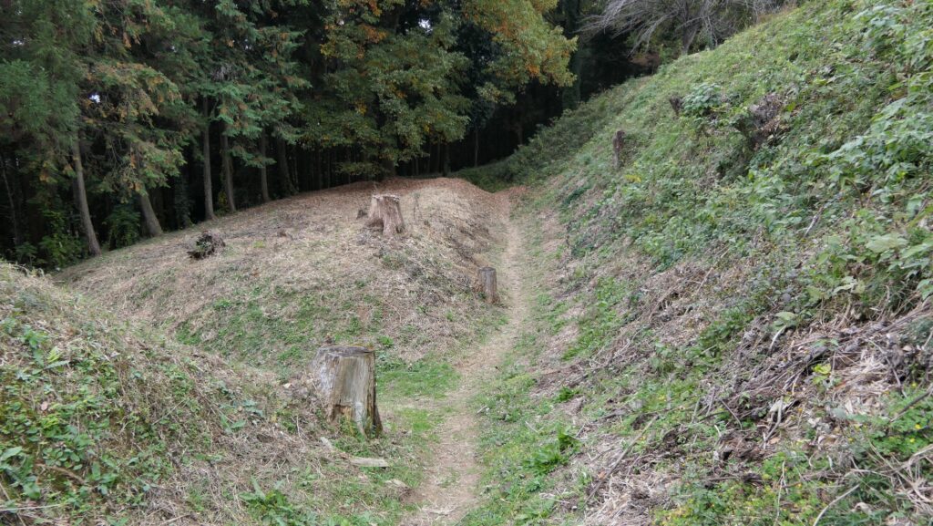
In addition, some bypass routes are set in the castle, but some of them are dead-end alleys. If you see the layout of the castle, you may think it looks like a maze. It’s true for enemies, but it’s a well-designed fortress for defenders.
The locations of the spots which are supposed be dead-end alleysThe dead-end alley at the Southern Second EnclosureThe dead-end alley beyond the Well Enclosure
Later History
The ruins of Sugiyama Castle were not known to the public until around 1980s. Only the researchers who studied the layout of castles were interested in this castle. They published the dictionaries and magazines which featured the layout of castles since 1987. The layout drawing of Sugiyama Castle has been one of the most featured ones in these books. The castle became popular little by little. After the excavations between 2002 and 2007, the ruins became a National Historic Site in 2008. It is considered one of the “Hiki Castles Ruins”.
This location map is also a good layout drawing
My Impression
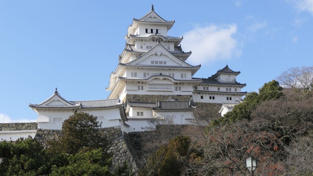
I imagine if Sugiyama Castle was much larger, and equipped with turrets, gates, and stone walls, it would look like the great castles built much later, such as Himeji Castle. This means Sugiyama Castle could be the pioneer of the advanced castle design. However, I rather prefer the effort of building the castle to its historical value. The unknown builders of the castle must have had a small budget, resources, workers, and little time because the purpose of the castle was limited. They thought hard to create their great work under the difficult situation. It may have been easier for them to build a great castle if they had enough resources. I think Sugiyama Castle is also a good lesson for us about how to use limited resources to create good work.
Himeji CastleThe ruins of Sugiyama Castle
How to get There
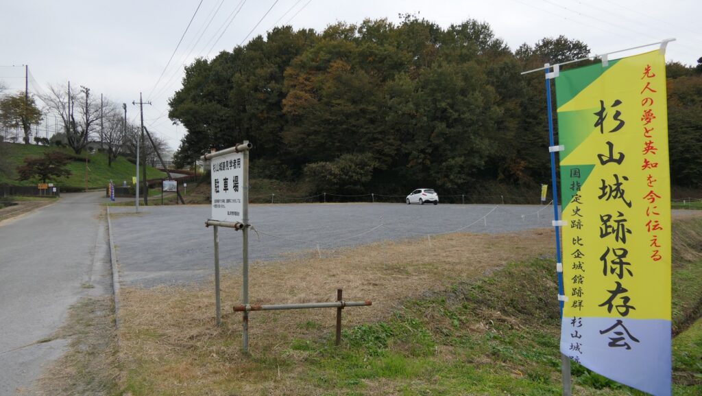
I recommend using a car when you visit the ruins. It is about 15 minutes away from Ranzan-Ogawa IC on Kanetsu Expressway. The ruins offer a parking lot. By public transportation, take the Tokigawa-cho route bus bound for Seseragi Center from Musashi-Ranzan Station on the Tobu-Tojo Line and get off at the Taguro bus stop. It is about 20 minutes on foot from the bus stop.