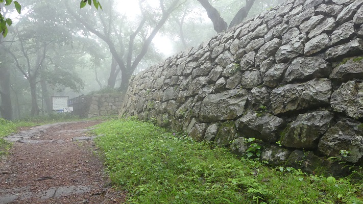
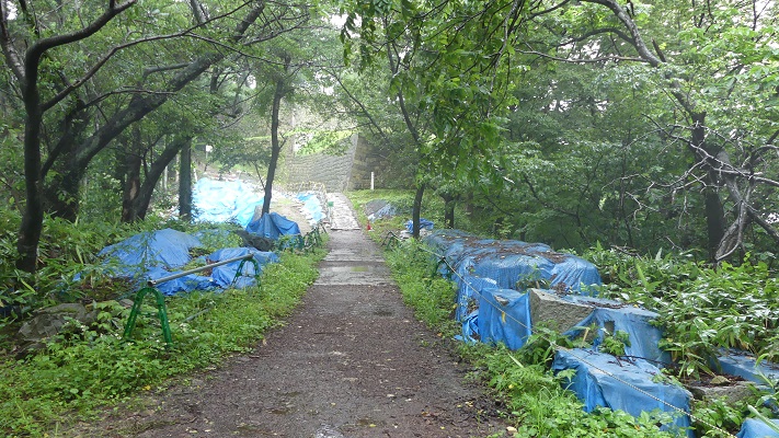
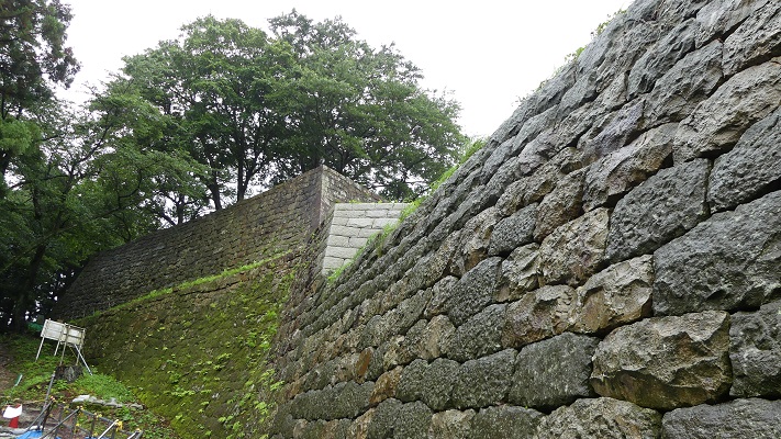
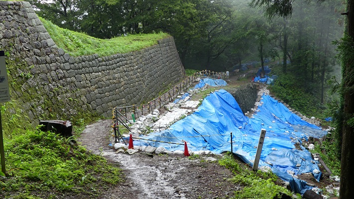
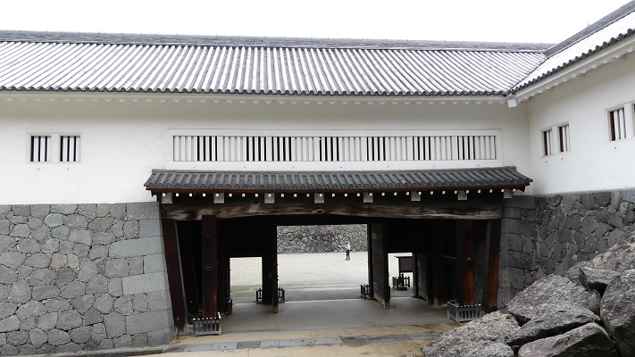
65.月山富田城~Gassan-Toda Castle

この大きな山城は、過酷な籠城戦を戦い抜きました。
This large mountain castle fought severe sieges.
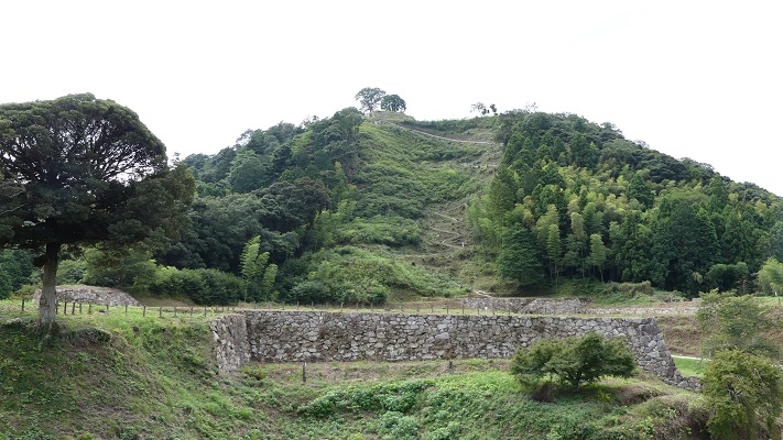
月山富田城の中心部~The center of Gassan-Toda Castle

立地と歴史~Location and History

山陰地方は現在、どちらかというと地味なイメージがあります。しかしながら、近代以前、この地方は人口面でも経済面でも繁栄していました。かつては沿岸航海が主要な交通手段でした。この地方の都市はこの経路に沿っていました。ここには石見銀山もあり、世界遺産になっています。戦国時代には、この鉱山からの銀は世界の3分の1のシェアがあったと言われています。山陰には鉄鉱山とその関連産業まであって、武器製造に生かされました。
San-in region now has a comparatively quiet image. However, before the Modern Ages, the region flourished in both population and economy. Sailing along the coast was a major way of transportation. The cities in the region were among the route. It also had Iwami Silver Mine, which has become a World Heritage Site. It is said that the silver from the mine was shared with one third of the world in the Warring States Period. San-in even had iron mines and relative industries which could produce weapons.

山陰地方の関連史跡の位置~The location of relative historic sites in San-in region

尼子氏はこの3つの重要資源を握っていて、有力な戦国大名となりました。月山富田城はもっと以前からあったのですが、尼子経久が15世紀後半にこの城を拡張しました。
The Amago clan had three important resources, then became great warlords. Though Gassan-Toda Castle was founded in earlier times, Tsunehisa Amago improved the castle in the late 15th century.
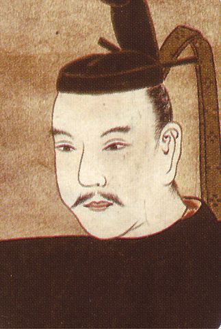
尼子経久肖像画、洞光寺蔵~The portrait of Tsunehisa Amago, owned by Doukouji Temple(licensed under Public Domain via Wikimedia Commons)

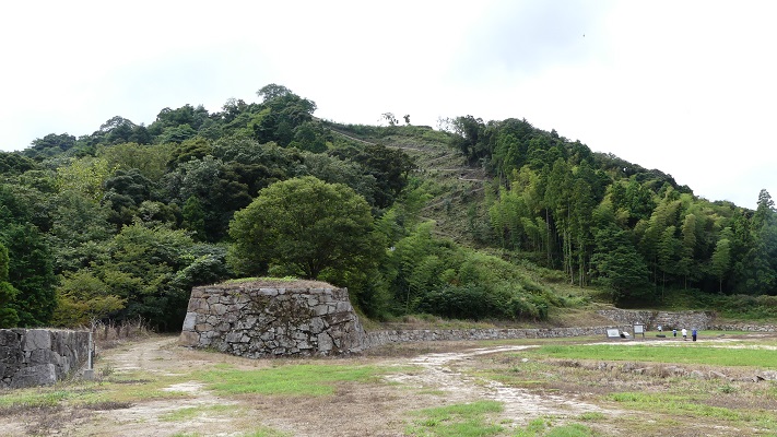
城は、靴のような形の月山の上に築かれました。そこには約500の曲輪があり、城下町の民衆を収容できるようになっていました。靴の形の甲の部分にあたる、城の中心である山中御殿に至るには3つのルートがありました。詰め城である本丸、二の丸、三の丸の各曲輪は、靴の形の頂点の部分にあり、御殿とは「七曲り」と呼ばれるたった一本の曲がりくねった山道でつながっていました。尼子は支城のネットワークも作り、本拠地の月山富田城を支えていました。
It was on Mt. Gassan, which looks like a shoe. It had about five hundred enclosures and could accommodate people in the castle town. There were three routes to reach Sanchu hall, the center of the castle, which was located on the upper part of the shoe shape. The last area of the castle, Honmaru, Ninomaru and Sannonaru enclosures were on the top part of the shoe shape, connected with the hall by only one zigzagged trail called “Nana-magari”. Amago made a network of branch castles as well to support the home base Gassan-Toda.
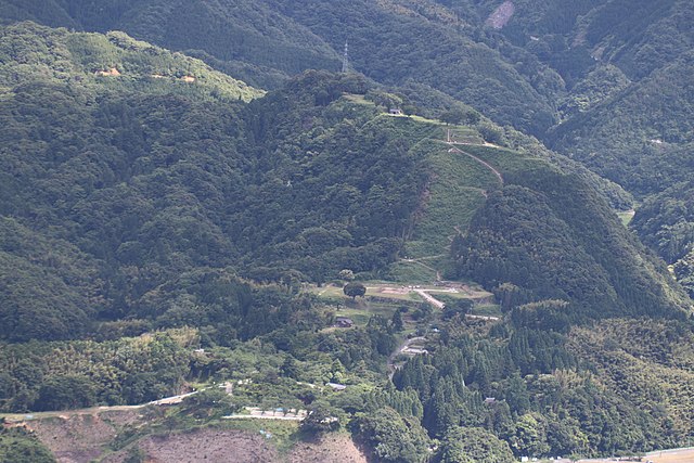
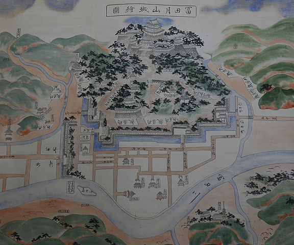
月山~Mt. Gassan(licensed by 安来市政策秘書課 via Wikimedia Commons)
月山富田城絵図(模写)、安来市立歴史資料館蔵~GassanーToda Castle old map (replica), owned by Yasugi City History Museum(licensed under Public Domain via Wikimedia Commons)

大内氏がこの城を1543年に攻撃しましたが、失敗し撤退しました。このことで大内氏の影響力が低下し、1551年の滅亡につながりました。大内氏の後継である毛利氏はより慎重に準備しました。毛利はあらかじめ尼子から石見銀山と支城を奪いました。毛利元就は、1565年に約3万の軍勢をもってこの城を攻撃しました。この攻撃は、尼子義久と約1万の守兵により再び退けられました。元就は戦術を変え、城を包囲し、多くの砦を築きました。この包囲戦は1年7ヶ月続きます。元就は尼子に内輪揉めを仕掛け、兵糧も尽きたため、義久はついに降伏しました。
The Ouchi clan attacked the castle in 1543, but failed and withdrew. It reduced their influence, and led to the destruction of the clan in 1551. The Mori clan following Ouchi, prepared more carefully. Mori took Iwami Mine and the branch castles away from Amago in advance. Motonari Mori with about 30,000 soldiers attacked the castle in 1565. This attack was repelled by Yoshihisa Amago with 10,000 defenders as well. Motonari changed his tactic, and surrounded the castle, building many fortresses. The siege lasted for one year and seven months. In the end, Yoshihisa surrendered after Motonari caused internal trouble in Amago, and supplies ran out.
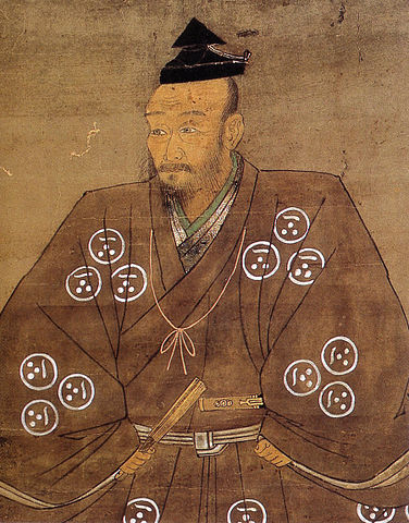
毛利元就肖像画、毛利博物館蔵~The portrait of Motonari Mori, owned by Mori Museum(licensed under Public Domain via Wikimedia Commons)

尼子の遺臣である山中鹿之助は1569年に尼子の仇を討とうとしました。彼は6千の同志とともにこの城を攻撃しましたが、そのときにはたった300名の守兵しかいませんでした。ところが城は持ちこたえ、毛利からの援軍が到着したことで鹿之助は撤退せざるを得なくなります。
The surviving retainer of Amago, Shikanosuke Yamanaka tried to avenge his clan in 1569. He attacked the castle with 6,000 supporters, while just 300 defenders were in the castle. However, the castle withstood the attack. Shikanosuke had to give up when reinforcements for Mori arrived.

山中鹿之助肖像画部分、安来市立歴史資料館蔵~Part of the portrait of Shikanosuke Yamanaka, owned by Yasugi City History Museum(licensed under Public Domain via Wikimedia Commons)

徳川氏の統治となって、1600年に堀尾氏がこの城に移されてきました。彼らは本拠地を新しい城、松江城に移すことにしました。月山富田城は1611年に廃城となります。
During the Tokugawa clan’s governance, the Horio clan was transferred to the castle in 1600. They decided to move their base to a new one called Matsue Castle. Gassan-Toda castle was abandoned in 1611.
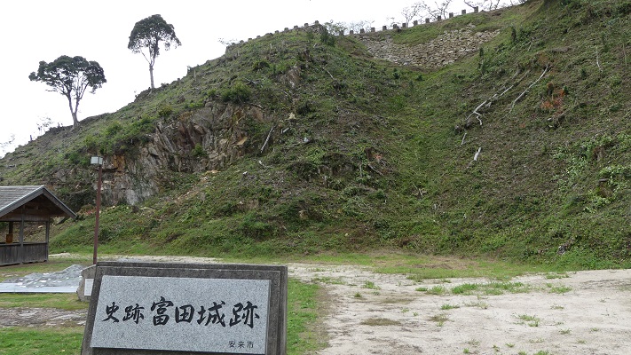
月山富田城の遺跡~The ruins of Gassan-Toda Castle

特徴~Features

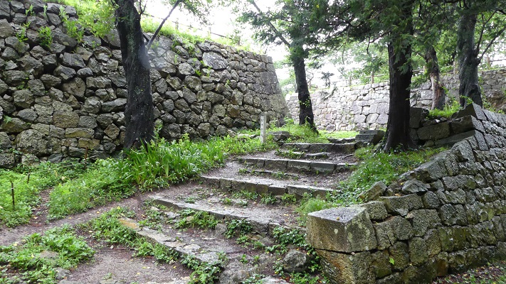
現在、観光客の人たちは通常、道の駅「広瀬・富田城」近くの、三つの登り口の一つ、菅谷口から登り始めます。山中御殿跡までたどり着くのに、いくつもの曲がりくねった道、曲輪、堀、そして関門を超えていかねばなりません。
Now, visitors usually start to climb up from Sugatani Route, one of three routes to the castle, near the roadside station “Hirose-Todajo”. You have to climb over several winding roads, enclosures, moats and gates to reach Sanchu hall ruins
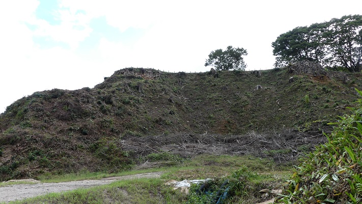
城周辺の航空写真~The aerial photo around the castle

菅谷口~The entrance of Suganani Route
菅谷口を進みます~Going on Suganani Route
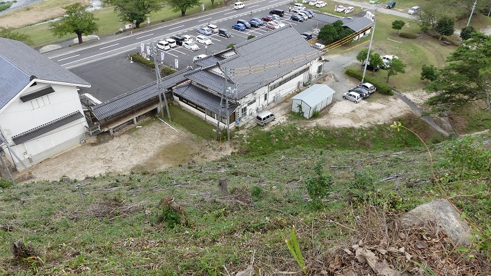
道の駅「広瀬・富田城」を見下ろします~Looking down the roadside station “Hirose-Todajo”

その途中には鹿之助の銅像もあります。
You can see the statue of Shikanosuke on the way.
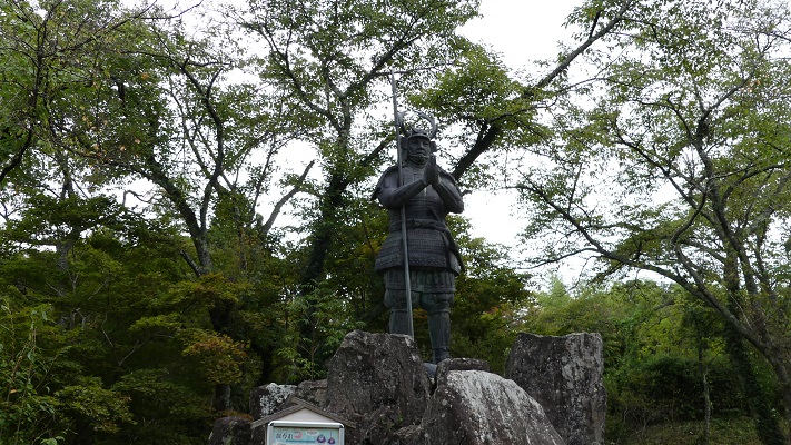
山中鹿之助銅像~The statue of Shikanosuke Yamanaka

山中御殿の前には、花の壇曲輪の上に復元された木造建物があります。
There are also restored wooden buildings on Hananodan enclosure in front of Sanchu hall.
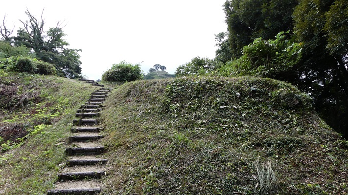
花の壇曲輪に向かいます~going to Hananodan enclosure
花の壇にある復元された木造建築物~The restored wooden buildings on Hananodan

城の主は通常は御殿の方に住んでいました。
The lords of the castle usually lived in the hall.
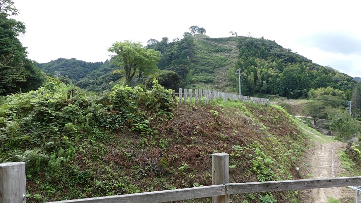
花の壇から見た城の中心部~The center of the castle from Hananodan
山中御殿跡~The ruins of Sanchu Hall

城で戦いが起こったときには、七曲りの山道を通って頂上の方に移動しました。尼子と毛利は、この山道を巡って戦ったと言われています。
When a battle happened there, they moved to the top area through Nanamagari trail. It is said that Aamago and Mori fought each other along the trail.
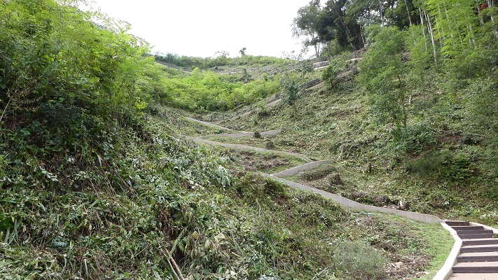
七曲りの山道~Nanamagari trail

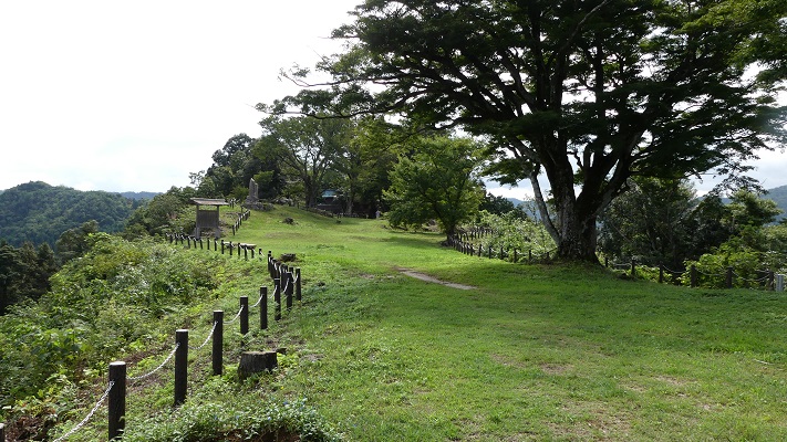
頂上の区域は、手前から奥に向かって三の丸、二の丸、本丸となっています。想像していたよりずっと広かったです。それで尼子は長い間持ちこたえられたのでしょう。
The top area includes Sannomaru, Ninomaru and Honmaru from the front to the back. The area is larger than I expected. That might make Amago keep the castle for a long time.
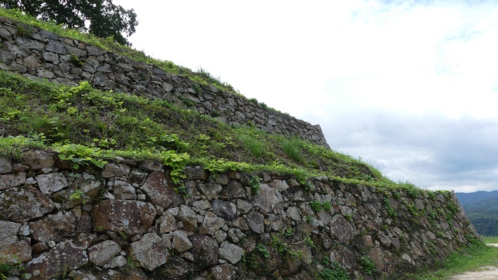
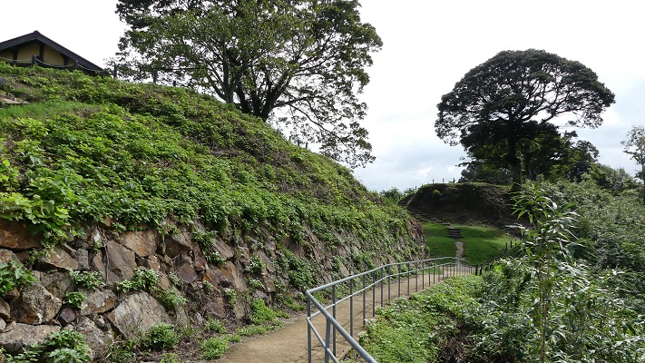
三の丸~Sannnomaru enclosure
手前が二の丸、奥が本丸~The front is Ninomaru, the back is Honmaru
本丸~Honmaru enclosure
本丸から二の丸を見ています~Looking at Ninomaru from Honmaru

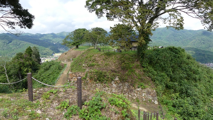
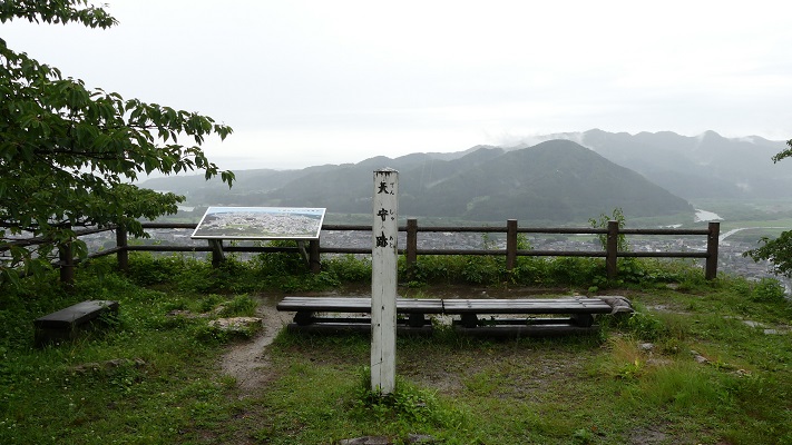
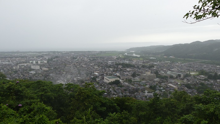
頂上からは海まで広がる地域一帯を見渡せます。尼子もまたここから自らの領地を見下ろしたことでしょう。
You can see a great view of the area below to the sea, from the top. Amago must have looked over this territory, too.
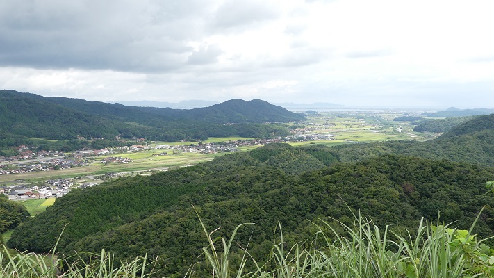
頂上からの眺め~A view from the top
城の前部と町を見下ろします~Looking over the front of the castle and the town

その後~Later Life

城跡は1934年に国の史跡に指定されました。また自治体も歴史公園として整備を行ったことで、気軽に訪れることができるうようになっています。
The castle ruins were designated as a National Historic Site in 1934. In more recent years, they were also developed as a historical park by officials. We can easily visit them.

七曲りの道も舗装されています~Even Nanamagari trail is paved

私の感想~My Impression

御籠り口と呼ばれるもう1つの城への登り口は車で通行可能です。今日では、山中御殿の近くにある駐車場まで車で行くことができます。でもお時間があれば、是非全部の行程を歩いて、城の大きさを実感していただきたいです。
Another route for the castle called Okomori Route is available for cars. Today, you can reach the parking lot near Sanchu hall by car. But, I recommend you to walk all the way on foot and feel how large the castle was, if you have time.

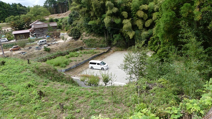
御籠り口~Okomori Route
山中御殿跡近くの駐車場~The parking lot near Sanchu Hall Ruins

ここに行くには~How to get There

ここに行くには車がお勧めです。山陰自動車道安来ICから約20分、JR安来駅から約20分かかります。安来駅には米子空港から米子駅経由の電車で1時間前後かかります。
I recommend using a car to get there. It takes about 20 minutes from the Yasugi IC on Sanin Expressway, or about 20 minutes from JR Yasugi Station. The station is around one hour from Yonago Airport by train via Yonago Station.

リンク、参考情報~Links and References

安来観光協会、月山富田城跡~Yasugi City Official Travel Guide
・「尼子氏の城郭と合戦」寺井毅著、戒光祥出版(Japanese Book)

131.村上城~Murakami Castle

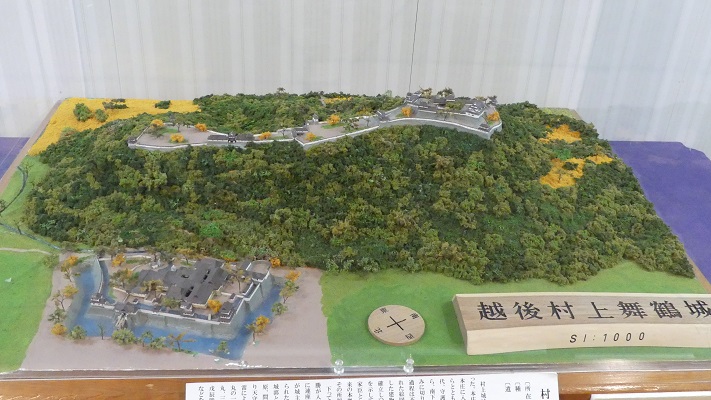
戦国時代のこの城の姿を伝える絵図が残っています。
A drawing shows the castle’s appearance in the Warring States.

本丸の出櫓跡の石垣~The stone walls of De-Yagura ruins at Honmaru

立地と歴史~Location and History

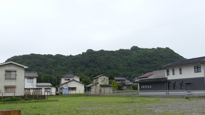
村上城は、「臥牛山」という牛が臥せている形をした山にありました。この場所は、新潟県の北部にある村上市に所属しています。この城がいつ最初に築かれたかははっきりしません。戦国時代には本荘氏がこの城を所有していて、当時は本荘城と呼ばれていました。
Murakami Castle was located on a mountain called “Gagyu-San” which means a mountain which looks like a cow laying down. The place belongs to Murakami City in the northern part of Niigata Pref. It is uncertain when castle was first built. In the Warring States Period, the Honjo clan owned the castle which was then called Honjo Castle.

臥牛山~Mt. Gagyu-San

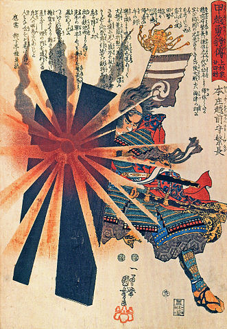
本荘繁長は、越後国(現在の新潟県)の有力戦国大名の上杉謙信に従っていました。ある時彼は独立を志し、謙信に反逆しました。謙信は無敵の武将とされており、城を取り囲みました。しかしこの城も難攻不落であり、約1年間耐え忍びました。ついには双方和睦を結びました。繁長はその後は上杉氏に献身的に仕え、十五里ヶ原の戦いでは最上氏を打ち破りました。ところが天下人の豊臣秀吉から、命令に背いたかどにより改易となってしまいます。
Shigenaga Honjo was under the great warlord in Echigo Province (what was now Niigata Pref.), Kenshin Uesugi. He once tried to be independent and rebelled against Kenshin. Kenshin who is considered invincible, surrounded the castle, but the castle which was also impregnable, stood for about a year. They finally made peace with each other. After that, Shigenaga was devoted to Uesugi. He defeated the Mogami clan in the battle of Jugorigahara. However, he was fired by the ruler Hideyoshi Toyotomi due to breaking Hideyoshi’s order.

本庄繁長の浮世絵、歌川国芳作、江戸時代~The woodblock print of Shigenaga Honjo, attributed to Kuniyoshi Utagawa, the Edo Period(licensed under Public Domain via Wikimedeia Commons)

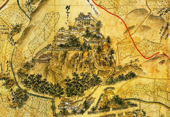
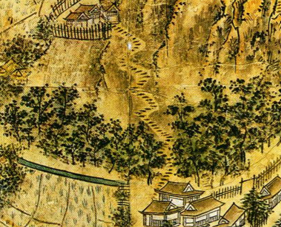
上杉氏は1598年に東北地方に移されるのですが、その移封の直前に領地の絵図面を作成し、新しい領地の方に持っていき、現在まで保管しています。そのうちの一つが越後国瀬波郡絵図です。村上城はこの絵図の中で「村上要害」(要害は砦といった意味)として描かれています。その絵図はこの城の戦国時代終わり頃の姿を伝えています。わが国の貴重な文物とされています。
Uesugi clan was transferred to the Tohoku region in 1598, but they created drawings of their territory just before the transfer, brought them to their new territory, and have kept them until now. One of them is called the drawing of Senami District in Echigo Province. Murakami Castle is in the drawing as “Murakami Yogai” (Yogai means stronghold). The drawing shows the appearance of the castle at the end of the Warring States Period. It is considered a very valuable material for the country.

「越後国瀬波郡絵図」に描かれた村上要害~Murakami Yogai from “the drawing of Senami District in Echigo Province”(村上市websiteより引用)

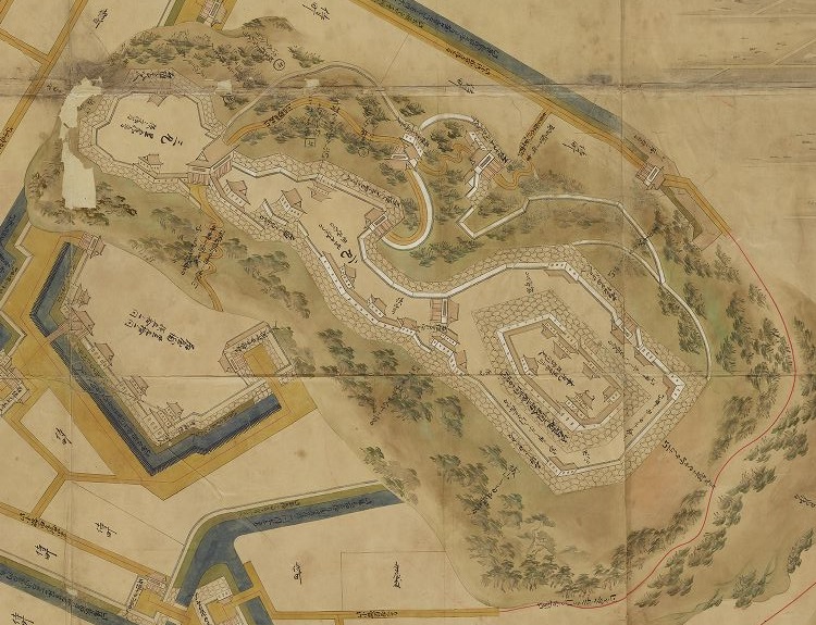
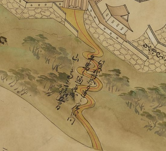
この絵図によれば、この城には天守はなく、石垣も白壁もなく、ただ柵に囲まれた土塁の曲輪の上に館があるだけです。それは、当時の東日本においては典型的な地方の城のスタイルでした。本荘氏の後は、村上、松平、そして内藤氏といった氏族がこの城を支配しました。この城は彼らの下で近代化されました。天守が山の頂に築かれ、多くの石垣も築かれ、城の範囲は山麓まで広がりました。江戸時代に描かれた「越後国村上城之絵図」を見るとそれがわかります。この城が中世と近世の間にどのように変わったのかがはっきりと見て取れます。
According to the drawing, the castle had no Tenshu, no stone walls and no plaster walls, just had halls on earthen enclosures surrounded by fences. That was a typical local castle style in eastern Japan at that time.
After Honjo clan, several clans like Murakami, Matsudaira, and Naito governed the castle. The castle was modernized under their governance. The Tenshu keep was built on the top of the mountain, a lot of stone walls were also built, and the range of the castle was spread to the foot of the mountain. “The illustration of Murakami Castle in Echigo Province” in the Edo Period shows them. We can clearly see how the castle had changed between the Middle and Modern Ages.

「越後国村上城之絵図」部分、江戸時代~Part of “The illustration of Murakami Castle in Echigo Province”,the Edo Period(出典:国立公文書館)

明治維新の間、村上藩の武士たちは新政府につくか旧幕府につくか逡巡していました。旧幕府側の支持者たちは城を退去し、東北地方の同志に合流すると決め、自ら城に放火してしまいました。
During the Meiji Restoration, warriors of the Murakami Domain were wondering if they should support the New Government or the former Shogunate. When the supporters of former Shogunate decided to withdraw the castle and join supporters in Tohoku region, they burn the castle by themselves.

村上市郷土資料館にある城の模型~The miniature model of the castle at Murakami History Museum

特徴~Features

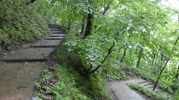
それでは入口から城跡に向けて登ってみましょう。山道は「七曲り道」と呼ばれていて、曲がりくねった山道といった意味です。
Let’s climb up to the castle ruins from the entrance. The trail is called “Nanamagari-Michi” which means a winding trail.

山道の入り口~The entrance of the trail

道の傾斜が緩やかになっているので、登りやすくなっています。実は、この道の由来は戦国時代にさかのぼると言われています。
That makes it easier for visitors to climb because the trail becomes more gentle. In fact, this trail can be traced back to the Warring States Period.

七曲り道~The trail called Nanamagari-Michi

それは、先ほどの「越後国瀬波郡絵図」と「越後国村上城之絵図」両方に、恐らくは同じ場所であろう所に、似たような山道が描かれているからです。何か素晴らしく感じます。そうなってくると、敵が簡単に城を攻撃できてしまうのではないかとも感じます。歴史家によると、敵がこのような曲がりくねった道を登るときは、側面を防御側に見せてしまうため、かえって防御側に有利になるということです。
Becase you can see the similar trail at probably the same place in both of “the drawing of Senami Distinct” and “the illustration of Murakami Castle”. It’s amazing. You may ask that enemies might attack the castle easily. Some historian suggest that attackers will have their sides facing the defenders when climbing such a winding trail. It can be advantageous for the defenders.

「越後国瀬波郡絵図」の山道部分~The trail part of “the drawing of Senami District in Echigo Province”
越後国村上城之絵図」の山道部分~The trail part of the drawing of Senami Distinct”

約15分ほどで山の上にある三の丸四つ門跡に到着します。
It will take about 15 minutes to reach the ruins of “Yottsu” gate at “Sannomaru” enclosure on the mountain.

四つ門跡~The ruins of “Yottsu” gate

本丸の方に行くには、狭い二の丸を通らねばなりません。
You can head towards “Honmaru” enclosure passing through narrow “Ninomaru”.

二の丸の通り道~The route on Ninomaru

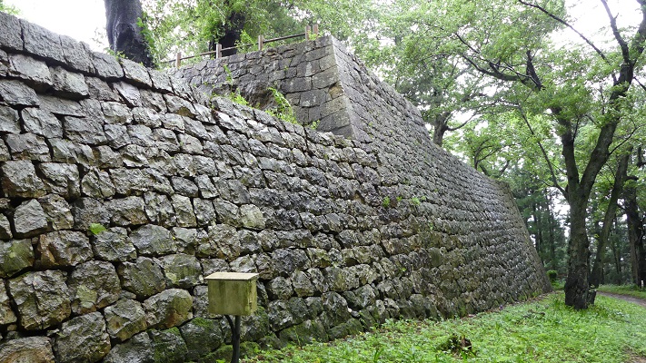
今に残る多くの石垣が見られます。全ての石垣は江戸時代に作られたものです。
A lot of remaining stone walls are there. They were all built in the Edo Period.

本丸の石垣~The stone walls at Honmaru

山の一部は現在発掘中です。戦国時代の遺跡が見つかるのではないかと言われています。
Part of the mountain is now under excavation. It is said that the ruins in the Warring States Period might be found.

本丸の発掘されている部分~The part of Honmaru being under excavation

そうするうちに、山の頂にある天守台に到着します。そこからは村上市全域が一望できます。
You will soon reach the Tenshu base at the top of the mountain, and can see the whole view of Murakami City.

本丸の入り口~The entrance of Honmaru
天守跡~The ruins of Tenshu
山上からの村上市の眺望~A view of Murakami City from the top

その後~Later Life

明治維新後、領主だった内藤氏は城の残りの建物と一部の石垣の売却を申し出て許されました。その後、藩士の子孫たちは城跡を維持してきました。1960年には県の史跡に指定され、1993年には国の史跡にもなりました。
After the Meiji restoration, the lord Naito applied for and was allowed to sell the rest of the buildings and part of the stone walls in the castle. After that, the descendants of the warriors has kept the ruins. They are designated as a Prefectural Historic Site in 1960. They also became a National Historic Site in 1993.

本丸の石垣~The stone walls at Honmaru

私の感想~My Impression

地元の人たちが「七曲り道」の山道を日頃の運動のために登ったり下ったりしているのを見ました。どうやら毎日頂上まで登って戻ってくるという感じでした。会ったときはお互いにあいさつをしていました。かつては戦いのために作られた古の道は、現在人々の健康やコミュニケーションのために使われているのです。素晴らしいことです。
I saw that local people were climbing up or down the trail “Nanamagari-Michi” for daily exercise. They seemed to reach the top and turn back everyday. They were also saying hello each other. the traditional trail, which was built for battle, is now used for people’s health and comminication. It’s amazing.

今は市民のための七曲り道~Nanamagari-Michi now for citizens

ここに行くには~How to get There

JR村上駅から歩いて30分近くかかります。
東京から村上駅まで:
上越新幹線に乗り、新潟駅でJR白新線に乗り換えてください。
車で行く場合:日本海東北自動車道村上瀬波温泉ICから10分以内、または村上駅から約5分。
城跡には駐車場はありますが、小さいのでよく満車になります。そのときは近くの村上市役所か村上郷土資料館に駐車してください。
It takes nearly 30 minutes From JR Murakami station to get there on foot.
From Tokyo to Murakami st.:
Take the Joetsu Shinkansen superexpress to Nigata station, and transfer for JR Hakushin line.
If you want to go there by car: It takes within 10 minutes from the Murakami-Senamionsen IC on Nihonkai-Tohoku Expressway, or about 5 minutes from Murakami station.
The ruins have a parking lot. But it’s small and can often be full. In that case, you can park at the Murakami City Hall or Murakami History Museum nearby.

リンク、参考情報~Links and References

鮭、酒、人情(なさけ)むらかみ~Murakami city tourism association
ビジュアル再現 村上城(Only Japanese)
・「甲信越の名城を歩く 新潟編」吉川弘文館(Japanese Book)

10.山形城~Yamagata Castle

日本で5本の指に入るほど大きな城でした。
It was one of the five largest castles in Japan.

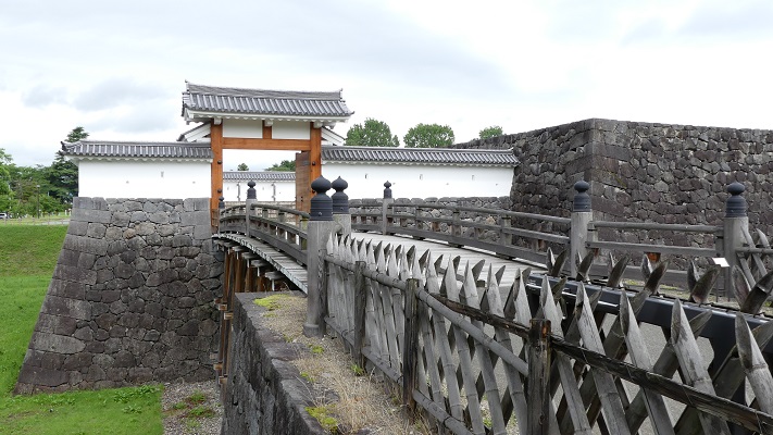
復元された二の丸東大手門~The restored East Main Entrance Gate at Ninomaru

立地と歴史~Location and History

山形城は山形県南部の山形盆地にありました。現在、この地域は県都である山形市として発展してきています。南北朝時代に、斯波氏が羽州(現在の山形県と秋田県に相当)探題として送られてきて、最初にこの城を築きました。初期の頃この城は、足利氏館のように一重の堀に囲まれた四角い土地の上に館があったと思われます。そして、戦国時代のころには、三重の堀に囲まれるまでに拡張されました。
Yamagata Castle was located in the Yamagata Basin in the eastern part of Yamagata Pref. Now, this area has been expanding up to Yamagata City as the prefectural capital. In the Period of Southern and Northern Courts, the Shiba clan was sent to this area as the local commissioner in Ushu (combining now Yamagata and Akita pref.), and first built the castle. The early castle seemed to be a hall on a square land surrounded by a single moat like the Ashikaga clan hall. Then, the castle was improved to be surrounded by triple moats in the Warring States Period.

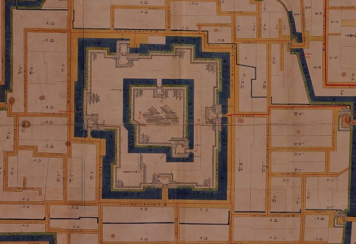
出羽国最上山形城絵図部分、江戸時代~Part of the illustration of Mogami Yamagata Castle in Dewa Province, the Edo Period(出典:国立公文書館)

斯波氏の子孫である最上義光が、この城を日本で5指に入る大きな城として完成させました。彼は、南では伊達氏と、北では天童氏と、西では大宝寺氏と戦いました。義光は山形城を本拠地とし、そして戦いに備えるため約50もの支城を築きました。このうち最も有名なものは長谷堂城で、ここで1600年に最上氏と上杉氏が戦いました。
Shiba’s descendent, Yoshiaki Mogami, completed the castle making it one of the five largest castles in Japan. He fought with Date in the south, Tendo in the nouth, and Daihoji in the west. He set Yamagata Castle as his home, and built about 50 branch castles to prepare for battle. The most famous one was Hasedo Castle where Mogami and Uesugi battled in 1600.

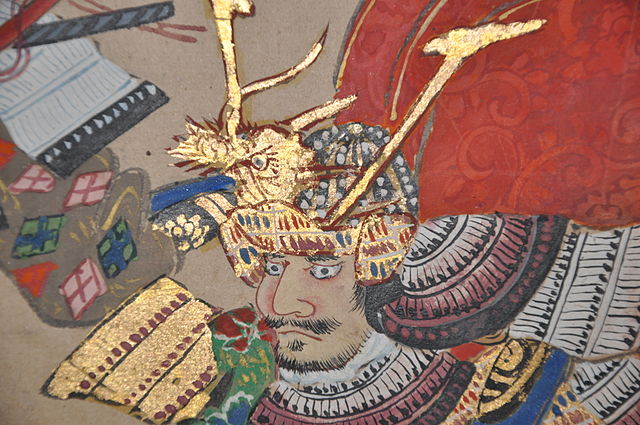
長谷堂合戦図屏風に描かれた最上義光~Yoshiaki Mogami from Battle of Hasedo Standing Screen(licensed under Public Domain via Wikimedia Commons)

結果として、義光は徳川幕府から57万石を与えられました。彼はその時点では日本で3番目の大大名となったのです。不幸なことに、後に最上氏はお家騒動により、幕府から改易されてしまいました。その後、いくつかの大名が城を維持するよう努めました。しかし、この城は大名たちにとって大きすぎました。最上氏以降の大名は皆石高がずっと少なかったからです。江戸時代の後半には城の一部分は既に荒廃していたと言われています。
As a result, Yoshiaki was given a fief of 570 thousand koku of rice by Tokugawa Shogunate. He became the third largest lord in Japan at that point. Unfortunately, Mogami clan was fired by the Shogunate later due to their internal troubles. After that, several lords tried to keep the castle. But the castle was too large for the lords because their earnings were much less than Mogami’s. It is said that part of the castle already fell into ruin in the late Edo Period.

二ノ丸南大手門跡~The ruins of South Main Entrance Gate at Ninomaru

特徴~Features

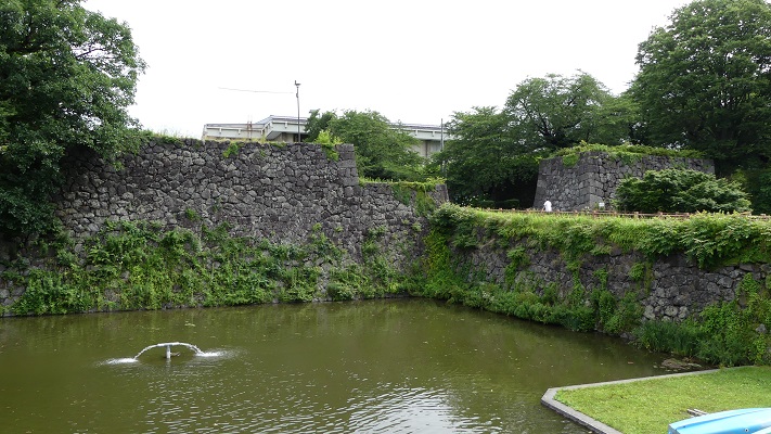
現在、二重目の堀の内側は、霞城公園として使われています。堀の外側はかつての三の丸に該当しますが、山形市の市街地になっています。堀の内側は中心に向かって二の丸、本丸という構成です。四角い形をしていて、その一辺は500mほどです。
Now, the inside of the second rounding moat is used as a park called Ka-jo Park. The outside of the moat, once called Sannnomaru, has become the Yamagata city area. The inside consists of Ninomaru and Honmaru towards the center. It is square shaped and one side is about 500 meters long.

霞城公園の航空写真~The aerial photo of Ka-jo Park

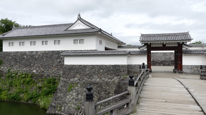
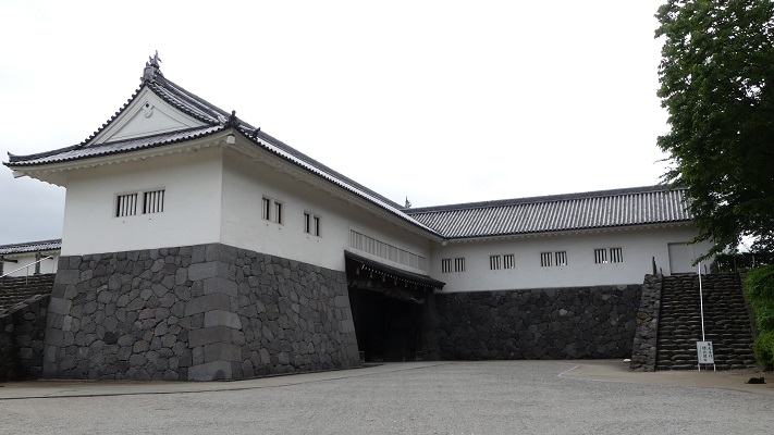
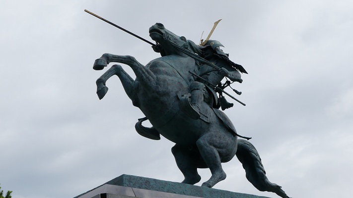
霞城公園は、何年にもわたって史跡公園として整備されてきました。その整備の一環で二の丸の東大手門が1991年に復元されました。この門は相当に大きくて、将軍が住んでいた江戸城の門にも匹敵するといいます。門の内側では、馬に乗った最上義光の銅像も見ることができます。
Ka-jo Park developed as a historical park over many years. With the development, the East Main Entrance Gate at Ninomaru called “Higashi-Otemon” was first restored in 1991. The gate is so large that its size might be as much as those of Edo Castle where the Shogun lived. You can see the statue of Yoshiaki Mogami riding a horse inside the gate.

東大手門の外側~The outside of East Main Entrance Gate
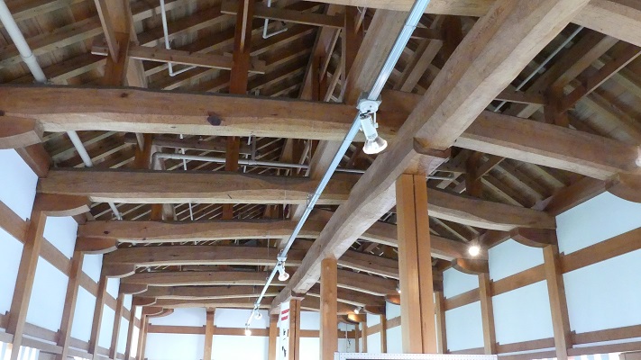
建物の内部~The inside of the building
東大手門を公園側から見た姿~The view of East Main Entrance Gate from the park side
最上義光の銅像~The statue of Yoshiaki Mogami

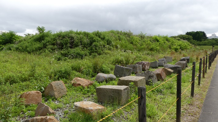
本丸は、現在発掘と整備の最中です。山形市は、本丸を復元するために古文書、
古写真、古図面の類を提供してもらうよう市民に呼び掛けています。しかし確かな証拠となるようなものは集まっていないようです。今のところ、本丸の正門である一文字門が、発掘の成果により部分的に復元されています。
You can also see Honmaru being excavated and developed now. Yamagata City has been asking people to send in old documents, pictures, and drawings to restore Honmaru. But it seems to be difficult to get certain evidence for doing it. So far, the main entrance of Honmaru, called Ichimonji-Gate, was partly restored recently with the excavation.

発掘中の本丸~Honmaru being excavated now
部分的に復元された一文字門~The partly restored Ichimonji-Gate

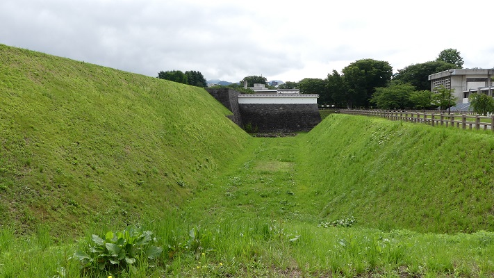
周辺の内堀もまた掘り返されています。本丸には天守はありませんでしたが、御殿が存在していました。市は御殿に関する何らかの展示を検討しています。また、2033年までに発掘を完了させ、本丸北虎口の復元を計画中です。
The inner moat around was also dug up again. Honmaru didn’t have the Tenshu keep, but had the Main Hall. The City is thinking about making an exhibition about it. It also plans to complete the excavation and restore the northern entrance of Honmaru by 2033.

本丸の空堀~The dry moat of Monmaru

その後〜Later Life

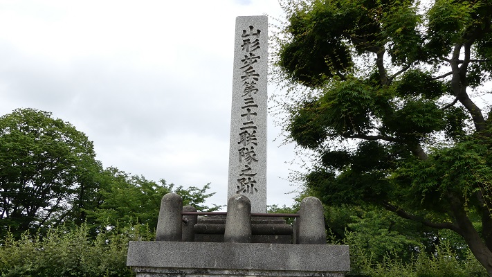
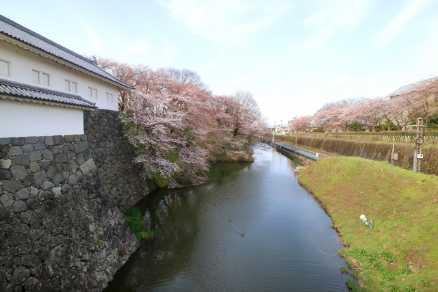
明治維新後、山形城は廃城となりました。本丸と二の丸の区域は、山形市に売られていきました。山形市は、その土地を日本陸軍の第32歩兵連隊に基地用地として提供しました。軍隊は内部を平らにするために内堀を埋め、本末の土塁を取り崩しました。一方で桜の木を植えて、それが新たな名所になったりしました。
After the Meiji Restoration, Yamagata Castle was abandoned. The area of Honmaru and Ninomaru was sold to Yamagata City. The city offered the area to the 32nd infantry regiment of the Japanese Amy for their base ground. They filled the inner moat and removed the Honmaru walls to make the inside plain, while they planted cherry blossoms which have become an attraction for people.

歩兵第32連隊の記念碑~The monument of the 32rd infantry regiment
霞城公園の桜(The cherry blossoms at Ka-jo Park)

第二次世界大戦後、この土地は霞城公園に転用されましたが、最初は運動公園としてでした。山形市は、公園についての整備方針を先程述べたように変更しています。野球場や体育館といった運動施設は、他の場所に移されているところです。三の丸区域は早い時期に町や畑になっていて、現在は山形市の市街地になりました。
After World War II, the area was turned into Ka-jo Park as a sports park first. Recently, Yamagata City has changed its policy about the park as mentioned above. Sport facilities like the baseball stadium and the gymnasium are being transferred to other places. The Sannomaru area turned early into towns and fields, now becoming the Yamagata city area.

1970年代の霞城公園の航空写真~The aerial photo of the area around Ka-jo Park in the 1970s

私の感想~My Impression

霞城公園は今なおとても大きなサイズです。山形市が観光を振興したい気持ちはよくわかります。でも歴史的建造物というのは、過去の大名たちがそうだったように維持にはとてもお金がかかります。一方で、運動、釣り、気晴らしなど他の目的をもった人たちもたくさん来ます。公園を整備するのにうまくバランスを取ってほしいと思います。
Ka-jo Park is still very large. I can understand what Yamagata City wants to do for tourism. But, historical facilities require a lot of funds for maintenance like lords used to do in the past. On the other hand, many people who have other purposes like exercise, fishing, and relaxing come every day. I hope that the city will take well-balanced control to develop the park.

東大手門からもう一枚~Another shot of East Main Entrance Gate

ここに行くには~How to get There

JR山形駅東口から二の丸東大手門まで歩いて約15分かかります。または、JR山形駅西口から二の丸南大手門跡まで歩いて約10分かかります。
東京から山形駅まで:山形新幹線に乗ってください。
車で行く場合:山形自動車道山形蔵王ICから15~20分かかります。霞城公園北門内側に駐車場があります。
It takes about 15 minutes From the east entrance of JR Yamagata station to the East Main Entrance Gate at Ninomaru on foot.
Or it takes about 10 minutes From the west entrance of JR Yamagata station to the ruins of South Main Entrance Gate at Ninomaru on foot.
From Tokyo to Yamagata st.: Take the Yamagata Shinkansen super express.
If you want to go there by car: It takes 15 to 20 minutes from the Yamagata-Zao IC on Yamagata Expressway. Ka-jo park offers a parking lot inside the north gate.

リンク、参考情報~Links and References

山形市:国指定史跡山形城跡「霞城公園」~Yamagata City:Nationally designated historic site Yamagata Castle “Kajo park”
・「東北の名城を歩く 南東北編: 宮城・福島・山形」吉川弘文館(Japanese Book)
・「最上義光の城郭と合戦」保角里志著、戒光祥出版(Japanese Book)