124.Shinagawa Batteries Part3

The ruins of Shinagawa Batteries are very useful for telling people about what happened in the past. Visual historical items are significantly better than only records or explanation boards.

Features

Looking around N0.3 Battery Ruins

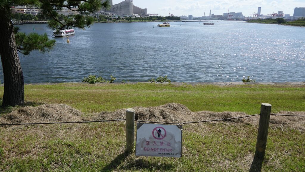
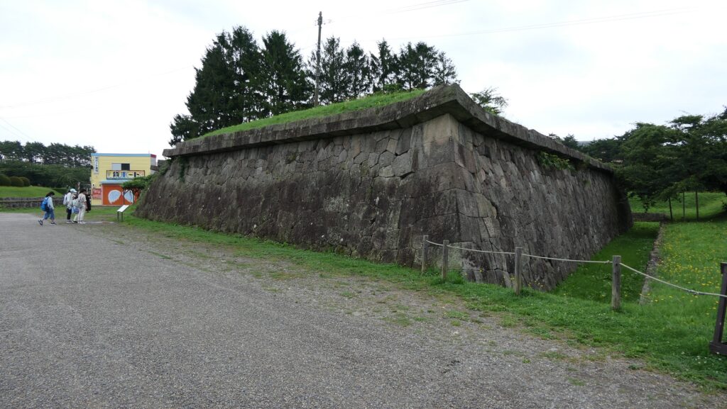
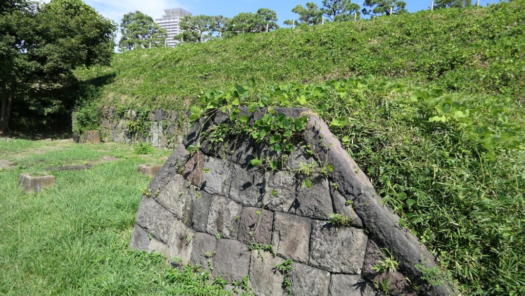
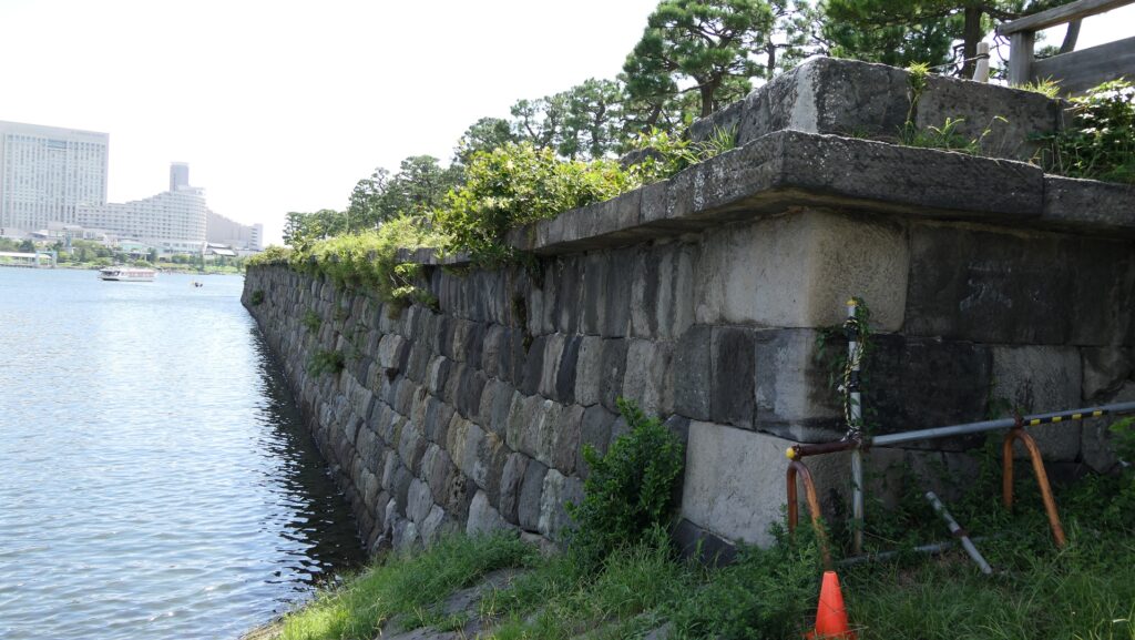
The ruins of the No.3 Battery as the Daiba Park is connected to the seaside by a marine walkway. The walkway was added when the park was established, that means the battery had originally been isolated. As you get close to the battery, you will see its characteristic stone walls using the Hanedashi system. The system refers to all the stones on the top row are layered to prevent enemies from invading, which emulated European castles. This system is rarely seen in other Japanese castles only in Goryokaku, Tatsuoka Castle and Hitoyoshi Castle which were built or renovated at the end of the Edo Period. In fact, this is the only spot where you can see them close by because it is prohibited for visitors to approach the stone walls from the other sides.

The aerial photo of the No.3 Battery
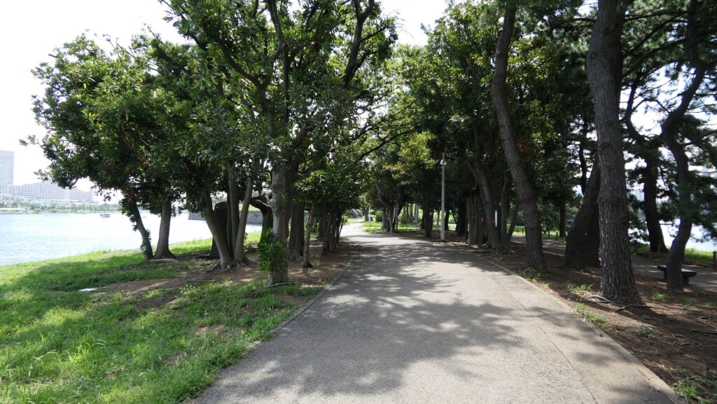
The marine walkway to the park
The Hanedashi system of the No.3 Battery
You can’t approach other stone walls of the battery in other places
The Hanedashi system of Goryokaku

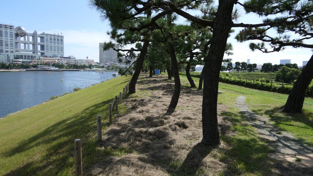
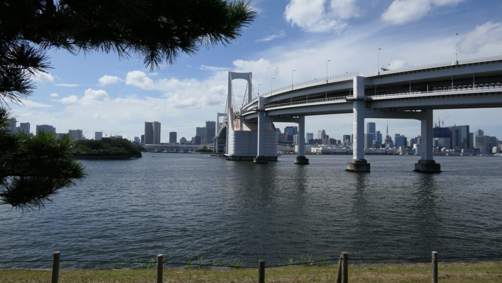
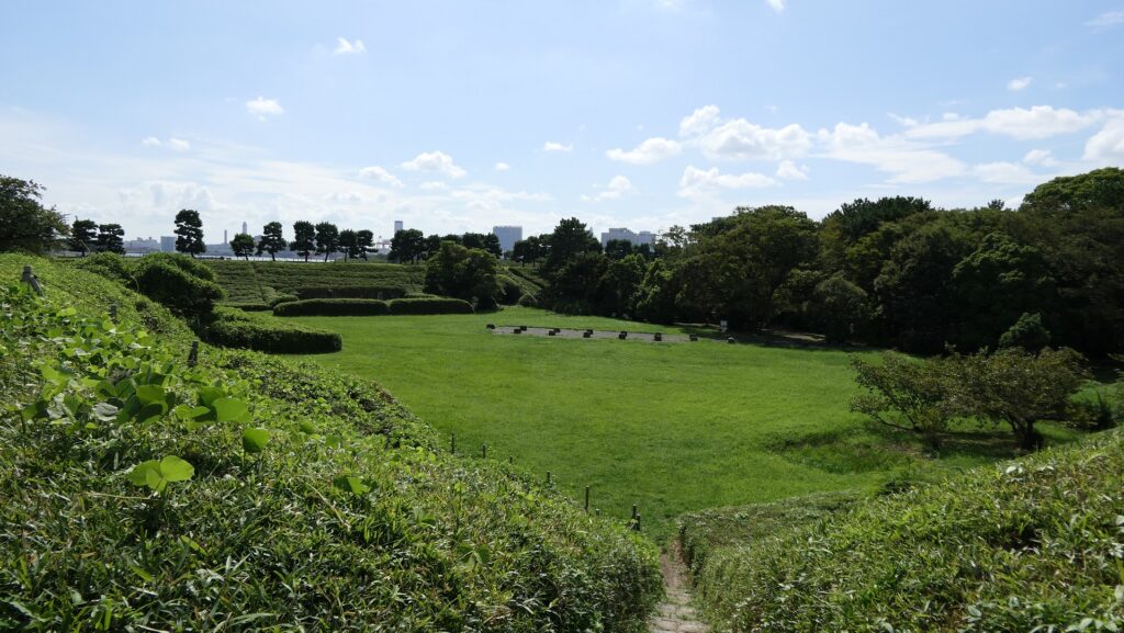
You can land at the battery by using steps like boarding a ship. You can next see a close view of the battery. It is a large square with one side being 160m long and its perimeter is higher than the center. There are few remaining original items, so some visitors might not notice that it is a ruin without the knowledge of its history. If you walk on the perimeter which is made with earthen walls from the entrance, the view is so nice. You can see Odaiba Seaside Park on the left, the Rainbow Bridge and the No.6 Battery on the right, and Tokyo Bay ahead.
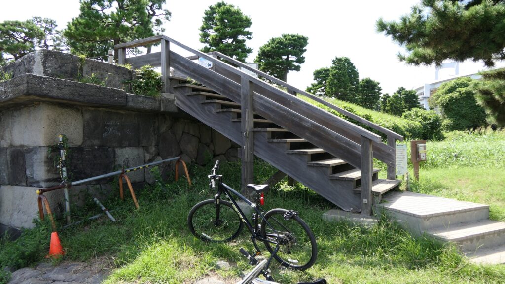
You can land the battery by using these steps
The close view of the battery
Walking on the earthen walls of the perimeter
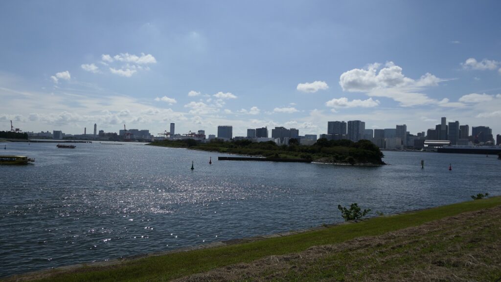
The view of Tokyo Bay ahead
The No.6 Battery on the left and the Rainbow Bridge on the right

Ruins regarding Guns

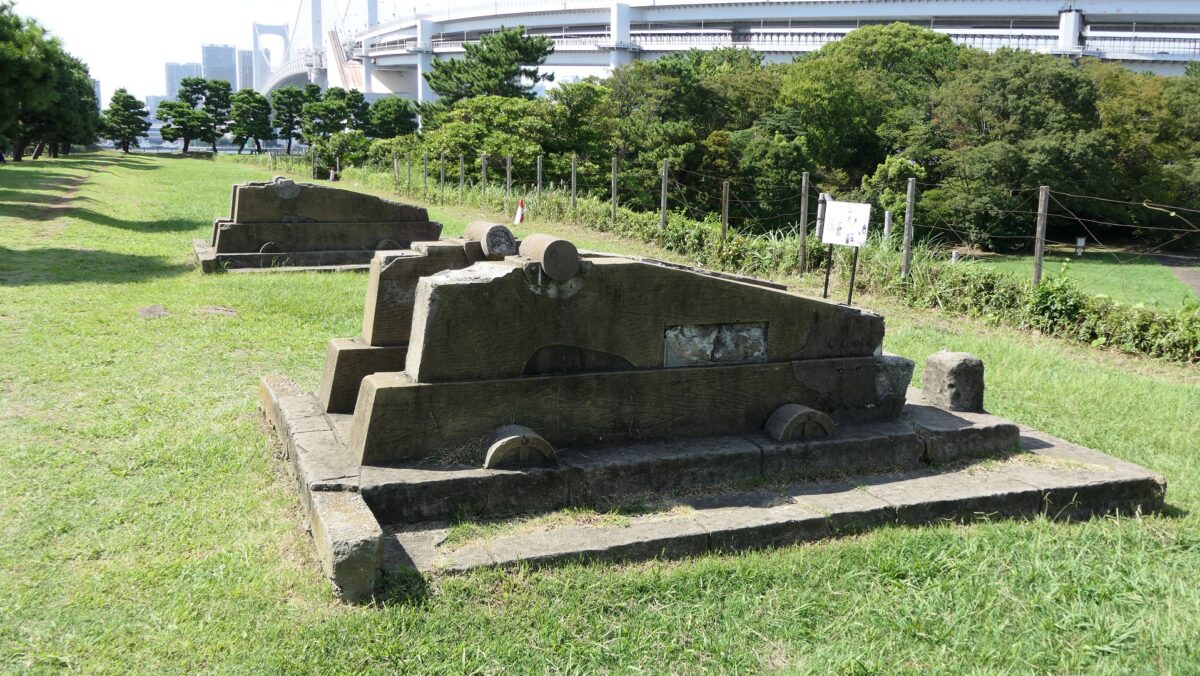
There are two imitations of gun platforms on one side of the perimeter opposite the entrance. However, they are not actually real and should not be considered even as replicas, according to historians. In addition, there were thick and long earthen protective walls called “breastworks” in front of cannons, but they seem to have collapsed. There were also earthen side walls dividing the canons to protect gunners from blasts, but were removed after the battery being abolished. This side was definitely the front line against enemies.
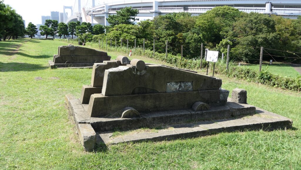
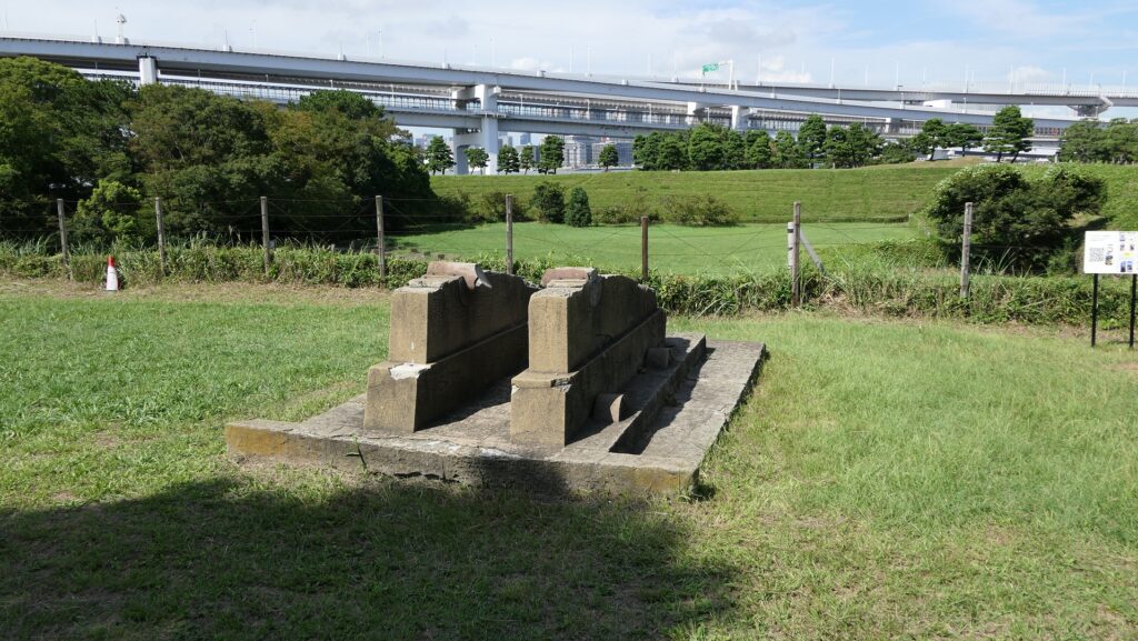
The two imitations of gun platforms
The protective walls around the guns have been lost

The ruins of the gun powder magazines are facing downward inside the front side walls, which are surrounded by earthen banks. There was the building for the magazine inside the banks, but it was demolished. There is now a stone-made item like a cocking stove instead, but it is not original for the battery. In addition, the banks are partially supported by stone walls which were built to recover them from the damage of the Great Kanto Earthquake of 1923.
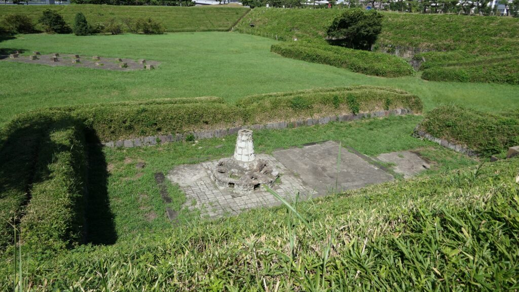
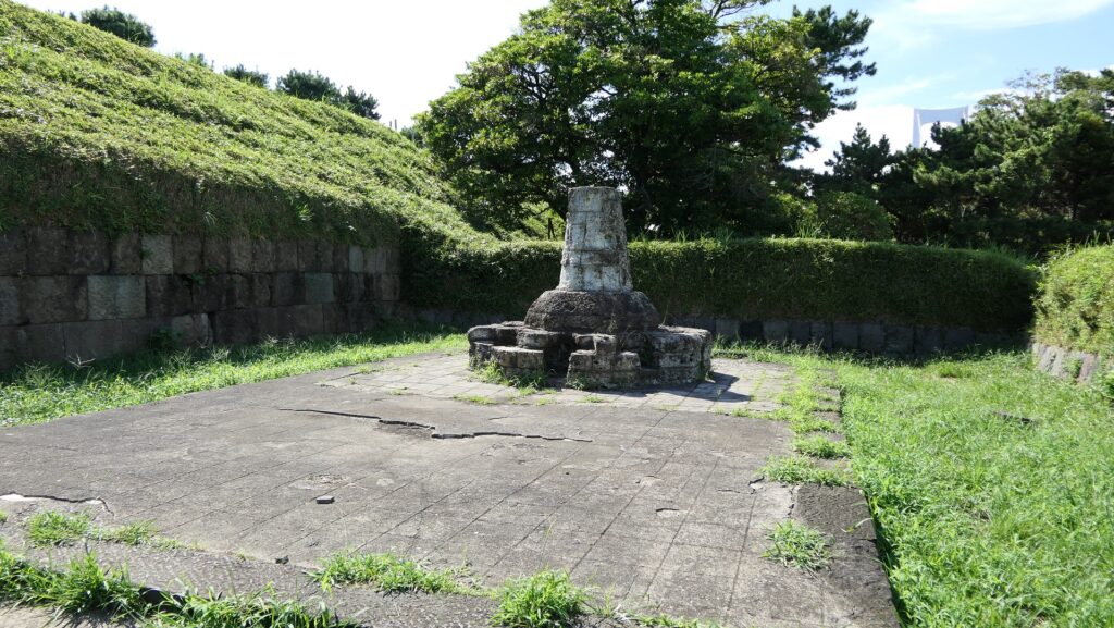
The ruins of the gun powder magazines
The inside of the ruins
These stone walls were built after the earthquake

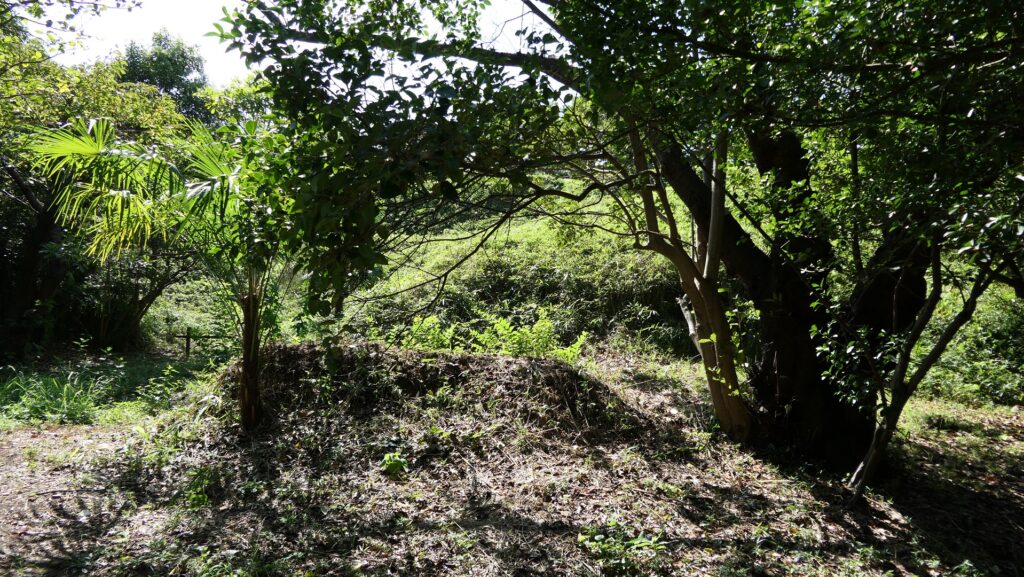
The ruins of the ammunition chambers are at other sides. The chambers were solidly built with a stone hut and wooden racks deep in the earthen walls. This was because ammunition was the most dangerous item in the battery, which might have caused accidents or explosions. We can now see the stone hut ruins behind earthen mounds around which were added later than when the battery was active, maybe for preservation.
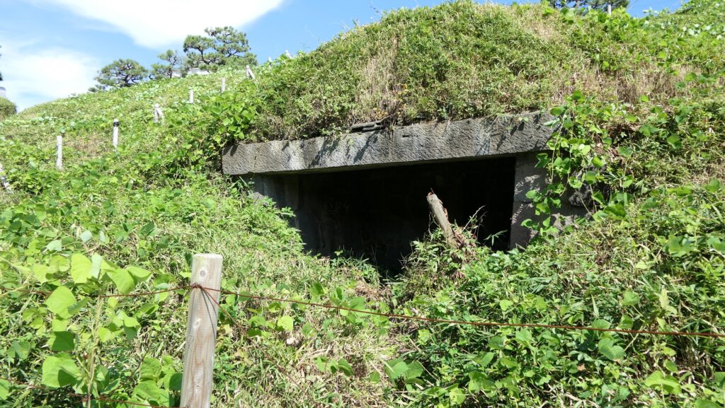
One of the ruins of the ammunition chambers

Ruins of Pier and Barrack

In the flat central part of the battery, there are only the stone foundations of the barrack. The barrack was a simple wooden building with no baths for the warriors to rest in. They would escape from the barrack if a battle happened before it would be burned.
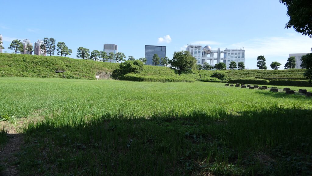
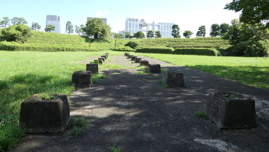
The central part of the battery
The ruins of the battery

The ruins of the pier are at the next corner to the current entrance. Visitors can not enter it, but only see it from the inside. The concreted part was worked in the later period, which might have been used when the park was developed.
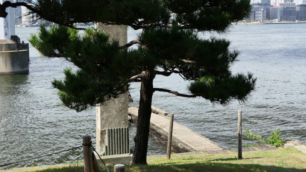
The ruins of the pier
You can’t enter the pier

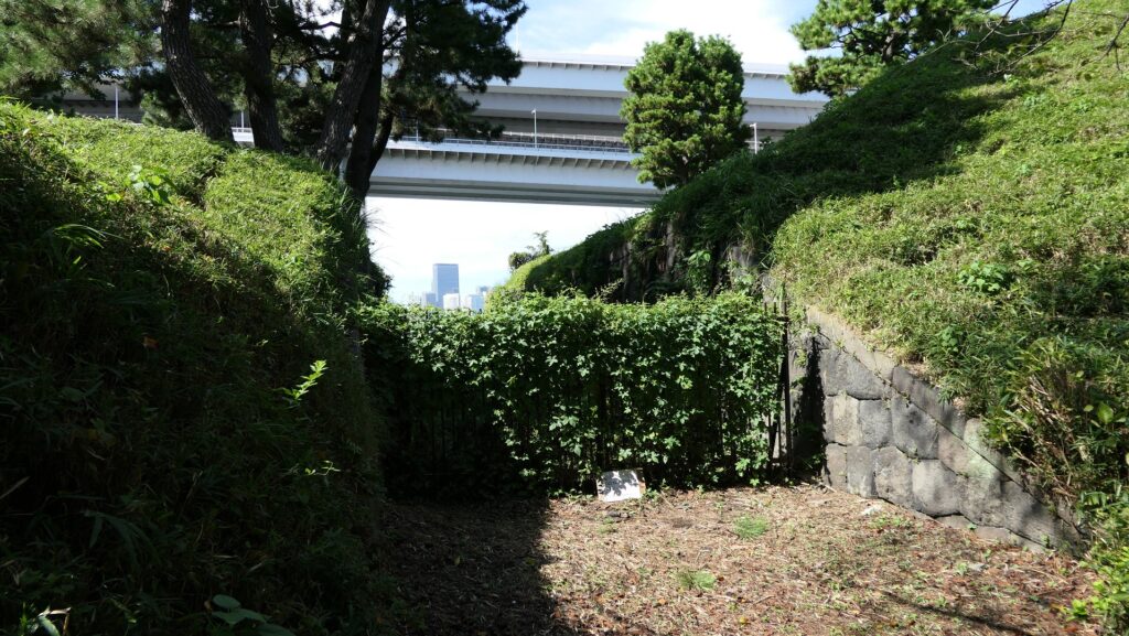
There are also remaining earthen walls in front of the pier, which is called “Ichimonji-tsutsumi” (meaning the bank like the Chinese letter for one which is a horizontal line). This structure was made to ensure visitors could not see inside and the defenders could protect the battery from enemies’ attacks from the tier as the original entrance.
The remaining earthen walls called Ichimonji-tsutsumi

My Impression

I think the ruins of Shinagawa Batteries are very useful for telling people about what happened in the past. Visual historical items are significantly better than only records or explanation boards. The waterfront area of Tokyo has been very important for the economy of the whole country. All the batteries ruins could have been removed. The decision of Tokyo Metropolitan which owns the ruins was so great. Now, just one thing, I would like the government to replace the imitation of gun platforms at the site with realistic replicas to make visitors better understand what the battery would have looked like.
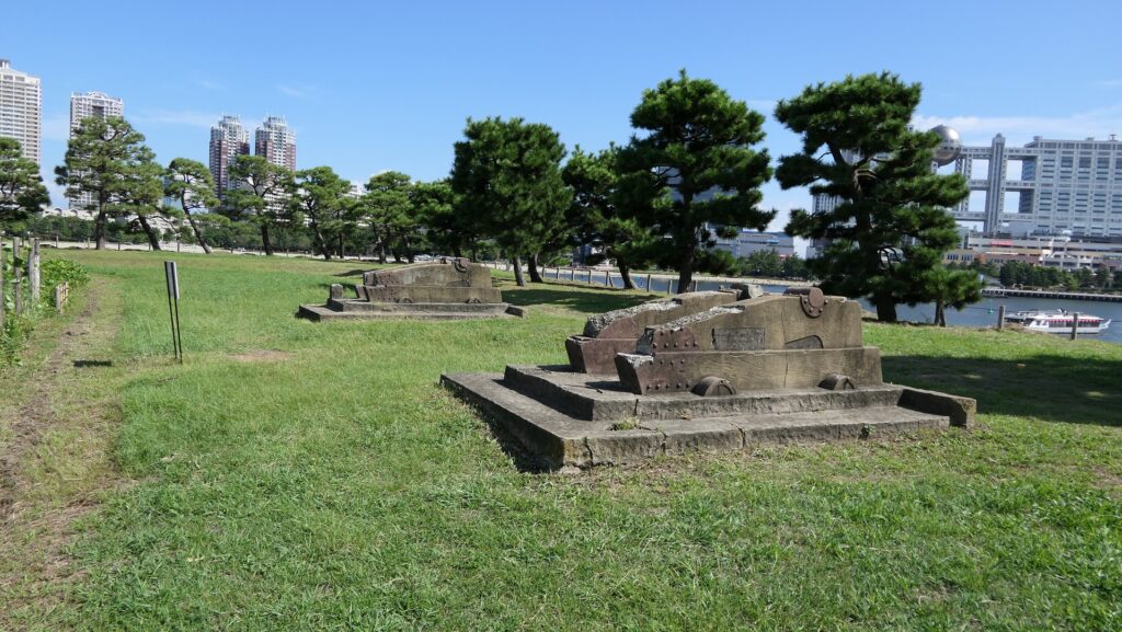
The two imitations of gun platforms on the No.3 Battery

That’s all. Thank you.
Back to “Shinagawa Batteries Part1”
Back to “Shinagawa Batteries Part2”

21.江戸城その1~Edo Castle Part1

江戸城は間違いなく日本で最大の城です。なぜなら城が東京そのものになったからです。時々、外国からの旅行者の方は、どこに有名な城や城跡があるのかと尋ねられます。もし、そこが東京の中心地であるなら、もうそこは城の中かもしれません。
Edo Castke was definitely the largest castle in Japan, because it became Tokyo itself. Some foreign tourists ask that where famous Japanese castles and ruins are. They may be standing among castles if they are in the center of Tokyo.

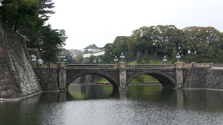
皇居正門石橋と伏見櫓~The Imperial Palace Main Entrance Bridge and Fushimi Turret

立地と歴史~Location and History

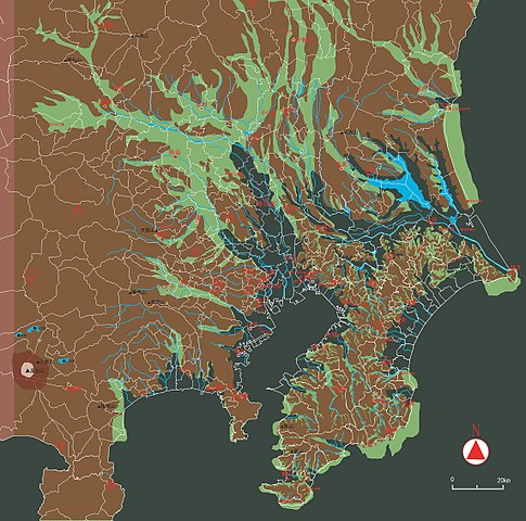
東京を含む関東平野には、中世までは大きな湿地帯がありました。この理由から、はるか昔の東海道は西日本から伸びてきて、 海を越えて房総半島に至っていました。利根、渡良瀬、隅田といった大河が直接江戸湾に注いでいたのです
The Kanto Plain including Tokyo had large waterlogged area until the Middle Ages. For this reason, the Tokaido road went from eastern Japan to Boso peninsula over the sea hundreds years ago. Large rivers like Tone, Watarase, and Sumida directly flow into what is now Tokyo Bay.

古代の関東平野の海岸線~The coastline of Kanto Plain in ancient times(licensed by Llhoi2013 via Wikimedia Commons

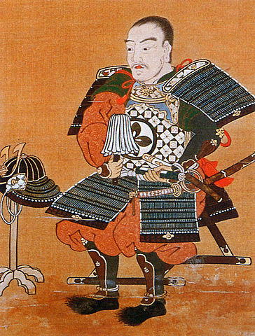
江戸城は1457年に太田道灌によって最初に築かれました。彼には敵との境界線であった利根川の近くに城を築く必要があったのです。その後この城は、戦国時代の間関東地方の支配者であった北条氏の支城の1つであり続けました。しかし、地理的な制約から武士たちの都とするには不十分でした。
Edo Castle was first built by Dokan Ota in 1457. He needed to build the castle near the border with his enemy, Tone River. After that, the castle had been one of the branch castles of the Hojo clan who were the ruler of Kanto region during the Warring States Period. But the castle still didn’t deserve warrior’s capital because of its geographical features.

太田道灌肖像画、大慈寺蔵~The portrait of Dokan Ota, owned by Daijiji Temple(licensed under Public Domain via Wikimedia Commons)

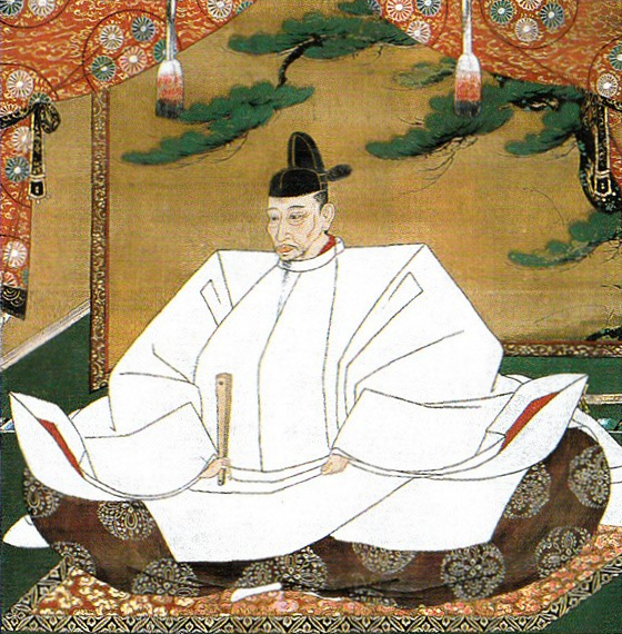
豊臣秀吉は1590年に北条氏を滅ぼし、徳川家康に対し、北条氏に代わり関東地方に転封するよう命じました。秀吉はまた、家康の首府として江戸を指定したと言われています。秀吉は、彼による攻撃を3ヶ月間も耐えた北条氏の首府、小田原に家康が居座るのを恐れたからといいます。
Hideyoshi Toyotomi defeated Hojo clan in 1590, and ordered Ieyasu Tokugawa to move to Kanto region instead of Hojo. It is said that he also designated Edo as Ieyasu’s capital because he feared Ieyasu would settle at Hojo’s capital Odawara which could withstand Toyotomi’s attack for three months.

豊臣秀吉肖像画部分、加納光信筆、高台寺蔵~part of the Portrait of Hideyoshi Toyotomi, attributed to Mitsunobu Kano, owned by Kodaiji Temple(licensed under Public Domain via Wikimedia Commons)

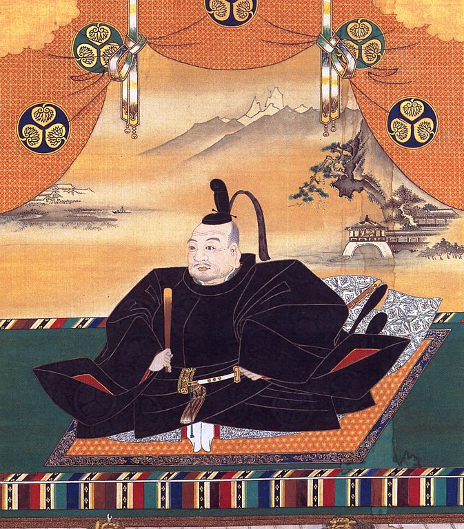
家康は江戸に到着した直後から、江戸城への驚くべき大改造を開始しました。これは、日本人による湾岸地域での都市作りの初めての試みと言われています。
Immediately after Ieyasu arrived at Edo, he started an incredible renovation of Edo Castle. It is said that it was the first attempt for Japanese people to build a city on a waterfront area.

徳川家康肖像画、加納探幽筆、大阪城天守閣蔵~The Portrait of Ieyasu Tokugawa, attributed to Tanyu Kano, owned by Osaka Castle Museum(licensed under Public Domain via Wikimedia Commons)

初期の江戸城は、現在の山の手地域にありました。現在の下町地域は、海面下か湿地帯でした。そして、江戸前島と呼ばれた砂州がありました。また、陸地と砂州の間には日比谷入江が入り込んでいました。
The first Edo Castle was in the present uptown area. The present down town area was below the Sea or waterlogged. There was a sand bank called Edo-Maeto. There was also the Hibiya arm of the sea between the land and the bank.

赤い線は現在の地図に残された江戸前島と日比谷入江の痕跡~The red line shows the remaining trace of Edo-Maetou and Hibiya Arm of the Sea on the present map

徳川家臣団は、水上交通のために江戸前島を横切る運河を掘り、川の流路を付け替えたりしました。彼らはまた、このような湾岸都市であったため、上下水道の設備も整えなければなりませんでした。その結果、江戸は水の都となったのです。
Tokugawa team created a canal across Edo-Maeto and change the route of rivers for water transportation. They also had to build a system for water supply and sewerage on such a waterfront city. As a result, Edo became a city of waterways.

戦前の東京の航空写真、まだ水路がたくさん残っていました~A aerial photo of Tokyo before the World War II, a lot of wateways still remained.

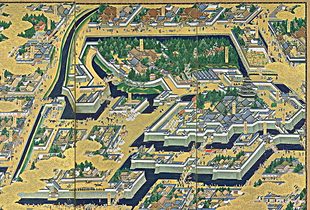
家康が1600年に天下を取った後、彼は全国の諸大名に天下普請と呼ばれる城の拡張工事を命じました。日比谷入江は城の用地拡大と防衛上の必要のため、埋め立てられました。この大規模な工事により、天守を含む多くの建物が作られ、多くの堀が掘られ、石垣が高く積まれました。
After Ieyasu got the power in 1600, he ordered lords of the whole country to improve the castle called Tenka-Bushin. They reclaimed Hibiya arm of the sea to spread the ground for the castle as well as the need for defense. Many buildings including Tenshu keep were built, many moats were dug, and high stone walls were built by the large scale construction.

「江戸図屏風」左隻部分、17世紀、国立歴史民俗博物館蔵~Part of “View of Edo” left screen. pair of six-panel folding screens, in the 17th century, owned by National Museum of Japanese History(licensed under Public Domain via Wikimedia Commons)

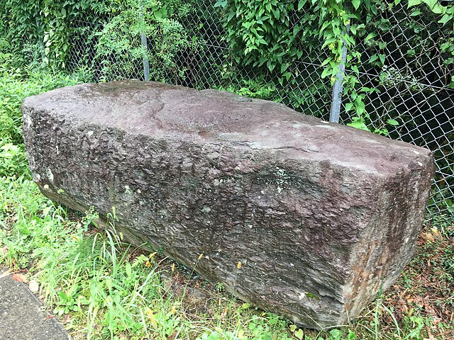
大名たちは少なくとも6万個もの百人石と呼ばれた4トン石を、伊豆半島から海を越えて江戸まで運ばねばなりませんでした。1603年から1660年まで続いた天下普請は江戸を日本一の大城郭に仕立てたのです。
These lords had to carry at least 60,000 four ton stones called Hyakunin-Ishi from Izu Peninsula to Edo over the sea. Tenka-Bushin between 1603 and 1660 resulted in Edo Castle being the largest castle in Japan.

伊豆半島に残されている江戸築城石~A quarry stone for building Edo Castle left in Izu Peninsula(licensed by GuchuanYanyi via Wikimedia Commons)

江戸城は、内郭と外郭に分かれていました。内郭は内堀の内側で、城の中心部分で、主要な曲輪である本丸、二の丸、西の丸から構成されていました。その外周は8km近くありました。そこには天守、それぞれの曲輪に御殿があり、そして警備のために多くの櫓や門がありました。
Edo castle was divided into Naikaku and Gaikaku. Naikaku was the inside of the inner moat, and consisted of the center portion of the castle including main enclosures Honmaru, Ninomaru, and Nishinomaru. Its perimeter was nearly 8 km. It had the Tenshu keep, halls for each main enclosure, many turrets and gates for security.

今に残る内郭部分の航空写真~The aerial photo of the remaining Naikaku portion

外郭は、外堀に囲まれていた区域で、その外周は約16kmもありました。見附と呼ばれた大型の門と橋のセットが約50ヶ所、主要街道と堀との交差点に置かれ、民衆と交通を監視していました。
Gaikaku was the surrounding area by outer moat whose perimeter was about 16 km, even including the city area. About 50 sets of a large gate and bridge called Mitsuke were placed at the intersections of the moat and major roads to check people and transportation.

江戸古地図上での外郭範囲~The range of Gaikaku on the old Edo map(licensed by Tateita via Wikimedia Commons)

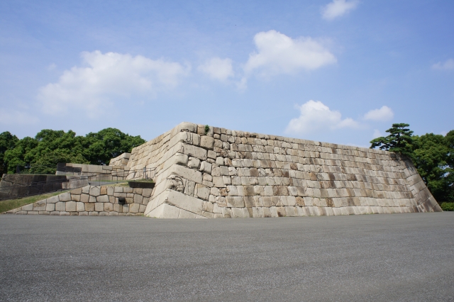
その完璧な構造にも関わらず、この城は敵からではなく、火災による被害を受けました。もっとも有名なのは1657年に発生した明暦大火です。この大火により、大半の江戸市域、江戸城、そして3代目の天守が焼け落ちました。大火の後、4代目天守の再建工事が開始されましたが、中止となりました。そのための天守台は今でも見ることができます。
Despite the perfect structure, the castle suffered not from enemies, but from fires. The most famous one was the great fire of Meireki in 1657. It burned out most of Edo City, Edo Castle, and the third Tenshu keep. After the fire, the rebuilding of a fourth Tenshu was launched, but canceled. We can now see the prepared Tenshu base for it.

4代目天守台~The base of the forth Tenshu keep(taken by 松波庄九郎 from photoAC)

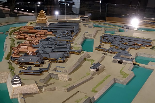
将軍は本丸御殿に住み、統治を行いましたが、御殿も火災での焼失と再建を繰り返しました。幕末になってから、将軍は焼けた本丸御殿から通常は隠居した将軍が住む西の丸御殿に移らなければなりませんでした。予算がなかったからです。
Shogun lived and governed in Honmaru hall, but the hall was also burned down and restored several times. At the end of the Edo Period, Shogun had to move from the burned Honmaru hall to Nishinomaru hall where retired Shogun usually lived, because of the lack of money.

江戸東京博物館にある本丸と二ノ丸御殿の模型~The miniature model of Honmaru and Ninomaru halls at Edo-Tokyo Museum(licensed by Daderot via Wikimedeia Commons)

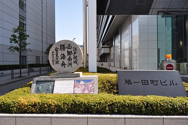
明治維新のとき、西日本の方で新政府と幕府の間で戦いが起こりました。結果として、西郷隆盛と勝海舟との会談が行なわれ、江戸城は新政府に平和裏に引き渡されました。
During the Meiji Restoration, a battle between the New Government and Shogunate was fought in eastern Japan. As a result, Edo Castle was handed over to New Government without war after the meeting between Takamori Saigo and Kaishu Katsu.

西郷・勝会談の記念碑~The monument of the meeting between Saigo and Katsu(licensed by 江戸村のとくぞう via Wikimedia Commons)

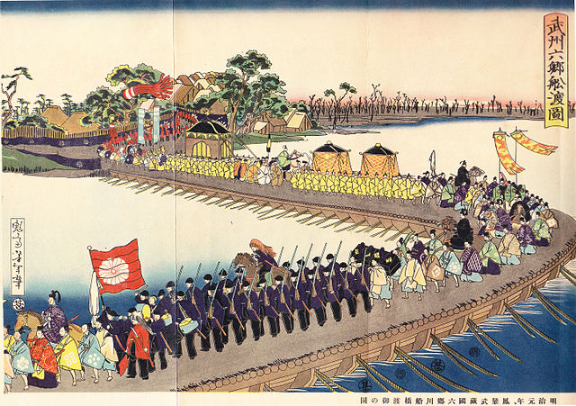
1869年、江戸は東京と名前を変え、日本の首都となりました。そして明治天皇が将軍と入れ替わりで、古都京都から東京の江戸城西の丸御殿に移りました。そのため、現在西の丸は皇居の一部となっています。
In 1869, Edo was renamed Tokyo which became the capital of Japan, before the Emperor Meiji move from old capital Kyoto to Nishinomaru hall of Edo Castle in Tokyo instead of Shogun. That’s why Nishinomaru is now part of the Imperial Palace.

明治天皇の東京到着を描いた錦絵~The picture that shows the arrival of Emperor Meiji to Tokyo(licensed under Public Domain via Wikimedia Commons)

「江戸城その2」に続きます。~To be continued in “Edo Castle Part2”