I think that the bast way to feel what Odawara Castle was during the Sengoku Period, would be to wak the So-gamae structure. Therefore, this article will show you how to walk around the So-gamae in the current Odawara City.
Features
I think that the bast way to feel what Odawara Castle was during the Sengoku Period, would be to wak the So-gamae structure. Therefore, this article will show you how to walk around the So-gamae in the current Odawara City.
Rare Remaining So-Gamae structures on Plain Area
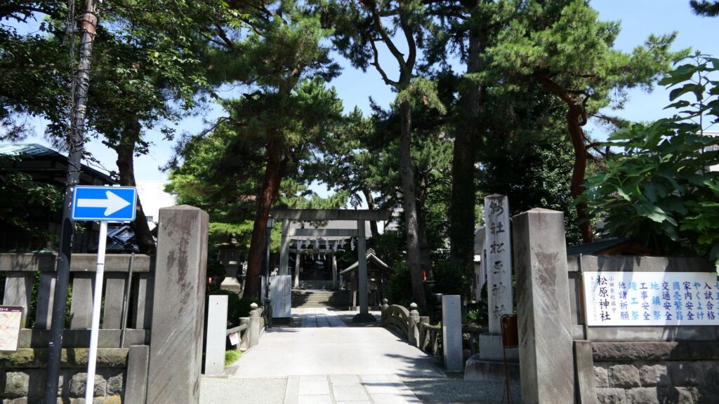
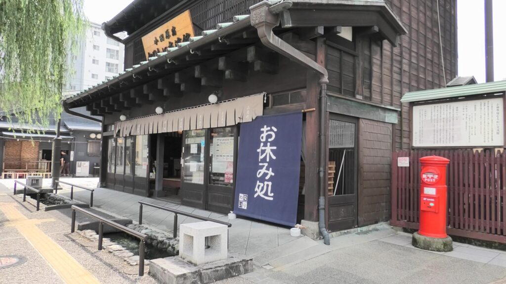
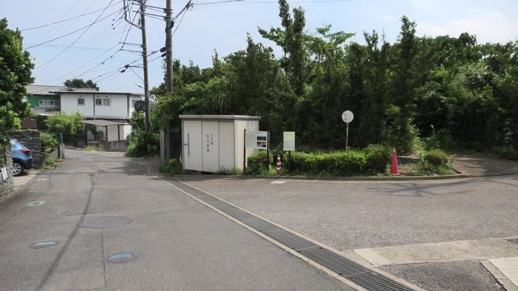
Unfortunately, there are only a few remaining structures of So-gamae on the plain city area. First of all, it might y be better to walk the old Tokaido Road to the east. The starting point would be Matsubara Shrine, or a rest station called “Odawarajuku-Nariwai-Koryukan”, which are located at the center of the old transportation hub of Odawara.
The Matsubara ShrineThe rest station
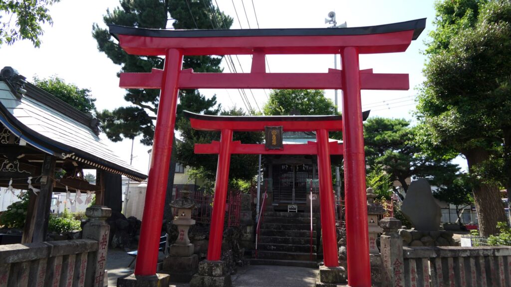
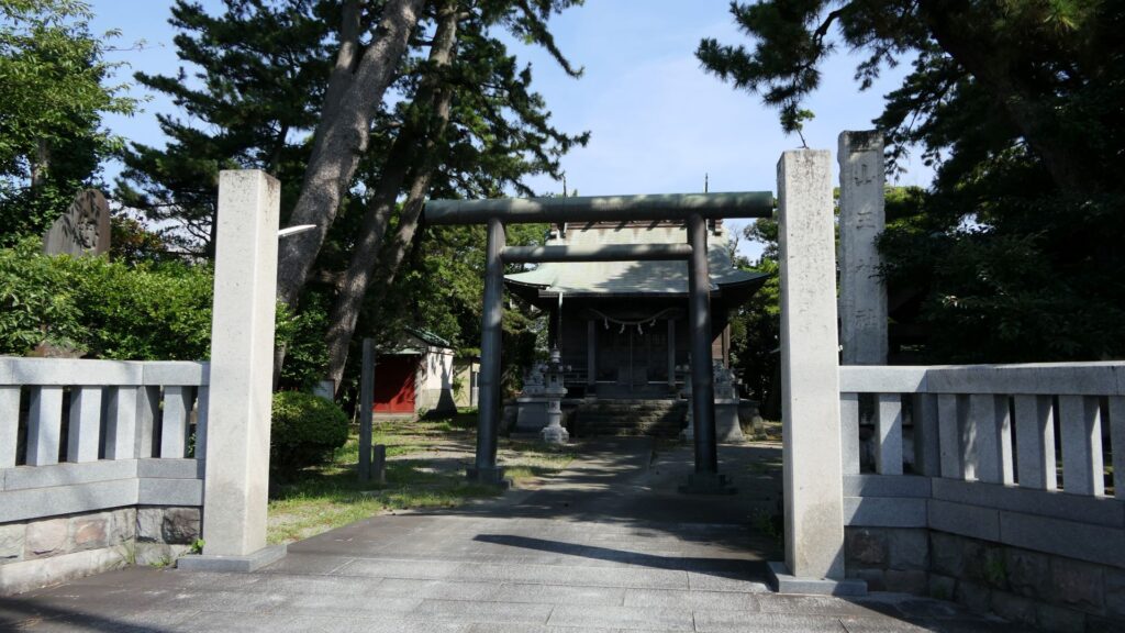
It would be more comfortable to go on Kamaboko Street, where there are many traditional Japanese fish cake (which is called Kamaboko) shops are located, which is also similar to the route of the old Tokaido Road during the Sengoku Period. If you walk along the street for a while, you will eventually reach Hojo Inari Shrine. The shrine was built by the Hojo Clan and at the southeast corner of the So-gamae structure.
The Hojo Inari Shrine
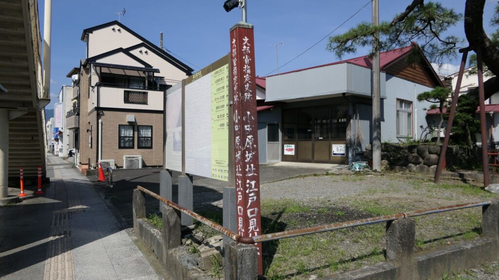
If you turn left to the north of the shrine, you will soon find the ruins of Edoguchi-mitsuke (which means the gate to Edo). The gate was the eastern entrance of Odawara Transportation Hub during the Edo Period. It was also the Sannoguchi Gate of the So-gamae structure earlier on. Therefore, the partitions of the gate were used until the end of the Edo Period.
The ruins of Edogchi-mitsuke
In addition, there is also Sanno Shrine, which is little far from the gate ruins, which was a defensive position of the Hojo Clan outside the So-mgamae during the Battle of Odawara. The only direct fighting during the battle happened at this site.
The Sanno ShrineThe ground of the shrine looks like a defensive position
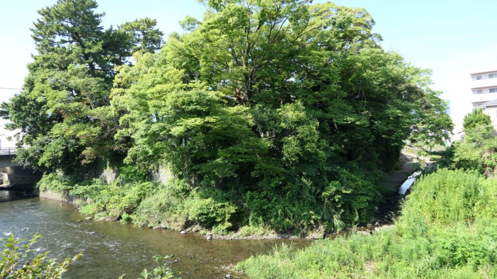
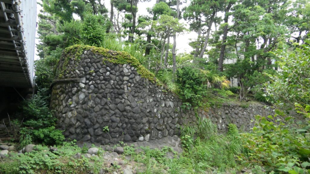
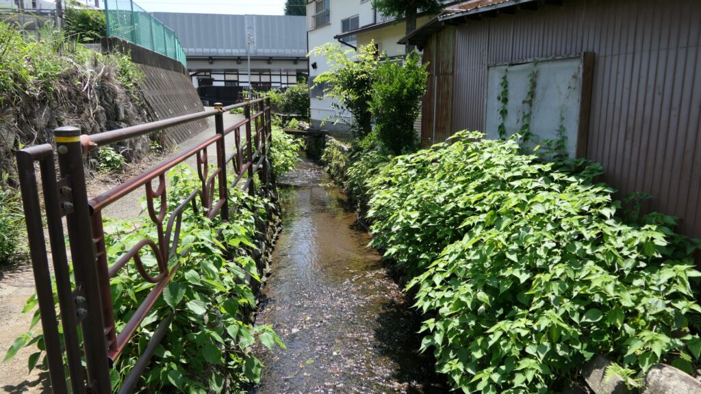
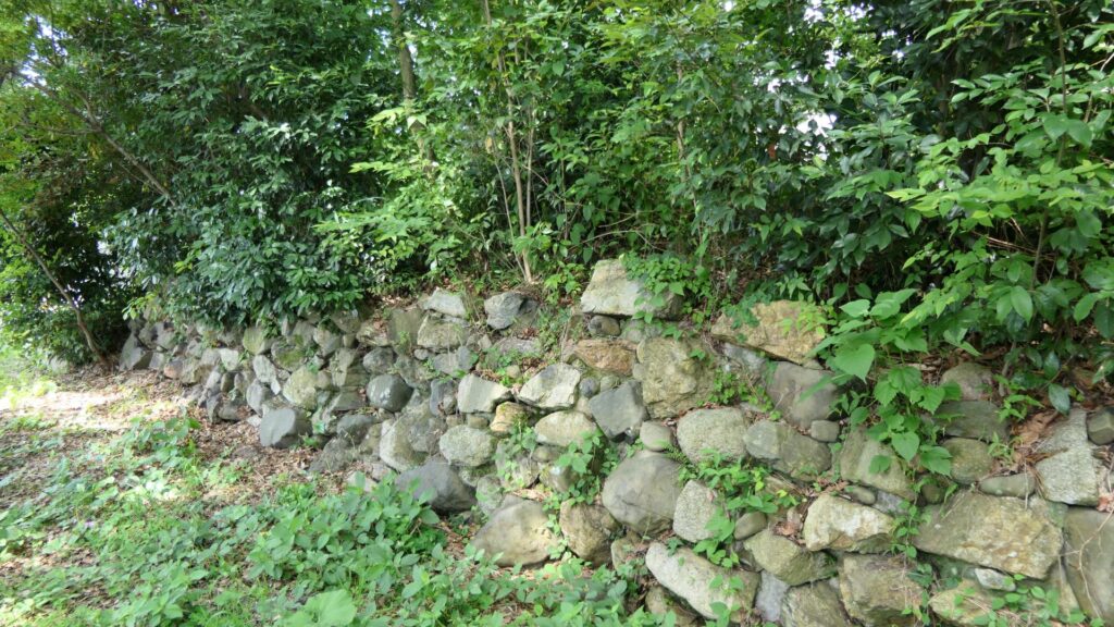
If you go on the path beside the gate ruins, you will eventually arrive at one of the few remaining structures of So-Gamae in the city area. It is called, Renjoin Temple Earthen Walls, which is about 100m long and about 3m high. It was originally set with a moat and more defensive than this single unit. You will see a large dent on the walls, which was caused by the Odawara air raid in 1945 during World War II. The ruins had a long history through the multiple periods.
The Renjoin Temple Earthen Walls
Remaining Structures on the Hill Areas
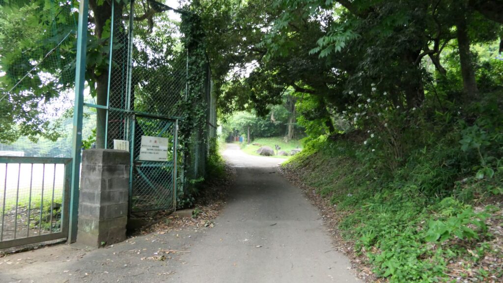
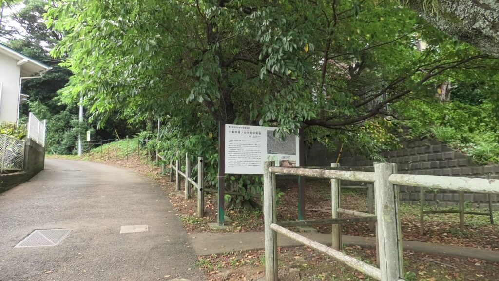
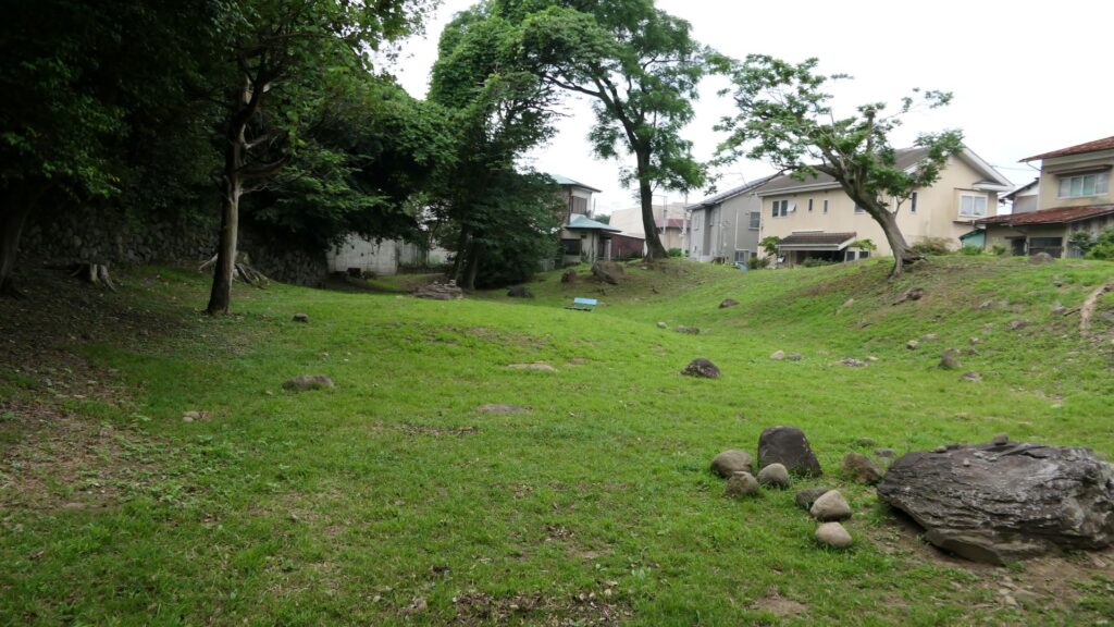
An easy way to the So-gamae structure on the hill area is to go on the opposite street of a park, called “Medaka-no-gakko”. The street will go up on Yatsu Hill, one of the hill areas behind the Odawara city area. You will eventually find the ruins of Shiroshita-Haridashi. Haridashi refers to the overhanging part of the So-gamae structure. The defenders could have lookout point of the attackers and could counterattack the side from the site. The remaining structure is the base of the overhanging part. That’s why the line forms a right angle.
The ruins of Shiroshita-Haridashi.
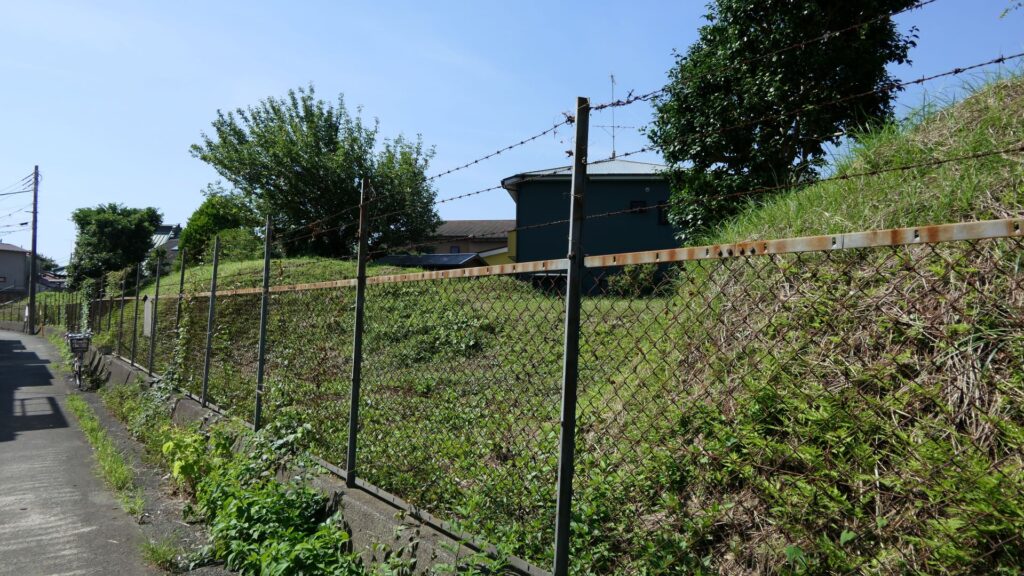
You can also look around the remaining dry moats along the hill. However, most of them are currently farms now, where visitors are not allowed to enter.
The dry moats which have become farms
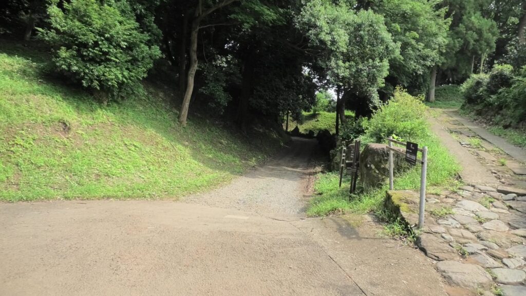
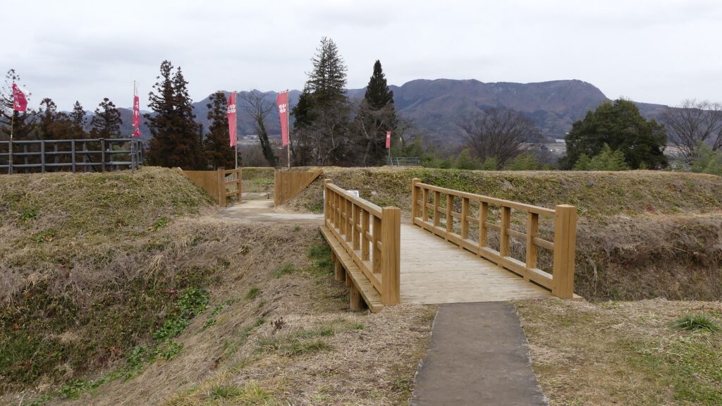
If you continue to go along the street for a while, you will eventually encounter a three-way intersection. Turn right at the intersection, then you will be able to travel on the So-gamae structure easily.
The three-way intersection
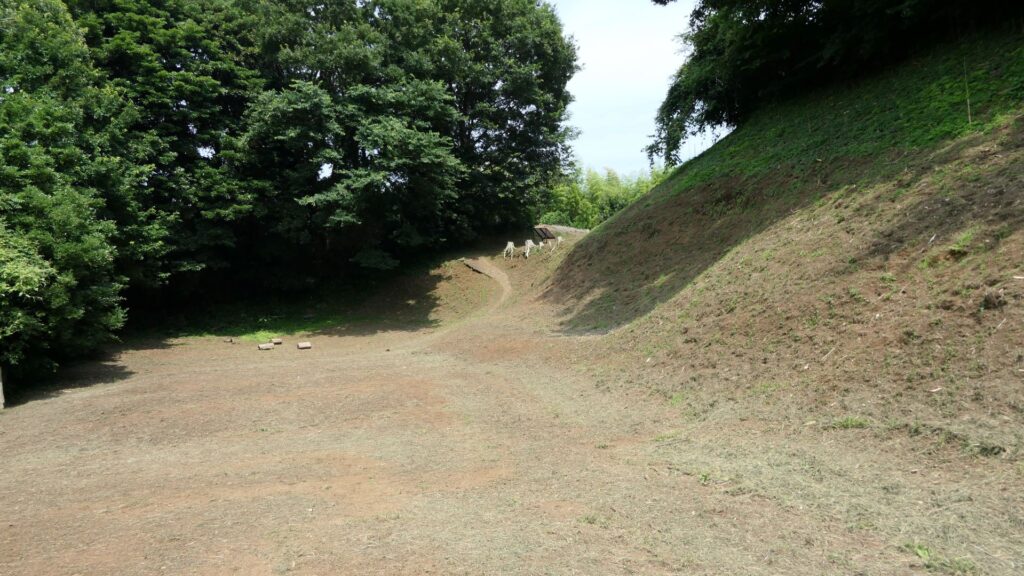
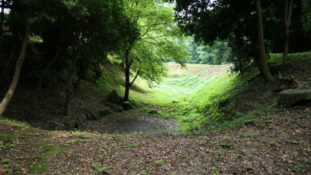
After a while, you will be at Yamanokami-Horikiri. Horikiri refers to a ditch separating a hill in order to avoid the enemies from attacking through the hill. If you go to the bottom edge of the Horikiri, you will find the dry moat of the So-gamae structure touching the Horikiri at right angles. However, the moat is much deeper than the Horikiri. That means the enemies that fell inside the moat, would not be able to invade the Horikiri easily.
Yamanokami-HorikiriLooking at the moat of the So-gamae structure from the edge of the Horikiri ditchLooking up the earthen walls of the So-gamae structure and the ditch from the bottom of the moats
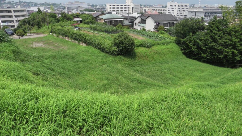
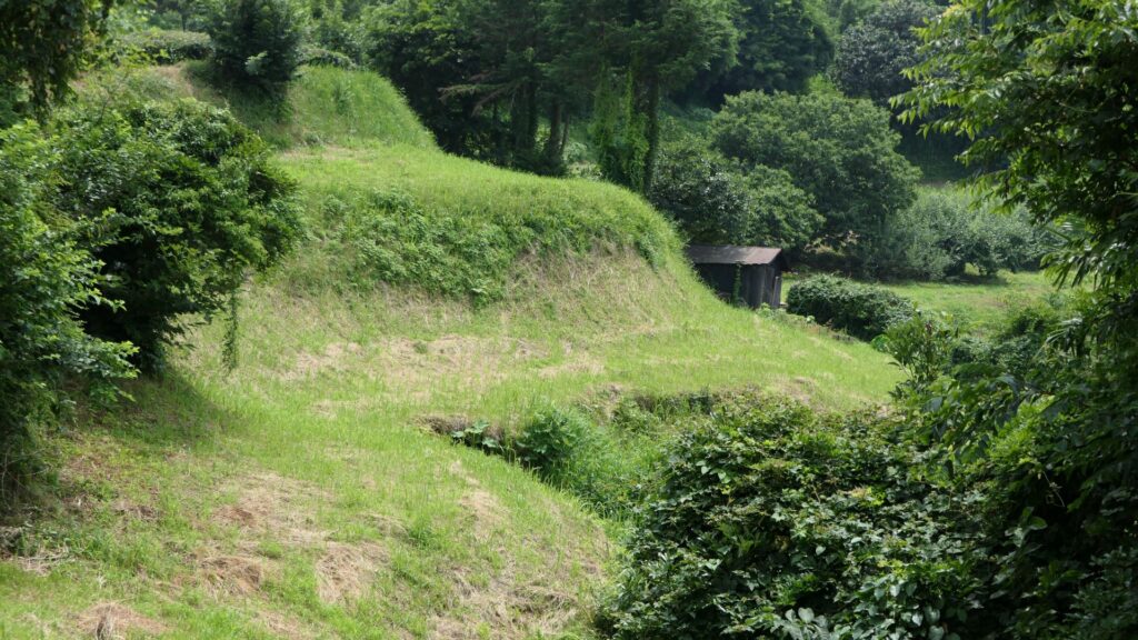
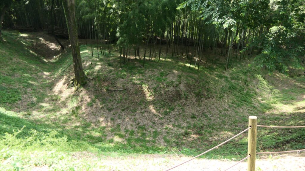
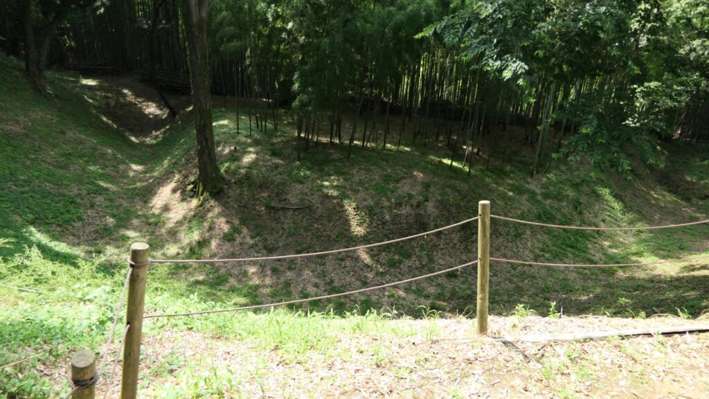
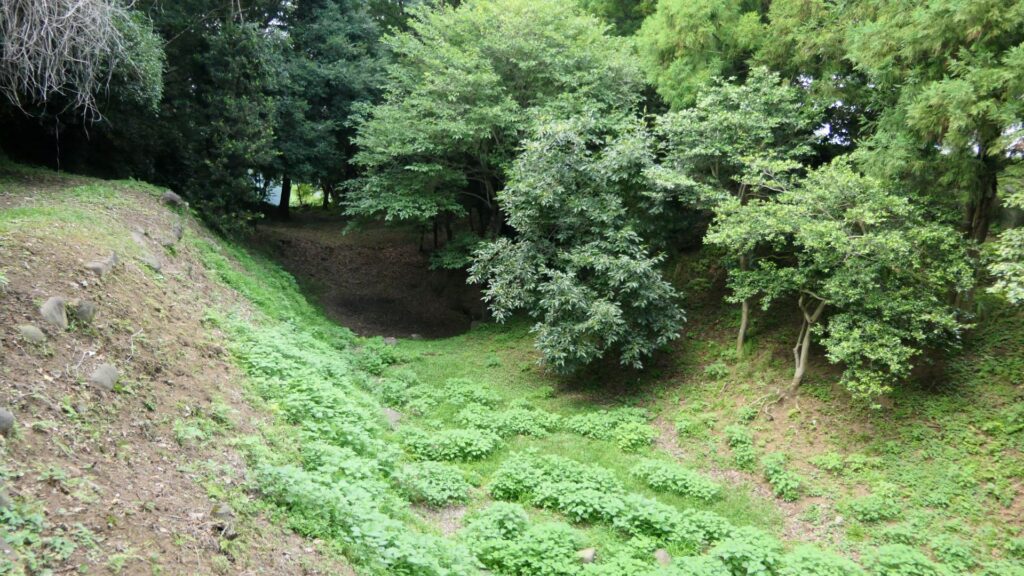
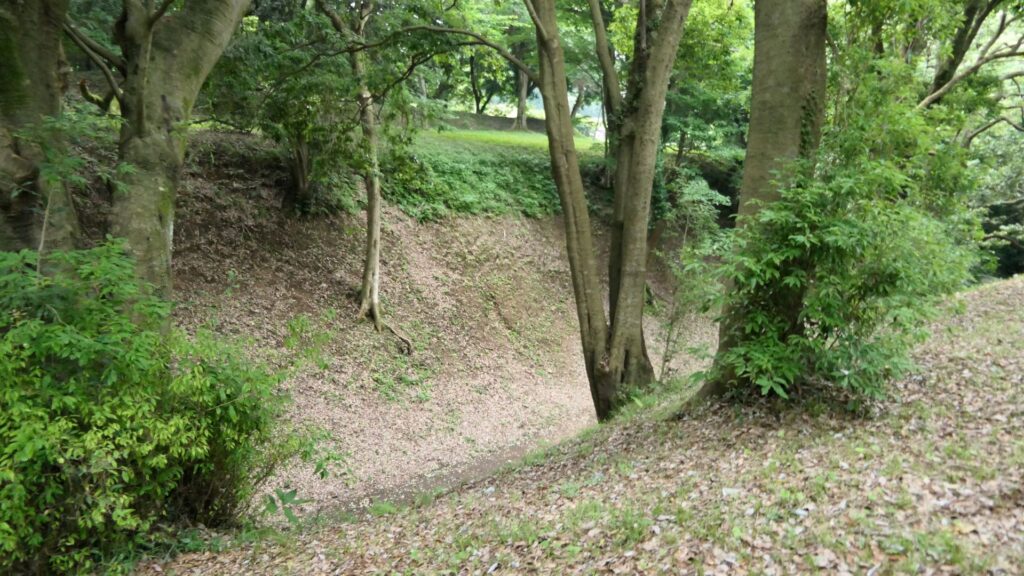
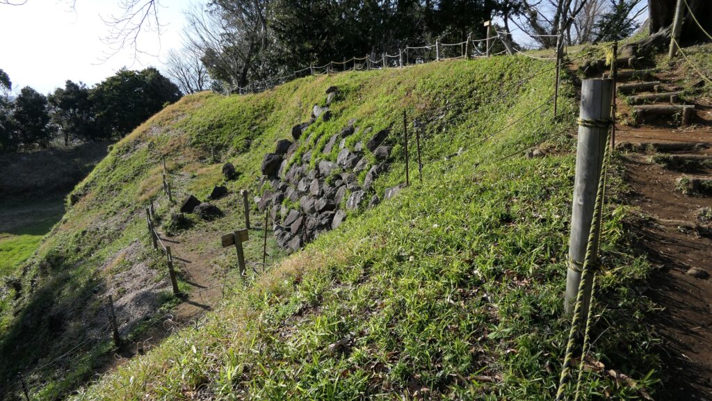
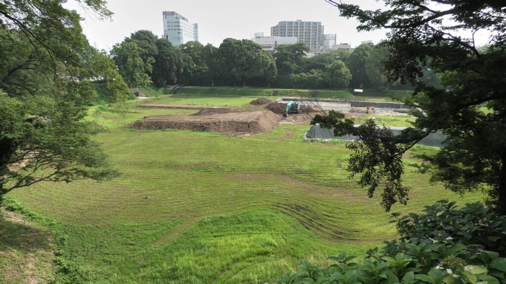
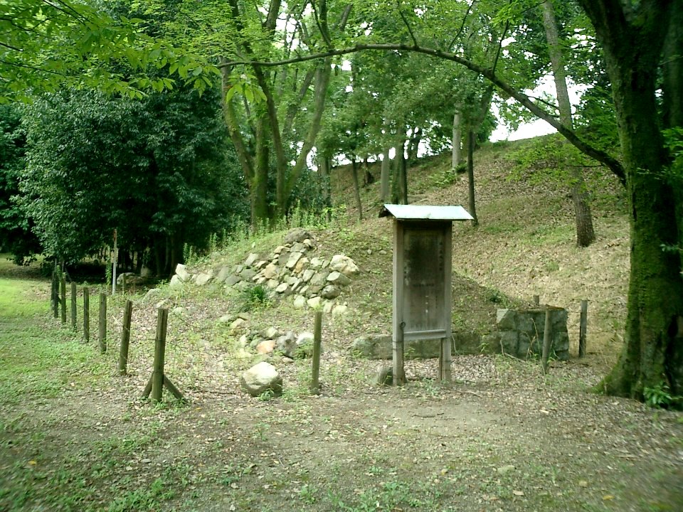
Next comes Inari-mori (which is the town name). At this site, the earthen walls and dry moats of the So-gamae makes a dent inwards along the natural terrain. The outside of the depression looks like an isolated island. The Hojo Clan also built earthen walls on the island in part to not allow enemies to stay there. This site is one of the most intact parts of the So-gamae structure. The moats managed to keep their original conditions of about 10m deep and over 50-degree slant. This is probably why the visitors are kept out from the moats by ropes and poles.
Inari-moriVisitors can only see the ruins
Large Ditchies of Komine Okane-no-dai, Highlight of So-gamae Structure
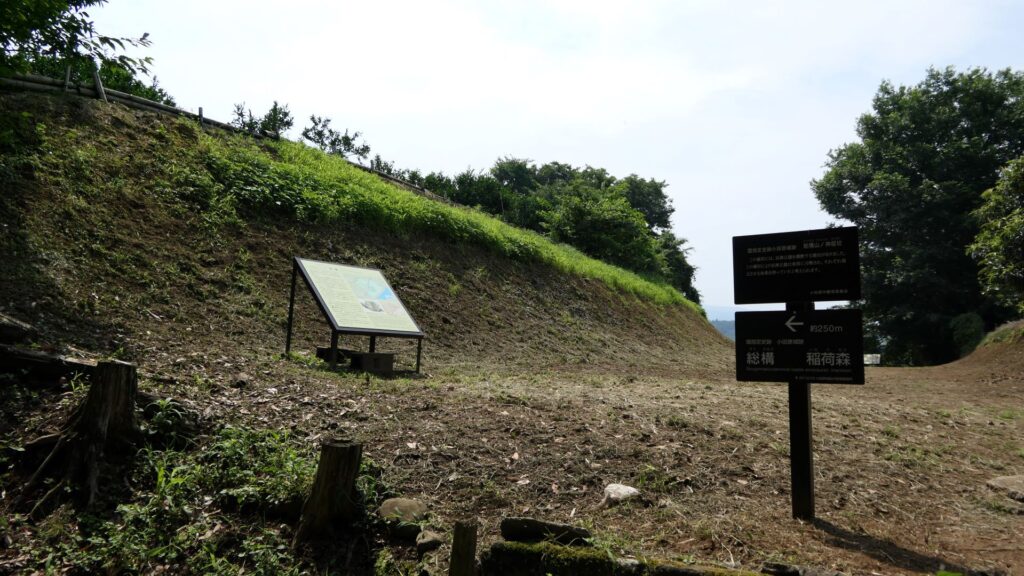
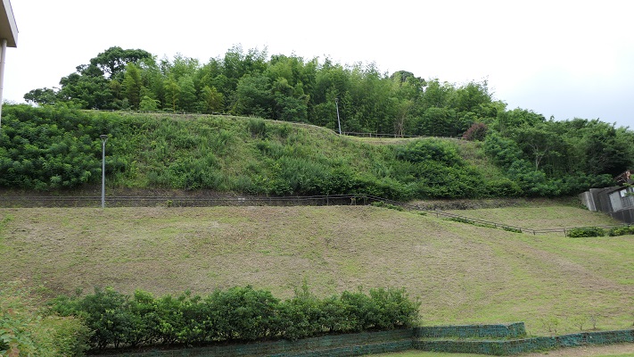
The northern part of Odawara City is surrounded by the three hill areas: Hachimanyama, Tenjinyama, and Yatsu. Komine Okane-no-dai hill is part of the Hachimanyama hill area and the highest among the areas. Therefore, the hill was the most important spot for the Hojo Clan in terms of protecting Odawara Castle from invasion. The clan eventually separated the hill by building three ditches. If you walk from the Inarimori Ruins along the So-gamae structure, you will reach the intersection to the three ditches. If you turn right, you will be at the western ditch, left to the eastern ditch, or if you keep going straight, it will lead to the central one.
The intersection to the three ditches
The western ditch is at the outermost area on the hill, which was originally over 200m long, but is now only 150m long. It was built just before the Battle of Odawara. The ditch seems to get shallower and gentler compared to the original condition. However, if you look at the bottom of it, you can still see something that resembles partitions, which may be the traces of the Shoji-bori system. The edge of the ditch is still connected to the moat of the So-gamae structure.
The western ditchThe bottom of the ditch
Next comes the central ditch, which was built at the same time as the western one. The bottom of the ditch is now used as a modern road. You can still see some of the earthen walls around it remaining. A connecting road between this ditch and the eastern ditch still exists.
The central ditch
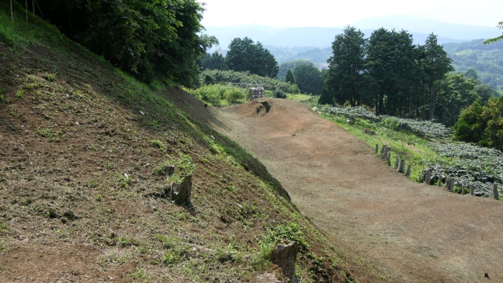
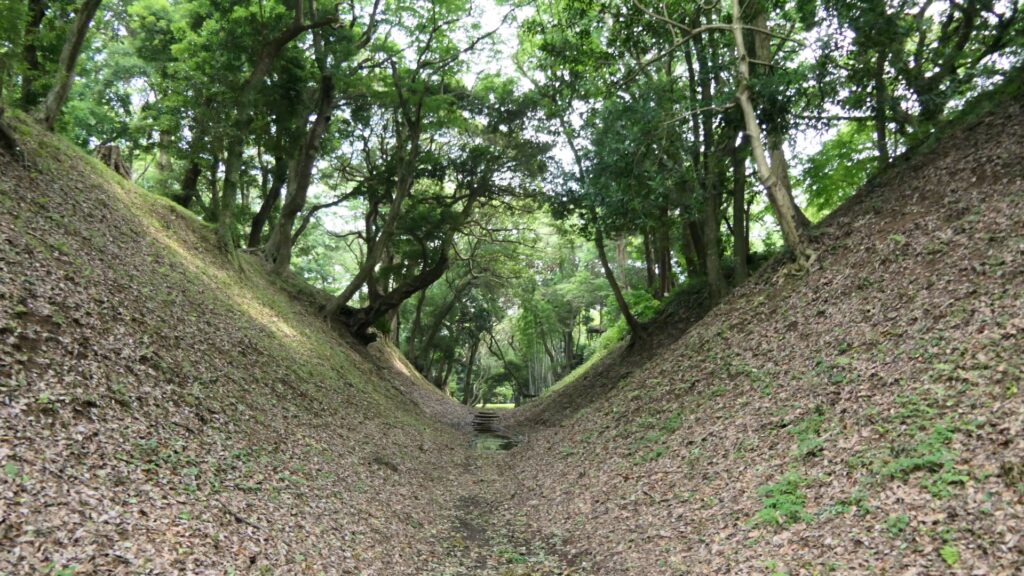
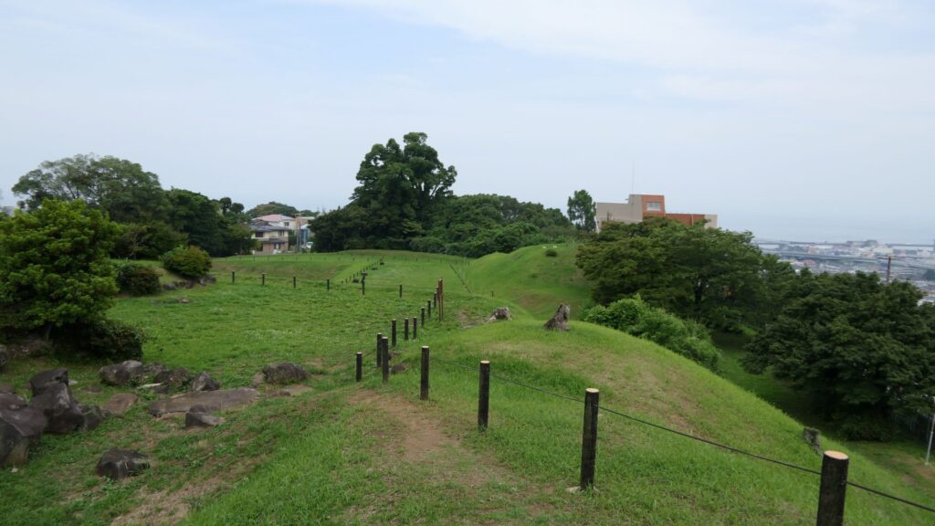
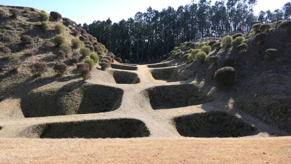
You will finally arrive at the eastern ditch, which has been developed as a park. You can easily walk the bottom of it. This ditch is the most intact one among the three ditches, which is 280m long and 25 to 30m wide, the same as the original conditions. It is currently 8 to 10m deep, but it was originally about 12m with the Shoji-bori system. Its slant is about 50 degrees, which may be the same as original one, too. The bottom of the ditch is not straight but rather curved, which made it difficult for enemies to walk through smoothly.
The eastern ditchThe ditch seen from its earthen walls aroundThe southern entrance of the ditch
Where is the goal of the So-gamae?
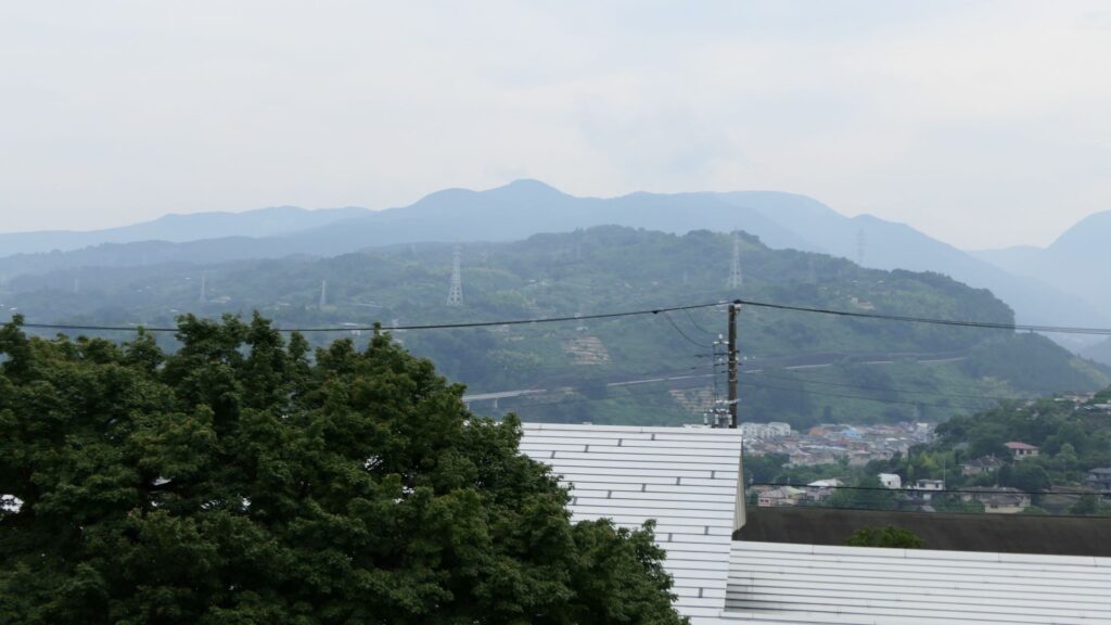
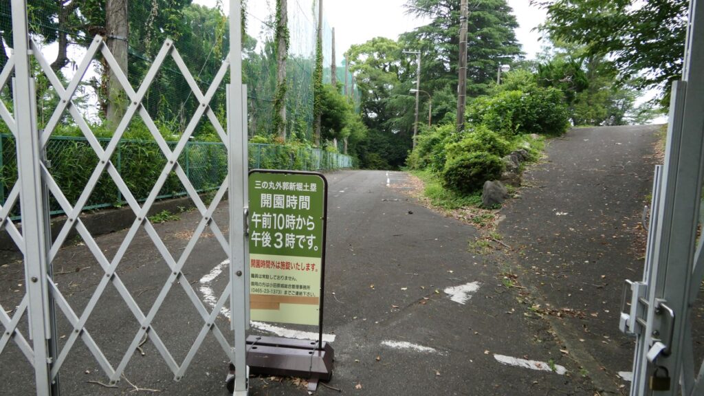
You will eventually go down on the hill to the New Moats and Earthen Walls of the Outer Third Enclosure. This place is where Ujimasa Hojo launched the constructions of the So-gamae structure. You can see a great view to the west from there, including Ishigakiyama Mountain where Hideyoshi Toyotomi built his Ishigakiyama Castle during the Battle of Odawara Castle. There is another interesting story where the Hojo side was very surprised to see the completion of Ishigakiyama Castle after all the trees around were cut down, called “Ichiyajo” which means “one night castle” (a castle that only took one night to build). However, the story may be doubtful because the castle ruins can clearly be seen from the site. In addition, please be mindful that the site closes at 3:00 PM, which is much earlier than other historical sites.
The New Moats and Earthen Walls of Outer Third EnclosureThe view to the west from the siteYou need to check out the opening hours of the site
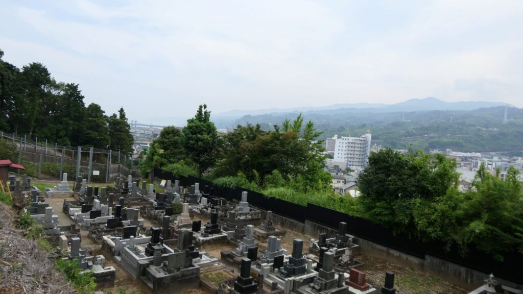
You will next walk down to the Tenjinyama hill area. This area also has walls of the So-gamae, called the Earthen Walls, at the west of Denjoji Temple. The walls are located in front of the elevated railways of the Shinkansen (bullet train) and used as a graveyard. If you look up the site from below, you will realize this structure uses natural terrain as well.
The Earthen Walls, at the west of Denjoji TempleLooking up the walls
After returning to the city area, you should also check out Hayakawa-guchi Ruins (Guchi means entrance or route), one of the few remaining items of the So-gamae structure on the plain area. The Hayakawa-guchi entrance was the front line to the west, where the Toyotomi troops attacked from. Therefore, the entrance was fortified heavily by doubled earthen walls and moats. If you enter the ruins, which have been developed as a park, you will eventually find that the park is sandwiched between the remaining doubled walls.
The Hayakaga-guchi Ruins
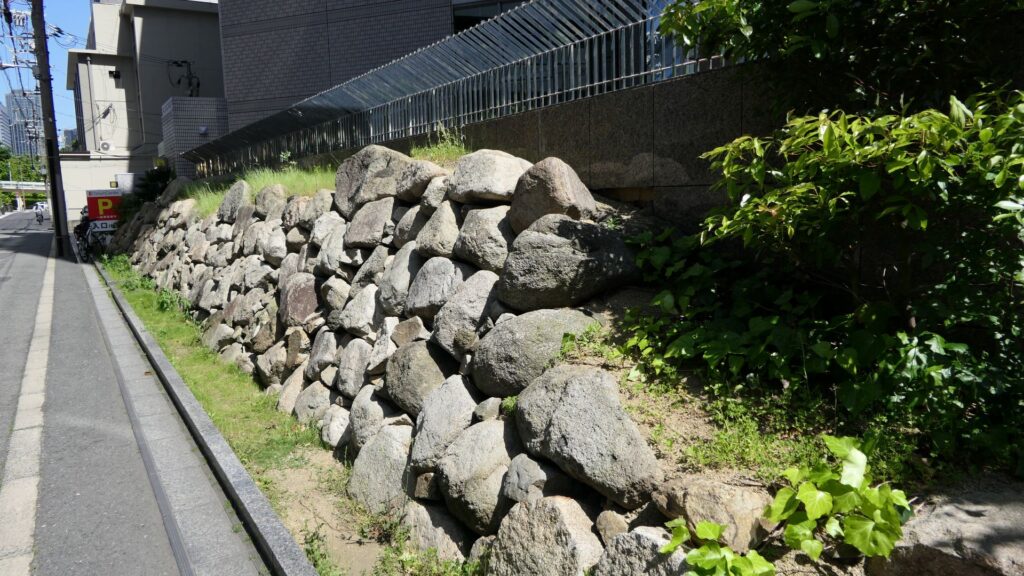
Other than that, you will be able to find other remaining earthen walls of the So-gamae structure, which are used as the bases of the modern residences along the seaside. If you find one of them, you will be able to understand that these structures were built on such a place and are still intact for the modern facilities to use. This will conclude the tour of the So-gamae structure.
This base of the modern residence uses the earthen walls of the So-gamae structure (its stone walls were probably added later on)
Odawara was supposed to be the capital of five generations of the Hojo Clan. The city is now supposed to be a popular tourist spot near Hakone hot spring. Odawara Castle first started as a small one in a new post town. The castle eventually grew under the rules of the Hojo Clan to one of the greatest castles during the Sengoku Period. It was finally turned into an important castle at the western edge of the Kanto Region during the Edo Period. The castle was located at the same place through all its life while it changed a lot, which is a very rare case. This article will focus on the history of the castle until the Sengoku Period.
Odawara was supposed to be the main castle for the five generations of the Hojo Clan. The city is now supposed to be a popular tourist spot near Hakone hot spring. Odawara Castle first started as a small one in a new transportation hub. The castle eventually grew under the rules of the Hojo Clan to one of the greatest castles during the Sengoku Period. It was finally turned into an important castle at the western edge of the Kanto Region during the Edo Period. The castle was located at the same place through all its life while it changed a lot, which is a very rare case. This article will focus on the history of the castle until the demise of The Hojo Clan during the Sengoku Period.
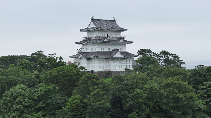
The current Odawara Castle, this main tower was rebuilt according to that during the Edo Period
Location and History (until Sengoku Period)
Beginning of the Castle and the Appearance of Sozui Ise
In the ancient time, passengers, who went to the Kanto Region from western Japan, didn’t often use the Hakone Route, but used the Ashigara Route instead. However, they eventually used the Hakone Route when some shrines near the route became more popular. Odawara was first formed as a transportation hub for the passengers not later than the 14th Century. On the other hand, Odawara Castle was thought to be built in the middle of the 15th Century. The Omori Clan, the first lord of the castle, built it in order to collect taxes from the passengers. For this reason, the castle was still small during its early stage.
The location of the castle
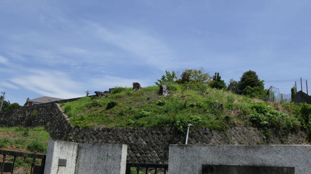
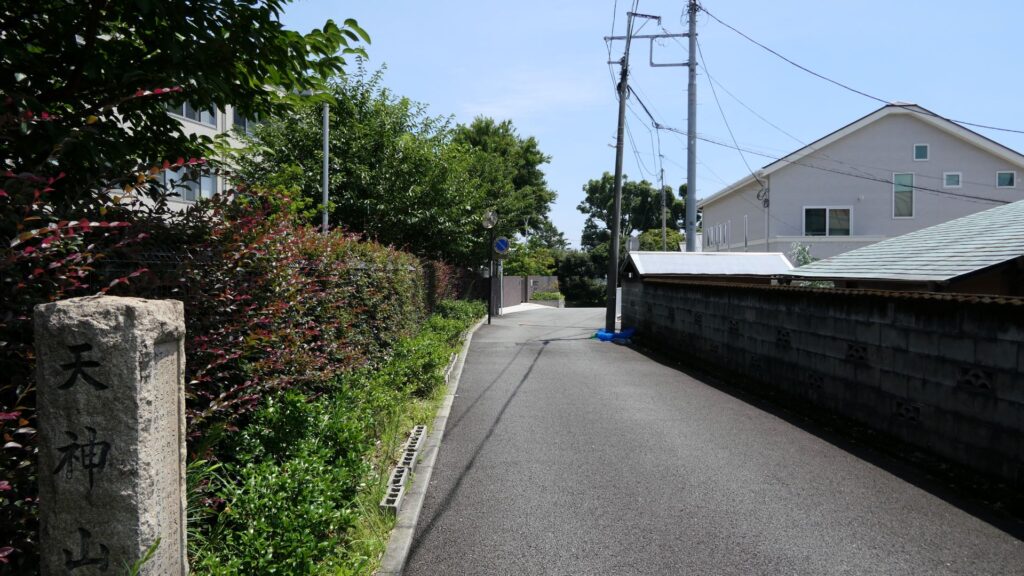
As for the location of the castle, it was said that it was first situated at Hachimanyama old enclosure, which is the north of the current Odawara Castle, and further away from the transportation hub. Considering the purpose of the castle, it may have been at the same place as the current one, or at Tenjinyama Hill, closer to the town.
The Hachimanyama old enclosureThe current Tenjinyama Hill
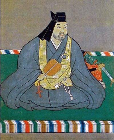
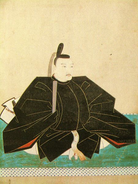
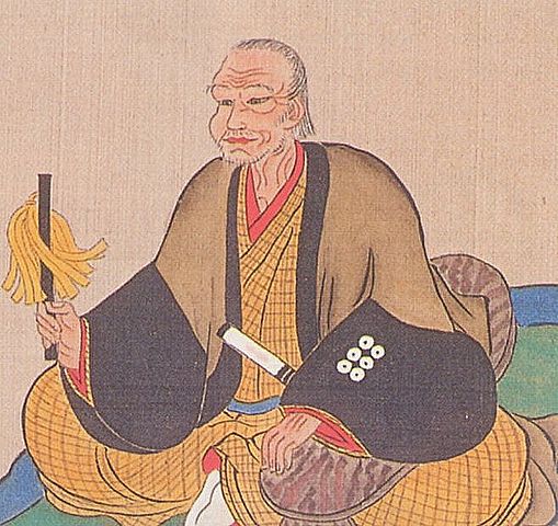
In the beginning of the Sengoku Period, a man named Sozui Ise, became one of the biggest heroes at that time, and later would become a legend. According to the legend, he started only as a Ronin, but eventually became a great warlord, through his own excellent talent. This has been recognized as a big success story of “Gekokujo” which means “giant killer”. However, in recent studies, it was discovered that he was originally a shogunal military guard called Moritoki Ise. He went to Sunpu, which is the current Shizuoka City, to help his sister who was in a dispute about the succession. She was the wife of the Imagawa Clan’s previous lord and wanted her son to be the successor but had to compete with another candidate.
A copy of the portrait of Sozui Ise, owned by Odawara Castle (licensed under Public Domain via Wikimedia Commons)
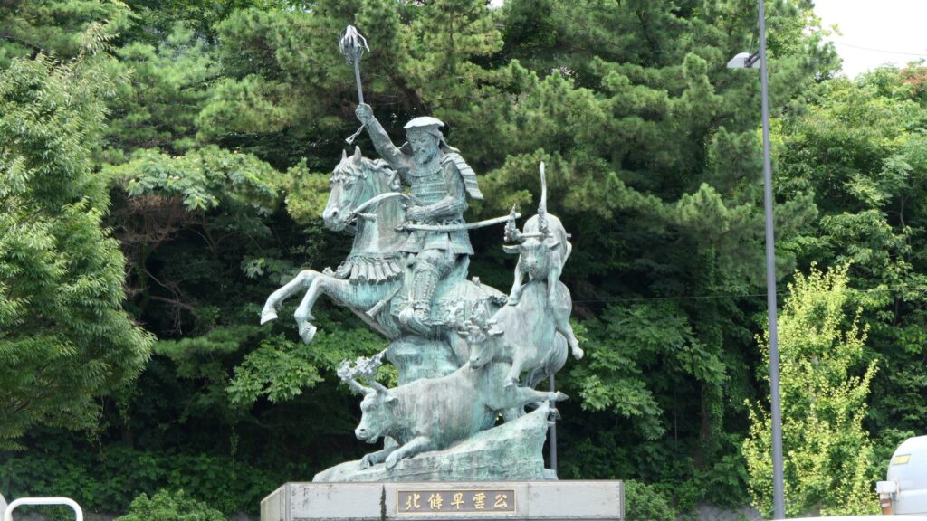
Sozui (Moritoki) succeeded in the son’s victory. He got Kokokuji Castle as an award of his contribution, which was the beginning of his real success story. The legend also says that Sozui drove the Omori Clan, which was the lord family of Odawara Castle, out from the castle, by tactics known as “Kagyu-no-kei”. Kagyu-no-kei refers to attacking enemies’ bases by using cows with lit torches on their horns. It was said that the statics had been done since the start of ancient China. However, the recent studies argue that it’s not that simple. According to a historical record, Sozui’s brother and the Omori Clan were actually on the same side at Odawara Castle and were defeated by the Uesugi Clan. Historians speculate that Sozui got Odawara Castle when they became enemies, or the castle was damaged because of a huge earthquake around 1500. Sozui was probably not only a hero, but also a practical man and a good negotiator. The castle was still a branch castle even after Sozui got it.
The ruins of Kokokuji CastleThe statue of Sozui at Odawara Station, attacking by Kagyu-no-kei
Improvement of the Castle by Ujitsuna and Ujiyasu Hojo
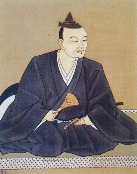
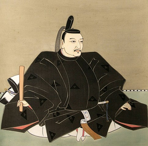
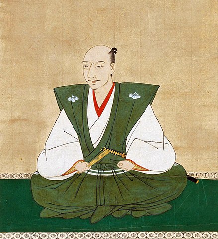
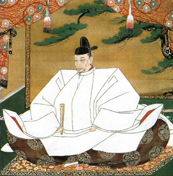
Sozui’s successor was his son, Ujitsuna Hojo, who was the second generation of the Hojo Clan. However, Ujitsuna was the person who changed his family name from Ise to Hojo. Therefore, Sozui Ise’s well-known alternate name Soun Hojo did not exist while he was alive. Soun was his Dharma name (this is the name given after the person dies). The reason for the change of the family name would be to go against the authority of the Uesugi Clan, the Hojo’s enemy. The Uesugi Clan looked down on the Hojo Clan because they were outlaws from another province. The Hojo Clan needed to improve their own authority in order to attract the local lords by using their new family name. “Hojo” had been the family name of the vice-Shoguns during the Kamakura Shogunate. Ujitsuna also moved his clan’s home to Odawara Castle.
The portrait of Ujitsuna Hojo, owned by Odawara Castle (licensed under Public Domain via Wikimedia Commons)
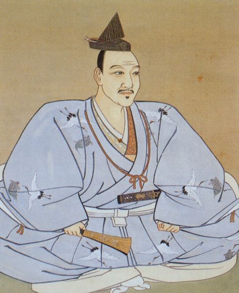
Ujitsuna’s son, Ujiyasu Hojo was the third generation of the clan. He managed to increase the clan’s territories in the southern Kanto Region, particularly after the victory of the battle of Kawagoe Castle against the Uesugi Clan in 1546. Odawara Castle and its town were becoming the center of the region. The original small transportation hub was turned into the castle town, being as large as that during the Edo Period. The Odawara Water Supply System was installed in the castle and the town. It is said to be one of the earliest water supply systems in Japan. As for the castle itself, the main portion of the castle was built, such as the current main and second enclosures. A priest, who visited Odawara Castle in 1551, recorded that there was a large pond surrounding the castle in three different directions. Part of the pond remains as the moat of the current second enclosure.
A copy of the portrait of Ujiyasu Hojo, owned by Odawara Castle (licensed under Public Domain via Wikimedia Commons)The current Odawara Water Supply SystemThe moat of the current second enclosure
The first big crisis happened to Odawara Castle in 1561. Kenshin Uesugi invaded the Kanto Region from his home of Echigo Province, which is currently Nigata Prefecture, in order to revive his clan. Kenshin sieged Odawara Castle with his allies and over 100 thousand soldiers the following February (according to the luna calendar). However, the attackers withdrew soon as they did not prepare for a long siege. Ujiyasu Hojo, who was the lord of the clan, avoided fighting against Kenshin but waited patiently for the withdrawal. After Kenshin went back to his home, Ujiyasu got the territories and the retainers in the region back to the same side.
The portrait of Kenshin Uesugi, owned by the Uesugi Shrine (licensed under Public Domain via Wikimedia Commons)
The second crisis occurred in October 1569 (according to the luna calendar). Shingen Takeda from Kai Province, which is currently Yamanashi Prefecture, invaded the Hojo’s territories and reached Odawara Castle on the 1st of October. Shingen first attacked the main gate, called Hasuike-mon (which means lotus-pond gate), and set the castle town on fire. Shingen’s troops also torched the hall of Ujimasa Hojo, Ujiyasu’s successor. Shingen stayed at Odawara for only five days and returned to his home. However, these two crises had a big impact on the Hojo Clan, especially on Ujimasa. When he followed his father’s position, he started to fortify Odawara Castle more and more. He probably thought that if he could build a castle that could withstand a long siege, no enemies would ever destroy it.
The portrait of Shingen Takeda, owned by Jimyo-in, in the 16th century (licensed under Public Domain via Wikimedia Commons)The portrait of Ujimasa Hojo, owned by Odawara Castle (licensed under Public Domain via Wikimedia Commons)Goyomai Enclosure, where Ujimasa’s hall was built
Completion of the Castle by Ujimasa and Ujinao Hojo
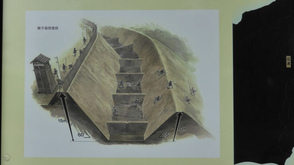
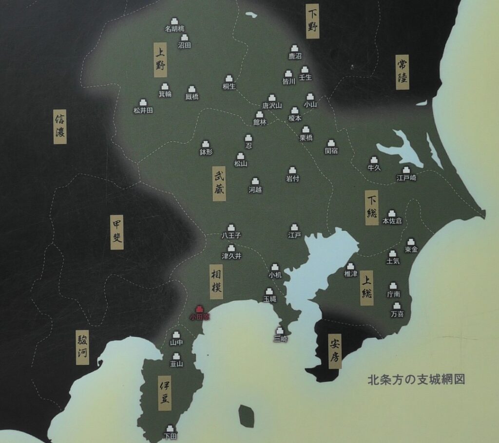
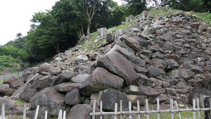
The Hojo Clan reached its peak in the period of Ujimasa and his successor, Ujinao. This was because Kenshin died in 1578 and the power of the Takeda Clan decreased. The Hojo ruled most of the Kanto Region and built the network of their branch castles to maintain their government. Odawara Castle became the center of it. Ujimasa also fortified the castle. For example, the third enclosure was built on a plain land around the second enclosure. After that, the outer third enclosure was also built on a hill behind the main portion of the castle. They were constructed to protect the castle from potential enemies attacking it from the front and from the back. Furthermore, a large ditch was built to separate the highest hill around the castle, called Komine-Okane-no-dai, next to the outer third enclosure. All of them were made using soil. It was dug to create very steep moats and was mounded to make high earthen walls. The soil around the area came from volcanic ash, which is called Kanto loam layer. It’s naturally slimy, which made enemies slipped when they walk on the surface. The bottoms of the moats were also partitioned forming many square partitions, called Shoji-bori (which means sliding paper door-moat) and Une-bori (which means hilling-moat). If enemies fell to the bottom, they would be trapped and would never be able to escape from it.
The portrait of Ujinao Hojo, owned by Hounji Temple (licensed under Public Domain via Wikimedia Commons)The outer third enclosureThe large ditch at Komine-Okane-no-dai HillThe Shoji-bori system in Yamanaka Castle
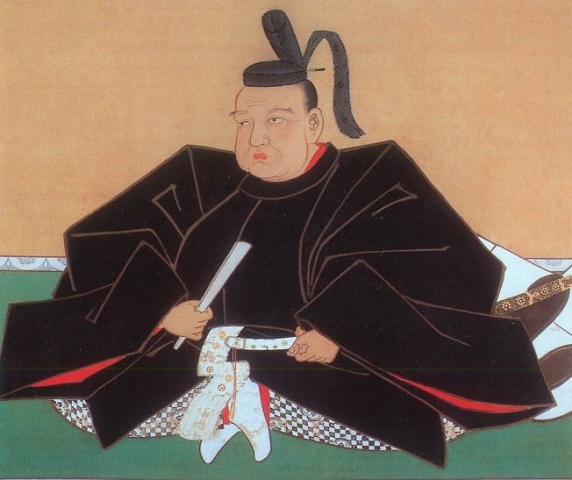
The development of the castle was related to the situation of the whole country and the diplomatic relations with other warlords. When Nobunaga Oda defeated the Takeda Clan in 1582, the Hojo was forced to be subordinate to Nobunaga. However, Nobunaga was killed during the Honnoji Incident in the same year. The Hojo, Tokugawa, Uesugi Clans battled each other in order to get the former territory of the Takeda Clan. A retainer of the Takeda Clan, the Sanada Clan gained power in order to be an independent lord by interrupting them. As time passed, Hideyoshi Toyotomi became the next ruler, ordering all the lords to stop fighting for themselves. Ujimasa ignored this new movement while other lords followed Hideyoshi by 1587. Ujimasa started a negotiation to serve the Hideyoshi side as well as the following year. One of the problems for the negotiation was about the Numata territory. There has been a dispute as to who was the true owner of the territory, between The Hojo Clan and Sanda Clan. Ujimasa asked Hideyoshi to resolve it. Hideyoshi’s decision was to give two thirds of the territory to the Hojo Clan and the other third to the Sanada Clan.
The portrait of Nobunaga Oda, attributed to Soshu Kano, owned by Chokoji Temple, in the late 16th century (licensed under Public Domain via Wikimedia Commons)The portrait of Masayuki Sanada, privately owned (licensed under Public Domain, via Wikimedia Commons)The Portrait of Ieyasu Tokugawa, attributed to Tanyu Kano, owned by Osaka Castle Museum (licensed under Public Domain via Wikimedia Commons)The Portrait of Hideyoshi Toyotomi, attributed to Mitsunobu Kano, owned by Kodaiji Temple (licensed under Public Domain via Wikimedia Commons)
On the other hand, Ujimasa continued to fortify Odawara Castle in case the negotiations broke down. The highlight of it was to surround the entire area of Odawara including the castle, the town and the hills behind them. This was done by building moats and earthen walls, whose perimeter was about 9km long. This structure is generally called So-gamae (which means outermost enclosure). Ujimasa probably thought that enemies would never enter Odawara, because of this long perimeter, called So-gamae structure.
The red line shows the estimated line of So-gamae structure The imaginary drawing of the So-gamae structure, from the signboard at the site
In October of 1589 (according to the luna calendar), an incident happened at the Numata territory. The Sanada Clan argued to Hideyoshi that the Hojo Clan forcibly got Nagurumi Castle on the Sanada’s side. This angered Hideyoshi and he finally decided to destroy the Hojo Clan completely. However, there are several questionable points about the incident. Some historians point out that It might have come from a deception of Hideyoshi and the Sanada Clan. Anyway, the battle between them may have been necessary. Hideyoshi wanted more territories to give to his retainers while Ujimasa didn’t want to surrender to Hideyoshi so easily. The So-gamae structure was eventually completed after the two-year constructions before the battle would happen.
The ruins of Nagurumi Castle
Battle of Odawara
In March of 1590 (according to the luna calendar), about 220,000 of soldiers, led by Hideyoshi Toyotomi, rushed into the Hojo’s territories. The number of the Hojo’s defenders was said to be about 80,000. About 50,000 of them were in Odawara Castle. The Hojo Clan probably expected that their enemies would be weakened by the network of the Hojo’s branch castles before they reached Odawara Castle. If they sieged the castle in poor conditions, the Hojo Clan could make peace with them in better conditions. However, most of the Hojo’s soldiers were drafted farmers, nor were they experienced, nor were they trained, and nor were they motivated. The battles occurred on the 28th of March at Matsuida Castle in Kozuke Province (which is currently Gunma Prefecture), and on the 29th at Yamanaka and Nirayama Castles near Odawara. Surprisingly, Yamanaka Castle, which had strong defensive systems like Shoji-bori, was captured in less than one day by the overwhelmingly powerful military force of the Toyotomi side. After that, the castles’ network of the Hojo side eventually collapsed. As a result, only 5 out of tens of the branch castles survived at the end of May. That was the first miscalculation for the Hojo Clan.
The network system of the Hojo’s castles, from the signboard at the site
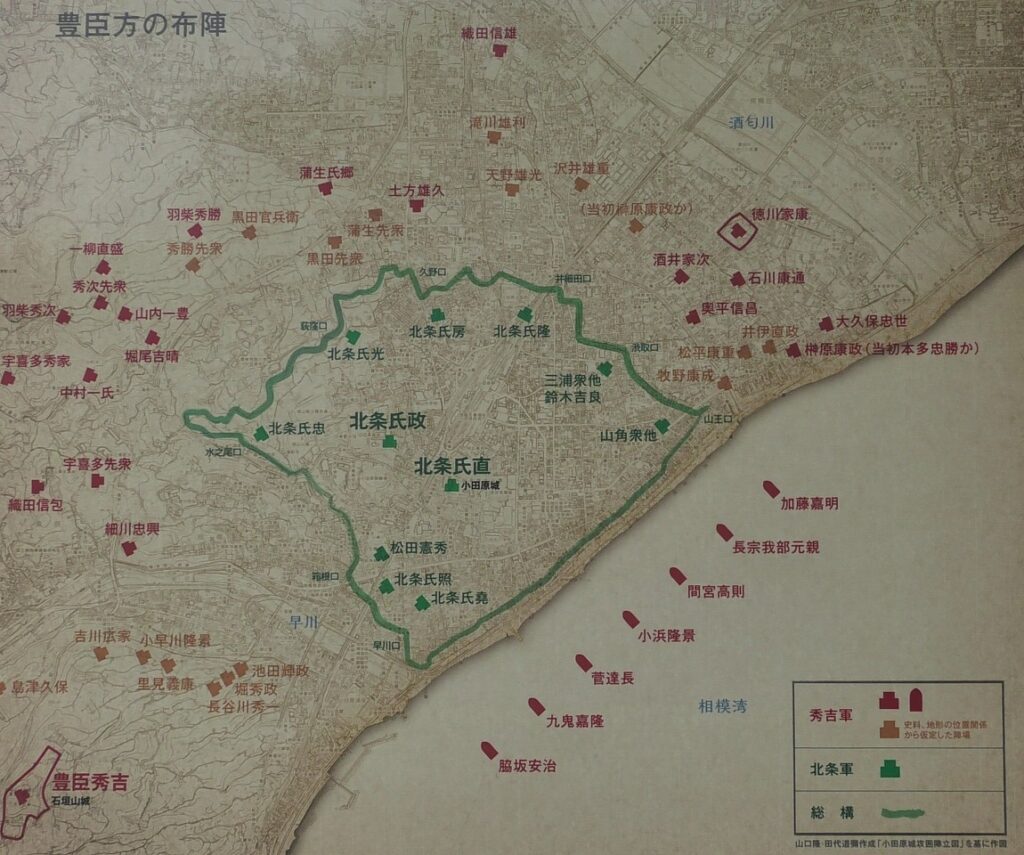
The Toyotomi’s troops reached Odawara Castle as early as in the beginning of April, surrounding the castle with about 180,000 soldiers. Hideyoshi launched the construction of his new stronghold, which would be called Ishigakiyama Castle, within the month. However, even with huge troops, they were not able to enter the castle, because they were blocked by the So-gamae structure. The structure was 30m wide at max and over 10m deep, with its slope at over 50 degrees. On the other hand, the Hojo side also miscalculated the features of the Toyotomi’s troops. Many of them were professionals and were equipped with enough supply systems. That meant they could survive in their battlefield for a very long time. They reached a much higher level in the combat than those of the Uesugi and Takeda Clans earlier on. As a result, the attackers and the defenders faced each other across the So-gamae structure in April and May.
The war map of Odawara Castle, from the signboard at the site
On the 5th of June, Masamune Date, who was the greatest warlord of the Tohoku Region, arrived at Odawara to serve Hideyoshi. That made the Hojo Clan know that no supporters would help them. The negotiation between the Toyotomi and Hojo sides started behind the scenes. Ujimasa’s successor, Ujinao Hojo was in charge of it. In Japanese, there is a figurative expression called “Odawara Hyojo” which means an inconclusive long conference. People generally think the Hojo didn’t know what to do during the siege. The fact might have been different from it. As time passed, four of the five surviving branch castles were captured in June. Only Oshi Castle was bearing being sieged by the Toyotomi troops like Odawara Castle. Ishigakiyama Castle, which had great stone walls, was completed on the 26th of June as Hideyoshi’s stronghold. Its appearance may have threatened the defenders of Odawara Castle, just a few kilometers away from it.
The portrait of Masamune Date owned by Sendai City Museum (licensed under Public Domain via Wikimedia Commons)The ruins of Ishigakiyama Caslte
Ujinao finally surrendered to Hideyoshi on the 5th of July. It was said that the negotiation may have included a few territories reserved for the Hojo Clan. However, the decision of Hideyoshi, who completed his unification of Japan, was too strict to allow it. The four leaders of the Hojo side, including Ujimasa, were forced to do Harakiri. Even Ujinao, who made peace with Hideyoshi, was eventually expelled to Koyasan Temple. The Hojo Clan lost everything they had had. Some say that the decision had been planned from the beginning. The territorial allocation after the Battle of Odawara was as followed. Ieyasu Tokugawa moved from around the current Shizuoka Prefecture to the Kanto Region the Hojo Clan had had. Nobukatsu Oda, who was Nobunaga’s son but followed Hideyoshi, was also fired by Hideyoshi due to his rejection to move to Ieaysu’s previous territory. Hideyoshi gave the large vacant territories to his successor, Hidetsugu and his retainers. The satisfied retainers would monitor the actions of Ieyasu who was a potential enemy for Hideyoshi, killing two birds with one stone. In addition, the Sanada Clan got all of the Numata territory after the battle. Were they all coincidental?
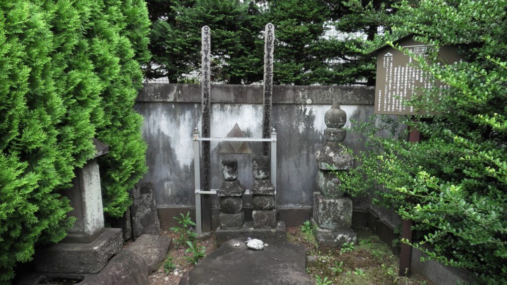
The grave of Ujimasa Hojo, near Odawara Station
The Hojo Clan declined but Odawara Castle with the So-gamae structure was very effective against the attackers. For example, it was recorded that Kazuuji Nakamura, who owned Sunpu Castle, built So-gamae structure for his castle, too. In fact, Hideyoshi Toyotomi also built very long earthen walls to surround Kyoto, called O-doi, whose perimeter was about 23 km long. It was recently discovered that the walls had the Shoji-bori system. Hideyoshi also improved his home, Osaka Castle by building So-gamae structure from 1594. Some other lords, who joined the Battle of Odawara, built their own So-gamae as well, probably influenced by Odawara Castle.
The current Sunpu CastleThe restored stone walls of Osaka Castle, used in its So-gamae structure
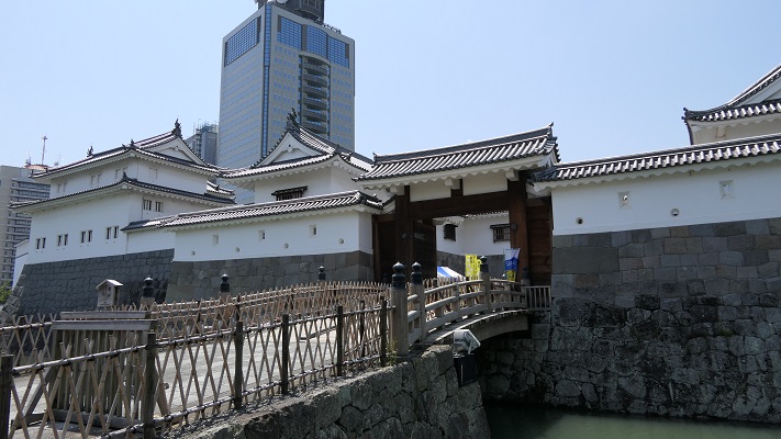
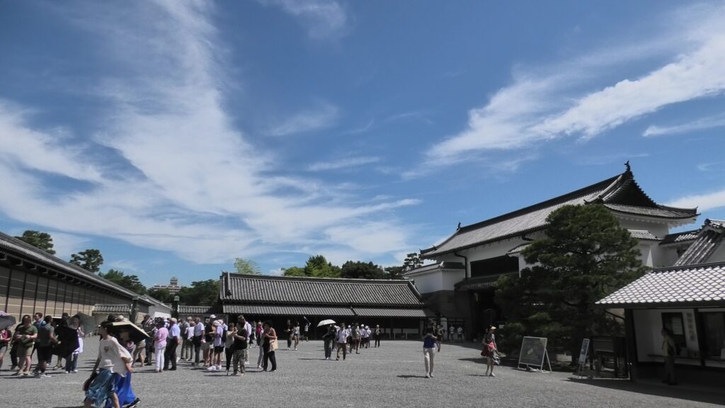
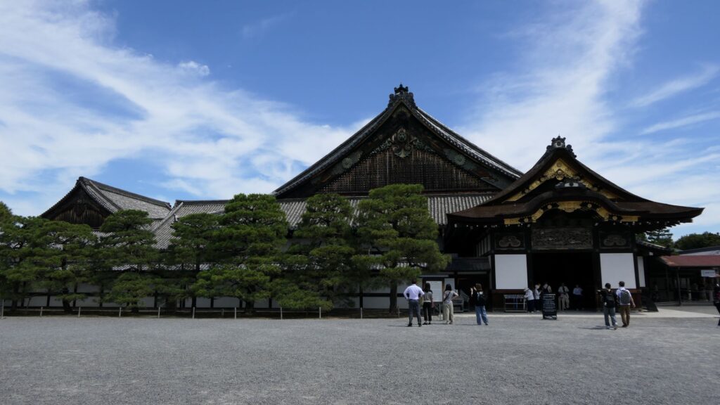
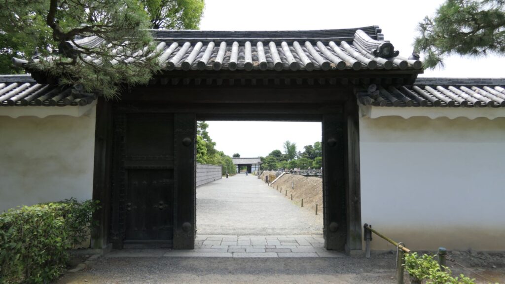
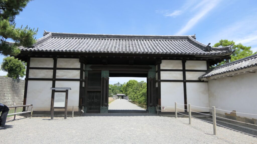
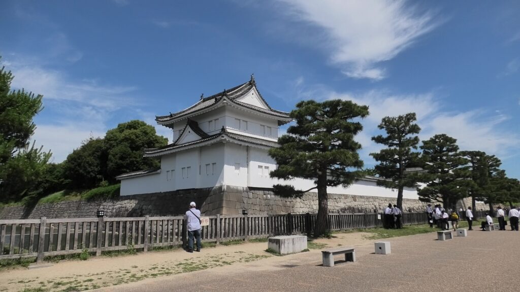
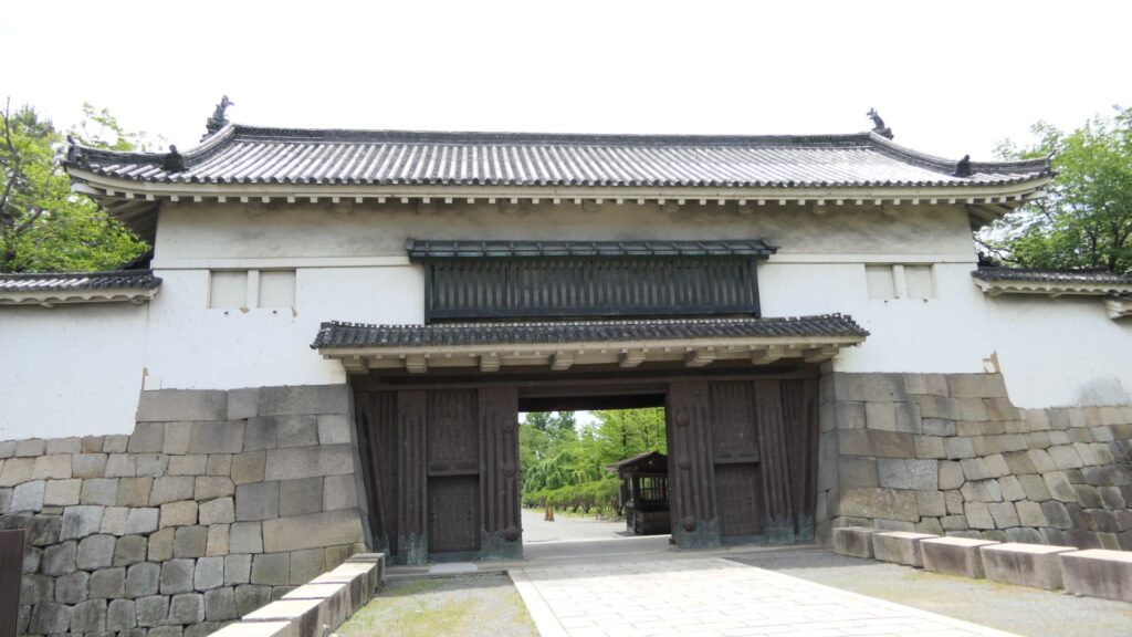
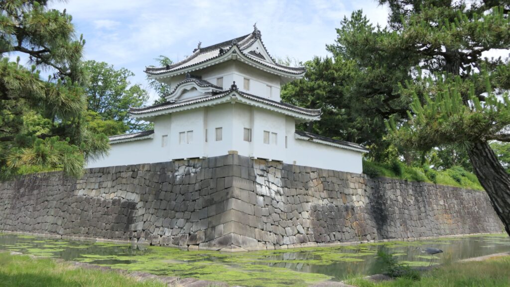
The eastern main gate is the only gate which visitors can use. It looks strict outside, however, if you enter inside, there will be an open space with the remaining guardhouse alongside. This is probably because this gate was the front gate of the castle, which was mainly used when ceremonies were held.
Later History
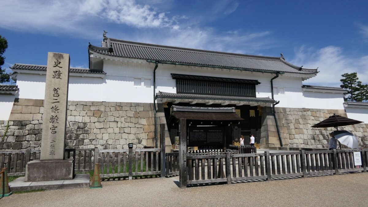
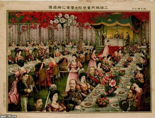
After the Meiji Restoration, Nijo Castle was used as a villa of the imperial family. For example, a party for the enthronement ceremony of the emperor Taisho was held there. The castle has become a historical site since 1934, named Former Imperial Villa Nijo-jo Castle. The site also became a World Heritage in 1994, as one of Cultural assets of the ancient capital of Kyoto.
The picture of the enthronement ceremony of the emperor Taisho (licensed by Ninijo via Wikimedia Commons)The eastern main gate with the signpost of the historical site
Features
Gorgeous Second Enclosure
The eastern main gate is the only gate available to visitors. It looks strong on the outside, however, if you enter inside, there will be an open space with the remaining guardhouse alongside. This is probably because this gate was the front gate of the castle, which was mainly used when ceremonies were held.
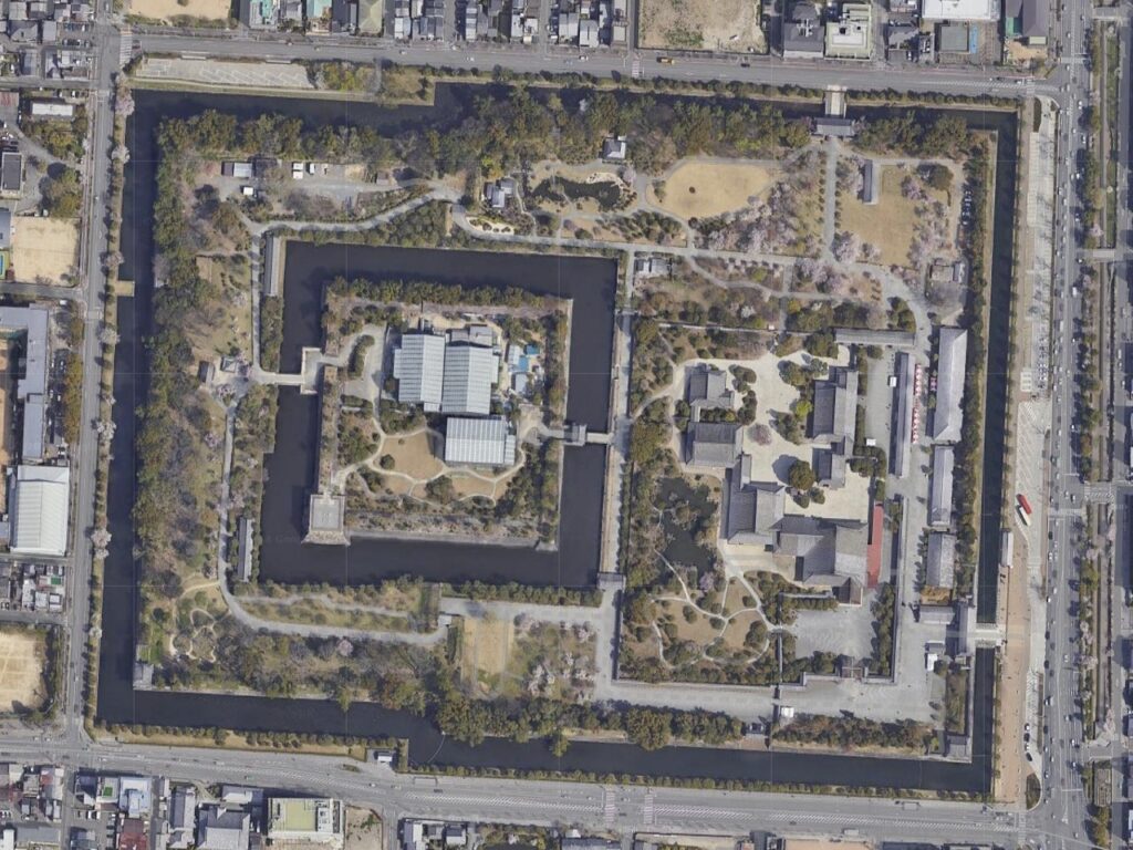
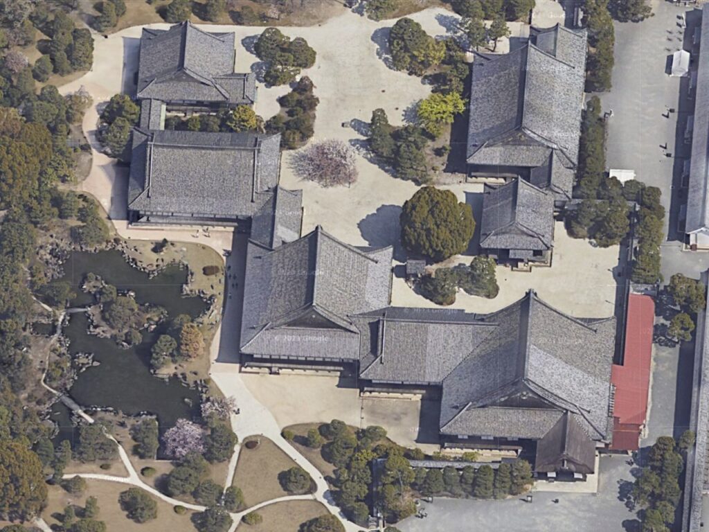
The aerial photo of Nijo Castle, the eastern main gate is located at the lower right of the map (Google Map)The inside of the gate, the guardhouse is in the back
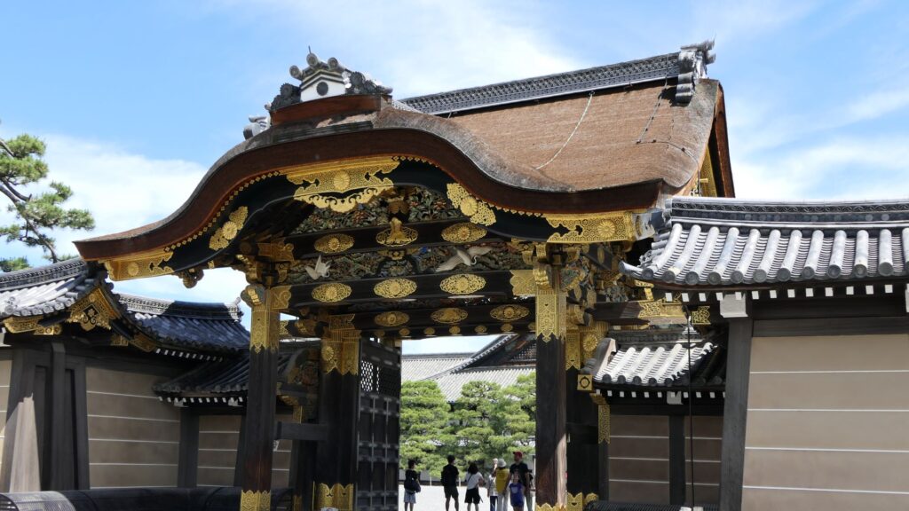
If you turn right at the first corner of the tour course, you will see the Kara-mon Gate (which means Chinese-style gate). It was built with the high sophistication, as the front gate of the second enclosure main hall. It also has lots of golden decorations, which attracts many tourists, particularly those from overseas.
The Kara-mon Gate
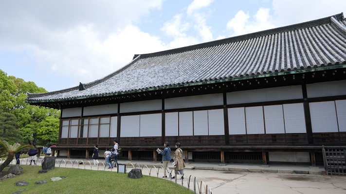
The route from the eastern main gate to the main hall through the Kara-mon Gate has been the official one since the beginning. The main hall has been intact since it was renovated for the Kanei Royal Visit in 1626. That’s why it was designated as a National Treasure in 1952, with its gorgeous pictures on its movable sliding doors inside.
The main hall of the second enclosure
Unfortunately, we can not take pictures inside the hall. Therefore, let me explain to you about each hall while looking at the aerial pictures of the six halls. The hall basically consists of 6 buildings. The first one is the largest one (located on the bottom right of the picture), called “To-zamurai” (which means gate guardians). It was used as the entrance and the waiting rooms, including the special room for the imperial envoys in the back. The hall next to it is called “Shikidai” (which means retainers’ rooms). It was the place for the agency service between the visitors and the shogun. The service was done by Roju (the members of the shogun’s council of elders) who had their rooms in the back.
The aerial photo of the main hall (Google Map)The “Shikidai” hall
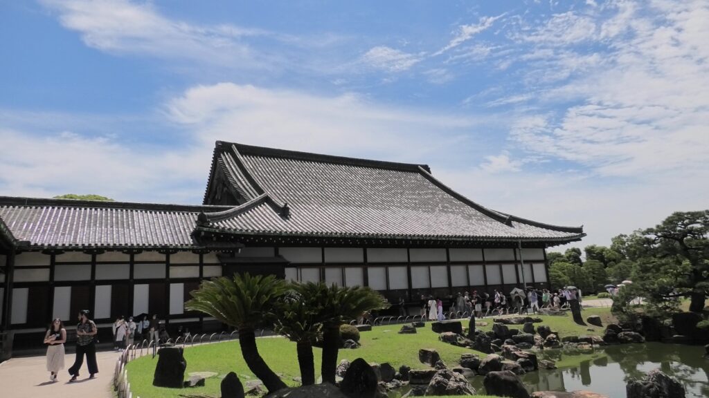
The third hall is O-hiroma (which means large hall), where the visitors officially met the shogun. In fact, The Returning of the Power to the Emperor was officially announced there in 1867. The three buildings above were like the government office. The others in the back were like the shogun’s residences. The fourth hall, called “Sotetsu-no-ma” (which means cycad room), was the connecting hall to them. The name originates from the cycad trees, presented from the Saga Domain. They were planted outside near it. Surprisingly, the trees are still alive there today.
The “Sotetsu-no-ma” hall in the left, the “O-hiroma” hall in the right, and the cycad trees are in the front
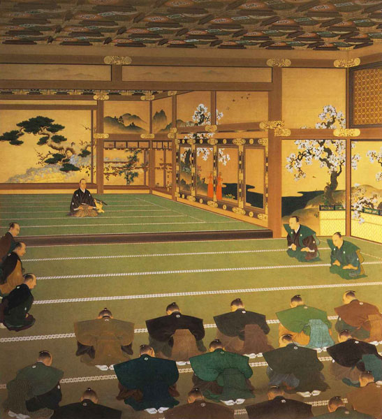
The fifth one is called Kuro-shoin (which means black library), where the shogun worked and met people in private. The famous picture of The Returning of the Power to the Emperor demonstrates the event in this room. The shogun (Yoshinobu Tokugawa) told the internal retainers about his decision in the picture.
The “Kuro-shoin” hallThe picture of the announcement of Returning the Power to the Emperor, owned by the Meiji Memorial Picture Gallery (licensed under Public Domain via Wikimedia Commons)
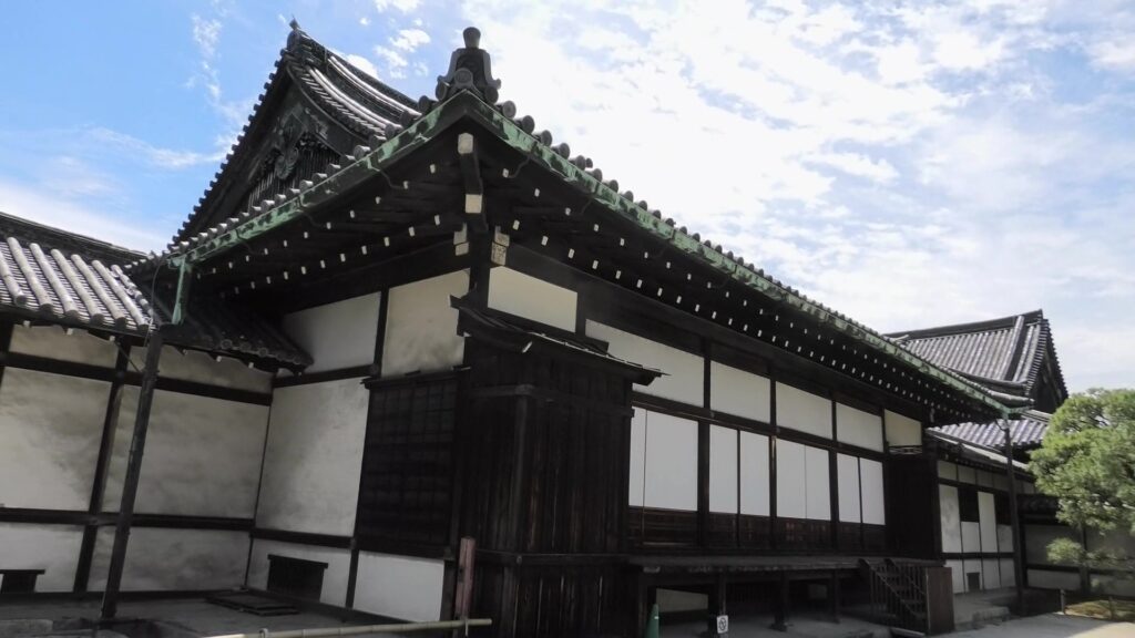
The last one is called Haku-shoin (which means white library). It was used as the shogun’s private room.
The “Haku-shoin” hall
Is the Main Enclosure a Castle-like Place?
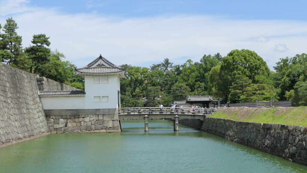
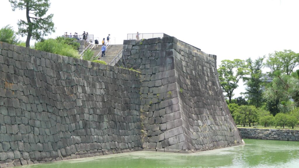
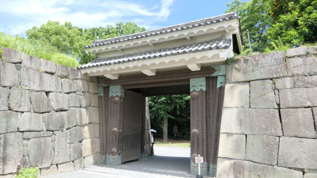
The main enclosure may be more likely a castle than the second enclosure. You can go there by crossing the bridge over the inner moat. The bridge used to have the second floor with roof overhead for the Kanei Royal Visit. The floor was demolished, but it is kept in a storage room, in case they want to restore in the future. If you go over the bridge, you will enter the remaining turret gate of the enclosure.
The bridge used to have the second floor with roof overhead
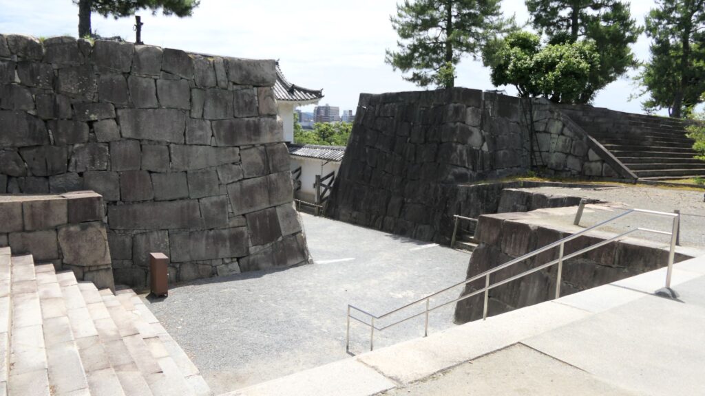
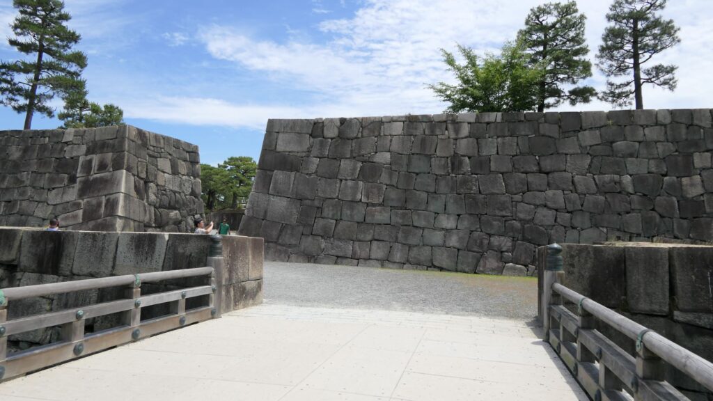
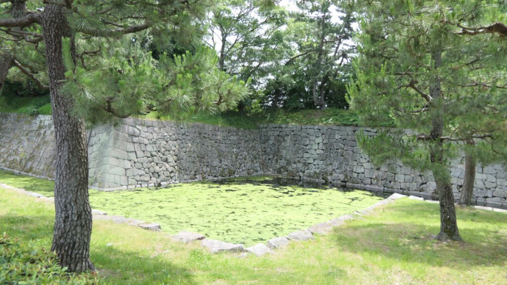
The inside of the gate is still surrounded by stone walls, which looks stronger than that of the second enclosure. The square inside the walls is one of the castle’s defense systems, called Masugata.
The Masugata system inside the gate
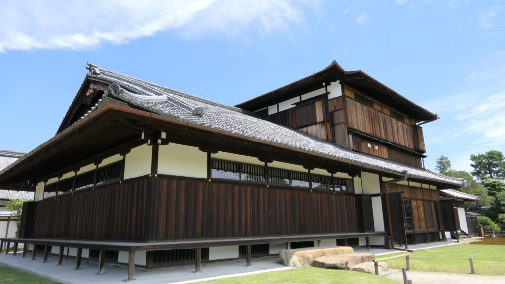
If you go to the center of the enclosure, the atmosphere around it will feel elegant. This is due to the place being developed as a garden for the former imperial villa. The remaining main hall of the enclosure is not the original of the castle but it came from the residence of the Katsura-no-miya imperial family in the Meiji Era. The emperor Taisho often stayed there when he was the prince.
The current main hall of the main enclosure
You can climb the main tower base, which had the real tower in the past. The emperor climbed the tower twice during the Kanei Royal Visit. The experts of the advisory panel for the site are now discussing how to restore the tower in the distant future.
The exterior of the main tower base
The tour course will eventually guide you to the exit of the enclosure through the western entrance which is the opposite side of the turret gate. This entrance also looks impenetrable with a square space even through it doesn’t have buildings there anymore.
The western entrance
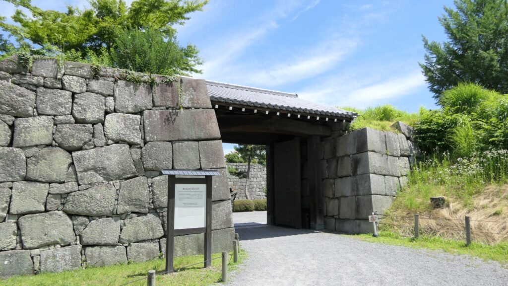
There are other defensive systems around the main enclosure. For example, the passage in front of the bridge and the gate, you first passed through, is separated by two gates, one in the north, one in the south.
The northern gate, called Naruko-monThe southern gate, called Momoyama-mon
In addition to the two gates mentioned above, there are two additional gates, which were built on the northern edge of the inner moat and on the southern edge of it. These gates were used to protect the castles from enemies’ attacks and to monitor regular visitors.
The northern partition gateThe southern partition gate
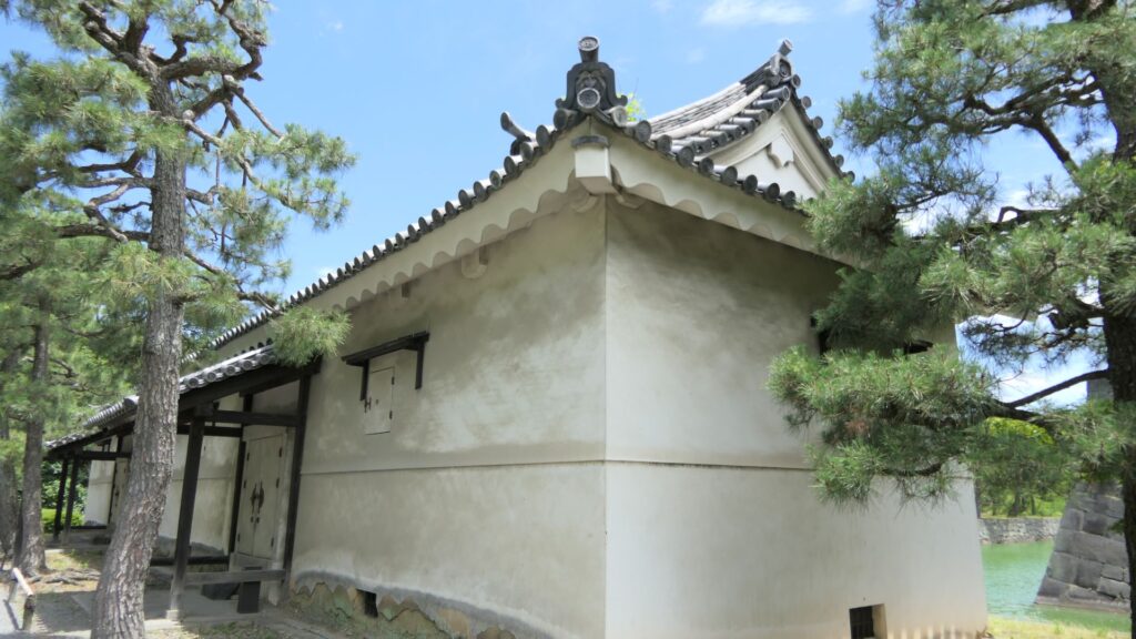
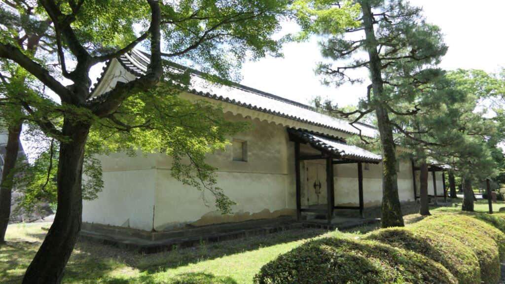
Furthermore, there are also two remaining storehouses on the western side of the enclosure. They were used to stock rice in preparation for a long siege. Three of the ten storehouses still remain in the castle today.
One of the remaining storehouses (in the northern side)Another remaining storehouse (in the southern side)
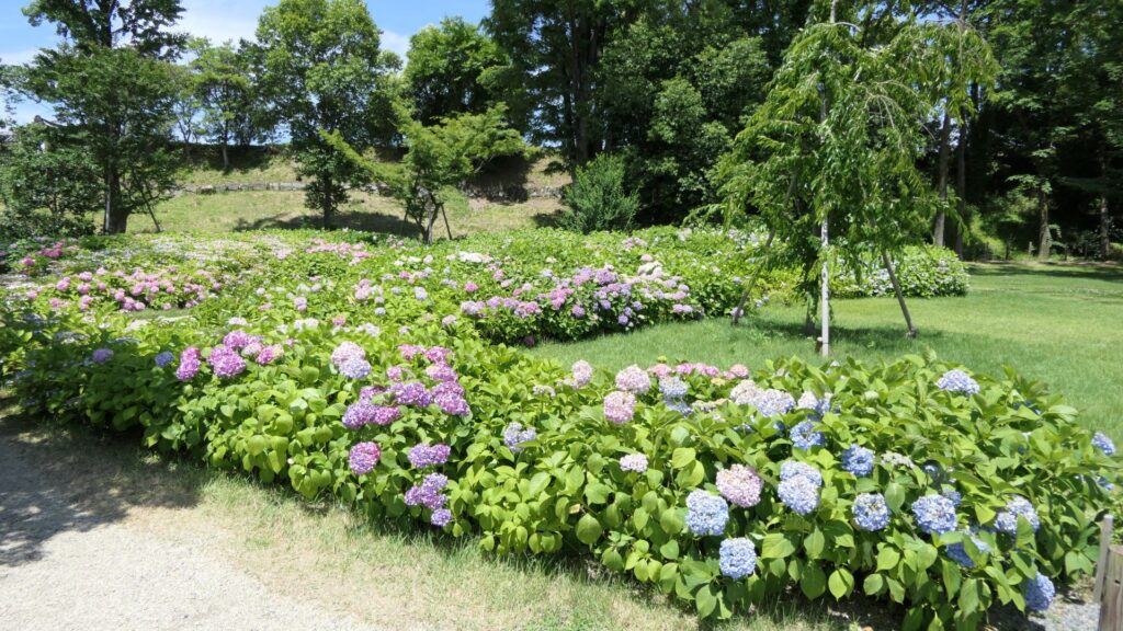
If you have time, I recommend you visit the southwestern side of the enclosure. You may enjoy seeing beautiful flowers such as plum blossoms in the spring, hydrangea flowers in the summer, etc.
Hydrangea flowers in the area
Let’s walk around Nijo Castle!
Many tourists may see only the inside of Nijo Castle. However, this article will guide you to other perspectives of the site. Let us walk around the perimeter of Nijo Castle, which is about 1.9 km long. Let’s start from the eastern side of it, where many tourists gather, finishing to the northern side.
The eastern side is always crowded with tourists
If you walk along the northern side, you will see the northern main gate, another highly sophisticated one, following the eastern main gate. It was probably used to communicate with the shogunate government office of Kyoto, which was located across the road. In fact, it is uncertain when it was built, that means it might be the oldest building in the castle.
The northern main gate
If you go further, the smaller square is attached the larger square by a protrusion shown in the picture below.
The protrusion between the small square and the large square
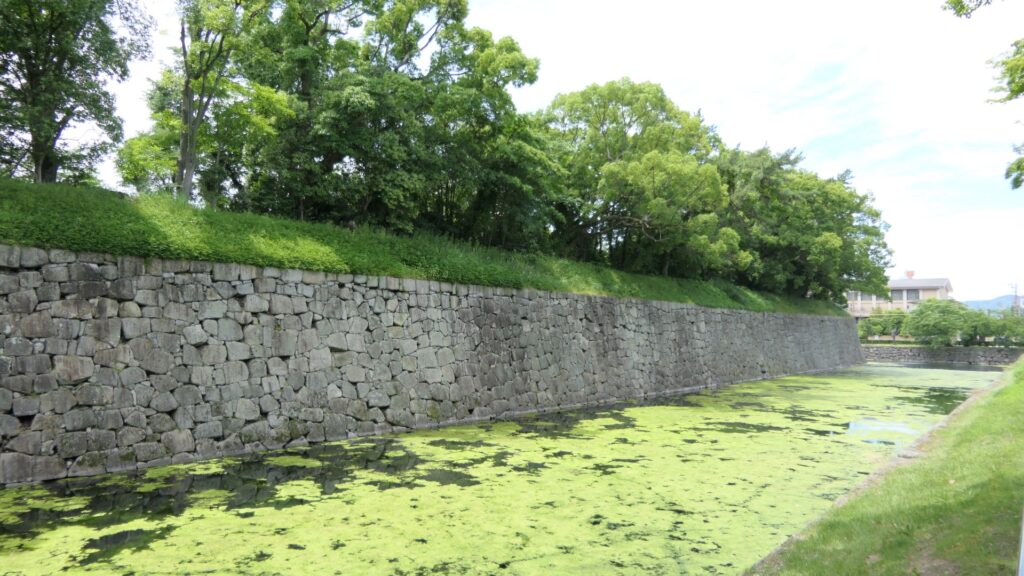
You can also walk on the special pathway, which was partially developed on this side, to see the stone walls and moats of the castle more closely.
The view from the pathway
If you go to the western side, you will see the ruins of the western gate. It was the side entrance of the castle, which people usually used, but you cannot use it now because there is no bridge over the moat. It looks smaller and more defensive than the other highly sophisticated gates of the castle. Unfortunately, you cannot get close to the gate ruins even from the inside When Yoshinobu Tokugawa, who was the last shogun, escaped from this castle, he used this same gate, not the front gate, in order to avoid confrontations.
The ruins of the west gate
You will eventually see the other remaining “southwestern corner turret” at the corner between the western and eastern sides. It has quiet environment, compared to the southeastern corner turret.
The southwestern corner turret
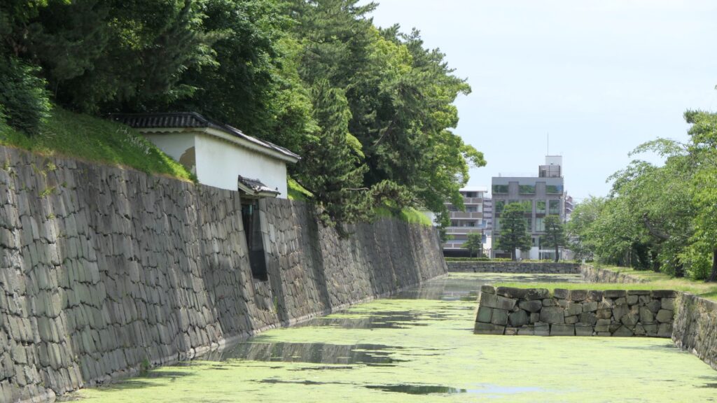
You will also see water flowing out from the moat of the eastern side. This water comes from a natural spring of this site. In fact, this site had been an ancient pond, called “Shinsenen”, before the castle was built. The current Shinsenen was downsized and is next to the castle. The castle benefits from nature of Kyoto.
The signpost of the old Shinsenen pondThe water of the moat flows out
Where are the Old Nijo Castle Sites?
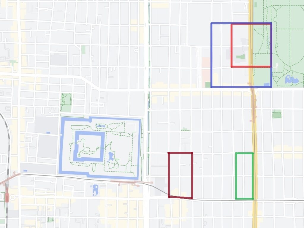
After walking around the current Nijo Castle, let us now go to the ruins of the old Nijo Castles. However, there are only a few of them remaining because they were all demolished. Basically, there is the only stone monument at each site.
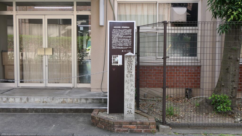
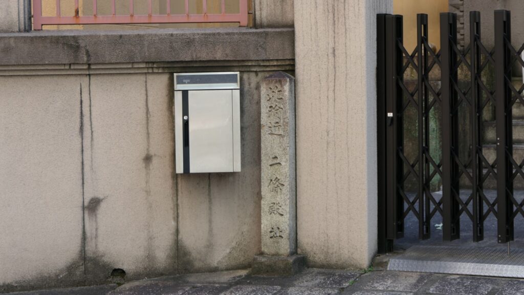
Yoshiteru’s Nijo Castle, marked by the red box, Yoshiaki’s Nijo Castle, marked by the blue box, Nobunaga’s Nijo Castle, marked by the green box, and Hideyoshi’s Myokenji Castle, marked by the brown box (Google Map)The monument of Yoshiteru’s Nijo CastleThe monument of Nobunaga’s Nijo Castle
Yoshiaki’s Nijo Castle Ruins have a few other things. Some of the stone walls were excavated when the subway constructions were done. They are now exhibited on three sites. One is near Sawaragi-guchi entrance of Kyoto Gyoen National Garden, and another is in the current Nijo Castle.
The stone walls, exhibited near Sawaragi-guchi entrance of Kyoto Gyoen National GardenThe stone walls, exhibited in the current Nijo Castle (licensed by Tomomarusan via Wikipedia Commons)
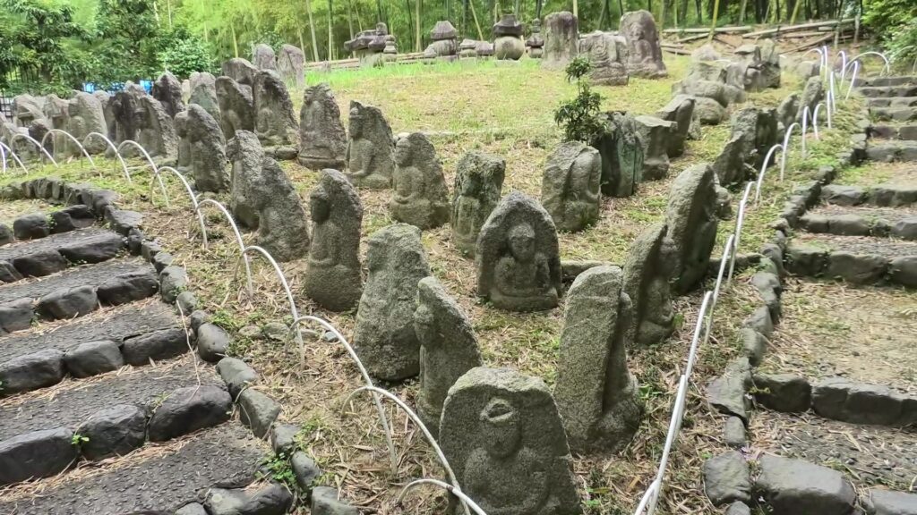
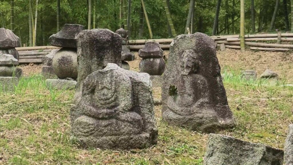
The other one is exhibited, about 10km away to the west of Nijo Castle, in Kyoto Bamboo Park. These stone walls have a distinct feature, which came from stone Buddha statues, collected by Nobunaga Oda.
The stone Buddha statues, which were used as the stone walls, are now exhibited in the Kyoto Bamboo Park
According to a Portugal missionary, Luis Frois, who was in Japan at that time, wrote that Nobunaga ordered his servants to carry these statues using ropes which made them look like prisoners. People in Kyoto were very afraid to see this because the people worshiped the Buddha statues. Some of the statues, which are exhibited in the park, were actually destroyed intentionally.
Some of the statues were actually destroyed intentionally
Even current Japanese people would be relieved to see that these statues survived despite the harsh treatment they were given.
My Impression
Looking at the histories of all the different Nijo Castles, there were some cases where the castles fell or their masters abandoned them. That may mean that Kyoto is easy to attack but difficult to protect. On the other hand, Kyoto must also have been an attractive place to stay for the masters. I think that the world was not built in a day and therefore, Nijo Castle was not built by one castle.
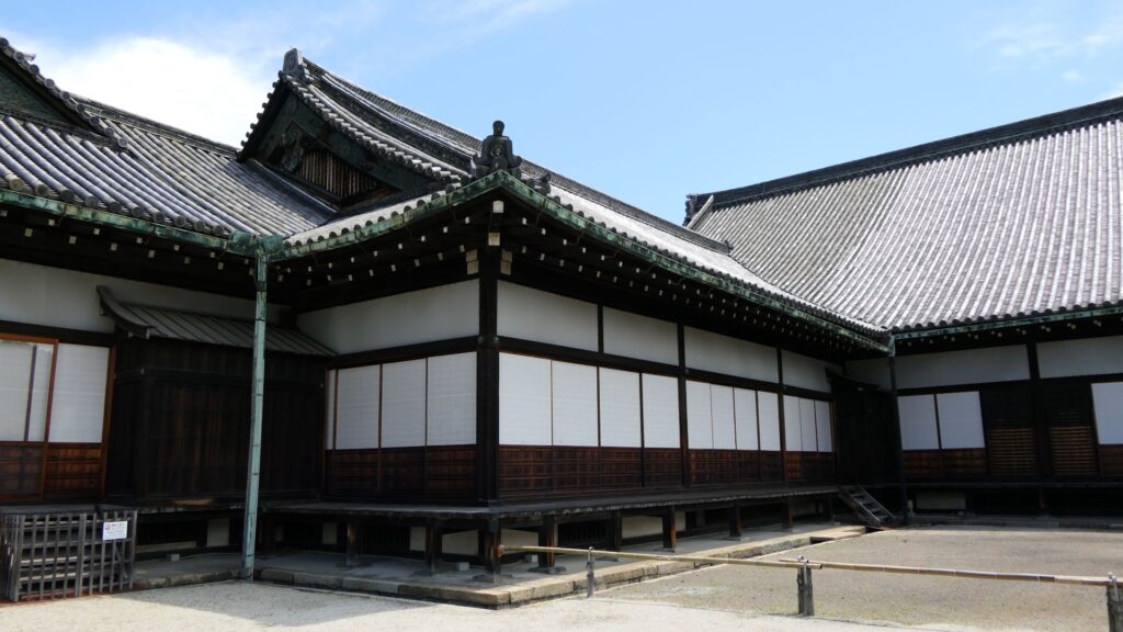
The garden of the second enclosure in the left and the Kuro-shoin hall in the right