萩市周辺の起伏地図、今でも旧城下町は低い位置にあります
4人の志士の誕生地または旧宅位置
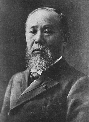
高杉晋作写真、1933年か1934年に出版 (licensed under Public Domain via Wikimedia Commons)木戸孝允(桂小五郎時代)、1869年 (licensed under Public Domain via Wikimedia Commons)吉田松陰肖像画、山口県文書館蔵 (licensed under Public Domain via Wikimedia Commons)伊藤博文写真、1909年以前 (licensed under Public Domain via Wikimedia Commons)
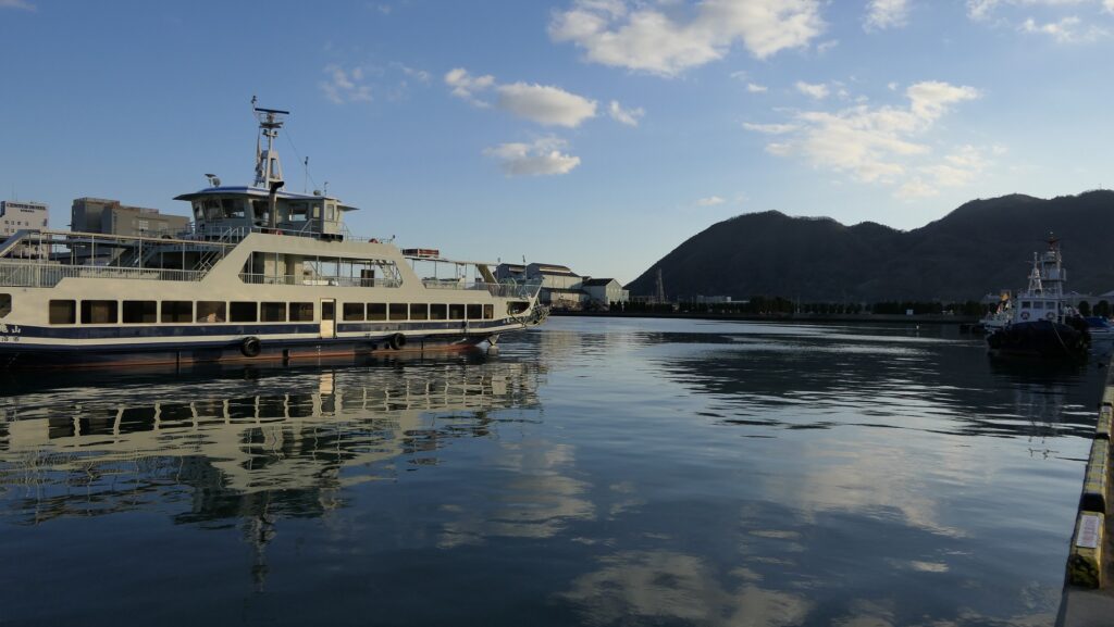
過去は海の城、今は駅の城
Sea castle in the past, Station castle in the present
立地と歴史~Location and History
毛利氏の海軍基地~Navy Base for Mori Clan
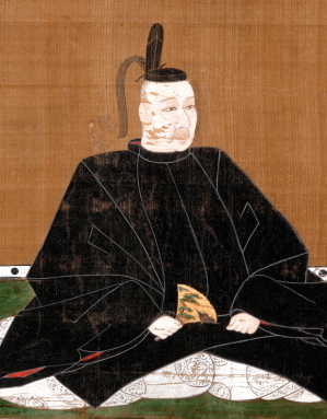
三原城は最初は、戦国時代の16世紀後半に中国地方を支配していた毛利氏の支族、小早川隆景が築きました。毛利氏は近畿地方の織田氏から侵略されていて、それを防ぐための大きな城で、海軍の基地としても使えるものを必要としていたのです。三原城はそのうちの一つで、沼田川の河口にあったデルタ地帯の島の上に築かれました。この地域は三原浦と呼ばれており、そのためその城も三原城と呼ばれました。このような立地は、後に毛利氏の本拠地となった広島城と似通っています。 Mihara Castle was first built by Takakage Kobayakawa, the head of a branch family of the Mori Clan which owned Chugoku Region in the late 16th Century during the Sengoku Period. The clan was being invaded by the Oda Clan in Kinki Region, so they thought they needed large castles to prevent invasions and to use as the bases for their navy. Mihara Castle was one of them and was built on the islands on the delta in the estuary of Nutagawa River. The area had been called Mihara Bay, so the castle has been called Mihara Castle. Such a location is similar to Hiroshima Castle which later became the home base of the Mori Clan.
小早川隆景肖像画、米山寺蔵~The portrait of Takakage Kobayakawa, owned by Beisanji Temple (licensed under Public Domain via Wikimedia Commons)
城の位置~The location of the castle
海の城~Sea Castle
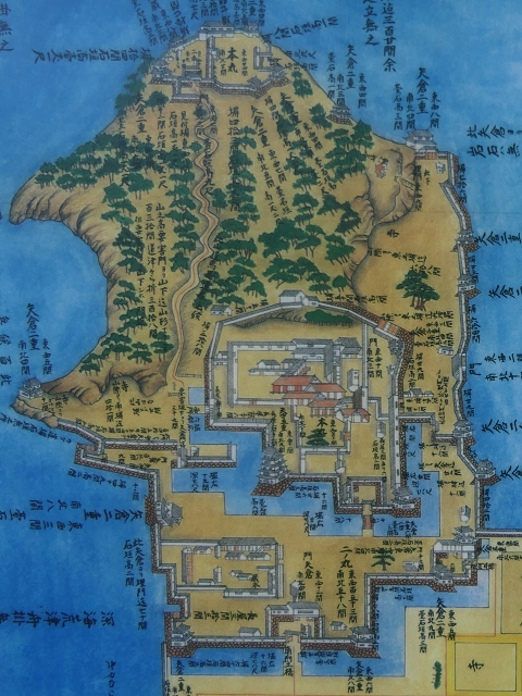
城の主要部分は、中央にある大きな三角形の島の上にあり、本丸と二の丸がありました。南側の三角形の底辺の部分は海に面しており、北側の三角形の頂点には天守台石垣がありました。しかし、天守は築かれずに、代わりに3基の二階櫓が台の上に築かれました。主要部は水堀と海によって周りの地区から完全に切り離されており、周りとは2つの橋がある門のみとつながっていました。更には、石垣に沿っていくつもの船着き場がありました。この城は、海の城とでもいえるものだったのです。 The main portion of the castle was on the large central triangular island which included the Main Enclosure and the Second Enclosure. The base of the triangle on the south faced the sea, and the top of the triangle on the north had the stone wall base for the Main Tower, but the tower was not built, instead, the three two-story turrets were built on the base. The main portion was completely separated from the area around by water moats and the sea, and just connected with two gates with bridges to surrounding area. In addition, several ports were built beside the stone walls. The castle could be called a sea castle.
備後国之内三原城所絵図~The illustration of Mihara Castle in Bingo Province (出展:国立公文書館)天守台石垣~The stone wall base for the Main Tower
福島氏、浅野氏が引き継ぐ~Fukushima, Asano Clans follow it
毛利氏の後は、福島正則が江戸時代の17世紀初頭にこの城を支配しました。彼は海に面して10基もの二階櫓を築き、城の防御力を強化しました。ところが、1619年に徳川幕府により改易になってしまいます。浅野氏が城を引き継ぎ江戸時代末まで統治しました。浅野氏は、広島城を本拠地としていて、三原城は支城とみなされていました。幕府は通常は大名に対して2つ以上の城を持つことを禁じていましたが、浅野氏は例外として三原城を維持することができたのでした。 After the Mori Clan, Masanori Fukushima governed the castle at the beginning of the 17th Century during the Edo Period. He built as many as ten two-story turrets facing the sea, which made the castle more defensive. However, he was fired by the Tokugawa Shogunate in 1619. The Aasano Clan took over the castle and governed it until the end of the Edo Period. The Asano Clan lived in Hiroshima Castle as their home base while Mihara Castle was regarded as their branch castle. The shogunate usually didn’t allow the lords to have a second castle, but the Asano Clan was able to have Mihara Castle as an exception.
福島正則肖像画、東京国立博物館蔵~The portrait of Masanori Fukushima, owned by the Tokyo National Museum (licensed under Public Domain via Wikimedia Commons)
特徴~Features
まるで駅の城~Just like Station Castle
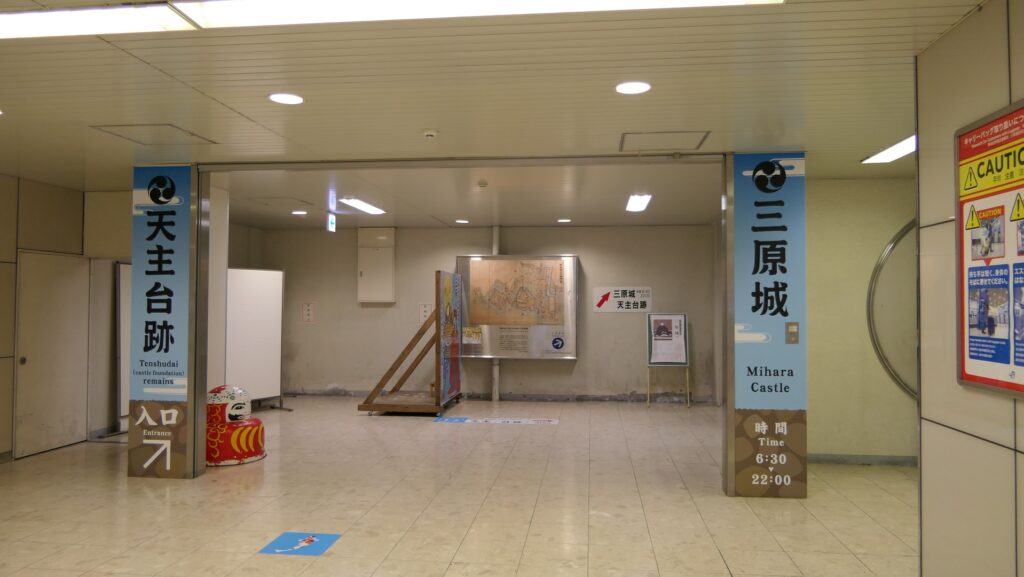
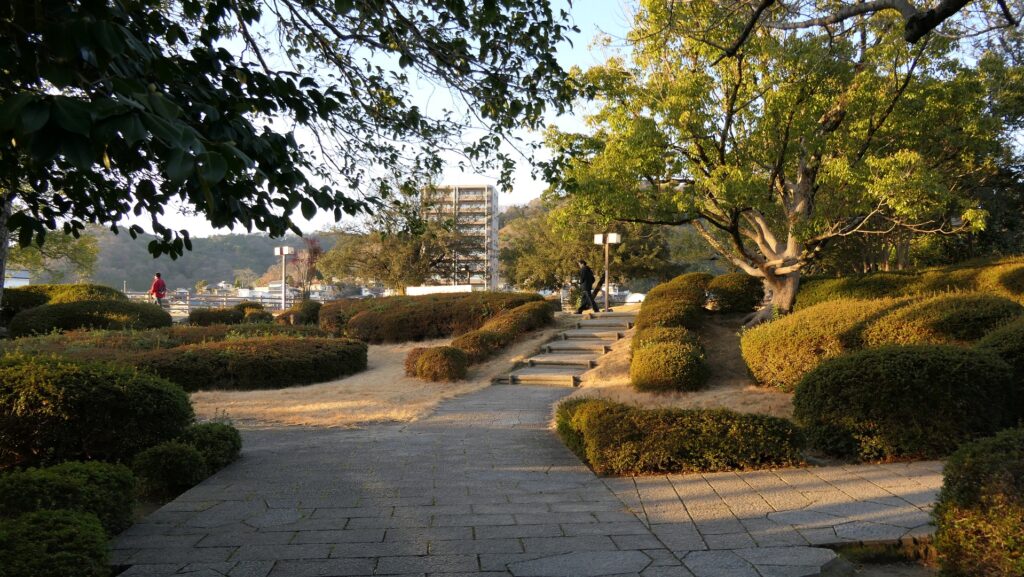
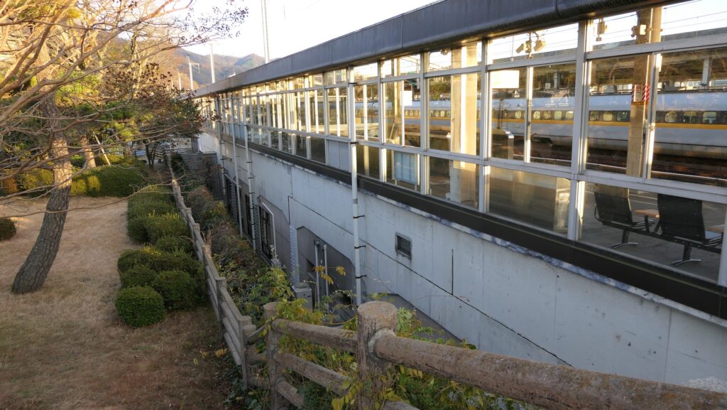
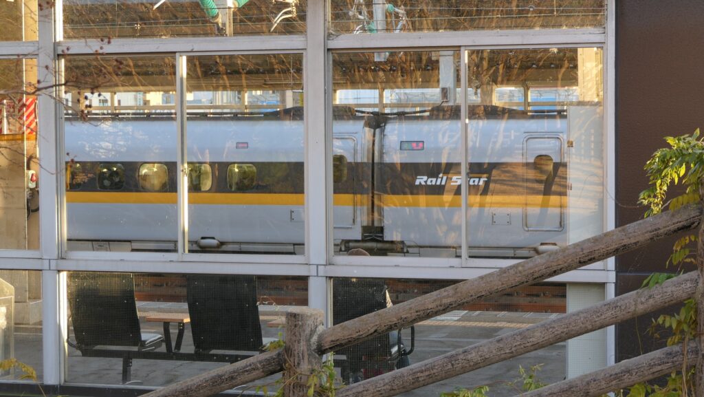
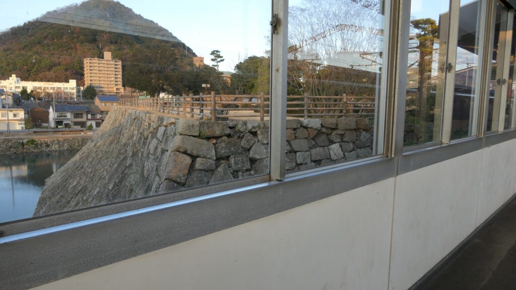
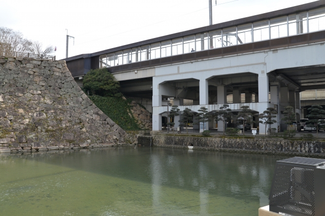
現在、三原城跡はJR三原駅と電車線に覆われているように見えます。実際、城跡の一部は専用通路により駅とつながっているのです。営業時間内であれば、誰でもこの通路を通ってそこに行くことができます。ここは天守台石垣の上で、城の主要部分ではもっとも北側に当たります。この区域は公園のように整備されていて、北側の方では、天守台を囲む水堀を眺めることができます。また、南側の方では山陽新幹線のホームをすぐ近くの同じ高さで見ることができます。ホームには新幹線の車両が頻繁に通り過ぎたり、止まったりしているのがよくわかります。大変ユニークであり、まるで駅の城とも言えるでしょう。 Now, the ruins of Mihara Castle look like being covered with JR Mihara Station and the JR Railway. In fact, part of the ruins is connected to the station by an exclusive path. Anyone can visit this part of the castle through the path during the opening hours. This is the top of the stone wall base for the Main Tower, which was the northmost part of the main portion of the castle. The area has been developed like a park where you can see a view of the water moat surrounding the base on the north. You can also see the platform for the Sanyo Shinkansen Super Express close by at the same level on the south. You can enjoy seeing the super express trains often passing by or stopping at the platform. It is very unique, and it could be called a station castle.
駅の中から天守台へ~From the inside the station to the base for the Main Tower天守台への階段~The stairways to the base for the Main Tower天守台入口~The entrance of the base天守台の上~The top of the base天守台から北側の眺め~A view from the base on the north天守台から南側の眺め~A view from the base on the south天守台はホームのすぐ近くです~The base is very close to the platform天守台から見た新幹線車両~A view of the trains for Shinkansen from the baseホームから見た天守台~A view of the base from the platform
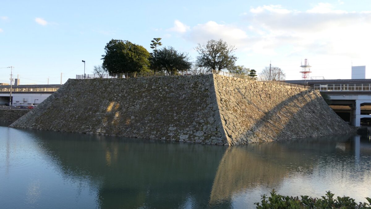
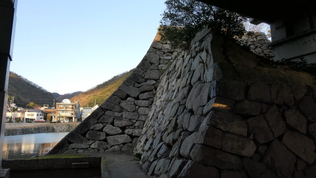
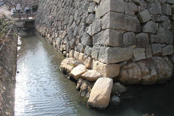
巨大な天守台~Huge base for Main Tower
また、駅の外で堀の周りを歩きながら天守台石垣を見上げることもできます。この天守台は、日本で最も大きなものの一つで、将軍の江戸城のものと同じくらいの大きさです。但し、天守の代わりに3基の二階櫓が立っていました。この天守台のもう一つの珍しい点は、違う時代の石材によりできていることです。西側の石は小早川時代のもので、東側は福島時代のものです。小早川の石は古い方式により積まれており、福島の方は新しい方式のよるとのことです。 You can also walk around the moat looking up at the stone walls for the base outside the station. This base for the Main Tower is one of the largest ones in Japan which has similar size to the Shogun’s Edo Castle. However, there were three two-story turrets on it instead of a Main Tower. Another unique point is that it has stones from different periods. The stones on the western side come from Kobayakawa’s period, and those on the eastern side come from Fukushima’s. Kobayakawa’s stone walls were built using an older method, whereas Fukushima’s method is newer.
駅の外から見た天守台~A view of the base from the outside of the station小早川時代に作られた部分~The part which was built in Kobayakawa’s period福島時代に作られた部分~The part which was built in Fukushima’s period
城跡の他の部分~Other parts of Ruins
城周辺の航空写真~The aerial photo around the castle
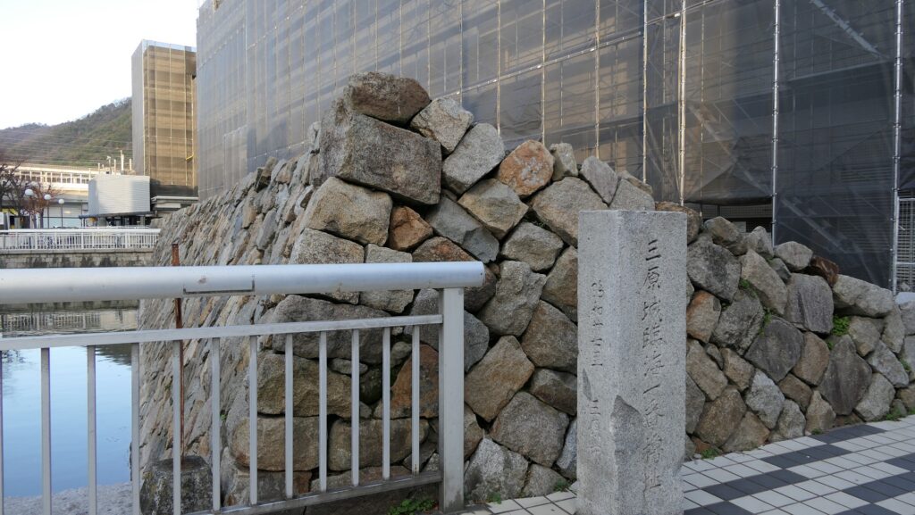
城跡としては他にはあまり残っていませんが、駅から三原港の方に歩いて行くと、現存している石垣を見ることができます。その上には現代の建物が建っています。ここは、城の主要部分の西端に当たります。石垣の中ほどには、2つの入口の一つであった中門跡があります。石垣の南端部分は、臨海一番櫓跡です。かつてこの櫓は海に面していました。ここから三原港までは海だったわけです。 Other ruins of the castle remain few, but if you walk down from the station to Mihara Port, you can see the remaining stone walls on which modern buildings stand. They were the western border of the main portion of the castle. On the middle of the stone walls, there are the ruins of Naka-mon Gate which was one of the two entrances to the portion. The southmost part of the stone walls are the ruins of Rinkai-Ichiban-Yagura Turret or the First Seaside Turret. The turret faced the sea in the past. The area from the ruins to Mihara Port was once the sea.
中門跡~The ruins of Naka-mon Gate臨海一番櫓跡~The ruins of the First Seaside Turret三原港~Mihara Port
主要部分の東側の城跡は、城町公園として残っています。この公園には船入櫓という櫓の跡があります。ここの石垣は岩礁の上に乗っていて、かつては海岸だったことがわかります。 The ruins of the eastern part of the main portion remain as Shiromachi Park. The park has the ruins of another turret called Funairi-Yagura Turret or the Port Turret. Their remaining stone walls are on a shore reef where it was once seaside.
船入櫓跡の石垣~The stone walls of the ruins of the Port Turret (三原市Websiteより引用)
その後~Later History
明治維新後、三原城は廃城となり、全ての建物は売られるか撤去されました。1894年、鉄道の三原駅と山陽本線が作られたとき、天守台石垣のすぐ南の本丸の用地がその建設のために供されたのです。本丸のほとんどの石垣は、他の港の資材として運ばれ、ほとんどの水堀はその工事中に埋められてしまいました。城跡は、1957年に国の史跡に指定されました。1975年、山陽新幹線が作られたとき、高架橋が城跡を壊さないよう、その上を覆って設置されました。 After the Meiji Restoration, Mihara Castle was abandoned, and all of its buildings were sold or demolished. In 1894, when Mihara Railway Station and Sanyo Railway Line were built, the ground for the Main Enclosure, just to the south of the stone wall base, was used for the construction of the train line and the station. Most of the enclosure’s stone walls were carried to another port as materials, and most of the water moats were filled during the construction. The ruins have been designated as a National Historic Site since 1957. In 1975, when the Sanyo Super Express Line was built, the overhead railway was placed across the ruins so as not to harm them. This is what we see there now.
石垣に被さっているような高架線~The overhead railway like covering the stone walls (taken by マンハッタン from photo AC)
私の感想~My Impression
三原城を最初に見た印象は人によってちがうかもしれません。城跡が現代の建物によりほとんど壊されていると思うかもしれませんし、城跡と駅の組み合わせが面白いと思うかもしれません。私は、ここを訪れる前は前者だったのですが、訪れた後は後者に近い印象です。また、一方で行政側に対しては、視覚に訴える掲示やVR技術を使ったりして、もっと三原城はどのような姿をしていたのか知らせるべきと思います。 The first impression of Mihara Castle may be different for each person. One might think the ruins were mostly destroyed by modern buildings, or others might think the combination of the ruins and the station looks interesting. I believed the former before I visited the ruins; my impression is now similar to the latter after visiting them. I also feel that officials should let people know what Mihara Castle looked like using visual image boards as well as VR technology.
天守台石垣~The stone wall base for the Main Tower
ここに行くには~How to get There
三原城跡は、三原駅のすぐ北隣です。 The ruins of Mihara Castle neighbors Mihara Station to the south.
リンク、参考情報~Links and References
・三原城跡、三原市(Mihara City Official Website) ・よみがえる日本の城7、学研(Japanese Book) ・「日本の城改訂版第42号」デアゴスティーニジャパン(Japanese Book)
広島は平和都市ですが、城からできた都市でもあるのです。
Hiroshima is a city of peace, but also a city from the castle.
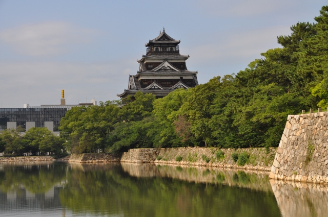
広島城の外観復元天守~The apparently restored Tenshu keep of Hiroshima Castle(licensed by Taisyo via Wikimedeia Commons)
立地と歴史~Location and History
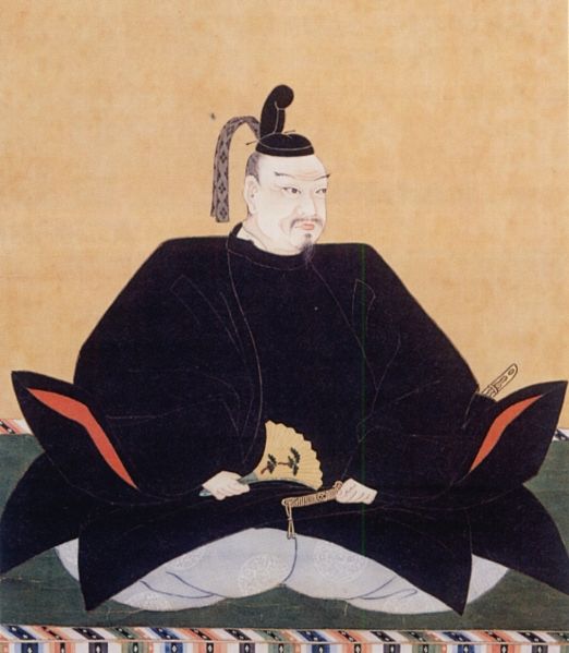
広島は今、平和を希求する都市となっています。この都市は毛利氏により築かれた広島城から始まりました。毛利氏もともと吉田郡山城という広大な山城に住んでいましたが、その城は戦国時代において防御力に優れていました。しかし統治や通商には不向きだったのです。豊臣氏による天下統一の後、毛利輝元は当時の他の事例にならい、本拠地を他の地に移すことにしました。彼は1589年に太田川のデルタ地帯にある島の上に新しい城を築きはじめました。この城と城下町は南方の海の方角に向かって広がっていきました。
Hiroshima is now a city for promoting peace. The city comes from Hiroshima Castle built by the Mori clan. The clan originally lived in a large mountain castle called Yoshida-Koriyama which was specialized for defense in the Warring States Period. But it was not convenient for governance and business. After the unification of the whole country by the Toyotomi clan, Terumoto Mori decided to move his home base to another place by emulating other cases at that time. He started to build a new castle on an island on the delta of Otagawa River in 1589. The area of the castle and its town spread towards the sea in the south.
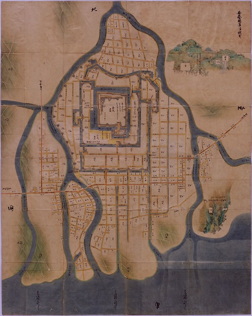
毛利輝元肖像画、毛利博物館蔵~The portrait of Terumoto Mori, owned by the Mori Museum(licensed under Public Domain via Wikimedia Commons)安芸国広島城所絵図、江戸時代~The illustration of Hiroshima Castle in Aki Province, in the Edo Period(出典:国立公文書館)
徳川幕府が設立されてから後に、福島氏が城を完成させたと言われています。城には5層の天守の他、88もの櫓がありました。主要な曲輪は水堀により区切られて、橋でのみつながっていました。また、他の川や堀によっても囲まれていました。代わりにこのような環境下では、洪水から被害を受けやすくなります。福島は洪水の度に城を補修せざるを得ませんでした。しかながら、頻繁な工事は幕府に福島が反乱を起こすのではないかと疑念を生じさせ、福島は1619年に改易となってしまいます。
After the Tokugawa Shogunate was established, it is said that the Fukushima clan completed the castle. It had a five layer Tenshu keep and 88 turrets. Primary enclosures were separated by water moats, connected by only bridges. They were also surrounded by many other rivers and moats. Instead, in such conditions, it could suffer from flooding. Fukushima had to repair the castle constantly after floods. However, frequent constructions made the Shogunate doubt Fukushima might be against the Shogunate. Fukushima was fired in 1619.
広島城の城主だった福島正則肖像画、東京国立博物館蔵~The portrait of Masanori Fukushima, the lord of Hiroshima Castle, owned by the Tokyo National Museum(licensed under Public Domain via Wikimedia Commons)
その後、浅野氏が広島を250年以上統治しました。浅野氏は城をほとんど同じ状態で維持しましたが、市街地や農地を埋め立てにより拡張しました。埋め立て地は、広島市の礎になっています。
After that, the Asano clan governed Hiroshima for 250 years. They had kept the castle almost the same as original. They continued to reclaim land for towns and fields. The reclaimed area is the foundation of Hiroshima City.
広島市周辺の現代の地図~The present map around Hiroshima City
特徴~Features
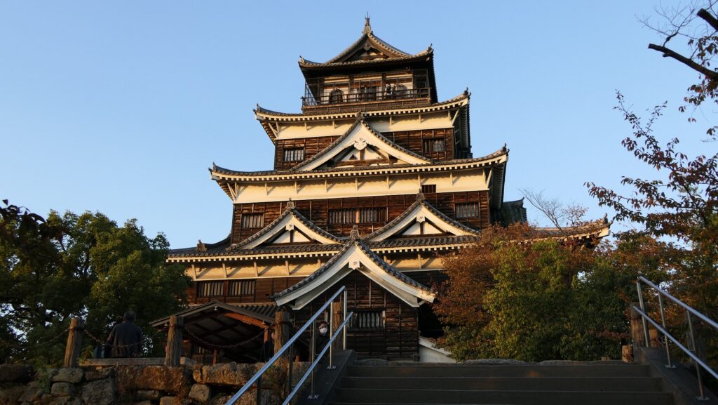
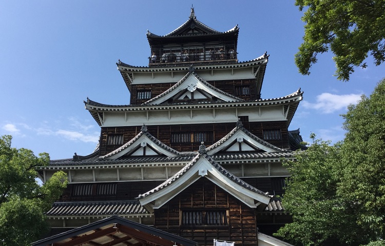
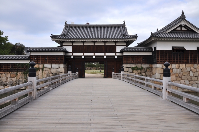
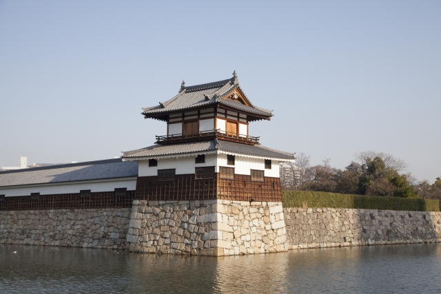
現在、主に本丸と二の丸の跡地が内堀に囲まれて残っています。そこには現存建物はありません。天守は本丸の北西隅に外観復元されています。その内部は歴史博物館として使われていて、広島市や広島城の歴史を学ぶことができます。二の丸は外部から本丸に向かう途中に、出丸のようになっていて、周りの内堀により独立しています。とても独特なスタイルです。 Now, ruins of mainly Honmaru and Ninomaru enclosures surrounded by the inner moat remain. No remaining buildings are there. The Tenshu has been apparently restored at the north-west corner of Honmaru. Its interior is used as a historical museum where you can learn about the history of the city and castle. Ninomaru is like a barbican on the way from outside to Honmaru, isolated by the inner moat around. It’s a very unique style.
城周辺の航空写真~The aerial photo around the castle 外観復元天守~The apparently restored Tenshu(taken by NR1000 from photoAC)
二の丸では、表御門や太鼓櫓といったいくつかの建物が最近になって元来の工法で復元されています。 Several buildings like the Front Gate and the Drum Turret were recently restored in the original way at Ninomaru.
復元された二の丸の表御門~The restored Front Gate at Ninomaru(taken by NR1000 from photoAC)復元された二の丸の太鼓櫓~The restored Drum Turret at Ninomaru(taken by acworks from photoAC)
その後~Later Life
この城の近代の歴史はより過酷だったかもしれません。明治維新後、城跡は日本陸軍の広島鎮台の用地に転用されました。多くの城の建物は軍施設に置き換わりました。特に、1894年の日清戦争時には大本営が移ってきました。明治天皇が東京からここに来て、直接軍隊を指揮したのです。近くの宇品には大きな軍港もあり、広島は第二次世界大戦までは軍都として繁栄したのでした。
The modern history of the castle might be stormier. After the Meiji Restoration, the ruins of the castle were turned into the ground for Hiroshima Chindai of the Japanese Army. Many castle buildings were replaced with military facilities. In particular, the Imperial Headquarters was relocated there during the Sino-Japanese War in 1894. Emperor Meiji moved there from Tokyo to order his soldiers. There was a large navy port called Ujina nearby, and Hiroshima had been a military-based city until World War II.
右側が広島大本営の建物~The building of the Imperial Headquaters on the right(licensed under Public Domain via Wikimedia Commons)
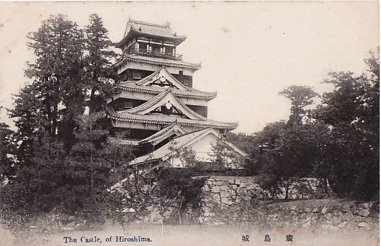
1945年8月、広島の人たちはなぜ大きな空襲がここにはないのか訝しんでいました。それは、広島が原子爆弾の標的の一つだったからでした。8月6日の朝、8時15分、原爆は非戦闘員、婦女子を含む約15万人もの人たちを殺し、市街地のすべての建物を破壊しました。現存していた広島城の天守は、原爆の爆風により一瞬のうちに倒壊し、それから燃え出しました。 In August 1945, people in Hiroshima were wondering why they didn’t suffer from large air raids. That was because the city was one of the targets of the atomic bombs. At 8:15 AM on August 6, the bomb killed around 150,000 people including non-combatants, women and children as well as all of the buildings in the city area. The remaining Tenshu keep of Hirosima Castle collapsed in an instant by the bomb blast before burning out.
第二次世界大戦まで現存した天守~The remaining Tenshu until World War II(licensed under Public Domain via Wikimedia Commons)
戦争直後の城周辺の航空写真~A aerial photo of around the castle just after the World War II
戦後になって、人々は焼土となった城跡をどう扱うべきか議論を行いました。1951年の広島国体の間のみ仮の天守が作られました。そのとき人々は広島の平和と復興のシンボルとして天守が必要だと気付いたのです。そのため、現在の天守が1958年に外観復元されました。
After the war, people discussed how they should treat the burned ruins of the castle. When the temporary Tenshu was built in 1951 just during a National Sports Festival in Hiroshima, they realized that they need to rebuild the Tenshu as a symbol of peace and restoration for the city. That’s why the present Tenshu was apparently restored in 1958.
復元された天守~The restored Tenshu
私の感想~My Impression
広島城は、城の存在意義が戦争から平和のためにと変わっていった典型例でしょう。日本のプロ野球球団、広島東洋カープの「カープ」という名前は、この城の愛称「鯉城」から来ています。この城が末永く平和と繁栄のシンボルであり続けるよう願ってやみません。
Hiroshima Castle is a typical example of a castle’s role being turned from war into peace. Hiroshima Toyo Carp is a Japanese pro baseball team. The name “Carp” comes from the castle’s nickname, the Carp Castle “Ri-Jo”. I hope that the castle will be a symbol of peace and prosperity now and forever.
広島城の堀にいる鯉~Carps in the water moat of Hiroshima Castle(taken by tomo3368 from photoAC)
ここに行くには~How to get There
広島駅から:徒歩で約25分かかります。市内電車の場合1・2・6番電車に乗り、紙屋町東停留所で降りてください。バスの場合は広島駅南口バスターミナルで7・8・9番乗り場から乗り、合同庁舎前バス停で降りてください。 車で行く場合:山陽自動車道の広島ICから約10分かかります。城の周りにいくつか駐車場があります。 From Hiroshima station: It takes about 25 minutes on foot. Or take the tram line 1, 2, or 6, and take off at the Kamiyacho-Higashi stop. Or take the bus line 7, 8, or 9 at Hiroshima Station south exit bus terminal, and take off at the Godochosha-Mae bus stop. If you want to go there by car: It takes about 20 minutes from the Hiroshima IC on San-yo Expressway. There are several parking lots around the castle.