過去は海の城、今は駅の城
Sea castle in the past, Station castle in the present
立地と歴史~Location and History
毛利氏の海軍基地~Navy Base for Mori Clan
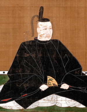
三原城は最初は、戦国時代の16世紀後半に中国地方を支配していた毛利氏の支族、小早川隆景が築きました。毛利氏は近畿地方の織田氏から侵略されていて、それを防ぐための大きな城で、海軍の基地としても使えるものを必要としていたのです。三原城はそのうちの一つで、沼田川の河口にあったデルタ地帯の島の上に築かれました。この地域は三原浦と呼ばれており、そのためその城も三原城と呼ばれました。このような立地は、後に毛利氏の本拠地となった広島城と似通っています。 Mihara Castle was first built by Takakage Kobayakawa, the head of a branch family of the Mori Clan which owned Chugoku Region in the late 16th Century during the Sengoku Period. The clan was being invaded by the Oda Clan in Kinki Region, so they thought they needed large castles to prevent invasions and to use as the bases for their navy. Mihara Castle was one of them and was built on the islands on the delta in the estuary of Nutagawa River. The area had been called Mihara Bay, so the castle has been called Mihara Castle. Such a location is similar to Hiroshima Castle which later became the home base of the Mori Clan.
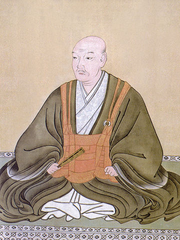
小早川隆景肖像画、米山寺蔵~The portrait of Takakage Kobayakawa, owned by Beisanji Temple (licensed under Public Domain via Wikimedia Commons)
城の位置~The location of the castle
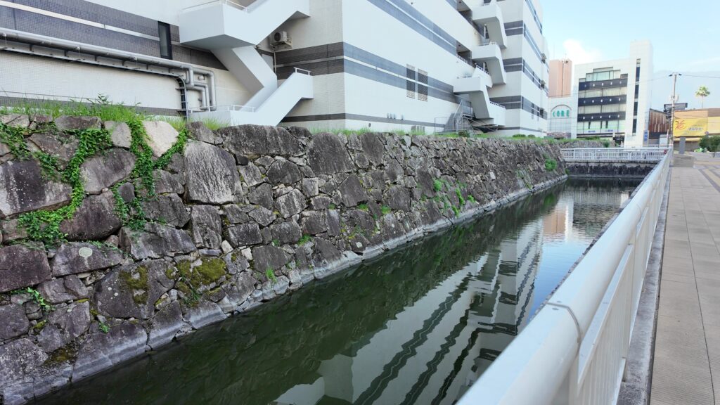
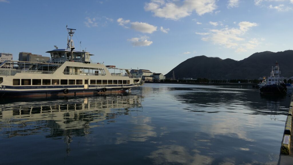
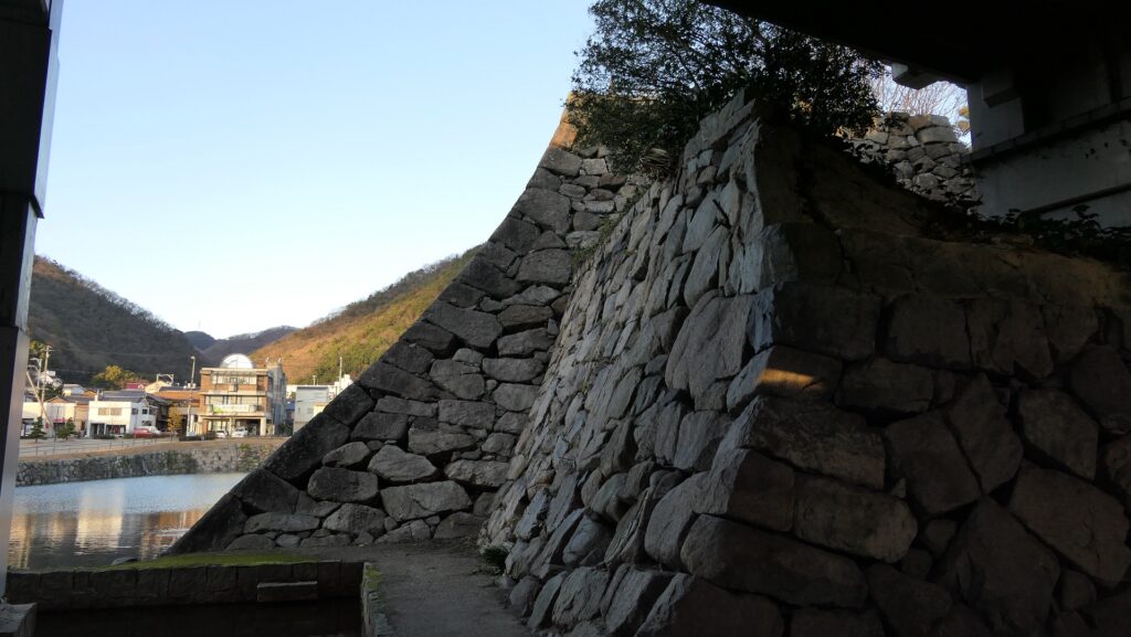
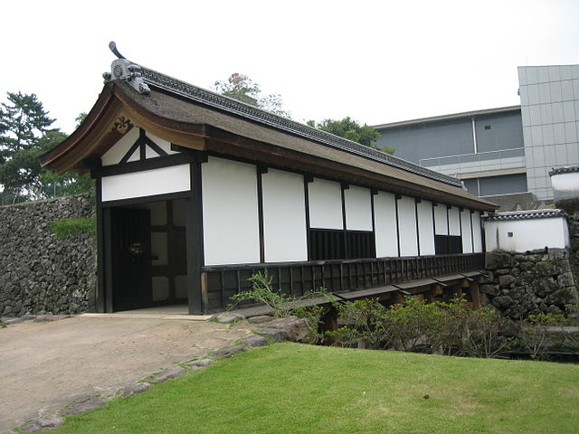
海の城~Sea Castle
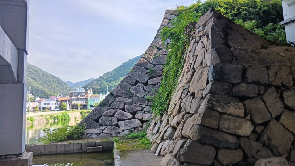
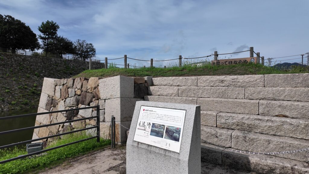
城の主要部分は、中央にある大きな三角形の島の上にあり、本丸と二の丸がありました。南側の三角形の底辺の部分は海に面しており、北側の三角形の頂点には天守台石垣がありました。しかし、天守は築かれずに、代わりに3基の二階櫓が台の上に築かれました。主要部は水堀と海によって周りの地区から完全に切り離されており、周りとは2つの橋がある門のみとつながっていました。更には、石垣に沿っていくつもの船着き場がありました。この城は、海の城とでもいえるものだったのです。 The main portion of the castle was on the large central triangular island which included the Main Enclosure and the Second Enclosure. The base of the triangle on the south faced the sea, and the top of the triangle on the north had the stone wall base for the Main Tower, but the tower was not built, instead, the three two-story turrets were built on the base. The main portion was completely separated from the area around by water moats and the sea, and just connected with two gates with bridges to surrounding area. In addition, several ports were built beside the stone walls. The castle could be called a sea castle.
備後国之内三原城所絵図~The illustration of Mihara Castle in Bingo Province (出展:国立公文書館)天守台石垣~The stone wall base for the Main Tower
福島氏、浅野氏が引き継ぐ~Fukushima, Asano Clans follow it
毛利氏の後は、福島正則が江戸時代の17世紀初頭にこの城を支配しました。彼は海に面して10基もの二階櫓を築き、城の防御力を強化しました。ところが、1619年に徳川幕府により改易になってしまいます。浅野氏が城を引き継ぎ江戸時代末まで統治しました。浅野氏は、広島城を本拠地としていて、三原城は支城とみなされていました。幕府は通常は大名に対して2つ以上の城を持つことを禁じていましたが、浅野氏は例外として三原城を維持することができたのでした。 After the Mori Clan, Masanori Fukushima governed the castle at the beginning of the 17th Century during the Edo Period. He built as many as ten two-story turrets facing the sea, which made the castle more defensive. However, he was fired by the Tokugawa Shogunate in 1619. The Aasano Clan took over the castle and governed it until the end of the Edo Period. The Asano Clan lived in Hiroshima Castle as their home base while Mihara Castle was regarded as their branch castle. The shogunate usually didn’t allow the lords to have a second castle, but the Asano Clan was able to have Mihara Castle as an exception.
福島正則肖像画、東京国立博物館蔵~The portrait of Masanori Fukushima, owned by the Tokyo National Museum (licensed under Public Domain via Wikimedia Commons)
特徴~Features
まるで駅の城~Just like Station Castle
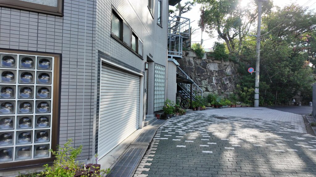
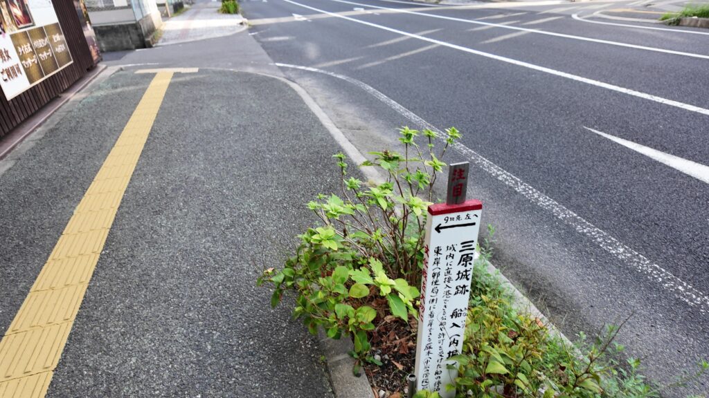
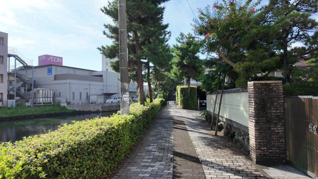
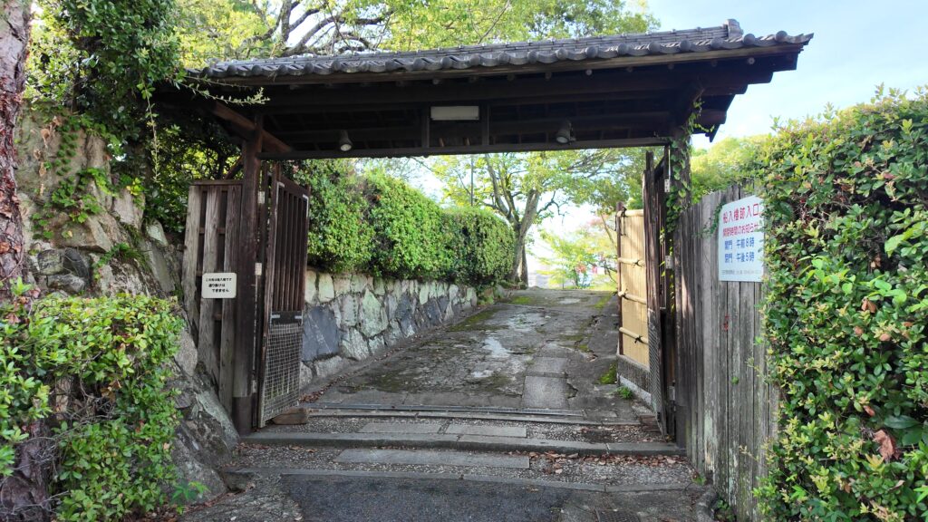
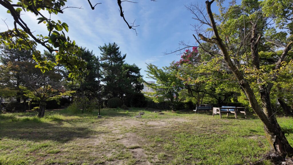
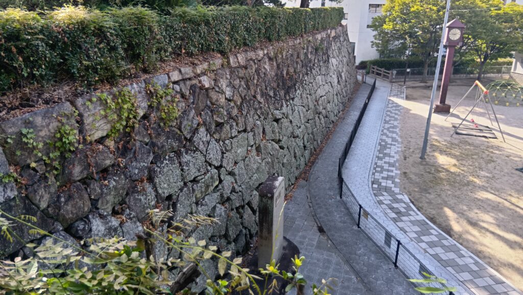
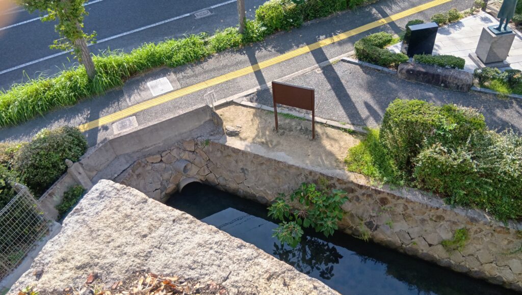
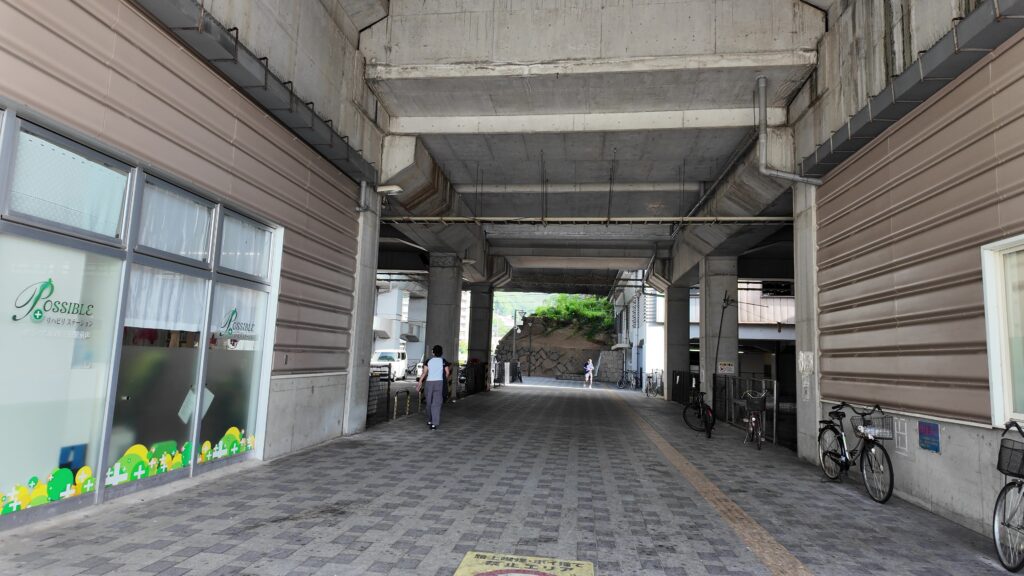
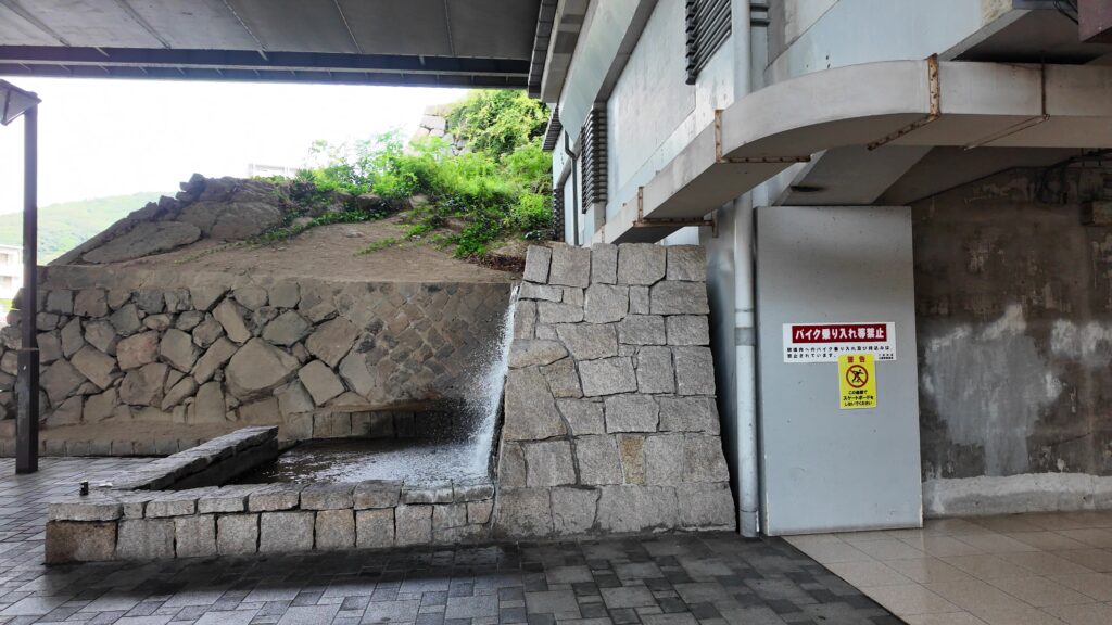
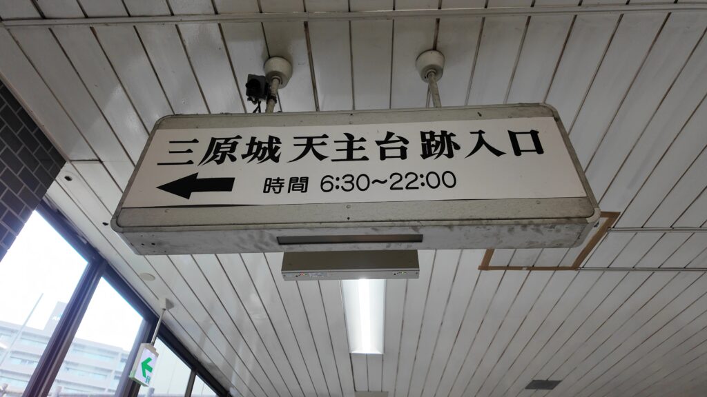
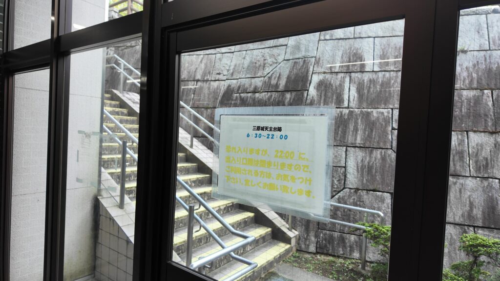
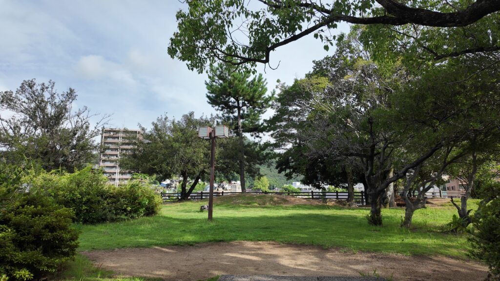
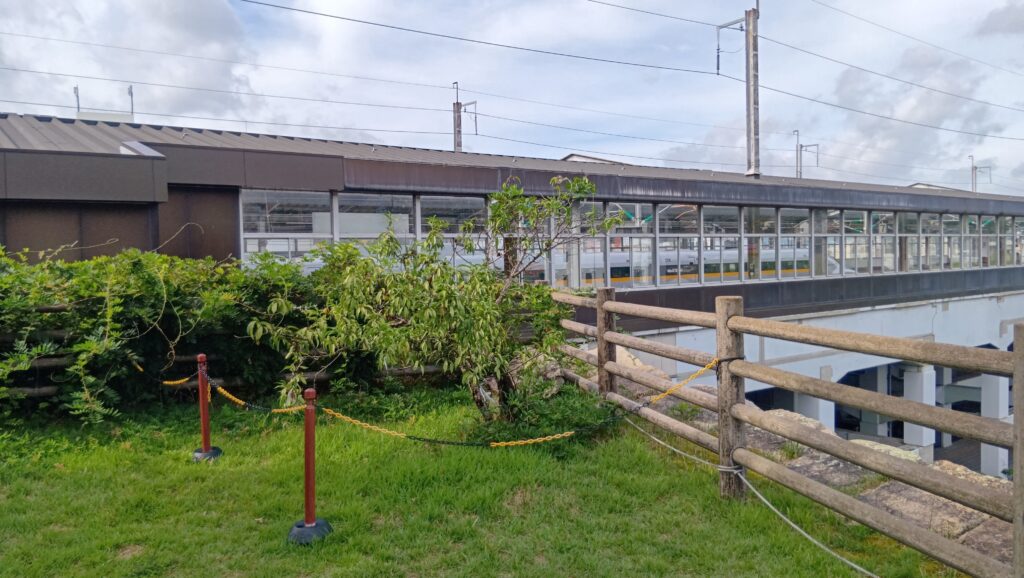
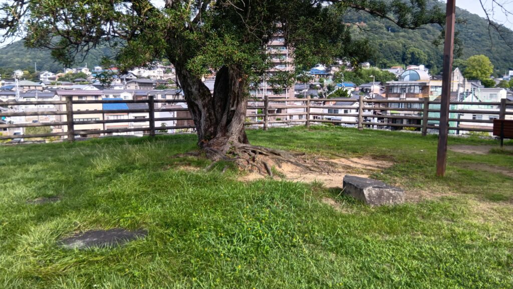
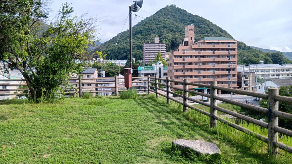
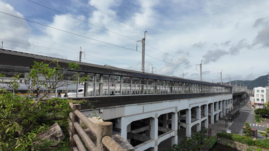
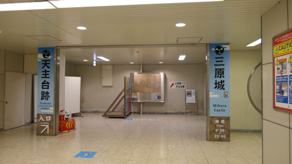
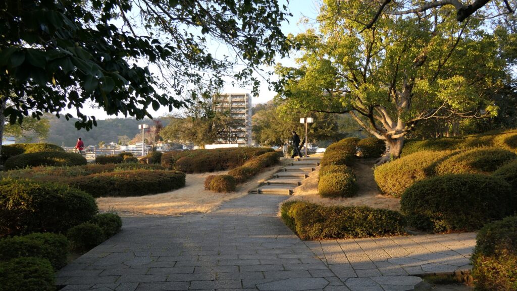
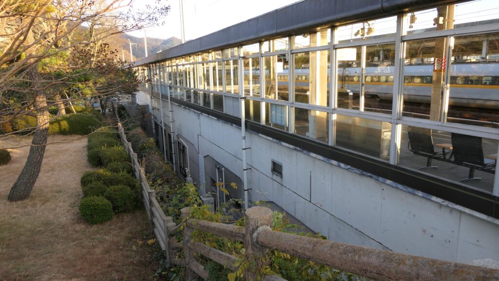
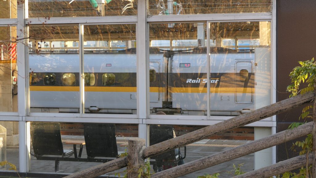
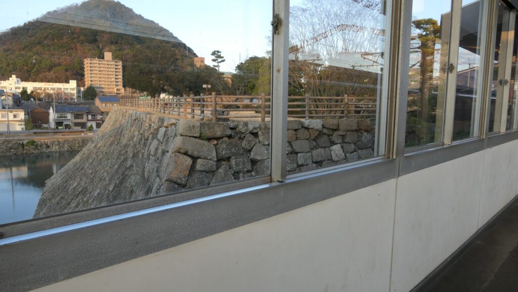
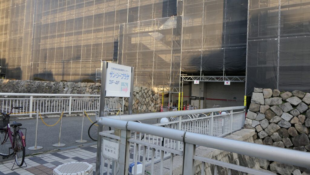
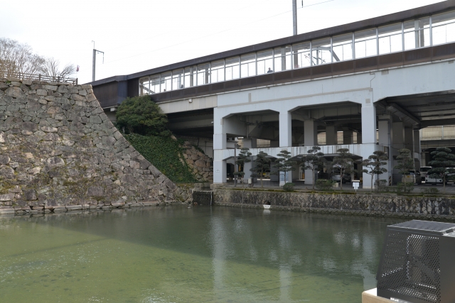
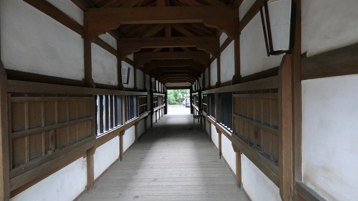
現在、三原城跡はJR三原駅と電車線に覆われているように見えます。実際、城跡の一部は専用通路により駅とつながっているのです。営業時間内であれば、誰でもこの通路を通ってそこに行くことができます。ここは天守台石垣の上で、城の主要部分ではもっとも北側に当たります。この区域は公園のように整備されていて、北側の方では、天守台を囲む水堀を眺めることができます。また、南側の方では山陽新幹線のホームをすぐ近くの同じ高さで見ることができます。ホームには新幹線の車両が頻繁に通り過ぎたり、止まったりしているのがよくわかります。大変ユニークであり、まるで駅の城とも言えるでしょう。 Now, the ruins of Mihara Castle look like being covered with JR Mihara Station and the JR Railway. In fact, part of the ruins is connected to the station by an exclusive path. Anyone can visit this part of the castle through the path during the opening hours. This is the top of the stone wall base for the Main Tower, which was the northmost part of the main portion of the castle. The area has been developed like a park where you can see a view of the water moat surrounding the base on the north. You can also see the platform for the Sanyo Shinkansen Super Express close by at the same level on the south. You can enjoy seeing the super express trains often passing by or stopping at the platform. It is very unique, and it could be called a station castle.
駅の中から天守台へ~From the inside the station to the base for the Main Tower天守台への階段~The stairways to the base for the Main Tower天守台入口~The entrance of the base天守台の上~The top of the base天守台から北側の眺め~A view from the base on the north天守台から南側の眺め~A view from the base on the south天守台はホームのすぐ近くです~The base is very close to the platform天守台から見た新幹線車両~A view of the trains for Shinkansen from the baseホームから見た天守台~A view of the base from the platform
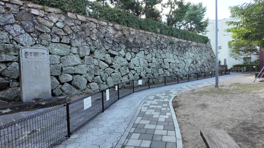
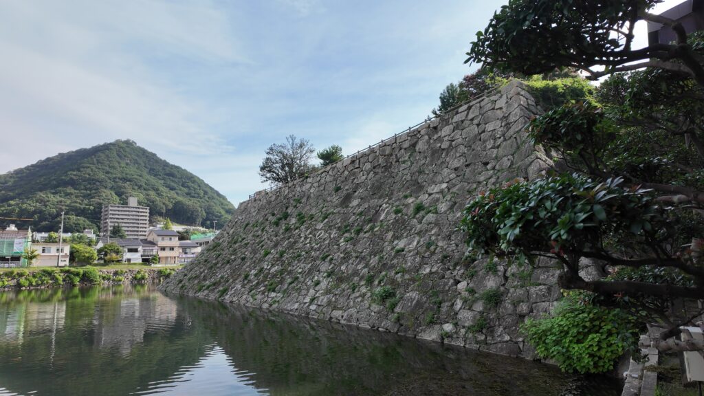
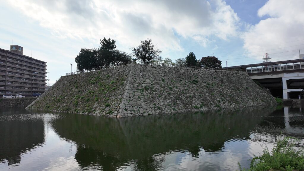
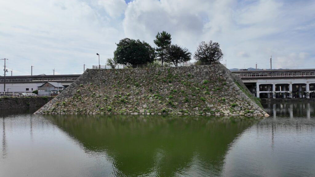
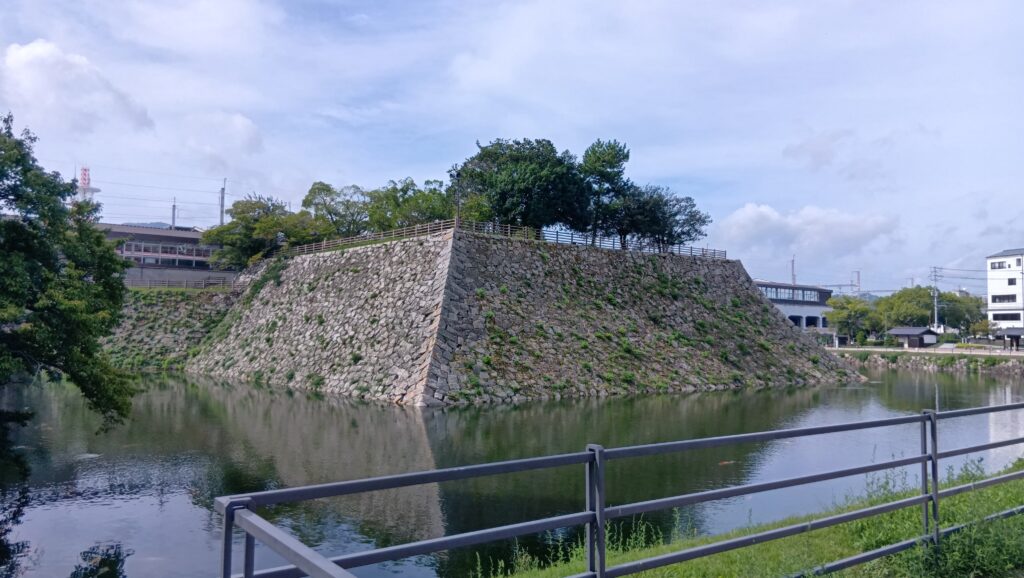
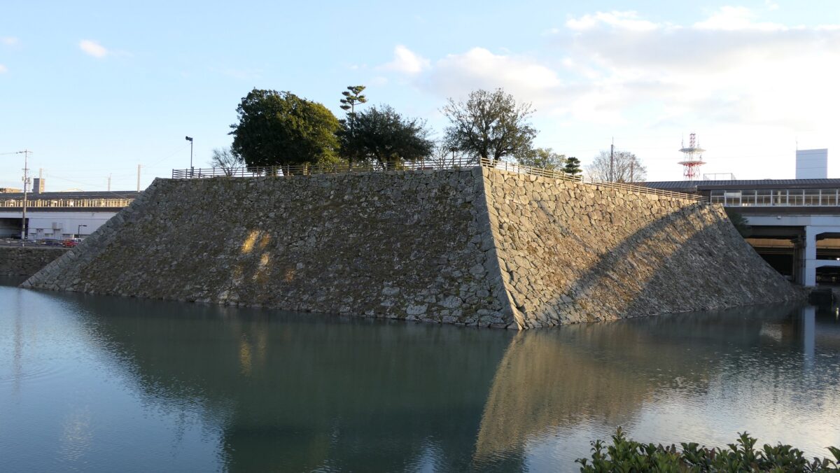
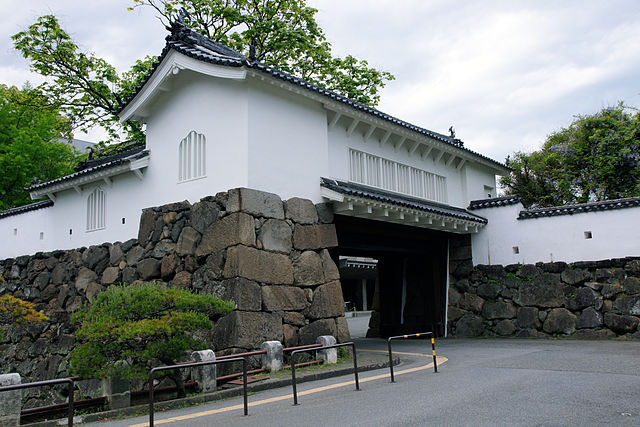
巨大な天守台~Huge base for Main Tower
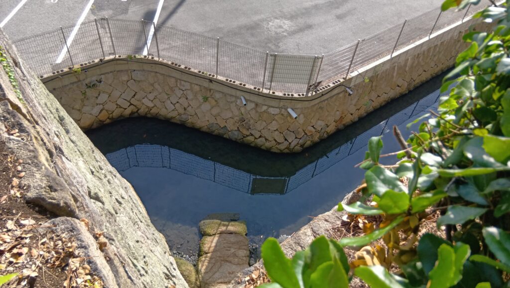
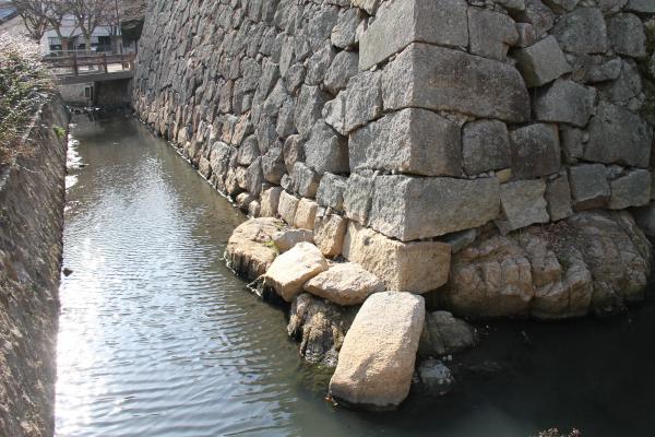
また、駅の外で堀の周りを歩きながら天守台石垣を見上げることもできます。この天守台は、日本で最も大きなものの一つで、将軍の江戸城のものと同じくらいの大きさです。但し、天守の代わりに3基の二階櫓が立っていました。この天守台のもう一つの珍しい点は、違う時代の石材によりできていることです。西側の石は小早川時代のもので、東側は福島時代のものです。小早川の石は古い方式により積まれており、福島の方は新しい方式のよるとのことです。 You can also walk around the moat looking up at the stone walls for the base outside the station. This base for the Main Tower is one of the largest ones in Japan which has similar size to the Shogun’s Edo Castle. However, there were three two-story turrets on it instead of a Main Tower. Another unique point is that it has stones from different periods. The stones on the western side come from Kobayakawa’s period, and those on the eastern side come from Fukushima’s. Kobayakawa’s stone walls were built using an older method, whereas Fukushima’s method is newer.
駅の外から見た天守台~A view of the base from the outside of the station小早川時代に作られた部分~The part which was built in Kobayakawa’s period福島時代に作られた部分~The part which was built in Fukushima’s period
城跡の他の部分~Other parts of Ruins
城周辺の航空写真~The aerial photo around the castle
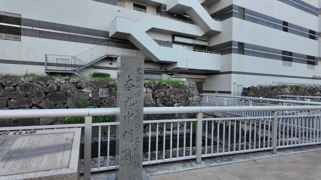
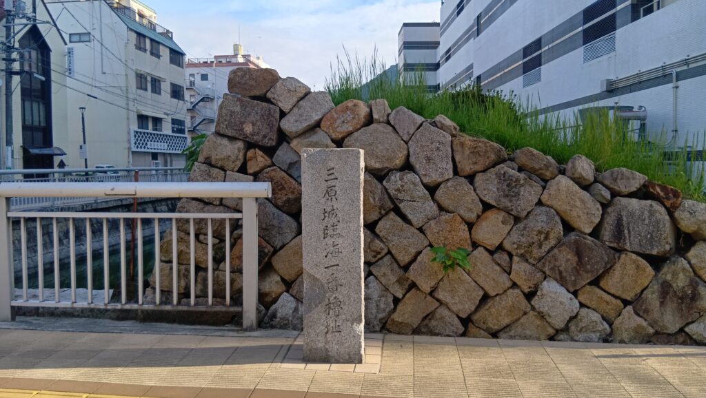
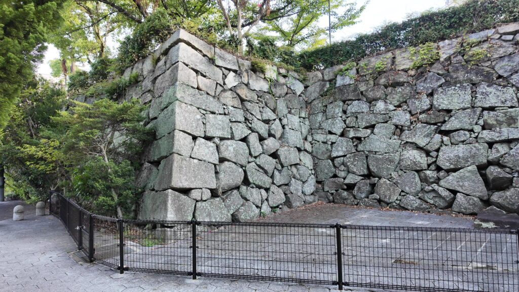
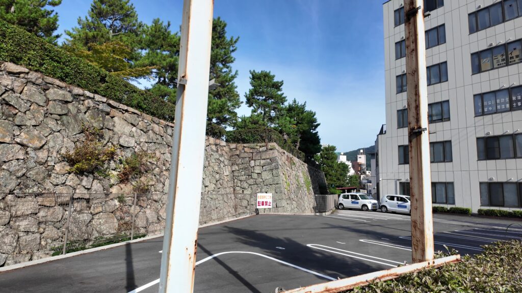
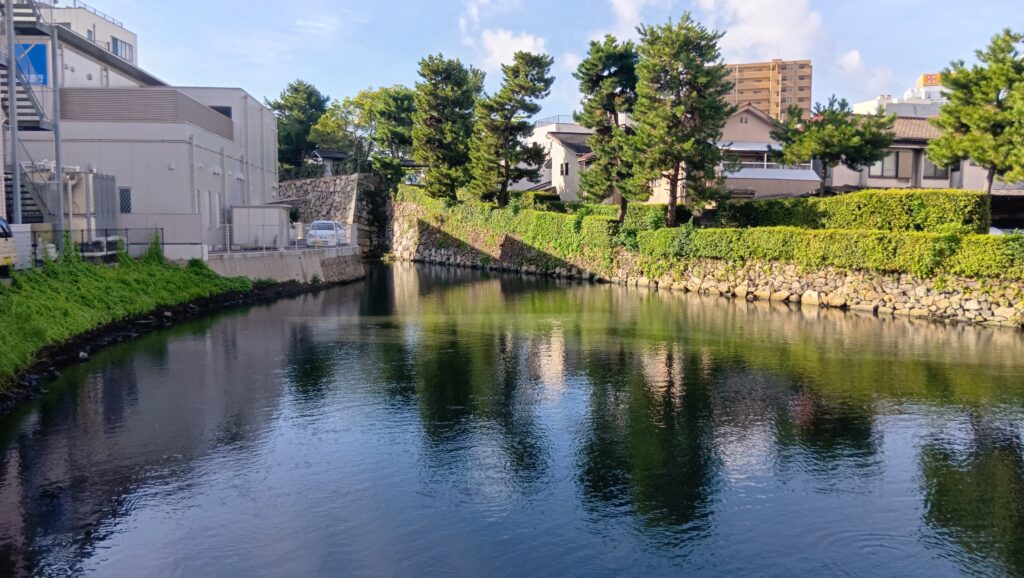
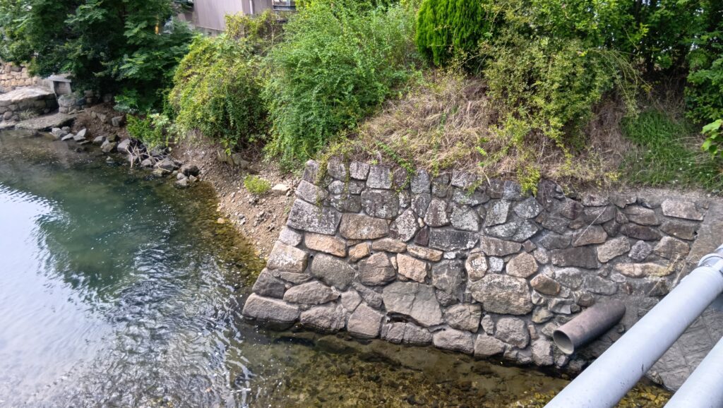
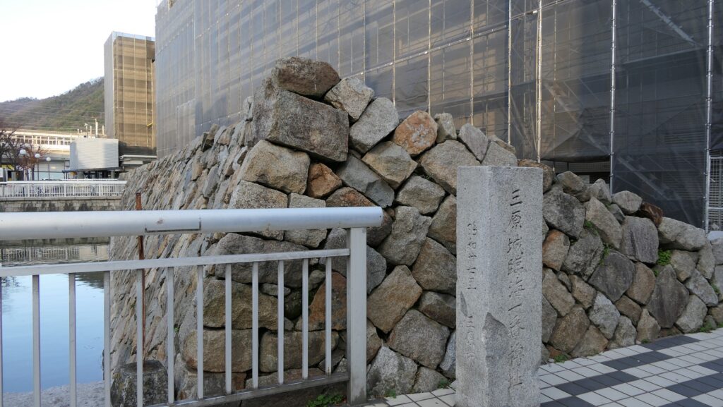
城跡としては他にはあまり残っていませんが、駅から三原港の方に歩いて行くと、現存している石垣を見ることができます。その上には現代の建物が建っています。ここは、城の主要部分の西端に当たります。石垣の中ほどには、2つの入口の一つであった中門跡があります。石垣の南端部分は、臨海一番櫓跡です。かつてこの櫓は海に面していました。ここから三原港までは海だったわけです。 Other ruins of the castle remain few, but if you walk down from the station to Mihara Port, you can see the remaining stone walls on which modern buildings stand. They were the western border of the main portion of the castle. On the middle of the stone walls, there are the ruins of Naka-mon Gate which was one of the two entrances to the portion. The southmost part of the stone walls are the ruins of Rinkai-Ichiban-Yagura Turret or the First Seaside Turret. The turret faced the sea in the past. The area from the ruins to Mihara Port was once the sea.
中門跡~The ruins of Naka-mon Gate臨海一番櫓跡~The ruins of the First Seaside Turret三原港~Mihara Port
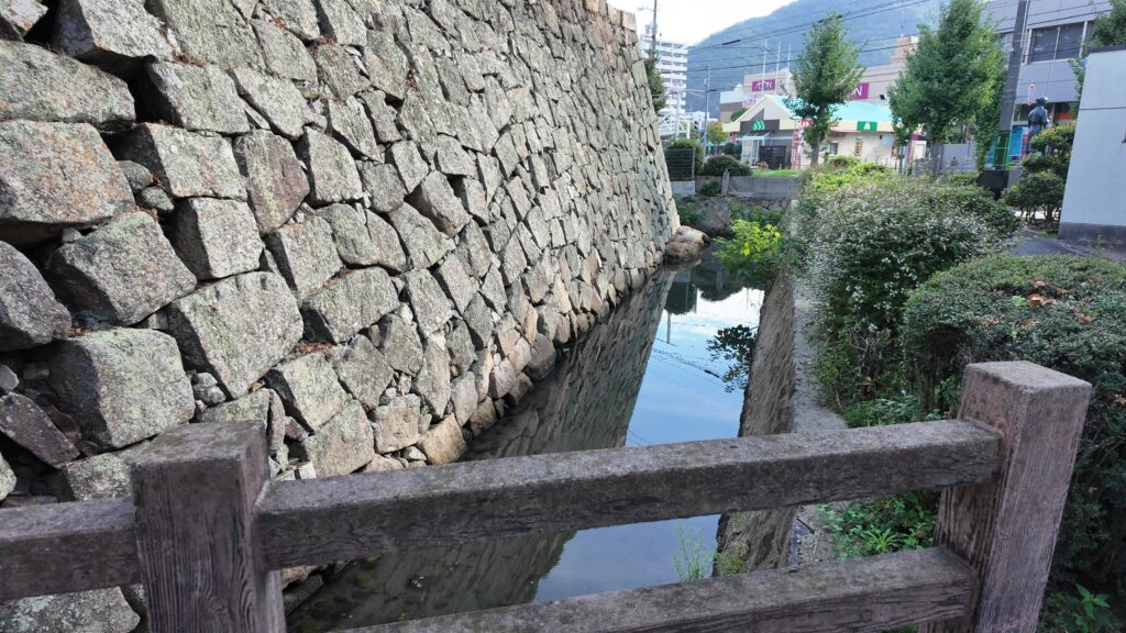
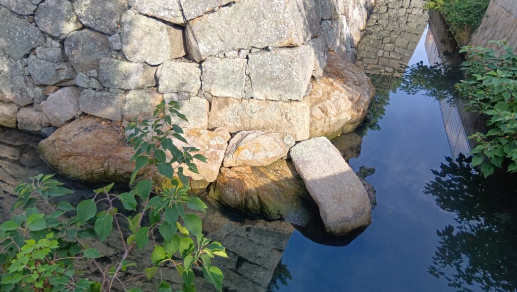
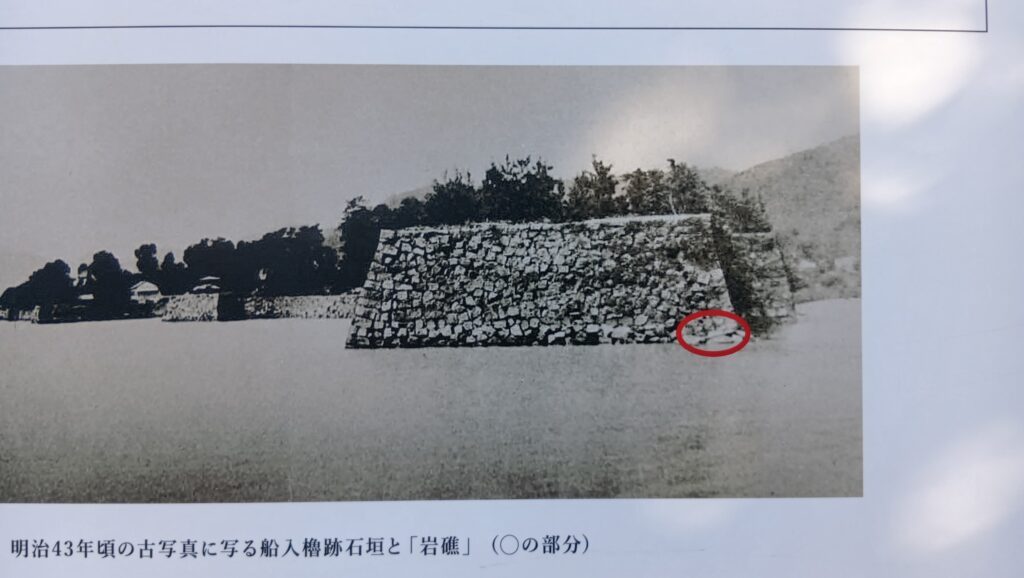
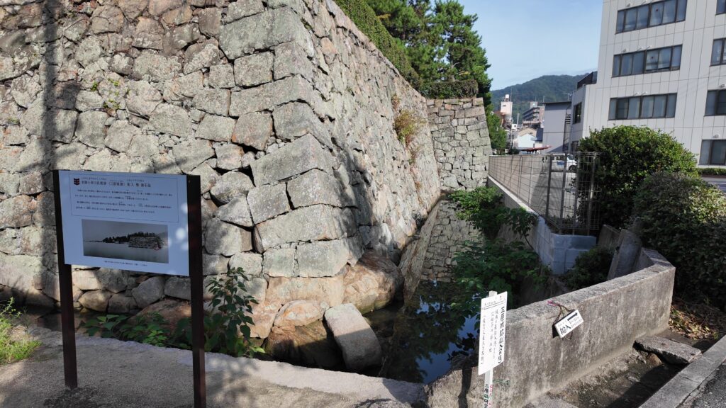
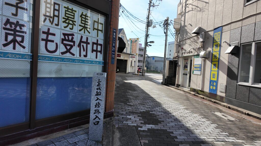
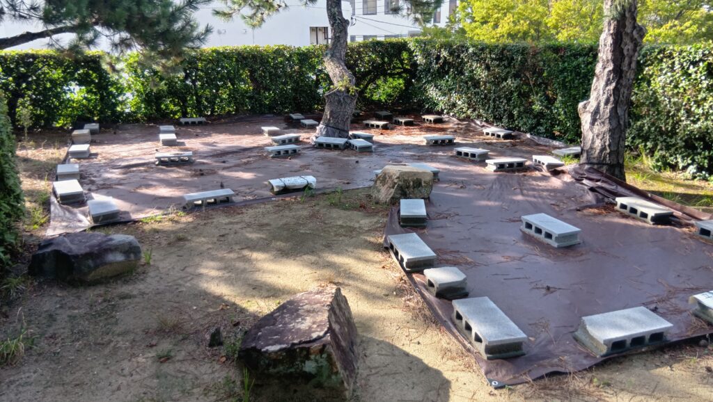
主要部分の東側の城跡は、城町公園として残っています。この公園には船入櫓という櫓の跡があります。ここの石垣は岩礁の上に乗っていて、かつては海岸だったことがわかります。 The ruins of the eastern part of the main portion remain as Shiromachi Park. The park has the ruins of another turret called Funairi-Yagura Turret or the Port Turret. Their remaining stone walls are on a shore reef where it was once seaside.
船入櫓跡の石垣~The stone walls of the ruins of the Port Turret (三原市Websiteより引用)
その後~Later History
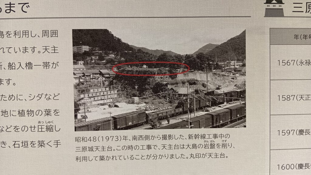
明治維新後、三原城は廃城となり、全ての建物は売られるか撤去されました。1894年、鉄道の三原駅と山陽本線が作られたとき、天守台石垣のすぐ南の本丸の用地がその建設のために供されたのです。本丸のほとんどの石垣は、他の港の資材として運ばれ、ほとんどの水堀はその工事中に埋められてしまいました。城跡は、1957年に国の史跡に指定されました。1975年、山陽新幹線が作られたとき、高架橋が城跡を壊さないよう、その上を覆って設置されました。 After the Meiji Restoration, Mihara Castle was abandoned, and all of its buildings were sold or demolished. In 1894, when Mihara Railway Station and Sanyo Railway Line were built, the ground for the Main Enclosure, just to the south of the stone wall base, was used for the construction of the train line and the station. Most of the enclosure’s stone walls were carried to another port as materials, and most of the water moats were filled during the construction. The ruins have been designated as a National Historic Site since 1957. In 1975, when the Sanyo Super Express Line was built, the overhead railway was placed across the ruins so as not to harm them. This is what we see there now.
石垣に被さっているような高架線~The overhead railway like covering the stone walls (taken by マンハッタン from photo AC)
私の感想~My Impression
三原城を最初に見た印象は人によってちがうかもしれません。城跡が現代の建物によりほとんど壊されていると思うかもしれませんし、城跡と駅の組み合わせが面白いと思うかもしれません。私は、ここを訪れる前は前者だったのですが、訪れた後は後者に近い印象です。また、一方で行政側に対しては、視覚に訴える掲示やVR技術を使ったりして、もっと三原城はどのような姿をしていたのか知らせるべきと思います。 The first impression of Mihara Castle may be different for each person. One might think the ruins were mostly destroyed by modern buildings, or others might think the combination of the ruins and the station looks interesting. I believed the former before I visited the ruins; my impression is now similar to the latter after visiting them. I also feel that officials should let people know what Mihara Castle looked like using visual image boards as well as VR technology.
天守台石垣~The stone wall base for the Main Tower
ここに行くには~How to get There
三原城跡は、三原駅のすぐ北隣です。 The ruins of Mihara Castle neighbors Mihara Station to the south.
リンク、参考情報~Links and References
・三原城跡、三原市(Mihara City Official Website) ・よみがえる日本の城7、学研(Japanese Book) ・「日本の城改訂版第42号」デアゴスティーニジャパン(Japanese Book)
大分府内城は、現在はビル街の中にありますが、かつては海城だったのです。
Oita-Funai Castle is among the modern buildings now, but was a sea castle.
大分府内城の西南隅櫓と二ノ丸堀~Seinan-Sumi-Turret and Ninomaru-Moat of Oita-Funai Castle (taken by TECHD from photoAC)
立地と歴史~Location and History
大分市は大分県の県都です。府内は大分市の以前の名前です。つまり「大分府内」という名前は新旧両方の名前が組み合わさったものです。府内も同じように豊後国(大分県の以前の名称)の国府であり、中世においては長い間大友氏によって統治されました。大友氏は、大友氏館に住んでいましたが、そこは大分府内城とは違う場所です。その館は中世の典型的は領主館で、恐らく足利氏館と同じようなものだったでしょう。 Oita City is the capital of Oita Prefecture. Funai is the former name of the city. So, the name “Oita-Funai” is combined from both of new and old names. Funai was likewise the capital of Bungo Province (the former name of Oita Pref.) governed by the Otomo clan for many years in the Middle Ages. They had been living in the Otomo Clan Hall which is different from Oita Funai Castle. It was a typical hall for a lord in the Middle Ages probably like the Ashikaga Clan Hall.
大分府内城と大友氏館の位置関係~The location of Oita-Funai Castle and Otomo clan hall)
大友氏館庭園遺構~The ruins of the Otomo clan hall’s garden(出典:文化庁)
府内の城下町は、館を中心に繁栄しましたが、戦国時代としては防御力が不足していました。1586年に島津氏の侵攻があり、館を含む市街地は焼き尽くされてしまいます。当主の大友宗麟とその息子義統は、その一族の危機の間他所に避難を余儀なくされました。彼らは天下人の豊臣秀吉からの助けにより何とか生き延びましたが、宗麟の死後、義統は秀吉により改易されました。 The Funai castle town flourished around that hall, but it had weak defenses in the Warring States Period. In 1586, Shimazu clan’s invasion happened. The city including the hall was burned out . The master, Sorin Otomo and his son Yoshimune had to escape to another place, during the destruction of the clan. They could somehow survive due to the help from the ruler, Hideyoshi Toyotomi. However, Yoshimune was fired by Toyotomi after Sorin passed away.
大友宗麟肖像画、瑞峯院蔵~The portrait of Sorin Otomo, owned by Zuihoin(licensed under Public Domain via Wikimedia Commons)
そして秀吉は彼の配下である福原直孝を、1597年に府内の領主とて派遣しました。直孝はもっと安全な城が必要と考え、荷の積み降ろし港の場所に新しい城を築き始め、「荷揚(荷を積むという意味)城」と名付け、その後いつしか「府内城」と改名されました。17世紀初期に、竹中氏が4層の天守や多くの櫓を含む城として完成させ、九州地方では有数な城となったのです。 Then, Toyotomi sent his man, Naotaka Fukuhara as the lord of Funai in 1597. Fukuhara thought that he needed to have a more secure castle. He started to build a new castle at a port of unloading, called “Niage Castle” (Niage means unloading), which was renamed to “Funai Castle” sometime later. In the first 17th century, the Takenaka clan completed the castle including the four-layer Tenshu keep and many turrets, becoming a prominent castle in Kushu region.
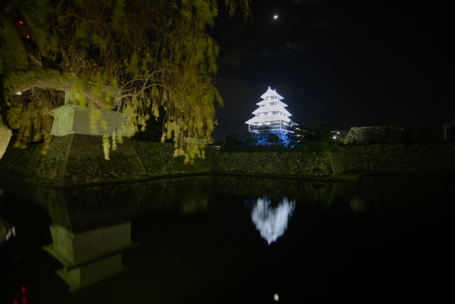
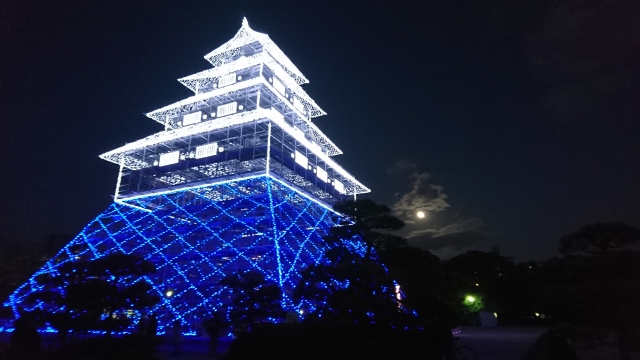
大分府内城でライトアップされた仮想天守~The illuminated virtual Tenshu on Oita-Funai Castle(taken by seama2 from photoAC)
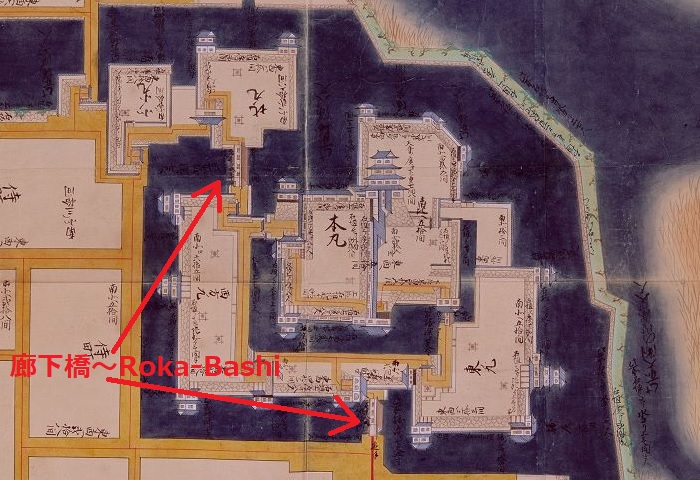
城の中心は安全確保と交通の便のため、細い堤を挟んで大分川の河口に面していました。河口から、本丸から二の丸へ、更には三ノ丸まで外側に向かって広がっていて、水堀によって互いに隔てられていました。特に二の丸へは、「廊下橋」と呼ばれた二つの橋のみが通じていて、もしこれらの橋を落とした場合、本丸と二ノ丸は完全に外部から遮断されるようになっていました。 The center of the castle faced the estuary of Oita River across a thin bank for safety and transportation. From the estuary, the main enclosure “Honmaru”, to the second enclosure “Ninomaru” until the third enclosure “Sannomaru” spread towards outside, separated by water moats each other. Particularly, only two bridges called “Roka-Bashi” led to Ninomaru area. If these bridges were fallen, the Honmaru and Ninomaru could be shut down from outside.
豊後国府内城之絵図部分、江戸時代、コメントを付加~Part of the illustration of Funai Castle in Bungo Province in Edo Period, adding comments(出典:国立公文書館)
しかし、松平氏統治下の1743年に城下町の大火による被害を被りました。天守を含むほとんどの城の建物が焼け落ちました。その後、櫓はいくつか再建されましたが、天守は再建されませんでした(天守台だけが残ります)。
But in 1743, under the Matsudaira clan’s governance, the castle suffered from a great fire around the castle town. Most of the buildings of the castle including Tenshu keep were burned down. After that, some turrets were restored, but Tenshu wasn’t (just the Tenshu base remains).
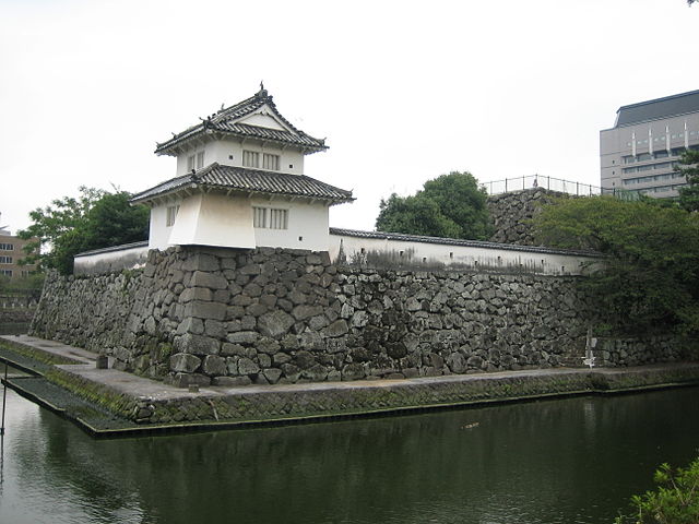
現存している人質櫓と天守台~The remaining Hitojichi-Turret and Tenchu base(licensed by Reggaeman via Wikimeia Commons)
特徴~Fertures
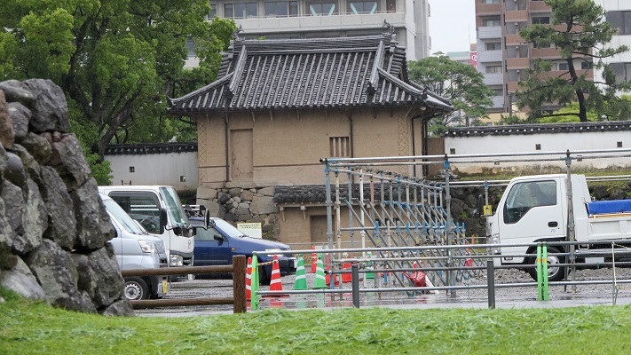
現在、本丸と二ノ丸の範囲は「大分城址公園」として公園になっています。この公園は今でも二の丸の水堀と石垣に囲まれています。しかし本丸の水堀は埋められていて、そのため公園の範囲はただ一つの曲輪のように見えます。ここにはまた櫓もあり、そのうち2つだけが元からあるものです(人質櫓と宗門櫓)。更には、一基の廊下橋が最近復元されました。 Now, the area of Honmaru and Ninomaru has been turned into a park called “Funai Castle Ruins”. The park is still surrounded by the Ninomaru water moat and stone walls. But the Honmaru water moat has been filled, so the park area looks like just one enclosure. It also has several turrets, out of whom only two turrets are original (Hitojichi-Turret and Shumon-Turret). In addition, one Roka-Bashi has recently been restored.
宗門櫓の裏側、修繕中か~The back side of Shumon-Turret, it appears being repaired.復元された廊下橋~The restored Roka-Bashi bridge(licensed by Reggaeman via Wikimeia Commons)廊下橋の内部~The inside of Roka-Bashi
ところが、公園の周りの地域は全て埋め立てられ、近代的な都市に変貌しています。歴史の知識がなければ、ここが海城だったとは想像できません。 However, all area outside the park has been filled in ground for the modernized city. No one can imagine that was a sea castle without historical knowledge.
城周辺の航空写真~An aeriel photo around the castle
その後~Later Life
明治維新後、大分県庁が本丸に置かれました。大正時代にその建物が新築拡張されることになり、本丸の水堀が埋め立てられました。第二次世界大戦では、米軍による大分空襲があり、城の現存櫓もいくつか焼けてしまいました。戦後市の復興計画により、城跡は大分城址公園となりました。県庁は以前の三ノ丸に移転し、そして本丸と二ノ丸の範囲は1963年に初めて県の史跡として指定されました。「西南隅櫓」「大手口多門櫓」「着到櫓」といった櫓が外観復元されました。それ以外に模擬櫓もあります。 After the Meiji Restoration, the Oita Prefectural Building was placed on Honmaru area. In the Taisho Era, the building was replaced to a new large one that caused the Honmaru water moat to be filled. In World War II, Oita Air Raid by the US Air Force burned out the Oita city area including several remaining turrets of the castle. After the war, with the reconstruction plan of the city, the castle ruins was turned into Funai Castle Ruins park. Prefectural Building was moved to the former Sannnomaru area, then the area within Honmaru and Ninomaru was first designated as a prefectural historic site in 1963. Some turrets such as “Seinan-Sumi-Turret”, “Oteguchi-Tamon-Turret” and “Chakuto-Turret” were externally restored. There are also some imitational turrets there.
大手口多門櫓~Oteguchi-Tamon-Turret(licensed by 663highland via Wikimedia Commons)
大分市は城跡の将来に向けた整備計画を検討しています。この計画によると、本丸石垣が部分的に復元され、地面に本丸水堀があったことを示す線が表示されることになっています。過去に海城があったことを周知したいようです。 Oita City is considering the development plan for the future of the ruins. They plan to restore part of the Honmaru stone walls and express the line of Hommaru water moat on the ground. They seem to let people know that there was a sea castle in the past.
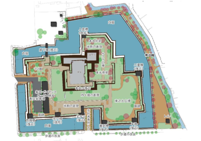
2026年までの城跡整備計画マップ~The development planning map of the castle ruins by 2026 (大分市Websiteより引用)
私の感想~My Impression
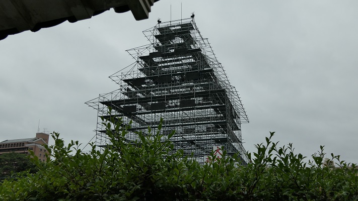
面白いイベントが城址公園で開催されました。それは、鉄骨のフレームとLEDライトによって天守の姿を再現したものでした。このイベントは終わってしまったのですが、私が最近訪れたときにはまだフレームが残っていました。フレームが存在していれば、また再開することも可能と思います。そうなったらよいですね。 An interesting event was held in the ruin park. That was recreating of the image of the Tenshu keep by using a steel frame and lots of LED light bulbs. Though the event has finished, the frame remained when I visited the ruins recently. The show could be held again as long as the frame is there. Hopefully that will happen.
大分府内城の仮想天守~The virtual Tenchu in Oita-Funai Castle(taken by ぴょんにゃん from photo AC)仮想天守の骨組み(The flame of the virtual Tenshu)
ここに行くには~How to get There
車で行く場合:東九州自動車道大分ICから約20分です。城址公園内に駐車場があります。 大分駅から:徒歩で約15分かかります。バスの場合大分駅南口から「大分きゃんバス」に乗り、市役所前バス停で降りてください。 大分空港から大分駅まで:空港アクセスバス(エアライナー)に乗ってください。 If you want to go there by car: It takes about 20 minutes from the Oita IC on Higashikyushu Expressway. The park offers a parking lot inside. From Oita station: It takes about 15 minutes on foot. Or take the Oita-Can-bus at the south entrance of the station, and take off at the Shiyakusho-Mae bus stop. From Oita Airport to Oita st.: Take the Airpor Eepress Airliner bus.