Now the ruins of Akutagawa-san Castle are private owned and not developed as a public park. Visitors usually have to walk from the nearest bus stop. You may be unsure which mountain you should climb and how you go to the ruins. It is a good idea to bring the route map called “Access to the Summit of Mt. Miyoshi” which you can download from the website of Takatsuki City. After about a 15-minute walk from the bus stop, the route is divided in to two branches. You can choose either of the two routes.
The map around the castle
Around the bus stopAccess to the Summit of Mt. Miyoshi (exhibited by Takatsuki City Website)
Tsukawaki Route
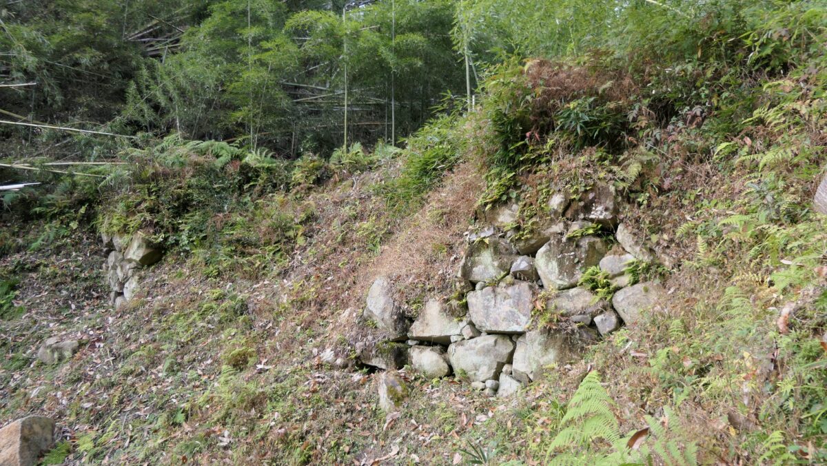
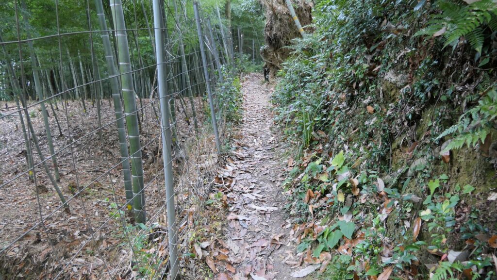
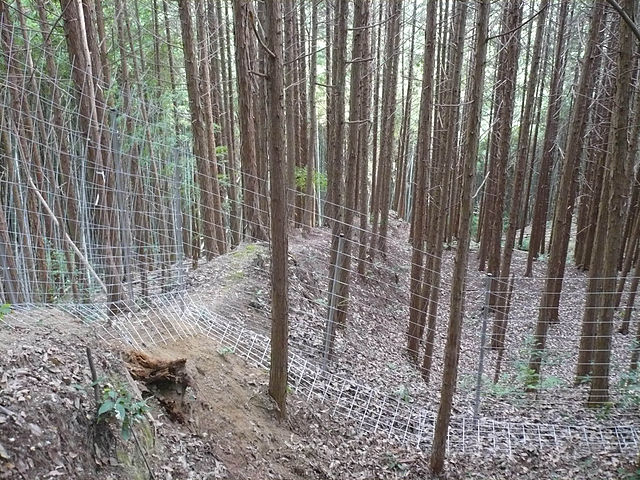
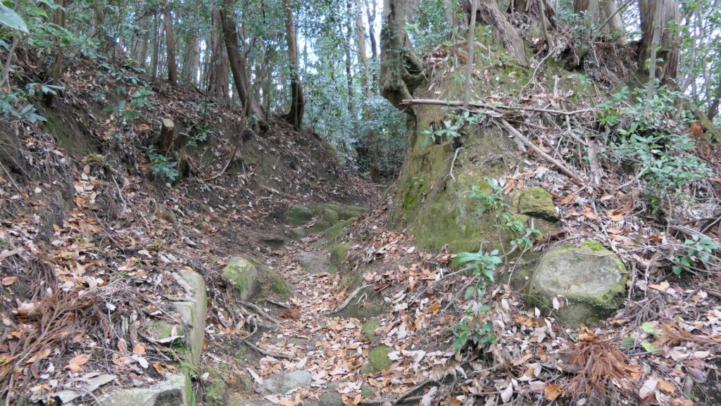
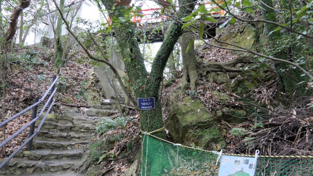
One of them is called Tsukawaki Route which goes around on the eastern side of the mountain and has a gentle slope. You can see a lot of the ruins of enclosures, but cannot enter them, because the route is surrounded by fences, so accessible areas are limited. You can also see the earthen walls crossing the route at a 90-degree angle. They are called Tate-Dorui or the Vertical Earthen Walls which prevented enemies from attacking the castle from other positions. You will also see the narrow earthen bridge with both sides having dry moats. The purpose of the system is the same as the Vertical Earthen Walls. You can even see something like the ruins of the alternate entrance.
Going to Tsukawaki RouteThe route goes alongside the fenceThe Vertical Earthen Walls (licensed by ブレイズマン via via Wikimedia Commons)The earthen wallsThe ruins which might have been the alternate entrance
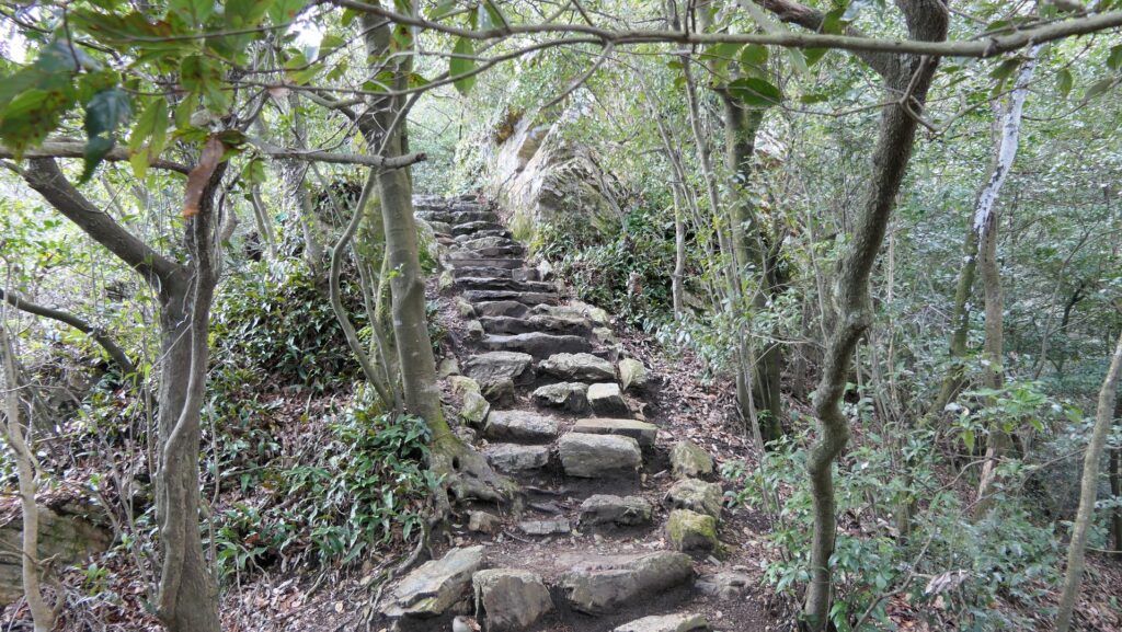
Main Route
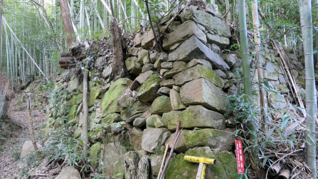
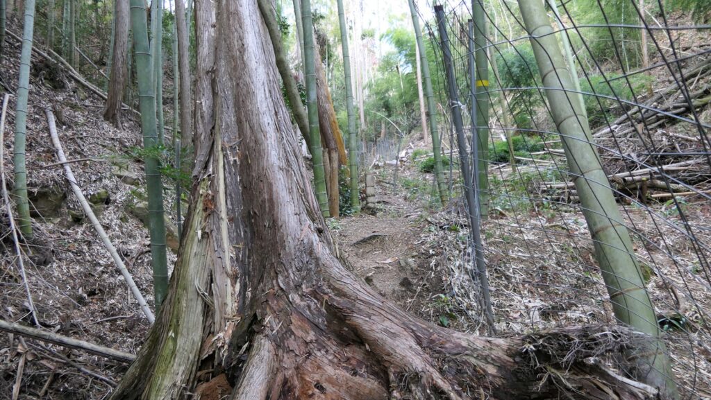
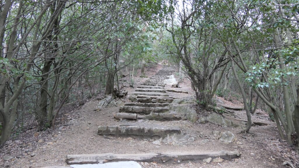
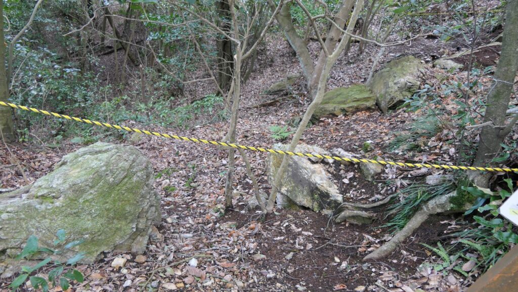
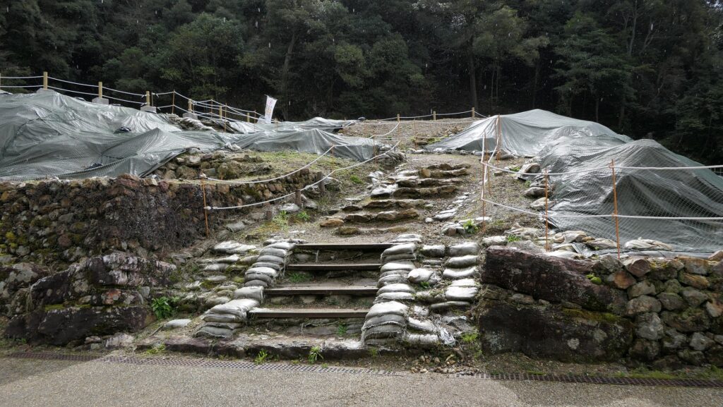
The other branch route is called Otesuji Route or the Main Route which goes straight up to the mountain. It is steep and rocky. You can see some old stone walls around the entrance of the mountain, but they seem to be not original for the castle. The route is also surrounded by fences and you even have to pass through a door for preventing wild boars from entering the area. Take care to close it after entering or leaving. After about a 15-minute climb, you will see the stone walls of the Main Gate. The center part of them collapsed, however they are original to the castle.
The stone walls around the entrance of the routeAn appearance of the Main RouteThe door for preventing wild boarsThe remaining stone walls of the Main Gate
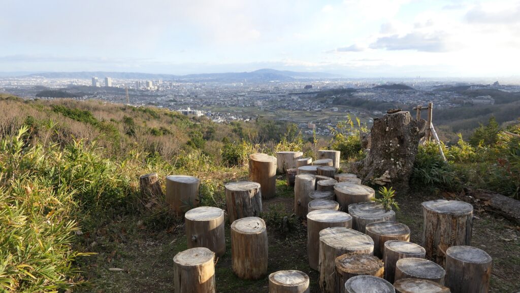
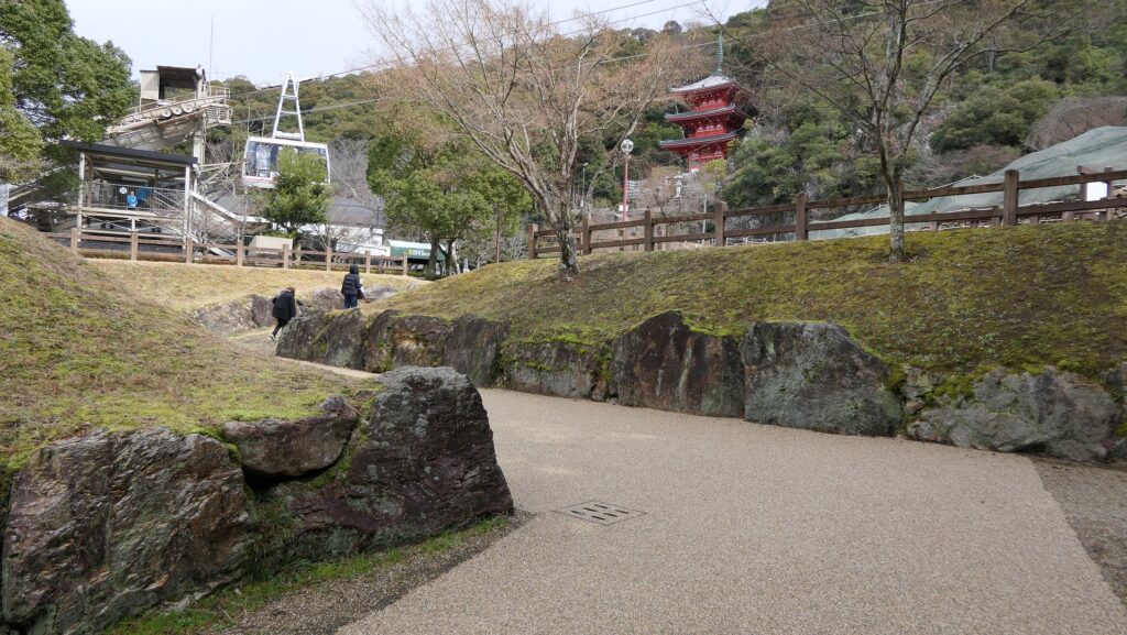
Great view from Main Enclosure
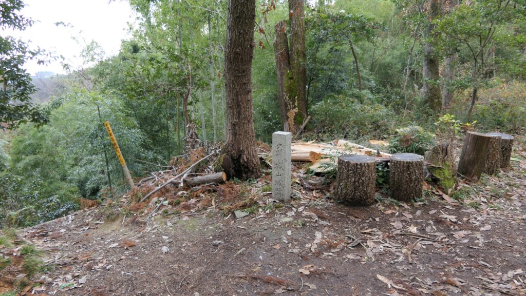
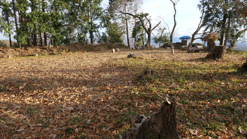
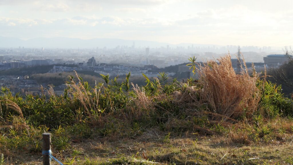
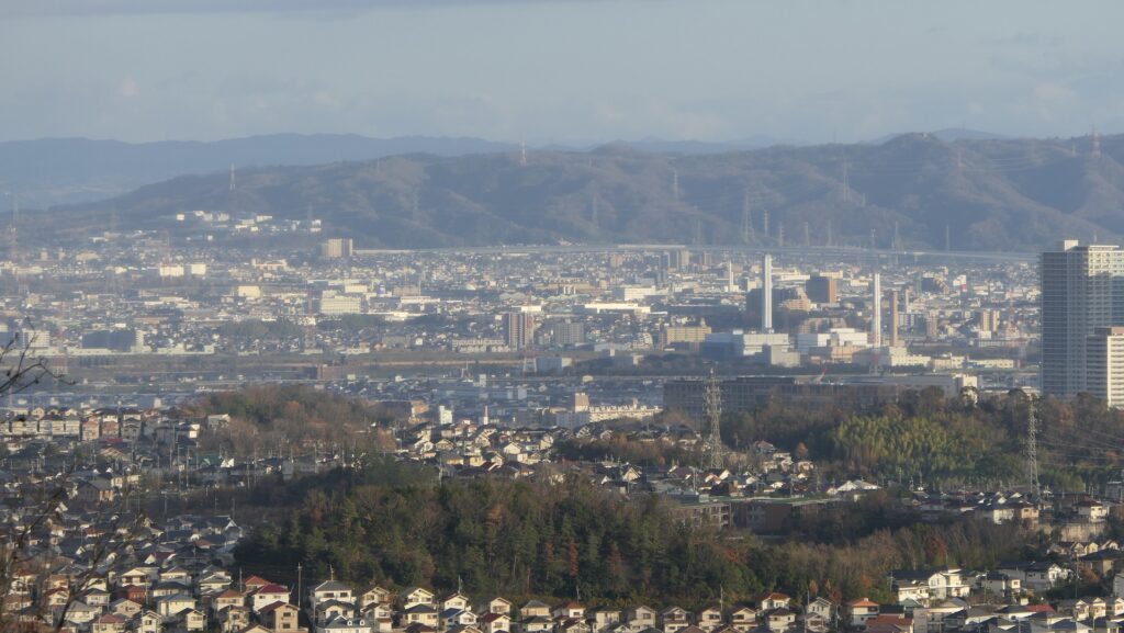
The two branch routes meet above the stone walls, as you approach the Main Enclosure on the top. The outside field will suddenly become visible; it provides a great view of the Osaka Plain. You will finally reach the Main Enclosure after another few minutes of climbing. The enclosure has been cleared to create an open space. The excavations found that the traces of the buildings which might have been used as turrets at the front, and the stone foundations of the building which could have been used as Nagayoshi Miyoshi’s Main Hall. You can enjoy the whole view of the plain including the tall buildings in Osaka City and the Ikoma Mountains where Imori Castle became Nagayoshi’s new home base after Akutagawa-san Castle.
The point where the two routes meetThe outside field will suddenly become visibleThe Main EnclosureThe tall buildings in Osaka City can be seenThe Ikoma Mountains
Please pay attention to both the top and foot of the mountain.
Features
The map around the castle
To Castle Ruins on Top
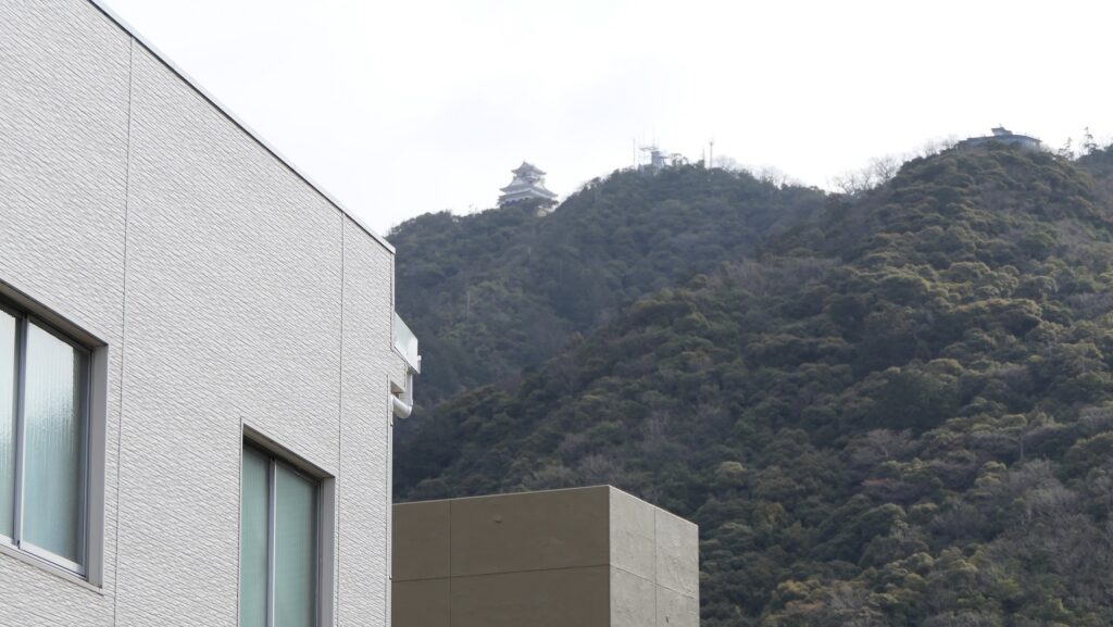
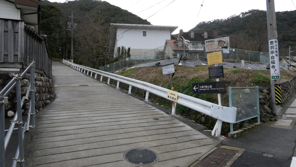
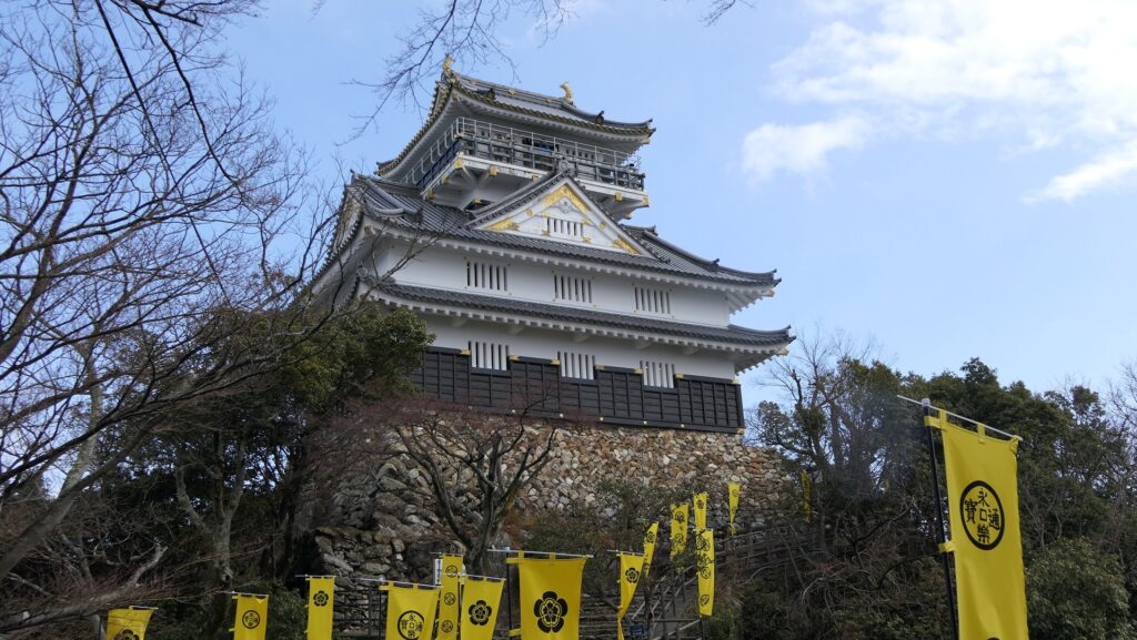
Now, the area around Mt. Kinkazan has become one of the most popular tourist spots in the Gifu Prefecture. You can easily go to the top of the mountain by the Kinkazan Ropeway. If you want to climb up there, it is common to use the Nanamagari Trail which was the Main Route for the castle. The tail is relatively gently sloped, so it takes around one hour to reach the top, climbing to about 300m from the ground.
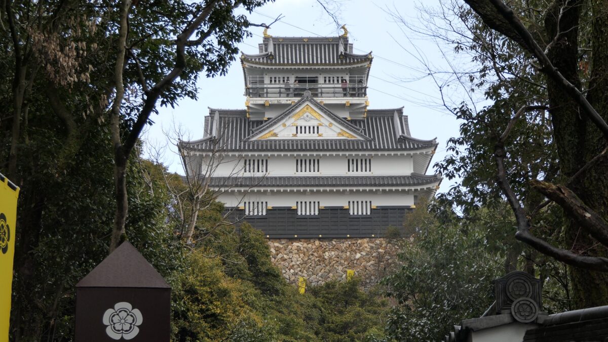
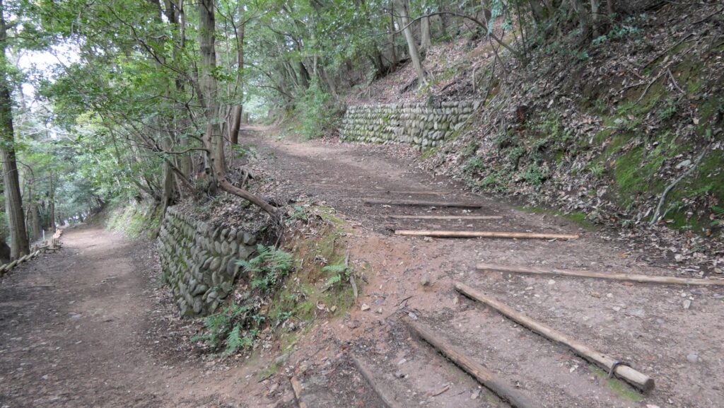
A view of the Main Tower from the city areaThe beginning of the Nanamagari TrailThe Nanamagari TrailGoing to the top
The top is actually also a tourist spot where the ropeway terminal, a restaurant, a zoo, and the imitation Main Tower stand. The routes around the top have also been paved in a modern style. However, you can see rocky surfaces made of chert everywhere on the top. As for the ruins of the castle, there are the ruins of the First Gate where the huge stones for the gate collapsed. After seeing the defensive trenches called “Horikiri”, next comes the ruins of the Second Gate. Their plaster walls have been rebuilt recently, but some of the stone walls are original. You should check out the two steps of stone walls under the route from the Second Gate to the Main Tower. The method for building the stone walls is very old, so it is thought that they were built by Nobunaga.
Arriving at the topThe ruins of the First GateThe huge stones for the gateThe defensive trenches called “Horikiri”The ruins of the Second GateThe stone walls under the route to the Main TowerThe stone walls have two tiers
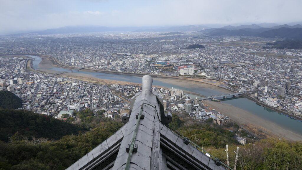
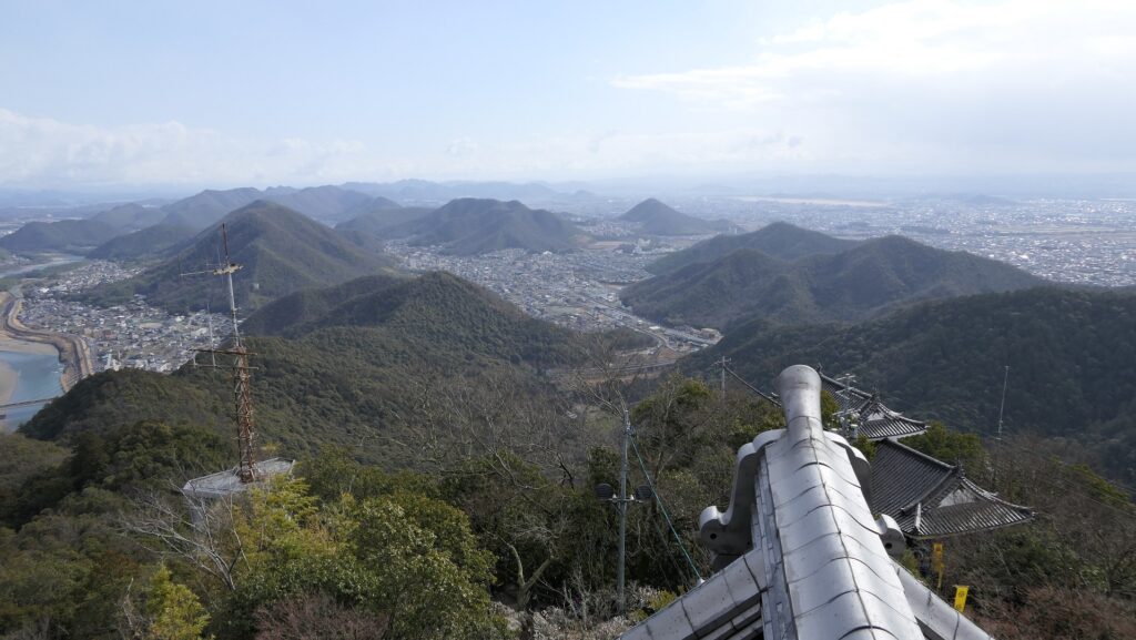
A Great View from Main Tower
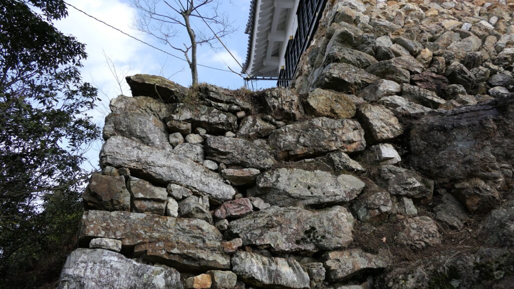
The imitation Main Tower was built in 1956, based on the drawings of the Three-Story Turret in Kano Castle. The turret was burned in the Edo Period, but there was a rumor that it might have been moved from the Gifu Castle. The interior of the tower is used as a museum which exhibits the history of the castle and Nobunaga. The top floor is also a sightseeing tower where you can see a great view of the area around, including Nagara-gawa River. The stone wall base of the tower looks very old. In fact, the stones are original, but the style is not, as the stones were re-piled when the tower was rebuilt.
The imitation Main TowerA view from the Main Tower (Nagaragawa River side)A view from the Main Tower (Mountain side)The stone walls for the Main Tower
You can also climb down on another tail, for example, from the ruins of the Back Gate. The gate also used huge stones of which you can see the remains on the route. After going down for a while, you can also see the huge, holy rock called “Eboshi-iwa”. The Inaba Shrine was originally located around the rock.
The ruins of the Back Gate.The remaining huge stonesYou can see rocky surfaces made of chert here and thereThe Eboshi-iwa Rock
Ruins of Nobunaga’s Residence
At the foot of the mountain, I recommend that you visit the ruins of Nobunaga’s palace residence, because, in fact, it might have been the center of the castle. At the entrance, you can see the remains of the alternate huge stones which were 1.7m high in the past. Walking up the stairs around the terraced stone walls, there is an empty spacious space where the main building was constructed. In the back of it, there were also buildings for the tearoom and sightseeing with an artificial water garden using huge stones. Another pond garden was next to it, and an artificial river flew from the fountain between them. Moreover, these gardens were connected to the main building by the air corridors. Nobunaga seemed to use his palace residence for official ceremonies and for hosting important visitors.
The entrance of the residence ruinsThe stairs to the ruins of the main buildingThe ruins of the main buildingThe ruins of the gardensThe imaginary drawing of around the gardens (Gifu Castle Museum)The residence ruinsThe imaginary drawing of the residence (from the signboard at the site)
美しい、しかしとても強力な城です。
Beautiful, but very strong castle
立地と歴史~Location and History
有名なグスクの一つ~One of famous Gusuku
14、15世紀ころ、琉球諸島(現在の沖縄諸島)は貿易によって栄えました。結果、琉球には「按司」と呼ばれた有力な豪族が多く現れ、中国や他国と貿易を行い、力をつけていきました。彼らは沖縄諸島一帯に、300以上の大規模な要塞を築き「グスク」と呼ばれました。勝連城は代表的なグスクの一つです。 Around the 14th and 15th centuries, the Ryukyu Islands (what is now Okinawa Islands) prospered thanks to trading. As a result, many powerful clans in Ryukyu called “Aji” traded with China and other countries, and had great power. They built over 300 large-scale fortresses called “Gusuku” around the Ryukyu Islands. Katsuren Castle was one of the representative Gusuku.
城の位置~The location of the castle
発掘の成果によれば、この城は最初は14世紀初めころ築かれました。これはグスクとしてはとても早い時期です。当初しばらくは勝連按司がこの城を保有していたと言われています。15世紀初頭に阿麻和利が10代目且つ最後の城主となり、この城は最盛期を迎えます。発掘では、高価な中国製陶器の破片も見つかっています。古い琉球歌集である「おもろそうし」には、この城は日本の武士の都、鎌倉のように栄えていた、と書かれています。 According to the excavation, the castle was first built around the beginning of the 14th century which is very early time for Gusuku. It is said that Katsuren Aji clan first owned the castle for a while. In the beginning of the 15th century, Amawari became the 10th and last lord of the castle that reached its peak time. The excavation also found pieces of valuable Chinese ceramic ware. A collection of traditional Ryukyu songs called “Omorososhi” says the castle prospered like Kamakura, the warriors’ capital of Japan.
琉球王国の進貢船、沖縄県立博物館・美術館~A tribute ship from the Ryukyu Kingdom, Okinawa Prefectural Museum and Art Museum collection(licensed under Public Domain via Wikimedia Commons)
船のようなグスク~Gusuku looking like Ship
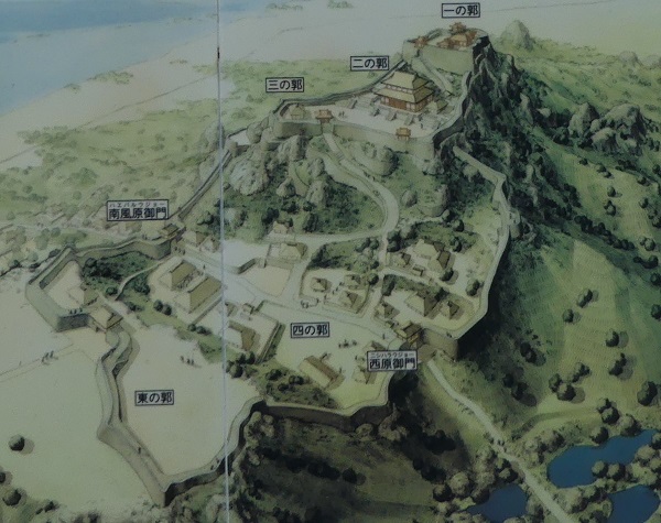
勝連城は、沖縄本島の東海岸にある勝連半島の付け根に位置していました。城の近くには貿易港もありました。城は3つの部分からなっていました。北西の部分は「ニシグスク」と呼ばれ、98mの高さの丘上にあり、城の主要且つ最も高い位置にある部分でした。真ん中の部分は、低い位置で城の入口に当たりました。南東の部分は、「へーグスク」と呼ばれ、違う丘の上にありましたが、北西部分よりは低くなっていました。結果的に、城は当時の船の形のように見えたため、別称で「進貢船のグスク」とも呼ばれました。 Katsuren Castle was located in the connecting part of Katsuren peninsula, the eastern coast of Okinawa Island. There was also a trade port near the castle. The castle had three parts. The northwest part called “Nishi-gushiku” on a 98m high hill was the main and highest part of the castle. The middle part was low and the entrance of the castle. Lastly, the southeast part called “He-gushiku” was on another hill lower than the northwest part. As a result, the castle looked like a traditional ship which was nicknamed “the Gusuku of a ship for tribute”.
城周辺の起伏地図~The relief map around the castle
城の想像画~The imaginary picture of the castle(現地説明板より~from the signboard at the site)
阿麻和利の乱~Amawari Rebellion
阿麻和利は有力な按司となり、その勢いは琉球王国の王に並ぶほどでした。実際、国王は彼の娘を阿麻和利に嫁がせ、親戚としていました。ところが、阿麻和利は国王に取って代わろうとしたと言われています。まずは国王の家臣、中城城の護佐丸を滅ぼします。次に王国を攻撃する準備をしますが、彼の妻は国王である彼女の父に夫の計画を伝えたのです。1458年、3日間の籠城戦の末、阿麻和利はついに王国によって討たれてしまいました。歴史家の中には、王国の方が阿麻和利をだましたのだという人もいますが、真相は不確かです。 Amawari became a great Aji, almost an equal to the king of the Ryukyu Kingdom. The king actually married his daughter with Amawari to make him his relative. However, it is said that Amawari wanted to take over for the king. Amawari first beat the king’s retainer, Gosamaru at Nakagusuku Castle. Amawari secondly prepared to attack the Kingdom, but his wife informed her father, the king, of her husband’s plan. Amawari was finally beaten by the Kingdom after the three-day siege in 1458. Some historians argue that the Kingdom might have deceived Amawari and beat him. The fact is still uncertain.
阿麻和利の墓~The tomb of Amawari(licensed by Kugel~commonswiki via Wikimedia Commons)
特徴~Features
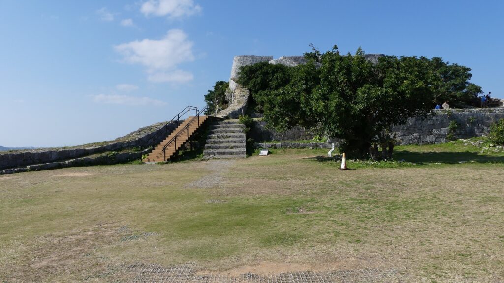
城跡に入る~Entering Castle Ruins
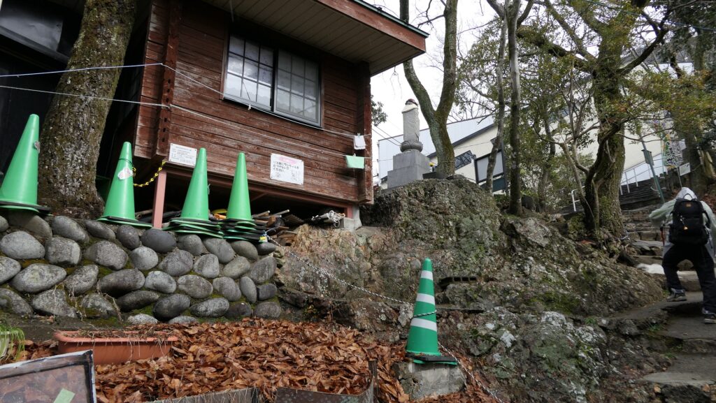
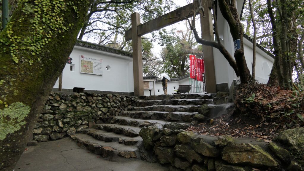
現在、勝連城跡は主にその北西部分に残っています。城跡を車で訪れる場合は、城跡休憩所の所に駐車できます。休憩所では城跡に行く前に城のことを学ぶこともできます。 Now, the ruins of Katsuren Castle remain mainly in the northwest part. If you drive your car to visit the ruins, you can park at the guide house. You can also learn about the castle at the house before you walk to the ruins.
城周辺の地図~The map around the castle
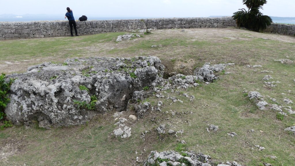
最初に城跡に入るには、西原御門跡、四の曲輪と呼ばれる城の入口である中間部分を通っていきます。「外郭」と呼ばれる石垣が、この曲輪と南東部分を囲っていましたが、現在ではその基礎部分しか見ることができません。 You will first enter the ruins through the ruins of Nishihara Gate, the entrance of the castle at the middle part called the Forth Enclosure. The stone walls called the Outer Fence or “Gaikaku” rounded the enclosure and the southeast part, but you can only see their base now.
城跡の入口~The entrance of the castle ruins外郭の基礎部分~The base of the outer fence
内郭と石垣~Inner Fence and its Stone Walls
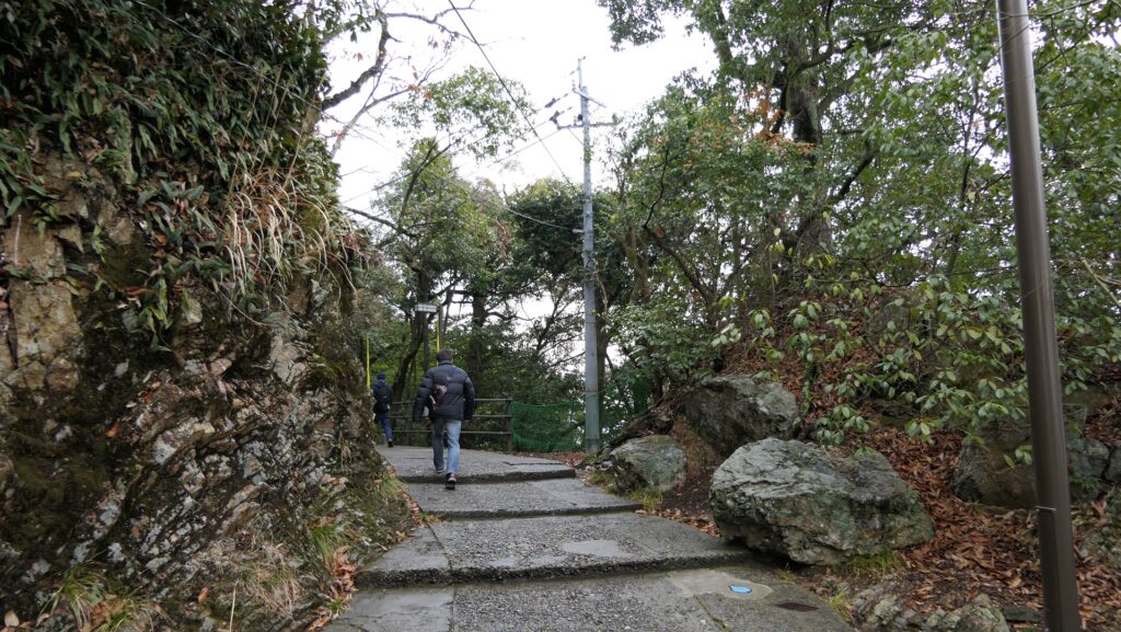
過去には石畳が西原御門と反対側の南風原御門から北西部分の方に伸びていました。現在では過去と同じルートに作られた木製階段に通って進んでいきます。 In the past, the stone pavement spread from another gate called Haebaru Gate at on the opposite side of Nishihara Gate to the northwest part. You will now go through the wooden stairway on the same line as the past.
南風原御門跡から見た風景~A view from the ruins of Haebaru Gate城跡に伸びるルート~The pavement to the castle ruins
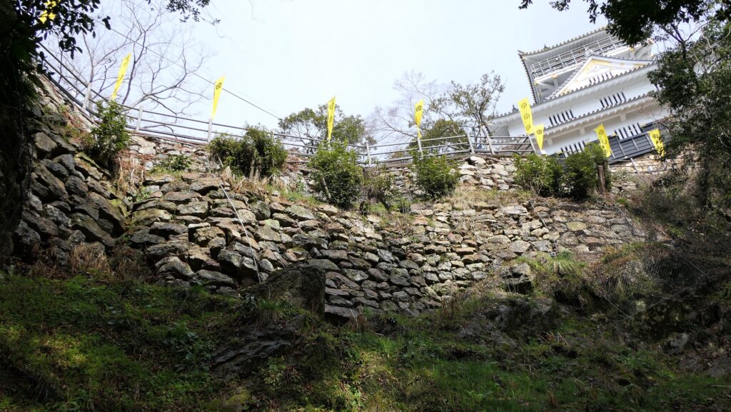
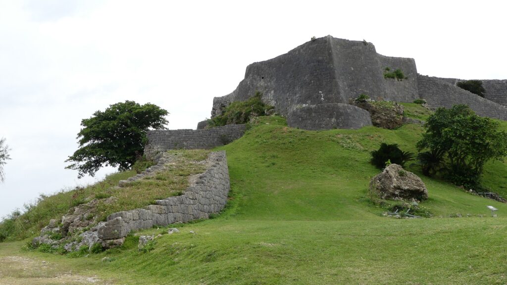
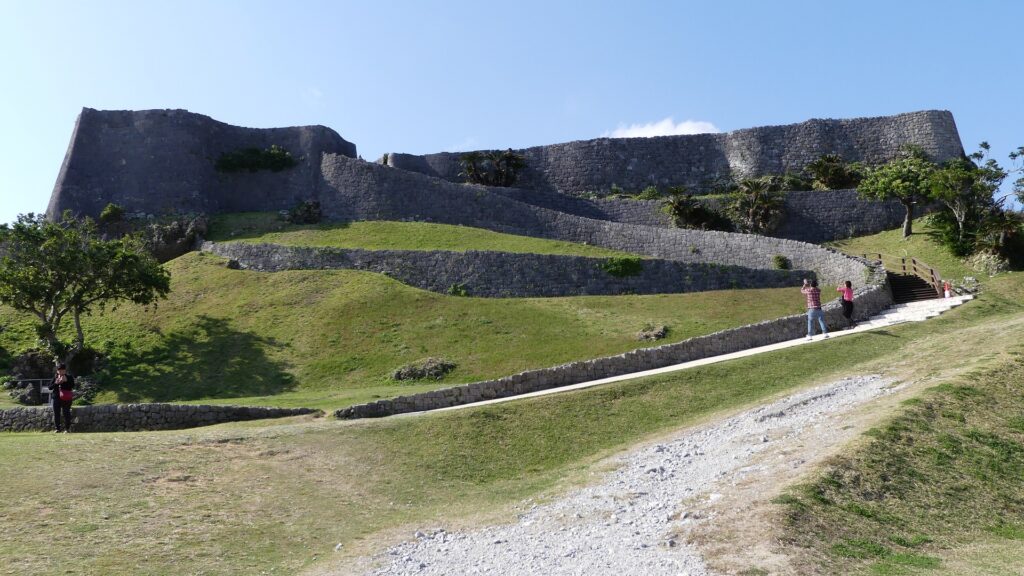
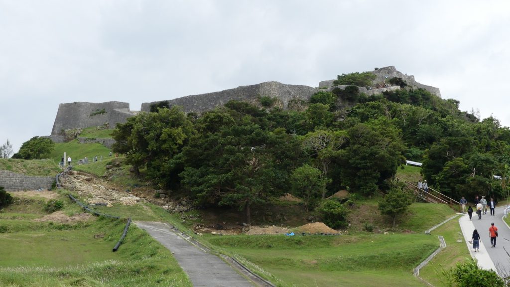
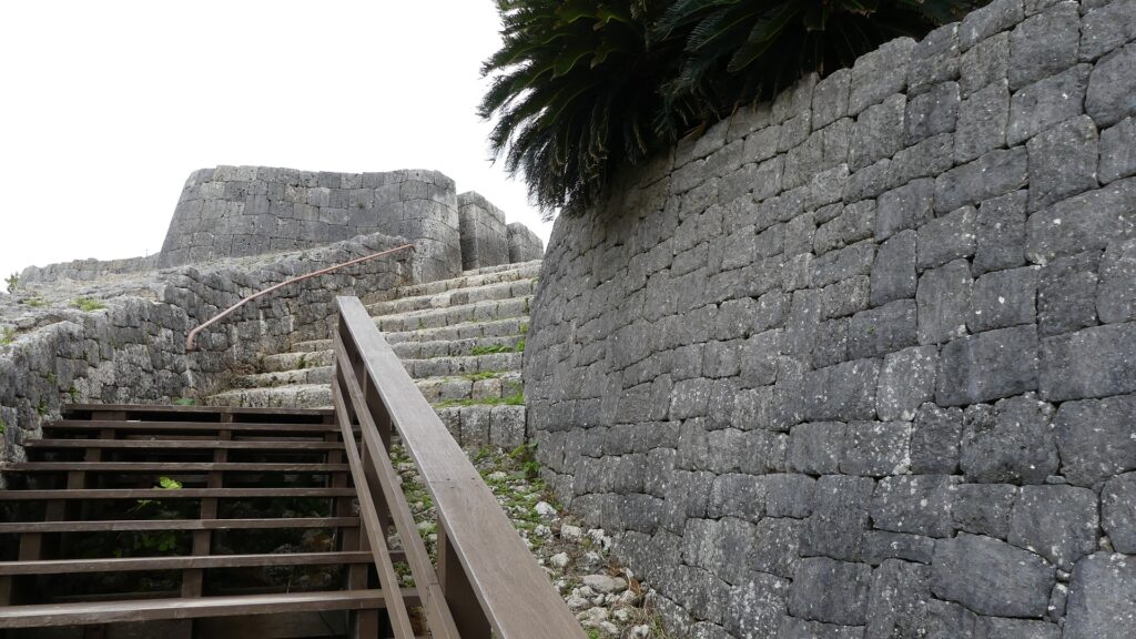
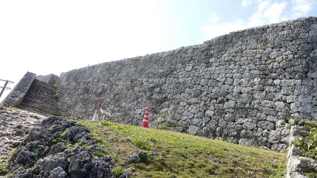
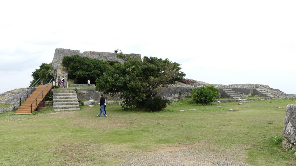
北西部分は、一段目の三の曲輪、二段目の二の曲輪、最上段の一の曲輪から成り立っています。この部分を囲んでいる石垣は「内郭」と呼ばれ、よく保存されており、美しく、そして強固です。 The northwest part consists of the Third Enclosure as the first tier, the Second Enclosure as the second tier, and the First Enclosure as the last tier. The stone walls surrounding this part are called the Inner Fence or “Naikaku” and remain very well-preserved and look very beautiful and strong.
内郭の全景~The whole view of the inner fence
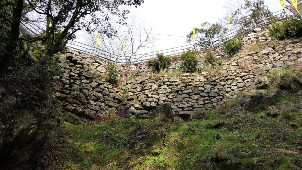
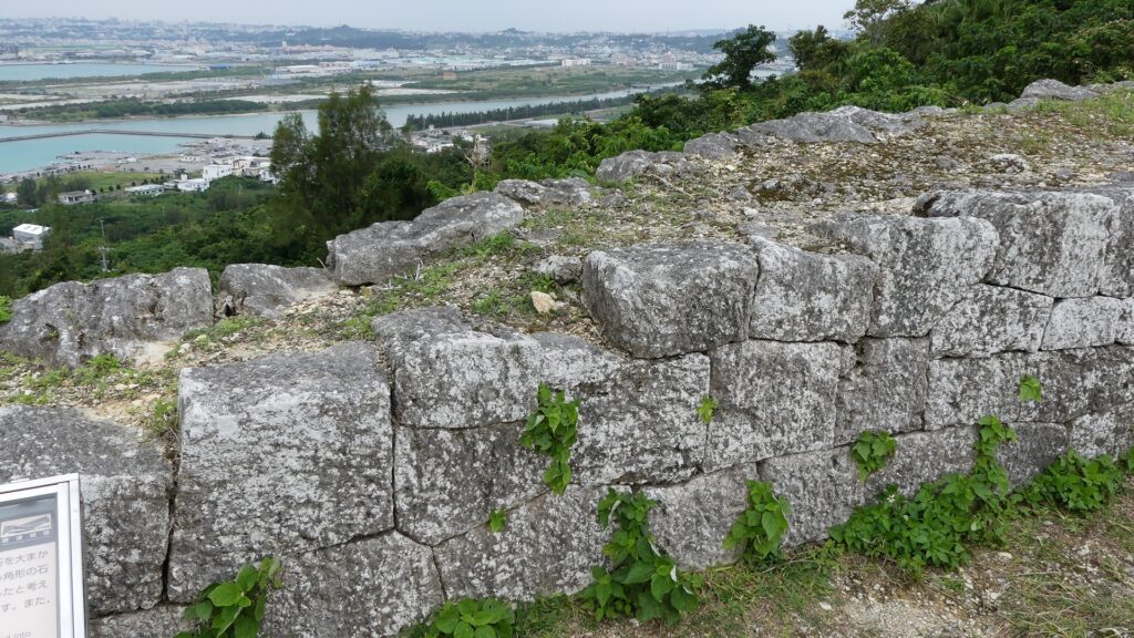
この城のほとんど全ての石垣は、「布積み」と呼ばれる方法で、四角く加工された石灰岩で水平に積まれています。また、それを鈎状に組むことで強度を増すための工夫も見られます。 Almost all of this castle’s stone walls are piled with square processed lime stones horizontally, the method called “Nuno-zumi”. They are also arranged in a hooked pattern to increase their strength.
勝連城の石垣~The stone walls of Katsuren Castle
曲輪群と素晴らしい景色~Enclosures and Great Views
三の曲輪の石垣は、訪れる人の前に立ちはだかります。この曲輪に門があり、今はその土台の石垣を見ることができます。この辺りは防衛上重要な地点であったにちがいありません。この曲輪の中は、儀式の場所として使われたようです。 The stone walls of the Third Enclosure stand out high for visitors. The enclosure had a gate, and We can see the gate’s stone wall base. The route to the enclosure turns at a right angle at the gate. This area must have been the an important point for defense. The inside of the enclosure seemed to be used as the space for ceremonies.
三の曲輪の入口~The entrance of the Third Enclosure三の曲輪の内部~The inside of the Third Enclosure
二の曲輪には首里城の正殿ような舎殿がありました。すなわち、この城では最も重要な場所ということです。主殿の屋根は瓦葺きであり、当時の琉球では大変稀なことでした。これらのことからもこの城がいかに栄えていたかがわかります。 The Second Enclosure had the palace like the the Main Palace in Shuri Castle. That meant this place was the most important for the castle. The palace had roof tiles which were very rare for that period in Ryukyu. These facts also prove the prosperity of the castle.
主殿跡~The ruins of the main palace
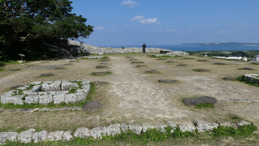
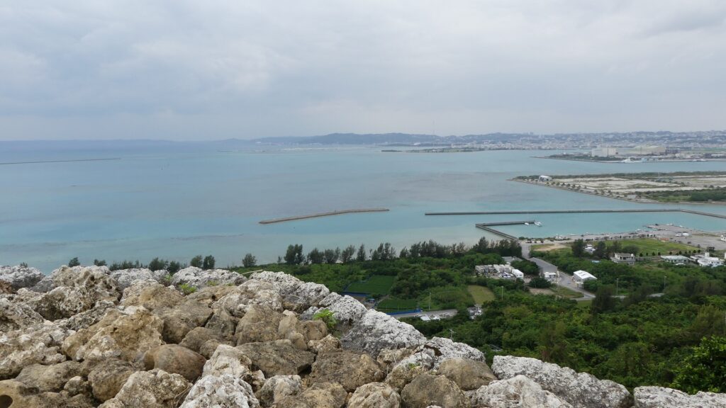
一の曲輪は、詰めの曲輪です。この曲輪には敵の攻撃を防ぐため、三の曲輪のように、正面の高石垣と屈曲した入口がありました。この曲輪にも瓦屋根の建物がありました。この場所は最も高い位置にあり、障害物もないため、ここからは360度の素晴らしい景色を堪能できます。 The First Enclosure is the last enclosure. The enclosure, like the Third Enclosure, has high front stone walls and a bent entrance route to prevent enemies from attacking. The enclosure also had a building with roof tiles. This place is the highest point with no obstruction, so you can have an excellent 360 degrees view from it.
一の曲輪の石垣~The entrance of the stone walls一の曲輪の入口~The entrance of the First Enclosure一の曲輪からの南方の景色~A southern view from the First Enclosure一の曲輪からの北方の景色~A northern view from the First Enclosure
この城には「御嶽」と呼ばれる多くの祈願所がありました。これは琉球のグスクに見られる共通の特徴です。例えば、一の曲輪には「玉ノミウヂ御嶽」跡があり、それでは城を守るための霊石が祀られていました。建物がその石の上に建てられていました。 The castle had many spots for praying called “Utaki”. That was the common feature for Gusuku in Ryukyu. For example, there are the ruins of “Tamanomiuji-Utaki” in the First Enclosure where people prayed the holy stone for protecting the castle. The building was built on the stone.
「玉ノミウヂ御嶽」跡~The ruins of “Tamanomiuji-Utaki”
その後~Later History
阿麻和利が倒されても城は祈願所として使われていましたが、いつしか廃城となりました。三の曲輪にある「肝高の御嶽」跡はその時代のものです。城のほとんどの石垣は長い間残っていたようです。ところが、約100年前の大正時代と昭和初期に、残念ながら多くの石垣が工事資材として遺跡から運び出され使われてしまいました。そのために外郭の石垣は基礎だけになっているのです。第二次世界大戦後、遺跡は国の史跡に指定されました。ついには、2000年から琉球王国のグスク及び関連遺産群として世界遺産に登録されています。 Although the castle was still used as the a places for prayer for a while after Amawari had been beaten, it was abandoned at some point. The ruins of “Chimudaka-nu-Utaki” in the Third Enclosure are from that period. Most stone walls of the castle seemed to remain for a long time. However, in the Taisho Era and the first Showa Era, about 100 years ago, many stones were unfortunately taken away from the ruins for and used as construction materials. That’s why we now see only the base of the Outer Fence. After World War II, they were designated as a National Historic Site. Lastly, they have also been on the World Heritage List as Gusuku Sites and Related Properties of the Kingdom of Ryukyu since 2000.
肝高の御嶽があった三の曲輪~The Third Enclosure where Chimudaka-nu-Utaki was
私の感想~My Impression
勝連城は素晴らしい景勝地です。グレーの石垣、緑の丘、沖縄の青い海が素晴らしいコントラストを醸し出しています。ここからの眺めもまた特別なものです。その上にこの城は、まるで阿麻和利から1世紀後の日本本土の戦国時代の山城のように強力だと思います。この城は美しさと強さを併せ持っていると断言できます。 Katsuren Castle is a great place to visit, because its gray stone walls, the green hill, and Okinawa’s blue sky can make a very good contrast. Views from the ruins are also very special. Moreover, I think the castle is so strong that is just like a mountain castle in the mainland of Japan in the Sengoku Period, about one century after Amawari. I can definitely say this castle has both of beauty and strength.
城跡からの眺め~A view from the castle ruins
ここに行くには~How to get There
ここには車で行かれることをお勧めします。 那覇空港から: 車の場合、那覇空港自動車道に名嘉地ICから入り、西原JCTで沖縄自動車道に合流し、沖縄北ICで降りてください。城跡はそこから10km以内で、休憩所に駐車場があります。 I recommend you to visit it by car. From the Naha Airport: By car, enter Naha Airport Expressway at the Nakachi IC, join Okinawa Expressway at the Nishihara JCT, and get off the expressway at Okinawa-Kita IC. The ruins are within 10 km of the IC, and the guide house offers a parking lot.