123.滝山城~Takiyama Castle

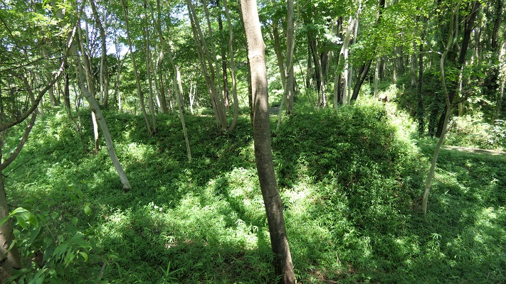
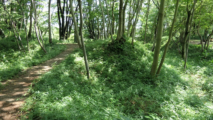
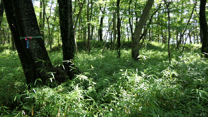
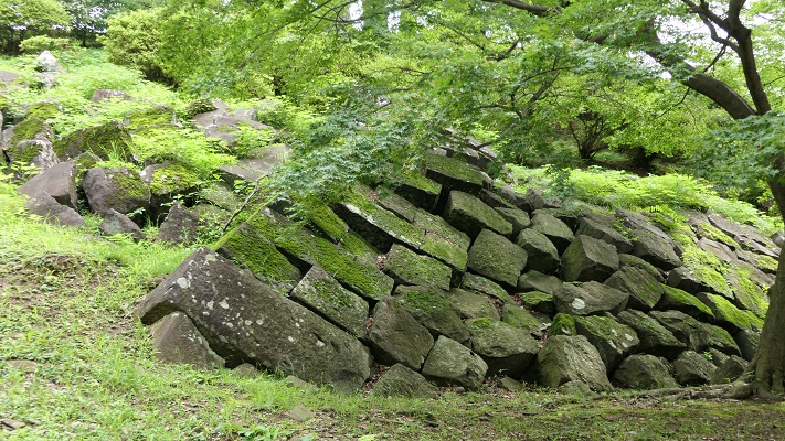
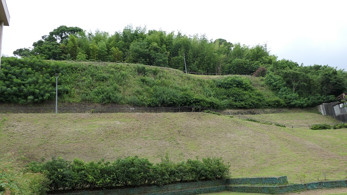
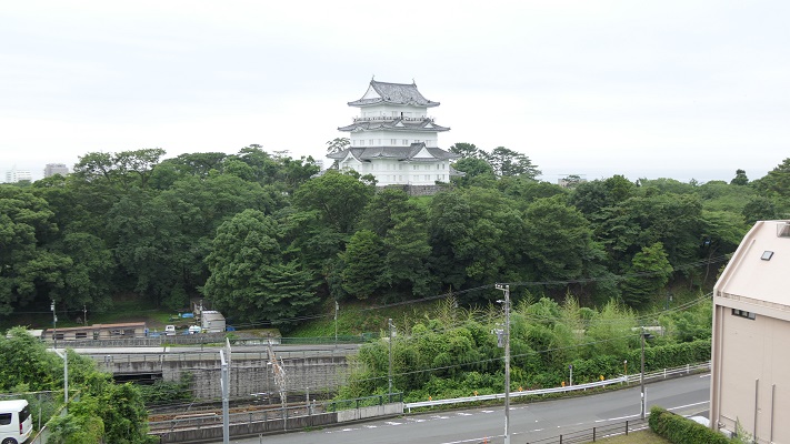
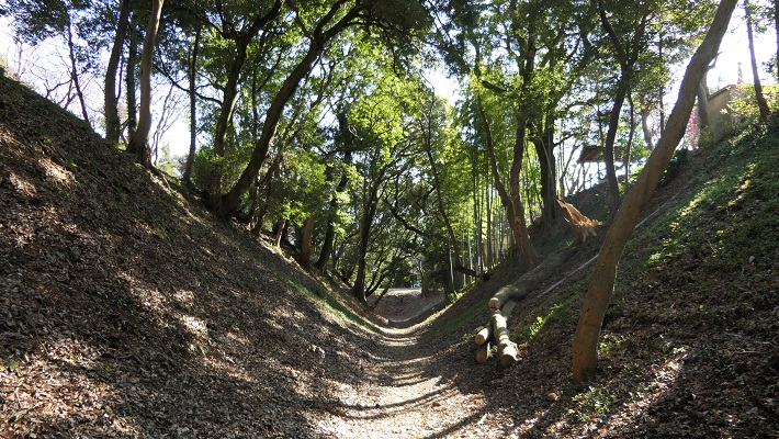
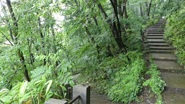
城跡は自然とともに残っています。
The castle ruins remain with nature.

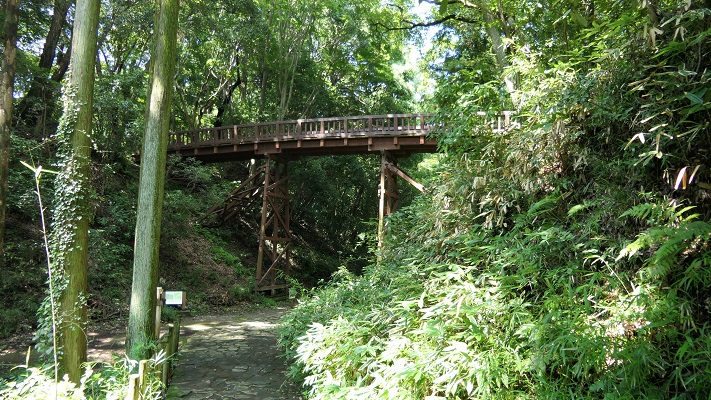
本丸と中の丸をつなぐ曳橋~The movable bridge between Honmaru and Nakanomaru

立地と歴史~Location and History

滝山城は現在の八王子市の多摩川南岸の河岸段丘上にありました。この城の起源は、戦国時代のいずれかの時点で大石氏によると言われていますが、1560年の上杉謙信の関東侵攻をきっかけとして、北条氏照が拡張、完成させました。この城の使命は、小田原城の防御線になることと、小田原と北関東とのルートを確保することでした。
Takiyama Castle was located on the southern bank terrace of Tamagawa River in what is now Hachioji City, Tokyo. The origin of the castle is said to be by the Oishi clan sometime in “Sengoku” or the Warring States Period, but Ujiteru Hojo improved and completed the castle, inspired by the Kenshin Uesugi’s Kanto invasion in 1560. The mission of the castle was to be the defense line for Odawara Castle and to hold the route between Odawara and the northern Kanto region.

滝山城の位置、赤い線は1560年の上杉謙信の侵攻概略ルート、青い線は1569年の武田信玄のもの~The location of Takiyama Castle, the red line shows the rough attack route of Kenshin Uesugi in 1560, the blue line is that of Shingen Takeda in 1569

この城の北側は多摩川に沿って急な崖となっていて、攻めるには困難でした。この城の3つの主な通路は、川の反対側にある滝山街道につながっていました。これらの通路は全て二の丸に集まっていました。二の丸は防衛の中心拠点であり、桝形という方形の入り口と、馬出と呼ばれる障壁となる関門が通路に向かって設置されていました。
The northern side of the castle was a steep cliff along Tamagawa River which is difficult to attack. The three main routes to the castle were connected from the Takiyama Road, the opposite side of the river. The routes all gathered the Ninomaru enclosure. The enclosure was the defensive center which had square entrances called Masugata and gateway barriers called Umadashi heading towards these routes.

城周辺の起伏地図~The relief map around the castle

二の丸の後ろには、中の丸と本丸がありました。双方が曳橋という可動橋によってつながっており、緊急時には容易に取り外しが可能でした。本丸は、中心でかつ最後の曲輪となりますが、比較的小さいように思えます。歴史家は、そこが土豪が作ったこの城の最初の場所だったのだろうと推測しています。
The back of Ninomaru are Nakanomaru and Honmaru enclosures. Both were tied by a movable bridge called Hikihashi that could be removed easily for in emergency. Honmaru was the main and last enclosure which looked relatively small. Some historians speculate it could be the origin of the castle for a local clan.

城周辺の地図~The map around the castle

1569年、甲斐(現在の山梨県)から武田信玄が北条の領地に侵入し、この城を攻撃しました。信玄は二の丸に迫りましたが、諦めて小田原の方に向かったと言われています。氏照は滝山城を守り切ったのです。
In 1569, Shingen Takeda from Kai Province (now Yamanashi Pref.) invaded Hojo’s territory and attacked the castle. It is said that Shingen approached Ninomaru, but gave up and transferred to Odawara. Ujiteru was successful in keeping Takiyama Castle.
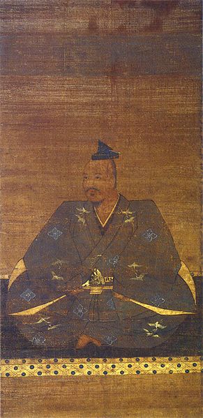
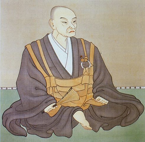
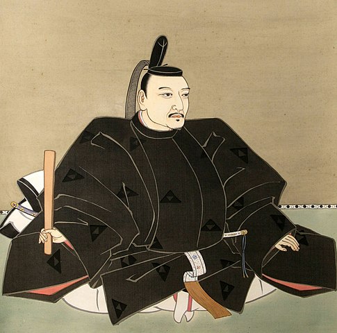
武田信玄肖像画、高野山持明院蔵、16世紀~The portrait of Shingen Takeda, owned by Jimyo-in, in the 16th century(licensed under Public Domain via Wikimedia Commons

1584年前後、氏照は城下町ごと八王子城の方に移っていきました。この理由は歴史家によって分かれています。一つは、武田との戦いの結果から北条がより強い城を必要としたというものです。もう一つは、1578年に謙信が死に、1582年に武田が滅亡したので滝山城はもう必要なくなったというものです。
Around 1584, Ujiteru moved to Hachioji Castle with the castle town. Historians’ opinion about the reason remain divided. One is that Hojo needed a stronger castle than Takiyama because of the result of battle with Takeda. The other is that there would be no need for Takiyama Castle after Kenshin died in 1578, and Takeda was destructed in 1582.
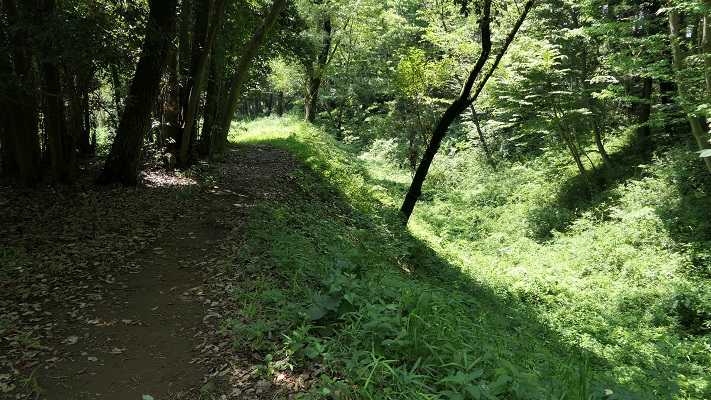
二の丸周辺~Around Ninomaru

特徴~Features

城周辺の航空写真~The aerial photo of around the castle

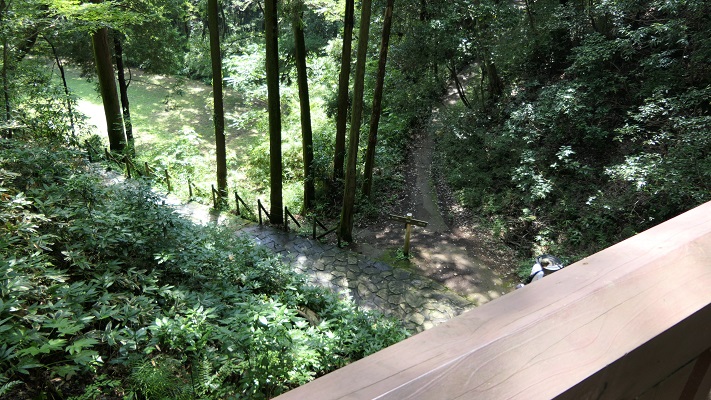
現在、城跡は都立滝山公園という自然公園の一部になっています。木々、植物、そして花に囲まれたハイキングコースがあります。車かバスを使った場合には、三の丸と小宮曲輪に挟まれた通路から入っていきます。
Now, the ruins of the castle are inside of a nature park called Metropolitan Takiyama Park. There are hiking trails among trees, plants and flowers. When using cars or buses, you will enter one of the routes sandwiched Sannnomaru and Komiya enclosures.
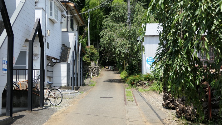
駐車場かバス停からの通路~The route from the parking lot or the bus stop

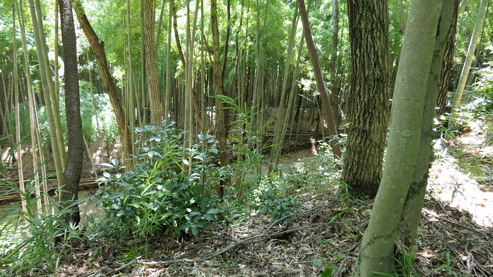
このルートは狭く、美しい竹林の合間をまっすぐ登っていきます。
The route is narrow and straight up among a beautiful bamboo forest.
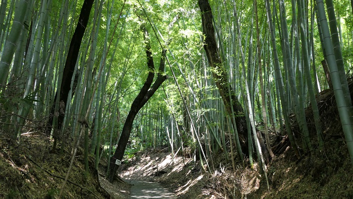
竹林に囲まれた通路~The route surrounded by the bamboo forest

城跡の入り口は折れ曲がっていて、かつては城全体を囲んでいた長い空堀が目に入ってきます。
The entrance of ruins is zigzagged and you can see a long dry moat that surrounded the whole castle area in the past.
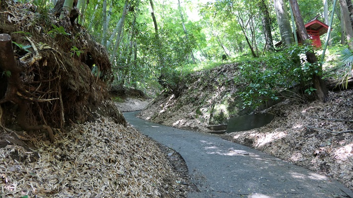
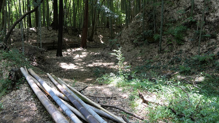
城跡の入り口~The entrance of the castle ruins
城跡を囲む空堀~The dry moat surrounding the castle ruins

敵は、周りの曲輪による両側からの反撃を受けることになります。1569年の武田の攻撃によりこの辺りは占領されてしまったと言われています。
Enemies had to break counterattacks from both sides of the enclosures around. It is said that Takeda’s attack in 1569 was able to capture this area.
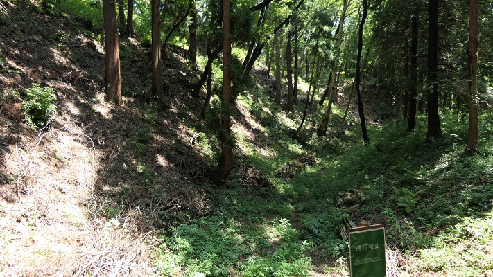
三の丸を見上げる~Looking up Sannomaru enclosure

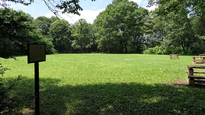
道は左手に深い谷を見ながら進み、千畳敷と呼ばれる広場を過ぎ、防御の中心拠点二の丸に至ります。ここには馬出しと桝形の遺構があります。
The route goes on next to a deep valley on your left. Then, passing a wide area called Senjojiki, you will reach the defense center Ninomaru. There are the ruins of Umadashi and Masugata.
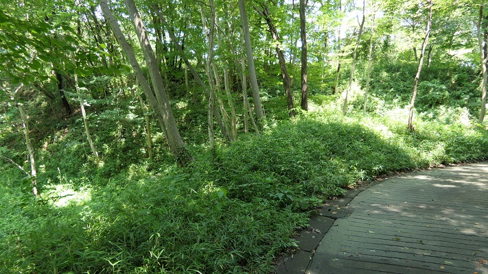
左手は深い谷です~The deep valley on the left
千畳敷~The area called Senjojiki
馬出し跡、正面~The ruins of Umadashi, the front side
馬出し跡、背面~The ruins of Umadashi, the back side
二の丸の中心地~The center of Ninomaru

その後、中の丸と本丸の間にかかった曳橋が見えてきます。
After that, you can see the restored movable bridge between Nakanomaru and Honmaru.
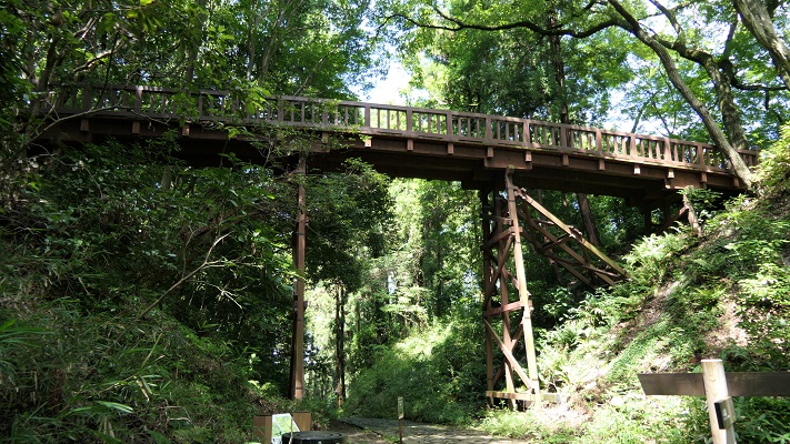
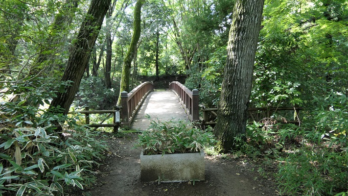
本丸と中の丸をつなぐ曳橋~The movable bridge between Honmaru and Nakanomaru
曳橋~The movable bridge
中の丸から見た橋~The bridge from Nakanomaru

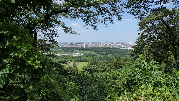
中の丸からは多摩川周辺の風景を眺めることができます。
You can also see a view of around Tamagawa River from Nakanomaru.
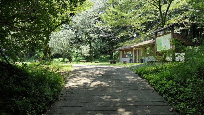
中の丸~Nakanomaru enclosure
中の丸からの眺め~A view from Nakanomaru

最近の発掘により、本丸には桝形があり、その床には自然石が敷き詰めてあり、排水の仕組みもあったとのことです。
The recent excavation found that Honmaru had a Masugata gate on the floor covered with natural river stones, and a draining system.
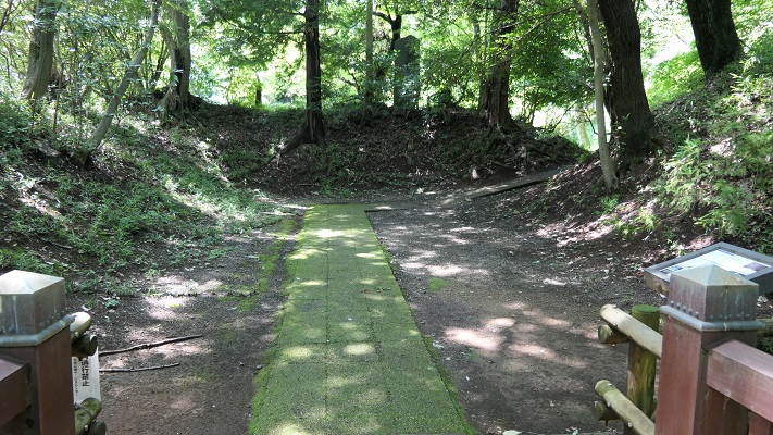
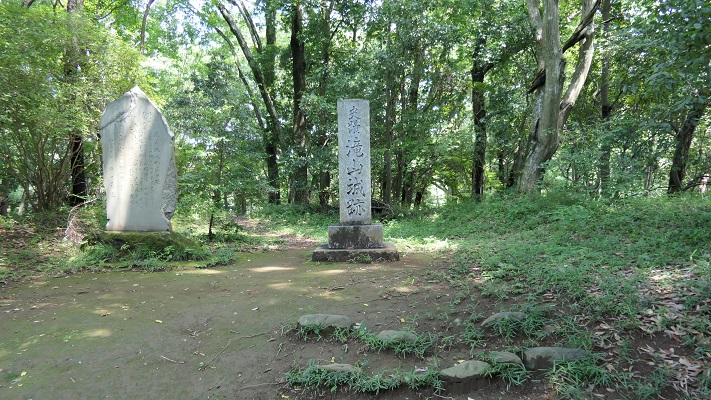
本丸の桝形跡~The ruins of Honmaru Masugata gate
本丸の内部~The inside of Honmaru

その後~Later History

この城は、戦国時代のうちに放棄されました。そのため、当時の城の構造がよい状態で自然とともに残っているのです。城跡は、1951年に国の史跡にも指定されました。
The castle was abandoned during the Warring States Period. That’s why the structure of a castle at that time remains well with nature. The ruins were designated as a National Historic Site in 1951 as well.
曳橋からの風景~A view from the movable bridge

私の感想~My Impression

城跡となっている場所は、主に自然公園として使われています。小道を歩き回っている観光客の人たちがたくさんいます。歴史ファンというよりは自然愛好家という感じです。これも史跡を活用する一つのやり方と思います。また、この城が自然の地形をうまく活用して作られたとも言えるでしょう。
The site of the castle ruins is mainly used as a natural park. You can see many tourists walking around the trails. They look like nature lovers rather than history fans. I think this is one of the ways to use historical sites. It also proves the castle was built using natural terrain very well.
小宮曲輪から通路を見下ろす~Looking down the route from Komiya enclosure

ここに行くには~How to get There

車で行く場合:中央自動車道の八王子ICから約15分かかります。国道411号(滝山街道)沿いに観光駐車場があります。
JR八王子駅または京王八王子駅からバスで行く場合:戸吹、秋川駅、または戸吹スポーツ公園入口行きバスに乗り、滝山城址下バス停で降りてください。
If you want to go there by car: It takes about 15 minutes from the Hachioji IC on Chuo Expressway. There is the parking lot for tourists along Route 411 (Takiyama Road).
If you want to go there by bus from JR Hachioji station or Keio-Hachioji station: Take the bus for Tobuki, Akikawa-eki or Tobuki-sports-koen-iriguchi and take off at the Takiyama-joshi-shita bus stop.

リンク、参考情報~Links and References

都立滝山公園・滝山城跡、八王子市~Hachioji City
よみがえる滝山城(Only Japanese)
・「関東の名城を歩く 南関東編/峰岸純夫、齋藤慎一編」吉川弘文館(Japanese Book)
・「歴史群像37号、戦国の堅城・滝山城」学研(Japanese Magazine)
・「越山、上杉謙信侵攻と関東の城」埼玉県立嵐山史跡の博物館(Japanese illustrated book)

23.小田原城~Odawara Castle

この城には2つの顔があります。
This castle has two faces.

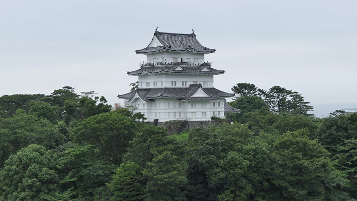
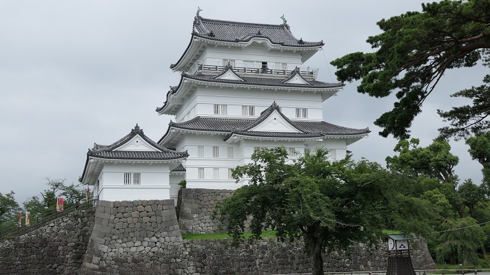
八幡山古郭から見た復興天守~The reconstructed Tenshu keep from Hachimanyama-Kokaku (old castle)

立地と歴史~Location and History

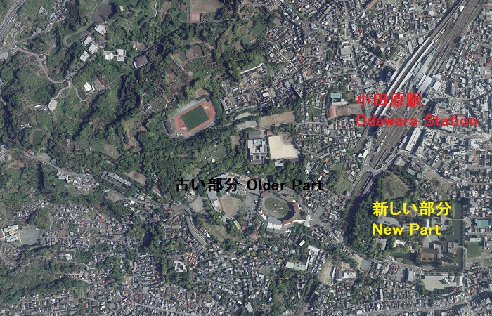
小田原城は大まかに、「八幡山古郭」と呼ばれる古い西側の部分と、通常「小田原城」と呼ばれている新しい東側部分に分けられます。新しい方は、JR線から簡単にアクセスでき、小田原駅の南側にあります。この城は最初は中世に大森氏により築かれたと言われています。
Odawara Castle can roughly be divided into an older western part called “Hachimanyama-Kokaku” and a new eastern part, which we now usually call “Odawara Castle”. The new part can be easily accessed by JR railways, and is located the south of Odawara Station. It is said that the castle was first built by the Omori clan in the Middle Ages.

小田原中心部の航空写真~The aerial photo of the central Odawara(国土交通省航空写真に加筆)

また、北条早雲が伊豆国(現在の静岡県東部地方)から来て大森氏から城を奪ったとも言いますが、詳細は不明です。戦国時代には、北条氏がこの城を本拠地として使いました。新しい部分の方に館を構え、古い部分の方は籠城するときに使われたようです。
It is also said that Soun Hojo from Izu Province (now the eastern part of Shizuoka Pref.) seized it from the Omori, but these details are uncertain. During the Warring States Period, the Hojo clan utilized the castle as their home base. It seems they lived in the hall in the new part and used the older part for besieged.

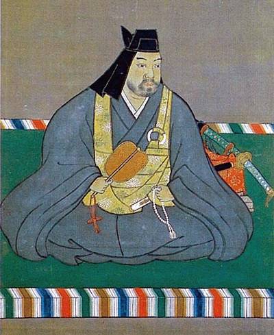
北条早雲肖像画の複製、小田原城天守閣蔵~The replica of the portrait of Soun Hojo, owned by Odawara Castle(licensed under Public Domain via Wikimedia Commons)

この城は3回籠城戦を経験しました。まず上杉謙信、次には武田信玄によるものです。2人ともよくその強さを知られた戦国大名ですが、北条は両方とも城を守り切ることに成功しました。最後の3回目は、天下人の豊臣秀吉による名高い1590年の小田原征伐と呼ばれる戦いです。
The castle was besieged three times. First, by Kenshin Uesugi. Second, by Shingen Takeda. While both are well known strong warlords, the Hojo were successful in defending the castle both times. The third and last one was the famous Siege of Odawara in 1590 by the ruler Hideyoshi Toyotomi.

上杉謙信肖像画~The portrait of Kenshin Uesugi(licensed under Public Domain via Wikimedia Commons)

北条は秀吉と戦いたくありませんでした。この戦いが始まったのは、秀吉が決定した北条と真田の領地の取り決めを、北条が破ったからだと言われています。しかしある歴史家は、秀吉は最初から北条と戦って排除するために騙したのだと主張しています。私は、その方が妥当と思います。
Hojo didn’t want to fight with Hideyoshi. It is said that the battle started with Hojo defying Hideyoshi’s decision of the territories of Hojo and Sanada. However, a historian argues that Hideyoshi tried to fight and exclude Hojo from the first, then deceived them. I’d rather prefer the later.

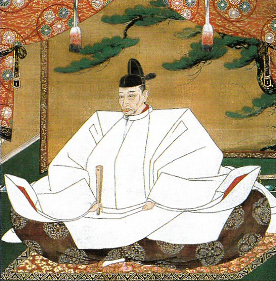
豊臣秀吉肖像画、加納光信筆、高台寺蔵~The Portrait of Hideyoshi Toyotomi, attributed to Mitsunobu Kano, owned by Kodaiji Temple(licensed under Public Domain via Wikimedia Commons)

どちらにしろ、戦いの前に北条は城下町を含む城全体を、巨大な土塁と空堀で囲みました。これを「総構え」といいます。その外周は約9kmあり、一部は二重三重に囲まれていました。秀吉は、20万以上の軍勢をもって3ヶ月間城を取り囲みました。
Anyway, before the battle, Hojo surrounded the whole area including the castle town by huge earthen walls and trenches called “So-gamae”. Their perimeter was about 9 km and part of them were doubled or tripled. Hideyoshi laid siege to the castle with over 200,000 soldiers for three months.

赤い線は総構え土塁の推定ライン~The red line shows the estimated line of So-gamae earthen walls

籠城している間に、ほとんどの北条の支城は落城しました。多くの歴史家は北条は成す術がなかったと言います。一方では、秀吉側は一兵たりとも小田原城の中には侵入できなかったのです。事実、秀吉自身がこの戦いの後、彼の大坂城でこの城を真似ています。この戦いに参加した多くの他の大名も同様でした。
During the siege, most of Hojo’s branch castles were captured. Many historians say there was nothing for Hojo to do. On the other hand, any soldier on Hideyoshi side was not able to invade the inside of Odawara Castle. In fact, Hideyoshi himself emulated the castle for his Osaka Castle after the battle. Many other lords who joined the battle did so too.

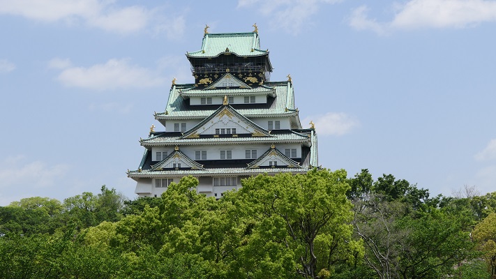
大坂城~Osaka Castle

北条は、秀吉に降伏した後改易となりました。しかし秀吉は味方に対しても過酷でした。彼は徳川家康に対して、領地に戻ることなくそのまま北条の領地に移るよう命令しました。織田信雄もまた移封を拒んだため改易となります。江戸時代には、城の領域は新しい部分だけに縮小し、小田原藩に属しました。
Hojo got fired after he surrendered to Hideyoshi, who was also cruel to his supporters. He ordered Ieyasu Tokugawa to directly move to Hojo’s territory without returning home. Nobukatsu Oda was also fired because he rejected his transfer. In the Edo Period, the castle was reduced to the new area belonging to Odawara Domain.

相模国小田原城絵図部分、江戸時代~Part of the illustration of Odawara Castle in Sagami Province, in the Edo Period(出典:国立公文書館)

特徴~Features

現在、小田原駅の東口からは、JRの線路に沿って小田原城の本丸まで近道で行くことができます。もし時間があれば、正面の方に向かって、それからお城端通りを右に曲がってください。その内に二の丸に着きますが、ここは最近整備計画が完了したところです。
Now, from the east entrance of Odawara Station, you can take a shortcut directly to the Honmaru enclosure of Odawara Castle along the JR railways. If you have time, I recommend going towards the front, then turn right on Oshirobata Street. You will reach the Ninomaru enclosure where the development project was done recently.

城周辺の地図~The map of around the castle

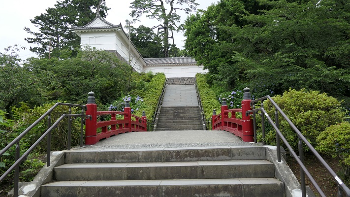
城への登城ルートが再現されていて、復元された馬出門と銅門を通ります。これらは、古写真や図面などを基に復元されました。
The original route to the castle has been recreated with the restored Umafdashi-mon Gate and Akagane-mon Gate. They were restored based on old photographs, drawings and so on.

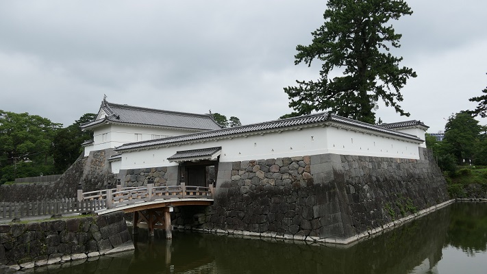
馬出門~Umafdashi-mon Gate
銅門~Akagane-mon Gate

そこから更に登っていくと、常盤木門を通り過ぎて天守に到着します。両方とも昭和時代に外観復元されたものです。
You can go up further and arrive at the Tenshu keep passing through the Tokiwagi-mon Gate. Both of them were apparently restored in the Showa Era.

本丸に向かいます~Going to Honmaru enclosure
常盤木門~Tokiwagi-mon Gate

天守は博物館としても使われています。左後方から戻ってくると、1923年の関東大震災で崩れたままになっている本丸石垣も見ることができます。
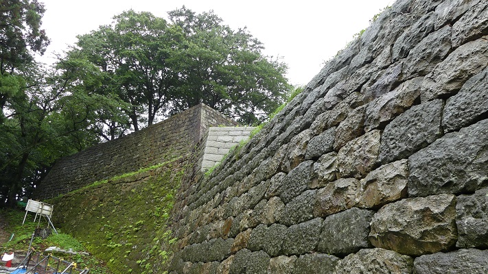
Tenshu is also used as a museum. If you return taking the left back route, you can also see abandoned stones which collapsed from Honmaru stone walls when Great Kanto Earthquakes in 1923 happened.

外観復元天守~The apparently restored Tenshu keep
崩れた石垣~The collapsing stone walls

古い方の小田原城にご興味があるのでしたら、近くにいくつか遺跡があります。
If you interested in the older part of Odawara Castle, there are few ruins near it.

古城周辺の地図~The map of around the old castle

・八幡山古郭東曲輪:ここは古城の端に当たりました。最近整備されて一般公開されています。ちょっと地味に見えますが、ここからは海を背景に天守の写真を撮ることができます。ここはちょうど線路を挟んで天守の反対側にあるからです。
・The Eastern Enclosure of Hachimanyama-Kokaku: It was the edge of the old castle. It has been developed recently and open to the public. It still seems to be simple, but you can take a picture of Tenshu with the background of the sea because of its location being just the opposite of Tensh across from the railways.

八幡山古郭東曲輪~The Eastern Enclosure of Hachimanyama-Kokaku
曲輪からの眺め~A view from the enclosure

・小峰大堀切:ここは「総構え」の数少ない遺構の一つです。この遺構のうち、「東堀」は約170mの長さがあり、一部曲がりくねっています。堀の底を歩いて通り抜けできるので、大きさを実感できます。小田原城下全体をこのような壮大な仕掛けで取り囲んでいたのです。
・Komine large-scale trenches: They are a few remaining ruins of “So-gamae”. Out of them, The East Moat “Higashi-bori” is about 170m long and partly zigzagged. You can walk through the bottom of the trench and feel how large it is. Imagine such huge structures surrounded the whole of Odarwara City!

東堀大堀切~Higashi-bori large-scale trench
曲がりくねった部分~The zigzaged part

・三の丸外郭新堀土塁:こちらは2012年から公開されている場所です。第二次世界大戦前まで皇族の閑院宮家の別荘でした。戦後になって、小田原市がある機関から購入しました。ここからは、小田原周辺の山や海を一望に見渡せます。秀吉が本陣を置いていた石垣山城も見えます。
・Sannomaru outline Shinbori earthen walls: They have been open since 2012. The ground was used for the second house of the Imperial Family Kaninnomiya before World War II. After the war, Odawara City bought it from an institution. You will have a great view of mountains and the sea around Odawara including the ruins of Ishigakiyama Castle where Hideyoshi built his stronghold.

三の丸外郭新堀土塁~Sannnomru outline Shinbori earthen walls
土塁からの眺め~A view from the earthen walls

その後~Later Life

明治維新後、ほとんどの城の建物は撤去されました。明治中期には、城跡は御用邸の一つとして使われましたが、関東大震災で壊滅してしまいます。その後、小田原城址公園として整備されました。天守は1960年に再建されますが、それまでは天守台の上に観覧車がありました。
After the Meiji Restoration, most of the castle buildings were demolished. In the mid Meiji Period, the ruins of the castle were used as one of the Imperial Villas, but the Great Kanto Earthquakes broke all of them. After that, they were developed as Odawara Castle Park. Tenshu keep was rebuilt in 1960 after a Ferris wheel was installed on the Tenshu base.

天守台の上の観覧車、1950年代~The Ferris wheel on the Tenshu base, in the 1950s(小田原市Websiteより引用)

私の感想~My Impression

日本語には「小田原評定」という比喩表現があり、延々結論が出ない会合のことを指します。北条は3ヶ月の間降伏するか否か逡巡していたと思われたのでしょう。ところがこの表現は、この戦いから100年以上後の江戸時代の軍記物により最初に広まったのです。滅びた北条は反論できません。
In Japanese, there is a figurative expression called “Odawara Hyojo” which means an inconclusive conference. People think Hojo wondered if they should surrender or not during the three month siege. However, the expression first spread more than 100 years after the battle in war chronicles of the Edo Period. The defeated Hojo couldn’t argue that.

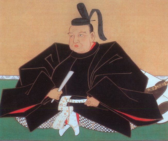
北条氏政肖像画、北条氏四代目当主、小田原城天守閣蔵~The portrait of Ujimasa Hojo, the forth head of the Hojo clan, owned by Odawara Castle(licensed under Public Domain via Wikimedia Commons)

守備側の主な2つの選択肢としては、援軍を待つか、攻撃側を撃退するかでしょう。私は、北条は同盟を結んでいた伊達政宗の援軍を待っていたのだと思います。しかし、正宗はついには秀吉に臣従してしまい、一方秀吉を撃退することも不可能でした。残ったのはいかに降伏するかです。実際、北条の降伏とその条件を交渉する使者が行き来していました。その条件は、北条は一部の領地を維持できるものであったと言われています。北条はそれを受け入れましたが、最終的には再び騙されてしまったのです。
The two major options for defenders are to wait for reinforces or to repel the attackers. I think that Hojo was waiting for Masamune Date who was once their ally, but finally served Hideyoshi as a vassal. The other option, beating Hideyoshi back was impossible. The rest was how they surrendered. Indeed, some messengers suggested Hojo surrender and negotiate conditions. It is said that the condition might allow Hojo to keep part of their territory. Hojo accepted that, but they were deceived again in the end.

伊達政宗像、仙台市博物館蔵(The picture of Masamune Date owned by Sendai City Museum)licensed under Public Domain via Wikimedia Commons

ここに行くには~How to get There

新しい方の「小田原城」または八幡山古郭東曲輪に行くには:
電車の場合は、小田原駅から徒歩で約10分です。車の場合は、西湘バイパス小田原ICから約5分です。小田原城址公園周辺に私営の駐車場があります。
小峰大堀切または三の丸外郭新堀土塁に行くには:
電車の場合は、小田原駅から徒歩で約20~30分です。車の場合は、小田原厚木道路荻窪ICから約5分です。遺跡近くの城山公園に駐車可能です。
To the new “Odawara Castle” or The Eastern Enclosure of Hachimanyama-Kokaku:
When using train, it takes about 10 minutes on foot from Odawara Station. When using car, it takes about 5 minutes from the Odawara IC on Seishou Bypass. There are private parking lots around Odawara Castle Park.
To Komine large-scale trenches or Sannomaru outline Shinbori earthen walls:
When using train, it takes about 20 to 30 minutes on foot from Odawara Station. When using car, it takes about 5 minutes from the Ogikubo IC on Odawara-Atsugi Road. You can park at the Shiroyama Park near the ruins.

リンク、参考情報~Links and Refernces

【公式】小田原城 難攻不落の城~【Official】Odawara Castle Immortal Castle
小田原市、まち歩きパンフレットOdawara City, Town walk brochure
小田原城街歩きガイド(Only Japanese)
・「北条氏滅亡と秀吉の策謀、森田善明著」洋泉社(Japanese Book)
・「よみがえる日本の城2」学研(Japanese Book)
131.村上城~Murakami Castle

戦国時代のこの城の姿を伝える絵図が残っています。
A drawing shows the castle’s appearance in the Warring States.

本丸の出櫓跡の石垣~The stone walls of De-Yagura ruins at Honmaru

立地と歴史~Location and History

村上城は、「臥牛山」という牛が臥せている形をした山にありました。この場所は、新潟県の北部にある村上市に所属しています。この城がいつ最初に築かれたかははっきりしません。戦国時代には本荘氏がこの城を所有していて、当時は本荘城と呼ばれていました。
Murakami Castle was located on a mountain called “Gagyu-San” which means a mountain which looks like a cow laying down. The place belongs to Murakami City in the northern part of Niigata Pref. It is uncertain when castle was first built. In the Warring States Period, the Honjo clan owned the castle which was then called Honjo Castle.

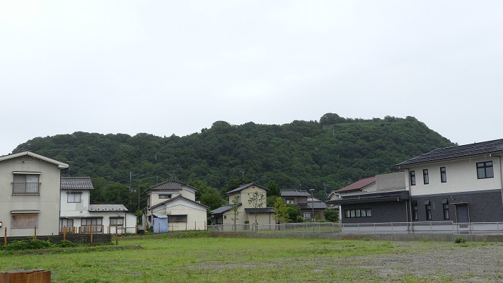
臥牛山~Mt. Gagyu-San

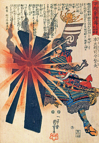
本荘繁長は、越後国(現在の新潟県)の有力戦国大名の上杉謙信に従っていました。ある時彼は独立を志し、謙信に反逆しました。謙信は無敵の武将とされており、城を取り囲みました。しかしこの城も難攻不落であり、約1年間耐え忍びました。ついには双方和睦を結びました。繁長はその後は上杉氏に献身的に仕え、十五里ヶ原の戦いでは最上氏を打ち破りました。ところが天下人の豊臣秀吉から、命令に背いたかどにより改易となってしまいます。
Shigenaga Honjo was under the great warlord in Echigo Province (what was now Niigata Pref.), Kenshin Uesugi. He once tried to be independent and rebelled against Kenshin. Kenshin who is considered invincible, surrounded the castle, but the castle which was also impregnable, stood for about a year. They finally made peace with each other. After that, Shigenaga was devoted to Uesugi. He defeated the Mogami clan in the battle of Jugorigahara. However, he was fired by the ruler Hideyoshi Toyotomi due to breaking Hideyoshi’s order.

本庄繁長の浮世絵、歌川国芳作、江戸時代~The woodblock print of Shigenaga Honjo, attributed to Kuniyoshi Utagawa, the Edo Period(licensed under Public Domain via Wikimedeia Commons)
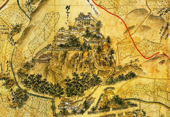
上杉氏は1598年に東北地方に移されるのですが、その移封の直前に領地の絵図面を作成し、新しい領地の方に持っていき、現在まで保管しています。そのうちの一つが越後国瀬波郡絵図です。村上城はこの絵図の中で「村上要害」(要害は砦といった意味)として描かれています。その絵図はこの城の戦国時代終わり頃の姿を伝えています。わが国の貴重な文物とされています。
Uesugi clan was transferred to the Tohoku region in 1598, but they created drawings of their territory just before the transfer, brought them to their new territory, and have kept them until now. One of them is called the drawing of Senami District in Echigo Province. Murakami Castle is in the drawing as “Murakami Yogai” (Yogai means stronghold). The drawing shows the appearance of the castle at the end of the Warring States Period. It is considered a very valuable material for the country.

「越後国瀬波郡絵図」に描かれた村上要害~Murakami Yogai from “the drawing of Senami District in Echigo Province”(村上市websiteより引用)

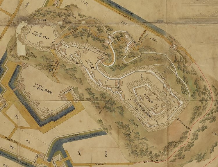
この絵図によれば、この城には天守はなく、石垣も白壁もなく、ただ柵に囲まれた土塁の曲輪の上に館があるだけです。それは、当時の東日本においては典型的な地方の城のスタイルでした。本荘氏の後は、村上、松平、そして内藤氏といった氏族がこの城を支配しました。この城は彼らの下で近代化されました。天守が山の頂に築かれ、多くの石垣も築かれ、城の範囲は山麓まで広がりました。江戸時代に描かれた「越後国村上城之絵図」を見るとそれがわかります。この城が中世と近世の間にどのように変わったのかがはっきりと見て取れます。
According to the drawing, the castle had no Tenshu, no stone walls and no plaster walls, just had halls on earthen enclosures surrounded by fences. That was a typical local castle style in eastern Japan at that time.
After Honjo clan, several clans like Murakami, Matsudaira, and Naito governed the castle. The castle was modernized under their governance. The Tenshu keep was built on the top of the mountain, a lot of stone walls were also built, and the range of the castle was spread to the foot of the mountain. “The illustration of Murakami Castle in Echigo Province” in the Edo Period shows them. We can clearly see how the castle had changed between the Middle and Modern Ages.

「越後国村上城之絵図」部分、江戸時代~Part of “The illustration of Murakami Castle in Echigo Province”,the Edo Period(出典:国立公文書館)

明治維新の間、村上藩の武士たちは新政府につくか旧幕府につくか逡巡していました。旧幕府側の支持者たちは城を退去し、東北地方の同志に合流すると決め、自ら城に放火してしまいました。
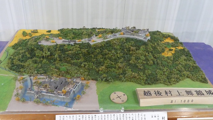
During the Meiji Restoration, warriors of the Murakami Domain were wondering if they should support the New Government or the former Shogunate. When the supporters of former Shogunate decided to withdraw the castle and join supporters in Tohoku region, they burn the castle by themselves.

村上市郷土資料館にある城の模型~The miniature model of the castle at Murakami History Museum

特徴~Features

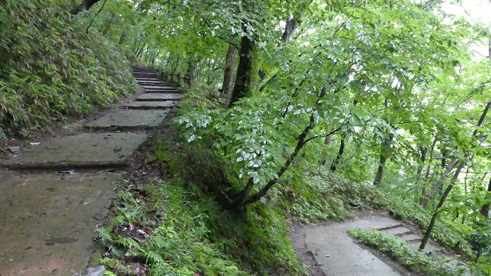
それでは入口から城跡に向けて登ってみましょう。山道は「七曲り道」と呼ばれていて、曲がりくねった山道といった意味です。
Let’s climb up to the castle ruins from the entrance. The trail is called “Nanamagari-Michi” which means a winding trail.

山道の入り口~The entrance of the trail

道の傾斜が緩やかになっているので、登りやすくなっています。実は、この道の由来は戦国時代にさかのぼると言われています。
That makes it easier for visitors to climb because the trail becomes more gentle. In fact, this trail can be traced back to the Warring States Period.

七曲り道~The trail called Nanamagari-Michi

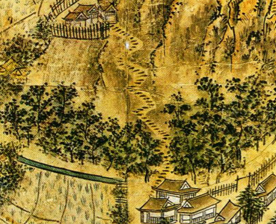
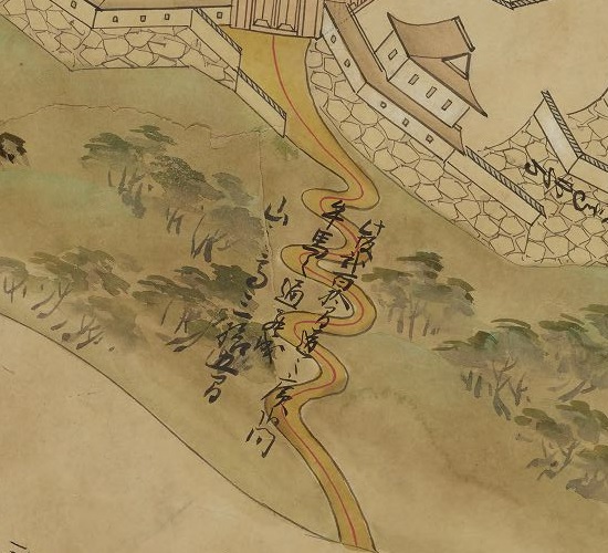
それは、先ほどの「越後国瀬波郡絵図」と「越後国村上城之絵図」両方に、恐らくは同じ場所であろう所に、似たような山道が描かれているからです。何か素晴らしく感じます。そうなってくると、敵が簡単に城を攻撃できてしまうのではないかとも感じます。歴史家によると、敵がこのような曲がりくねった道を登るときは、側面を防御側に見せてしまうため、かえって防御側に有利になるということです。
Becase you can see the similar trail at probably the same place in both of “the drawing of Senami Distinct” and “the illustration of Murakami Castle”. It’s amazing. You may ask that enemies might attack the castle easily. Some historian suggest that attackers will have their sides facing the defenders when climbing such a winding trail. It can be advantageous for the defenders.

「越後国瀬波郡絵図」の山道部分~The trail part of “the drawing of Senami District in Echigo Province”
越後国村上城之絵図」の山道部分~The trail part of the drawing of Senami Distinct”

約15分ほどで山の上にある三の丸四つ門跡に到着します。
It will take about 15 minutes to reach the ruins of “Yottsu” gate at “Sannomaru” enclosure on the mountain.

四つ門跡~The ruins of “Yottsu” gate

本丸の方に行くには、狭い二の丸を通らねばなりません。
You can head towards “Honmaru” enclosure passing through narrow “Ninomaru”.

二の丸の通り道~The route on Ninomaru

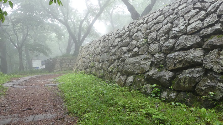
今に残る多くの石垣が見られます。全ての石垣は江戸時代に作られたものです。
A lot of remaining stone walls are there. They were all built in the Edo Period.

本丸の石垣~The stone walls at Honmaru

山の一部は現在発掘中です。戦国時代の遺跡が見つかるのではないかと言われています。
Part of the mountain is now under excavation. It is said that the ruins in the Warring States Period might be found.

本丸の発掘されている部分~The part of Honmaru being under excavation

そうするうちに、山の頂にある天守台に到着します。そこからは村上市全域が一望できます。
You will soon reach the Tenshu base at the top of the mountain, and can see the whole view of Murakami City.

本丸の入り口~The entrance of Honmaru
天守跡~The ruins of Tenshu
山上からの村上市の眺望~A view of Murakami City from the top

その後~Later Life

明治維新後、領主だった内藤氏は城の残りの建物と一部の石垣の売却を申し出て許されました。その後、藩士の子孫たちは城跡を維持してきました。1960年には県の史跡に指定され、1993年には国の史跡にもなりました。
After the Meiji restoration, the lord Naito applied for and was allowed to sell the rest of the buildings and part of the stone walls in the castle. After that, the descendants of the warriors has kept the ruins. They are designated as a Prefectural Historic Site in 1960. They also became a National Historic Site in 1993.

本丸の石垣~The stone walls at Honmaru

私の感想~My Impression

地元の人たちが「七曲り道」の山道を日頃の運動のために登ったり下ったりしているのを見ました。どうやら毎日頂上まで登って戻ってくるという感じでした。会ったときはお互いにあいさつをしていました。かつては戦いのために作られた古の道は、現在人々の健康やコミュニケーションのために使われているのです。素晴らしいことです。
I saw that local people were climbing up or down the trail “Nanamagari-Michi” for daily exercise. They seemed to reach the top and turn back everyday. They were also saying hello each other. the traditional trail, which was built for battle, is now used for people’s health and comminication. It’s amazing.

今は市民のための七曲り道~Nanamagari-Michi now for citizens

ここに行くには~How to get There

JR村上駅から歩いて30分近くかかります。
東京から村上駅まで:
上越新幹線に乗り、新潟駅でJR白新線に乗り換えてください。
車で行く場合:日本海東北自動車道村上瀬波温泉ICから10分以内、または村上駅から約5分。
城跡には駐車場はありますが、小さいのでよく満車になります。そのときは近くの村上市役所か村上郷土資料館に駐車してください。
It takes nearly 30 minutes From JR Murakami station to get there on foot.
From Tokyo to Murakami st.:
Take the Joetsu Shinkansen superexpress to Nigata station, and transfer for JR Hakushin line.
If you want to go there by car: It takes within 10 minutes from the Murakami-Senamionsen IC on Nihonkai-Tohoku Expressway, or about 5 minutes from Murakami station.
The ruins have a parking lot. But it’s small and can often be full. In that case, you can park at the Murakami City Hall or Murakami History Museum nearby.

リンク、参考情報~Links and References

鮭、酒、人情(なさけ)むらかみ~Murakami city tourism association
ビジュアル再現 村上城(Only Japanese)
・「甲信越の名城を歩く 新潟編」吉川弘文館(Japanese Book)