立地と歴史~Location and History
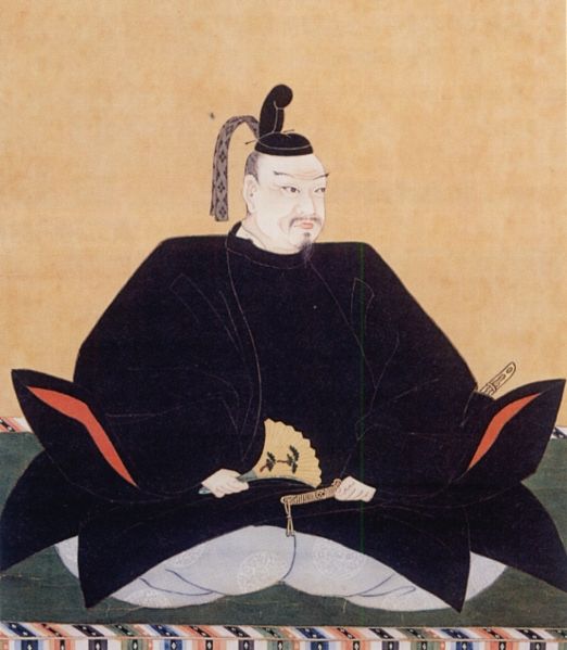
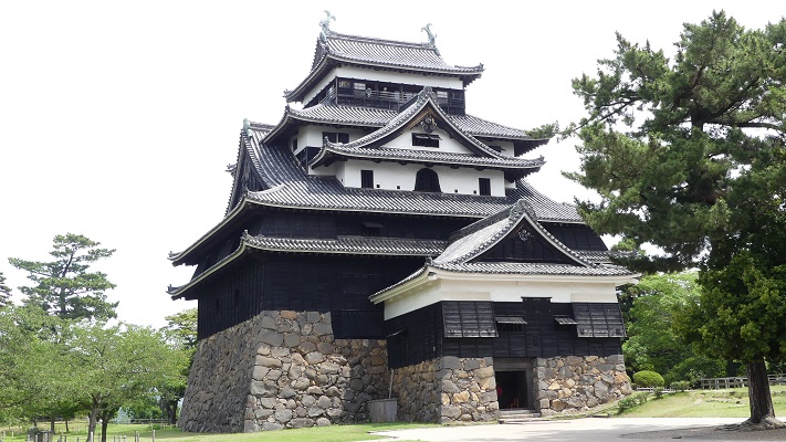
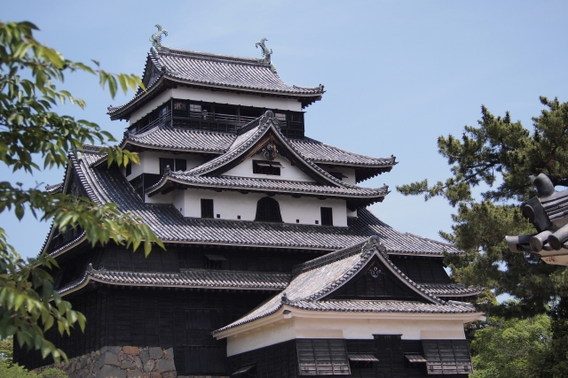
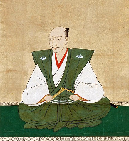
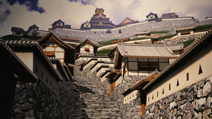
高くそびえる天守、高石垣の上には多くの櫓と漆喰の壁、大きな門構え、そして周りには水堀をたたえる・・・これらが我々の持つ日本の城の直感的なイメージですが、これらは安土城から始まっているのです。それぞれのパーツは以前の城にもありましたが、有力な戦国大名、織田信長がそれらを統合し、彼の城として表現したのでした。そして日本の城の歴史に決定的なインパクトを与えました。
A tall standing Tenshu keep, many turrets and plaster walls on high stone walls, large entrance gates, and water moats around… These are our intuitive images of Japanese castles come from Azuchi Castle. Though each part can be found in castles earlier than that, the great warlord Nobunaga Oda integrated and expressed them as his castle. It has definitely had a huge impact on the history of Japanese castles.
信長は、日本の統一事業を進めていく中で、自らの本拠地を尾張国(現愛知県)から西の方へ最初は岐阜(現岐阜県)、そして安土(現滋賀県)に移していきました。
As Nobunaga increased his work of unifying Japan, he moved his home base from Owari Province (now Aichi Pref.) to the west, at first Gifu (now Gifu Pref.), and Azuchi (now Shiga Pref.).
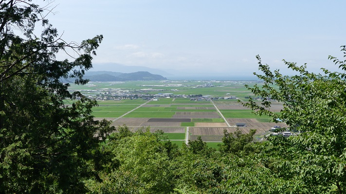
この地は中山道に沿って、琵琶湖に面しており水上交通に便利でした。安土は大体京都と岐阜の中間点に当たり、信長は緊急時には両方に駆け付けられました。
The site was along the Nakasendo Road and faced Biwa Lake which was useful for water transportation. Azuchi is around the middle point of Kyoto and Gifu, so Nobunaga could rush to both cities in emergency.
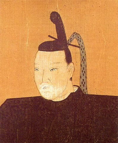
信長は1576年に、部下に対して高さ198mの安土山に城を築くよう命じました。彼は1579年5月から天主に住み始めました。実は、信長は普段から天主に住んでいた最初で最後の人物だと言われています。そこは彼にとって崇高で且つ権威そのものを表す場所だったようで、天主の中には滅多に他人を入れませんでした。信長はまた城下町を作り、人々に自由に商売と往来をさせ、これは「楽市楽座」と言われました。人々は大歓迎でこれを受け入れました。この当時はそれぞれの戦国大名がそれぞれの場所で高い税金をかけていたからです。
Nobunaga ordered his men to construct the castle on Mt. Azuchiyama which is 198m height, in 1576. He started to live in the Tenshu keep on May 1579. In fact, he is said to be the first and last person who usually lived in the Tenshu. It seemed to be spiritual and an authorization for him, so he rarely invited others to the inside of Tenshu. He also created the castle town below the castle and made people free to do business and transportation called “Rakuichi-Rakuza”. People welcomed it because each warlord charged high taxes on both of them in each place at that time.
ところが、この城は短命に終わりました。1582年、完成からわずか3年後、信長が京都で本能寺で殺されたとき、原因不明の火事で天主が焼け落ちます。その後、織田の一族がしばらくこの城を使いましたが、1585年に近くに八幡山城が新しくできたことで廃城となりました。
However, the castle had a short life. In 1582, just after three years from the completion, An unidentified fire burned the Tenshu when Nobunaga was killed at Honnoji Temple in Kyoto. After that, Oda’s relatives used the castle for a while, it was abandoned in 1585, as Hachimanyama Castle was newly built nearby.
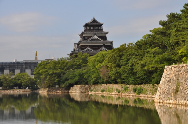
特徴~Features
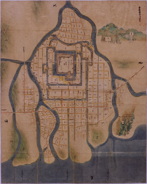
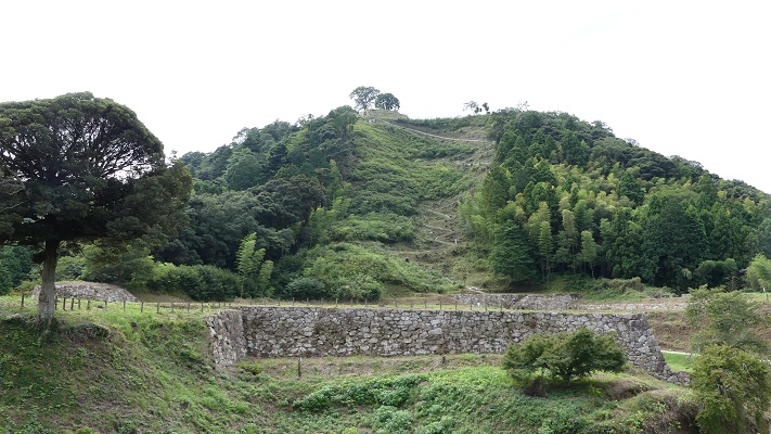
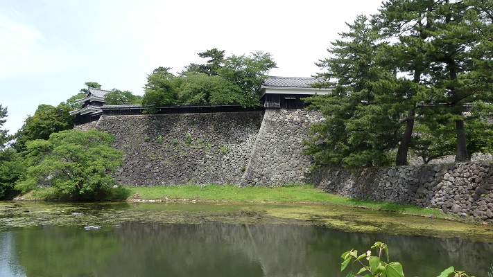
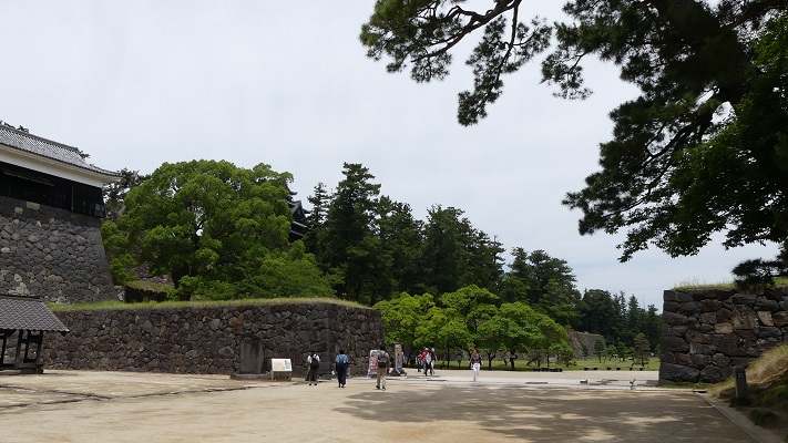
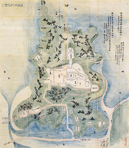
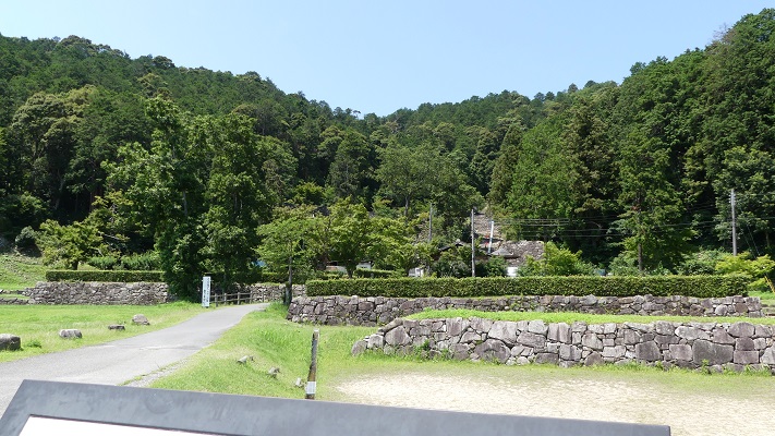
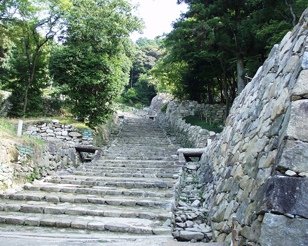
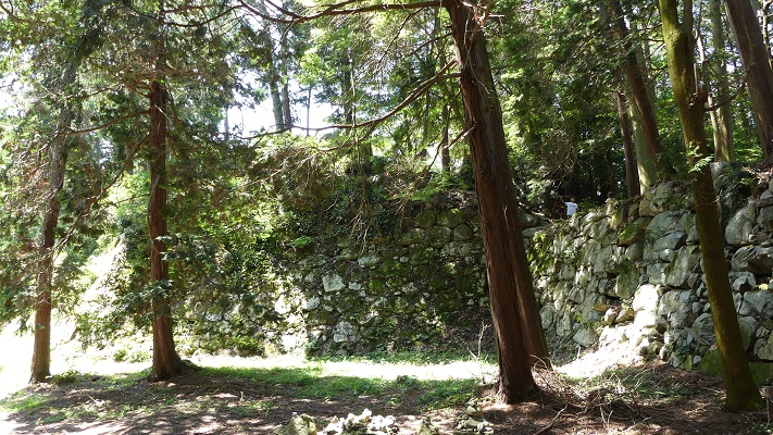
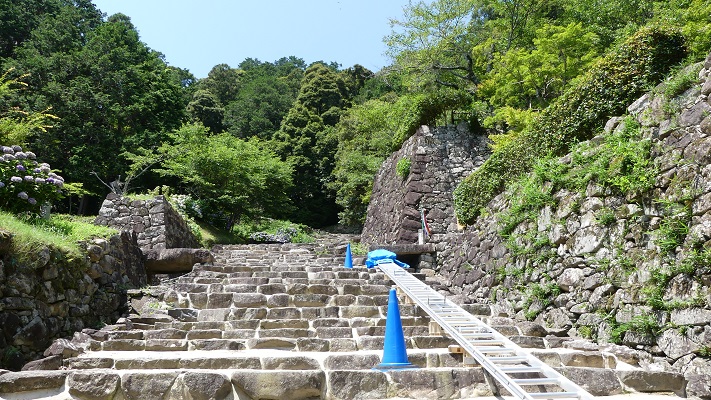
現在、城跡は国の特別史跡に指定されています。この場所は総見寺が所有しています。入り口から広くまっすぐな「大手道」が山の上の方に伸びています。ここは最近発掘され復元されました。また、このような道の作り方は明らかに防御には不利なので、他の山城とは随分異なっています。
Now, the ruins of the castle are designated as a National Special Historic Site. The site belongs to Sokenji Temple. From the entrance, the wide and straight Main Street “Ote-Michi” leads up to the mountain. It was excavated and restored recently. It is also different from other mountain castles, because such a road is clearly a disadvantage for defenders.
歴史家の中には、信長はこの道を彼の都の大通りとしていたと推測する人もいますし、単にこの城の権威を示すものだという人もいます。いずれにしろ、天主はこの道から見えたはずですし、周りを信長の家臣の屋敷が取り囲んでいました。
Some historians speculate Nobunaga regarded it as the central street of his capital. Others argue it just showed the authority of the castle. Anyway, the Tenshu should have been seen from the street, with the halls of Nobunaga’s retainers along it.
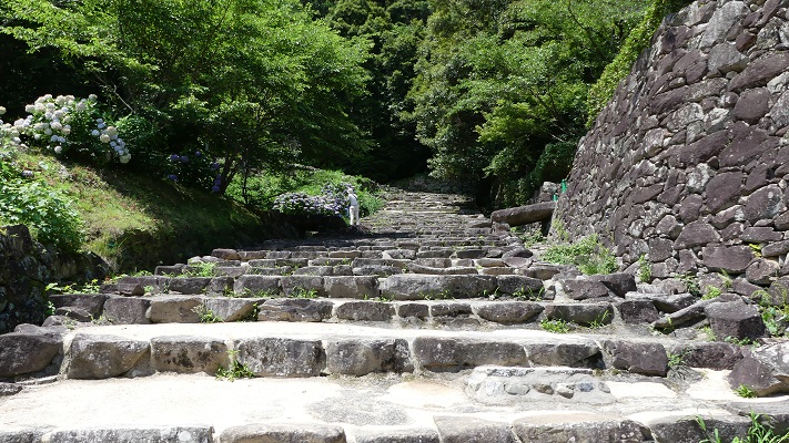
道は、山の中腹から曲がりくねり、「七曲り」と呼ばれます。そして城の主要部に向かっていきます。
The street gets zigzagged, called “Nana-Magari”, from the midslope of the mountain towards the main part of the castle.
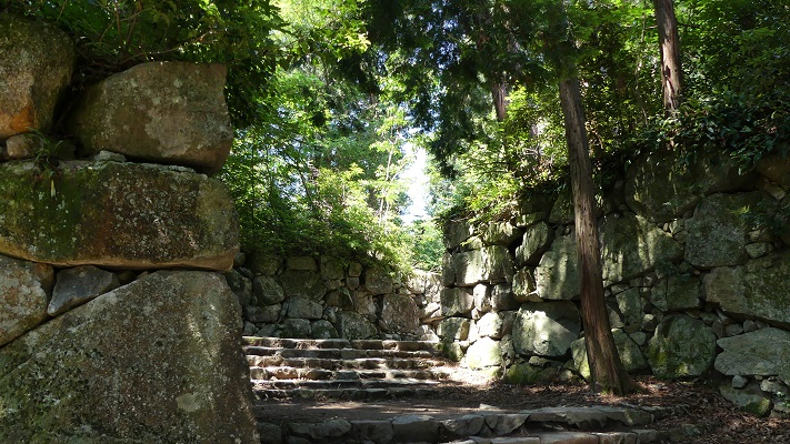
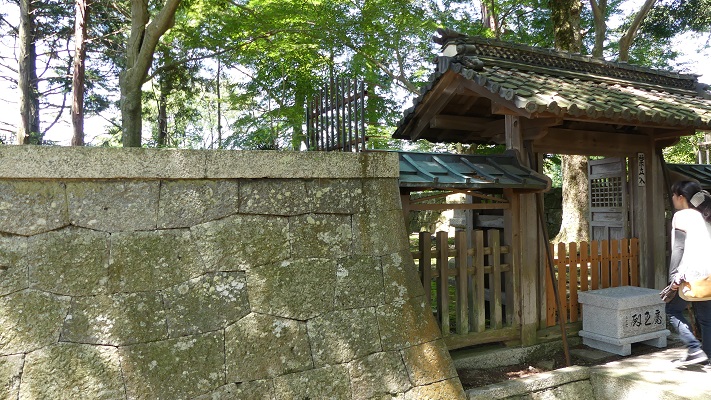
主要部は黒金門から始まりますが、この門は巨石を使い、権威を見せつけています。
The main part starts from “Kurogane” Gate ruins which was made using huge stones for showing authority.
次に来るのは二の丸跡で、信長の廟所があります。ここは元々一族の御殿があったかもしれない所です。
Next comes Ninomaru ruins where Nobunaga’s mausoleum remains, where his inner palace might have originally been.
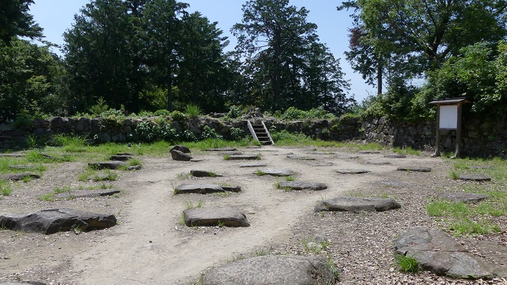
本丸は城の中心です。当時は多くの建物がひしめいていました。その一つは特に天皇のための宮殿だったと言われています。貴族の日記に天皇がこの城に行幸する予定があったと書いてあります。信長は天皇をそこに住まわせ、天主から見下ろし、自身の影響下におきたかったとも、そうではなくただの訪問だとも言われています。
Honmaru is the center of the castle. Many buildings were packed at that time. One of them is particularly said to be the palace for the Emperor. A noble’s diary says there was a plan of the Emperor’s visit to the castle. Some speculate Nobunaga tried to make the Emperor live in the palace and be under control ,looking down from Tenshu. Others say it was just a visit.
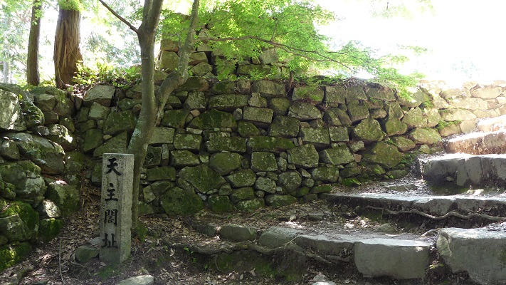
天主は本丸のとなりに立っていました。天主台とその内側に礎石が残っています。
Tenshu stood next to Honmaru. The base remains where you can see cornerstones inside.
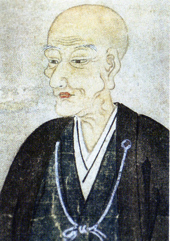
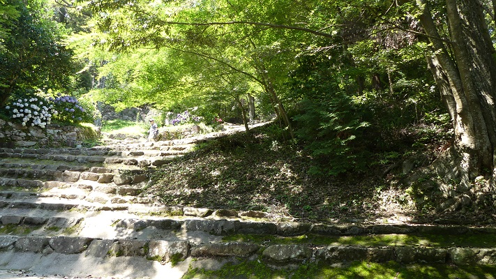
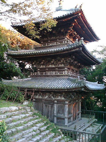
帰りの道は「諸々橋」口と呼ばれていて、信長が設立した総見寺の元の敷地を通り過ぎます。この寺は江戸時代に火災に遭いましたが、三重塔などいつくか建物が残っています。ポルトガルからの宣教師ルイス・フロイスは、信長はこの寺を自身を崇拝させるために建立したと言いました。これもまた謎めいています。
On the return route called “Dodobashi” Route, you will pass the ruins of original Sokenji Temple that Nobunaga founded. The temple suffered a fire in the Edo Period, but several buildings like the three-story pagoda still remain. A missionary from Portugal, Luis Frois said Nobunaga created it to celebrate himself. That is also controversal.
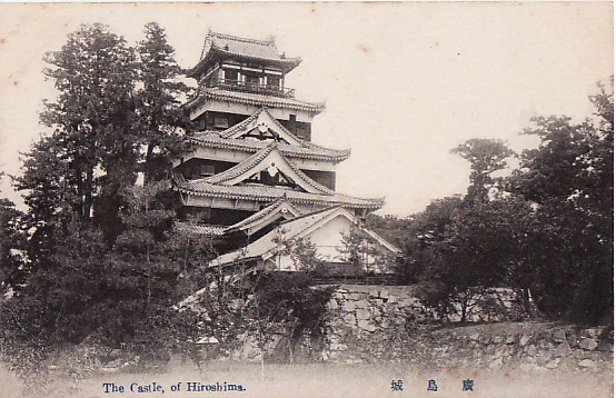
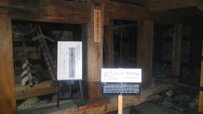
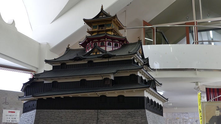
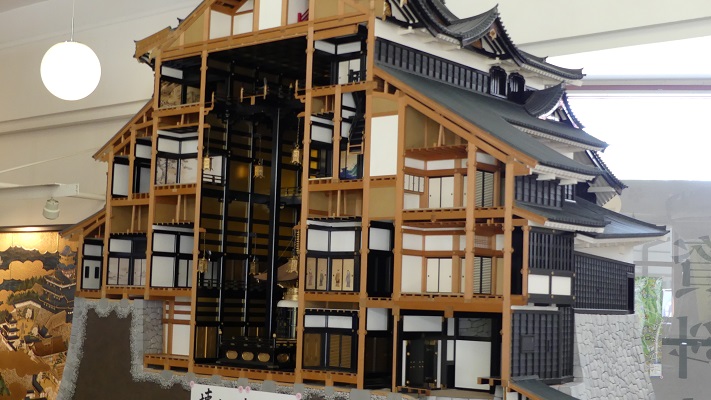
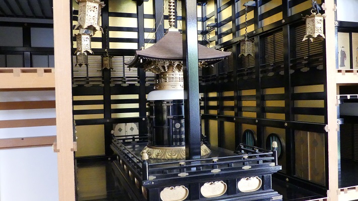
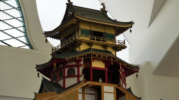
安土城郭資料館では、安土城天主の20分の1スケールの模型を見ることができます。これは古文書、図面、発掘の成果から製作されました。この模型では、天主は5層の外観で、地階を含めて7階建てです。それぞれの階は違う形と色をしています。5階は赤色の八角形で内側は仏画が描かれ、最上階の6階は金色の四角形で古代中国の聖人が描かれています。
You can see the one-twentieth scale model of Azuchi Castle’s Tenshu keep at Azuchi Castle Museum. It was created based on old documents, drawings and excavation. According to this model, it had a five-layer appearance, and seven floors including the basement. Each floor had a different shape and color. The 5th floor was octagonal of red with Buddhist wall paintings inside, and the top 6th floor was square of gold with paintings of ancient legendary Chinese saints.
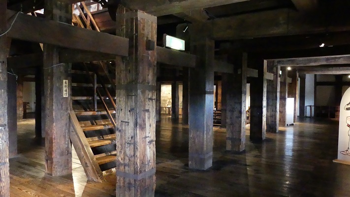
この両方の階の実寸大のレプリカが、信長の館で展示されています。
Both floors have been restored as the full scale replica at the House of Nobunaga.
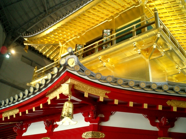
天主の地階から3階までは吹き抜けになっていて、地面には仏塔が設置してあったようです。これらは、信長の天主がとても象徴的かつ宗教的な存在であったことを示しています。
There was the stairwell inside Tenshu through BF to 3F, where the pagoda seemed to be set on the ground. These suggestions show Nobunaga’s Tenshu was very symbolic and religious.
その後~Later Life
城跡の領域は、江戸時代の間ずっと総見寺に所有されていました。火事があった後、寺の建物は現在の大手道周辺に再建されました。そして寺の石垣がこの道を覆って築かれました。時が過ぎるにつれ、人々はその石垣が安土城のものと思うようになります。1989年に安土城の調査整備事業が開始され、20年間続きました。その中で、寺の石垣の下にこのような広く長い通り道が発見され人々を驚かせたのです。総見寺は寺の石垣を撤去し、元の通りを復元することに協力しました。
The domain of the castle ruins was owned by Sokenji Temple all through the Edo Period. After the fire, the temple buildings were rebuilt around what is now Ote-michi street. They made their own stone walls across the street. As time has passed by, people got used to thinking the stone walls might come from Azuchi Castle. The investigation and development project for Azuchi Castle Ruins started in 1989. It lasted for 20 years. People were surprised to see that such a wide, long street was discovered under the stone walls. The temple cooperated to remove their stone walls and restore the original street.
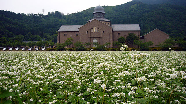
安土城考古博物館では、この事業の成果を見ることができます。
Azuchi Castle Archaeological Museum shows the achievement of the project.
私の感想~My Impression
安土城は、私の最も好きな日本の城の一つです。この城は信長の考え方を直接表していると思うからです。信長はときに過酷と言われますが、彼は当時の常識に対して自らの信念を貫いたと思うのです。しかし、彼の思想は歴史家の議論を経てもなお謎のままです。ですので、ここに来て、何かを感じ、自分で考えてみることが大事です。
Azuchi Castle is one of my most favorite castles in Japan, because the castle must directly show Nobunaga’s way of thinking. While Nobunaga is sometimes said to be cruel, I think he kept his faith against the common sense of that time. However, his basic idea is still mysterious after historians’ discussions. So it is important to come there , feel something, and think by yourself.
ここに行くには~How to get There
車で行く場合は、名神自動車道の八日市ICか竜王ICから約30分かかります。先程ご紹介した城跡と博物館に駐車場があります。
電車の場合は、レンタル自転車を使うことをお勧めします。城跡と博物館が点在しているからです。JR安土駅の前に2件のレンタル店があります。そこに荷物を預けることもできます。
東京から安土駅まで:東海道新幹線で米原駅まで行き、JR琵琶湖線に乗り換えてください。
大阪から安土駅まで:大阪か新大阪駅からJR京都線に乗ってください。
If you want to go there by car, it takes about 30 minutes from the Yokaichi IC or the Ryuo IC on Meishin Expressway. The ruins and the museums mentioned above offer a parking lot.
When using train, I recommend you to use a rental bicycle, because the ruins and the museums are spread out. There are two rental bicycle shops in front of JR Azuchi Station. You can also leave your baggage there.
From Tokyo to Azuchi st.:
Take the Tokaido Shinkansen superexpress to Maibara station, and transfer for JR Biwako line.
From Osaka to Azuchi st.:
Take the train on JR Kyoto line from Osaka or Shin-Osaka station.
リンク、参考情報~Links and References
・安土城跡(滋賀県観光情報)~Azuchi Castle Ruins
・織田信長の安土城と総見寺(Only Japanese)
・あづち周遊(Only Japanese)
・「信長の城/千田嘉博著」岩波新書(Japanese Book)
・「安土 信長の城と城下町/滋賀県教育委員会」(Japanese Book)
・「現代語訳 信長公記/太田牛一著、中川太古訳」新人物文庫(Japanese Book)