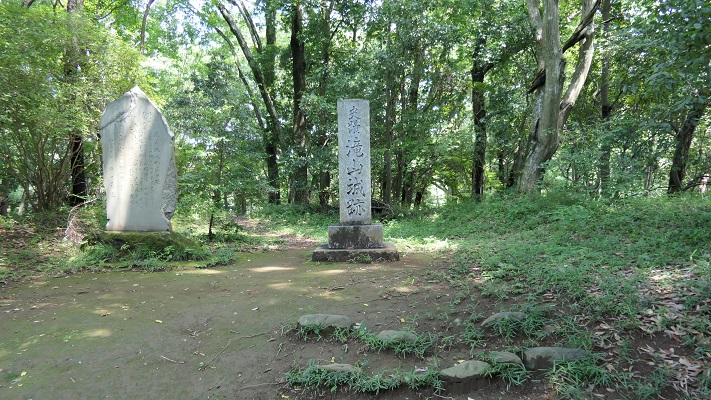
21.江戸城その1~Edo Castle Part1

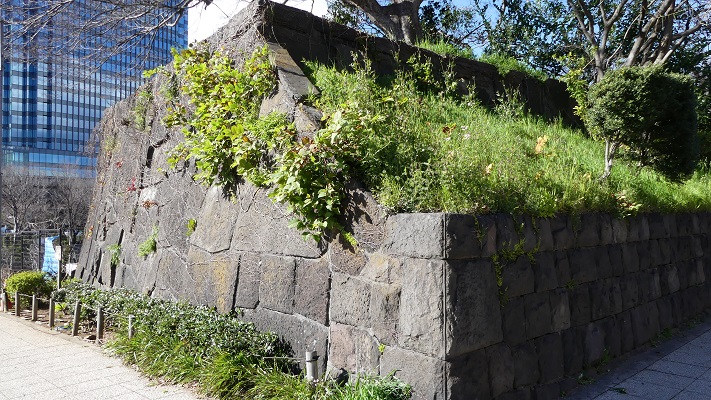
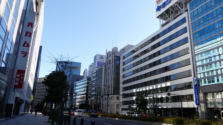
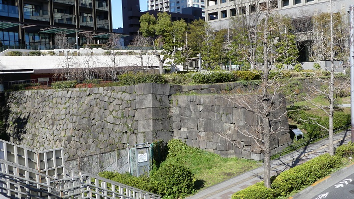
江戸城は間違いなく日本で最大の城です。なぜなら城が東京そのものになったからです。時々、外国からの旅行者の方は、どこに有名な城や城跡があるのかと尋ねられます。もし、そこが東京の中心地であるなら、もうそこは城の中かもしれません。
Edo Castke was definitely the largest castle in Japan, because it became Tokyo itself. Some foreign tourists ask that where famous Japanese castles and ruins are. They may be standing among castles if they are in the center of Tokyo.

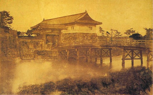
皇居正門石橋と伏見櫓~The Imperial Palace Main Entrance Bridge and Fushimi Turret

立地と歴史~Location and History

東京を含む関東平野には、中世までは大きな湿地帯がありました。この理由から、はるか昔の東海道は西日本から伸びてきて、 海を越えて房総半島に至っていました。利根、渡良瀬、隅田といった大河が直接江戸湾に注いでいたのです
The Kanto Plain including Tokyo had large waterlogged area until the Middle Ages. For this reason, the Tokaido road went from eastern Japan to Boso peninsula over the sea hundreds years ago. Large rivers like Tone, Watarase, and Sumida directly flow into what is now Tokyo Bay.

古代の関東平野の海岸線~The coastline of Kanto Plain in ancient times(licensed by Llhoi2013 via Wikimedia Commons

江戸城は1457年に太田道灌によって最初に築かれました。彼には敵との境界線であった利根川の近くに城を築く必要があったのです。その後この城は、戦国時代の間関東地方の支配者であった北条氏の支城の1つであり続けました。しかし、地理的な制約から武士たちの都とするには不十分でした。
Edo Castle was first built by Dokan Ota in 1457. He needed to build the castle near the border with his enemy, Tone River. After that, the castle had been one of the branch castles of the Hojo clan who were the ruler of Kanto region during the Warring States Period. But the castle still didn’t deserve warrior’s capital because of its geographical features.

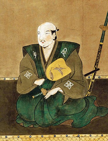
太田道灌肖像画、大慈寺蔵~The portrait of Dokan Ota, owned by Daijiji Temple(licensed under Public Domain via Wikimedia Commons)

豊臣秀吉は1590年に北条氏を滅ぼし、徳川家康に対し、北条氏に代わり関東地方に転封するよう命じました。秀吉はまた、家康の首府として江戸を指定したと言われています。秀吉は、彼による攻撃を3ヶ月間も耐えた北条氏の首府、小田原に家康が居座るのを恐れたからといいます。
Hideyoshi Toyotomi defeated Hojo clan in 1590, and ordered Ieyasu Tokugawa to move to Kanto region instead of Hojo. It is said that he also designated Edo as Ieyasu’s capital because he feared Ieyasu would settle at Hojo’s capital Odawara which could withstand Toyotomi’s attack for three months.

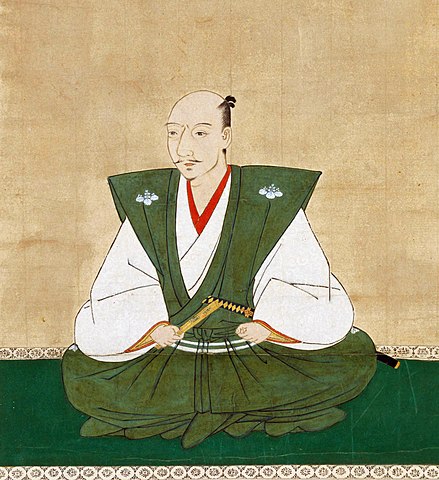
豊臣秀吉肖像画部分、加納光信筆、高台寺蔵~part of the Portrait of Hideyoshi Toyotomi, attributed to Mitsunobu Kano, owned by Kodaiji Temple(licensed under Public Domain via Wikimedia Commons)

家康は江戸に到着した直後から、江戸城への驚くべき大改造を開始しました。これは、日本人による湾岸地域での都市作りの初めての試みと言われています。
Immediately after Ieyasu arrived at Edo, he started an incredible renovation of Edo Castle. It is said that it was the first attempt for Japanese people to build a city on a waterfront area.

徳川家康肖像画、加納探幽筆、大阪城天守閣蔵~The Portrait of Ieyasu Tokugawa, attributed to Tanyu Kano, owned by Osaka Castle Museum(licensed under Public Domain via Wikimedia Commons)

初期の江戸城は、現在の山の手地域にありました。現在の下町地域は、海面下か湿地帯でした。そして、江戸前島と呼ばれた砂州がありました。また、陸地と砂州の間には日比谷入江が入り込んでいました。
The first Edo Castle was in the present uptown area. The present down town area was below the Sea or waterlogged. There was a sand bank called Edo-Maeto. There was also the Hibiya arm of the sea between the land and the bank.

赤い線は現在の地図に残された江戸前島と日比谷入江の痕跡~The red line shows the remaining trace of Edo-Maetou and Hibiya Arm of the Sea on the present map

徳川家臣団は、水上交通のために江戸前島を横切る運河を掘り、川の流路を付け替えたりしました。彼らはまた、このような湾岸都市であったため、上下水道の設備も整えなければなりませんでした。その結果、江戸は水の都となったのです。
Tokugawa team created a canal across Edo-Maeto and change the route of rivers for water transportation. They also had to build a system for water supply and sewerage on such a waterfront city. As a result, Edo became a city of waterways.

戦前の東京の航空写真、まだ水路がたくさん残っていました~A aerial photo of Tokyo before the World War II, a lot of wateways still remained.

家康が1600年に天下を取った後、彼は全国の諸大名に天下普請と呼ばれる城の拡張工事を命じました。日比谷入江は城の用地拡大と防衛上の必要のため、埋め立てられました。この大規模な工事により、天守を含む多くの建物が作られ、多くの堀が掘られ、石垣が高く積まれました。
After Ieyasu got the power in 1600, he ordered lords of the whole country to improve the castle called Tenka-Bushin. They reclaimed Hibiya arm of the sea to spread the ground for the castle as well as the need for defense. Many buildings including Tenshu keep were built, many moats were dug, and high stone walls were built by the large scale construction.

「江戸図屏風」左隻部分、17世紀、国立歴史民俗博物館蔵~Part of “View of Edo” left screen. pair of six-panel folding screens, in the 17th century, owned by National Museum of Japanese History(licensed under Public Domain via Wikimedia Commons)

大名たちは少なくとも6万個もの百人石と呼ばれた4トン石を、伊豆半島から海を越えて江戸まで運ばねばなりませんでした。1603年から1660年まで続いた天下普請は江戸を日本一の大城郭に仕立てたのです。
These lords had to carry at least 60,000 four ton stones called Hyakunin-Ishi from Izu Peninsula to Edo over the sea. Tenka-Bushin between 1603 and 1660 resulted in Edo Castle being the largest castle in Japan.

伊豆半島に残されている江戸築城石~A quarry stone for building Edo Castle left in Izu Peninsula(licensed by GuchuanYanyi via Wikimedia Commons)

江戸城は、内郭と外郭に分かれていました。内郭は内堀の内側で、城の中心部分で、主要な曲輪である本丸、二の丸、西の丸から構成されていました。その外周は8km近くありました。そこには天守、それぞれの曲輪に御殿があり、そして警備のために多くの櫓や門がありました。
Edo castle was divided into Naikaku and Gaikaku. Naikaku was the inside of the inner moat, and consisted of the center portion of the castle including main enclosures Honmaru, Ninomaru, and Nishinomaru. Its perimeter was nearly 8 km. It had the Tenshu keep, halls for each main enclosure, many turrets and gates for security.

今に残る内郭部分の航空写真~The aerial photo of the remaining Naikaku portion

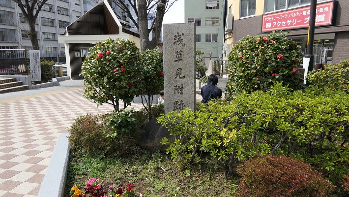
外郭は、外堀に囲まれていた区域で、その外周は約16kmもありました。見附と呼ばれた大型の門と橋のセットが約50ヶ所、主要街道と堀との交差点に置かれ、民衆と交通を監視していました。
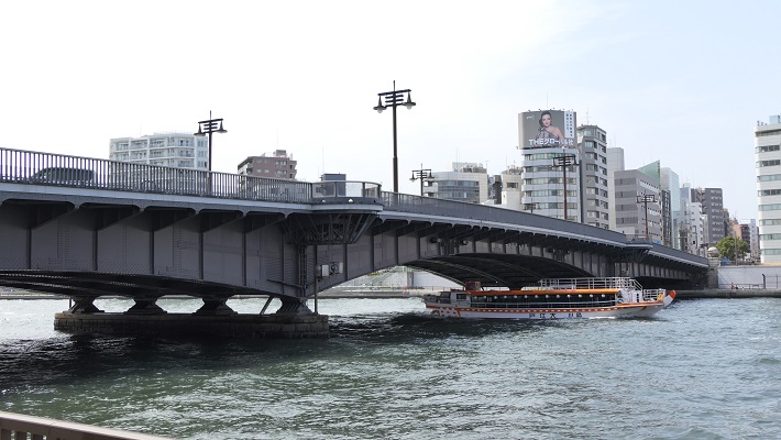
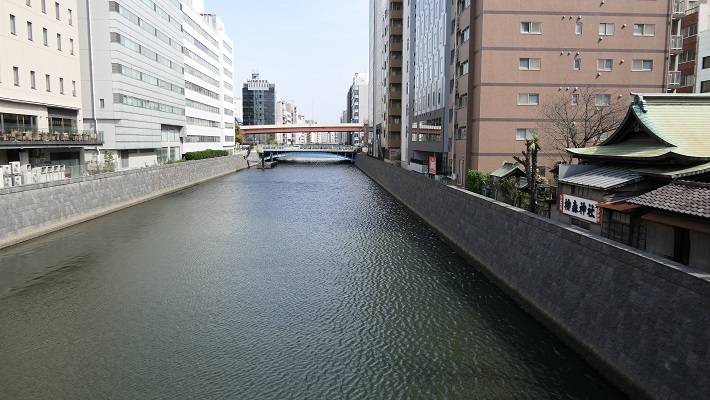
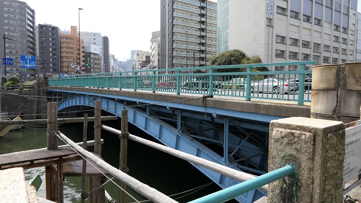
Gaikaku was the surrounding area by outer moat whose perimeter was about 16 km, even including the city area. About 50 sets of a large gate and bridge called Mitsuke were placed at the intersections of the moat and major roads to check people and transportation.

江戸古地図上での外郭範囲~The range of Gaikaku on the old Edo map(licensed by Tateita via Wikimedia Commons)

その完璧な構造にも関わらず、この城は敵からではなく、火災による被害を受けました。もっとも有名なのは1657年に発生した明暦大火です。この大火により、大半の江戸市域、江戸城、そして3代目の天守が焼け落ちました。大火の後、4代目天守の再建工事が開始されましたが、中止となりました。そのための天守台は今でも見ることができます。
Despite the perfect structure, the castle suffered not from enemies, but from fires. The most famous one was the great fire of Meireki in 1657. It burned out most of Edo City, Edo Castle, and the third Tenshu keep. After the fire, the rebuilding of a fourth Tenshu was launched, but canceled. We can now see the prepared Tenshu base for it.

4代目天守台~The base of the forth Tenshu keep(taken by 松波庄九郎 from photoAC)

将軍は本丸御殿に住み、統治を行いましたが、御殿も火災での焼失と再建を繰り返しました。幕末になってから、将軍は焼けた本丸御殿から通常は隠居した将軍が住む西の丸御殿に移らなければなりませんでした。予算がなかったからです。
Shogun lived and governed in Honmaru hall, but the hall was also burned down and restored several times. At the end of the Edo Period, Shogun had to move from the burned Honmaru hall to Nishinomaru hall where retired Shogun usually lived, because of the lack of money.

江戸東京博物館にある本丸と二ノ丸御殿の模型~The miniature model of Honmaru and Ninomaru halls at Edo-Tokyo Museum(licensed by Daderot via Wikimedeia Commons)

明治維新のとき、西日本の方で新政府と幕府の間で戦いが起こりました。結果として、西郷隆盛と勝海舟との会談が行なわれ、江戸城は新政府に平和裏に引き渡されました。
During the Meiji Restoration, a battle between the New Government and Shogunate was fought in eastern Japan. As a result, Edo Castle was handed over to New Government without war after the meeting between Takamori Saigo and Kaishu Katsu.

西郷・勝会談の記念碑~The monument of the meeting between Saigo and Katsu(licensed by 江戸村のとくぞう via Wikimedia Commons)

1869年、江戸は東京と名前を変え、日本の首都となりました。そして明治天皇が将軍と入れ替わりで、古都京都から東京の江戸城西の丸御殿に移りました。そのため、現在西の丸は皇居の一部となっています。
In 1869, Edo was renamed Tokyo which became the capital of Japan, before the Emperor Meiji move from old capital Kyoto to Nishinomaru hall of Edo Castle in Tokyo instead of Shogun. That’s why Nishinomaru is now part of the Imperial Palace.

明治天皇の東京到着を描いた錦絵~The picture that shows the arrival of Emperor Meiji to Tokyo(licensed under Public Domain via Wikimedia Commons)

「江戸城その2」に続きます。~To be continued in “Edo Castle Part2”

117.岩櫃城(Iwabitsu Castle)

岩櫃城は、防りが固そうに見えますが、実は攻撃のための城なのです。
Iwabitsu Castle looks like defensive, but actually aggressive.

岩櫃山と潜龍院跡(Mt. Iwabitsu and the ruins of Senryuin)

Location and History

過去において信濃国(現在の長野県)と上野国(群馬県)の間を結ぶ街道がいくつかありました。最も有名なのは中山道ですが、その他の一つとして信州街道があり、信濃の上田と上野の沼田をつないでいました(現在の国道145号線に相当します)。戦国時代の後半に武田氏配下であった真田氏は、この信州街道に沿って信濃から上野に向けて攻撃を仕掛けました。岩櫃城はこの途上にあり、真田氏が改修を行い、上野攻略のための重要拠点としました。
There were several roads between Shinano Proivnce (now called Nagano Prefecture) and Kozuke Province (Gunma Prefecture) in the past. The most famous one was Nakasendo, and one of the others was Shinshu-Kaido connecting Ueda in Shinano and Numata in Koduke (equivalent to current the National Route 145). In the late Warring States Period, the Sanada clan under the Takeda clan attacked from Shinano to Koduke along this Shinshu-Kaido. Iwabitsu Castle was on the way, renovated by the Sanada clan to be an important site for the capture of Koduke.


国道145号線の周辺地図と岩櫃城の位置(The map around National Route 145 and the location of Iwabitsu Castle)

この城は岩櫃山にありましたが、山頂ではありませんでした。そこは岩山で危険であったからです(現在でも登頂には登山の装備が必要です)。それで城の中心は、山の中腹にありました。つまり、城の背後は自然の要害である岩山により守られていたということです。また、もう一つの障壁として吾妻川にも守られていました。
The castle was located on Mt.Iwabitsu, but not on the top, because the spot is too rocky and dangerous to stay (Even now, climbing to the top requires a modern climbing equipment). So the center of the castle was halfway up the mountain. This means that the behind the castle was protected by rock as a natural hazard. The castle also had another hazard, the Agatsuma River.

現地案内所にある城のミニチュアモデル(The miniature model of the castle at the information center at the site)

この城は最初は南北朝時代に土豪により作られたと言われています。その後真田幸隆が大変な苦労をしてこの城を手に入れました。そして彼の息子である真田昌幸が改修したのです。
It is said the castle was first built in the North-South Court Period by a local clan. After that, Yukitaka Sanada got it with great difficulty. His son, Masayuki Sanada renovated it.

真田昌幸像、個人蔵(The portlait of Masayuki Sanada, privately owned)licensed under Public Domain, via Wikimedia Commons

1582年3月、真田の主君である武田勝頼は織田信長の侵攻により滅亡の危機を迎えていました。昌幸は、勝頼をこの城に迎え入れ、支えていくことを考えました。彼はまた、勝頼のために山の麓に館を作りました(現在の潜龍院跡)。しかしながら、勝頼がすぐに死んでしまったため、計画は実現しませんでした。
Sanada’s master, Katsuyori Takeda faced the crisis of destruction due to Nobunaga Oda’s invasion in March 1582. Masayuki thought about accommodating and supporting the master in this castle. He built the hall for Katsuyori at the foot of the mountain as well(What is now called “the ruins of Senryuin”).However, it didn’t happen as Katsuyori died shortly.

潜龍院跡(The ruins of Senryuin)

一方、真田は何とかこの城を維持することができましたが、戦国時代が終わったとき、この城は必要がなくなったため、1614年に昌幸の息子、真田信之により廃城とされました。
On the other hand, Sanada somehow manage to keep this castle. When the Warring States Period ended, the castle was not needed, and was abandoned by Masayuki’s son, Nobuyuki Sanada in 1614.

真田信之像、個人蔵(The portlait of Nobuyuki Sanada, privately owned)licensed under Public Domain, via Wikimedia Commons

Features

岩櫃山は南に向かって岩の頂が際立っていますが、城跡は北西の方向に向いており、山の背後に残されています。城跡は、山の尾根の上にあり、そこから「本丸」「二の丸」「中城」といった曲輪が広がっており、それらもまた自然の障壁に守られていました。
Mt.Iwabitsu has a great rocky looking part facing the south, but the castle ruins remain at back of the mountain facing the north east direction. They are on a ridge of the mountain spreading down several enclosures called “Honmaru”, “Ninomaru” and “Nakashiro” surrounded by natural hazards.

岩櫃山の正面(The front of Mt. Iwabitsu)

城跡の麓にたどり着くには、たった一本の細く曲がりくねった道しかありません。その入り口はまた「柳沢城」という支城によっても守られていました。
There is only one narrow and winding road to reach the foot of the ruins. The entrance was also protected by the branch castle called “Yanagisawa Castle”.

城跡への道(The road to the ruins)

ここまで聞くと、この城は守りがとても固いと思われるでしょうが、この城には別の側面もあるのです。まず、尾根の上の曲輪は空堀や溝により区切られていますが、まるでネットワークのようです。これらは敵を防ぐためだけではなく、連絡のためにも使われたようです。
You may feel the castle was very defensive, however it had a different perspective. First, enclosures on the ridge are separated by dry moats or ditches like network. The network seemed to be used not only for preventing enemies, but also for connection.

空堀、兼通路(Dry moats or passages)

この城にはまた、山麓に天狗丸と呼ばれる曲輪と城下町があり、多くの兵士や住民を収容できました。
The castle also had an enclosure called Tengu-Maru and the castle town at the foot that could accommodate a large numbers of soldiers or residents.

天狗丸跡(The ruins of Tengu-Maru)

更には、尾根の上の本丸はそれ程大きくなく、指令所として使われたのではないでしょうか。
In addition, Honmaru on the ridge is not so large that might be used for the headquarter.

本丸跡(The ruins of Honmaru)

つまるところ、この城は真田の攻撃拠点として使われたと思うのです。郷土史家の山崎一は、このような城のレイアウト(縄張り)を「陽の縄」と言っています。
Overall, I think the castle was used for Sanada’s base to attack. Hajime Yamazaki, a local historian says that such a layout is called a bright layout “You-no-Nawa”.

二の丸から本丸を見上げる(Lookimg up Honmaru from Ninomaru)

Later Life

この城の立地のこともあり、廃城後の岩櫃城の遺跡は長い間そのまま放置されてきました。山崎氏が最初に城跡を調査したのは、1970年代のことでした。彼は調査の結果を公表し、それがきっかけで城跡は1972年に町の史跡に指定されました。そしてつい最近の2019年10月に国の史跡にも指定されました。これからこの城跡がどうのように整備されるのかとても楽しみです。
Because of its location, the ruins of Iwabitsu Castle had been left as they were for a long time after being abandoned. Yamazaki first investigated the ruins in the 1970s. He published his achievement, then the ruins were designated as a local historic site in 1972. They also became a national historic site just recently in October 2019. I’m looking forward to seeing how they are developed in the future.

本丸にある岩櫃城の標柱(The signpost of Iwabitsu Castle at Honmaru)

My Impression

歴史に「もしも」はないと言われますが、多くの歴史ファンはもし勝頼が岩櫃城に来ていたらどうなっていただろうと空想を逞しくしています。私ももしそうであれば、武田と織田の戦いは長引いたと思うのです。この城であれば大軍を前にしばらくは持ちこたえられるからです。そうしたら、歴史は史実と変わっていたでしょう。なぜなら信長の予想外の大勝利は彼を自己満足や自信過剰に陥らせたからです。それが、この勝利からわずか3ヶ月後の本能寺の変での彼の死につながったのです。
It is said that there is no “if” in history. But many history fans enjoy speculating what would happen if Katsuyori came to Iwabitsu Castle. I imagine the battle between Takeda and Oda would be longer as the castle could hold out against large troops for a while. Then, history might change from that fact, because Nobunaga’s unexpected great victory made him complacent and overconfident. That led to his death in the Honnoji Incident in June 1582, just three months after the victory.

岩櫃山の麓にある潜龍院跡(The ruins of Senryuin on the foot of Mt. Iwabitsu)

How to get There

岩櫃城跡へは:車の場合は、平沢登山口に駐車してください。電車の場合はJR吾妻線群馬原町駅から駐車場まで歩いて約40分です。駐車場から本丸までは更に歩いて約20分です。
To the ruins of Iwabitsu Castle: When using car, park at the Hirasawa starting point for a climb. When using train, it takes about 40 minutes on foot from the Gunma-Haramachi station on JR Agatsuma line to the parking lot. it takes another about 20 minutes on foot from the parking lot to Honmaru.

潜龍院跡へは:車の場合は、古谷登山口に駐車してください。電車の場合はJR吾妻線郷原駅から駐車場まで歩いて約20分です。駐車場から潜龍院跡までは更に歩いて約15分です。
To the ruins of Senryuin: When using car, park at the Furuya starting point for a climb. When using train, it takes about 20 minutes on foot from the Gobara station on JR Agatsuma line to the parking lot. it takes another about 15 minutes on foot from the parking lot to the ruins.

東京駅から群馬原町駅または郷原駅まで:上越新幹線に乗り、高崎駅で吾妻線に乗り換えてください。
From Tokyo to Gunma-Haramachi or Gobara station: Take the J0etsu Shinkansen super express to Takasaki station, and transffer to Agatsuma local line.

Links and References

岩櫃なび(Iwabitsu Navi, only Japanese?)
・「群馬の古城 北毛編/山崎一」あかぎ出版(Japanese Book)
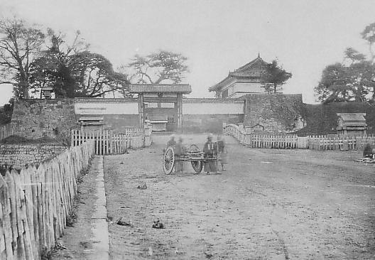
・「真田太平記 1岩櫃の城/池波正太郎」朝日新聞社(Japanese Book)
120.菅谷館(Sugaya Hall)
この城は、伝説と現実の間(はざま)にあります。
This castle is between legend and reality.

現在の菅谷館本郭の入り口(The present entrance of Sugaya Hall Hon-Kuruwa)

Location and History

「菅谷館」という名前には少し説明が必要です。「館」という用語は、この場合には「中世初期の武士の館」を指します。通常は、平地の上に土塁か柵を伴う館が堀で囲まれている構成でした。例としては足利氏館が挙げられるでしょう。
The name “Sugaya Hall” needs a small explanation. The term “hall” means ”warrior’s hall in the early Middle Ages” in this case. It usually consists of a hall with earthen walls or fences, and a surrounding moat on a plain, for example, like the Ashikaga clan hall.

足利氏館跡(Ashikaga Clan Hall Ruins)

菅谷館には、鎌倉幕府の重臣であった畠山重忠について、当時ここに住んでいたという地元の言い伝えがあります。古い記録である「吾妻鏡」にも彼が菅谷館に住んでいたという記載があります。そのためこの遺跡が菅谷「館」と呼ばれ、ここに重忠の像が立っているのです。
Sugaya Hall has a local tale about Shigetada Hatakeyama, a senior vassal of the Kamakura Shogunate, living there at that time. An old document called “Aduma-Kagami” also says he lived in Sugaya Hall. That’s why these ruins are called Sugaya “Hall” and the statue of Hatakeyama is standing on the ruins.

畠山重忠像(The statue of Shigetada Hatakeyama)

しかしながら、この遺跡の外観はそのような説明と違っています。明らかに戦国時代の城跡に見えるのです。その時代の古書もまたこの城を「館」ではなく、菅谷「城」と記しています。加えて、発掘の結果からも戦国時代の1500年前後に使われたことが判明しています。つまるところ、「菅谷館」という名前は、行政側による伝説と現実との間での妥協の産物のようなのです。
However, the appearance of the ruins is different from such descriptions. They look like the ruins of a castle in the Warring States Period obviously. Old documents in the period also call them Sugaya “Castle”, not “Hall”. In addition, the result of excavation says the castle was used around 1500 in the Warring States Period. Overall, the name “Sugaya Hall” seems to come from a kind of compromise between legend and reality by the officials.

菅谷館跡全景(The whole view of Sugaya Castle Ruins)~埼玉県立嵐山史跡の博物館ウェブサイトより引用

いずれにせよ、この城は1488年の「須賀谷原の戦い」のような戦国大名が戦いを繰り広げた重要な地域にありました。戦国大名の一つ、扇谷上杉氏がその戦いのため菅谷古城を再興したこと、しかし敗れてその城に幽閉されたことが記録されています。他の文書にはその約100年後には北条氏がこの城を使っていたとあります。つまり、この城は何度か使われたり放棄されたりしたようなのです。
Anyway, the castle was in the important area where warlords battled each other such as “The battle of Sugayahara” in 1488. Records say that one of the warlords, the Ogigayatsu Uesugi clan, restored the old Sugaya Castle for the battle, but they were defeated and kept under arrest in the castle. Another document says that the Hojo clan used the castle about 100 years later. After all, the castle seemed to be used and abandoned several times.

二の郭前の堀(The moat in front of Ni-no-Kuruwa)

菅谷城は現在の埼玉県西部にあたる場所の低台地上にあり、近くには中世の主要街道である鎌倉街道が通っていました。中心の本郭は、背後を都幾川に、両側を自然の渓谷により守られていました。本郭の入り口は厳重に防御され、二の郭、三の郭などいくつかの郭が本郭の前に広がっていました。
Sugaya Castle is located on a low plateau in what is now the western part of Saitama pref. where the Kamakura road, a main road in the Middle Ages was passing nearby. The main enclosure, “Hon-Kuruwa”, was protected by the Tokigawa river behind it and natural valleys both sides. The entrance of Hon-Kuruwa is strictly guarded and several enclosures including “Ni-no-Kuruwa” and “San-no-Kuruwa” spread out in front of Hon-Kuruwa.

菅谷館跡の地図(The map of Sugaya Hall Ruins)~現地案内板写真に追記

Features

菅谷館跡には建物はありませんが、基礎は残っており、よい状態で保存されています。基礎は全て土造りであり、戦国時代の東国においてはそれが一般的な方法でした。
The ruins of Sugaya Castle retain their foundation but with no buildings. The foundation is well preserved, and is all made from soil which is a typical method of building castles in eastern Japan in the Warring States Period.

菅谷館跡の土塁(An earthen wall of Sugaya Hall Ruins)

一例として、本郭を見てみましょう。この郭は、重忠の館があったと考えられています。それが事実なら、後から城の中心部分として強化されたはずです。
Let’s look at Hon-Kuruwa for instance. This enclosure is thought to be Hatakeyama’s hall. If it’s true, it must have been strengthened as the center of the castle later.

菅谷館跡の地図、アルファベットは以下の写真を撮った位置(The map of Sugaya Hall Ruins, Alfabetic characters show the points pictures below were taken)~現地案内板写真に追記

本郭は、高い土塁と深い空堀に囲まれています。これにより、防御側は敵の攻撃から守りやすくなります。「虎口」と呼ばれる入り口は狭くなっており、そこに至る進路はジグザグに作られていて、敵がまっすぐ内部に入れないようになっています。
Hon-Kuruwa is surrounded by a high earthen wall and deep dry moat. That makes it easier for defenders to protect them from an enemy’s attack. Its entrance, called “Koguchi”, is narrow and the route to it is made zigzagged so that attackers are unable to enter inside directly.

A.本郭の土塁と空堀(The earthen wall and dry moat of Hon-Kuruwa)
B.本郭の入り口(The entrance of Hon-Kuruwa)

更には、この土塁は部分的に意図的に突き出ています。これにより防御側はその部分から敵の正面と側面両方を攻撃することができます。このような構造は「出桝型土塁」と言われます。これは戦国時代においては、他の構造と組み合わせることで、高度な城の防御システムとなりました。よって一部の歴史家は、北条氏が城を改修したのだろうと推定しています。
In addition, the wall is partly stuck out on purpose. This allows defenders to attack from the sticking point to an enemy’s front and sides. Such a structure is called a “Dematsu” shaped earthen wall. It is an advanced system when combined with other defensive features for castles in the Warring States Period. So some historians speculate Hojo might have improved the castle.

C.出桝型土塁(The “Dematsu” shaped earthen wall)
D.本郭の内部(The inside of Hon-Kuruwa)
E.二の郭の入り口、最も高くなっている(The entrance of Ni-no-Kruwa, the highest point)

Later Life

この城は戦国時代の終り頃から長い間放置されていたようです。それ以来、城跡は民間の所有となり、畠山重忠の遺産であると思われてきました。約100年前の大正時代に初めてここが調査されたとき、重忠の像が建てられます。1973年になって遺跡が国の史跡に指定され、2008年には「比企城館跡群」の一つに改めて指定されました。
The castle seemed to be abandoned for a long time since sometime at the end of the Warring States Period. Since then, the ruins were private owned and thought of as Hatakeyama’s heritage. His statue was built when the ruins were first investigated in the Taisho Era about 100 years ago. In 1973, the ruins were designated as a National Historic Site, then were newly designated one of the “Hiki Castles Ruins” in 2008.

明治初期の城跡周辺の地図、土塁が残り畑・林となっていた(The map around the ruins in the early Meiji Era, there was a field and woods)

My Impression

関東地方の戦国大名は必要な数だけ城を作りました。その城がいらなくなったときは、速やかに廃城としました。一方、廃城となった城を再利用したいときは、その城を再建または増築しました。結果として城を廃城とするときは、完全には破壊しませんでした。代わりに一部を壊すか、建物だけを撤去しました。恐らくそれが効率的で、且つ再利用しやすかったからでしょう。それで菅谷館(城)の基礎がよく残ったと思うのです。
Warlords in the Kanto region built castles as many as they needed. When they didn’t need the castles, they immediately abandoned the castles. On the other hand, when warlords wanted to reuse abandoned castles, they restored or improved the castles. As a result, when warlords abandoned castles, they didn’t completely destroy the castles. Instead, they often destroyed part of the castles, or just remove their buildings. Probably it could be because it is more efficient and easy to reuse. I think that’s why the foundation of Sugaya Hall (Castle) remains well.

本郭の裏手(The back of Hon-Kuruwa)

今、城跡の三の郭には嵐山史跡の博物館があります。そこでは比企城館跡群(菅谷館、杉山城、松山城、小倉城)の歴史や出土品を展示しています。そこで歴史を学んでまず菅谷館に行ってみましょう。その他の内、杉山城はここからわずか5キロのところにあります。両方行ってみるのもよいでしょう。
There is the Ranzan Historical Museum on San-no-Kuruwa of the ruins now. It shows the exhibition of history and the excavation about Hiki Castle Ruins including Sugaya Hall, Sugiyama, Matsuyama and Ogura Castles. Let’s look into their history and visit Sugaya Hall first. Out of the others, Sugiyama Castle ruins is only about 5 km from there. So, how about visit the set of them.

嵐山史跡の博物館(the Ranzan Historical Museum)

比企城館跡群の4つの城(The four castles of Hiki Castle Ruins)


How to get There

車を使う場合、遺跡は関越自動車道の嵐山小川ICの近くです。嵐山史跡の博物館に駐車場があります。
電車を使う場合は、東武東上線の武蔵嵐山駅から歩いて約15分です。
東京から武蔵嵐山駅まで:池袋駅から東武東上線に乗ってください。
When using car, the ruins is near Ranzan-Ogawa IC on Kan-Etsu Expressway. Ranzan Historical Museum offers a parking lot.
When using train, it takes about 15 minutes on foot from Musashi-Ranzan Station on Tobu Tojo line.
From Tokyo to Musashi-Ranzan Station: Take the train on Tobu Tojo line from Ikebukuro Station.

Links and References

埼玉県立 嵐山史跡の博物館(the Ranzan Historical Museum)