立地と歴史(建設の歴史編)
Introduction
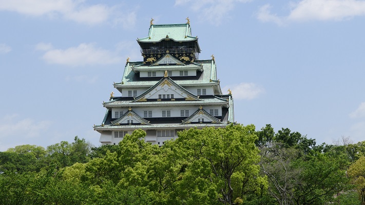
今回は、メジャー中のメジャーな将軍の城、江戸城です。江戸城といえば、今の皇居のことじゃないかと思われるかもしれませんが、実は相当大きかったのです。東京の中心部がほぼ入ってしまうくらいです。江戸城は大まかには、内堀の範囲の内郭と、外堀の範囲の外郭に分かれるのですが、それぞれ外周が約8km、約16kmもありました。他の主要な城郭と比べても、日本最大級と言っていいでしょう。その歴史を追うだけでも大変そうなので、歴史編も2つに分けることにしました。今回は「建設の歴史編」として、太田道潅が最初に築いたと言われる地方城郭から、江戸幕府の権威を象徴し、現代の首都の礎となる最大級の城になるまでの歴史をご説明します。

今回の内容を趣向を変えて、Youtube にも投稿しています。よろしかったらご覧ください。
太田道灌による築城
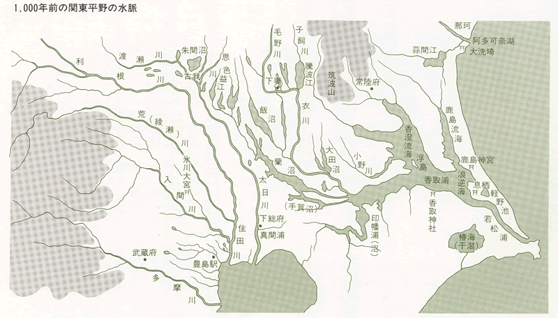
江戸城の歴史に入る前に、中世の関東の地理的状況を確認したいと思います。中世までの関東地方は、現在と全く異なり、利根川・荒川・渡良瀬川などの大河が、直接江戸湾(現・東京湾)に注いでいました。現在の利根川などの流路は、水運・治水などのために、江戸時代に付け替えられたのです。現在の東京都の低地は、大河の流路または湿地帯になっていて、都市開発や交通には不向きな土地でした。例えば、古代に関東南部を通過する主な交通手段は、三浦半島から房総半島に舟で渡ることでした。
源頼朝が挙兵し、一旦敗れた後に渡ったのも房総半島で、そこから盛り返して鎌倉に入る前に、太井(ふとい)、隅田の両河を渡ったという記録があります(下記補足1)。そのとき帰参した豪族の一人に江戸重長がいて、彼ら一族の館は、後の江戸城の辺りにあったという説があります。関東時代の戦国時代の幕開けとなった享徳の乱(1455年・享徳3年~)では、上杉氏勢・関東公方勢の境界線は利根川でした。その上杉氏(扇谷)の家宰(筆頭家老)だった太田道潅が、前線の重要拠点として築いたのが江戸城だったのです。それでは、公方側の重要拠点はどこだったかというと、国府台から関宿を結ぶラインでした。この辺りは丘陵地帯で、東北方面にも通じていたので、各戦国大名がその確保のために戦いました。北条氏と里見氏が戦った国府台合戦が有名です。
(補足1)
治承四年(1180)十月小二日辛巳。武衛は常胤、廣常等之舟檝于相乘り、太井、隅田兩河を濟る。淸兵三万餘騎に及び武藏國に赴く。豊嶋權守淸元、葛西三郎淸重等は最前に參上す。又、足立右馬允遠元は兼日命を受くるに依て、御迎の爲に參向すと云々。今日、武衛の御乳母で故八田武者宗綱の息女〔小山下野大掾政光の妻で寒河尼と号す〕鍾愛の末子を相具し、隅田宿に參向す。則ち御前に召し往時を談ぜ令め給ふ。彼の子息を以て、眤近の奉公を致さ令む可し之由を望み申す。仍て之を召し出し自ら首服を加へ給ひ、御烏帽子を取り之を授け給ふ。小山七郎宗朝と号す〔後に朝光と改む〕今年十四歳也と云々。(吾妻鏡)
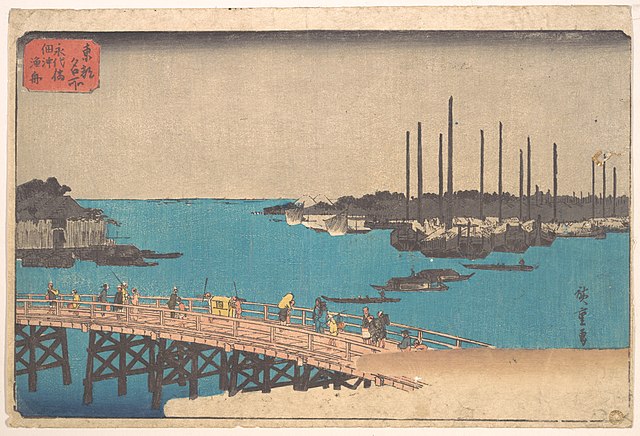
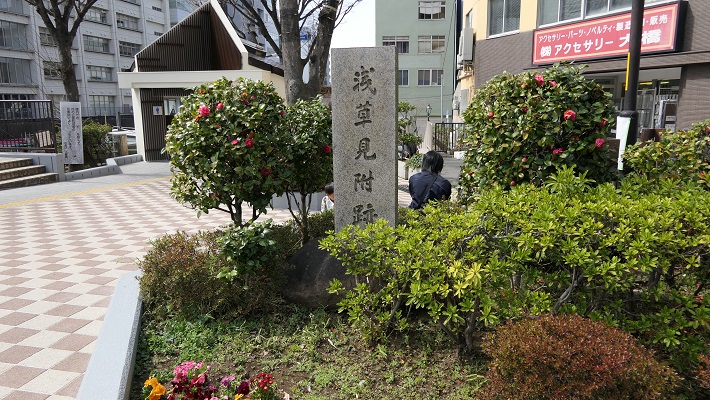
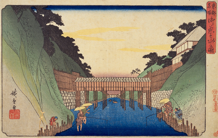
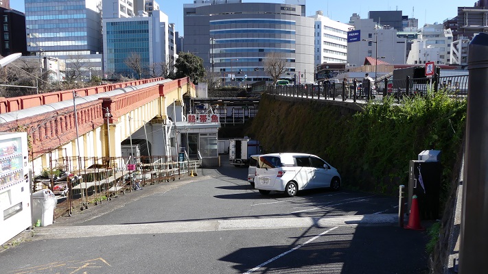
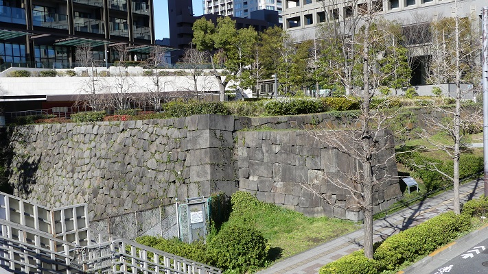
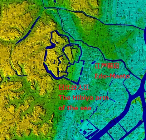
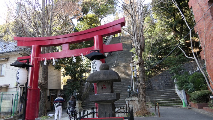
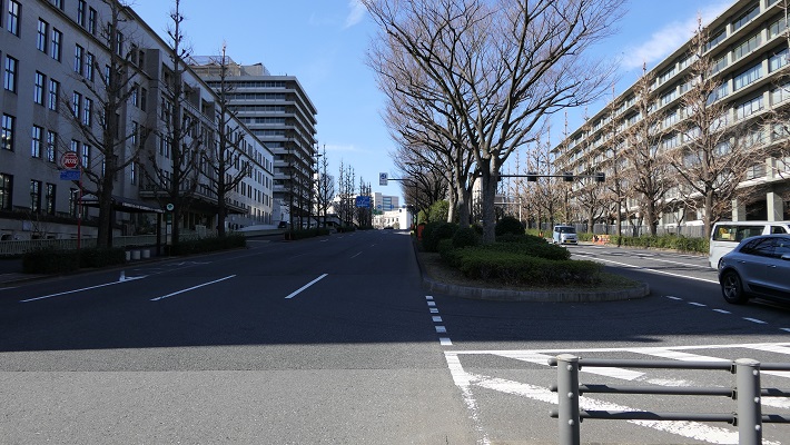
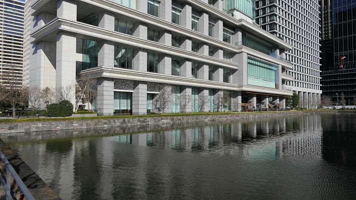
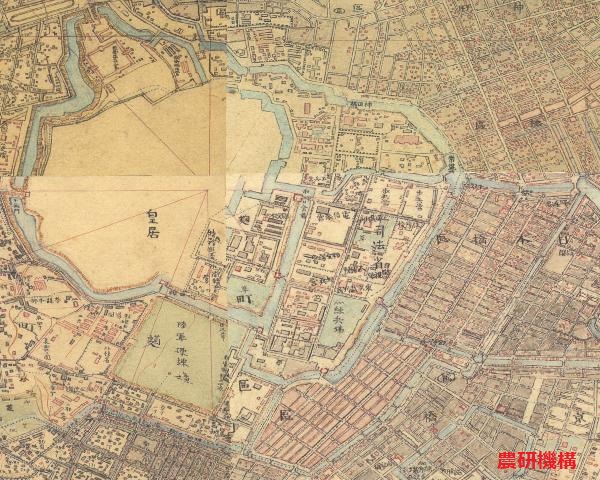
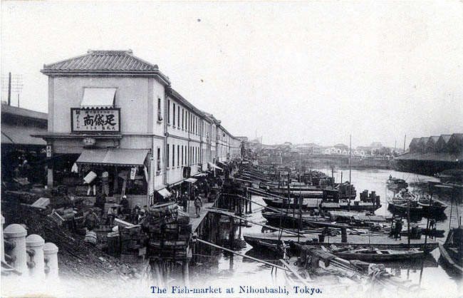
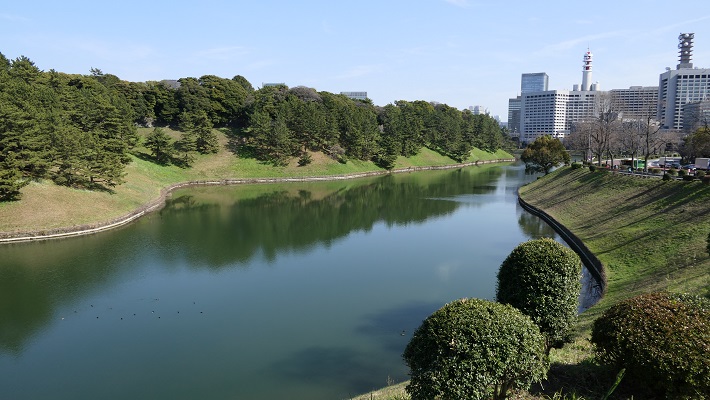
次に、江戸城周辺がどうだったかというと、これも現在と全然違っていました。後の城の中心地は、武蔵野台地の東端に当たりましたが、そこから江戸前島という小半島が突き出ていました。そしてその間には、日比谷入江(海)が入り込んでいました。現在の皇居外苑や日比谷公園のあたりです。そして、ここにも平川という川が直接流れ込んでいました。「江戸」という地名も、「江(入江)」の「戸(入口)」という説があり、この地形を反映しているのかもしれません。

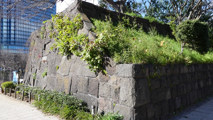
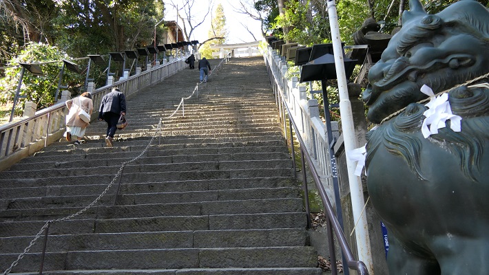
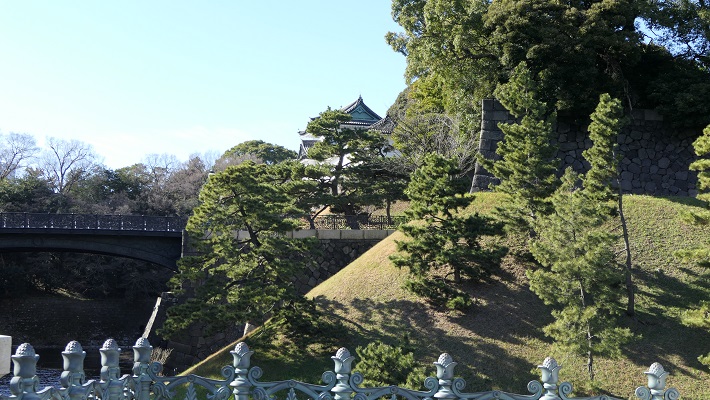
太田道潅がこの地に江戸城を築いたのは1457年(康正3年)とされていますが、このときの詳細はわかっていません。自然の要害である台地上の、江戸時代の本丸周辺(現在の皇居東御苑)に築かれたと推定されています。また、城を訪れた禅僧たちが残した詩からある程度様子をうかがい知ることができます。(「梅花無尽蔵」「寄題江戸城静勝軒詩序」など)それらによると、「子城(しじょう、本丸に相当)」「中城(ちゅうじょう)」「外城(がいじょう)」という曲輪があり、周りを切岸・(土)塁・水堀に囲まれていました。内部には、道灌の居館「静勝軒」とその背後に「閣」がありました。佐倉城の銅櫓は、この静勝軒を移築したものと伝わりますが、真実かどうか現存していないので何とも言えません。道潅が居館からの景色を詠った歌として「我が庵は、松原つづき海近く 富士の高嶺を軒場にぞ見る」というのが残っています。江戸城本丸東側には、道潅が梅の木を植えたことにちなむと言われる「梅林坂」や「汐見坂」がありますので、この辺からの景色だったかもしれません。
また、城の東側には川が流れ、南の海に注ぎ、河口には橋がかかっていたそうです。その橋の付近には船が集まり、市が形成されていました。平川や、日比谷入江周辺のことだと思われます。城はやがて、関東地方の覇者となる北条氏の支城になりますが、基本的にこの姿が継承されたと考えられます。
徳川家康の「江戸御打入り」
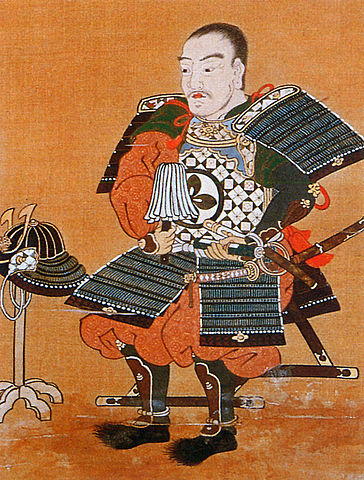
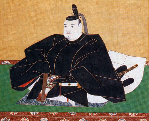
1590年(天正18年)の小田原合戦の結果、徳川家康が関東地方に移封、そして本拠地として江戸城を選びます。小田原城に籠っていた北条氏が降伏したのが天正18年7月5日、家康の江戸入府は8月1日(八朔)と言われますが(公式日か)、7月下旬頃には一旦入城していました。家康は、旧領国(東海)に帰ることなく、小田原の陣から直接江戸に向かったのです。家康の新領国には、小田原も鎌倉もあるのに、なぜ江戸?ということですが、選んだ人から理由まで諸説あります。
・選んだ人(豊臣秀吉)
景勝の地である(「徳川実紀」)
家康を関東・東北の押さえとするため
最強の大名、家康を中央から遠ざけるため(一般的?)
・選んだ人(徳川家康)
水運の利点を考慮(「朝野旧聞裒藁(ちょうやきゅうぶんほうこう)」幕府編纂)
富士山が見えるから(足利健亮氏)
朝鮮出兵の負担を逃れるため
最近は、秀吉と家康が合議の上決めたという説もありますが、後から見れば大英断だったと言えるでしょう。
また、家康入府時の江戸や江戸城の状態についても、北条時代にも開発が続いていたとも、さびれて寒村状態になっていたとも言われますが(下記補足2)、当時豊臣政権下では最大の大名となった家康の本拠地として不足だったのは確かでしょう。
(補足2)(城には)二の丸、三の丸、外郭にある家までそのまま残っていた。(中略)だが、ことのほか古い家屋だったため、本多佐渡守(さどのかみ / 正信)が『これは見苦しい』と言上したところ、(家康は)笑って家づくりにはかまわず、本丸と二の丸の間の堀を埋めて、城の普請を急いだ(「落穂集(おちぼしゆう)追加」)
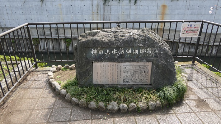
そんな家康が、その時優先したのは、城の拡張ではなく、江戸・領国のインフラの整備でした。当時は天下人ではないので、大規模築城のために他の大名や技術者集団を動員できなかった事情もあったでしょう。家康はまず、江戸前島を横断する運河として「道三堀」を開削させました(1590年~)。続いて、行徳(現・千葉県)と結ぶ人工河川・小名木川を通しました。これは、塩を確保するためとされますが、それ以外にも、国府台から関宿につながる丘陵地帯を軍事的に掌握するためだったとの見解も出されています。関宿は、やがて利根川を銚子の方に付け替える大事業の重要地点にもなります。この時代からその構想があり、第一歩(1594年の会の川の締め切り)が始まったという見解があります。一方、水害対策の一環だったという意見もあります。
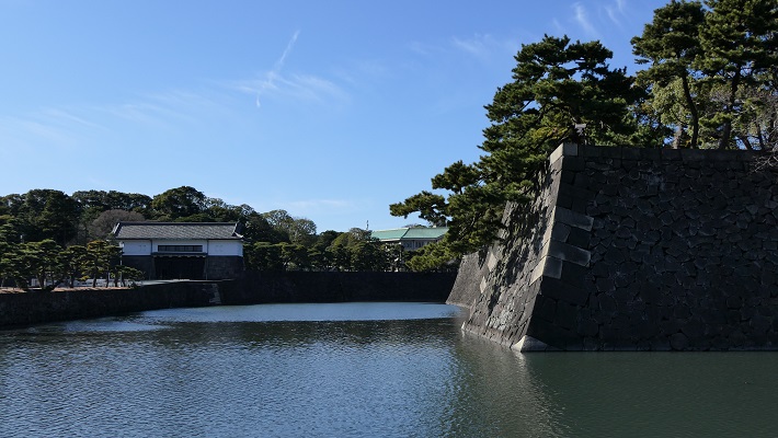
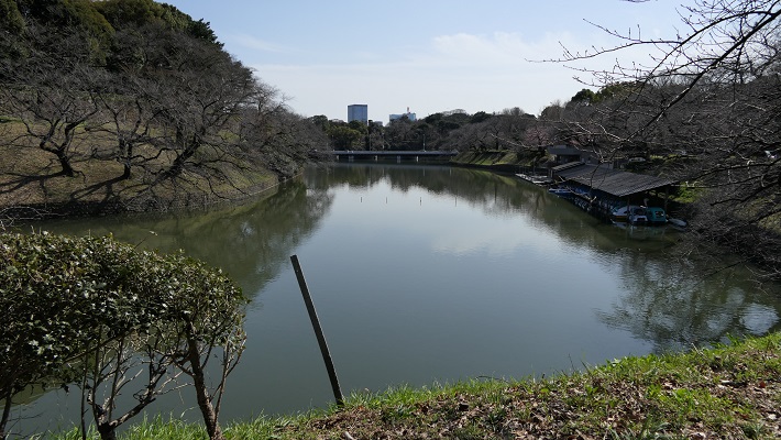
城の近くでは、飲料水の確保が重要な課題でした。江戸城は海辺に近く、質量ともに不足していたのです。そこで、城の西側の谷筋の湧水や小河川の水をせきとめ、「千鳥ヶ淵」「牛ヶ淵」を作りました(1592年頃~)。これが城の内堀の原型になります。それと並行して、城の曲輪としては、本丸に加えて、家康の隠居地ということで西の丸を増築しました。
天下普請による城拡張
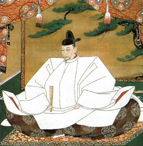
家康は、関ヶ原の戦いで勝利し、1603年(慶長8年)に征夷大将軍になると「天下人」として各大名を動員できるようになります。この動員により行われた大規模な築城などの工事を「天下普請」といいます。その対象は将軍の居城・江戸城も含まれました。江戸城の拡張が本格化するのです。
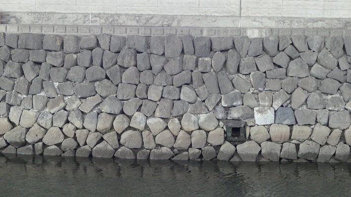
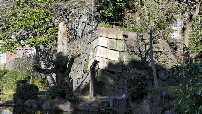
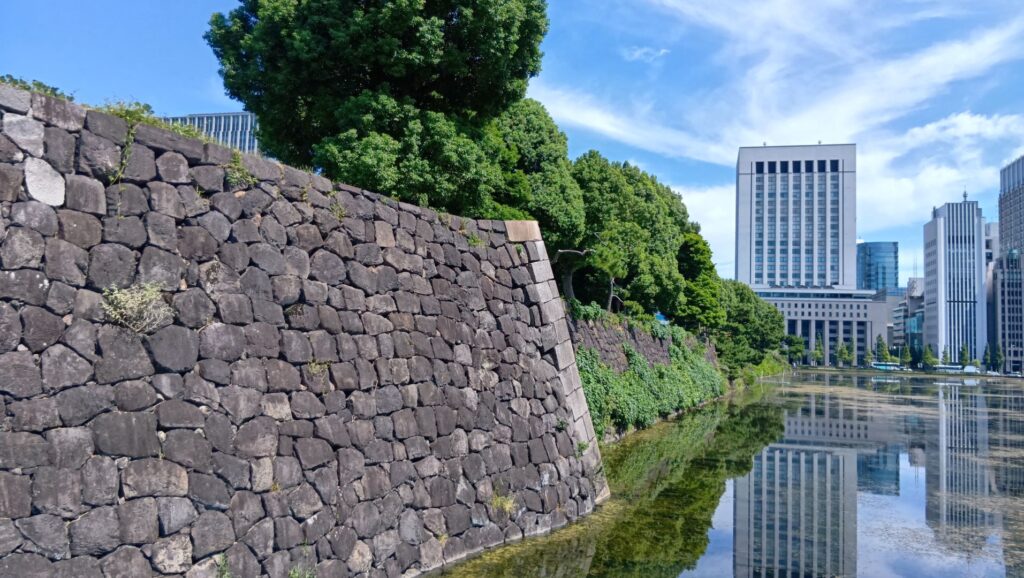
翌年(1604年)家康は、西国の外様大名などに、石垣築造のための石材の調達(約6万個相当)、それを運搬するための石船(3000艘)の建造を命じました。幕府も建造費として支出(金1192枚5両)しましたが、実態として大名たちの負担は大変なものでした。石1個は「百人持之石」で約4トンもあり、舟1艘で2個ずつ運べたそうです。運搬だけでも困難で、慶長11年5月26日には大風のため、鍋島家の120艘、加藤(喜明)家の46艘、黒田家の30艘が沈没したとの記録があります。
(判明している内訳)
・浅野幸長(和歌山藩) 385艘
・島津忠恒(薩摩藩) 300像
・黒田長政(福岡藩) 150艘
・尼崎又次郎(堺の豪商) 100艘
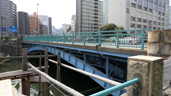
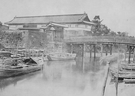
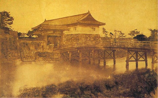
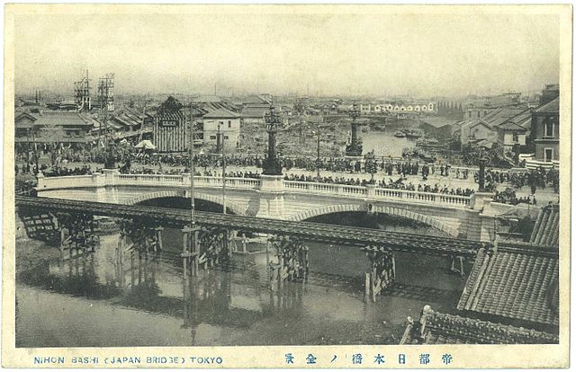
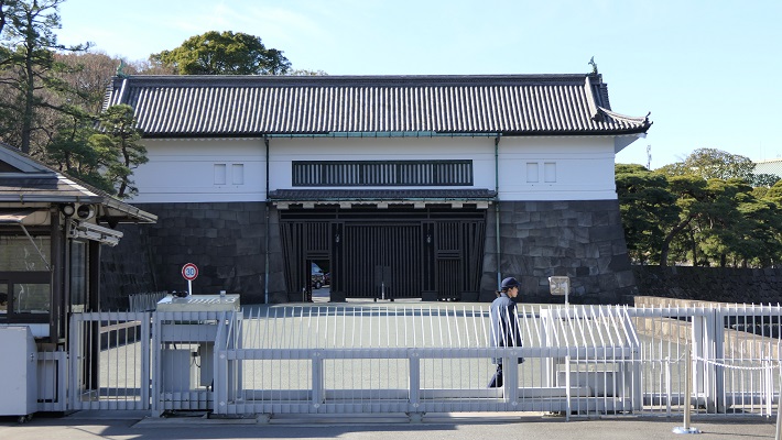
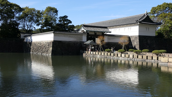
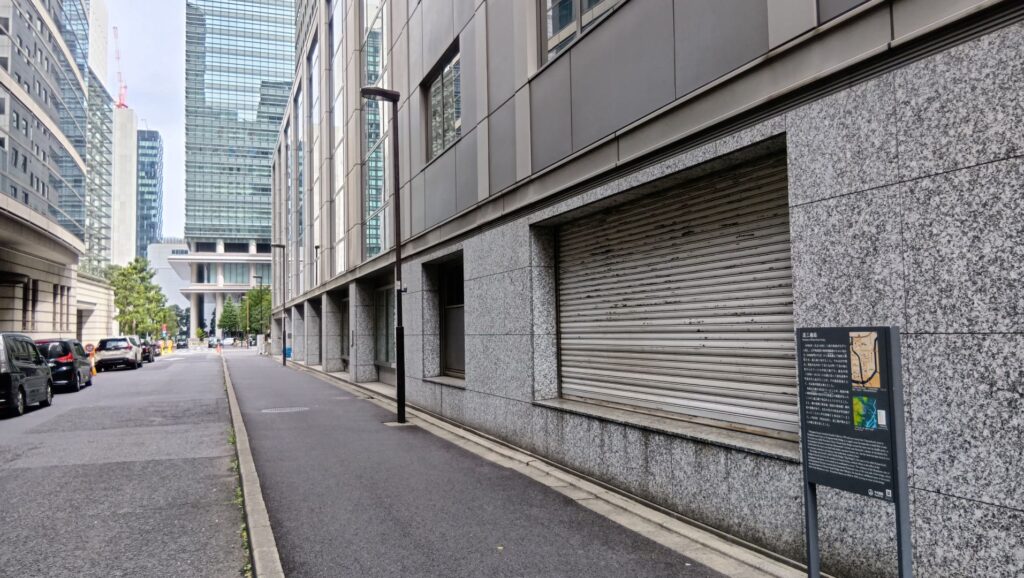
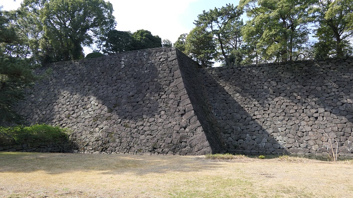
江戸城の第一次天下普請は、1606年(慶長11年)から翌年にかけて本格的に行われました。それとともに、大名屋敷などの敷地確保のため、日比谷入江が埋められていきました。残土処理、城を脅かす軍船の侵入を防ぐためでもありました。城については、本丸の強化が中心で、周りは石垣で固められ、天守台・天守(初代)・御殿などが建設されました。最近の研究(「江戸始図」の発見による)では、本丸の南側には5連続の枡形が備えられてたとされています。その他、二の丸・北の丸・西の丸(継続)の工事が行われました。また、日比谷入江に代わる運搬経路として、外堀が新設されました。付け替えられた平川(日本橋川)の延長線上に、江戸前島の尾根をなぞって掘られました。
江戸城の天下普請は一段落しますが、他の城の天下普請はひたすら続きます。まだ健在であった大坂城の豊臣家に対する包囲網を形成するためと、豊臣に味方するかもしれない西国の外様大名の力を削ぐためです。主な天下普請を挙げてみます。
・彦根城(1603~1606年)
・篠山城(1603~1604年)
・名古屋城(1610年~)
・駿府城(1606~1611年)
・他に亀山城、膳所城など

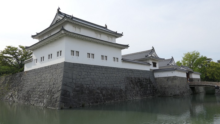

そうするうちに、江戸城第二次天下普請も始まりました(1611年、慶長16年)。このときは西の丸の堀と石垣の工事が中心でした。堀普請は東国大名、石垣は西国大名が中心でした。一旦中断しますが大坂包囲網が完成すると再開され(1614年)、本丸・二の丸・西の丸の強化、そして、以前日比谷入江だった西の丸下でも石垣工事が行われました。工事が行われた堀は、入江を埋め残したものと言われます。その普請の最中、大坂冬の陣が起こり、動員されていた大名たち(34家)は、そのまま徳川方として、戦に動員されることになったのです。つまりこの頃の江戸城天下普請は、必ずしもそれを最優先させていたわけではなく、大名をコントロールする政策の一環として行われていたと言えるでしょう。
日本一の城の完成
1615年(慶長20年)、幕府は豊臣氏を亡ぼしますが、まだまだ天下普請は続きました(下記は主なもの)。徳川の世を盤石にするための措置でした。なお、この頃から外様大名だけでなく、親藩や譜代大名も動員されるようになりました。天下普請の目的が徐々に変わってきたということでしょう。これらに比べると、まだ江戸城は控えめな状況だったのかもしれません。
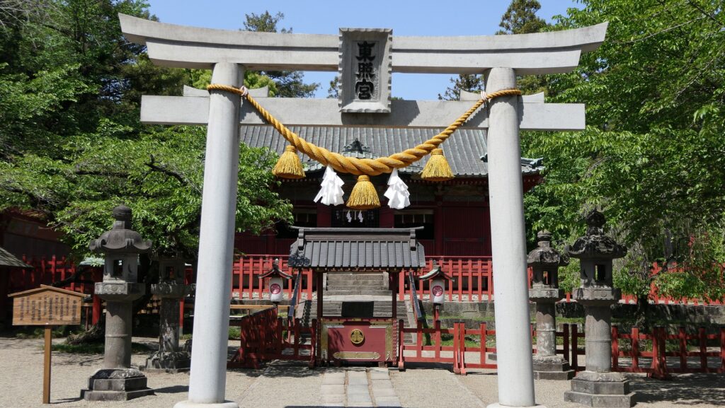
・徳川家康逝去に伴う日光東照宮造営(1617年、このときの社殿は後に、世良田東照宮として移築)
・明石城築城(1619年)
・福山城築城(1619年~)
・大坂城再建(1620年~)
・他に尼崎城、高槻城修築、利根川東遷事業など

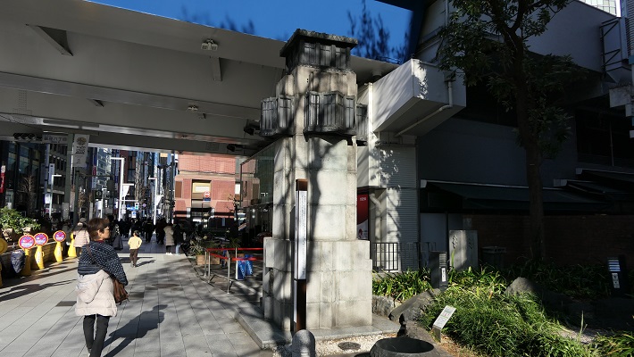
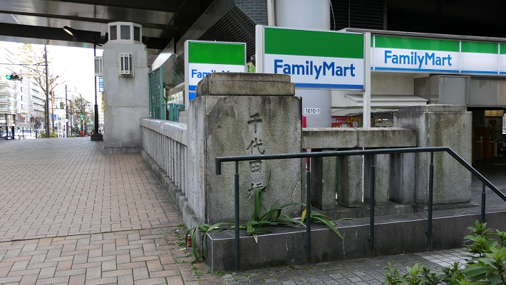
江戸城の天下普請は、家康の跡を継いだ徳川秀忠により1620年(元和6年)に本格的に再開されました。このときは、伊達政宗・上杉景勝など主に東北地方の大名が動員されました。内容としては、主に内郭の北側の石垣や枡形門が整備されました。(清水門など、清水門の現存建物は1658年の再建)。1623年(元和9年)には、秀忠のためとも言えるような2代目天守も完成しました。これに合わせて本丸御殿も拡張されました。これをもって内郭部分が完成したとされています。また、外郭の整備も始まり、神田川が開削されました。伊達政宗の仙台藩が担当した部分は「仙台堀」と呼ばれています。直接的には平川の源流を、隅田川に放流されるためでした。


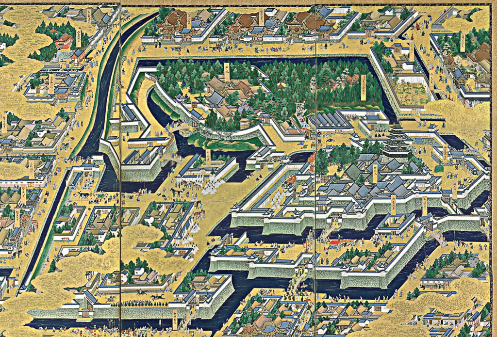
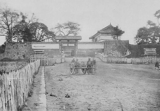
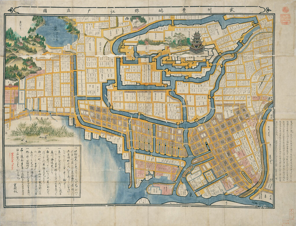
また、秀忠隠居後になりますが(大御所として実権)、1628年(寛永5年)には、その年に発生した地震による被害の修復と、枡形門の増築が行われました。この直後の江戸城の姿がいわゆる「寛永図(武州豊嶋郡江戸庄図)」として残されています。1632年、寛永9年に描かれたとされています。完成した江戸城中心部だけでなく、発展中の江戸の町の様子もわかります。例えば、日本橋・京橋を通る東海道や、以前江戸前島だった陸地の沖が埋め立てられて、広がっています。その間には、水路が張り巡らされています。
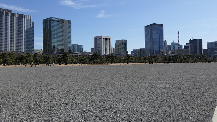
1632年(寛永9年)に秀忠が亡くなり、名実ともに権力者になった3代将軍・徳川家光は、1636年(寛永13年)に最大規模の天下普請を江戸城で行いました。合計120家もの大名が動員されました(下記内訳)。外郭、つまり総構を構築し、江戸城全体が完成させるときが来たのです。
・石垣築造組:6組62大名(中国・四国・九州が中心)
・外濠の掘り方工事組:7組58大名(東北・関東・北陸・信濃)
堀は、それまでに神田川が開通していましたので、その続きが掘られました。現在のJR四谷駅近くに跡がある「真田濠」は、この開削に真田信之が加わっていたことにちなみます。外郭の場合、ほとんどが土塁で、石垣は要所に設けられた枡形門に築かれました。現在も地名になっているものがあります。これだけ大きな総構を築いた理由として、城の中心を、当時の大砲の射程外に置くためだったという見解があります。ちょうど幕府が「鎖国政策」に向かっている時期でした。大規模な天下普請を通して、各大名を統制し、幕藩体制を確立するという意味もあったのでしょう。

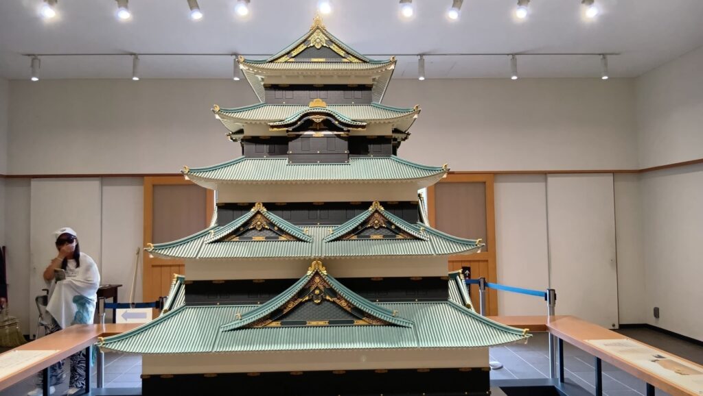
外郭(総構)が完成すると、翌年(1637年・寛永14年)には、空前絶後の新天守(寛永天守)の建設が始まります。次の年までには完成していたようです。これも江戸の城と町を描いた「江戸図屏風」は、家光の治世を顕彰するために作られたと言われています。そうであれば、この姿は、その完成した天守と江戸城ということになります。江戸城の天下普請は、この後、1660年(万治3年)の4代将軍・家綱の時代まで続くのですが、この記事は寛永天守の完成をもって終幕にしたいと思います。