21.江戸城その3~Edo Castle Part3

この城の中心部は、皇居、庭園や公園になりました。
The center of the castle has become Imperial Palace, gardens or parks.

ビル街を背景に桜田門と桜田濠~Sakurada-mon Gate and Sakurada-bori moat with the background of modern buildings

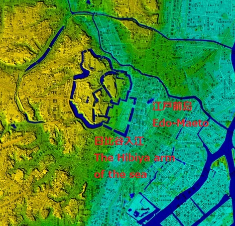
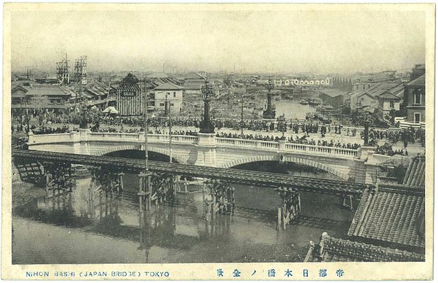
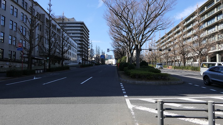
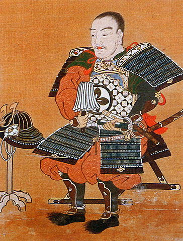
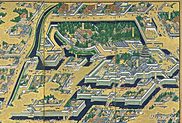
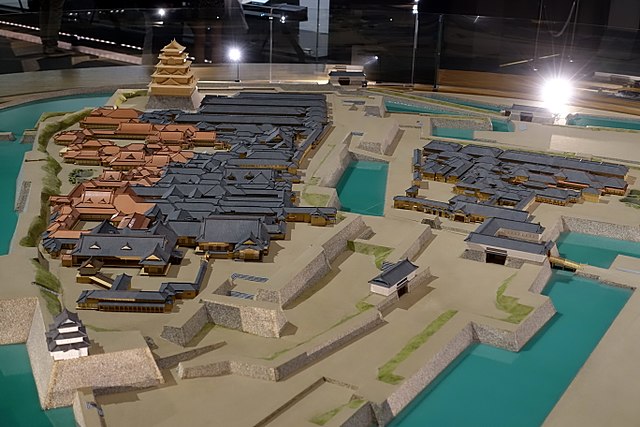
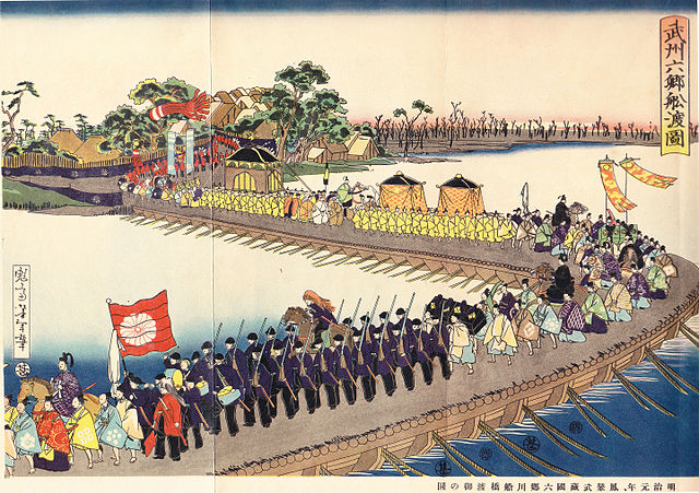
江戸城は内郭と外郭に分かれていました。内郭は内堀の内側にあって城の中心的機能を果たしていて、本丸、北の丸、西の丸といった主要な曲輪から成っていました。その外周は8km近くです。そこには天守、豪華な御殿があり、多くの櫓や門によって警備されていました。現在、内郭は4つの部分に区切られています。一つずつ見ていきましょう。
Edo castle was divided into Naikaku and Gaikaku. Naikaku was the inside of the inner moat, and consisted of the center portion of the castle including primary enclosures such as Honmaru, Kitanomaru, and Nishinomaru. Its perimeter was nearly 8 km. It had the Tenshu keep, luxurious halls, many turrets and gates for security. Now, Naikaku is separated into four parts. Let’s look at each part one by one.

江戸城内郭の4つの部分~The 4 parts of Edo Castle Naikaku(国土地理院航空写真に加筆)

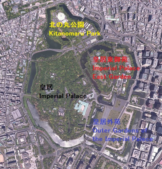
皇居東御苑~Imperial Palace East Garden

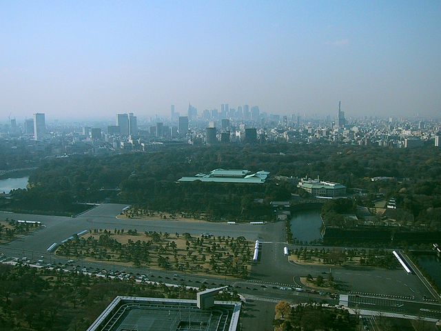
ここは、本丸、二の丸、そして三の丸の各曲輪を由来としています。将軍は長年本丸にあった御殿に住んでいましたが、1863年の火災の後は西の丸に移り、本丸には戻りませんでした。明治維新後、明治天皇もまた西の丸に住み続けました。そのため本丸とその周辺は宮内庁によって使われてきました。そして1968年からは、その多くの部分が庭園として公開されています。
It is derived from the enclosures, Honmaru, Ninonaru and Sannomaru. The Shogun usually lived the main hall at Honmaru for many years. But after the fire in 1863, they moved to Nishinomaru, didn’t returned to Honmaru. After the Meiji Restoration, Emperor Meiji also continued to lived in Nishinomaru. So Honmaru and the area around were used for Imperial Household Agency. Many parts of them have lastly been open to the public as the garden since 1968.

皇居東御苑の航空写真~The aerial photo of Imperial Palace East Garden

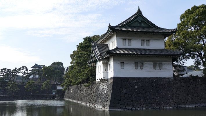
・三の丸巽二重櫓:江戸城に現存している4つの櫓のうちの一つです。庭園の外側からは、本丸富士見三重櫓を背景に、素晴らしい姿を眺めることができます。
・Tatsumi two-story turret at Sannomaru: It is one of four remaining turrets in Edo Castle. You can see a great view of the turret with the background of Fujimi three-story turret at Honmaru from outside the garden.

巽二重櫓と富士見三重櫓(背景)~Tatsumi two-story turret with the background of Fujimi three-story turret

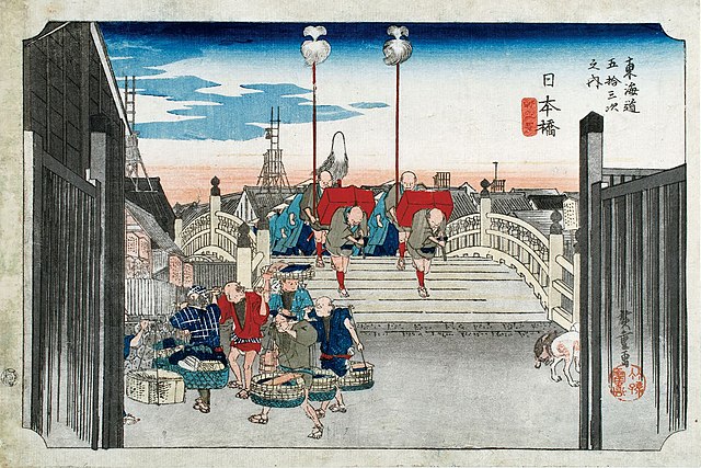
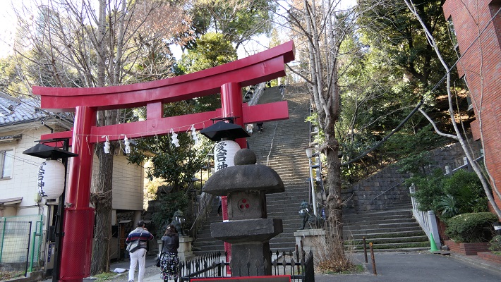
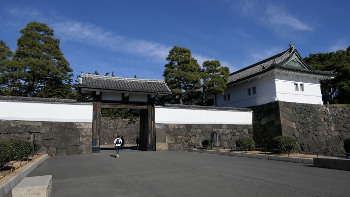
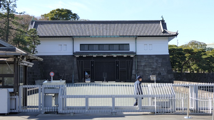
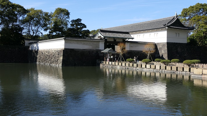
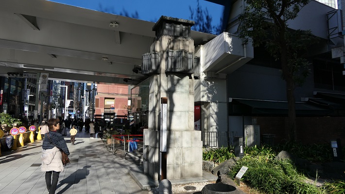
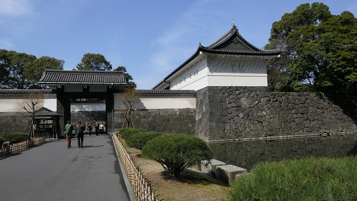
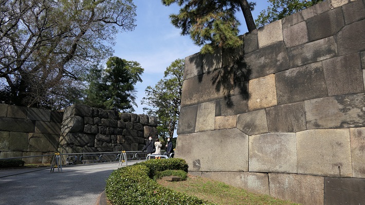
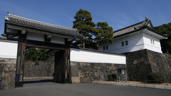
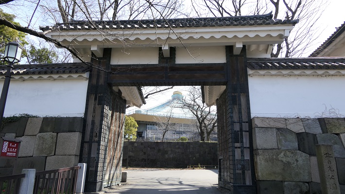
・大手門:この門は、江戸城の正門でした。現存するのは一部分で、残りは復元されています。庭園の入り口の一つでもあります。皇宮警察の人たちが荷物チェックをします。この内側が三の丸となります。
・Ote-mon Gate: This gate was the main entrance of the castle. It is partly original and the rest has been restored. It is also one of the entrances of the garden. The Imperial Guards will check your baggage. The inside of the gate is Sannomaru.

大手門~Ote-mon Gate

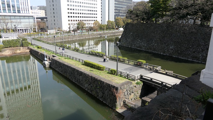
・大手三の門跡:ここは二の丸の入り口でした。過去には大きな櫓と門の前には内堀がありました。残念なことに全て撤去されてしまいました。
・The ruins of Ote-Sannomon Gate: this was the entrance of Ninomaru enclosure. There were large turrets around and the inner moat in front of the gate in the past. Unfortunately, they have all been demolished.

大手三の門跡~The ruins of Ote-Sannomon Gate
大手三の門の古写真~An old picture of Ote-Sannomon Gate(licensed under Public Domain via Wikimedia Commons)

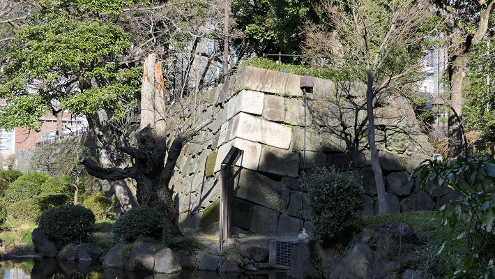
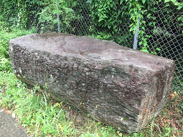
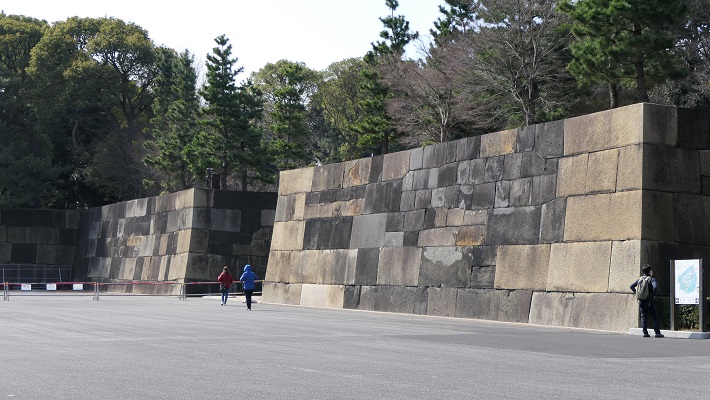
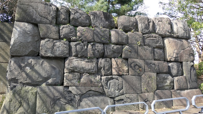
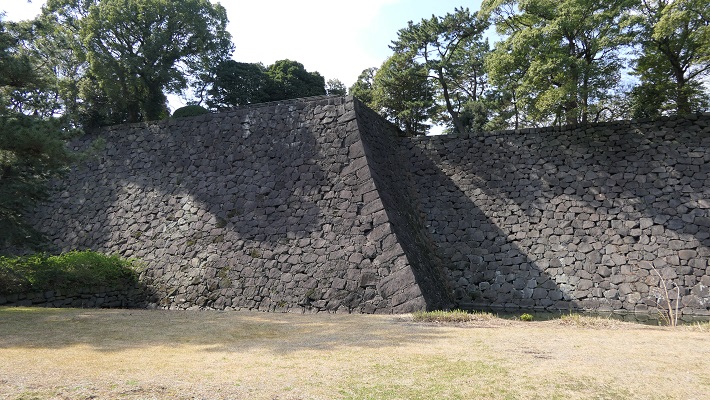
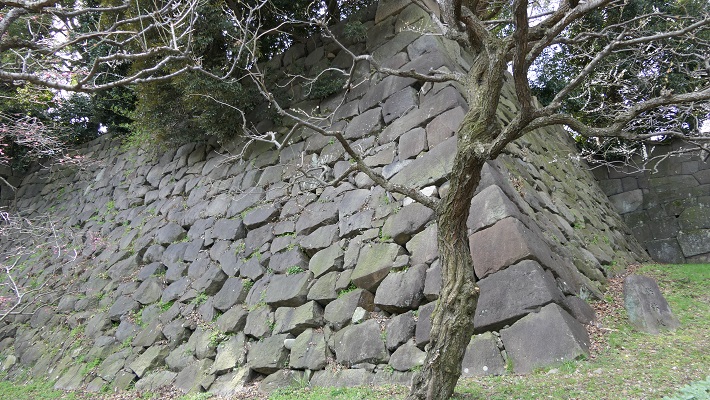
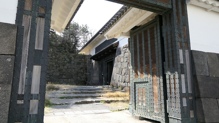
・中の門跡:ここは本丸の入り口でした。ここにも建物は残っていませんが、残っている巨大な石垣には驚かれるでしょう。これらの石は、瀬戸内海から運ばれてきたものです。
・The ruins of Nakanomon Gate: this was the entrance of Honmaru enclosure. They also have no buildings, but you will be surprised to see huge remaining stone walls. These stones were brought from Seto Islands Sea area.

中の門跡~The ruins of Nakanomon Gate
中の門の古写真~An old picture of Nakanomon Gate(現場説明版より)

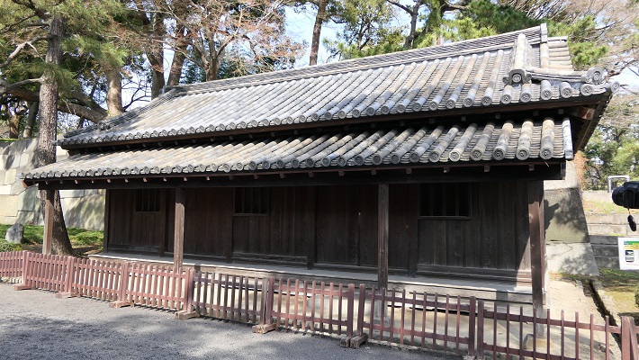
・三つの現存している番所:これらは前述の門の周辺にあります。武士が厳しく訪問者をチェックしていました。その中には忍者もいたそうです。
・The three remaining guard stations: they are around the gates mentioned before. Warriors did security check strictly. Some of them are said to be Ninja.

大手三の門内にある同心番所~The guard station inside Ote-Sannomon Gate
中の門前にある百人番所~The station for 100 guards in front of Nakanomon Gate
中の門内にある大番所~The last guard station inside Nakanomon Gate

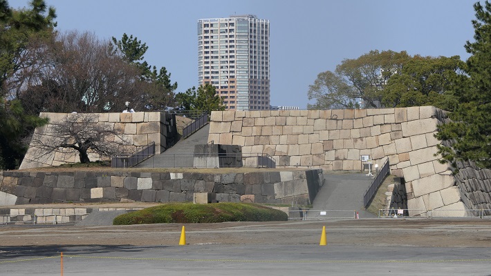
・中雀門跡:この門は、本丸御殿に至る最後の門でした。残っている石垣が黒ずんでいるのは1863年の火災による影響のようです。
・The ruins of Chujaku-mon Gate: this gate was the last one that led to Honmaru main hall. Their remaining stone walls look dark that might have been caused by the fire in 1863.

中雀門跡~The ruins of Chujaku-mon Gate
恐らくは火災により傷んだ石垣~The stone walls probably damaged by the fire

・本丸御殿跡:広大な土地に御殿がひしめいていました。ここは今は花と木の庭園になっています。
・The ruins of Honmaru main hall: this spacey area was packed with the hall. They are now used for a garden with flowers and trees.

本丸御殿跡~The ruins of Honmaru main hall
本丸の古写真、1863年の火災後~An old picture of Honmaru enclosure after the fire in 1863(licensed under Public Domain via Wikimedia Commons)

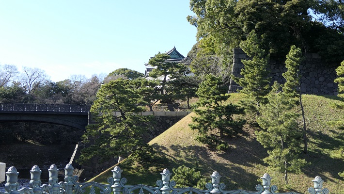
・富士見三重櫓:江戸城で唯一現存している三重櫓です。三代目の天守が焼けた後は代用天守として使われました。本丸からはその背面を見物できます。
・Fujimi three-story turret: it is the only remaining three-story turret in Edo Castle. It was used as the alternative Tenshu keep after the third Tenshu was burned down. We can see the back side of it at Hommaru.

富士見三重櫓(背面)~Fujimi three-story turret(the back side)
富士見三重櫓の正面~The front side of Fujimi three-story turret(taken by TECHD from photoAC)

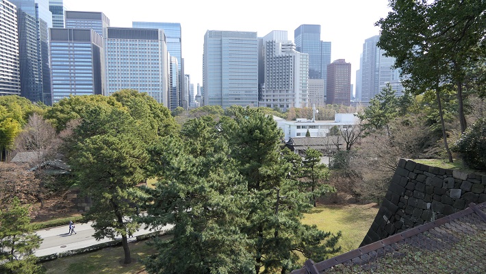
・本丸展望台:ここからは二の丸庭園越しに東京中心地の景色を楽しめます。ここには台所前三重櫓がありました。過去には武士たちが見張りをしていたはずです。
・The viewing platform at Honmaru: You can have a good view of the center of Tokyo looking over Ninomaru Garden. The Daidokoro-mae three-story turret was there. Warriors should be likely looking over for security in the past.

本丸展望台からの眺め~A scene from the viewing platform at Honmaru
展望台を二の丸から見上げる~Looking up the viewing platform from Ninomaru enclosure

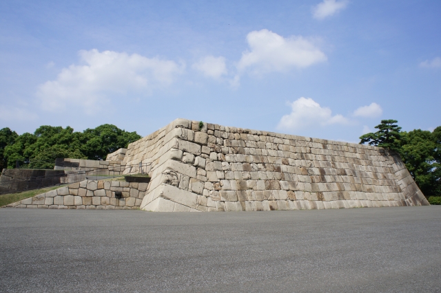
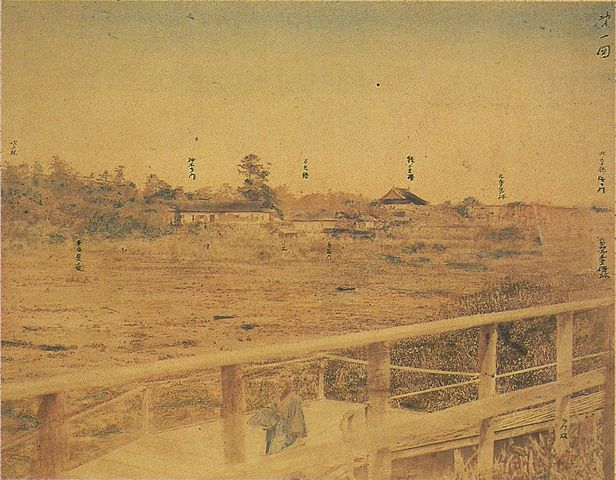
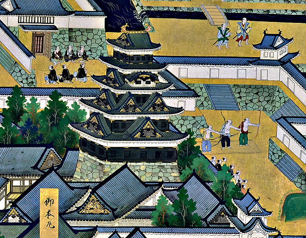
・天守台石垣:この城には天守がありました。最初の三人の将軍は、先代の天守に代わる自身の天守を築きました。三代目の天守は特に史上最大と言われる程巨大でした。ところが、1657年の明暦大火で焼け落ちてしまいます。その後四代目の天守再建が始まりますが、中止となりました。現在その四代目用の天守台が残っています。
・The stone walls for Tenshu keep: the castle had the Tenshu keep. The first three Shoguns built their own Tenshu instead of using the previous one. The third Tenshu was especially big which might have been the biggest one in history. However, it was burned down by the great fire of Meireki in 1657. After the fire, the rebuilding of a fourth Tenshu was launched, but canceled. We can now see the prepared Tenshu base for it.

残っている天守台~The remaining Tenshu base
二代目または三代目天守、「江戸図屏風」より、17世紀~The second or third Tenshu, from “View of Edo”, in the 17th century(licensed under Public Domain via Wikimedia Commons)

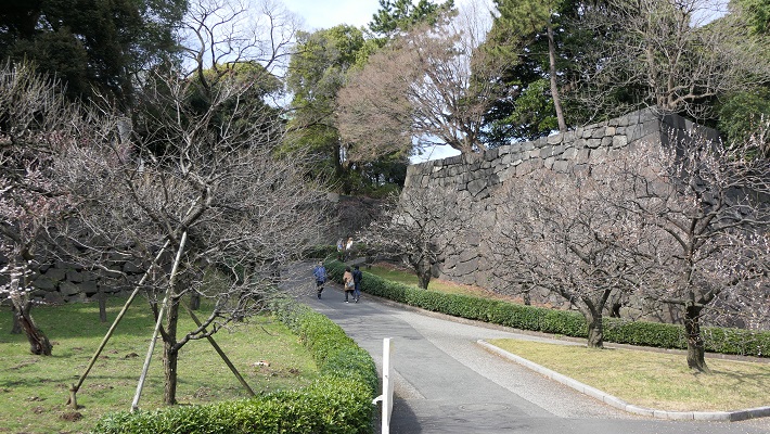
・梅林坂:この城の創始者である太田道灌が梅の木を植え、神社を作った所と言われています。梅林の合間に、より古風な石垣が残ります。
・Bairin (Plum Grove) Slope: it is said that the founder of the castle, Dokan Ota planted plum trees and built a shrine there. We can now see the trees among older looking stone walls.

梅林坂~Bairin (Plum Grove) Slope
古風な石垣~The older looking stone walls

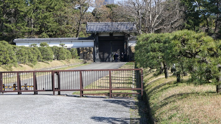
・平川門:ここは城の裏門で、現存しています。この門は、鬼門である東北を向いています。このため、城での罪人はこの門を通して追放されたとのことです。
・Hirakawa-mon Gate: this was the back gate of the castle and remains now. The gate faces the traditional taboo direction – the northeast. For this reason, the offenders in the castle were banished through the gate.

平川門~Hirakawa-mon Gate

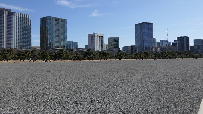
皇居外苑~Outer Gardens of the Imperial Palace

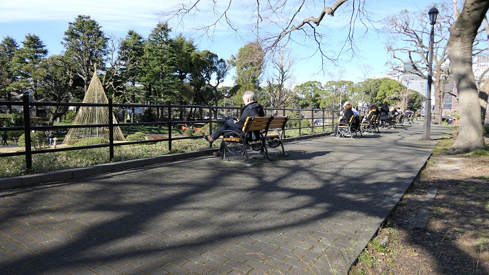
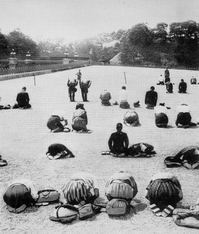
ここは「皇居前広場」とも呼ばれています。江戸時代には「西の丸下」と呼ばれており、多くの大名屋敷が建っていました。明治時代に皇室の園地となりましたが、市民にとって親しみのある場所でもありました。皇居がすぐ近くに見えるからです。第二次世界大戦が終わったとき、敗戦を嘆く人たちがここに集まったことで有名です。現在の人たちも似たような状況です。簡単に来れるので、いつも多くの観光客が集まっています。現在ここは一般に公開されています。
It is called “The Palace Plaza” as well. This area was called “Under Nishinomaru” where many halls for lords were in the Edo Period. In the Meiji Era, it was turned into the garden for Imperial Families, but also familiar to citizens because they could see the Imperial Palace closely. At the end of World War II, it became a well known place for people mourning the loss of the war. This idea is similar to people in the present. Many tourists always visit there due to easy access. Now, garden is open to the public.

皇居外苑~The Outer Gardens of the Imperial Palace
終戦時に皇居前広場に集まった人々、1945年8月16付毎日新聞より~The gathering people at the Palace Plaza at the end of the war, in the Argust 16th 1945 edition of the Mainichi Shinbun(licensed under Public Domain via Wikimedia Commons)

皇居外苑の航空写真~The aerial photo of The Outer Gardens of the Imperial Palace

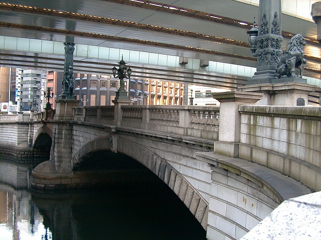
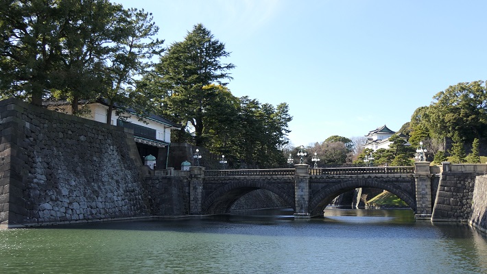
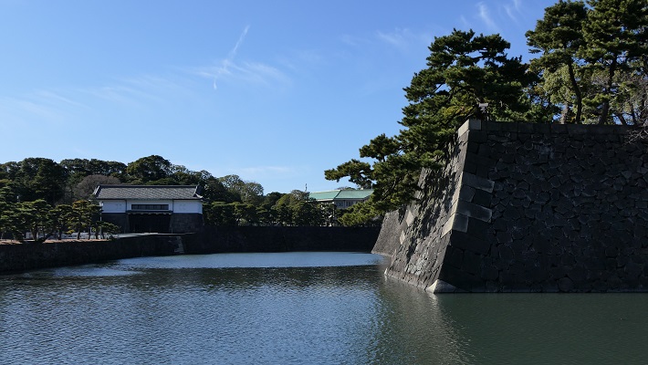
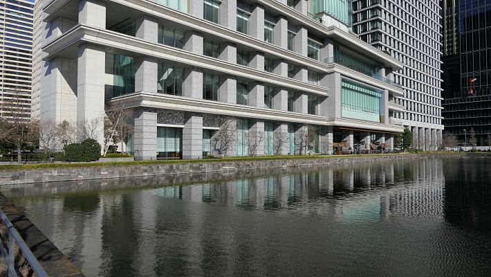
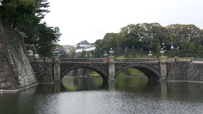
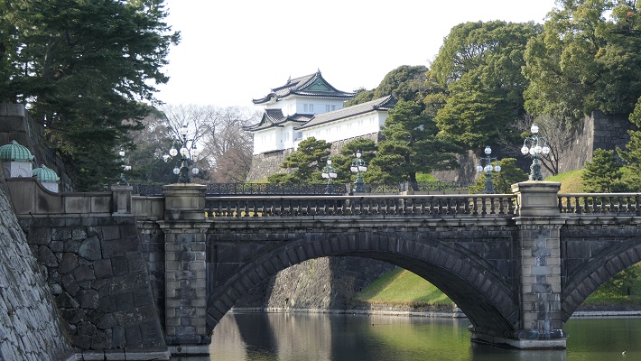
・皇居正門石橋と現存する伏見櫓の風景:外苑そのものは広大な広場です。なので多くの観光客は皇居と江戸城建物の景色を愛でています。この取り合わせは一番有名なものです。
・The view of the Palace Stone Bridge and the remaining Fushimi Turret: The garden itself is an extensive square. So many tourists enjoy the views of Imperial Palace and Edo Castle buildings. This is the most popular one.

皇居正門石橋と伏見櫓~The Palace Stone Bridge and Fushimi turret

・桜田門:これは最も有名な江戸城の建物の一つです。1860年に桜田門外の変が起こった所です。幕府大老であった井伊直弼が暗殺され、幕府の権威失墜を招きました。この門は現存しており、重要文化財に指定されています。
・Sakurada-mon Gate: This is one of the most popular buildings of Edo Castle. Because this is where Sakuradamon Incident in 1860 happened. The chief minster of Shogunate, Naosuke Ii was assassinated and it caused Shogunate’s the authority to decreas. The gate remains now and has been designated as a Important Cultural Property.

桜田門~Sakurada-mon Gate

北の丸公園~Kitanomaru Park

北の丸曲輪は、本丸の搦め手を北の方角から守る任務があり、とても重要でした。将軍の親族である清水家と田安家が江戸時代の後期に住んでいました。明治維新後は、近衛師団の兵舎がありました。第二次世界大戦後は公園になり、日本武道館や科学技術館などの施設が置かれています。
Kitanomaru enclosure was very important because it had to guard the rear of Honmaru in the north. The Shogun’s relatives, the Simizu and Tayasu clans lived in the late Edo Period. After the Meiji Restoration, the barracks of the Imperial Guard division were there. After the World War II, it became the park where facilities, like Japan Budokan, Science and Technology Museum, are located.

北の丸公園の航空写真~The aerial photo of Kitanomaru Park

・清水門:清水家の屋敷の門として使われました。とても優れた構造で、重要文化財になっています。この門は、内堀が窪んでいる奥に設置されていて、誰もが長く細い土橋を渡って入らなければなりません。侵入者は堀に沿った塀から反撃されてしまいます。
・Shimizu-mon Gate: It was used as the gate for Shimizu clan’s hall. It has a excellent structure and has become an Important Cultural Property. The gate is set at the back of the curved inner moat. Everyone has to go on a long and narrow earthen bridge to enter. Invaders were countered by defenders on walls along the moat.

清水門~Shimizu Gate
門の内側から見た土橋~The earthen bridge looking from the inside of the gate

この門はまた2つの「桝形」と呼ばれる方形の区画が外と内両方にありました。守備側は背後から敵を攻撃できたのです。実に強靭な防御力です。私が思うにこの門はもっと有名になってしかるべきです。
The gate also has two square shape blocks called “Masugata” both outside and inside. Defenders were able to counter the enemy from the back. The gate is very strongly defensive. By I think it should be more well-known.

外側の「桝形」~The outside “Masugata”
内側の「桝形」~~The inside “Masugata”

・田安門:ここは田安家の門でした。地下鉄から武道館に行く人は皆、この門を通ります。この門もまた重要文化財に指定されています。
・Tayasu-mon Gate: It was the gate of Tayasu clan’s hall. Now, all people from the subway station to Budokan go through the gate. It looks just like the Budokan gate. It has also been designated as a Important Cultural Property.
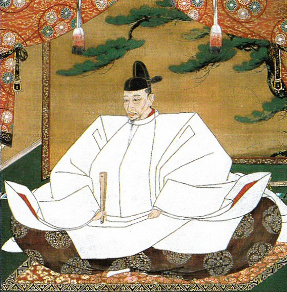
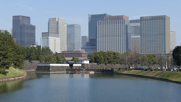
田安門、向こうは武道館~Tayasu-mon Gate, Budokan is over there

皇居~Imperial Palace

この区域は元々西の丸曲輪と吹上と呼ばれる場所でした。将軍は江戸時代末期に西の丸にある御殿に住んでいました。明治維新のとき、明治天皇はこの御殿に入り、使い続けました。そのため西の丸周辺が皇居になったのです。一般の人は通常皇居には入れませんが、年始や天皇誕生日といった特別な日には一部開放されます。今回は、外側から見ることができる2つの興味ある景色をご紹介します。
This area includes the original Nishinomaru enclosure and a place called Fukiage. The Shogun lived in the hall at Nishinomaru at the end of the Edo Period. During the Meiji Restoration, Emperor Meiji got the hall and continued to use. That’s why Ninomaru around has become Imperial Palace. Visitors can’t usually enter the palace, but it is partly open to people on special days such as New Year Celebration and the Emperor’s birthday. This time, I will show you two of interesting views of the area from outside.

皇居全景、手前は皇居外苑~The overview of Imperial Palace, the front is the Outer Gardens(licensed by Chris73 via Wikimedia Commons)

皇居の航空写真~The aerial photo of Imperial Palace

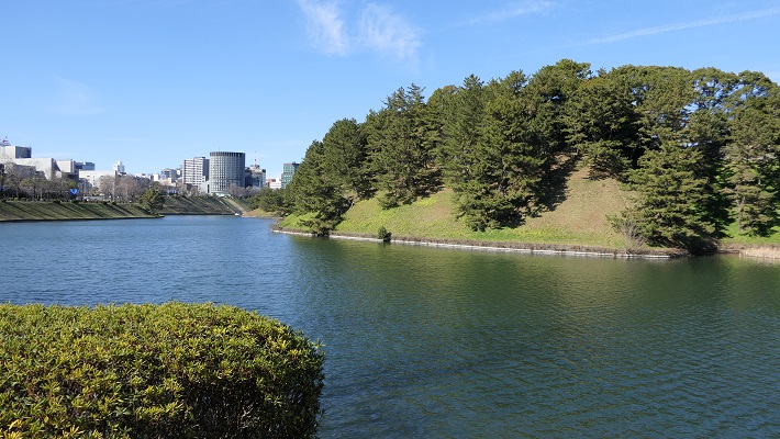
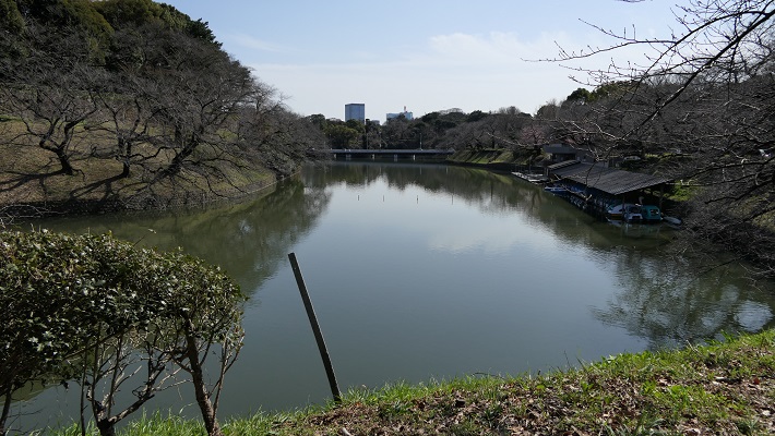
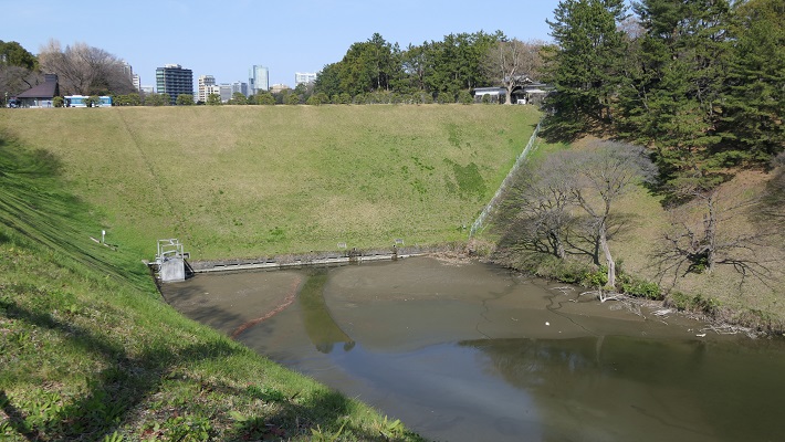
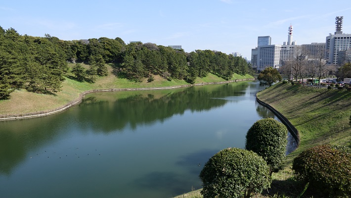
・千鳥ヶ淵:ここは今は内堀の一部になっていますが、元来は川だったようです。「淵」はこの場合、水流をせき止めて作った沼を意味します。この堀は全国的に桜の名所として知られています。春になると、堀の上にはボートで花見をする人たちで溢れます。
・Chidori-ga-Fuchi moat: it is now a part of the inner moat, but seemed to be originally a river. “Fuchi” means a lake made by damming the water in this case. The moat is known around the whole country for cherry blossoms. A lot of people seeing them are on the boats in the moat in the early spring.

千鳥ヶ淵~Chidori-ga-Fuchi moat

・半蔵門~この名前は、この門を警護していた忍者の頭領、服部半蔵に由来します。外側から門に伸びる土橋はまるでダムのように見えます。実際、この橋は水位を維持するために築かれました。橋の片側の水位は反対側よりかなり高くなっています。
・Hanzo-mon Gate: its name comes from the leader of Ninja, Hanzo Hattori who kept the gate. The earthen bridge from outside to the gate looks just like a dam. Indeed, the bridge was built to hold back the water. You can see the one side of the bridge keep much higher level of the water than the other side.

半蔵門~Hanzo-mon Gate
半蔵門土橋の下流部分~The lower part of Hanzo-mon Gate earthen bridge
桜田濠、半蔵門の下流にあり、まるで大河のようです~Sakurada-bori moat, the lower section of Hanzo-mon Gate, looks just like a large liver

「江戸城その4」に続きます。~To be continued in “Edo Castle Part4”
「江戸城その2」に戻ります。~Back to “Edo Castle Part2”
「江戸城その1」に戻ります。~Back to “Edo Castle Part1”

21.江戸城その2~Edo Castle Part2

江戸は、水の都だったのです。
Edo was a city of waterways.

葛飾北斎「富嶽三十六景」より「江戸日本橋」、江戸時代~”Nihonbashi Bridge in Edo” from the series “Thirty-six Views of Mount Fuji” attributed to Hokusai Katsushika in the Edo Period(licensed under Public Domain via Wikimedia Commons)

特徴~Features

今となっては、ほとんどの人が東京が水の都とは思わないでしょう。ところが、実は江戸はそうだったのです。徳川氏が江戸に移ってきたとき、江戸城は現在の山の手区域にありました。現在の下町にあたる地域は海の下にあったか、湿地帯でした。そして江戸前島と呼ばれた砂州が存在していました。また、陸地と砂州の間には日比谷入江が入り込んでいました。徳川の家臣団は、江戸前島を横切る運河を掘り、水運の便のために川筋を変更したのです。
These days, most people don’t realize that Tokyo is a city of waterways. However, Edo actually was. When the Tokugawa clan moved into Edo, Edo Castle was in the present uptown area. The present down town area was below the sea or waterlogged. There was a sand bank called Edo-Maeto. There was also the Hibiya arm of the sea between the land and the bank. Tokugawa’s team created a canal across Edo-Maeto and change the route of rivers for water transportation.

東京中心部のカラー標高図にコメント付加、江戸前島と日比谷入江の痕跡がわかります~The color altitude map of central Tokyo, adding comments, you can see traces of Edo-Maeto and the Hibiya arm of the sea(出典:国土地理院)

日比谷入江から江戸前島の東側に川筋を変更して作られた運河が、日本橋川でした。そこには現在日本橋がかかっています。この橋は昔ながらの姿で知られており、多くの主要道路の出発地点でもあります。
A canal created for changing the route of the river from the Hibiya arm of the sea to east of Edo Maeto is Nihonbashi River, where Nihonbashi Bridge goes across. The bridge is known for a traditional view and the starting point of many major roads.

日本橋~Nihonbashi Bridge
1911年に完成直後の現存日本橋~The remaining Nihonbashi Bridge just after the complition in 1911(licensed under Public Domain via Wikimedia Commons)
日本橋にある日本国道路元標~The starting milestone of Japan at Nihonbashi Bridge(licensed by Aimaimyi via Wikimedia Commons)
歌川広重「東海道五十三次」より「日本橋」、江戸時代~”Nihonbashi Bridge” from the series “Fifty-three Stations of Tokaido” attributed to Hiroshige Utagawa in the Edo Period(licensed under Public Domain via Wikimedia Commons)

事実、この橋の下を流れる川は人工物で、それは400年以上前に作られたものなのです。この川からは、江戸前島の中心を通る外堀が分かれていました。
In fact, the river below the bridge is artificial and was created over 400 years ago. From the river, the outer moat separated out trough the center of Edo Maeto.

日本橋川~Nihonbashi River
戦前の有楽町付近の外堀~The outer moat near Yurakucho before World War II(licensed under Public Domain via Wikimedia Commons)

徳川は、城の敷地を広げるためと防衛上の必要から日比谷入江を埋め立てました。更に、江戸前島の周りの海も市街地の確保のため埋め立てたのです。一方で、海の一部分は埋め残して堀、川や運河としました。結果として、江戸は水路とともに広がっていきました。今だにその痕跡は現代の地図上に残っています。それらをいつくか巡ってみましょう。
Tokugawa reclaimed the Hibiya arm of the sea to expand the ground for the castle as well as the need for defense. They also filled the sea around Edo Maeto to create the city area. Meanwhile, they left part of the sea as moats, rivers and canals. As a result, Edo city was spread with waterways. There are still traces of them on the present map. Let’s see some examples.

江戸時代初期の江戸推定地図~The estimated map of Edo in the first Edo Period(国土交通省Websiteから引用)

赤い線は現在の地図に残された江戸前島と日比谷入江の痕跡、マーカーは以下の項目に関連しています~The red line shows the remaining trace of Edo-Maetou and Hibiya Arm of the Sea on the present map, markers are related with the following items

愛宕神社~Atago Shrine

ここは急坂に「出世」の階段があることで有名です。日比谷入江の入り口の近くにあたります。
It is famous for its steep steps of “success”. It was near the entrance of the Hibiya arms of the sea.

愛宕神社の鳥居~The Torii Gate of Atago Shrine
出世の階段、馬にのってこの階段を登り切った武士は出世できると言われていました~The Steps of Success, it was said that if a warrior riding a horse could get the top, he would be promoted

赤坂1丁目交差点~Akasaka-icchome intersection

ここは溜池から流れる川の河口でした。外堀の一部に転用されました。
This was the estuary of the river from Tameike. It was turned into a part of the outer moat.

赤坂1丁目交差点に向かいます~Going to Akasaka-icchome intersection
かつて外堀であった「外堀通り」~”Sotobori Street” which means outer moat street, former the outer moat
今に残る外堀の石垣~Remaining stone walls alomgside the outer moat

潮見坂~Shiomi slope

霞ヶ関官庁街の中にあります。ここは日比谷入江の西際だったようです。
It is among Kasumigaseki governmental ministries. It seems to be the west edge of the Hibiya arm.

潮見坂~Shiomi Slope

桜田門周辺~Aroud Sakurada-mon Gate

この門の近くに別の川の河口があったようです。内堀の一部として残っています。
This seems to be the estuary of another river near the gate. It remains a part of the inner moat.

桜田門~Sakurada-mon Gate
桜田濠と呼ばれる内堀の一部~A part of the inner moat called Sakurada-bori

皇居正門~The main entrance of Imperial Palace

宮殿は西の丸だった所にあります。正門前の内堀は元は海でした。
The palace is on what was Nishinomaru enclosure. The inner moat in front of it was originally the sea.

皇居正門と石橋~The main entrance of Imperial Palace and The Stone Bridge
西の丸は高い所にあります~Nishinomaru enclosure is in a high place

皇居外苑~The Outer Gardens of the Imperial Palace

ここは完全に海で、周りの内堀を残して埋め立てられました。
This was completely a sea, and filled without the inner moat around.

皇居外苑~The Outer Gardens of the Imperial Palace

坂下門~Sakashita-mon Gate

門の周辺の内堀は、もともと川や谷だった所を使っています。
The inner moat around the gate uses the original rivers and valleys.

坂下門~Sakashita-mon Gate
門周辺の内堀~The inner moat around the gate

大手門周辺~Around Ote-mon Gate

ここには日比谷入江に注ぐ平川の河口がありました。
This was the estuary of Hirakawa River emptied into the Hibiya arms of the sea.

大手門~Ote-mon Gate
大手門前の内堀~The inner moat in front of Ote-mon Gate

和田倉門~Wadakura-mon Gate

日比谷入江の一番奥の場所にあたります。和田倉とは海岸にある倉庫の意味です。
This was the inmost place of the Hibiya arm of the sea. Wadakura means warehouse st seashore.

和田倉門~Wadakura-mon Gate
ここが最奥だった地点か?~Was this the inmost spot?

日比谷公園~Hibiya Park

内堀の石垣跡が休憩所として活用されています。
The ruins of stone walls for the inner moat is used for a resting place.

日比谷公園の休憩所~The resting place of Hibiya Park
それは石垣の上にあります~It is on the stone walls

山手線の側面~The side of Yamanote line

レンガ造りの高架鉄道は元から陸地の所だから可能だったと言われています。
It is said that the elevated red brick railway could be available on the primary land.

山手線のレンガ作りの高架鉄道~The elevated red brick railway of Yamanote line

新橋跡~The ruins of Shinbashi bridge

この橋は汐留川にかかっていましたが、元は江戸前島の突端にあたります。
The bridge went across Shiodome-gawa River which was originally the edge of Edo Maeto.

現存する新橋の親柱~The remaining newel post of Shinbashi Bridge

銀座の裏通り~The back street of Ginza

江戸前島の東海岸を利用して作られた三十間堀川がここを流れていました。
Sanjukkenbori River went through it and it was built using the east coast of Edo Maeto.

銀座の裏通り、ここも海や川でした~The back street of Ginza, it was also the sea or river

首都高速都心環状線~The Tokyo Metropolitan Expressway Ring Route

ここは楓川と、ドックのような形の舟入堀がありました。この川は日本橋川につながっていました。
This was Kaedegawa River with several Funairi moats like docks. The river connected to Nihonbashi River.

首都高速都心環状線、元楓川~The Tokyo Metropolitan Expressway Ring Route, the former Kaedegawa River
かつては楓川を渡っていた橋、A bridge which went across Kaedegawa River in the past

その後~Later Life

明治維新後、城の多くの建物は撤去されましたが、多くの水路は残りました。人々がまだ使っていたからです。一例として、東京の魚市場は1923年の関東大震災まで日本橋川沿いにありました。地震の後になって築地に移転したのです。
After the Meiji Restoration, many buildings of the castle were demolished, but many waterways remained, because people still used them. For instance, the fish market in Tokyo was along Nihonbashi River until the Great Kanto Earthquakes in 1923. After that, the market moved to Tsukiji.

明治初期の東京中心地の地図、まだ多くの水路がありました~The map of central Tokyo in the early Meiji Era, there were still a lot of waterways
日本橋の魚市場~The Fish Market at Nihonbashi(licensed under Public Domain via Wikimedia Commons)

第二次世界大戦後、一部の外堀が焼けた建物の残骸により埋められました。今の外堀通りです。
After World War II, part the outer moat was filled by the debris of burned buildings. It has become Sotobori Street.

外堀通り~Sotobori Street

昭和の中期に車が普及し、1959年には、1964年の夏のオリンピックが東京で開催されることが決まりました。東京の交通インフラ、特に高速道路を整備するための時間はわずかしかありません。政府は高速道路の用地として残っていた水路を使わざるをえませんでした。買収する必要がないからです。東京のほとんど全ての水路が消え失せました。
In the mid Showa Era, motorization came and it was decided in 1959 that the 1964 summer Olympics in Tokyo would be held. There would be little time to develop the infrastructure for transportation in Tokyo, especially an expressway. The government had to use the remaining waterways as the land for the expressway. Because they didn’t need buy them. Almost all of the waterways in Tokyo died out.

京橋川上に建設中の高速道路、1960年~The expressway under construction above Kyobashigawa River in 1960(licensed under Public Domain via Wikimedia Commons)

日本橋と日本橋川は歴史的価値があるため、かろうじて残されました。そのため高速道路がその上を走っているのです。日本橋地域の人たちは、古き良き景観を取り戻すため政府に対し高速道路を地下に移すよう請願しています。
Nihonbashi Bridge and Nihonbashi River have survived due to their historical values. That’s why the expressway goes above them. Now, people in the Nihonbashi area urge the government to move the expressway underground to get its good old landscape back.

日本橋上の高速道路~The expressway above Nihonbashi Bridge

「江戸城その3」に続きます。~To be continued in “Edo Castle Part3”
「江戸城その1」に戻ります。~Back to “Edo Castle Part1”

21.江戸城その1~Edo Castle Part1

江戸城は間違いなく日本で最大の城です。なぜなら城が東京そのものになったからです。時々、外国からの旅行者の方は、どこに有名な城や城跡があるのかと尋ねられます。もし、そこが東京の中心地であるなら、もうそこは城の中かもしれません。
Edo Castke was definitely the largest castle in Japan, because it became Tokyo itself. Some foreign tourists ask that where famous Japanese castles and ruins are. They may be standing among castles if they are in the center of Tokyo.

皇居正門石橋と伏見櫓~The Imperial Palace Main Entrance Bridge and Fushimi Turret

立地と歴史~Location and History

東京を含む関東平野には、中世までは大きな湿地帯がありました。この理由から、はるか昔の東海道は西日本から伸びてきて、 海を越えて房総半島に至っていました。利根、渡良瀬、隅田といった大河が直接江戸湾に注いでいたのです
The Kanto Plain including Tokyo had large waterlogged area until the Middle Ages. For this reason, the Tokaido road went from eastern Japan to Boso peninsula over the sea hundreds years ago. Large rivers like Tone, Watarase, and Sumida directly flow into what is now Tokyo Bay.

古代の関東平野の海岸線~The coastline of Kanto Plain in ancient times(licensed by Llhoi2013 via Wikimedia Commons

江戸城は1457年に太田道灌によって最初に築かれました。彼には敵との境界線であった利根川の近くに城を築く必要があったのです。その後この城は、戦国時代の間関東地方の支配者であった北条氏の支城の1つであり続けました。しかし、地理的な制約から武士たちの都とするには不十分でした。
Edo Castle was first built by Dokan Ota in 1457. He needed to build the castle near the border with his enemy, Tone River. After that, the castle had been one of the branch castles of the Hojo clan who were the ruler of Kanto region during the Warring States Period. But the castle still didn’t deserve warrior’s capital because of its geographical features.

太田道灌肖像画、大慈寺蔵~The portrait of Dokan Ota, owned by Daijiji Temple(licensed under Public Domain via Wikimedia Commons)

豊臣秀吉は1590年に北条氏を滅ぼし、徳川家康に対し、北条氏に代わり関東地方に転封するよう命じました。秀吉はまた、家康の首府として江戸を指定したと言われています。秀吉は、彼による攻撃を3ヶ月間も耐えた北条氏の首府、小田原に家康が居座るのを恐れたからといいます。
Hideyoshi Toyotomi defeated Hojo clan in 1590, and ordered Ieyasu Tokugawa to move to Kanto region instead of Hojo. It is said that he also designated Edo as Ieyasu’s capital because he feared Ieyasu would settle at Hojo’s capital Odawara which could withstand Toyotomi’s attack for three months.

豊臣秀吉肖像画部分、加納光信筆、高台寺蔵~part of the Portrait of Hideyoshi Toyotomi, attributed to Mitsunobu Kano, owned by Kodaiji Temple(licensed under Public Domain via Wikimedia Commons)

家康は江戸に到着した直後から、江戸城への驚くべき大改造を開始しました。これは、日本人による湾岸地域での都市作りの初めての試みと言われています。
Immediately after Ieyasu arrived at Edo, he started an incredible renovation of Edo Castle. It is said that it was the first attempt for Japanese people to build a city on a waterfront area.

徳川家康肖像画、加納探幽筆、大阪城天守閣蔵~The Portrait of Ieyasu Tokugawa, attributed to Tanyu Kano, owned by Osaka Castle Museum(licensed under Public Domain via Wikimedia Commons)

初期の江戸城は、現在の山の手地域にありました。現在の下町地域は、海面下か湿地帯でした。そして、江戸前島と呼ばれた砂州がありました。また、陸地と砂州の間には日比谷入江が入り込んでいました。
The first Edo Castle was in the present uptown area. The present down town area was below the Sea or waterlogged. There was a sand bank called Edo-Maeto. There was also the Hibiya arm of the sea between the land and the bank.

赤い線は現在の地図に残された江戸前島と日比谷入江の痕跡~The red line shows the remaining trace of Edo-Maetou and Hibiya Arm of the Sea on the present map

徳川家臣団は、水上交通のために江戸前島を横切る運河を掘り、川の流路を付け替えたりしました。彼らはまた、このような湾岸都市であったため、上下水道の設備も整えなければなりませんでした。その結果、江戸は水の都となったのです。
Tokugawa team created a canal across Edo-Maeto and change the route of rivers for water transportation. They also had to build a system for water supply and sewerage on such a waterfront city. As a result, Edo became a city of waterways.

戦前の東京の航空写真、まだ水路がたくさん残っていました~A aerial photo of Tokyo before the World War II, a lot of wateways still remained.

家康が1600年に天下を取った後、彼は全国の諸大名に天下普請と呼ばれる城の拡張工事を命じました。日比谷入江は城の用地拡大と防衛上の必要のため、埋め立てられました。この大規模な工事により、天守を含む多くの建物が作られ、多くの堀が掘られ、石垣が高く積まれました。
After Ieyasu got the power in 1600, he ordered lords of the whole country to improve the castle called Tenka-Bushin. They reclaimed Hibiya arm of the sea to spread the ground for the castle as well as the need for defense. Many buildings including Tenshu keep were built, many moats were dug, and high stone walls were built by the large scale construction.

「江戸図屏風」左隻部分、17世紀、国立歴史民俗博物館蔵~Part of “View of Edo” left screen. pair of six-panel folding screens, in the 17th century, owned by National Museum of Japanese History(licensed under Public Domain via Wikimedia Commons)

大名たちは少なくとも6万個もの百人石と呼ばれた4トン石を、伊豆半島から海を越えて江戸まで運ばねばなりませんでした。1603年から1660年まで続いた天下普請は江戸を日本一の大城郭に仕立てたのです。
These lords had to carry at least 60,000 four ton stones called Hyakunin-Ishi from Izu Peninsula to Edo over the sea. Tenka-Bushin between 1603 and 1660 resulted in Edo Castle being the largest castle in Japan.

伊豆半島に残されている江戸築城石~A quarry stone for building Edo Castle left in Izu Peninsula(licensed by GuchuanYanyi via Wikimedia Commons)

江戸城は、内郭と外郭に分かれていました。内郭は内堀の内側で、城の中心部分で、主要な曲輪である本丸、二の丸、西の丸から構成されていました。その外周は8km近くありました。そこには天守、それぞれの曲輪に御殿があり、そして警備のために多くの櫓や門がありました。
Edo castle was divided into Naikaku and Gaikaku. Naikaku was the inside of the inner moat, and consisted of the center portion of the castle including main enclosures Honmaru, Ninomaru, and Nishinomaru. Its perimeter was nearly 8 km. It had the Tenshu keep, halls for each main enclosure, many turrets and gates for security.

今に残る内郭部分の航空写真~The aerial photo of the remaining Naikaku portion

外郭は、外堀に囲まれていた区域で、その外周は約16kmもありました。見附と呼ばれた大型の門と橋のセットが約50ヶ所、主要街道と堀との交差点に置かれ、民衆と交通を監視していました。
Gaikaku was the surrounding area by outer moat whose perimeter was about 16 km, even including the city area. About 50 sets of a large gate and bridge called Mitsuke were placed at the intersections of the moat and major roads to check people and transportation.

江戸古地図上での外郭範囲~The range of Gaikaku on the old Edo map(licensed by Tateita via Wikimedia Commons)

その完璧な構造にも関わらず、この城は敵からではなく、火災による被害を受けました。もっとも有名なのは1657年に発生した明暦大火です。この大火により、大半の江戸市域、江戸城、そして3代目の天守が焼け落ちました。大火の後、4代目天守の再建工事が開始されましたが、中止となりました。そのための天守台は今でも見ることができます。
Despite the perfect structure, the castle suffered not from enemies, but from fires. The most famous one was the great fire of Meireki in 1657. It burned out most of Edo City, Edo Castle, and the third Tenshu keep. After the fire, the rebuilding of a fourth Tenshu was launched, but canceled. We can now see the prepared Tenshu base for it.

4代目天守台~The base of the forth Tenshu keep(taken by 松波庄九郎 from photoAC)

将軍は本丸御殿に住み、統治を行いましたが、御殿も火災での焼失と再建を繰り返しました。幕末になってから、将軍は焼けた本丸御殿から通常は隠居した将軍が住む西の丸御殿に移らなければなりませんでした。予算がなかったからです。
Shogun lived and governed in Honmaru hall, but the hall was also burned down and restored several times. At the end of the Edo Period, Shogun had to move from the burned Honmaru hall to Nishinomaru hall where retired Shogun usually lived, because of the lack of money.

江戸東京博物館にある本丸と二ノ丸御殿の模型~The miniature model of Honmaru and Ninomaru halls at Edo-Tokyo Museum(licensed by Daderot via Wikimedeia Commons)

明治維新のとき、西日本の方で新政府と幕府の間で戦いが起こりました。結果として、西郷隆盛と勝海舟との会談が行なわれ、江戸城は新政府に平和裏に引き渡されました。
During the Meiji Restoration, a battle between the New Government and Shogunate was fought in eastern Japan. As a result, Edo Castle was handed over to New Government without war after the meeting between Takamori Saigo and Kaishu Katsu.

西郷・勝会談の記念碑~The monument of the meeting between Saigo and Katsu(licensed by 江戸村のとくぞう via Wikimedia Commons)

1869年、江戸は東京と名前を変え、日本の首都となりました。そして明治天皇が将軍と入れ替わりで、古都京都から東京の江戸城西の丸御殿に移りました。そのため、現在西の丸は皇居の一部となっています。
In 1869, Edo was renamed Tokyo which became the capital of Japan, before the Emperor Meiji move from old capital Kyoto to Nishinomaru hall of Edo Castle in Tokyo instead of Shogun. That’s why Nishinomaru is now part of the Imperial Palace.

明治天皇の東京到着を描いた錦絵~The picture that shows the arrival of Emperor Meiji to Tokyo(licensed under Public Domain via Wikimedia Commons)

「江戸城その2」に続きます。~To be continued in “Edo Castle Part2”