21.江戸城その2~Edo Castle Part2

江戸は、水の都だったのです。
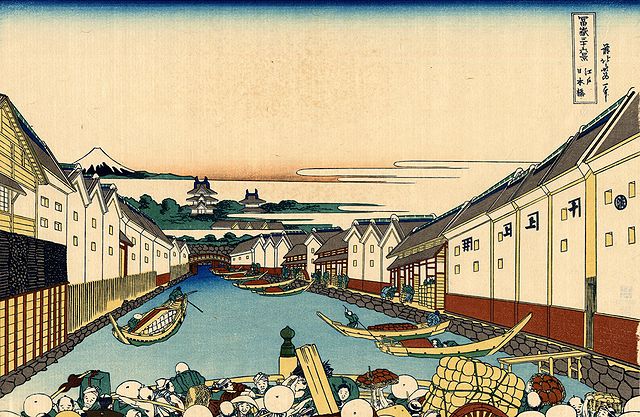
Edo was a city of waterways.

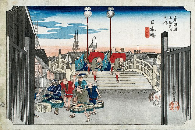
葛飾北斎「富嶽三十六景」より「江戸日本橋」、江戸時代~”Nihonbashi Bridge in Edo” from the series “Thirty-six Views of Mount Fuji” attributed to Hokusai Katsushika in the Edo Period(licensed under Public Domain via Wikimedia Commons)

特徴~Features

今となっては、ほとんどの人が東京が水の都とは思わないでしょう。ところが、実は江戸はそうだったのです。徳川氏が江戸に移ってきたとき、江戸城は現在の山の手区域にありました。現在の下町にあたる地域は海の下にあったか、湿地帯でした。そして江戸前島と呼ばれた砂州が存在していました。また、陸地と砂州の間には日比谷入江が入り込んでいました。徳川の家臣団は、江戸前島を横切る運河を掘り、水運の便のために川筋を変更したのです。
These days, most people don’t realize that Tokyo is a city of waterways. However, Edo actually was. When the Tokugawa clan moved into Edo, Edo Castle was in the present uptown area. The present down town area was below the sea or waterlogged. There was a sand bank called Edo-Maeto. There was also the Hibiya arm of the sea between the land and the bank. Tokugawa’s team created a canal across Edo-Maeto and change the route of rivers for water transportation.
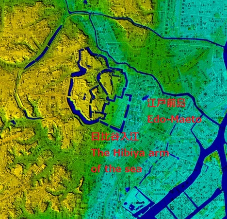
東京中心部のカラー標高図にコメント付加、江戸前島と日比谷入江の痕跡がわかります~The color altitude map of central Tokyo, adding comments, you can see traces of Edo-Maeto and the Hibiya arm of the sea(出典:国土地理院)

日比谷入江から江戸前島の東側に川筋を変更して作られた運河が、日本橋川でした。そこには現在日本橋がかかっています。この橋は昔ながらの姿で知られており、多くの主要道路の出発地点でもあります。
A canal created for changing the route of the river from the Hibiya arm of the sea to east of Edo Maeto is Nihonbashi River, where Nihonbashi Bridge goes across. The bridge is known for a traditional view and the starting point of many major roads.
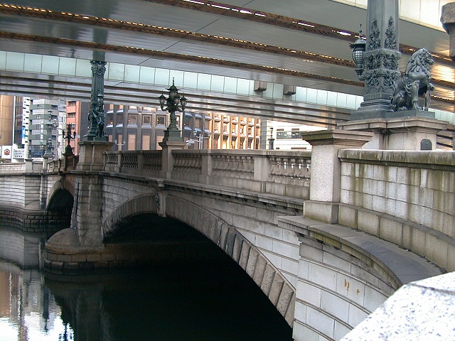
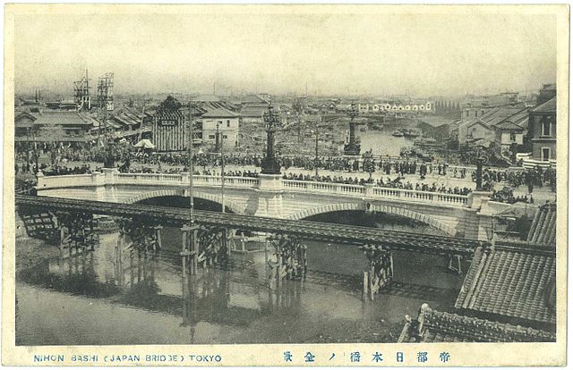
日本橋~Nihonbashi Bridge
1911年に完成直後の現存日本橋~The remaining Nihonbashi Bridge just after the complition in 1911(licensed under Public Domain via Wikimedia Commons)
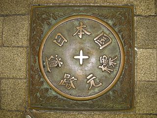
日本橋にある日本国道路元標~The starting milestone of Japan at Nihonbashi Bridge(licensed by Aimaimyi via Wikimedia Commons)
歌川広重「東海道五十三次」より「日本橋」、江戸時代~”Nihonbashi Bridge” from the series “Fifty-three Stations of Tokaido” attributed to Hiroshige Utagawa in the Edo Period(licensed under Public Domain via Wikimedia Commons)

事実、この橋の下を流れる川は人工物で、それは400年以上前に作られたものなのです。この川からは、江戸前島の中心を通る外堀が分かれていました。
In fact, the river below the bridge is artificial and was created over 400 years ago. From the river, the outer moat separated out trough the center of Edo Maeto.
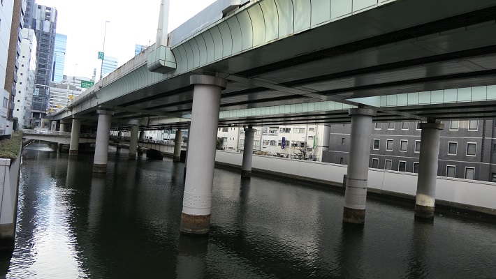
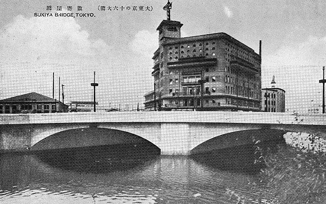
日本橋川~Nihonbashi River
戦前の有楽町付近の外堀~The outer moat near Yurakucho before World War II(licensed under Public Domain via Wikimedia Commons)

徳川は、城の敷地を広げるためと防衛上の必要から日比谷入江を埋め立てました。更に、江戸前島の周りの海も市街地の確保のため埋め立てたのです。一方で、海の一部分は埋め残して堀、川や運河としました。結果として、江戸は水路とともに広がっていきました。今だにその痕跡は現代の地図上に残っています。それらをいつくか巡ってみましょう。
Tokugawa reclaimed the Hibiya arm of the sea to expand the ground for the castle as well as the need for defense. They also filled the sea around Edo Maeto to create the city area. Meanwhile, they left part of the sea as moats, rivers and canals. As a result, Edo city was spread with waterways. There are still traces of them on the present map. Let’s see some examples.

江戸時代初期の江戸推定地図~The estimated map of Edo in the first Edo Period(国土交通省Websiteから引用)

赤い線は現在の地図に残された江戸前島と日比谷入江の痕跡、マーカーは以下の項目に関連しています~The red line shows the remaining trace of Edo-Maetou and Hibiya Arm of the Sea on the present map, markers are related with the following items

愛宕神社~Atago Shrine

ここは急坂に「出世」の階段があることで有名です。日比谷入江の入り口の近くにあたります。
It is famous for its steep steps of “success”. It was near the entrance of the Hibiya arms of the sea.
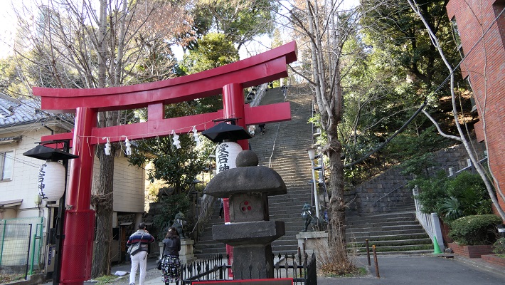
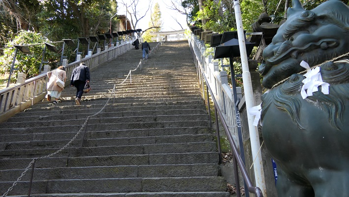
愛宕神社の鳥居~The Torii Gate of Atago Shrine
出世の階段、馬にのってこの階段を登り切った武士は出世できると言われていました~The Steps of Success, it was said that if a warrior riding a horse could get the top, he would be promoted

赤坂1丁目交差点~Akasaka-icchome intersection

ここは溜池から流れる川の河口でした。外堀の一部に転用されました。
This was the estuary of the river from Tameike. It was turned into a part of the outer moat.
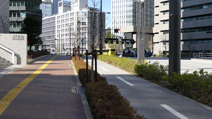
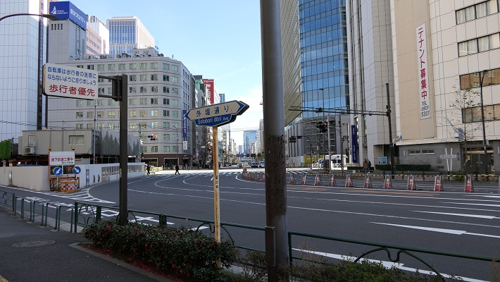
赤坂1丁目交差点に向かいます~Going to Akasaka-icchome intersection
かつて外堀であった「外堀通り」~”Sotobori Street” which means outer moat street, former the outer moat
今に残る外堀の石垣~Remaining stone walls alomgside the outer moat

潮見坂~Shiomi slope

霞ヶ関官庁街の中にあります。ここは日比谷入江の西際だったようです。
It is among Kasumigaseki governmental ministries. It seems to be the west edge of the Hibiya arm.
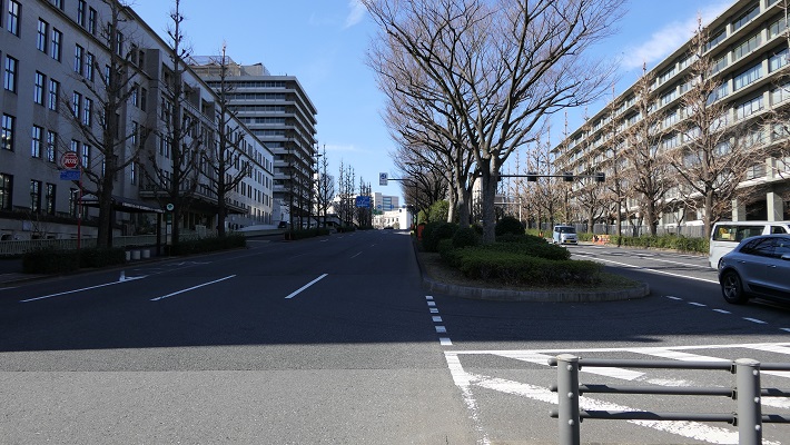
潮見坂~Shiomi Slope

桜田門周辺~Aroud Sakurada-mon Gate

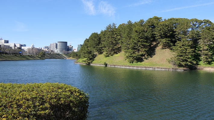
この門の近くに別の川の河口があったようです。内堀の一部として残っています。
This seems to be the estuary of another river near the gate. It remains a part of the inner moat.
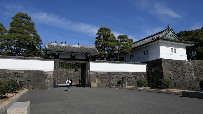
桜田門~Sakurada-mon Gate
桜田濠と呼ばれる内堀の一部~A part of the inner moat called Sakurada-bori

皇居正門~The main entrance of Imperial Palace

宮殿は西の丸だった所にあります。正門前の内堀は元は海でした。
The palace is on what was Nishinomaru enclosure. The inner moat in front of it was originally the sea.
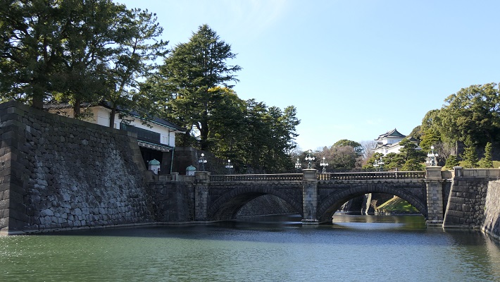
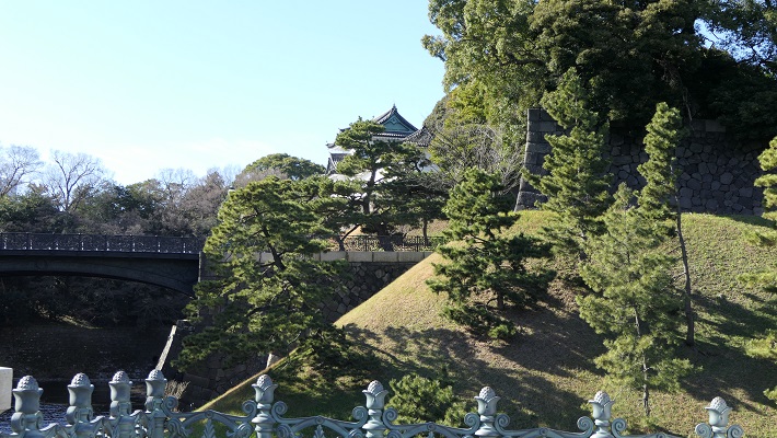
皇居正門と石橋~The main entrance of Imperial Palace and The Stone Bridge
西の丸は高い所にあります~Nishinomaru enclosure is in a high place

皇居外苑~The Outer Gardens of the Imperial Palace

ここは完全に海で、周りの内堀を残して埋め立てられました。
This was completely a sea, and filled without the inner moat around.
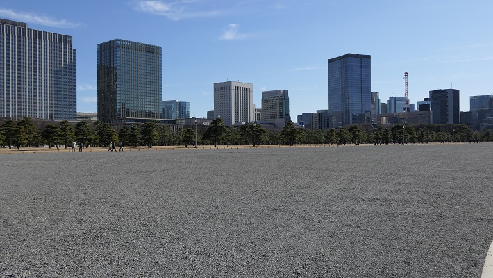
皇居外苑~The Outer Gardens of the Imperial Palace

坂下門~Sakashita-mon Gate

門の周辺の内堀は、もともと川や谷だった所を使っています。
The inner moat around the gate uses the original rivers and valleys.
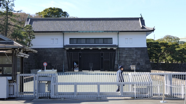
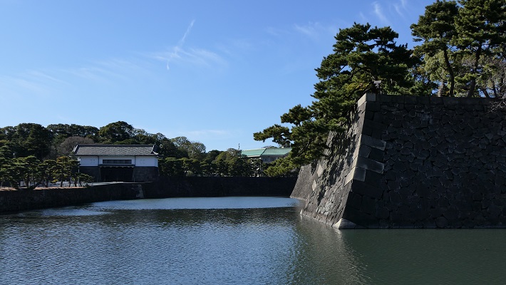
坂下門~Sakashita-mon Gate
門周辺の内堀~The inner moat around the gate

大手門周辺~Around Ote-mon Gate

ここには日比谷入江に注ぐ平川の河口がありました。
This was the estuary of Hirakawa River emptied into the Hibiya arms of the sea.
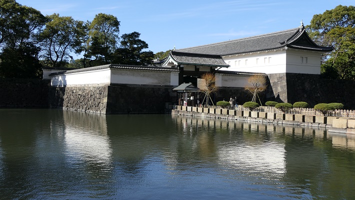
大手門~Ote-mon Gate
大手門前の内堀~The inner moat in front of Ote-mon Gate

和田倉門~Wadakura-mon Gate

日比谷入江の一番奥の場所にあたります。和田倉とは海岸にある倉庫の意味です。
This was the inmost place of the Hibiya arm of the sea. Wadakura means warehouse st seashore.

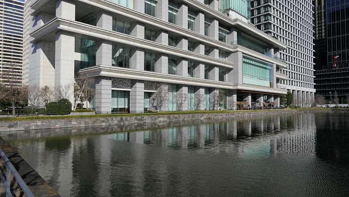
和田倉門~Wadakura-mon Gate
ここが最奥だった地点か?~Was this the inmost spot?

日比谷公園~Hibiya Park

内堀の石垣跡が休憩所として活用されています。
The ruins of stone walls for the inner moat is used for a resting place.
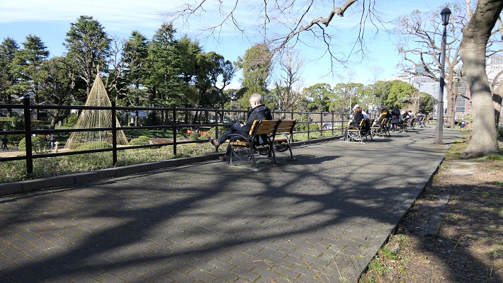
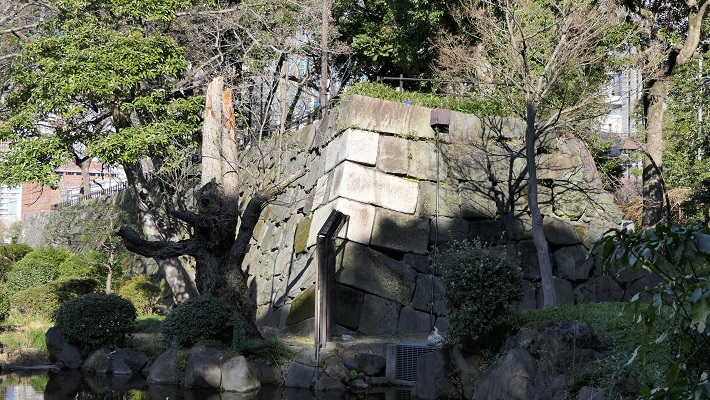
日比谷公園の休憩所~The resting place of Hibiya Park
それは石垣の上にあります~It is on the stone walls

山手線の側面~The side of Yamanote line

レンガ造りの高架鉄道は元から陸地の所だから可能だったと言われています。
It is said that the elevated red brick railway could be available on the primary land.
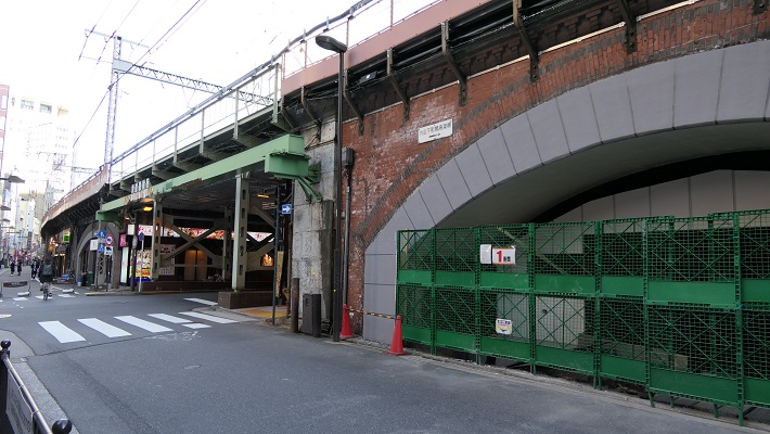
山手線のレンガ作りの高架鉄道~The elevated red brick railway of Yamanote line

新橋跡~The ruins of Shinbashi bridge

この橋は汐留川にかかっていましたが、元は江戸前島の突端にあたります。
The bridge went across Shiodome-gawa River which was originally the edge of Edo Maeto.
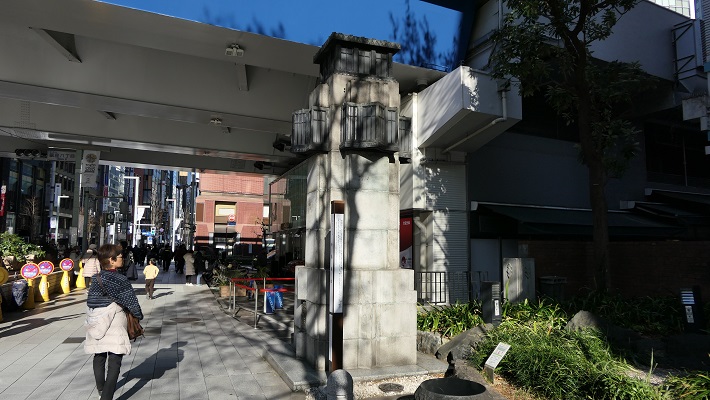
現存する新橋の親柱~The remaining newel post of Shinbashi Bridge

銀座の裏通り~The back street of Ginza

江戸前島の東海岸を利用して作られた三十間堀川がここを流れていました。
Sanjukkenbori River went through it and it was built using the east coast of Edo Maeto.

銀座の裏通り、ここも海や川でした~The back street of Ginza, it was also the sea or river

首都高速都心環状線~The Tokyo Metropolitan Expressway Ring Route

ここは楓川と、ドックのような形の舟入堀がありました。この川は日本橋川につながっていました。
This was Kaedegawa River with several Funairi moats like docks. The river connected to Nihonbashi River.

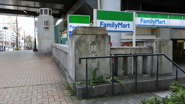
首都高速都心環状線、元楓川~The Tokyo Metropolitan Expressway Ring Route, the former Kaedegawa River
かつては楓川を渡っていた橋、A bridge which went across Kaedegawa River in the past

その後~Later Life

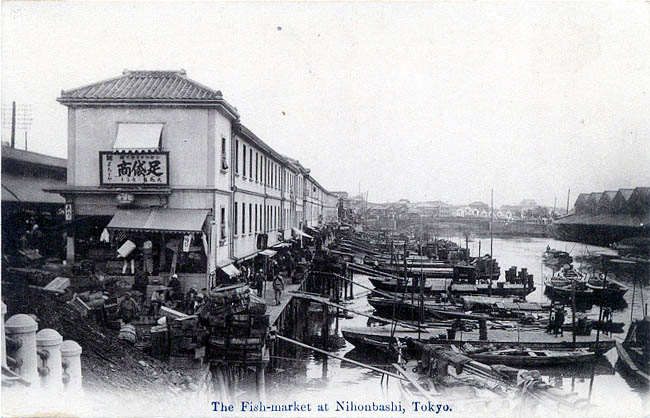
明治維新後、城の多くの建物は撤去されましたが、多くの水路は残りました。人々がまだ使っていたからです。一例として、東京の魚市場は1923年の関東大震災まで日本橋川沿いにありました。地震の後になって築地に移転したのです。
After the Meiji Restoration, many buildings of the castle were demolished, but many waterways remained, because people still used them. For instance, the fish market in Tokyo was along Nihonbashi River until the Great Kanto Earthquakes in 1923. After that, the market moved to Tsukiji.
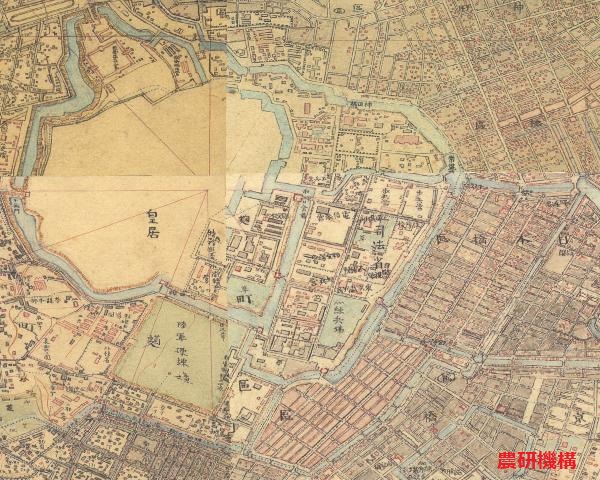
明治初期の東京中心地の地図、まだ多くの水路がありました~The map of central Tokyo in the early Meiji Era, there were still a lot of waterways
日本橋の魚市場~The Fish Market at Nihonbashi(licensed under Public Domain via Wikimedia Commons)

第二次世界大戦後、一部の外堀が焼けた建物の残骸により埋められました。今の外堀通りです。
After World War II, part the outer moat was filled by the debris of burned buildings. It has become Sotobori Street.
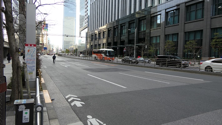
外堀通り~Sotobori Street

昭和の中期に車が普及し、1959年には、1964年の夏のオリンピックが東京で開催されることが決まりました。東京の交通インフラ、特に高速道路を整備するための時間はわずかしかありません。政府は高速道路の用地として残っていた水路を使わざるをえませんでした。買収する必要がないからです。東京のほとんど全ての水路が消え失せました。
In the mid Showa Era, motorization came and it was decided in 1959 that the 1964 summer Olympics in Tokyo would be held. There would be little time to develop the infrastructure for transportation in Tokyo, especially an expressway. The government had to use the remaining waterways as the land for the expressway. Because they didn’t need buy them. Almost all of the waterways in Tokyo died out.

京橋川上に建設中の高速道路、1960年~The expressway under construction above Kyobashigawa River in 1960(licensed under Public Domain via Wikimedia Commons)

日本橋と日本橋川は歴史的価値があるため、かろうじて残されました。そのため高速道路がその上を走っているのです。日本橋地域の人たちは、古き良き景観を取り戻すため政府に対し高速道路を地下に移すよう請願しています。
Nihonbashi Bridge and Nihonbashi River have survived due to their historical values. That’s why the expressway goes above them. Now, people in the Nihonbashi area urge the government to move the expressway underground to get its good old landscape back.
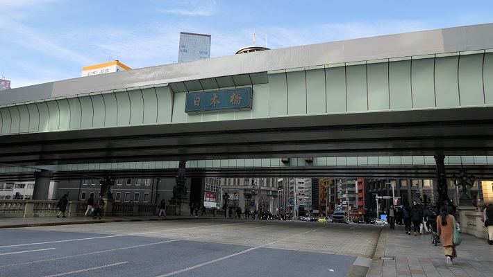
日本橋上の高速道路~The expressway above Nihonbashi Bridge

「江戸城その3」に続きます。~To be continued in “Edo Castle Part3”
「江戸城その1」に戻ります。~Back to “Edo Castle Part1”

116.沼田城(Numata Castle)

沼田城は真田がこだわり続け、しかし最後には失った城です。
Numata Castle is the one that Sanada stuck to strongly, but lost in the end.

沼田城西櫓跡(The ruins of Nishi-Yagura of Numata Castle)

Location and History

群馬県の北部に位置する沼田市は、全国的に河岸段丘の地形で有名です。その高さは、JR沼田駅近くの利根川から70メートル以上になります。市街地はその段丘の上にあり、「天空の城下町」と呼ばれています。
Numata City, in the northern part of Gunma pref., is famous around the whole country for its terrain with river terraces. The height is over 70m higher than Tone River near the JR Numata Station. The urban area of the city is on the top of the terraces and now called “Castle Town in the Sky”.

沼田市の河岸段丘、左側が段状になっている(The river terraces in Numata City, they are on the left side)taken by igamania from photo AC

この辺り一帯が最初に注目されたのは恐らく、戦国時代の16世紀頃、関東地方の支配権を巡って戦った上杉、北条、武田、織田、徳川などの有力戦国大名たちによってだと思われます。沼田地域は、関東地方の北の入り口にあたり、東の東北地方から西の信濃国(現在の長野県)に抜けていく主要街道が通っていました。
The area was probably first focused on in the Warring States Period in the 16th century by major warlords such as the Uesugi, Hojo, Takeda, Oda and Tokugawa clans who battled over the right to rule of the Kanto region . The Numata area was the northern entrance of Kanto and had a main road passing through from the east for Tohoku region to the west for Shinano Province (now Nagano pref.).

城周辺の地図及び起伏地図(A normal and relief map around Numata Castle)


沼田城は最初、土豪の沼田氏によって1532年に段丘の突端に築かれました。しかし、1560年の上杉氏の関東侵攻からは非常に重要な拠点として認識されました。結果的には、戦国時代の終わりにおいては武田氏配下の真田昌幸がこの城を保持していました。1582年には彼の主君である武田氏は滅びてしまうのですが、他の有力大名を差し置いて何とか城を守り抜きました。
Numata Castle was first built on the tip of the terrace in 1532 by the local clan Numata, but the castle became a very important site after the Uesugi’s Kanto invasion in 1560. Eventually, Masayuki Sanada under Takeda held the castle at the end of the Warring States Period. Though his master Takeda was beaten in 1582, he struggled against other major warlords to keep the castle.

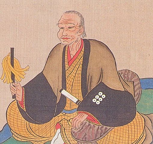
真田昌幸像、個人蔵(The portlait of Masayuki Sanada, privately owned)licensed under Public Domain, via Wikimedia Commons

クライマックスは、1589年に天下人豊臣秀吉の裁断によって、この城が北条氏に引き渡されたときでした。何と真田は、1590年の秀吉の関東侵攻と、北条氏の滅亡により、城の奪還に成功します。この出来事は、北条が約束を破り、真田の名胡桃城を乗っ取ったからだと言われていますが、真相は謎のままです。死人に口なしだからです。
The climax was that the castle was turned over to Hojo in 1589 by the decision of the ruler, Hideyoshi Toyotomi. However, Sanada was successful to get it back after Toyotomi’s Kanto invasion and the fall of Hojo in 1590. It is said that the event was caused due to Hojo breaking the rule and taking Sanada’s Nagurumi Castle. The fact is mysterious because dead men tell no tales.

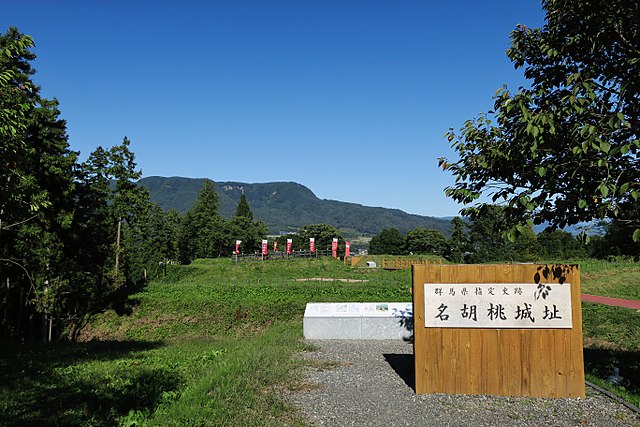
名胡桃城跡(The ruins of Nagurumi Castle)licensed by Qurren via Wikimedia Commons

その後、昌幸の息子、真田信之が徳川の下につき、この城を引き継ぎ1600年前後に天守の建築を含め完成させました。この天守は、将軍がいる江戸城を除いては関東地方で唯一の5層の天守でした。
After that, Masayuki’s son Nobuyuki Sanada under Tokugawa inherited and completed the castle with building the castle Tenshu keep around 1600. The Tenshu was the only five-story one in Kanto region, excluding Edo Castle owned by the Shogun.

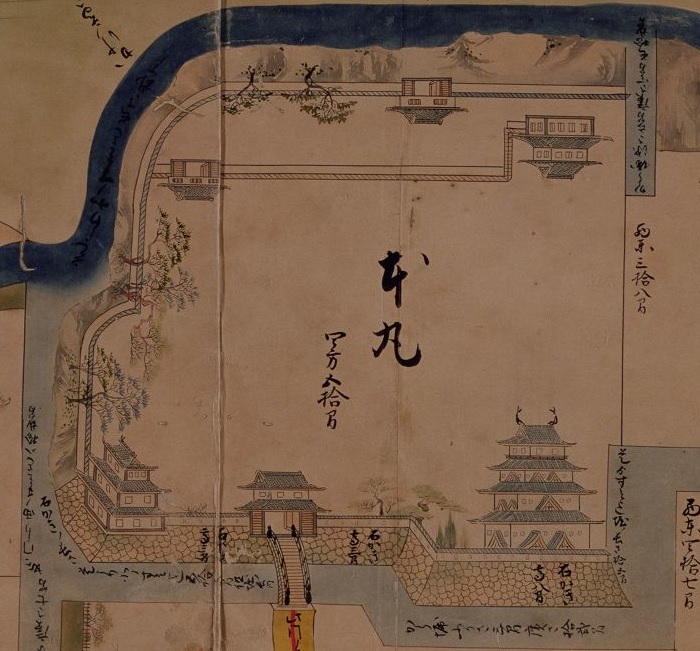
上野国沼田城絵図部分、江戸時代(Part of the illustration of Numata Castle in Kozuke Province in Edo Period)|出典:国立公文書館

1658年に、真田一族の中でこの城の相続を巡ってお家騒動が起こりました。徳川幕府は、真田の分家である信利を沼田藩として、信濃国松代にあった真田本家より独立させる決定をしました。
There was internal trouble in the Sanada clan over the inheritance of the castle in 1658. The Tokugawa Shogunate decided to make the branch Sanada, Nobutoshi separate from the head Sanada in Matsushiro, Sinano Province as the Numata Domain.

真田信利肖像画、加納永泰筆、大法院蔵(The Portrait of Nobutoshi Sanada, attributed to Eitai Kano, ownd by Daihoin)licensed under Public Domain via Wikimedia Commons

信利は、幕府から困難な課役を引き受け、真田本家に対抗するため豪華な屋敷も造営しました。その結果沼田藩の領民は重い年貢に苦しみました。そして信利は、両国橋再建の資材調達に失敗したのと、農民の茂左衛門の幕府への直訴により、1681年に改易となってしまいました。ついには、真田があれほどまでこだわった沼田城は、1682年に幕府により完全に破壊されたのです。
Nobutoshi accepted hard tasks from Shogunate and built luxurious halls against the head Sanada. The result was that people in Numata Domain suffered from high taxes. Nobutoshi was fired in 1681 inspired by his failure of preparing materials for the Ryogoku Bridge rebuilding and the direct appeal to Shogunate by a farmer called Mozaemon. At last, Numata Castle that Sanada were so much devoted to, was completely destroyed by Shogunate in 1682.

天守があったと思われる場所(The place where there seemed be Tenshu)

Features

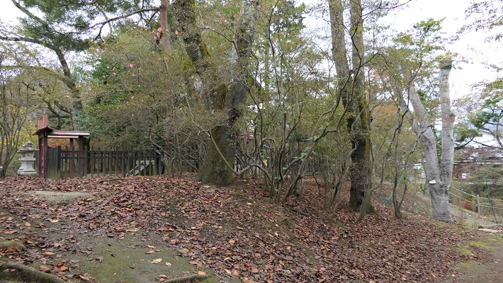
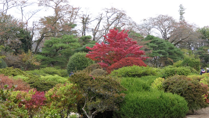
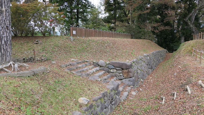
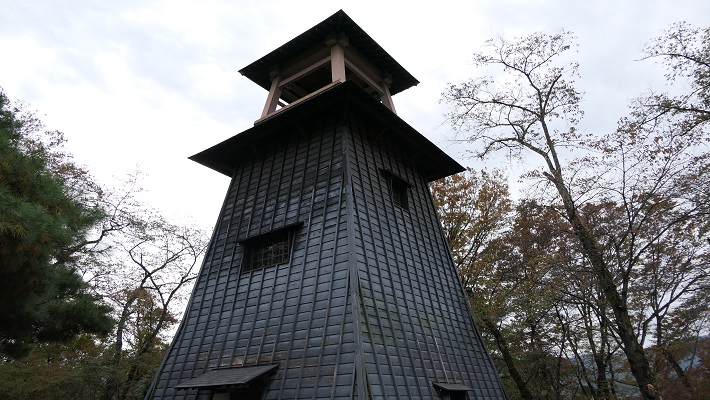
現在沼田城の城跡は、沼田公園として使われています。そこには美しい花々や木々による庭園があるのですが、西櫓の石垣が掘り出されたのと、復元された時計台が残っているのみです。
Now, the ruins of Numata castle have been turned into a park called the Numata Park. Though it has a beautiful flowers and trees garden, only unearthed stone walls of the west turret and the restored clock tower remain.

沼田公園(Numata Park)
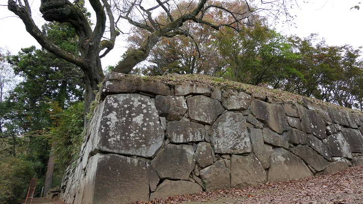
掘り出された西櫓石垣(The unearthen stone walls of the west turret)
復元された時計台(The restored clock tower)

Later Life

真田の城が撤去された後、土岐氏などの大名が江戸時代の間この地域を支配しましたが、藩庁のための建物が設置されたのみでした。明治維新後その建物も撤去され、堀は埋められました。幸いだったのは元藩士の久米民之助が城跡を買い上げ、市に公園として寄付したことでした。
After Sanada’s castle was demolished, some lords like the Toki clan governed the area in the Edo Period. They just had a few office halls to govern. After the Meiji Restoration, the buildings of the castle were removed, and moats were filled. The good thing was that a former warrior Taminosuke Kume bought the ruins and donated them to the city for a park.

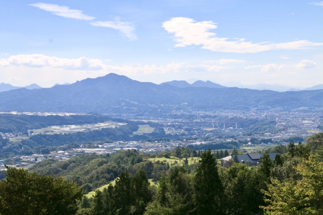
公園からの眺め(A view from the park)

現在、2016年に人気が出たNHK大河ドラマ「真田丸」が放送された後、沼田市には天守を復元できないか検討している人たちがいます。そのドラマは、真田氏、主には信之の弟、真田信繁の人生を描いたもので、信繁は大坂城で豊臣のために徳川と戦ったことで有名です。(真田氏は意図的に徳川方と豊臣方に分かれていました。)ドラマでは、沼田も取り上げられており、そのことが沼田市の観光振興にも寄与しました。
Now, some people in this city are considering how they could restore the Tenshu after a popular NHK drama called “Sanada-Maru” aired in Japan in 2016. The drama was about the lives of the Sanada clan, mainly about Nobushige Sanada, Nobuyuki’s little brother, famous for the fights with Tokugawa for Toyotomi in Osaka Castle. (Sanada clan were divided into Tokugawa and Toyotomi on purpose.) The drama which also featured Numata, led to an increase in tourism for the city.

現地案内板にある天守の想像図(The imaginary drawing of Tenshu on the sign board at the site)

市の人たちは、近い将来に人気が衰えてしまうのを心配しているようです。そして天守のような新しいシンボルを模索しており、白石城のような成功事例を視察したりしています。
People in the city seem worried about the decrease in the near future. They are searching for a new symbol like the Tenshu, and researching successful cases such as the Shiroishi Castle.

復元された白石城(The restored Shiroishi Castle)

しかしながら実現にはいくつもの大きな問題があります。まず、早々に城が破壊されたため天守の詳細が全くわかりません。現在のところ本丸石垣と、金箔瓦や什器などいくつかの品が発掘されたのみです。加えて文化庁が各地方自治体に明確な根拠なしに歴史的建造物を安易に復元しないよう指導している事情もあります。次として莫大な予算が必要です。もし天守を伝統的木造建築のスタイルで再建する場合、市の年間一般会計予算に匹敵する資金が必要となります。実に悩ましい問題です。
However, there will be big problems that come with it. At first, the details are not clear at all because of the castle being destroyed. Stone walls of Honmaru, and few items like roof tiles with gold leaf and utensils have been excavated so far. In addition, the Agency for Cultural Affairs instructs local governments not to restore historical buildings without clear evidence. Secondly it needs a large budget. If they ever decide to construct the Tenshu in a traditional wooden style, it will require a fund as much as their annual general budget. That is too controversial.

発掘された本丸石垣(The excavated stone walls of Honmaru)

市は、自らを「真田の里」として売り出しています。これからどんな展開になるか注目したいと思います。
The city is also trying to identify itself as “Sanada’s Hometown”. I will keep watching what they are doing now.

My Impression

人気を維持するためまず考えられるのは、大坂城上田城、名胡桃城、岩櫃城など真田にまつわる城や城跡を持つ自治体と連携してイベントを開くことだと思います。
To keep the population, I think that a reasonable idea is holding events together with other municipalities having relative castles and ruins to Sanada such as Osaka, Ueda, Nagurumi and Iwabitsu.

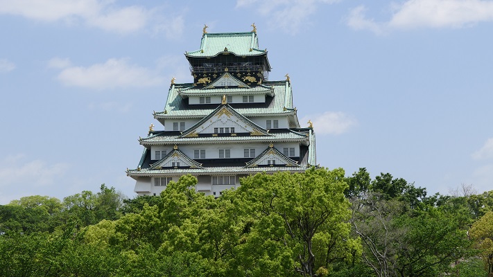
大坂城(Osaka Castle)
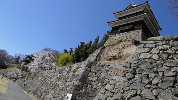
上田城(Ueda Castle)

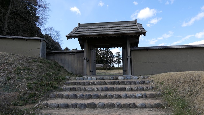
そして、可能性がある方法としては、発掘の結果を基に門か櫓を再建することです。例えば、鉢形城などが類似のケースでしょう。
Then, one possible solution could be rebuilding a gate or a turret based on excavation. There are similar cases, for example in Hachigata.

鉢形城の再建された門(The rebuilt gate in Hachigata Castle)

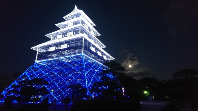
もう一つの可能性として、大分府内城のようにLEDを使って仮想天守の姿を創り出してはいかがでしょう。
For another possibility, how about creating the image of virtual Tenshu with LED like Oita-Funai.

大分府内城の仮想天守(The virtual Tenchu in Oita-Funai Castle)taken by ぴょんにゃん from photo AC

But if they actually want to construct a real Tenshu building, they might have to be prepared for using it as their office hall.
でも、もし本当に本物の天守を作りたいのであれば、市役所の建物に使うくらいの覚悟が必要なのではないでしょうか。

How to get There

沼田城跡に行くには車が便利です。関越自動車道の沼田ICから約10分です。電車を使う場合は、JR沼田駅から歩いて約20分かかります。河岸段丘の急坂を登っていく必要がありますが、それも面白いかもしれません。
東京から沼田駅まで:上越新幹線に乗って高崎まで行き、上越線に乗り換えてください。
It is useful to access Numata Castle Ruins by car. It takes about 10 minutes from Numata IC on Kan-Etsu Expressway. When using train, it takes about 20 minutes on foot from JR Numata Station. It needs to climb up a steep hill on the river terraces, but it may be interesting.
From Tokyo to Numata Station: Take the Jo-Etsu Shinkansen super express to Takasaki, then transfer to Jo-Etsu local line.

Links and References

沼田市観光協会(Numata Tourism Association)
・沼田市議会新政同志会平成29年第1回会派調査・研修報告(Japanese Document)

146.諏訪原城(Suwahara Castle)

諏訪原城は短命でしたが、その役割はすこぶる戦略的でした。
Suwahara Castle had a short life, but its role was very strategic.

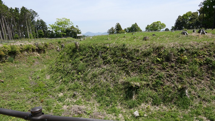
諏訪原城の二の曲輪中馬出し(The Central Umadashi of Ninokuruwa for Suwahara Castle)

Location and History

戦国時代、武田氏と徳川氏は、現在の静岡県西部にあたる遠江国を巡って戦いました。徳川氏は遠江国を本拠にしていましたが、武田氏はその領国を、甲斐国(現在の山梨県)と駿河国(現在の静岡県中部)から遠江に広げようとしていました。遠江には、浜松、掛川、高天神などいくつもの重要な城がありました。
In the late Civil War Period, the Tekeda clan and Tokugawa clan battled each other over Totoumi province which is now the western part of Shizuoka prefecture. Tokugawa was based in this province, while Takeda aimed to spread their territory from Kai (now Yamanashi pref.) and Suruga (now the middle of Shizuoka pref.) provinces to Totoumi. There were several important castles in Totoumi such as Hamamatsu, Kakegawa, Takatenjin and so on.

遠江国周辺の重要な城(Important castles around Totoumi Province)


武田氏は、遠江国の奥深くに位置し難攻不落として知られていた高天神城を手に入れようとしました。それは難しい命題であり、そのため武田は橋頭堡を必要としました。その橋頭堡が諏訪原城だったのです。諏訪原城は1573年に旧東海道に沿った牧之原台地の端に築かれました。その甲斐あって1574年に高天神城の奪取に成功しました。
Takeda took aim at Takatenjin castle which was located deep in the province, and known as impregnable. It was a difficult mission, so Takeda needed to make a bridgehead. That was Suwahara Castle. Suwahara Castle was built on the edge of Makinohara plateau alongside the old Tokaido Road in 1573. Thanks to their effort, Takeda was successful in taking Takatenjin castle in 1574.

諏訪原城周辺の起伏地図(A relief map around Suwahara Castle)


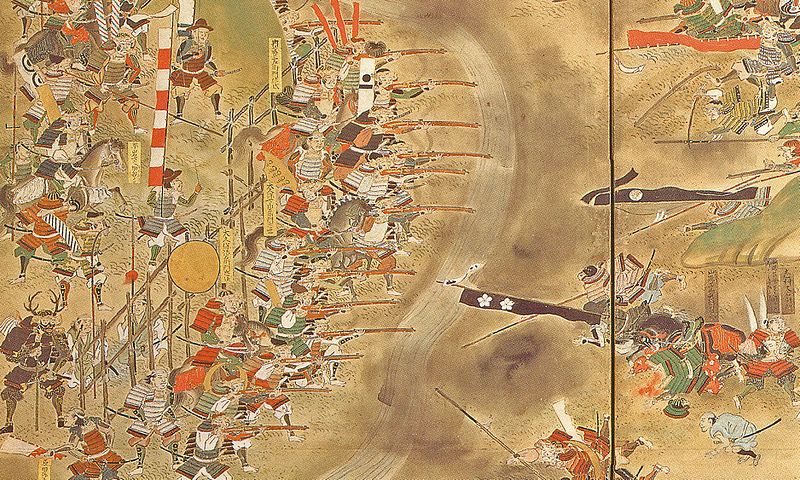
武田は余勢をかって、遠江の西の三河国にあった長篠城を攻撃しました。ところが、1575年5月の長篠の戦いにおいて織田・徳川連合軍に惨敗してしまいました。それ以降、武田の勢いは急激に衰え、徳川が代わって反撃を始めたのです。
Taking advantage of their momentum, they attacked Nagashino Castle located in Mikawa province on the west of Totoumi. However, they were completely beaten by the ally of the Oda clan and Tokugawa in the Battle of Nagashino in May, 1575. After that, Takeda’s influence declined rapidly, and Tokugawa started to raid back instead.

長篠合戦図屏風部分、徳川美術館蔵(Part of “Battle of Nagashino”folding screens, owned by Tokugawa Art Museum)licensed under Public Domain via Wikimedia Commons

諏訪原城は、長篠の戦いのわずか3ヶ月後、1575年8月に徳川方に占領されてしまいました。この城は今度は、まだ武田が確保していた高天神城に対する徳川の橋頭堡になったのです。徳川の粘り強い攻撃は、ついに1581年に高天神城を落とすことに成功し、それは1582年の武田氏滅亡につながりました。徳川の勝利をもって諏訪原城の役目は終わりました。この城は1590年までに廃城となり、その生涯はわずか17年足らずでした。
Suwahara Castle was taken over by Tokugawa in August, 1575, just three months after the Nagashino battle. The castle was turned into Tokugawa’s bridgehead towards Takatenjin Castle that Takeda still held. Tokugawa’s persistent attacks finally made the castle fall in 1581 that would lead to the defeat of Takeda in 1582. With the victory of Tokugawa, the role of Suwahara Castle was finished. The castle was abandoned by 1590 meaning its lifespan was less than 17 years.

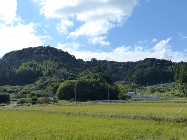
高天神城遠景(A distant view of Takatenjin Castle)

Features

諏訪原城跡には土台しか残っていませんが、武田流築城法が表れていると言われています。その流儀には、背後に自然の要害を備え、三日月形の堀を持ち、丸い形の「馬出し」があるとされています。馬出しとは、防御のため出入口の前に設けられた関門のことです。これは防御のために使われるだけではなく、城の内部から外の敵に対して攻め出す目的でも使われました。
The ruins of Suwahara Castle remain only its foundation, but they are said to show Takeda’s method of building castles. It has a rear natural hazard, bow-shaped moats and round-shaped “Umadashi”. Umadashi refers to defensive gateway barriers in front of the entrance of castles. They were used not only for defense, but also for offence from inside the castle to enemies outside.

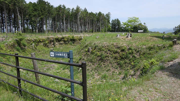
諏訪原城の「二の曲輪中馬出し」(”Ninokuruwa Central Umadashi” in Suwahara Castle)

二の丸中馬出しの航空写真(The aerial photo of Ninomaru Central Umadashi)


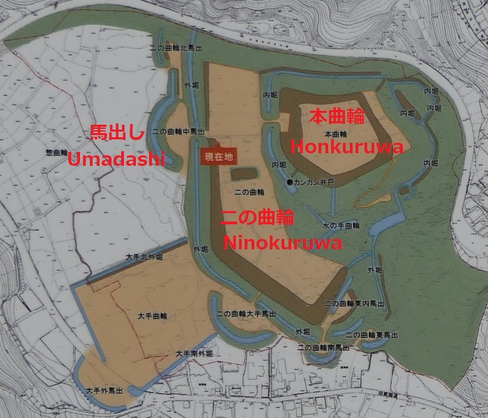
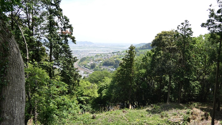
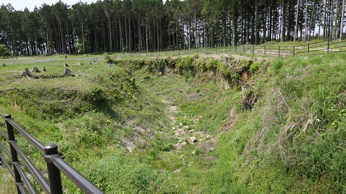
諏訪原城は、これらの条件に全て当てはまります。まず急崖が本曲輪の背後、北東の方向にあります。そして二の曲輪、三の曲輪といった他の曲輪が、南西すなわち高天神城の方向に向かって広がっています。また、三日月形の堀と馬出しの組み合わせがいくつもあります。
Suwahara Castle met all of the factors. A steep cliff was behind its main enclosure called Honmaru in the north east direction, and other enclosures such as Ninokuruwa and Sannokuruwa spread out in the south west direction, which headed towards Takatenjin Castle. The castle also had several sets of a bow-shaped moat and Umadashi.

城跡の地図、現地案内版に加筆(The map of the ruins, from a sign at the site adding information)
本曲輪背後の急崖(The steep cliff behind Honkuruwa)

特に、もっとも大きいものが二の曲輪の前で発掘され、復元されています(二の曲輪中馬出し)。ついでながら、最新の発掘の成果では、徳川はこの城を武田流の方法で改修したらしいのです。歴史家たちは、この結果に少し当惑しているようです。Especially, the largest one is excavated and restored in front of Ninokuruwa enclosure called “Ninokuruwa Central Umadashi”. In addition, the late excavation showed the castle was renovated by Tokugawa using Takeda’s method. Historians are still a bit puzzled by this.

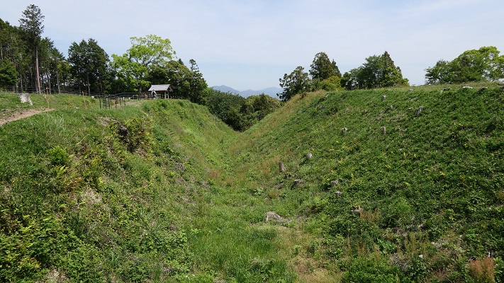
馬出しと二の曲輪の間の深い溝(The deep ditch between Umadashi and Ninokuruwa)
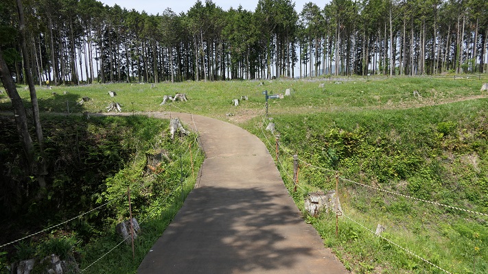
二の曲輪から馬出しへの通路(The passage from Ninokuruwa to Umadashi)

Later Life

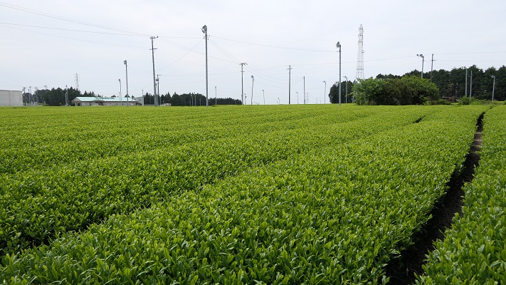
諏訪原城は廃城となった後、長い間放置されました。それがかえって木々や土に覆われ、保全されることになったのかもしれません。明治時代になって、この遺跡周辺の土地は旧徳川藩士によって茶畑として開拓されました。
Suwahara Castle was left as was for a long time after being abandoned. It might have been preserved covered with forests and soil. In the Meiji Era, the area around the ruins was developed into tea plantation by former Shogunate warriors.

牧之原台地の茶畑(A plantation on Makinohara plateau)

第二次世界大戦後、ある郷土史家が城跡を調査し、結果を公開しました。この後、城跡は1954年に県史跡に指定され、そして1975年には国の史跡に指定されました。
After World War II, a local historian investigated the ruins and published them. After this, the ruins were designated as a prefectural historic site in 1954, and then a national historic site in 1975.

二の丸中馬出しを違う角度から(Ninomaru Central Umadashi from a different angle)

My Impression

私が思うに、徳川が武田流を踏襲した理由は単に効率的だったからでしょう。戦国大名は、必要な時に迅速に城を築く必要がありました。敵の城を占領したとき、最も効率的な方法は、その城が使われていた通りに使うことです。改修が必要な時には、その城が作られた方法によるのが最善でしょう。同じように、必要がなくなったときには、そのまま放置すればよかったのではないでしょうか。
I think the reason for Tokugawa using Takeda’s method was just for efficiency. Warlords had to build castles as necessary and quickly as possible. When they captured an enemy’s castle, the most efficient way to use it is using it as it was. When they needed to renovate it, following the way it was created would be the best. Likewise, they could easily abandon it when they no longer needed it.

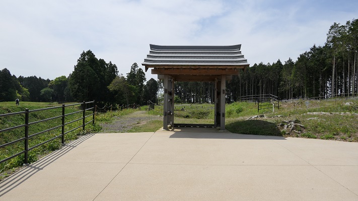
復元された二の曲輪北馬出しの門(The restored gate of Ninokuruwa North Umadashi)

How to get There

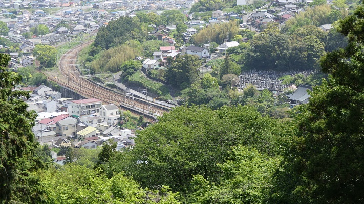
城跡に隣接する諏訪原城ビジターセンターに駐車場があります。また、もしJR金谷駅から来られる場合はちょっときついかもしれません。駅が城の崖下にあるからです。
The Suwahara Castle Visitor Center next to the ruins offers a parking lot.
Or if you try to get the ruins from JR Kanaya Station, it may be tough to get them, because the station is under the cliff.

崖下の金谷駅(Kanaya Station under the cliff)

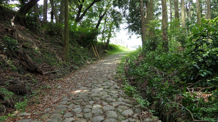
でも、もし挑戦されるとしたら、最近復元された旧東海道の金谷坂石畳を歩くことができます。
But if you try to do it, you can walk through the Kanaya sloped stone pavement on the old Tokaido which was restored recently.

旧東海道金谷坂石畳(The Kanaya sloped stone pavement on the old Tokaido)