A beautiful historical park, now with a view of Mt. Fuji
Features
Third Enclosure as Entrance
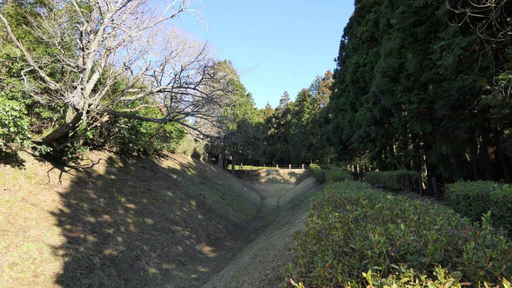
Now, the ruins of Yamanaka Castle have been well developed and maintained as the Yamanaka-jo Castle Park by Mishima City, though the ruins have only earthen foundation. The entrance of the ruins is alongside the old Tokaido Road, and you can park at the parking lot inside when you visit the ruins by car. The entrance was also once that of the Third Enclosure which is now the town area. So, you will walk to the center of the castle by passing through the ruins of the moats for the enclosure. Most of the moats are dried, but part of them remains as a pond called “Tajiri-no-Ike”.
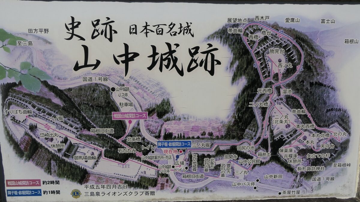
The map around the castle
The entrance of the castle ruinsThe dry moat of the Third EnclosureTajiri-no-Ike Pond
Second Enclosure as Pivot of Defense
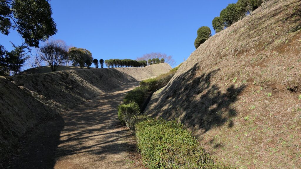
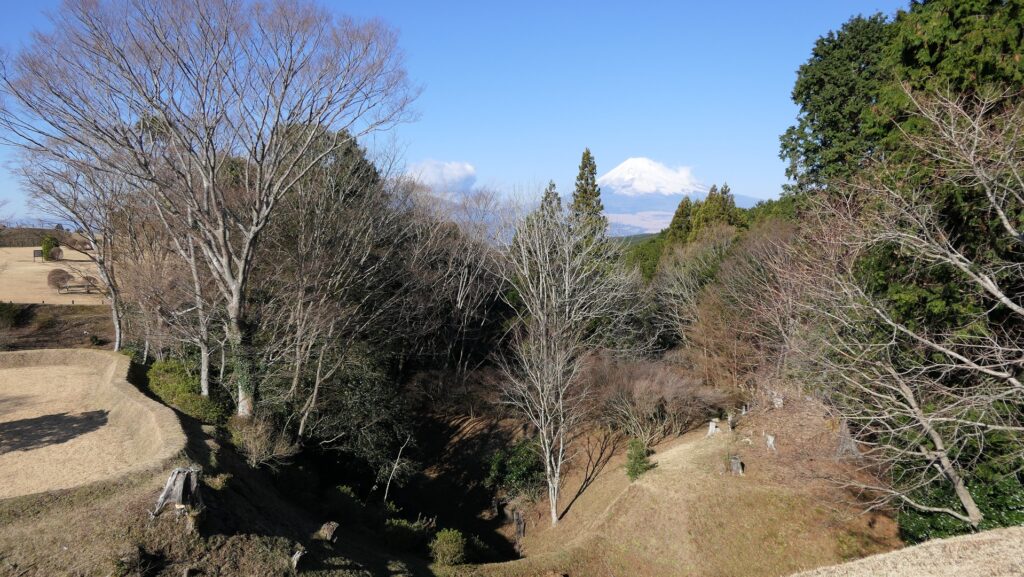
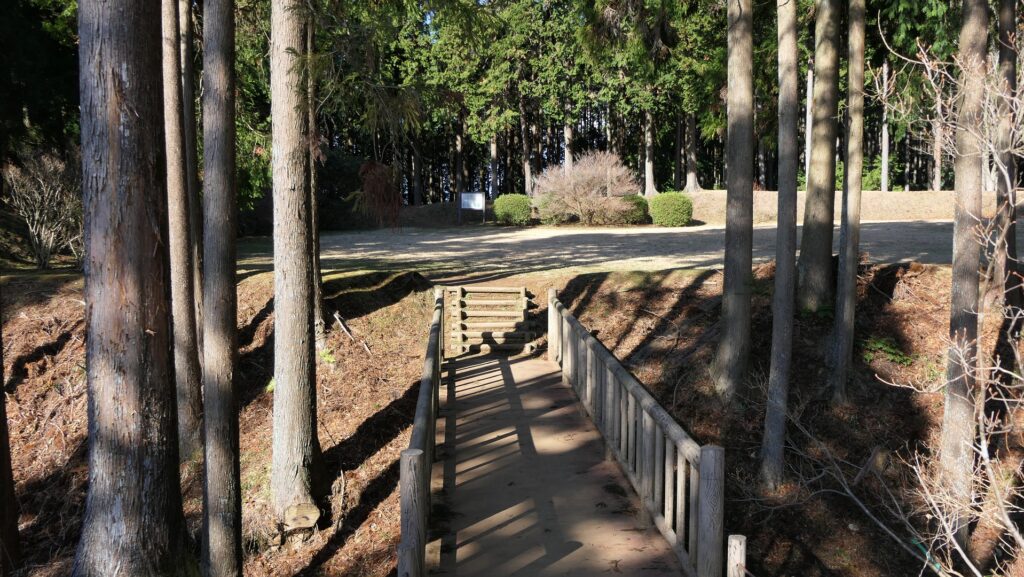
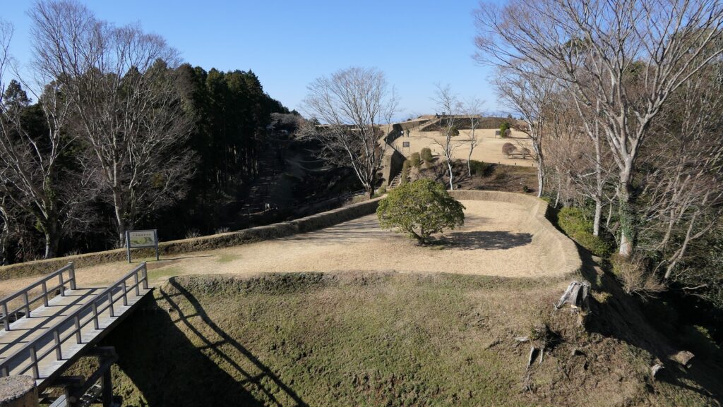
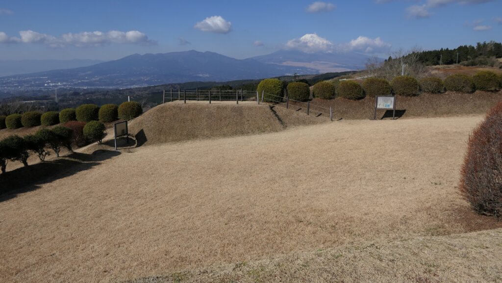
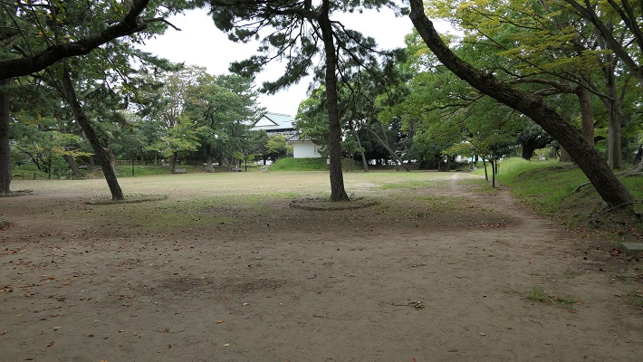
From the pond, you have to walk up the stairs and winding slope to reach the Second Enclosure. The Second Enclosure was large and the connecting point with the center of the castle and the other parts. You can see good views of the area around, including Mt. Fuji from the enclosure. It is surrounded by high, thick earthen walls. It was the important point to protect the castle. Two more enclosures, including the North Enclosure, have been built to protect the Main Enclosure.
The slope to the Second EnclosureThe entrance of the Second EnclosureA view from the Second Enclosure
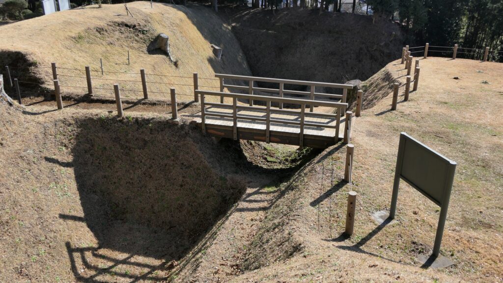
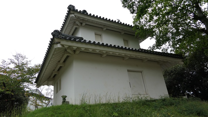
Main Enclosure as Center of Castle
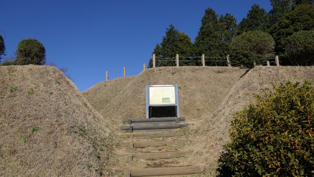
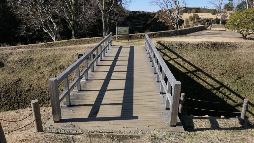
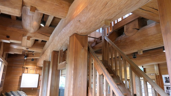
You have to walk up more and across the bridge to the center of the castle, the Main Enclosure. The bridge, which is made of half wood and half earth, looks very interesting. The part of woods could be destroyed when a battle happened. The Main Enclosure is the highest place in the castle and has two tiers. It is thought that a high turret called “Tenshu Turret” stood on the upper tier. The enclosure is surrounded by deep valleys.
The slope to the Main EnclosureThe bridge made of half wood and half earthThe ruins of Tenshu Turret at the Main EnclosureThe dry mort surrounding the Main EnclosureThe North Enclosure
Group of Western Enclosures
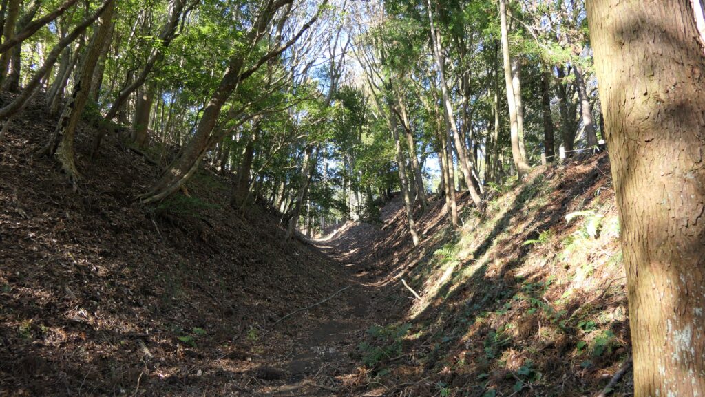
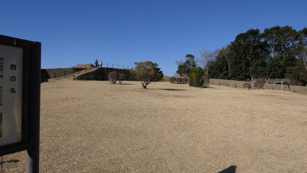
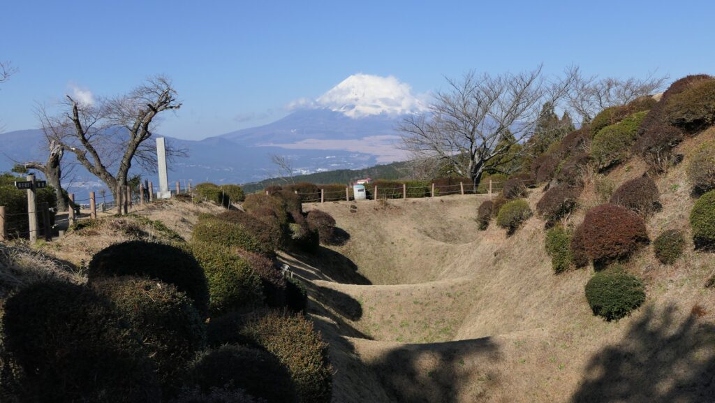
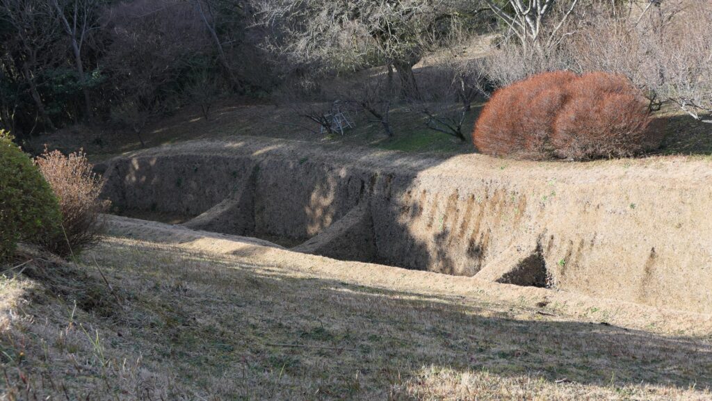
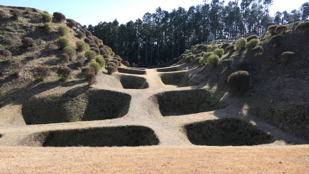
On the west of the Second Enclosure, there are the West Enclosure and the West Turret over another small enclosure called the former West Turret. Though they were all connected by wooden bridges in the past, we can now go to these enclosures through wooden or earthen bridges. The West Turret is also a kind of enclosures, but once had buildings for defense as the frontline of the castle. Actually, the severe battle between Hojo and Toyotomi occurred there. Many of the latticed dry moats called Une-bori and Shoji-bori remain around the West Turret and the West Enclosure. They were originally deeper and the soil was exposed. The original surfaces have been buried and planted to protect them, as a result, the moats look very beautiful like a waffle with a great view of Mt. Fuji.
The group of western enclosuresGoing to the Former West TurretThe inside of the West EnclosureA view from the West EnclosureThe West TurretThe latticed dry moat called Shoji-bori between the West Enclosure and the West Turretthe latticed dry moat called Une-bori around the West Turret
Taizaki-demaru defense strongpoint, others
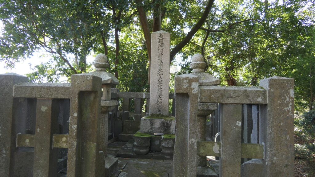
Going back to the entrance of the ruins, you can also visit Taizaki-Damaru defense strongpoint to the south. This is a long and gently sloped enclosure which is also surrounded by earthen walls and Une-bori dry moats. The severe battle also occurred there, but it has a good atmosphere to walk around now. It may be a good idea to have lunch with a beautiful view of Mt. Fuji. You can also walk on the stone pavement of the old Tokaido Road below Taizaki-Dmaru. If you have time, I recommend that you visit the Sokan-ji Temple in the former Third Enclosure town area. There is the tomb of Naosue Hitotsuyanagi, a Hideyoshi’s commander, together with other tombs of Hojo’s soldiers.
Taizaki-Damaru defense strongpointA view from Taizaki-Damaru defense strongpointthe latticed dry moat called Une-bori at Taizaki-Damaru defense strongpointA view of Mt. FujiThe stone pavement of the old Tokaido RoadThe old Tokaido Road through the Third EnclosureThe tomb of Naosue Hitotsuyanagi
The castle for the western defense of the Hojo Clan
Location and History
Western Defense for Hojo Clan
Yamanaka Castle was located on the west of Hakone Barrier, the western gateway of Kanto Region, now in the eastern part of Shizuoka Prefecture. The castle was first built in the middle 16th Century during the Sengoku Period by the Hojo Clan, who owned Kanto Region. The clan aimed to protect their home base, Odawara Castle on the eastern side of Hakone Barrier, by building Yamanaka Castle. This castle was also improved before the ruler, Hideyoshi Toyotomi, attacked the Hojo Clan in 1590.
The location of the castle
Yamanaka Castle was built surrounding the Tokaido Road, one of the major roads in Japan. During that time, if someone walked up the slope on the road from the west, it would require passing through the castle. The road was actually on the Third Enclosures of the castle, and beside the Main Enclosure. The Third Enclosure also had water moats on the west to prevent enemies’ attacks and was for the water reservoir. On the south of the Third Enclosure, a long defense strongpoint called “Taizaki-demaru” spread with the road parallelly. On the west of the Third Enclosure, the Second Enclosure, the West Enclosure, and the West Turret were added towards that direction. These enclosures were able to work closely to prevent attacks from enemy forces.
The location map of the ruins of Yamanaka Castle (from the signboard at the site)
Hojo’s Unique Methods for building Castle
The techniques used in the castle were unique to the Hojo Clan. All the enclosures were made of earthworks, using natural terrain such as ridges and valleys. They were mainly connected by wooden bridges which could fall down when a battle happened. They were also divided by deep dry moats whose bottoms were left parallel or as latticed ridges. The method for building the moats is called “Une-bori” for the parallel ridges and “Shoji-bori” for the latticed ridges. These dry moat building methods are considered features of the Hojo’s castles. Once soldiers fell into the moat, they couldn’t move from there at all. The area of the castle reached about 200,000 square meters. Hojo thought the castle could make Hideyoshi stuck for a while.
“Une-bori” for the parallel ridges“Shoji-bori” for the latticed ridges
Fall in Battle of Yamanaka Castle
However, the castle was captured by Hideyoshi in just half a day. In the early morning, March 29, 1590, nearly 70,000 soldiers of Hideyoshi’s troop started to attack the castle, while the number of the defenders was only about 4,000. The attackers first charged both the West Turret and the Taizaki-Demaru defense strongpoint, but they suffered a significant number of casualties by the counterattack of Hojo’s guns. If it was a local battle, the attacker might have paused the charge to prevent more damages. However, the commanders forcibly continued to charge, otherwise, they might have been fired by the ruler. That resulted in the success of capturing the castle for Hideyoshi in exchange for a lot of dead soldiers including one of the Hideyoshi’s commander, Naosue Hitotsuyanagi.
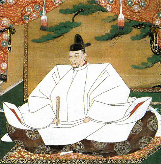
The Portrait of Hideyoshi Toyotomi, attributed to Mitsunobu Kano, ownd by Kodaiji Temple (licensed under Public Domain via Wikimedia Commons)
This battle lasted for a few hours. It is said that another reason for the short battle was that Hojo’s soldiers were confused because their head, Ujikatsu Hojo, escaped from the castle. Others point out that the Taizaki-Demaru defense strongpoint was unfinished in construction before Hideyoshi’s attack. Anyway, even such a strong castle couldn’t survive without enough soldiers and the right instructions.
城の「亀」の部分が残っています。
The “tortoise” part of the castle remains.
立地と歴史~Location and History
城は交通の要地~The castle has a good location for transportation
土浦市は茨城県の南部にあり、水戸街道に沿っています。また、霞ヶ浦の西端にもあたります。過去においては、このような環境は水陸交通の結節点として絶好の立地となりました。この街は、江戸初期辺りから大いに栄えました。 Tsuchiura City is located in the south part of Ibaraki Prefecture, along Mito-kaido Road. It is also beside the western edge of Kasumigaura Lake. In the past, this environment provided a perfect intersection of transportation for land and waterways. The city flourished since around the first Edo Period.
城の位置~The location of the castle
土浦城は、それより以前に小田氏により築城されましたが、街と同時にに少しずつ拡張されました。この城は土浦藩の本拠地でしたが、最初の頃領主が度々変わりました。最終的には土屋氏が17世紀後半から江戸時代末期までこの地を治めました。 Tsuchiura Castle was developed little by little at the same time, though it was first built earlier by the Oda clan. The castle became the home base of Tsuchiura Feudal Domain where several clans governed by turns at first. In the end, the Tsuchiya clan governed the area from the late 17th century to the end of the Edo Period.
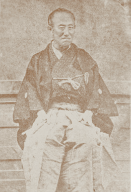
土屋寅直、第9代土屋家藩主~Toranao Tsuchiya, the 9th lord of the Tsuchiya clan(licensed under Public Domain via Wikimedeia Commons)
土塁と水路の城~ A castle with earthen walls and waterways
土浦城には「天守」や石垣はありませんでした。その代わりに「本丸」にはいくつかの櫓と門があり、土塁と水堀に囲まれていました。二の丸などの他の曲輪は本丸の周りにあり、多くの水堀や水路につながっていました。 Tsuchiura Castle had no “Tenshu” or main tower and no stone walls. Instead, the main enclosure called “Honmaru” had several turrets and gates, and was surrounded by earthen walls and a water moat. Other enclosures such as Ninomaru were set around the Honmaru, connecting with many water moats and waterways.
明治初期の城周辺の地図、まだ水路がたくさん残っていました~The map around the castle in the first Meiji Period, a lot of waterways still remained then
発掘により本丸の土塁は、4段階の工事により積み上げらられ、より強固にされたと判明しました。。最終段階では、防水や美観のために石が敷かれていました。このような立地のため、この城は何度も洪水に襲われましたが、城の中心部分は決して水面下に沈みませんでした。洪水の時期には、城は水に浮かぶ亀のように見えたそうで、そのためこの城は「亀城」とも呼ばれました。 Excavation shows that the earthen walls of Honmaru were built by a four-step construction process, lending extra strength to the walls. In their final state, the walls were covered in stones for protection from water and also for aesthetic value. Due to its location, the castle suffered from floods several times, but the center of the castle never sunk under the water. During the flood season, the castle looked like a tortoise floating in the water, so people have called the castle “Ki-jo” or the Tortoise Castle.
本丸の土塁~The earthen walls of Honmaru
特徴~Features
現存する建物~Remaining buildings
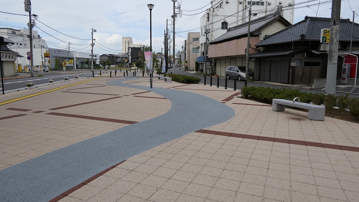
現在、ほとんどの土浦城の土塁と水路は、街の近代化のため、撤去されたり埋められたりしました。実際、JR土浦駅から城跡への通りでさえ、昔は水路の一つでした。その通りには水路だったことを示す掲示と塗装がなされています。 Now, most of Tsuchiura Castle’s earthen walls and waterways have been removed or filled to modernize the city. In fact, even the street from JR Tsuchiura Station to the castle ruins was one of the waterways in the past. You can see the sign and painting which shows that was a waterway on the street.
水路であったことを示す塗装がある通り~The street with the painting that show it was a waterway
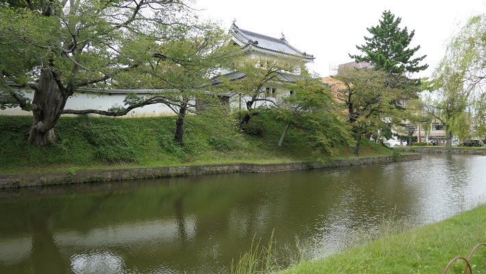
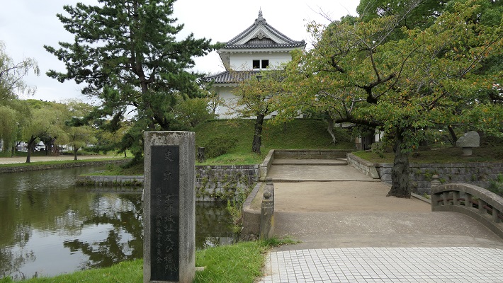
本丸と、二の丸の一部の跡地が亀城公園として残っています。本丸はまだ水堀に囲まれ、亀のように見えますし、現在建物もあります。 The ruins of the Honmaru and part of the Ninomaru remain as the Ki-jo-Koen Park. The Honmaru still looks like a tortoise surrounded by its water moat, where several buildings are now.
城周辺の航空写真~The aerial photo of around the castle
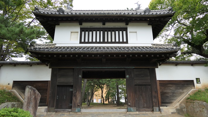
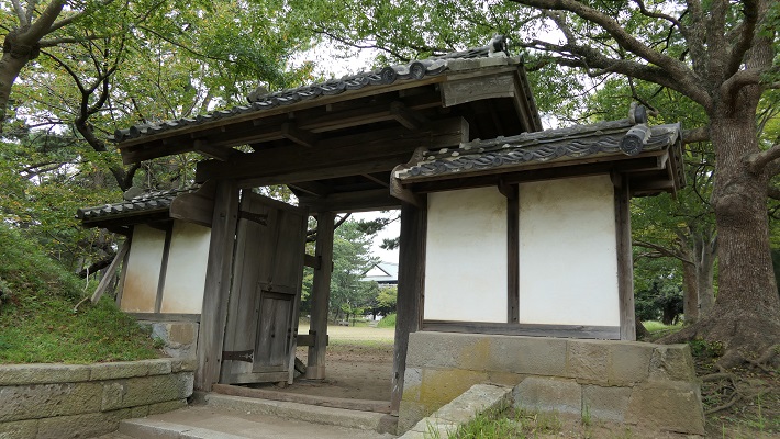
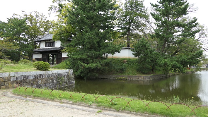
「太鼓門」と呼ばれる正門はオリジナルです。関東地方では唯一の本丸で現存している櫓門です。 The front gate called the Drum Tower or “Taiko-mon” is the original. This is the only remaining turret-style gate in Honmaru in the Kanto Region.
現存する太鼓門~The remaining Taiko-mon Gate
「霞門」と呼ばれる裏門も現存しており、簡便な薬医門という形式です。東櫓と組み合わされて出入口を守っていました。 The back gate called “Kasumi-mon” is also original and has a simple “Yakui-mon” style. It was used combined with the East Turret or “Higashi-yagura” to guard the entrance.
現存する霞門~The remaining Kasumi-mon Gate
復元された建物~Restored buildings
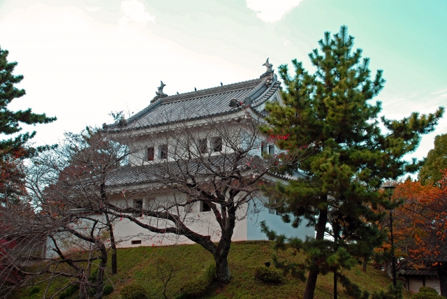
東櫓は1998年に、元の状態に近くなるよう伝統的工法で復元されました。土浦市立博物館の別館としても利用されています。 The East Turret was restored in 1998 using traditional methods, to resemble its original state. It is also used as the annex for Tsuchiura City Museum.
復元された東櫓~The restored East Turret(taken by チャコ from photoAC)東櫓の内部~The inside of East Turret
もう一つ西櫓があり、1949年の大型台風で破壊され、1950年に撤去されましたが、元から使われていた資材を利用して1991年に復元されました。 There is aother turret, the West Turret or “Nishi-yagura” which suffered damege from a big typhoon in 1949, was demolished in 1950, but was also restored in 1991 using the same materials as in the original construction.
復元された西櫓~The restored West Turret
本丸の内部は空き地になっていて、以前には御殿がありましたが、明治時代の火事で焼けてしまいました。 The inside of the Honmaru is empty where the main hall stood which was burned out by a fire in the Meiji Period.
本丸の内部~The inside of the Honmaru
更には、本丸の土塁上には太鼓門と東櫓をつなぐ白壁が復元されたことで、本丸の外側からは、復元された城の外観を楽しむことができます。 In addition, the plaster wall between the Drum Tower and East Tower was also restored on the earthen walls of the Honmaru, so you can see the restored appearance of the castle from the outside.
復元された城の外観~The restored appearance of the castle
その後~Later History
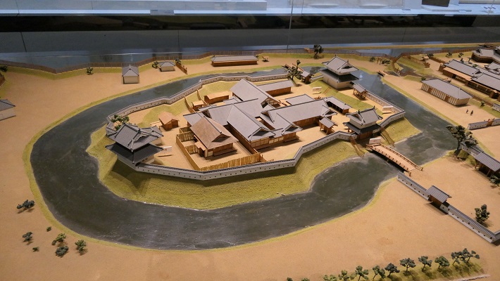
明治維新後、土浦城は地方政府庁舎に転用されました。本丸御殿はそのために使われたのですが、残念なことに1884年に焼失しました。しばらくして、城跡は1899年に亀城公園となりました。1988年には二の丸区域に土浦市立博物館がオープンしました。そこでは土浦市の歴史や文化、そして土浦城のことも展示しています。亀の形に似ている城の中心部の模型を見ることができます。 After the Meiji Restoration, Tsuchiura Castle was turned into the hall for the local government. The Honmaru main hall was used for it, but unfortunately it was burned down in 1884. After a while, the castle ruins became the Ki-jo-Koen Park in 1899. The Tsuchiura City Museum has been open since 1988 in the Ninomaru area. It has exhibits about the history and culture of the city as well as the castle. You can see a miniature model of the castle’s center portion, resembling a tortoise.
土浦市立博物館にある城の模型~The miniature model of the castle at Tsuchiura City Museum
私の感想~My Impression
霞ヶ浦は現在、日本で琵琶湖に次ぐ2番目に大きな湖です。中世初期までは内海だっともいいます。土浦市はまた、近代まで洪水の被害を受けていました。水を制御するのは難しかったのでしょうが、この地域の人たちはそれを成し遂げたのです。城跡の地は、周りの敷地よりも少し高くなっており、それを見たとき、人々が城を災害からの被害を防ぎ、城を守ろうとした努力の跡だと理解しました。公園は今は閑静でくつろげる場所となっています。 Kasumigaura Lake is now the second largest lake in Japan, following Biwako Lake. It had been an inland sea until around the first Middle Ages. Tsuchiura City also suffered from floods until the Modern Ages. It seemed to be difficult to control the water, but people in the area were able to use it. When I saw the castle ruins set a little higher than the area around, I was able to understand people made great efforts to prevent disasters and protect the castle. The park is quiet and a relaxing place now.
公園の入り口~The entrance of the park
ここに行くには~How to get There
車で行く場合:常磐自動車道の佐倉土浦ICか土浦北ICから約15分です。博物館に駐車場があります。 電車の場合は、JR土浦駅から歩いて約15分です。 If you want to go there by car: It takes about 15 minutes from the Sakura-Tsuchiura IC or the Tsuchiura-Kita IC on Joban Expressway. The museum offers a parking lot. When using train, it takes about 15 minutes on foot from JR Tsuchiura station.