26.松代城~Matsushiro Castle

中世と近世が同居している城
A castle mixed with the Middle Ages and the Modern times

立地と歴史~Location and History

武田信玄の本陣~Stronghold for Shingen Takeda

長野県長野市にある松代城は、真田氏の城下町として有名な観光地です。この城には長い歴史があります。16世紀に武田氏が最初に築城し、その頃は海津城と呼ばれていました。この城の建設の理由は、近くの川中島が越後国(現在の新潟県)の上杉氏との最前線であったからです。城は北側が千曲川に接していて、土塁や水堀に囲まれていました。また、城の門の外側には馬出しという武田氏独特の防御システムが備えられていました。城は実際に、1561年の非常に有名な上杉謙信との川中島の戦いにおいて武田信玄の本陣として使われました。
Matsusshiro Castle is a famous attraction in Nagano City, Nagano Prefecture, which was known as a Sanada Clan castle town. The castle has a long history. It was first built by the Takeda Clan in the late 16th Century and was called Kaizu Castle. The reason for the construction was that the area nearby called Kawanakajima was the front line against the Uesugi Clan in Echigo Province (what is now Niigata Prefecture). The castle bordered Chikuma-gawa River on the north and was surrounded by earthen walls and water moats. It is also said that it was equipped with the Takeda Clan’s unique defense system called Umadashi outside the castle gates. The castle was actually used as the stronghold for Shingen Takeda when he fought with Kenshin Uesugi in the very famous fourth Battle of Kawanakajima in 1561.

城の位置~The location of the castle

城内にある「海津城」の碑~The monument of “Kaizu Castle” in the castle
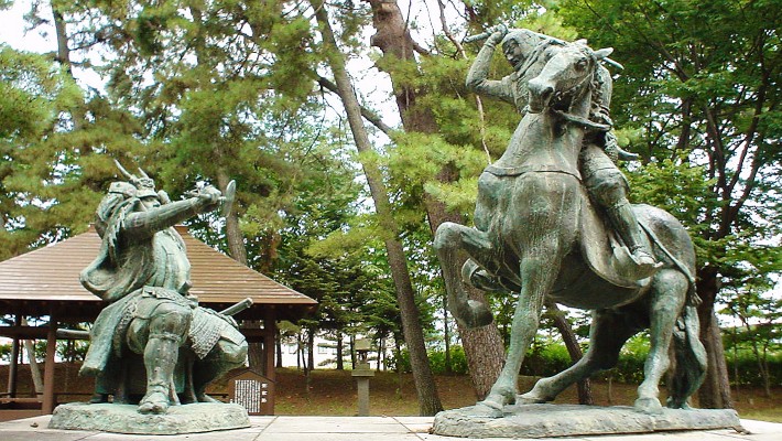
川中島古戦場にある武田信玄と上杉謙信の銅像~The statues of Shingen Takeda and Kenshin Uesugi at the Kawanakajima Battlefield (licensed under Public Domain via Wikimedia Commons)

真田氏による統治~Governance by Sanada Clan

1582年に武田氏が織田氏により滅ぼされた後は、この城の城主は何度も変わりました。最終的には真田氏が、城と城下町を含む松代藩を1622年から江戸時代末まで支配しました。また、1711年には徳川幕府により、城の名前が松代城と変更されました。城はそれまでに改修が続けられます。例えば、城の中心地である本丸は、内堀とともに石垣によって囲まれました。石垣の四隅の上には4基の櫓が築かれ、3基の門が本丸の入口に設置されました。本丸の内部には御殿があり、城主が住んでいました。一方、外堀とともに本丸と内堀を囲む二の丸は、まだ土塁があるだけでした。また、恐らくは武田時代に由来する馬出しも残っていました。
After the Takeda Clan was defeated by the Oda Clan in 1582, the lords of the castle were changed several times. The Sanada Clan finally governed the Matsushiro Domain including the castle and the castle town from 1622 until the end of the Edo Period. The castle was also renamed Matsushiro Castle by the Tokugawa Shogunate in 1711. The castle continued to be improved until then. For example, the center of the castle called the Main Enclosure was surrounded by stone walls with the Inner Moat. Four turrets were built on the four corners of the stone walls, and three gates were set at the entrances of the enclosure. The Main Hall was inside of the enclosure where the lord lived. On the other hand, the Second Enclosure with the Outer Moat surrounding the Main Enclosure and InnerMoat still had the earthen walls. The Umadashi system which probably originated in Takeda’s period, also remained.

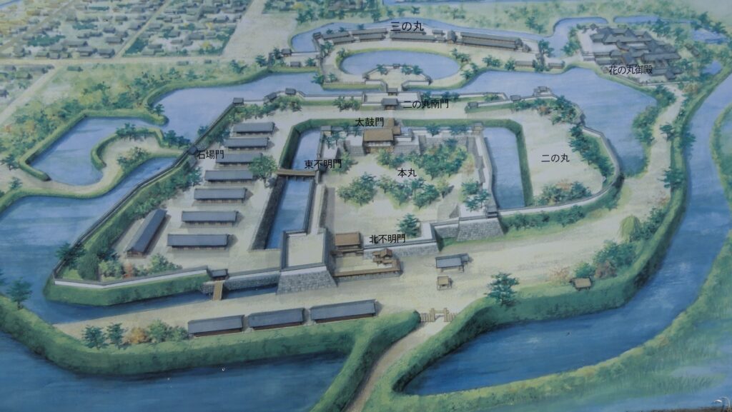
城の想像図(正面)~The imaginary drawing of the castle (the front) (現地説明板より~from the signboard at the site)
城の想像図(背面)~The imaginary drawing of the castle (the back) (現地説明板より~from the signboard at the site)

新しい御殿~New Main Halls

しかしながら、この城の川に近い立地は防御には有利でしたが、統治や居住には不利でした。城は洪水の被害に何度も見舞われました。火災による被害もあり、真田氏は居宅を城の中心地から南西部分に移すことを決め、花の丸御殿を建設します。江戸時代末には城から離れた地に、親族関係者(婦女子)のための新御殿も建てました。
However, this castle’s location near the river was positive for defense, but negative for governance and living. The castle suffered damage from floods several times. It was also damaged by fires, so the Samada Clan decided to escape their home from the center of the castle to the southwest part, building Hananomaru Main Hall. The clan also built the New Main Hall for their relatives (women and children) far from the castle at the end of the Edo Period.
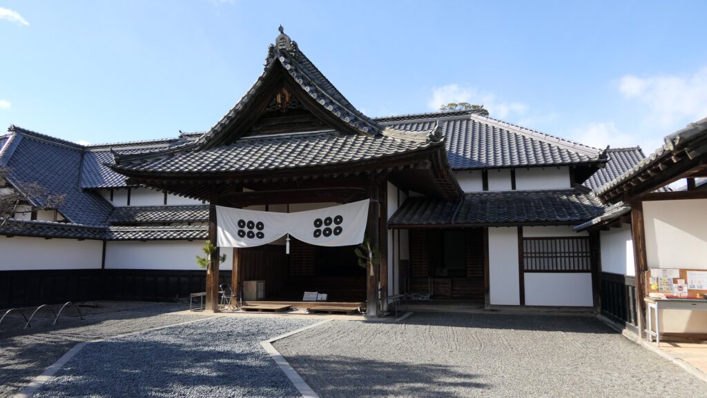
新御殿~The New Main Hall

特徴~Features

江戸時代末期のように復元~Restored like End of Edo Period

現在、松代城の中心部は以前の姿に似通って見えます。本丸の石垣のみが現存しているのですが、本丸の2つの門、内堀と2つの橋、そして二の丸を囲む土塁さえもが長野市によって復元されています。市の関係者によると、江戸時代末期の姿を再現したということです。
Now, the center of Matsushiro Castle looks similar to its former appearance. Only the stone walls of the Main Enclosure are original, but two gates to the Main Enclosure, the Inner Moat with two bridges, and even earthen walls surrounding the Second Enclosure have been restored by Nagano City. The city officials say they tried to restore the castle to show its appearance at the end of the Edo Period.
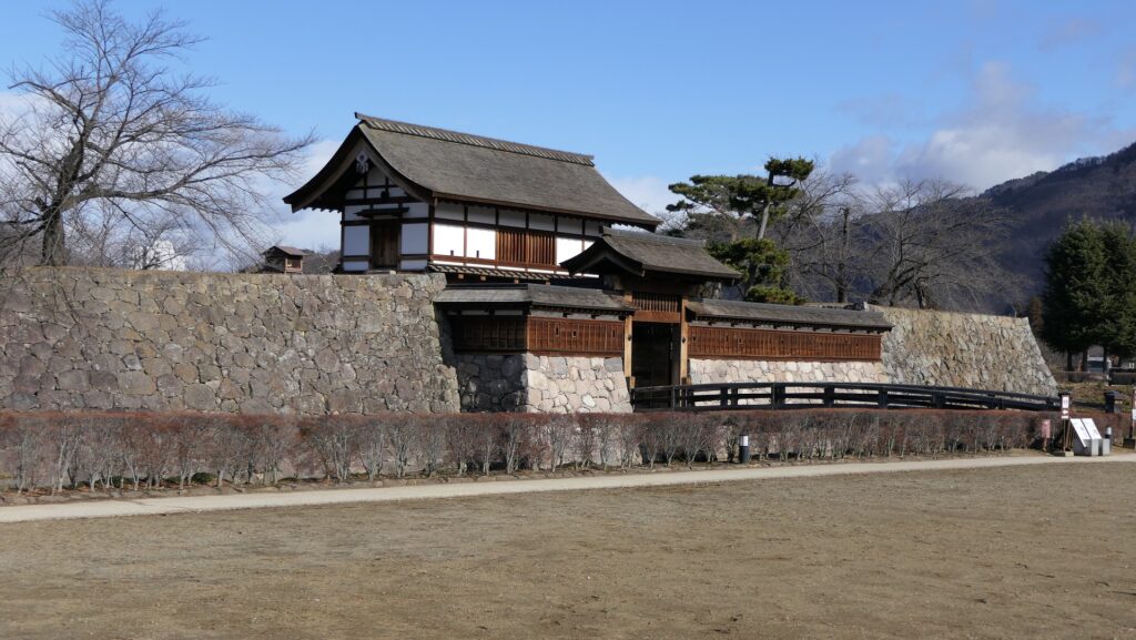
復元された本丸~The restored Main Enclosure

城周辺の航空写真~The aerial photo around the castle

対照的な二の丸と本丸~Contrastive Second and Main Enclosures

観光客は通常、二の丸の入口である南門跡から城に入っていきます。この門跡は、復元された土塁に囲まれていて、その近くには馬出しの痕跡がわずかに残っています。この土塁と本丸の石垣はとても対照的です。それぞれが元々は別の時代に作られたからです。土塁は中世の戦国時代に由来し、石垣は主に江戸時代に作られました。
Visitors usually enter the castle through the ruins of the South Gate, the entrance of the Second Enclosure. The ruins are surrounded by the restored earthen walls and the trace of the Umadashi system slightly remains nearby. The earthen walls and the stone walls of the Main Enclosure are very contrastive because both of them come from different periods. The earthen walls are from the Sengoku Period of the Middle Ages and the stone walls are mainly from the Edo Period of the Modern Times.

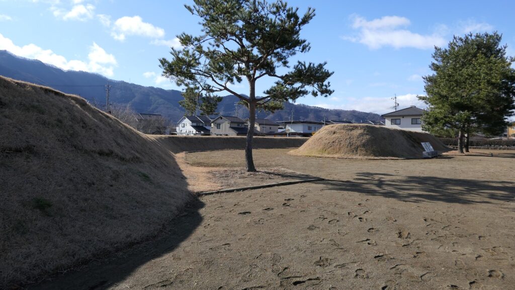
南門跡~The ruins of the South Gate
復元された二の丸~The restored Second Enclosure

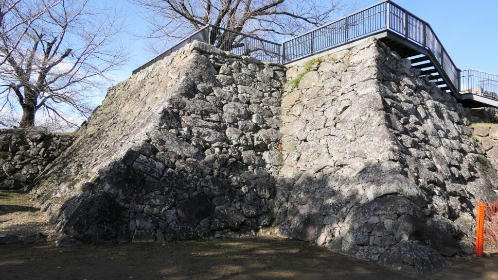
本丸へは内堀にかかっている橋を渡り、太鼓門を通って入ります。これらは皆復元されたもので、城の新しいシンボルになりました。本丸の内側は1717年の大火以降は空き地になっています。角にあった4つの櫓は復元されていませんが、石垣は残っています。北西角のものは一番大きく、櫓の以前には天守が立っていたのではないかと言われています。また、この櫓の石垣とその積み方は他のものよりは古風であり、とても荒々しく見えます。櫓台の上に階段で登り、城周りの景色を見ることができます。
You can enter the Main Enclosure through the Taiko-mon Gate after crossing the bridge over the Inner Moat. These structures have all been restored and have become new symbols of the castle. The inside of the Main Enclosure has remained empty since the great fire in 1717. The four turrets on the corners have not been restored, but their stone wall bases remain. The northwest one is the largest and it is said that the Main Tower might have stood on it before the turret. Its stone walls and the method for piling them are also older than other stone walls, so they look very rough. You can go up the stairs to the top of the base to see a view around the castle.
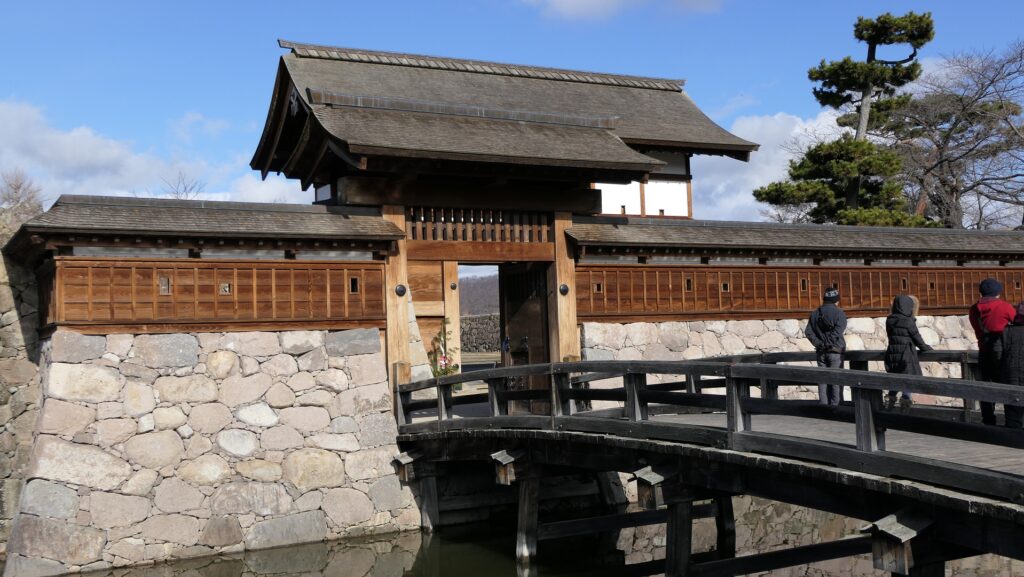
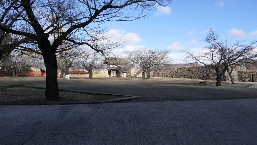
太鼓門~The Taiko-mon Gate
本丸の内部~The inside of the Main Enclosure
北西櫓石垣(内側)~The stone walls for the Northwest Turret (the inside)
北西櫓石垣(外側)~The stone walls for the Northwest Turret (the outside)

独特な構造~Unique Structures

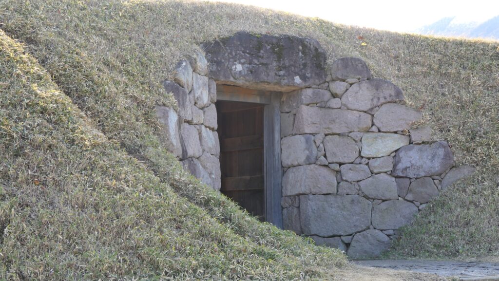
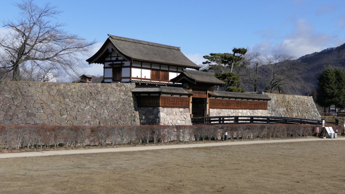
本丸の北側にはもう一つの復元された北不明門があります。その門をくぐっていくと、本丸を囲んでいる二の丸に戻っていきます。二の丸の北外側は、かつては千曲川でした。江戸時代に洪水を防ぐため、川の流路が替えられたのです。面白いものとしては、埋門という復元された小さな門が二の丸の土塁の所にあります。土塁に通した穴の中に組み込まれていますが、戦が始まったときには埋められるようになってました。
The northern side of the Main Enclosure has another restored gate called Kita-Akazu-mon. You can go through the gate back to the Second Enclosure surrounding the Main Enclosure. The outside of the Second Enclosure on the north was the Chikumagawa-River in the past. The route of the river was changed in the Edo Period to prevent floods. There is an interesting small, restored gate called Uzumi-mon in the earthen walls of the Second Enclosure. It was originally set in a hole through the walls which would have been filled when a battle happened.
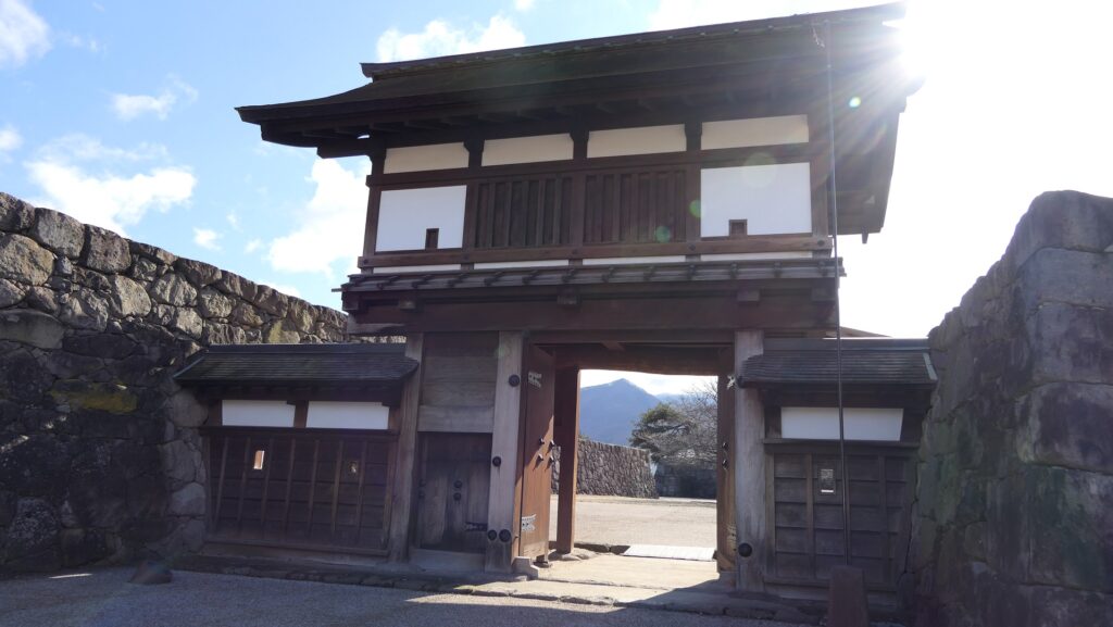
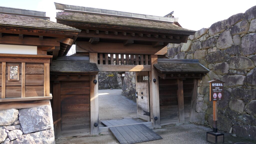
北不明門(櫓門部分)~The Kita-Akazu-mon Gate (the turret gate part)
北不明門(表門部分)~The Kita-Akazu-mon Gate (the front gate part)
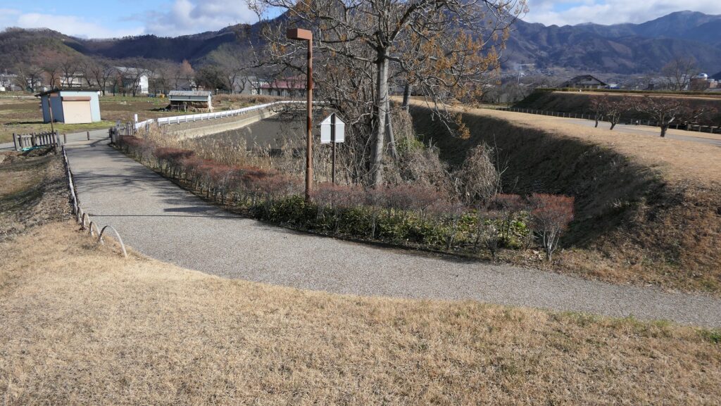
二の丸の北外側~The outside of the Second Enclosure on the north
復元された埋門~The restored Uzumi-mon Gate

その後~Later History

明治維新後、松代城は廃城となり、ほとんどの建物は売られるか撤去され、ほとんどの土地は元藩士に分け与えられ農地となりました。1904年、元藩主であり新御殿に住んでいた真田家は土地の一部を買い戻し、城跡を公園として公開しました。最終的には1951年にその土地を公共のものとして寄付しました。1981年には城跡は国の史跡に指定されましたが、当時は城の中心部に石垣だけが残っている状態でした。長野市は城跡を調査しいくつかの門、橋、土塁、水堀の復元を開始します。その復元は2004年に完了し、現在私たちは城が過去どのような姿であったか目にすることができるのです。
After the Meiji Restoration, Matsushiro Castle was abandoned, most of its buildings were sold or demolished, and most of its land was divided by former warriors to be turned into farm. In 1904, the former lord of the castle, the Sanada Clan, living in the New Main Hall, bought part of the land back to open the ruins of the castle as a park. The clan lastly donated the land to the officials in 1951. The ruins of the castle were designated as a National Historic Site in 1981, but only the stone walls remained at the center of the castle at that time. Nagano City investigated the ruins and started to restore some of gates, bridges, earthen walls and water moats. The restoration was completed in 2004 and we can now see what the castle looked like in the past.

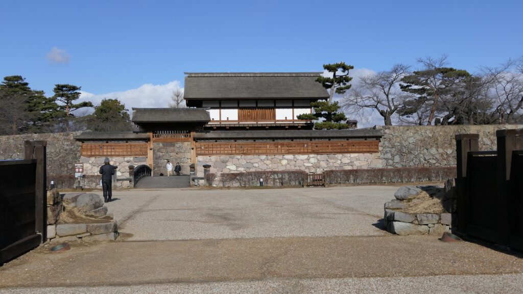
復元中の城跡~The castle ruins being restored
復元後の城~The castle after the restoration

私の感想~My Impression

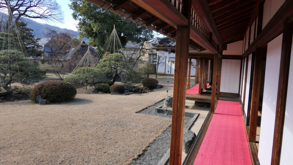
松代城には、異なる時代の異なる特徴が同居しており、独特の雰囲気があると思います。石垣と土塁の面白い組み合わせを見ることができるからです。加えて、城から250m南にある真田邸をご覧になることをお勧めします。真田邸は実は新御殿の現在の名前なのです。城に関連する数少ない現存建物の一つです。これもまた国の史跡となっています。もともと藩主の近親者のために作られたものなので、その内装はとても優雅です。
I think that Matsushiro Castle has a unique atmosphere because it has different perspectives from different periods. You can see the interesting combination of its stone walls and earthen walls. In addition, I recommend that you visit the Sanada Hall, about 250m south of the castle. In fact, Sanada Hall is the present name of the New Main Hall, one of the few remaining buildings that form part of the castle. It is also designated as a National Historic Site. Its interior is very elegant as it was first built for the lord’s relatives.

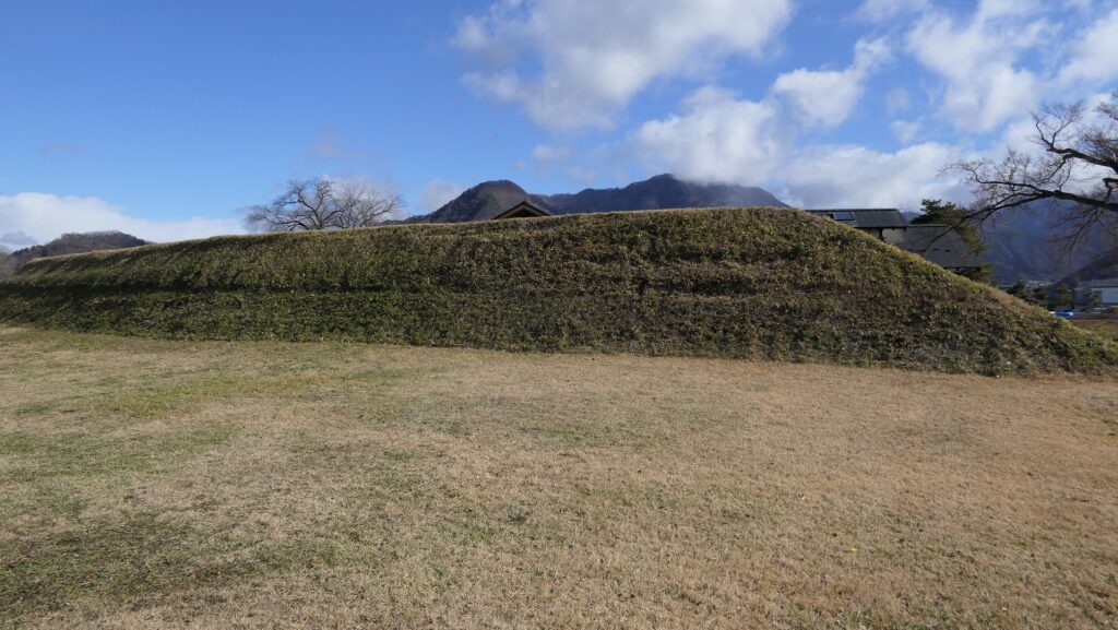
本丸の石垣~The stone walls of the Main Enclosure
二の丸の土塁~The earthen walls of the Second Enclosure
真田邸の内装~The interior of the Sanada Hall
真田邸の御居間~The living room of the Sanada Hall
真田邸の縁側と庭園~The veranda and garden of the Sanada Hall

ここに行くには~How to get There

上信越自動車道の長野ICから約5分のところです。城の周りにいくつか駐車場があります。
公共交通機関を使う場合は、長野駅からバスに乗り、松代駅バス停で降りてください。
It takes about 5 minutes from Nagano IC on Joshinetsu Expressway. There are parking lots around the castle.
If you want to go there by public transportation, take the bus from Nanano Station and get off at the Matsushiro-eki bus stop.

リンク、参考情報~Links and References

松代城の環境整備、長野市(Nagano City Official Website)
・よみがえる日本の城14、学研(Japanese Book)
・「日本の城改訂版第7号」デアゴスティーニジャパン(Japanese Book)

106.脇本城~Wakimoto Castle

安東氏が最盛期のときの城
The castle when the Ando clan was its peak

立地と歴史~Location and History

舟運で繁栄した出羽国~Dewa Province Prospering by Ships

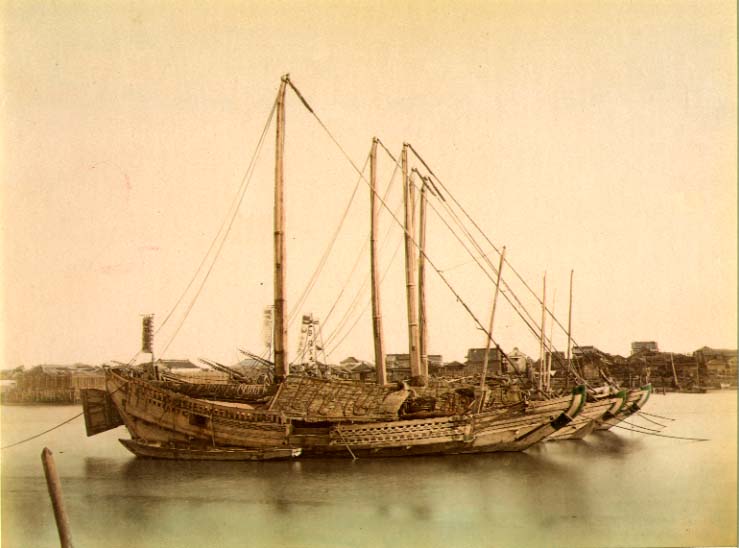
近代以前、大量輸送は船によって行われましたが、海上での航海は危険でした。船が十分発達していなかったからです。日本の場合、中世においては、商業船は主には太平洋ではなく、瀬戸内海や日本海などの内海を航行していました。そのため、当時は内海沿いの大きな港をもつ地域が繫栄しました。出羽国(現在の秋田、山形県を合わせた範囲)はそのような地域でした。
Before the Modern times, mass transportation was done by ships, but sailing on ocean could be dangerous because ships were not developed enough. In the case of Japan, in the Middle Ages, merchant ships sailed mainly on islands seas, such as the Seto Island Sea and the Japan Sea, not on the Pacific Ocean. For this reason, areas with a large port along the island seas prospered at that time.
Dewa Province (combining what is now Akita and Yamagata Prefectures) was one such areas.

1860年代の日本古来の弁財船~Traditional Japanese junks in 1860s (licensed under Public Domain via Wikimedia Commons)

秋田で力をつけた安東氏~Ando Clan has power at Akita

安東氏は、北出羽(大体今の秋田県)を根拠地として海上交通を支配して大きな勢力となりました。戦国時代(日本中の地方大名が覇権をめぐって争った時代)には安東氏は、檜山安東氏と湊安東氏の2つのグループに分かれていました。檜山安東氏は北秋田にあった檜山城に住み、湊安東氏は南秋田にあった湊城を拠点としていました。
The Ando Clans had a great power to manage the marine transportation based in the north Dewa (roughly now Akita Prefecture). In the “Sengoku” Period- a period when local clans around Japan were fighting for control over all of the country- the Ando Clans was divided into two groups namely the Hiyama-Ando Clan and the Minato-Ando Clan. The Hiyama-Ando Clan lived in Hiyama Castle which was located on the northern part of Akita, while the Minato-Ando Clan lived in Minato Castle located on the southern part of Akita.

城の位置~The location of the castle

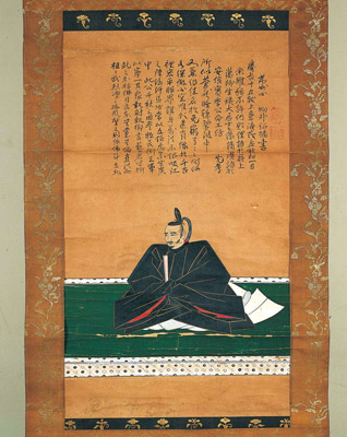
安東愛季は、最初は檜山安東氏の総領でしたが、湊安東氏に固有の跡継ぎがいなかったため、取り込むことに成功しました。彼は、秋田全域を統治することで最も有力な戦国大名の一人になったのです・
Chikasue Ando was at first the lord of the Hiyama-Ando, but was able to take over the Minato-Ando as it didn’t have its own successor. As a result, he ruled over the entire Akita and became known as one of the greatest warlords.

安東愛季の肖像画、東北大学附属図書館蔵~The portrait of Chikasue Ando, owned by Tohoku University Library (licensed under Public Domain via Wikimedia Commons)

安東愛季が脇本城を拡張~Chikasue Ando develops Wakimoto Castle

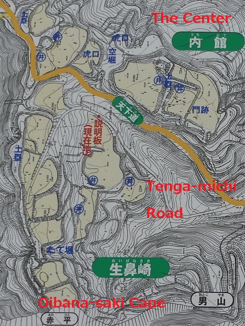
愛季は1577年、彼の本拠地を檜山城と湊城の間にある城に移しました。彼が選んだ城が脇本城だったのです。この城は最初は15世紀に築かれたと言われていますが、その後愛季が東日本では有数の規模の山城にまで拡張しました(約150ヘクタール)。この城は、男鹿半島の根元にある100mの高さの丘の上に築かれ、重要な商業港であった土崎湊の近くでもありました。また、主要道路の「天下道」が城の中を通っているため、非常に戦略的な立地であり、城の領主は完全に交通を制御することができました。
Chikasue moved his home base to a castle located between Hiyama and Minato Castles in 1577. The castle that he chose was the Wakimoto Castle. The castle is said to be first built in the 15th century, then Chikasue developed the castle as one of the largest mountain castles in eastern Japan (about 150 hectare). The castle was located on a 100m high hill in the connecting part of Oga Peninsula, near an important trading port called Tsuchizaki-minato. This location proved to be very strategic as a main road called “Tenga-michi” ran between the two sides of the castle giving the Lord full control over transportation.

遺跡の全体図、現地案内板より~The whole map of the ruins, from the signboard at the site

愛季は支配者として絶頂期にあって、領土を拡張する一方、織田信長といった外の有力戦国大名とは手紙や贈り物により親交を深めました。ところが、1587年の戦いのさ中、彼は突然の病に倒れ、亡くなってしまいます。彼の息子、実季は湊城に住み、最終的には1602年に徳川幕府により関東地方に移されてしまいました。脇本城はそれから廃城となってしまったようです。
Chikasue was at the peak of his career as an administrator expanding his territory and building relationship with other great warlords such as Nobunaga Oda by sending letters and gifts. However, during a battle in 1587 he suddenly fell ill and died. His son, Sanesue lived in Minato Castle and was lastly transferred to Kanto Region by the Tokugawa Shogunate in 1602. Wakimoto Castle seemed to be abandoned since then.

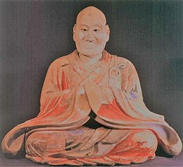
安東実季木造、羽賀寺蔵~The wooden statue of Sanesue Ando, owned by Haga-ji Temple (licensed under Public Domain via Wikimedia Commons)

特徴~Features

城跡へ登っていく~Walking up to Castle Ruins

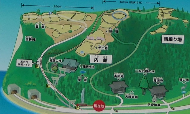
現在、脇本城跡は今もって非常に広大であり、5つの地区に分けられています。しかしながら、5つの地区全てが等しく整備されているわけではありません。そこで、私の訪問時には、一番整備されている「内館」1箇所を見学しました。ここは城の中心部分であり、現在はより整備されていて、観光客が訪れやすいようになっています。
Now, the ruins of Wakimoto Castle are still very large, and they are divided into five areas. However, not all the 5 areas have been developed equally. So, when I visited, I covered the one that was most developed which is “Uchidate”. This was the main portion of the castle, and now is further developed for tourists to visit easily.

城周辺の航空写真~The aerial photo of around the castle

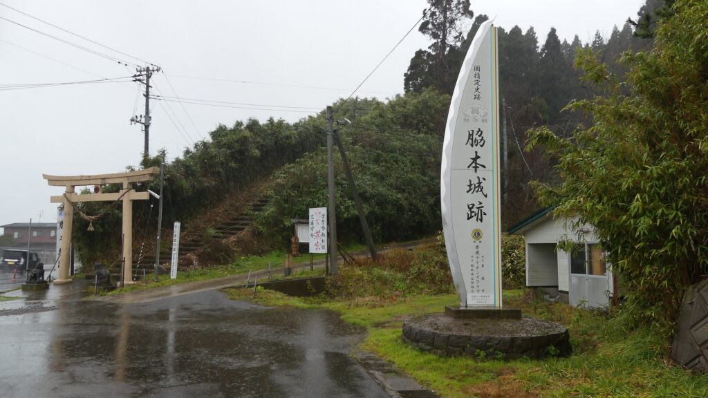
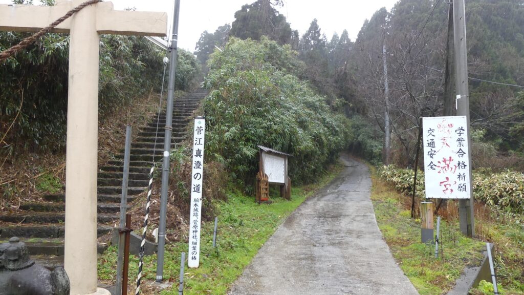
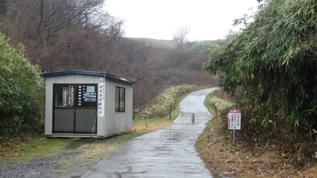
城跡の入口は国道101号線沿いにあります。車で来られた方のために駐車場があります。そこから城跡への道を登っていく必要がありますが、それはかつてからある「天下道」の一部分です。更に進んで城跡の案内所を過ぎると、丘の頂上部分が見えてきます。
The entrance of the ruins is alongside National Route 101. You can park at a parking lot if you are driving. Then, you need to walk up the road to the ruins which was part of the old road, “Tenga-michi”. When you go farther passing through the guide house of the ruins, you will see the top of the hill.

城跡の入口~The entrance of the castle ruins
残っている「天下道」~The remaining “Tenga-michi” road
案内所を越えて頂上へ~Passing the guide house to the top

生鼻崎周辺~Around Oihana-saki Cape

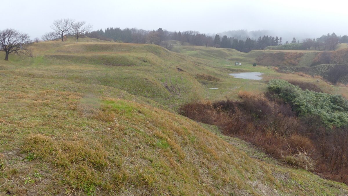
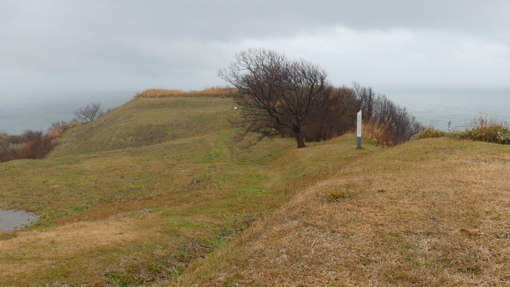
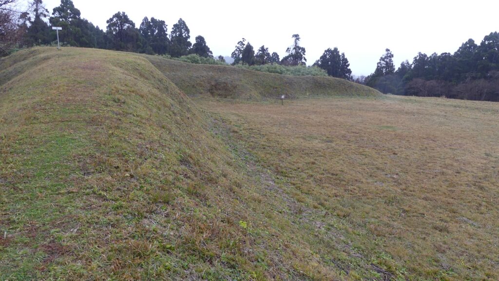
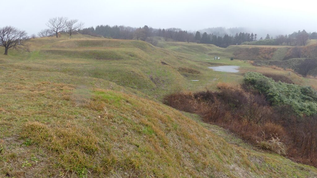
基本的に、戦国時代の東日本では、城の基礎部分は土造りでした。城跡には建物はありませんが、土塁、空堀、虎口などが残っています。丘の頂上に登ってみると、左手(西の方角)には、海に突き出ている「生鼻崎」という岬の上にたくさんの曲輪があるのがわかります。それらの曲輪は岬の先端に向かって列を作って並んでいます。実はかつてはもっと多くの曲輪が岬と共に海に伸びていたのですが、江戸時代の地震のときに崩壊してしまいました。歴史家はこれらの曲輪は安東氏の家臣の屋敷地として使われたのではないかとしています。岬の先端では、日本海の荒々しい姿が見えます。
Basically, the foundations of the castles, in eastern Japan during the Sengoku Period, were made out of soil. The ruins have no buildings, instead they have earthen walls, dry moats, entrances, etc. When you climb on top of the hill, you will see a lot of enclosures on a cape called “Oibana-saki”, sticking out to the sea on the left on the west direction. You can see that these enclosures are in lines towards the top of the cape. In fact, there were many more enclosures with the cape spread to the sea in the past, but they collapsed when an earthquake happened in the Edo Period. Historians speculate that they were used for the Ando clan’s retainers’ houses. At the top of the cape, you can also have a wild view of the Japan Sea.

内館地区の地図、現地案内板に注記~The map of Uchidate Area, from the signboard at the site, adding notes
岬に伸びる曲輪~The enclosures spreading to the cape
生鼻崎周辺の想像図、現地案内板より~The imaginary drawing around Oibana-saki Cape, from the signboard at the site
日本海の眺め~A view of the Japan Sea

城の中心部分~Center of Castle

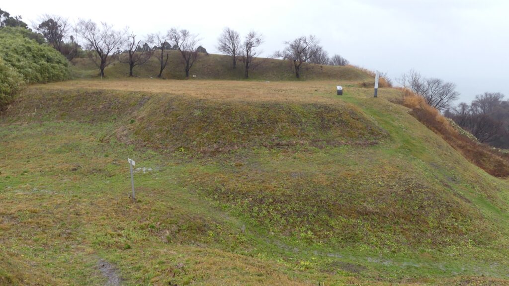
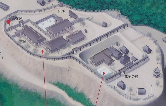
道の反対側の東の方向には、空堀に囲まれたもっと大きな曲輪があります。この辺りが、城の中心地であったと考えられます。歴史家は、北側には別々の目的で作られた2つの建物があったと推定しています。一つは公式の儀式で使われた「主殿」という建物で、もう一つはお客をもてなす「会所」という建物です。
There are two larger enclosures surrounded by dry moats on the opposite side of the route on the east direction. They are supposed to be the center of the castle. Historians also speculate that two buildings on the northern side were used for other purposes. For example one of them was used as the building for the public ceremonies called “Shuden’ and the other for hosting the guests called “Kaisho”.

城の中心部分~The center of the castle
空堀~The dry moat
北側の曲輪~The north enclosure
中心部の想像図、現地案内板より~The imaginary drawing around the center, from the signboard at the site

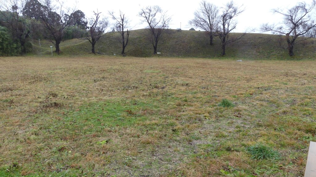
もう一つの南側の曲輪は高くて太い土塁に囲まれており、これもまたとても大きいものです。ここには城主の館があったと考えられています。愛季が住んでいたのでしょうか。この曲輪からは、海岸線とかつては城下町であった街並みの素晴らしい景色が望めます。
The other southern enclosure is surrounded by high thick earthen walls, and it is also very large one. This is thought to be used as the house of the lord. I wonder if Chikasue lived in it. From the enclosure, you can also have a great view of the coast line and the town which was once the castle town.

土塁に囲まれた南側の曲輪~The south enclosure surrounded by the earthen walls
海岸線の景色~A view of the coast line

その後~Later History

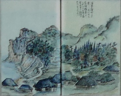
江戸時代の1804年、有名な旅行家の菅江真澄が脇本城の城跡を訪れています。彼は日記に城跡のことを記録し、スケッチも残しました。1993年からは調査が行われており、この城が非常に大きな規模であったことがわかりました。そのため、城跡は2004年に国の史跡に指定されました。
In 1804 of the Edo Period, a famous traveler, Masumi Sugae visited the ruins of Wakimoto Castle. He recorded the ruins on his diary and left his sketches of them. Investigations have been done since 1993 and it was found out that the castle had a huge scale. Because of it, the ruins were designated as a National Historic Site in 2004.

菅江真澄の脇本城のスケッチ、現地案内板より~One of Sugae’s sketches for Wakimoto Castle, from the signboard at the site

私の感想~My Impression

私が脇本城跡に行ったときは、ひどい天気でした。更に「内館」地区しか行っていません。それでもこの城跡が大変な規模だということは言えます。もし晴れた日に十分時間が取れれば、もっと城跡を満喫できると思います。他の有名な城に比べてこの城の研究は始まったばかりです。この城から新たな発見がもたらされるのが楽しみです。
When I visited the ruins of Wakimoto Castle, the weather was very bad. In addition, I saw only one area called “Uchidate”, but I was able to witness the large scale of the ruins. If you have enough time to visit the ruins in a fine day, you can enjoy them more! I think the study for the castle have just started compared with other famous castles. I will be looking forward to seeing the new discovery from the castle.

岬側からの城跡の風景~A view of the castle ruins from the cape

ここに行くには~How to get There

車で行く場合:秋田自動車道昭和男鹿ICから約30分かかります。城跡の入口に駐車場があります。
電車の場合、JR男鹿線脇本駅から城跡まで歩いて約30分かかります。
東京から脇本駅まで:新幹線に乗り、秋田駅で男鹿線に乗り換えてください。
If you want to go there by car: It takes about 30 minutes from the Showa-Oga IC on Akita Expressway. There is a parking lot at the entrance of the ruins.
By train, It takes about 30 minutes from Wakimoto Station on JR Oga line to the ruins on foot.
From Tokyo to Wakimoto Station: Take the Shinkansen super express and transfer to Oga line at Akita Station.

リンク、参考情報~Links and References

脇本城跡、男鹿市観光協会(Oga city tourism association)
・「日本の城改訂版第150号」デアゴスティーニジャパン(Japanese Book)
・「土崎港(秋田港)の「みなと文化」/渡辺英夫」(Japanese Paper)

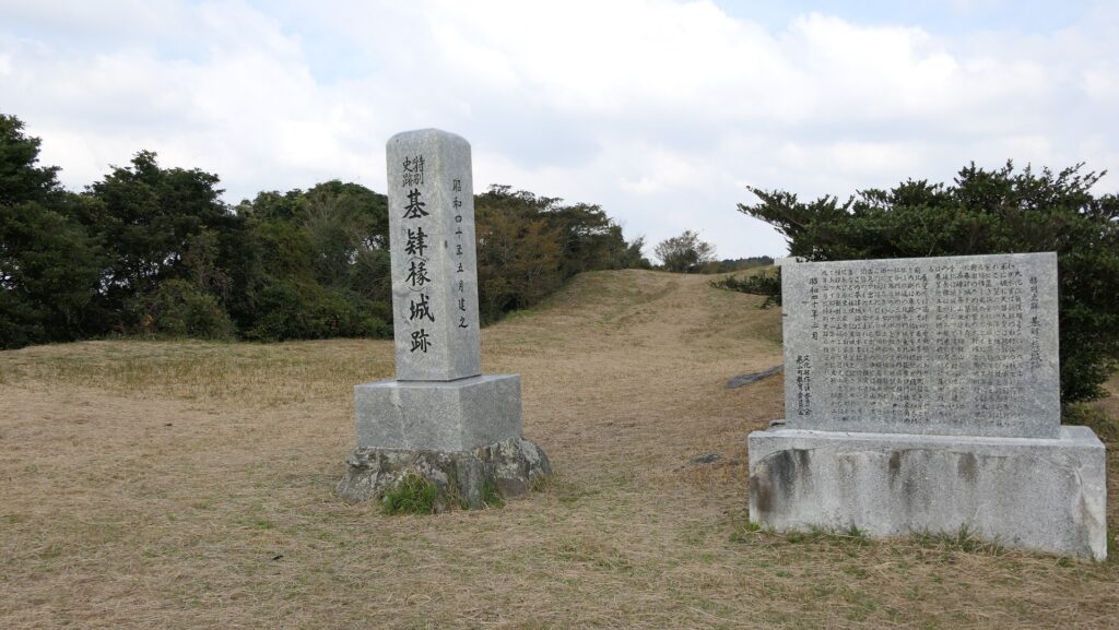
184.基肄城~Kii Castle

見張り台のような城
A castle like a lookout

立地と歴史~Location and History

古代山城の一つ~One of Ancient Mountain Castles

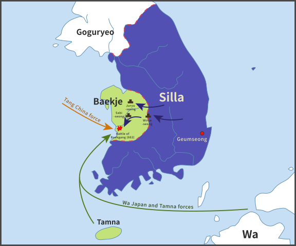
基肄城は、西日本にあった古代山城の一つです。663年に朝鮮で起きた白村江の戦いの後、朝廷により築かれました。日本は百済を助けようとしましたが、唐と新羅の連合軍に敗れたのです。天智天皇は、この連合軍による将来の侵攻の可能性を恐れ、百済からの難民の助けも借り、これらの城の築城を命じたのです。そのため、これらの城は「朝鮮式山城」とも呼ばれています。
Kii Castle is one of ancient mountain castles in western Japan. It was built by the Imperial Court after the Battle of Baekgang, Korea in 663. Japan tried to help Baekje, but was beaten by the ally of Tang and Silla. Emperor Tenchi, worried by the future possibility of invasion by this alliance, ordered the construction of these castles with the help of Baekje refugees. That’s why these castles are also called “Korean style mountain castles”.

白村江の戦いの図~The map about the Battle of Baekgang(licensed by Samhanin via Wikimedia Commons)

城特有の役割~Castle’s own Role

基肄城は、九州地方で記録がある五つのうちの一つです。その他は、大野水城麹池、そして金田です。それぞれの城には独自の役目がありました。基肄城は、物見のための城だったように思います。もし、連合軍が日本を攻めた場合、2つの考えられる侵攻ルートがありました。両方とも最初は金田城が築かれた対馬海峡にある対馬は通るでしょう。そして、壱岐島の辺りで2つに分かれることが推測され、一つは北の方角から博多湾経由で福岡平野に上陸し、もう一つは西の方角から有明湾経由で佐賀平野に上陸するものです。
Kii Castle was one of the five recorded ones in Kyushu region. The others were Ono, Mizuki, Kikuchi, and Kaneda. Each castle had its own role. I think Kii Castle was kind of a lookout castle. If the ally were to attack Japan, there would be two possible routes to enter from. Both would first pass through Tsushima Island on Tsushima Strait where Kaneda Castle was built. There are speculations that the routes may be divided around Iki Island, one would land on the Fukuoka plain through Hakata Bay from the north direction, and the other would land on the Saga plain through Ariake Bay from the west direction.

九州地方の5つの記録された古代山城の位置~The location of five recorded ancient mountain castles in Kyushu region

基山(標高404m)の上にあり、その頂上からは福岡、佐賀両平野が見渡せます。この城は主に佐賀の防衛の備えとされ、一方水城は福岡の方の備えとされました。基山には3つの峰(山頂、北峰、東峰)があり、南方になる谷を取り囲んでいました。それらの峰に沿って土塁が築かれ、その総延長は3.9kmありました。南側の谷には石垣が築かれ、排水口により水量を調整していました。城には4つの門があり、内側には倉庫や兵舎など多くの建物がありました。
Kii Castle was built on Kizan mountain (404m above sea level) and from its top both the Fukuoka and the Saga plains are visible. It was mainly prepared for the protection of Saga, while Mizuki was built for the protection of Fukuoka. Kizan mountain has three ridges (the top, the North Peak, and the East Peak) surrounding the valley on the south. The earthen walls were built along the ridges whose overall length was 3.9km. The stone walls were also built on the southern valley which had drains to control water. The castle had four gates and lots of buildings inside such as warehouses and barracks.

城周辺の起伏地図~The relief map around the castle

戦国時代に再利用~It was reused in Sengoku Period

古書によれば、基肄城は665年に築かれ、698年に修繕されました。結果的には連合軍は幸いにも日本を攻撃しませんでした。城の倉庫や兵舎は8、9世紀頃はで使われたとする歴史家もいます。15、16世紀頃、戦国時代として知られる時期には、その立地の良さから戦国大名によって再び城は使われました。
Old books say that Kii Castle was built in 665, and repaired in 698. As a result, the ally fortunately did not attack Japan. Some historians believe that the castle’s warehouses and barracks were used until around the 8th and 9th centuries. Around the 15th and 16th centuries which is also sometimes known as “Sengoku” Period or the Warring State Period, the castle was used again by some warlords, because of its good location.

戦国時代の城跡~The ruins of the castle in the Sengoku Period

特徴~Features

現在(2021年2月)、城跡の中心部に入ることと、全体を歩き通すことはできません。2018年の西日本での豪雨によりこの辺りが深刻な被害を受けたからです。行政がこの地域の道路と山道の通行を禁止しているのです。このため、観光客は行政が許可したいくつかの地点のみ見ることができます。それでは、現在行くことができる2つの地点をご紹介しましょう。
Now (in February 2021), it is impossible for anyone to enter the center of the castle ruins, and walk straight through the whole area. This is because the area was seriously destroyed by the heavy rain in western Japan in 2018. The local government bans the use of roads and trails in that area. For this reason, visitors are able to see only some spots that the Local Government has opened. I will describe two spots you can visit now.

城周辺の地図~The map around the castle

基山山頂~Summit of Kizan

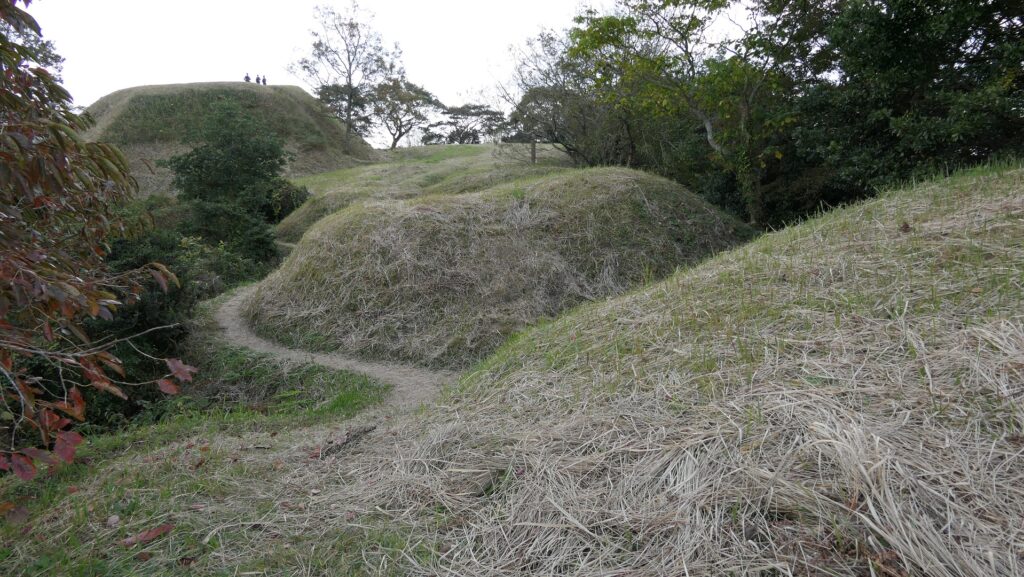
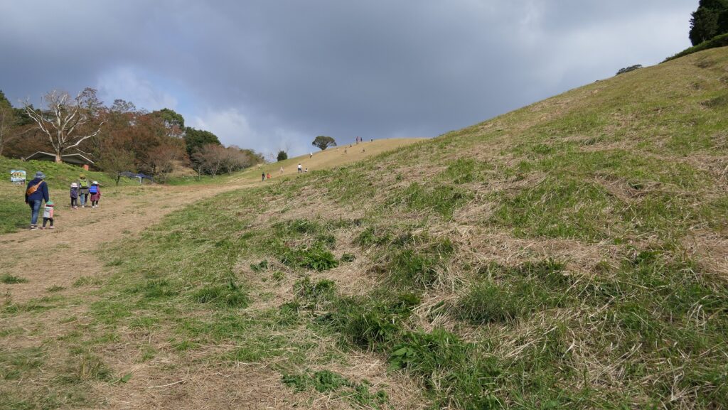
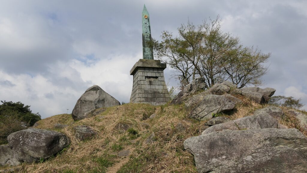
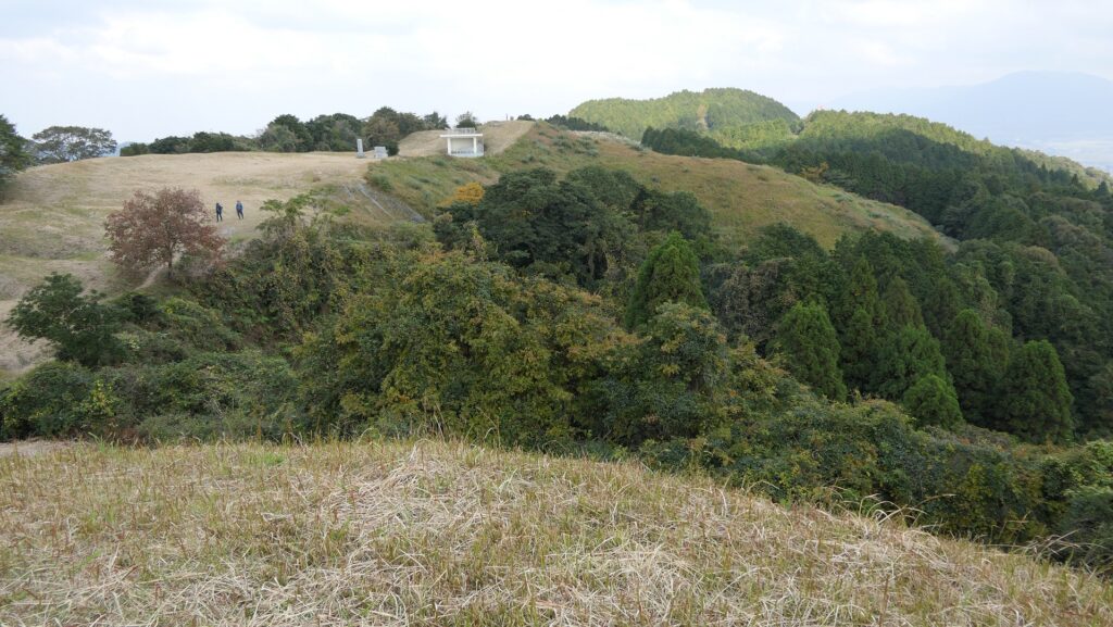
ここは城の最高地点だった所で、土塁の西側部分に当たります。そしてまた戦国時代の城の本丸でもありました。その外側は急坂になっていて、現在ではグラススキー場のゲレンデとして使われています。山頂の麓には駐車場があり、城跡を訪れる際駐車することができます。15分程山頂の方に登っていくと、その途中に沢山の溝が見えてきます。それは何か入口のように見えるかもしれませんが、実は戦国時代の城主により作られた「いものがんぎ」と呼ばれる空堀跡なのです。
This was the highest spot of the castle and the western part of the earthen walls, as well as the Main Enclosure of the castle in Sengoku Period. The outside is steep slope, so it is now used as a grass ski ground. There is a parking lot on the foot of the summit where you can park your cars while visiting the ruins. Its 15 minutes climb to the top and on the way you will see many ditches . You may think they are some of the entrances, but they are, in fact, ruins of dry moats called “Imono-gangi”, made by the lord of the Sengoku castle.

土塁外側の急坂~The steep slope outside of the earthen walls
「いものがんぎ」と呼ばれる空堀跡~The ruins of dry moats called “Imono-gangi”

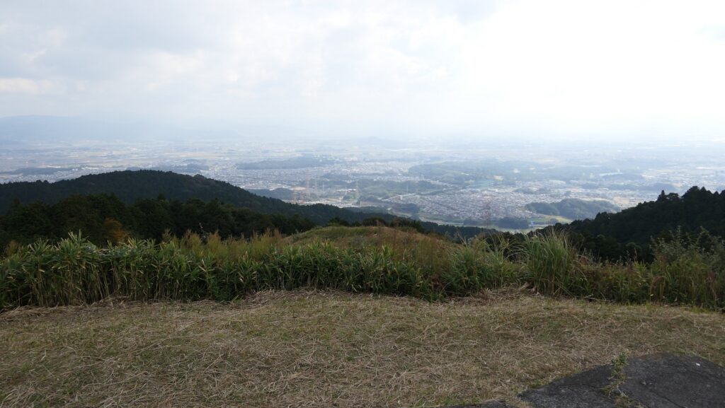
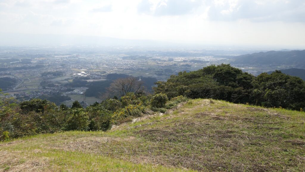
その空堀を越えていくと、土塁の上のよく開けた場所に至ります。土塁は南北に走っています。北の方角には基肄城を示す標識があり、福岡平野を望むことができます。
Over the dry moats, you will enter the widely open area, on the earthen walls. You can see the ridge of the mountain, the earthen walls, that goes both north and south. You can also have a view of the Fukuoka plain with the signboard of Kii Castle on the north.

基肄城の標識~The signboard of Kii Castle
福岡平野の眺め~A view of the Fukuoka Plain

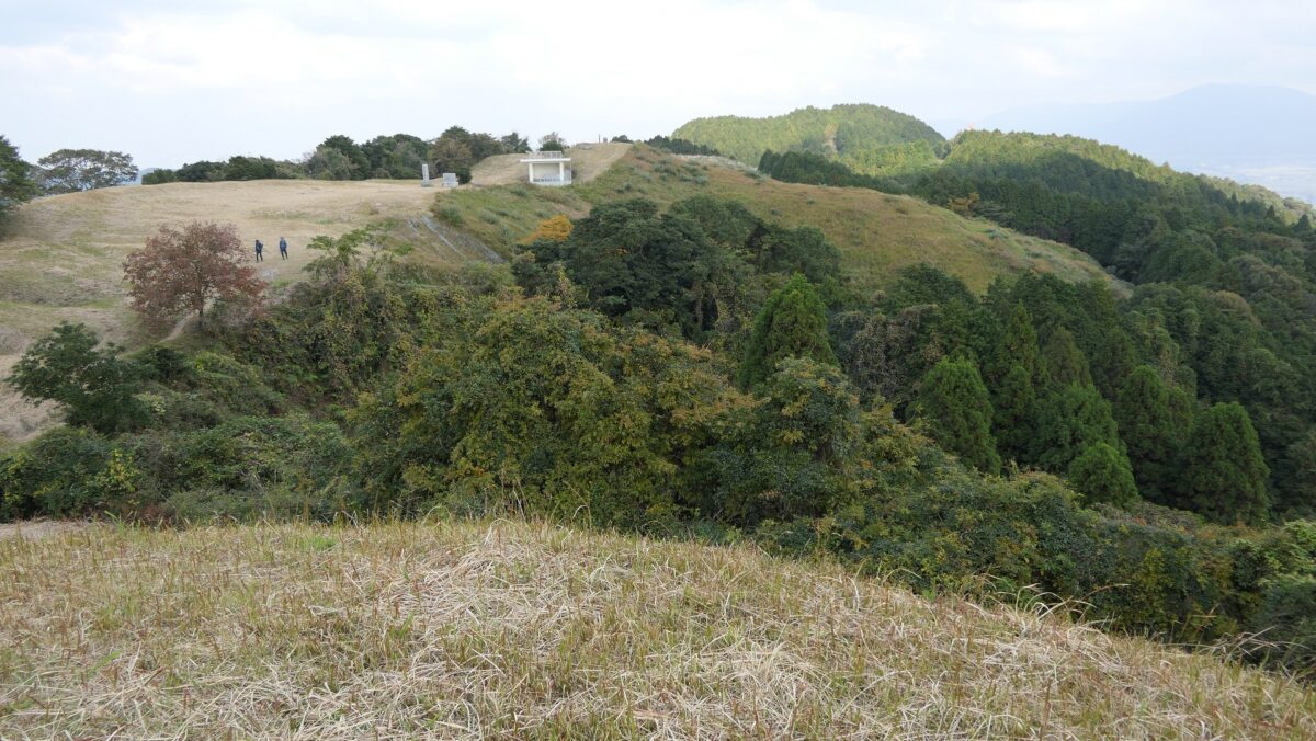
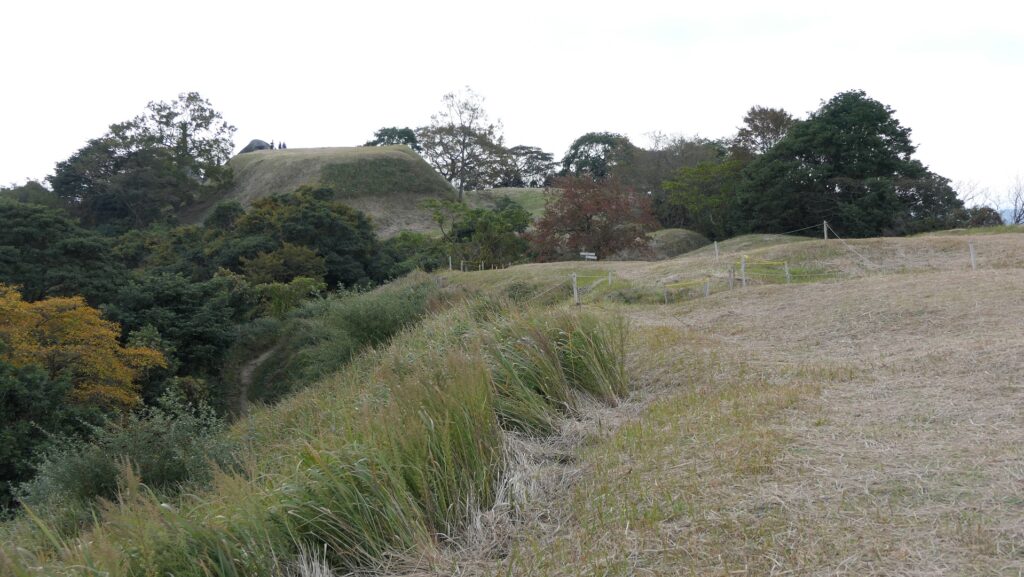
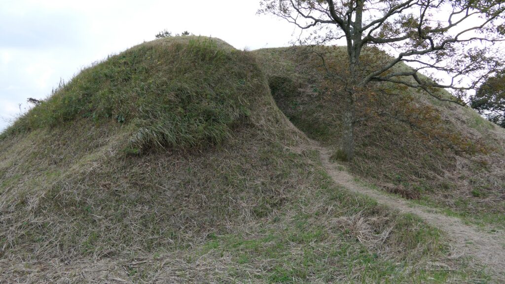
次に、反対側の南の方角に向かってみると、人工の土盛りが見えてきます。これらは戦国時代の本丸の跡なのです。この本丸は山の頂に作られたのです。もう一つ、天智天皇に関わる記念碑がここにあります。山頂からは、佐賀平野を見渡すことができます。
Next, if you go to the opposite side on the south, you can find artificial mounds, which are also the ruins of the Main Enclosure in Sengoku Period. The Enclosure is situated on the top of the mountain. There is another monument for Emperor Tenchi. You can also see the Saga plain from the top.

南の方角を見る~Lookng at the south direction
戦国時代の本丸跡~The ruins of the Main Enclosure in Sengoku Period
天智天皇の記念碑~The monument for Emperor Tenchi
佐賀平野の眺め~A view of the Saga Plain

水門跡~Ruins of Water Gate

この場所は、城の南の部分に当たり、谷を埋めるため、水門と共に石垣が築かれました。石垣と水門の一部が今に残っています。ここに行くには違う道筋を進む必要があります。現存の石垣は全長26m、高さ8.5mあります。水門は石垣の下に設置され、住吉川の水を内側から外側に排出しています。
This spot was located on the southern part of the castle where the stone walls were built with the water gate to fill the valley. Part of the stone walls with the gate remain now. To visit them, you have to take a different route. The remaining stone walls are 26m long and 8.5m tall. The water gate is placed under the wall to drain the water of Sumiyoshi-gawa River from the inside to the outside.

水門跡~The ruins of the water gate(licensed by Wxrx via Wikimedia Commons)

その後~Later History

江戸時代(18、19世紀頃)においてでも、人々は基肄城が古代の遺跡であることを認識していました。というのは、公式の歴史書である「日本書紀」にこの城のことが記録されていたからです。城跡は最終的に1954年に国の特別史跡に指定されました。
Even in the Edo Period (around the 18th and 19th centuries), people recognized Kii Castle as ancient ruins, because the castle have been recorded in an official history book called “Nihon-Shoki”. The ruins were finally designated as a Special National Historic Site in 1954.

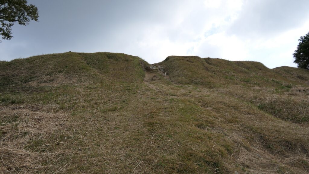
基肄城の土塁~The earthen walls of Kii Castle

私の感想~My Impression

私が基山山頂を訪れたとき、その山頂からは福岡・佐賀両平野の素晴らしい景色が見えました。そのときこの城はとても良い立地にあることが理解できたのです。役所によると城跡の中心地の道路は2022年3月までに復旧するとのことです。その後またこの城跡を訪れてみたいと思います。
When I visited the summit of Kizan, and saw great views both of the Fukuoka and Saga plains from the top, I really found out the castle had a very good location. The local government says that the roads in the center of the ruins will be repaired by March 2022. I would like to visit them again after that.

基山山頂付近~Around the top of Kizan mountain

ここに行くには~How to get There

ここには車で行くことをお勧めします。
九州自動車道の筑紫野ICから5km以内のところです。
もし基山町役場に立ち寄ることができれば、職員の方が城跡への道のりを詳しく教えてくれます。
I recommend you to go there by car at this point.
The ruins are within 5 km away from the Chikushino IC on Kyushu Expressway.
If you drop by at the Kizan Town hall, the officials will offer you the detailed routes to the ruins.

リンク、参考情報~Links and References

基肄城跡、基山町(Kizan Town Official Website)