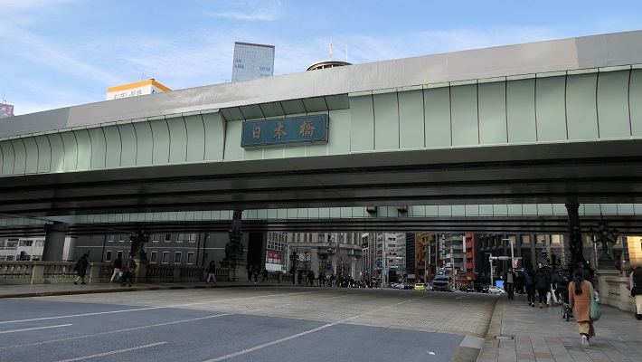
立地と歴史~Location and History
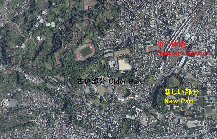
小田原城は大まかに、「八幡山古郭」と呼ばれる古い西側の部分と、通常「小田原城」と呼ばれている新しい東側部分に分けられます。新しい方は、JR線から簡単にアクセスでき、小田原駅の南側にあります。この城は最初は中世に大森氏により築かれたと言われています。
Odawara Castle can roughly be divided into an older western part called “Hachimanyama-Kokaku” and a new eastern part, which we now usually call “Odawara Castle”. The new part can be easily accessed by JR railways, and is located the south of Odawara Station. It is said that the castle was first built by the Omori clan in the Middle Ages.
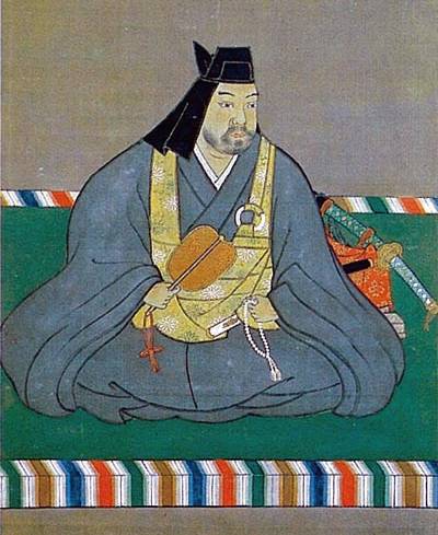
また、北条早雲が伊豆国(現在の静岡県東部地方)から来て大森氏から城を奪ったとも言いますが、詳細は不明です。戦国時代には、北条氏がこの城を本拠地として使いました。新しい部分の方に館を構え、古い部分の方は籠城するときに使われたようです。
It is also said that Soun Hojo from Izu Province (now the eastern part of Shizuoka Pref.) seized it from the Omori, but these details are uncertain. During the Warring States Period, the Hojo clan utilized the castle as their home base. It seems they lived in the hall in the new part and used the older part for besieged.
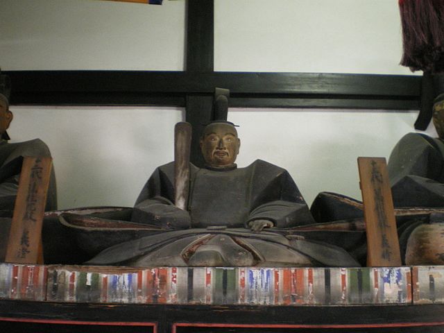
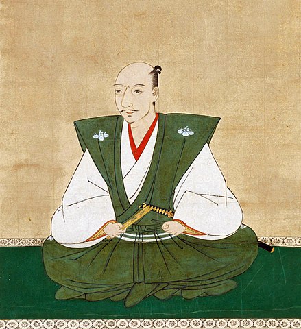
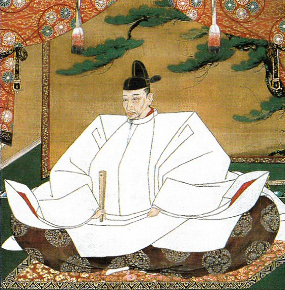
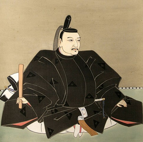
この城は3回籠城戦を経験しました。まず上杉謙信、次には武田信玄によるものです。2人ともよくその強さを知られた戦国大名ですが、北条は両方とも城を守り切ることに成功しました。最後の3回目は、天下人の豊臣秀吉による名高い1590年の小田原征伐と呼ばれる戦いです。
The castle was besieged three times. First, by Kenshin Uesugi. Second, by Shingen Takeda. While both are well known strong warlords, the Hojo were successful in defending the castle both times. The third and last one was the famous Siege of Odawara in 1590 by the ruler Hideyoshi Toyotomi.
北条は秀吉と戦いたくありませんでした。この戦いが始まったのは、秀吉が決定した北条と真田の領地の取り決めを、北条が破ったからだと言われています。しかしある歴史家は、秀吉は最初から北条と戦って排除するために騙したのだと主張しています。私は、その方が妥当と思います。
Hojo didn’t want to fight with Hideyoshi. It is said that the battle started with Hojo defying Hideyoshi’s decision of the territories of Hojo and Sanada. However, a historian argues that Hideyoshi tried to fight and exclude Hojo from the first, then deceived them. I’d rather prefer the later.
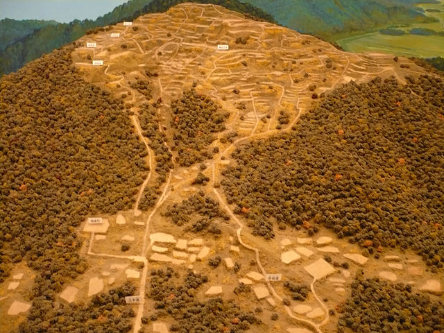
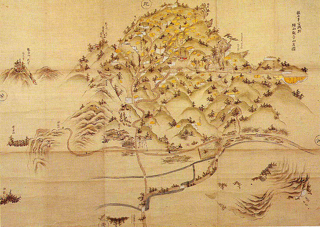
どちらにしろ、戦いの前に北条は城下町を含む城全体を、巨大な土塁と空堀で囲みました。これを「総構え」といいます。その外周は約9kmあり、一部は二重三重に囲まれていました。秀吉は、20万以上の軍勢をもって3ヶ月間城を取り囲みました。
Anyway, before the battle, Hojo surrounded the whole area including the castle town by huge earthen walls and trenches called “So-gamae”. Their perimeter was about 9 km and part of them were doubled or tripled. Hideyoshi laid siege to the castle with over 200,000 soldiers for three months.
籠城している間に、ほとんどの北条の支城は落城しました。多くの歴史家は北条は成す術がなかったと言います。一方では、秀吉側は一兵たりとも小田原城の中には侵入できなかったのです。事実、秀吉自身がこの戦いの後、彼の大坂城でこの城を真似ています。この戦いに参加した多くの他の大名も同様でした。
During the siege, most of Hojo’s branch castles were captured. Many historians say there was nothing for Hojo to do. On the other hand, any soldier on Hideyoshi side was not able to invade the inside of Odawara Castle. In fact, Hideyoshi himself emulated the castle for his Osaka Castle after the battle. Many other lords who joined the battle did so too.
北条は、秀吉に降伏した後改易となりました。しかし秀吉は味方に対しても過酷でした。彼は徳川家康に対して、領地に戻ることなくそのまま北条の領地に移るよう命令しました。織田信雄もまた移封を拒んだため改易となります。江戸時代には、城の領域は新しい部分だけに縮小し、小田原藩に属しました。
Hojo got fired after he surrendered to Hideyoshi, who was also cruel to his supporters. He ordered Ieyasu Tokugawa to directly move to Hojo’s territory without returning home. Nobukatsu Oda was also fired because he rejected his transfer. In the Edo Period, the castle was reduced to the new area belonging to Odawara Domain.

特徴~Features
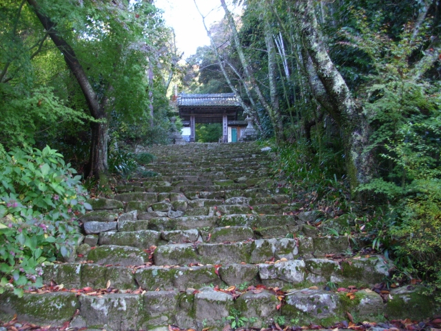
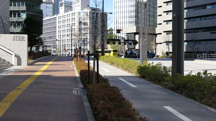
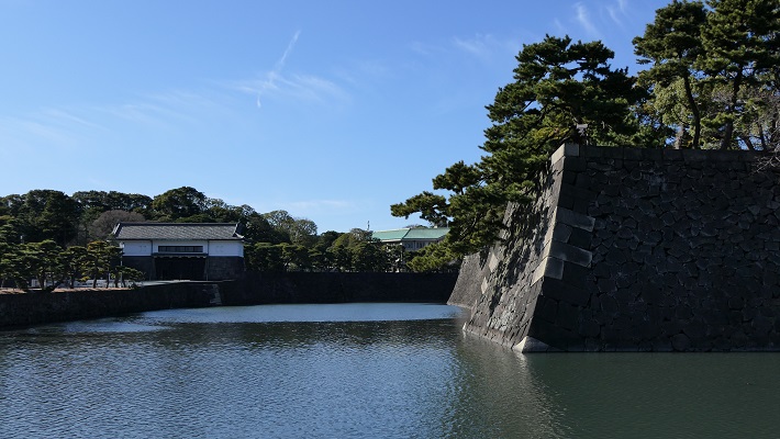
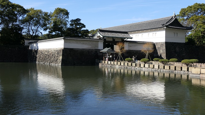
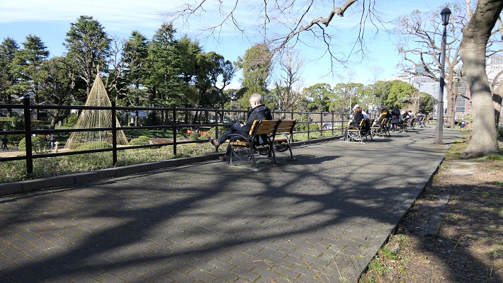
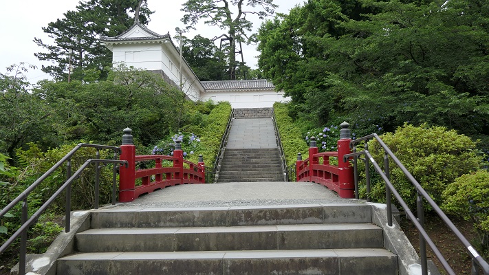
現在、小田原駅の東口からは、JRの線路に沿って小田原城の本丸まで近道で行くことができます。もし時間があれば、正面の方に向かって、それからお城端通りを右に曲がってください。その内に二の丸に着きますが、ここは最近整備計画が完了したところです。
Now, from the east entrance of Odawara Station, you can take a shortcut directly to the Honmaru enclosure of Odawara Castle along the JR railways. If you have time, I recommend going towards the front, then turn right on Oshirobata Street. You will reach the Ninomaru enclosure where the development project was done recently.
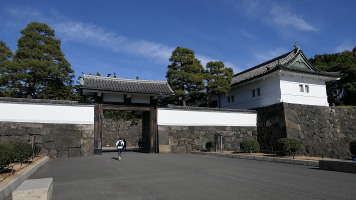
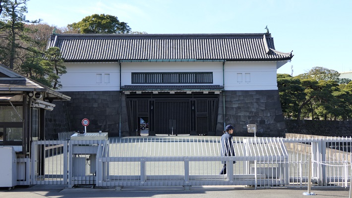
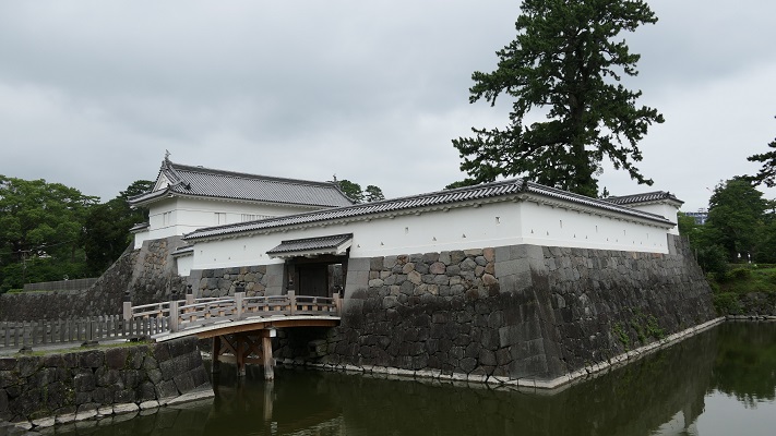
城への登城ルートが再現されていて、復元された馬出門と銅門を通ります。これらは、古写真や図面などを基に復元されました。
The original route to the castle has been recreated with the restored Umafdashi-mon Gate and Akagane-mon Gate. They were restored based on old photographs, drawings and so on.

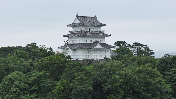
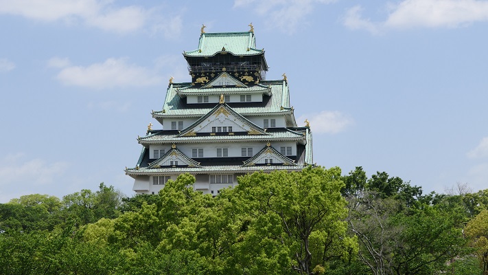
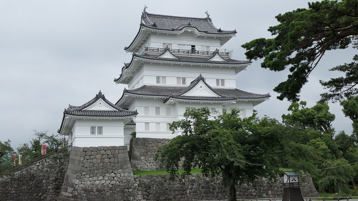
そこから更に登っていくと、常盤木門を通り過ぎて天守に到着します。両方とも昭和時代に外観復元されたものです。
You can go up further and arrive at the Tenshu keep passing through the Tokiwagi-mon Gate. Both of them were apparently restored in the Showa Era.

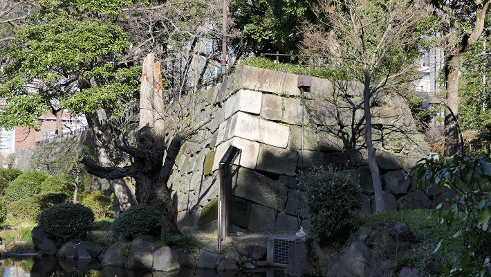
天守は博物館としても使われています。左後方から戻ってくると、1923年の関東大震災で崩れたままになっている本丸石垣も見ることができます。
Tenshu is also used as a museum. If you return taking the left back route, you can also see abandoned stones which collapsed from Honmaru stone walls when Great Kanto Earthquakes in 1923 happened.
古い方の小田原城にご興味があるのでしたら、近くにいくつか遺跡があります。
If you interested in the older part of Odawara Castle, there are few ruins near it.
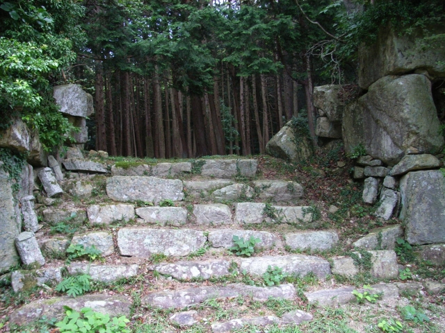
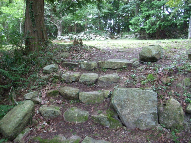
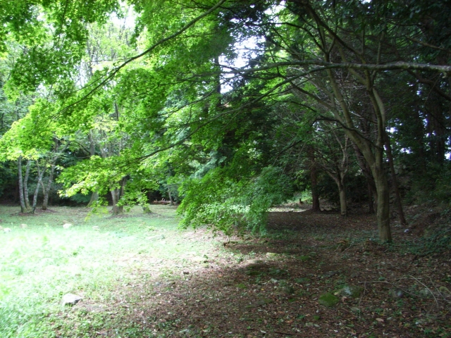
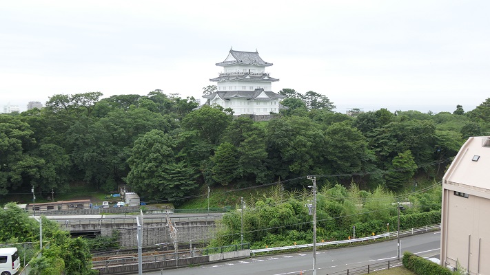
・八幡山古郭東曲輪:ここは古城の端に当たりました。最近整備されて一般公開されています。ちょっと地味に見えますが、ここからは海を背景に天守の写真を撮ることができます。ここはちょうど線路を挟んで天守の反対側にあるからです。
・The Eastern Enclosure of Hachimanyama-Kokaku: It was the edge of the old castle. It has been developed recently and open to the public. It still seems to be simple, but you can take a picture of Tenshu with the background of the sea because of its location being just the opposite of Tensh across from the railways.
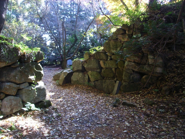
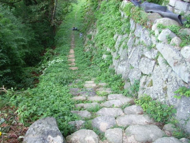
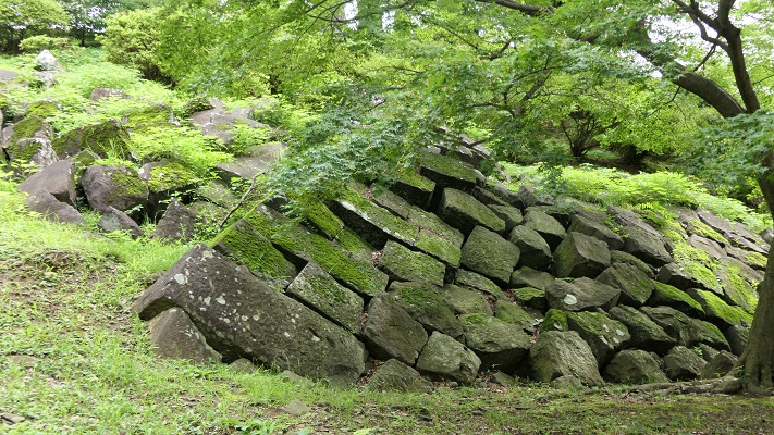
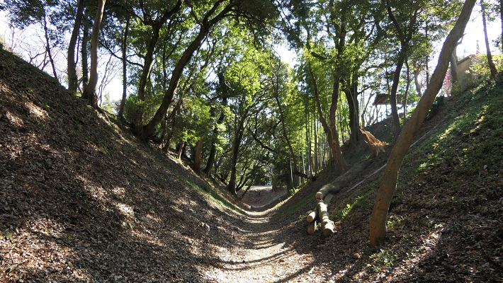
・小峰大堀切:ここは「総構え」の数少ない遺構の一つです。この遺構のうち、「東堀」は約170mの長さがあり、一部曲がりくねっています。堀の底を歩いて通り抜けできるので、大きさを実感できます。小田原城下全体をこのような壮大な仕掛けで取り囲んでいたのです。
・Komine large-scale trenches: They are a few remaining ruins of “So-gamae”. Out of them, The East Moat “Higashi-bori” is about 170m long and partly zigzagged. You can walk through the bottom of the trench and feel how large it is. Imagine such huge structures surrounded the whole of Odarwara City!

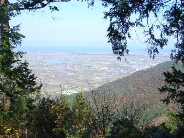
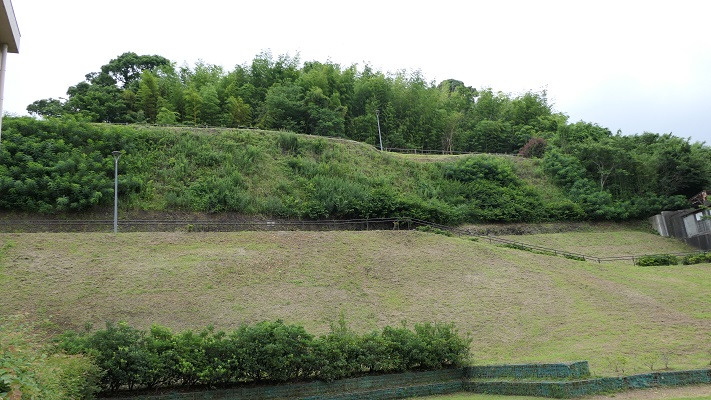
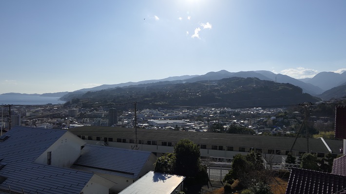
・三の丸外郭新堀土塁:こちらは2012年から公開されている場所です。第二次世界大戦前まで皇族の閑院宮家の別荘でした。戦後になって、小田原市がある機関から購入しました。ここからは、小田原周辺の山や海を一望に見渡せます。秀吉が本陣を置いていた石垣山城も見えます。
・Sannomaru outline Shinbori earthen walls: They have been open since 2012. The ground was used for the second house of the Imperial Family Kaninnomiya before World War II. After the war, Odawara City bought it from an institution. You will have a great view of mountains and the sea around Odawara including the ruins of Ishigakiyama Castle where Hideyoshi built his stronghold.

その後~Later Life
明治維新後、ほとんどの城の建物は撤去されました。明治中期には、城跡は御用邸の一つとして使われましたが、関東大震災で壊滅してしまいます。その後、小田原城址公園として整備されました。天守は1960年に再建されますが、それまでは天守台の上に観覧車がありました。
After the Meiji Restoration, most of the castle buildings were demolished. In the mid Meiji Period, the ruins of the castle were used as one of the Imperial Villas, but the Great Kanto Earthquakes broke all of them. After that, they were developed as Odawara Castle Park. Tenshu keep was rebuilt in 1960 after a Ferris wheel was installed on the Tenshu base.

私の感想~My Impression
日本語には「小田原評定」という比喩表現があり、延々結論が出ない会合のことを指します。北条は3ヶ月の間降伏するか否か逡巡していたと思われたのでしょう。ところがこの表現は、この戦いから100年以上後の江戸時代の軍記物により最初に広まったのです。滅びた北条は反論できません。
In Japanese, there is a figurative expression called “Odawara Hyojo” which means an inconclusive conference. People think Hojo wondered if they should surrender or not during the three month siege. However, the expression first spread more than 100 years after the battle in war chronicles of the Edo Period. The defeated Hojo couldn’t argue that.
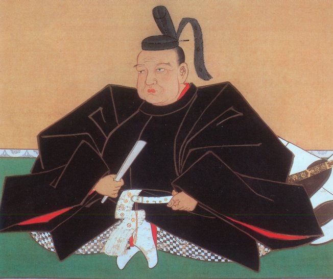
守備側の主な2つの選択肢としては、援軍を待つか、攻撃側を撃退するかでしょう。私は、北条は同盟を結んでいた伊達政宗の援軍を待っていたのだと思います。しかし、正宗はついには秀吉に臣従してしまい、一方秀吉を撃退することも不可能でした。残ったのはいかに降伏するかです。実際、北条の降伏とその条件を交渉する使者が行き来していました。その条件は、北条は一部の領地を維持できるものであったと言われています。北条はそれを受け入れましたが、最終的には再び騙されてしまったのです。
The two major options for defenders are to wait for reinforces or to repel the attackers. I think that Hojo was waiting for Masamune Date who was once their ally, but finally served Hideyoshi as a vassal. The other option, beating Hideyoshi back was impossible. The rest was how they surrendered. Indeed, some messengers suggested Hojo surrender and negotiate conditions. It is said that the condition might allow Hojo to keep part of their territory. Hojo accepted that, but they were deceived again in the end.
ここに行くには~How to get There
新しい方の「小田原城」または八幡山古郭東曲輪に行くには:
電車の場合は、小田原駅から徒歩で約10分です。車の場合は、西湘バイパス小田原ICから約5分です。小田原城址公園周辺に私営の駐車場があります。
小峰大堀切または三の丸外郭新堀土塁に行くには:
電車の場合は、小田原駅から徒歩で約20~30分です。車の場合は、小田原厚木道路荻窪ICから約5分です。遺跡近くの城山公園に駐車可能です。
To the new “Odawara Castle” or The Eastern Enclosure of Hachimanyama-Kokaku:
When using train, it takes about 10 minutes on foot from Odawara Station. When using car, it takes about 5 minutes from the Odawara IC on Seishou Bypass. There are private parking lots around Odawara Castle Park.
To Komine large-scale trenches or Sannomaru outline Shinbori earthen walls:
When using train, it takes about 20 to 30 minutes on foot from Odawara Station. When using car, it takes about 5 minutes from the Ogikubo IC on Odawara-Atsugi Road. You can park at the Shiroyama Park near the ruins.
リンク、参考情報~Links and Refernces
・【公式】小田原城 難攻不落の城~【Official】Odawara Castle Immortal Castle
・小田原市、まち歩きパンフレット~Odawara City, Town walk brochure
・小田原城街歩きガイド(Only Japanese)
・「北条氏滅亡と秀吉の策謀、森田善明著」洋泉社(Japanese Book)
・「よみがえる日本の城2」学研(Japanese Book)