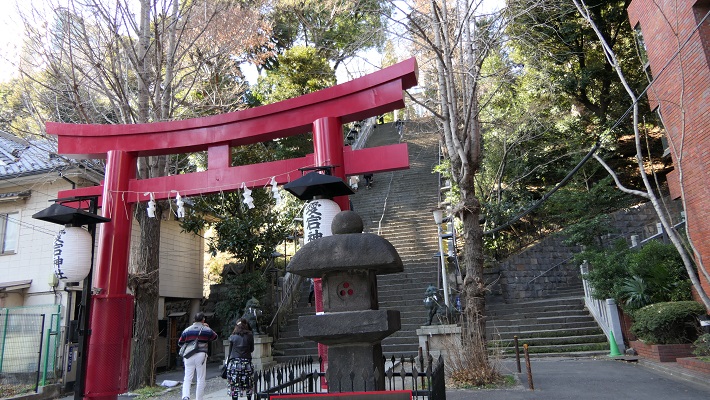
立地と歴史~Location and History
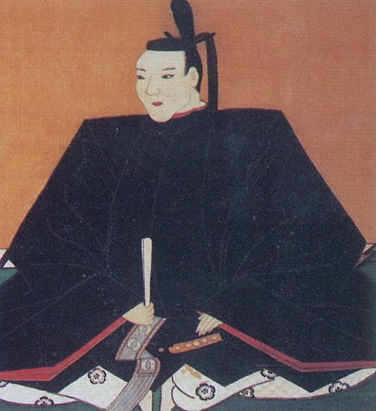
島根県の松江市は、松江城の城下町を由来としています。城の歴史は江戸時代の初期に始まりました。1600年に堀尾忠氏が出雲・隠岐両国(現在の島根根県の一部)の領主として置かれました。
Matsue City in Shimane Prefecture comes from the castle town of Matsue Castle. The history of the castle started at the beginning of the Edo Period. Tadauji Horio was placed as the lord of Izumo and Oki Provinces (part of what is now Shimae Pref.) in 1600.
忠氏は最初は当時最も防御に優れていた山城の一つ、月山富田城に住んでいたのですが、統治や交通の便はよくありませんでした。そこで、彼は本拠地を移すことを決め、父親の吉晴とともに新しい城の建設を開始しました。それが松江城だったのです。
Tadauji first lived in Gassan-Toda Castle which was one of the most protective mountain castles at that time, but it was not convenient for governance and transportation. Then he decided to move his home base and launched to build a new castle with his father, Yoshiharu. That was Matsue Castle.
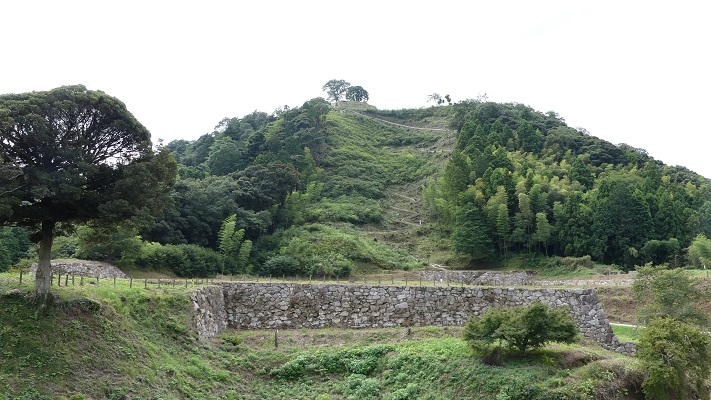
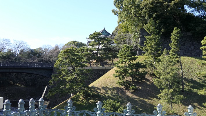
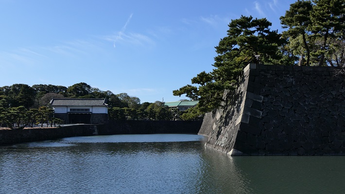
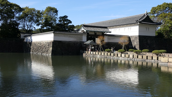
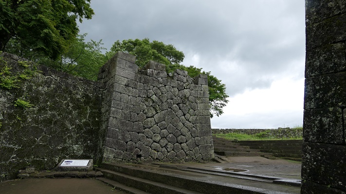
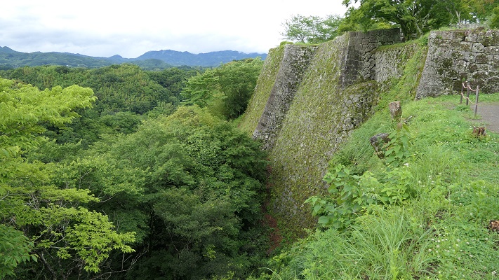
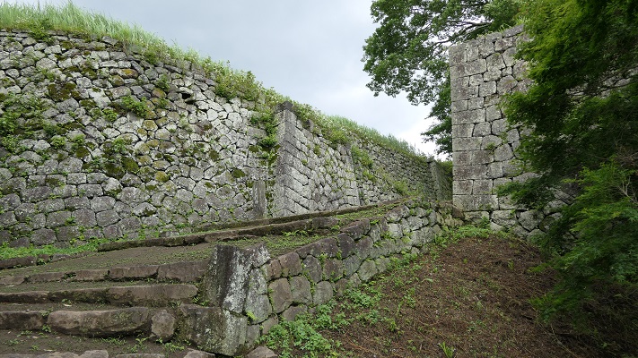
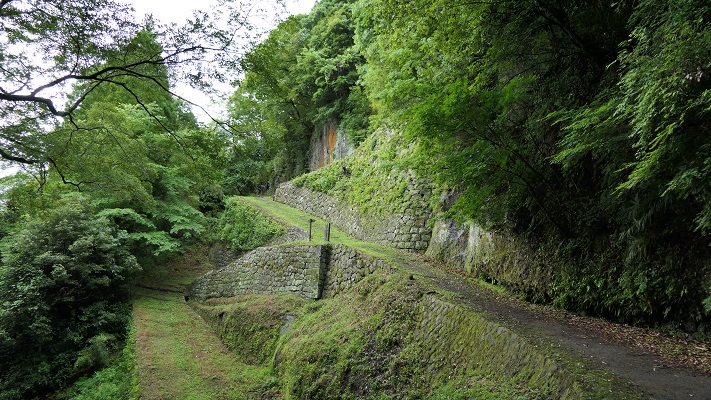
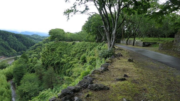
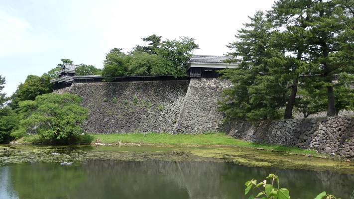
松江城は宍道湖の近く、太田川に沿った亀田山という小山の上にありました。城は南方は太田川に面しており、北方は山を削り堀を穿ち、防御を固めました。堀尾は城下に町を作り、それは川をまたいでいました。これにより民衆や産業を支配下に収めました。天守を含む城は、1611年に完成しました。
Matuse Castle was located on a hill called Kamedayama alongside Otagawa River, near Shinji Lake. The castle faced the river in the south, cut the mountain and dug a moat in the north making it very defensive. Horio created the castle town below the castle, across the river. They were able to get people and industries under control. The castle including Tenshu keep was completed by 1611.
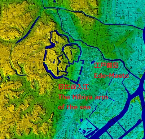
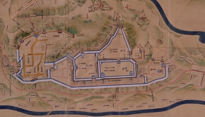
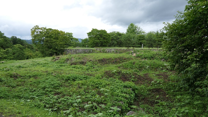
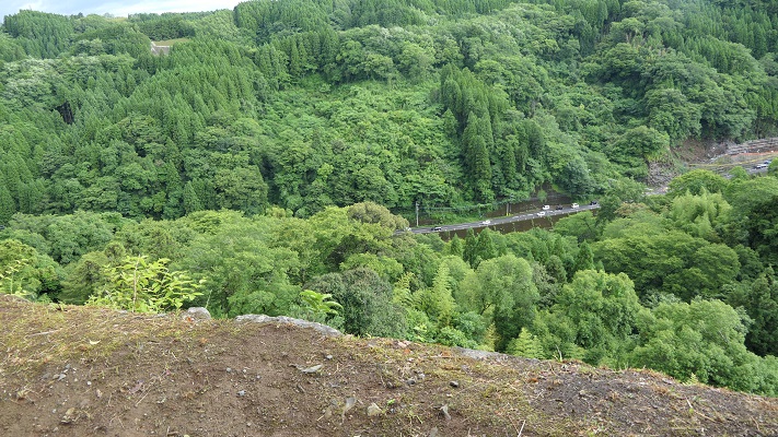
城周辺の起伏地図~The relief map around the castle
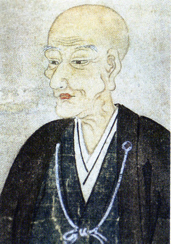
松江藩と呼ばれたこの地域の領主は京極に、最後は1638年に松平氏に代わりました。松平の統治は200年以上続きます。松江は文化面でも繁栄しました。一例を挙げると、7代目の藩主、松平不昧は有名な茶人でした。彼は茶事に使う名器を調べ上げ、情報を体系化したのです。江戸時代も後半になると、領主は平地の三の丸にある御殿に住んでいました。小高い本丸にある天守は、倉庫として使われていたようです。
The lords of the area called Matsue Domain were changed to Kyogoku, lastly Matsudaira clan by 1638. The governance of Matsudaira lasted for over 200 years. Matsue flourished in culture as well. For example, the seventh lord of the domain, Fumai Matsudaira was a famous master of tea ceremony. He researched noted items for tea ceremony and organized their information. In the late Edo Period, the lords lived in the hall in plain Sannomaru. The Tenshu keep on hilly Honnmaru seemed to be used for a warehouse.

特徴~Features
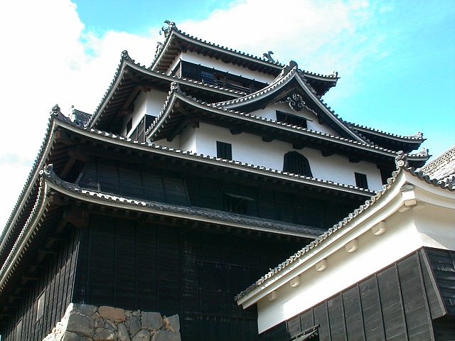
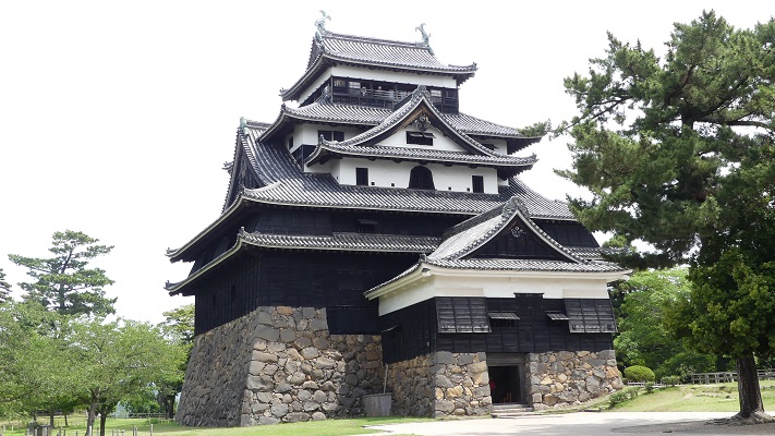
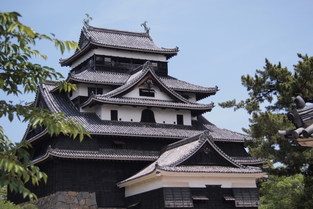
この城の特徴といえば、やはり天守でしょう。日本の現存12天守の一つです。また、2015年に5つ目の国宝天守にも指定されました。この指定は、この天守が1611年に築かれたと確認されたことによります。それまでは、天守がいつ作られたのかが不明確でした。
The main feature of this castle is the Tenshu. It is one of the 12 remaining Tenshu keeps in Japan. It was also designated as the fifth Tenshu for National Treasure in 2015. This is due to the Tenshu being confirmed built by 1611. It was uncertain if Tenshu was built before then.
1611年1月の記載がある木製の祈祷札が松江神社で見つかりました。その形が天守の地下にある木柱に残された、それが設置された跡と一致したのです。祈祷札は1611年の城の落成式のときに使われたに違いありません。
A wooden talisman dated in January 1611 was found at Matsue Shrine. Its shape matches the installation trace left on the wooden column at the basement of Tenshu. The talisman should be used when the completion ceremony of the castle in 1611.
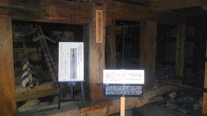
天守は、長く太い木のような高価な材料からではなく、様々な種類の木材を使って建設されています。それは恐らく堀尾が、城の建設ブームにより良い材料が集められなかったのか、それとも月山富田城の廃材を使ったからなのかもしれません。これらの資材は組み合わされて天守の重さを支え、また分散させています。更には「包板」と呼ばれる資材を長持ちさせる方法も見ることができます。それは、柱を板、鉄輪、かすがいで覆うやり方です。
The Tenshu was constructed using several types of wooden materials, not using valuable ones like a long thick wood. It could be because Horio were not able to collect good materials due to the boom of castles constructing, or they might use waste materials of Gassan-Toda Castle. These materials are combined to support and break up the weight of Tenshu. In addition, you can see the method to maintain the materials called “Tsutsumi-Ita” which is covering columns with lumbers, iron rings and clamps.
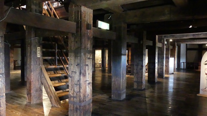
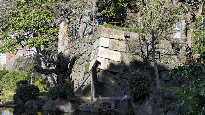
以上の発見により、松江城の建設方法が後の多くの他の城に引き継がれていたことがわかりました。これが高い評価を受け、松江城の国宝指定につながりました。いずれにせよ、天守の重厚な外観、実用的な内装、そして「牛蒡積み」と呼ばれる独特の天守台の石積みを純粋に見て楽しむのもよいでしょう。
That fact proves the method of building Matue Castle was followed by many other castles later. The high evaluation led to Matue Castle being a National Treasure. Anyway, you can purely enjoy seeing the profound appearance, the practical interior, and the base built using unique stone walls called “Gobo-Zumi” of the Tenshu.

その後~Later Life
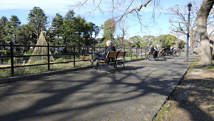
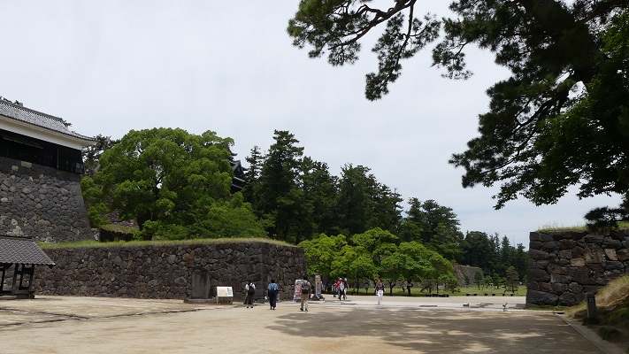
明治維新後、天守以外の全ての建物は撤去され、売られていきました。地元の有志が何とか天守だけは買い戻すことができました。天守は1934年に最初は国の史跡に指定されました。第二次世界大戦後、城周辺の地区は公園として整備されました。国宝に向けた活動のほか、松江市は二の丸など城の建物の復元を進めています。将来的には本丸にあった大手門の復元を計画しています。松江城の全景が街に戻りつつあります。
After the Meiji Restoration, all the buildings except for Tenshu were demolished and sold. Local volunteers somehow manage to get Tenshu back. It was first designated as a National Historic Site in 1934. After World War II, the area around the castle has been developed as Matsue Shiroyama Park. In addition to the campaign for the National Treasure, Matue City has been restoring buildings of the castle like those in Ninomaru. They are planing to restore Main Entrance Gate at Honmaru in the future. The whole view of Matue Castle will be returning to the city.
私の感想~My Impression
私は、武骨な松江城の天守が好きです。この天守には、姫路城のような城の美しさとは対照的な独特な雰囲気があります。松江城天守が国宝になったと聞いたときはとてもうれしかったです。ところが、姫路城と比べるとまだ人気がありません。それは天守の中にいつでも入れるということを意味します。松江の街もまた、くつろいだ雰囲気があります。是非訪れてみてはいかがでしょう。
I like the rough, strong Tenshu keep of Matsue Castle. It has a unique atmosphere in contrast to the beauty of castles like Himegi. It was a pleasure for me to hear that Matsue Castle Tenshu had become a National Treasure. However, it is still not popular compared with Himeji. That means you can usually enter the inside of Tenshu. Matue town also has a laid-back atmosphere. I recommend you to visit them.


ここに行くには~How to get There
車で行く場合:山陰自動車道の松江西ICから約10分かかります。公園の周りにいくつか駐車場があります。
JR松江駅からバスで行く場合:レイクラインバスに乗り、大手前バス停で降りてください。
If you want to go there by car: It takes about 10 minutes from the Matsue-Nishi IC on San-in Expressway. There are several parking lots around the park.
If you want to go there by bus from JR Matsue station: Take the Lake Line bus and take off at the Ote-Mae bus stop.
リンク、参考情報~Links and Rererences
・松江観光ガイド~VISIT MATUE
・国宝松江城(Only Japanese)
・松江観光ステーション(Only Japanese)
・城の科学、萩原さちこ著、講談社ブルーバックス(Japanese Book)
・よみがえる日本の城6、学研(Japanese Book)