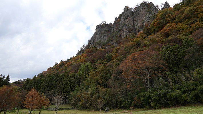
182.水城~Mizuki

緑の防衛ラインが今だにくっきりと残っています。
The green defense line still stands prominently.

立地と歴史~Location and History

大宰府を守る防衛線~Difense Line to protect Dazaifu

水城は、663年の朝鮮での白村江の戦いで日本が唐と新羅の連合軍に敗れた直後、国が初めて作った本格的な軍事施設です。それは、連合軍の侵攻から古代日本の地方政府であった「大宰府」を守るための防衛ラインでした。つくられたのは664年で、大野麹智基肄などの古代山城と呼ばれた西日本の軍事施設より以前のことでした。そのため水城は、日本の城のうちの一つとみなされています(その名前自体が水の城です)。
Mizuki was the first national full-scale military facility built immediately after Japan was beaten by the ally of Tang and Silla in the Battle of Baekgang, Korea in 663. It was a defense line to protect the ancient Japanese local government, “Dazaifu” in Kyushu Island from the ally’s invasion. It was first built in 664 before other military facilities in western Japan called ancient mountain castles such as Ono, Kikuchi, and Kii. That’s why Mizuki is regarded as one of the castles of Japan (The name means Water Castle in Japanese).
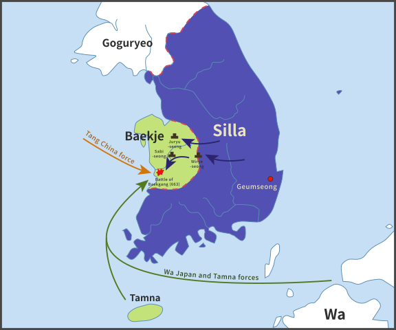
白村江の戦いの図~The map about the Battle of Baekgang(licensed by Samhanin via Wikimedia Commons)

戦略的な設計~Strategic Design

この防衛ラインは東は四王寺山の麓と、西にあるもう一つの丘との間に設けられており、福岡平野では最も狭い部分に当たり、大宰府政庁の北にありました。幅80m、高さ10mの土塁が1.2kmに渡っていました。そして両側に水堀がありました。この地域の地盤が弱かったので、土塁は丈夫な枝葉の基礎の上に設置されました。この構成により土塁を強固にする方法は「敷そだ」と呼ばれました。土塁自体を強固にするためには、土を突き固める版築という方法が採用されました。水堀は、土塁の下を通る木樋によってつながっていました。その水は内側の堀から外側の堀に流れていました。
The defense line is located between the foot of Shioji-yama mountain on the east and another hill on the west, which is the narrowest part of the Fukuoka Plain, and the north of Dazaifu government. It consisted of earthen walls that were 1.2km long, 80m wide and 10m high. It was surrounded by water moats on both sides. As the earth was weak in that area so the walls were laid on a foundation of strong branches. And this method of making the structure or wall strong was called “Sikisoda”. To make the walls sturdy the workers use to ram soil on the wall and this method was called Rammed earth. The water moats were connected under the earthen walls through wooden water pipes. The water flowed from the inside into the outside part of the moat.
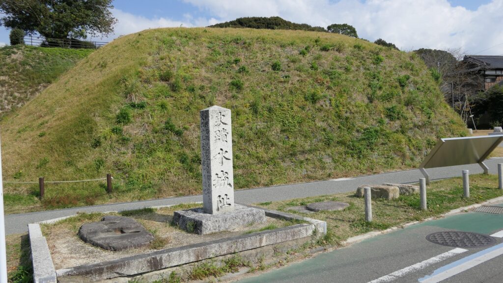
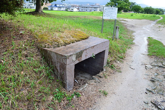
城の位置~The location of the castle

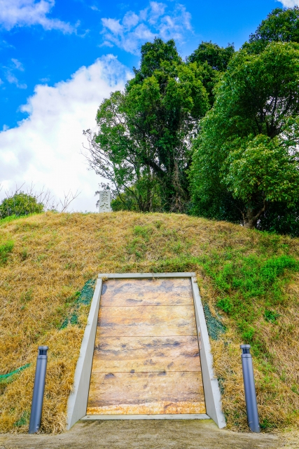
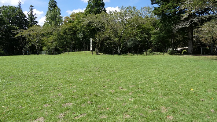
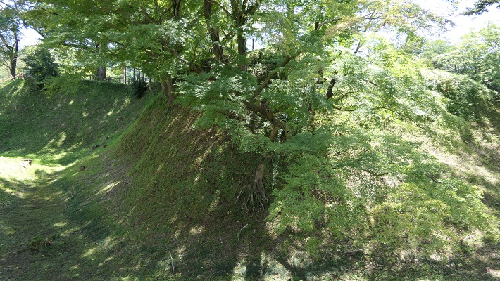
水城に残る土塁~The remaining earthen walls of Mizuki
復元された木樋~The restored wooden water pipe(licensed by Saigen Jiro via Wikimedia Commons)

土塁の幅は戦略的に設計されており、守備兵の矢は土塁の高い位置から放たれ外側に届くが、敵の矢は外側の低い位置から放たれ、内側には届かないようになっていました。歴史家は、朝鮮からの亡命者がこれを設計したと推定しています。
Its width was strategically designed so that when the defender’s arrows shot from the upper part of the wall, it could reach outside but when the enemy shot from lower part outside the moat, it couldn’t reach inside. Historians speculate that this method was designed by Korean refugees.
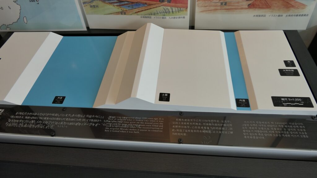
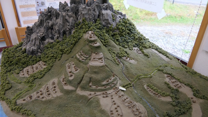
水城の構造模型~The model of Mizuki(水城館~Mizuki Site Exhibition Hall

交通の要地~Important Point for Traffic

このラインには2つの門があり、それぞれ官道が通っていました。一つは東門から博多港の方に伸びており、もう一つは西門から鴻臚館と呼ばれた中国や朝鮮からの人々をもてなす迎賓館の方に伸びていました。大宰府政庁の出入口としても使われており、この地域の交通や旅行者の出入りを監視していました。
The line had two gates for two government-run roads. One of them went through the East Gate to Hakata Port, and the other went through the West Gate to the guest house called Kouro-kan that was used to host people from China and Korea. It was also used as the entrance of Dazaifu government, and it checked transportation and passengers in and out of that region.
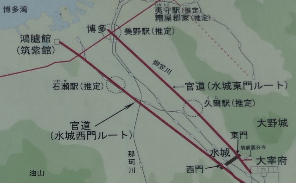
古代官道の推定ルート~The estimated routes of the government-run roads(現地説明板より~From the signboard at the site)

幸いにも、連合軍は日本を攻撃しませんでした。水城は大宰府政庁の道しるべとなりました。多くの人々が訪問客の出迎えや見送りのためにここを使ったのです。
Fortunately, the ally did not attack Japan. Mizuki became a landmark of Dazaifu government. Many people used it to welcome or say good-bye to visitors.
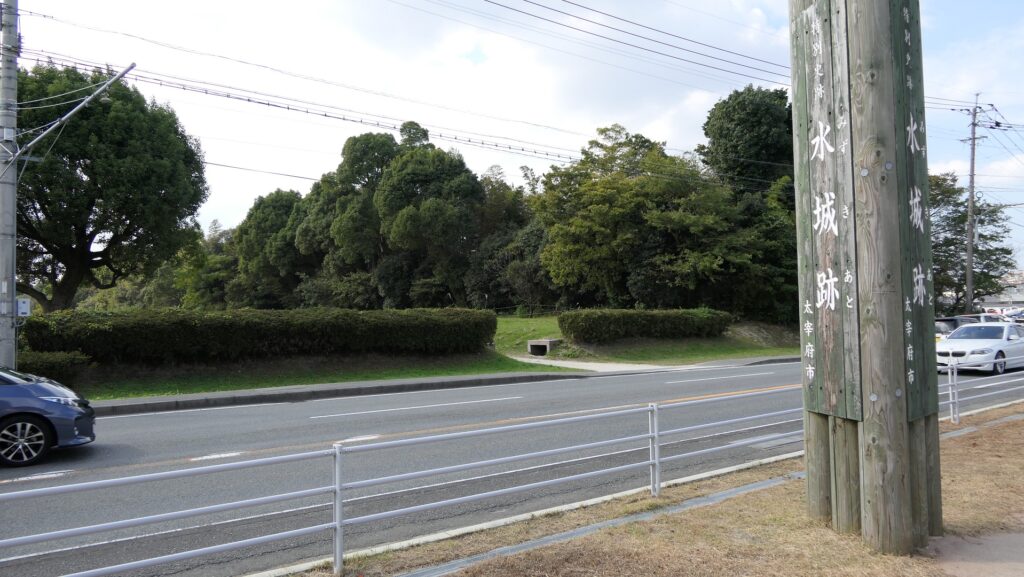
現在水城を通り抜ける道路~The present road through Mizuki

特徴~Features

現在、この辺りを通る人たちの多くは、水城跡をはっきりと見ることができます。なぜなら、この遺跡は緑地帯のように今だにこの一帯に横たわっていて、公道、高速道路、鉄道といった多くの現代の交通網もまたこの遺跡を横切っているからです。この遺跡は緑の林に覆われた土塁として残っているのです。素晴らしいことだと思いませんか。
Now, many people who go through the area around the ruins of Mizuki can clearly see them. This is because the ruins still lay across the area like a green belt, and a lot of modern transportation such as public roads, Expressways and Railways, also go across the ruins. The ruins remain as earthen walls covered with green forests. Isn’t that fantastic?

城周辺の航空写真~The aerial photo of around the castle

土塁周辺を歩く~Waking around Earthen Walls

この土塁からは既に水堀は失われています。そして、ところどころ現代の交通網により寸断されてしまってもいます。しかしながら、土塁の周辺を歩いてみれば、少なくとも高さが違っている構造になっていることはわかると思います。また、JR鹿児島本線により寸断されている箇所では、どのように土塁が積み上げられているかがわかります。The earthen walls have already lost their water moats, and the walls are partly destroyed by the modern transportation. However, when you walk around the walls, you can at least see the different levels of the structure. You can also see how the walls were rammed at the cross section of the walls which are cut through by the JR Kagoshima Line.
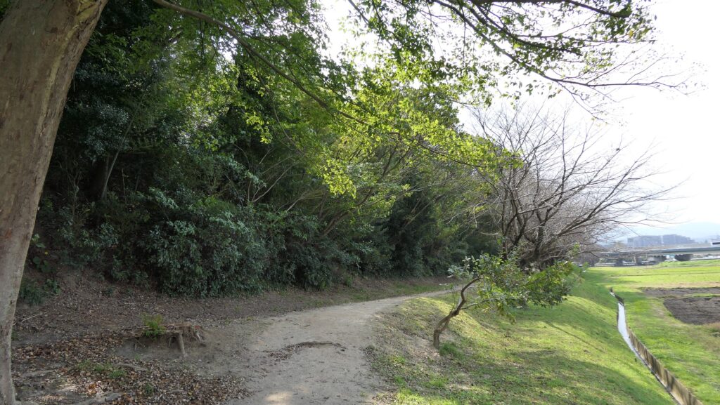
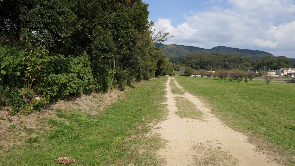
低くなっている土塁の外側~The lower outside of the earthen walls
高くなっている土塁の内側~The higher inside of the earthen walls
土塁の断面~The cross section of the walls(taken by ヘンリー3世 from photoAC)

東門周辺~Around East Gate

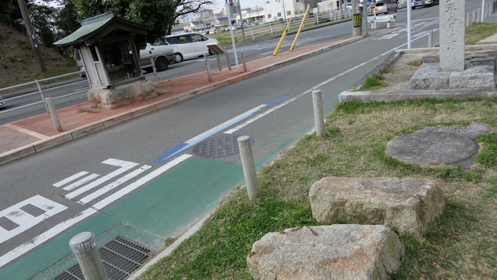
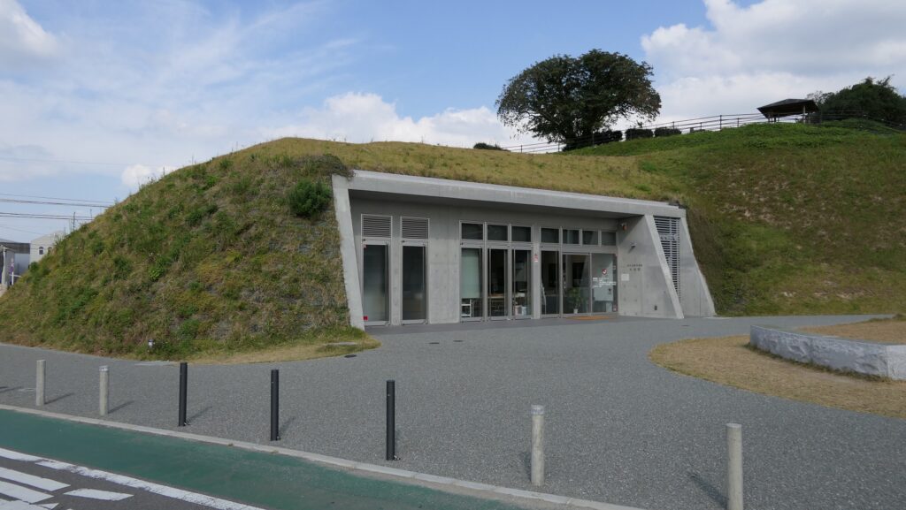
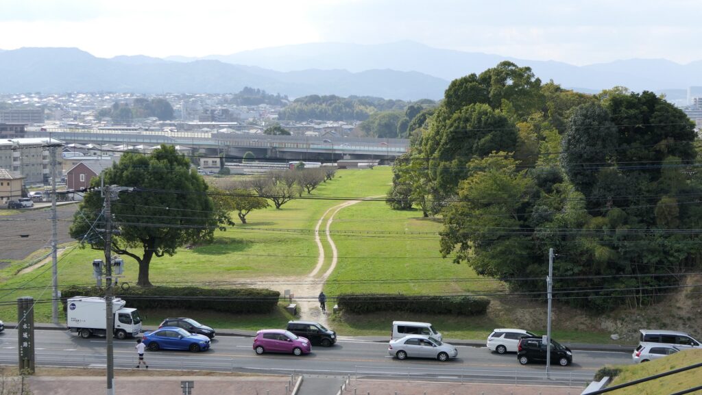
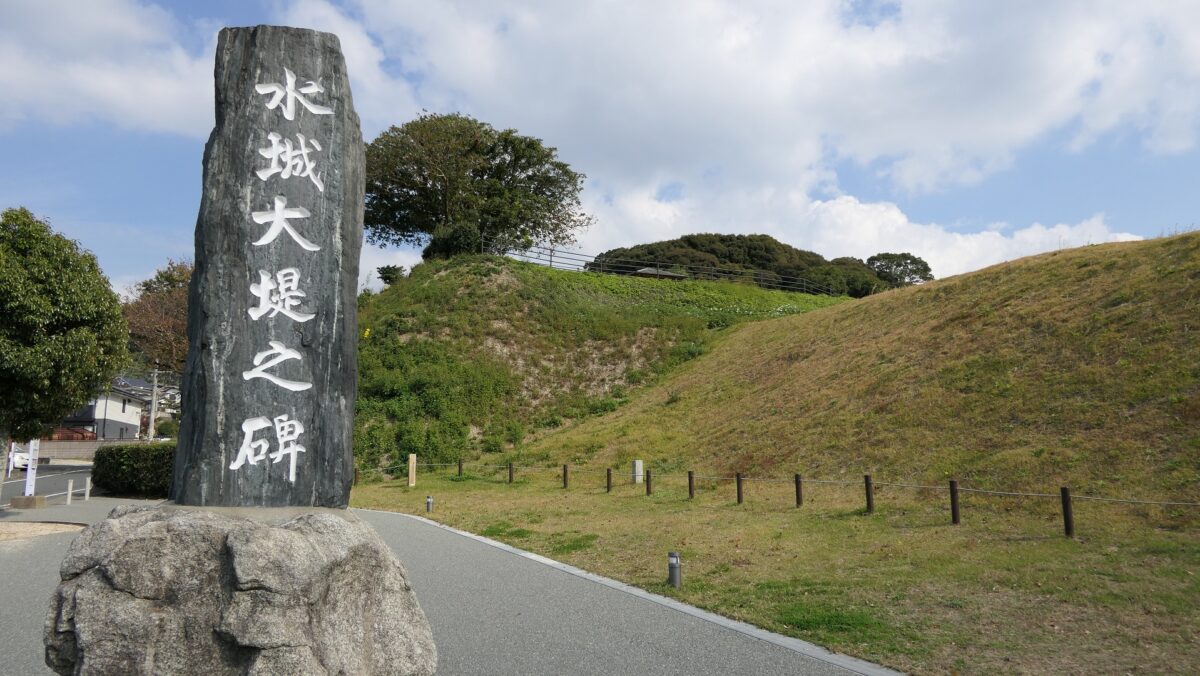
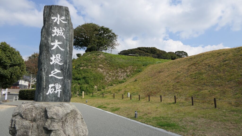
東門跡では、国道112号線がかつての古代官道のように遺跡を通り抜けています。後になって人々は門が元々あった場所に石碑を作って設置しました。門の礎石はまだ残っていて、遺跡を見に来た人であれば、すぐ見つけられます。また、水城館という展示施設があって、水城の歴史や使われている技術を学ぶことができます。この辺りは土塁の東端に当たるため、山裾の方に登って行って、遺跡の全景を見ることもできます。
At the ruins of the East Gate, the National Route 112 goes through the ruins like the ancient government road. Later on, people made and placed stone structures where the gates use to stand originally. The cornerstones of the gate still exists and anybody who visits the ruins can see them . You can also visit the guest house called Mizuki-kan which exhibits the history and technology of the ruins. The area is near the eastern edge of the earthen walls, so you can walk up to the foot of the mountain and have the whole view of the ruins.
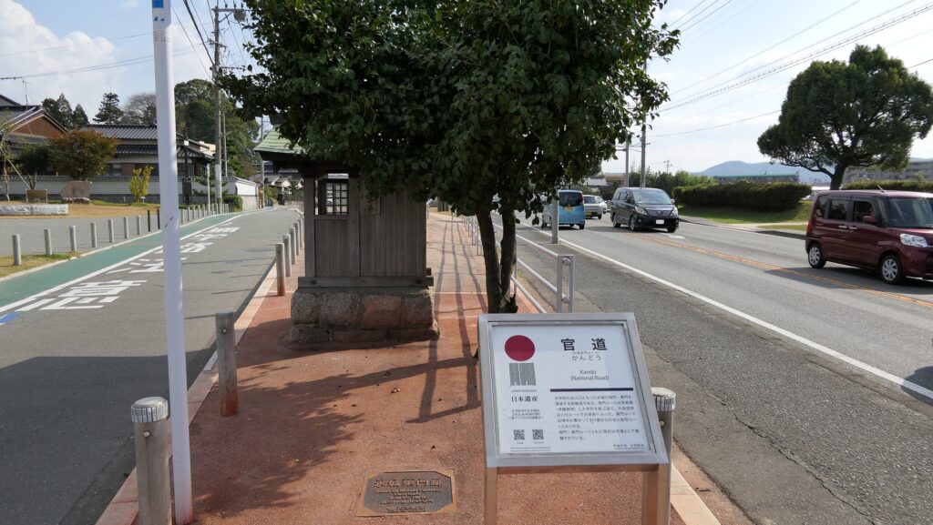
国道112号線~The National Route 112
石碑と土塁~The stone structure and earthen walls
東門の礎石~The cornerstones of the East Gate
水城館~Mizuki-kan
水城の全景~A full view of Mizuki

西門周辺~Around West Gate

西門の跡については、ここもまた地方道路により壊されてしまっています。発掘によれば、西門は3回立て直されています。門はその時代ごとの要請によって、機能が違っており、外交関係が悪いときは関門として機能し、関係がよくなると飾り立てられていたようです。
At the ruins of the West Gate, they are also destroyed by a local road. The excavation found that the gate had been rebuilt three times. It was a functional gate that was built as per requirement. The gate served as a barrier when foreign relations were bad. However, when relations were good it was more decorative.
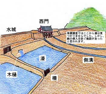
西門の想像図~The imaginary drawing of the West Gate(大野城市Websiteより引用)

その後~Later History

中世の13世紀頃、門は失われていました。しかし武士たちはモンゴル襲来のときに跡地を陣地として使用したようです。江戸時代には東側の官道は日田街道となり、多くの人々が往来しました。人々は水城を著名は遺跡として認識していました。1953年には国の特別史跡に指定されます。
Around the 13th century of the Middle Ages, the gates had been lost, but warriors seemed to use the ruins as a position against the Mongol Invasion. In the Edo Period, the eastern government road was being turned into Hita Road many people used. The people had already recognized Mizuki as famous ruins. The ruins have been designated as a Special National Historic Site since 1953.
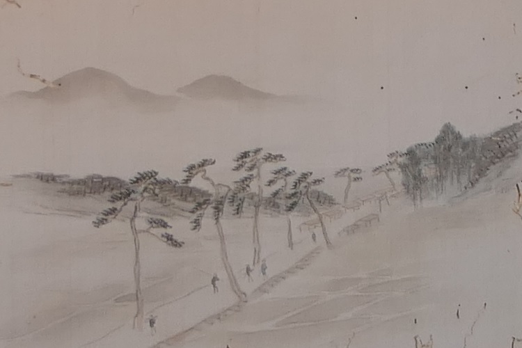
水城関跡、筑前名勝画譜より、江戸時代、国立公文書館蔵~The ruins of Mizuki, from The Picture Book of Famous Sights in Chikuzen Province, in the Edo Period, owned by National Archives of Japan(水城館展示、An exhibition of Mizuki-kan)

私の感想~My Impression

白村江の戦いは、日本の歴史において重要な出来事でした。水城跡は、多くの人々が近くを通るだけで目にすることができる、とても分かりやすい遺跡だと思うのです。歴史の知識があれば、水城がなぜ築かれたか多分わかるでしょう。知識がなくとも、遺跡を見てもっと知りたいと思うかもしれません。水城が永久に守られることを切に望みます。
The battle of baekgang is an important event in the history of Japan. I think that the ruins of Mizuki are very easy to understand for many people, because they can have many chances to see the ruins when they pass by. If they have the knowledge of history, they will probably understand why Mizuki was built easily. Even if not, they may want to learn more about the ruins seeing them. I really hope that Mizuki will be kept forever.
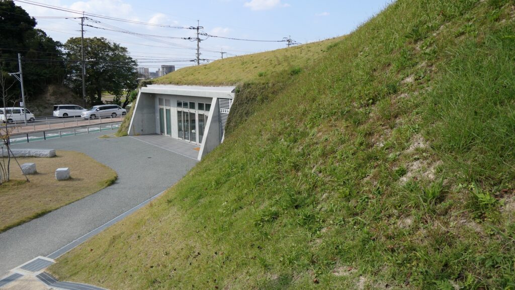
土塁と水城館~The earthen walls and Mizuki-kan

ここに行くには~How to get There

東門跡に行くには:
車では、九州自動車道の大宰府ICから数分のところです。展示施設に駐車場があります。
電車の場合は、西鉄天神大牟田線の下大利駅から歩いて約20分です。
西門跡に行くには:
車では、九州自動車道の大宰府ICから約10分かかります。水城ゆめ広場に駐車場があります。
電車の場合は、JR鹿児島本線の水城駅から歩いて数分のところです。
To the ruins of the East Gate:
By car, it takes few minutes from the Dazaifu IC on Kyushu Expressway. The guest house offers a parking lot.
By train, it takes about 20 minutes on foot from Shimo-ori Station on Nishitetsu Tenjin-Omuta Line.
To the ruins of the West Gate:
By car, it takes about 10 minutes from the Dazaifu IC on Kyushu Expressway.
Mizuki-Yumehiroba Park offers a parking lot.
By train, it takes few minutes on foot from Mizuki Station on JR Kagoshima Line.

リンク、参考情報~Links and References

水城跡、大野城市(Onojo City Website)
水城館、古都大宰府保存協会(Japanese Association Website)

46.長篠城~Nagashino Castle

この場所が日本の歴史を大きく動かしました。
This place had a large role in Japanese history.

立地と歴史~Location and History

勝頼、長篠城を狙う~Katsuyori tries to get the castle

長篠城は三河国(愛知県の東側に相当)の山側に位置しており、二つの川の合流地点にある崖の上に築かれました。城そのものよりも、1575年の長篠の戦いによって有名なのかもしれません。
Nagashino Castle was located in a mountain side of Mikawa Province (what is the eastern part of Aichi Pref.), on a cliff at the meeting point of two rivers. It may be more famous for the battle of Nagashino in 1575 than for itself.

城の位置と三河国の範囲~The location of the castle and the range of Mikawa Province

戦国時代の1574年、武田勝頼は遠江国にある高天神城を徳川家康より奪いました。武田は東方にある甲斐国(山梨県)と駿河国(静岡県の中部)を領しており、徳川は西方にある遠江国(静岡県西部)と三河国を有していました。勝頼は、高天神城の更に西方にある長篠城を手に入れようとします。家康にとっては脅威でした。そして盟友の織田信長に援軍を要請します。
In 1574, the “Sengoku” or Waring State Period, Katsuyori Takeda took Takatenjin Castle in Totoumi Province away from Ieyasu Tokugawa. Takeda owned Kai (Yamanashi Pref.) and Suruga (mid Shizuoka Pref.) Provinces in the east, and Tokugawa had Totoumi (west Shizuoka Perf) and Mikawa Provinces in the west. Katsuyori aimed to capture Nagashino Castle, further west than Takatenjin. That was a threat to Ieyasu. He asked his ally, Nobunaga Oda for help.

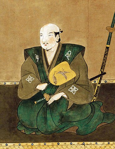
武田勝頼肖像画、高野山持明院蔵、16世紀後半~The Portrait of Katsuyori Takeda, ownd by Koyasan Jimyoin, in the late 16th century(licensed under Public Domain via Wikimedia Commons)

勝頼、決戦を挑む~Katsuyori wants a decisive battle

1575年5月、勝頼は医王寺にある丘に本陣を置き、武田騎馬隊を含む1万人以上の軍勢で長篠城を包囲しました。一方、城の守備兵は僅か5百名でした。信長と家康は3万人以上の兵を率いて城の西方約4キロにある設楽原に至り、現地に陣地を築き、鉄砲隊を配置しました。
In May 1575, Kstduyoti set his stronghold on a hill at Ioji Temple, and surrounded the Nagashino Castle with over 10,000 soldiers including the Takeda Cavalry. On the other hand, defenders in the castle were only 500 in number. Nobunaga and Ieyasu took more than 30,000 soldiers to Shitara-ga-Hara field, about 4km west from the castle, and built fortresses along the field and brought gun troops.

城周辺の地図~The map around the castle

城の運命はさておき、両方の陣営はこれは決着をつける場であると考えました。勝頼は本陣の丘を下り、信長の方に向かっていきました。しかしながら、それは信長の罠だったのです。
Beside the destiny of the castle, both sides thought it would be the chance to have a showdown. Katsuyori went down the hill and headed towards Nobunaga. However, he was going to be trapped by Nobunaga.

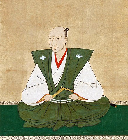
織田信長肖像画、狩野宗秀作、長興寺蔵、16世紀後半~The portrait of Nobunaga Oda, attributed to Soshu Kano, owned by Chokoji Temple, in the late 16th century(licensed under Public Domain via Wikimedeia Commons)

勝頼、信長に突撃~Katsuyori attacks Nobunaga

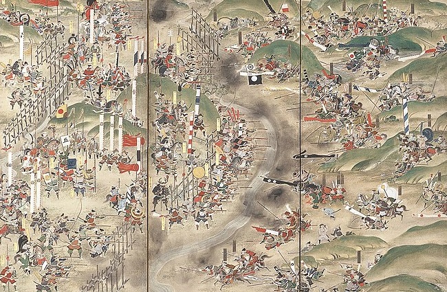
5月21日、信長は別働隊を勝頼の背後に送り出しました。勝頼は当惑し、すぐさま信長の陣地に突撃するしかなくなりました。設楽原は狭い上に真ん中に連吾川が流れており、周囲は湿地帯となっていました。武田騎馬隊は機動力と攻撃力で知られていましたが、このような状況では普段の力を発揮できません。武田は陣地に向かって一部隊ずつ攻撃せざるをえません。信長の陣地は、設楽原の西側の丘状の場所に築かれ、鉄砲隊の前には木柵が幾重にも設置されていました。まるで城のようだったのでしょう。武田は柵に阻まれ、鉄砲で撃たれ、各個撃破されていきました。
On May 21, Nobunaga sent his detached force to the back of Katsuyori. Katsuyori was confused and there was no other way than charging Nobunaga’s fortresses right away. Shitara-ga-Hara field is narrow with the Rengogawa River flowing at the center, and was waterlogged around. Takeda Cavalry was known for its mobile and strong power, but its power was less than usual under such conditions. Takeda had to attack from one troop to another against the fortresses. Nobunaga’s fortresses were constructed in a hilly area on the western side of the field, which installed several wooden fence layers in front of gun troops. They seemed to look like castles. Takeda was blocked by the fences, shot by the guns, and defeated one by one.

長篠合戦図屏風部分、徳川美術館蔵~Part of “Battle of Nagashino”folding screens, owned by Tokugawa Art Museum(licensed under Public Domain via Wikimedia Commons)

勝頼、完敗す~Katsuyori completely defeated

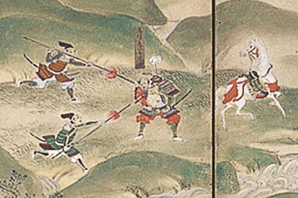
勝頼は攻略を諦め、撤退しました。そして信長は追撃を開始します。この戦いの間、武田の軍勢のうち約半数が失われたと言われています。武田の多くの重臣や指揮官も戦死しました。この戦いの結果は、信長の天下統一事業と、武田氏の滅亡への動きを加速しました。大きな歴史の節目となりました。
Katsuyori gave up and withdrew. Then Nobunaga started to chase them. It is said that about half of Takeda’s soldiers were lost during the battle. Many senior vassals and troop leaders of Takeda were also killed. The result of the battle would lead to the boost of Nobunaga’s unification of Japan and the destruction of the Takeda clan. It was a big turning point.

武田重臣、馬場信春の最期、長篠合戦屏風より~The last moment of Nobuharu Baba, a Takeda’s senior vassal, from “Battle of Nagashino”folding screens(licensed under Public Domain via Wikimedia Commons)

多くの歴史家は、この戦いの勝敗の要因は、戦術革命(鉄砲対騎馬隊)にあると言います。しかし、そんなに単純な話ではなく、信長は強力な武田軍に対処するため考え抜いたと指摘する人もいます。彼の決断は、自軍を防御することに徹しながらも、有利な条件下に武田を誘いこむことでした。実際彼は兵士に対し、武田が撤退するまでは陣地から出ないよう命令しました。彼はまた、戦略的にも完勝したのです。
Many historians have said that the result was caused by the tactics revolution (gun vs cavalry). However, it was not so simple. Others point out that Nobunaga considered how they should deal with strong Takeda. His decision was to be devoted to protecting themselves, but to invite Takeda there under advantage. He actually ordered his soldiers that they were no to go out of the fortresses until Takeda withdraw. He was completely successful by his strategy, too.

設楽原古戦場~Shitaragahara Battlefield

特徴~Features

長篠城だけではなく、関連遺跡も一緒に回ってみることをお勧めします。歴史への理解をより深めることができます。
I recommend you to visit not only Nagashino Castle but also relative ruins. That will help you to learn more about history.

城周辺の起伏地図~The relief map around the castle

長篠城跡~Nagashino Castle Ruins

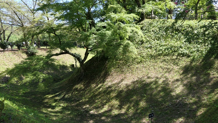
現在、崖の上の本丸が残っています。本丸は土塁で囲まれていて、外側とは空堀で隔てられています。過去にはもっと多くの曲輪が広がっていました。城跡は国の史跡に指定されています。
Now, the Main enclosure or “Honmaru” remains on the cliff. It is surrounded by earthen walls and divides from outside by a deep dry moat. More enclosures spread out in the past. The ruins have been designated as a National Historic Site.

本丸の土塁と空堀~The earthen walls and dry moat of Honmaru
本丸の内部~The inside of Honmaru

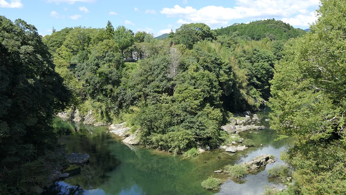
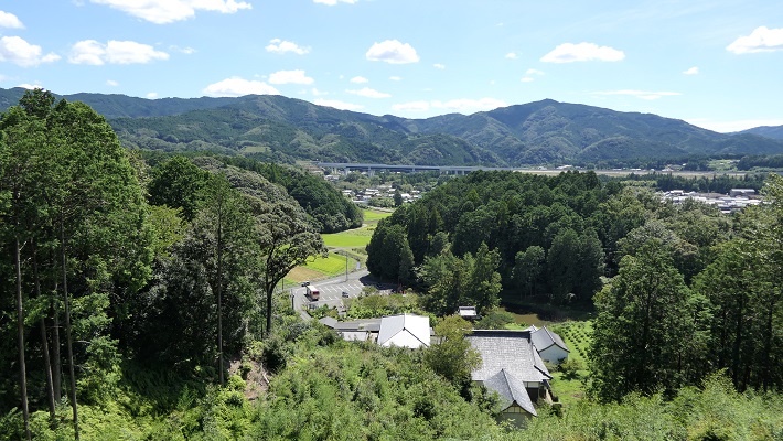
川を越えて城の反対側に行ってみると、崖の下の川の合流地点を見下ろす、素晴らしい景色です。城が自然の要害の上にあったこともわかると思います。
If you go to the opposite of the castle across the rivers, you can see a great view of the meeting point of the revers under the cliff. You can also realize that the castle was on a natural fortress.

川の合流地点~The meeting point of the rivers

医王寺(勝頼の本陣跡)~Ioji Temple (The ruins of Katsuyori’s stronghold)

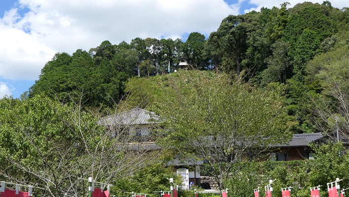
本陣は、この寺の裏山にありました。山道を通って簡単に登ることができます。
The stronghold was on the back hill of the temple. You can easily climb up to the top through the trail.

医王寺~Ioji Temple
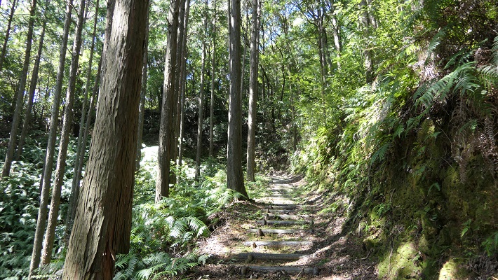
頂上への山道~The trail to the top

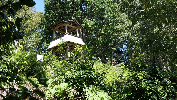
頂上には簡単な物見やぐらが復元されています。ここからは長篠城は見えるのですが、信長の陣地があった設楽原は見えません。十分な情報なしに勝頼がなぜ山を下り、信長の方に向かっていったのか考えてみるのも一興です。
There is a restored simple watch tower on the top. You can see Nagashino Castle from the tower, but can’t see Shitara-ga-Hara where Nobunaga’s fortresses were. It may be interesting to speculate why Katsuyori decided to go down the hill and head towards Nobunaga without enough information.

復元された物見やぐら~The restored watch tower
頂上からの眺め~A view from the top

設楽原古戦場~Shitara-ga-Hara Battlefield

この場所は現在は水田になっていますが、丘状の地形に囲まれた谷のようになっているのが今でもわかります。ここが更に湿地帯であったなら、騎馬隊は十分な能力を発揮できなかったでしょう。
This place has now become a rice field, but you can still see it is like a valley surrounded by hilly areas. If it was also waterlogged, troops with horses couldn’t fulfill their potential.

設楽原~Shitara-ga-Hara Field

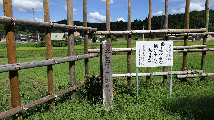
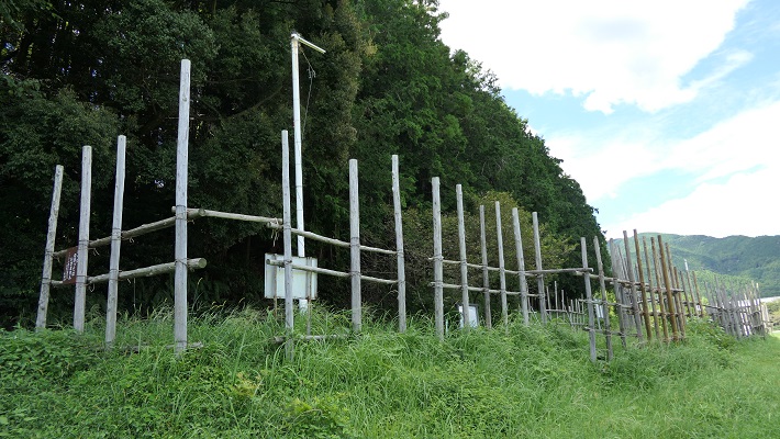
設楽原の西側には木柵と空堀がいくらか復元されています。実際にはもっと縦横に広がっていたはずです。武田は明らかに不利な状況で織田・徳川連合軍と戦わざるをえなかったのです。それが信長の戦略眼だったのです。
There are some restored wooden fences and dry moats on the western side of the field. They must have been spread wider and deeper. Takeda clearly had to fight with the allied forces of Oda and Tokugawa under disadvantage. That was the idea of Nobunaga’s strategy.

復元された木柵~The retored wooden fences

その後~Later History

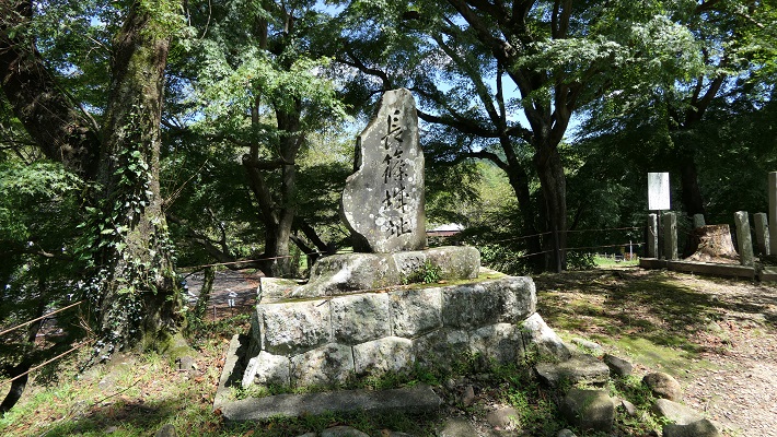
長篠城は、長篠の戦いのわずか1年後、1576年に廃城となりました。ここの城主が新しい城を作り、移っていったからです。その後は、江戸時代には城跡の地に旗本や庄屋の屋敷があったようです。城跡は最終的には1929年に国の史跡に指定されました。
Nsgashino Castle was abandoned 1n 1576, just one year later the battle of Nagashino, because the lord of the castle built and moved to another castle. After that, a shogunal retainer and local administrator seemed to have their residences at the ruins of the castle in the Edo Period. The ruins were lastly designated as a National Historic Site in 1929.

城址の石碑~The monument of the ruins

私の感想~My Impression

長篠の戦いから得られる教訓は3つあると思います。
1.リーダーは普段は乾坤一擲の戦いは避けなければならない。
2.どうしても避けられないときは、十分な情報を基にした決断が必要である。
3.リーダーは常にいかに安全に撤退するかも考えておくべきである。
信長は、もし勝頼に敗れたとしてもどう撤退するか考えていたと思うのです。
I think we can learn three lessons from the battle of Nagashino.
1.Leaders must usually avoid playing for all or nothing.
2.If they can’t avoid it, informed decision will be essential, or withdraw immediately.
3.Leaders must always consider how to withdraw safely.
I believe that Nobunaga had considered how to withdraw if he was beaten by Katsuyori.

勝頼の本陣があった丘~The hill where Katsuyori’s stronghold was
長篠城の土塁~The earthen walls of Nagashino Castle

ここに行くには~How to get There

これまで述べた遺跡を回るには、車を使うのが便利です。みな新東名自動車道の新城ICの近くです。
長篠城だけでよければ、電車で行くこともできます。JR長篠城駅から徒歩10分くらいで現地に着きます。東京または名古屋からでしたら、東海道新幹線で豊橋まで行き、飯田線に乗り換えてください。
I recommend you using car to visit these ruins mentioned above. They are all near Shinshiro IC on Shin-Tomei Expressway.
If you want to visit only Nagashino Castle, it is also accessible by train. It takes about 10 minutes to get there on foot from JR Nagashino-Jo Station. From Tokyo or Nagoya, take the Tokaido Shinkansen super express to Toyohashi Station, then transfer for Iida local line.

リンク、参考情報~Links and References

史跡長篠城跡、新城市(Multilingual service is available)
新城市設楽原歴史資料館、新城市(Multilingual service is available)
・「長篠の戦い/藤本正行著」洋泉社(Japanese Book)
・「籠城/榎本秋著」宝島社(Japanese Book)
・「現代語訳 信長公記/太田牛一著、中川太古訳」新人物文庫(Japanese Book)

117.岩櫃城(Iwabitsu Castle)

岩櫃城は、防りが固そうに見えますが、実は攻撃のための城なのです。
Iwabitsu Castle looks like defensive, but actually aggressive.

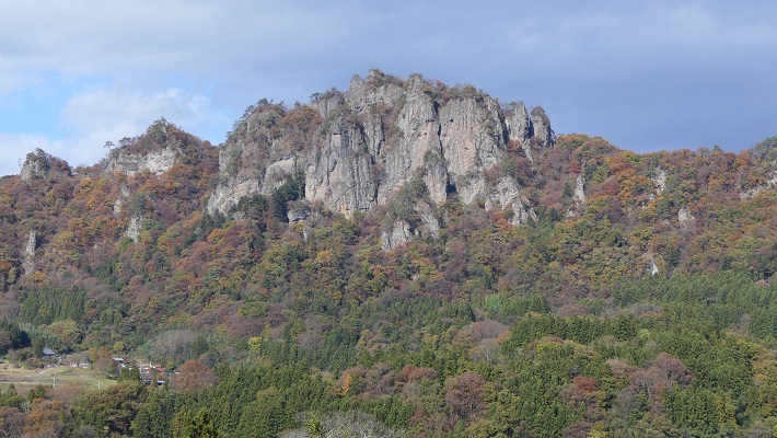
岩櫃山と潜龍院跡(Mt. Iwabitsu and the ruins of Senryuin)

Location and History

過去において信濃国(現在の長野県)と上野国(群馬県)の間を結ぶ街道がいくつかありました。最も有名なのは中山道ですが、その他の一つとして信州街道があり、信濃の上田と上野の沼田をつないでいました(現在の国道145号線に相当します)。戦国時代の後半に武田氏配下であった真田氏は、この信州街道に沿って信濃から上野に向けて攻撃を仕掛けました。岩櫃城はこの途上にあり、真田氏が改修を行い、上野攻略のための重要拠点としました。
There were several roads between Shinano Proivnce (now called Nagano Prefecture) and Kozuke Province (Gunma Prefecture) in the past. The most famous one was Nakasendo, and one of the others was Shinshu-Kaido connecting Ueda in Shinano and Numata in Koduke (equivalent to current the National Route 145). In the late Warring States Period, the Sanada clan under the Takeda clan attacked from Shinano to Koduke along this Shinshu-Kaido. Iwabitsu Castle was on the way, renovated by the Sanada clan to be an important site for the capture of Koduke.


国道145号線の周辺地図と岩櫃城の位置(The map around National Route 145 and the location of Iwabitsu Castle)

この城は岩櫃山にありましたが、山頂ではありませんでした。そこは岩山で危険であったからです(現在でも登頂には登山の装備が必要です)。それで城の中心は、山の中腹にありました。つまり、城の背後は自然の要害である岩山により守られていたということです。また、もう一つの障壁として吾妻川にも守られていました。
The castle was located on Mt.Iwabitsu, but not on the top, because the spot is too rocky and dangerous to stay (Even now, climbing to the top requires a modern climbing equipment). So the center of the castle was halfway up the mountain. This means that the behind the castle was protected by rock as a natural hazard. The castle also had another hazard, the Agatsuma River.

現地案内所にある城のミニチュアモデル(The miniature model of the castle at the information center at the site)

この城は最初は南北朝時代に土豪により作られたと言われています。その後真田幸隆が大変な苦労をしてこの城を手に入れました。そして彼の息子である真田昌幸が改修したのです。
It is said the castle was first built in the North-South Court Period by a local clan. After that, Yukitaka Sanada got it with great difficulty. His son, Masayuki Sanada renovated it.

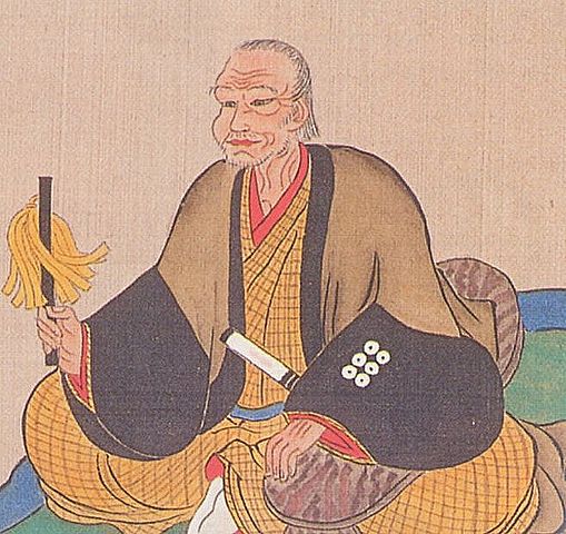
真田昌幸像、個人蔵(The portlait of Masayuki Sanada, privately owned)licensed under Public Domain, via Wikimedia Commons

1582年3月、真田の主君である武田勝頼は織田信長の侵攻により滅亡の危機を迎えていました。昌幸は、勝頼をこの城に迎え入れ、支えていくことを考えました。彼はまた、勝頼のために山の麓に館を作りました(現在の潜龍院跡)。しかしながら、勝頼がすぐに死んでしまったため、計画は実現しませんでした。
Sanada’s master, Katsuyori Takeda faced the crisis of destruction due to Nobunaga Oda’s invasion in March 1582. Masayuki thought about accommodating and supporting the master in this castle. He built the hall for Katsuyori at the foot of the mountain as well(What is now called “the ruins of Senryuin”).However, it didn’t happen as Katsuyori died shortly.

潜龍院跡(The ruins of Senryuin)

一方、真田は何とかこの城を維持することができましたが、戦国時代が終わったとき、この城は必要がなくなったため、1614年に昌幸の息子、真田信之により廃城とされました。
On the other hand, Sanada somehow manage to keep this castle. When the Warring States Period ended, the castle was not needed, and was abandoned by Masayuki’s son, Nobuyuki Sanada in 1614.

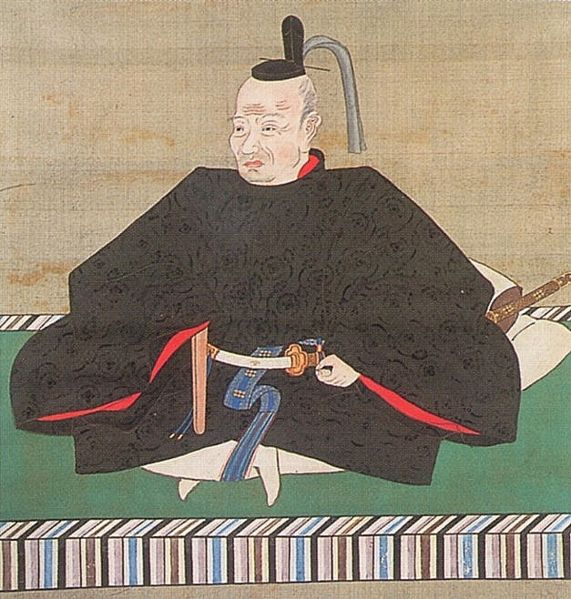
真田信之像、個人蔵(The portlait of Nobuyuki Sanada, privately owned)licensed under Public Domain, via Wikimedia Commons

Features

岩櫃山は南に向かって岩の頂が際立っていますが、城跡は北西の方向に向いており、山の背後に残されています。城跡は、山の尾根の上にあり、そこから「本丸」「二の丸」「中城」といった曲輪が広がっており、それらもまた自然の障壁に守られていました。
Mt.Iwabitsu has a great rocky looking part facing the south, but the castle ruins remain at back of the mountain facing the north east direction. They are on a ridge of the mountain spreading down several enclosures called “Honmaru”, “Ninomaru” and “Nakashiro” surrounded by natural hazards.

岩櫃山の正面(The front of Mt. Iwabitsu)

城跡の麓にたどり着くには、たった一本の細く曲がりくねった道しかありません。その入り口はまた「柳沢城」という支城によっても守られていました。
There is only one narrow and winding road to reach the foot of the ruins. The entrance was also protected by the branch castle called “Yanagisawa Castle”.

城跡への道(The road to the ruins)

ここまで聞くと、この城は守りがとても固いと思われるでしょうが、この城には別の側面もあるのです。まず、尾根の上の曲輪は空堀や溝により区切られていますが、まるでネットワークのようです。これらは敵を防ぐためだけではなく、連絡のためにも使われたようです。
You may feel the castle was very defensive, however it had a different perspective. First, enclosures on the ridge are separated by dry moats or ditches like network. The network seemed to be used not only for preventing enemies, but also for connection.

空堀、兼通路(Dry moats or passages)

この城にはまた、山麓に天狗丸と呼ばれる曲輪と城下町があり、多くの兵士や住民を収容できました。
The castle also had an enclosure called Tengu-Maru and the castle town at the foot that could accommodate a large numbers of soldiers or residents.

天狗丸跡(The ruins of Tengu-Maru)

更には、尾根の上の本丸はそれ程大きくなく、指令所として使われたのではないでしょうか。
In addition, Honmaru on the ridge is not so large that might be used for the headquarter.

本丸跡(The ruins of Honmaru)

つまるところ、この城は真田の攻撃拠点として使われたと思うのです。郷土史家の山崎一は、このような城のレイアウト(縄張り)を「陽の縄」と言っています。
Overall, I think the castle was used for Sanada’s base to attack. Hajime Yamazaki, a local historian says that such a layout is called a bright layout “You-no-Nawa”.

二の丸から本丸を見上げる(Lookimg up Honmaru from Ninomaru)

Later Life

この城の立地のこともあり、廃城後の岩櫃城の遺跡は長い間そのまま放置されてきました。山崎氏が最初に城跡を調査したのは、1970年代のことでした。彼は調査の結果を公表し、それがきっかけで城跡は1972年に町の史跡に指定されました。そしてつい最近の2019年10月に国の史跡にも指定されました。これからこの城跡がどうのように整備されるのかとても楽しみです。
Because of its location, the ruins of Iwabitsu Castle had been left as they were for a long time after being abandoned. Yamazaki first investigated the ruins in the 1970s. He published his achievement, then the ruins were designated as a local historic site in 1972. They also became a national historic site just recently in October 2019. I’m looking forward to seeing how they are developed in the future.

本丸にある岩櫃城の標柱(The signpost of Iwabitsu Castle at Honmaru)

My Impression

歴史に「もしも」はないと言われますが、多くの歴史ファンはもし勝頼が岩櫃城に来ていたらどうなっていただろうと空想を逞しくしています。私ももしそうであれば、武田と織田の戦いは長引いたと思うのです。この城であれば大軍を前にしばらくは持ちこたえられるからです。そうしたら、歴史は史実と変わっていたでしょう。なぜなら信長の予想外の大勝利は彼を自己満足や自信過剰に陥らせたからです。それが、この勝利からわずか3ヶ月後の本能寺の変での彼の死につながったのです。
It is said that there is no “if” in history. But many history fans enjoy speculating what would happen if Katsuyori came to Iwabitsu Castle. I imagine the battle between Takeda and Oda would be longer as the castle could hold out against large troops for a while. Then, history might change from that fact, because Nobunaga’s unexpected great victory made him complacent and overconfident. That led to his death in the Honnoji Incident in June 1582, just three months after the victory.

岩櫃山の麓にある潜龍院跡(The ruins of Senryuin on the foot of Mt. Iwabitsu)

How to get There

岩櫃城跡へは:車の場合は、平沢登山口に駐車してください。電車の場合はJR吾妻線群馬原町駅から駐車場まで歩いて約40分です。駐車場から本丸までは更に歩いて約20分です。
To the ruins of Iwabitsu Castle: When using car, park at the Hirasawa starting point for a climb. When using train, it takes about 40 minutes on foot from the Gunma-Haramachi station on JR Agatsuma line to the parking lot. it takes another about 20 minutes on foot from the parking lot to Honmaru.

潜龍院跡へは:車の場合は、古谷登山口に駐車してください。電車の場合はJR吾妻線郷原駅から駐車場まで歩いて約20分です。駐車場から潜龍院跡までは更に歩いて約15分です。
To the ruins of Senryuin: When using car, park at the Furuya starting point for a climb. When using train, it takes about 20 minutes on foot from the Gobara station on JR Agatsuma line to the parking lot. it takes another about 15 minutes on foot from the parking lot to the ruins.

東京駅から群馬原町駅または郷原駅まで:上越新幹線に乗り、高崎駅で吾妻線に乗り換えてください。
From Tokyo to Gunma-Haramachi or Gobara station: Take the J0etsu Shinkansen super express to Takasaki station, and transffer to Agatsuma local line.

Links and References

岩櫃なび(Iwabitsu Navi, only Japanese?)
・「群馬の古城 北毛編/山崎一」あかぎ出版(Japanese Book)
・「真田太平記 1岩櫃の城/池波正太郎」朝日新聞社(Japanese Book)