Each independent lord was not allowed to have castles, excluding the only one the lord lived in, by the shogunate. However, Shiroishi Castle, where the Katakura Clan as a retainer lived in, remained as an exemption. This was probably due to Date’s strong influence as well as Katakura’s contributions.
Location and History
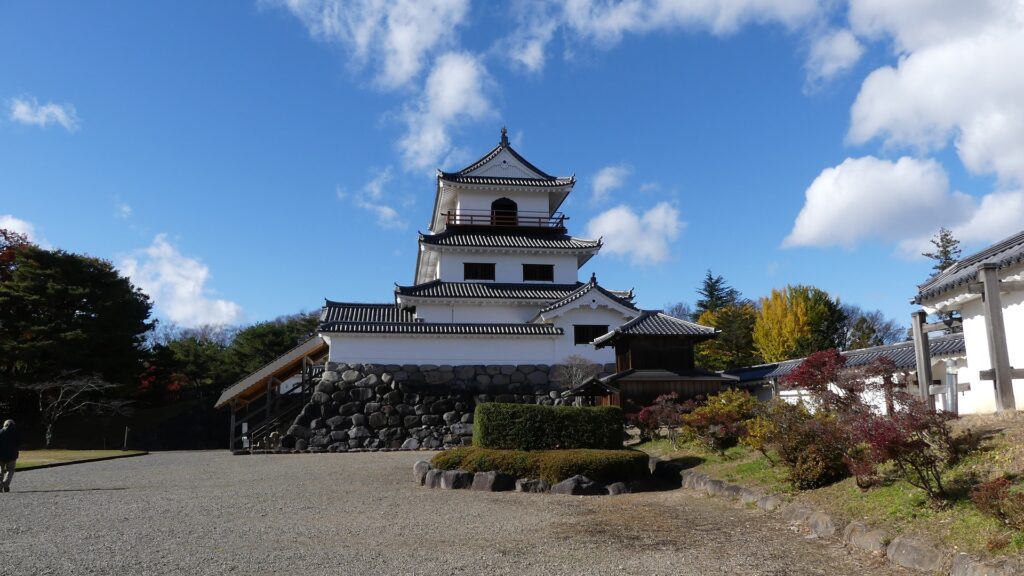
Castle owned by Katakura Clan, Senior Vassal of Date Clan
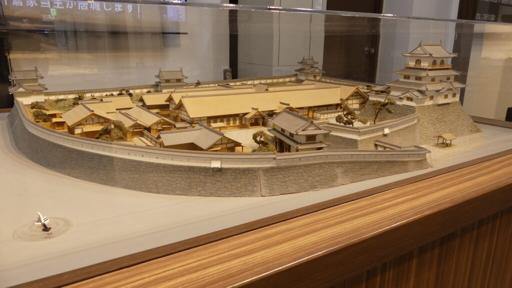
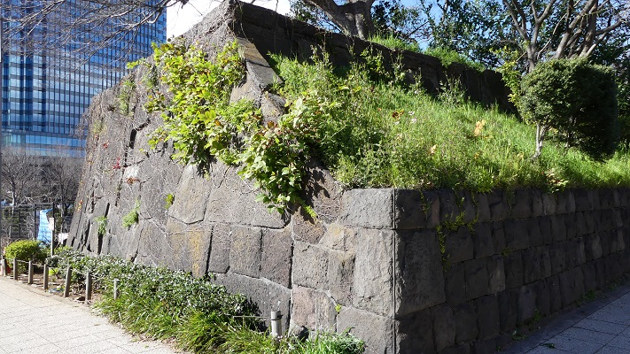
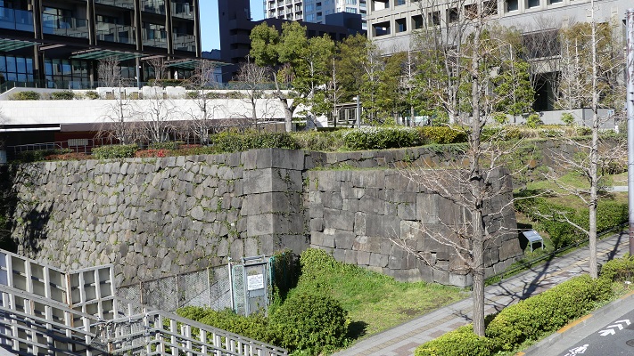
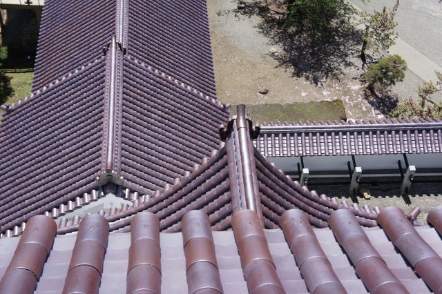
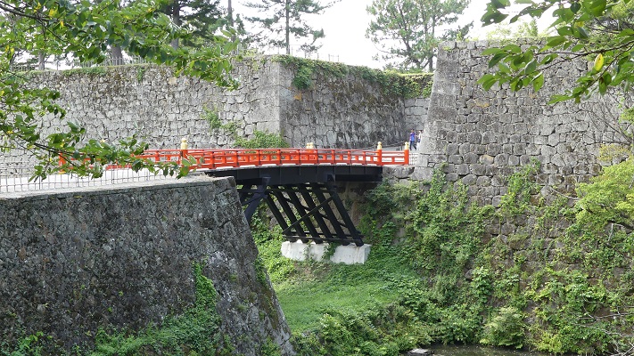
Shiroishi Castle is located in modern day Shiroishi City at the southern edge of Miyagi Prefecture. It was also located in the southern edge of the Date Clan’s territory during the Edo Period. The lords of the clan had the area around the castle being governed by their trusted senior vassal family, the Katakura Clan all through the period. The castle had a three level turret called the Large Turret which was actually equivalent to the Main Tower. That’s why the castle looked like a symbol of an independent lord.
The range of MIyagi Prefecture, the range of the Sendai Domain was larger than the prefecture
The restored Main Tower of Matsumoto Castle
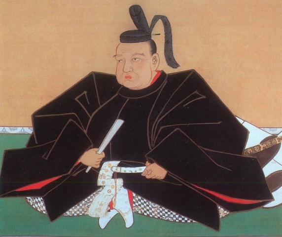
The founder of the Katakura Clan, Kagetsuna Katakura served his master, Masamune Date from his childhood because Kagetsuna’s older sister, Kita became Masamune’s foster mother. Since then, Kagetsuna contributed to Masamune becoming the greatest warlord in the Tohoku Region during the late 16th Century by joining many battles and being a diplomatic agent with other warlords. When the ruler, Hideyoshi Toyotomi invaded the Kanto Region to complete his unification of Japan in 1590, Masamune was wondering if he should follow Hideyoshi or not. Kagetsuna advised Masamune to do so, and as a result, they were able to survive. Masamune eventually gave Kagetsuna the important Shiroishi area in 1602 after the Date Clan’s territory was fixed as the Sendai Domain by the Tokugawa Shogunate.
The portrait of Kagetsuna Katakura, owned by Sendai City Museum (licensed under Public Domain via Wikimedia Commons)The portrait of Masamune Date, owned by Sendai City Museum (licensed under Public Domain via Wikimedia Commons)
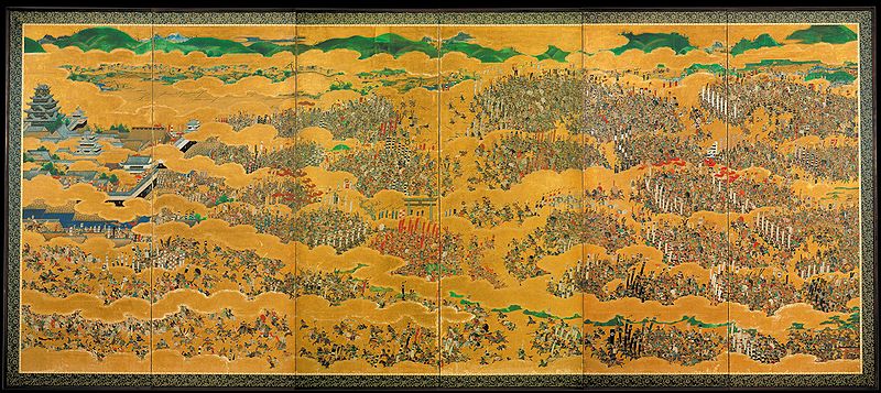
Kagetsuna’s son, Shigenaga was very active in the summer campaign of the Siege of Osaka in 1615 where the shogunate defeated the Toyotomi Clan. There is a heroic story about him and his rival, Nobushige Sanada. They once fought each other in the battle, but Nobushige sent a letter (affixed to an arrow) to Shigenaga, which asked him to accommodate Nobushige’s children before his death. Kagetsuna accepted it, and then, Oume, Nobushige’s daughter would be Shigenaga’s second wife and another son, Daihachi would be a retainer of the Sendai Domain. One theory seems to be that Shigenaga took Oume away from Osaka Castle when it was falling and accommodated the other children when they later visited her in Shiroishi Castle. In either case, Shigenaga must have been a man of great capacity.
The portrait of Shigenaga Katakura, drawn in a Ukiyoe-painting, attributed to Yoshiiku Ochiai (licensed under Public Domain via Wikimedia Commons)The summer campaign of the siege of Osaka folding screens, owned by Osaka Castle Museum (licensed under Public Domain via Wikimedia Commons)The portrait of Nobushige Sanada, owned by Ueda City Museum (licensed under Public Domain via Wikimedia Commons)
Castle survives as exemption of One Castle per Province
Shigenaga’s successor, Kagenaga was also important for the domain. When an internal trouble of the Date Clan, called Date-sodo (feud), happened in 1671, the government of the domain got out of control due to a bloody affair at the shogunate court in Edo. Kagenaga stayed local to keep other retainers calm and kept the government. These events were decisive for the position of the Katakura Clan. In addition, each independent lord was not allowed to have castles, excluding the only one the lord lived in, by the shogunate. However, Shiroishi Castle, where the Katakura Clan as a retainer lived in, remained as an exemption. This was probably due to Date’s strong influence as well as Katakura’s contributions.
The ruins of Sendai Castle, the home of the Date Clan
Castle is completed by Gamo and Katakura Clans
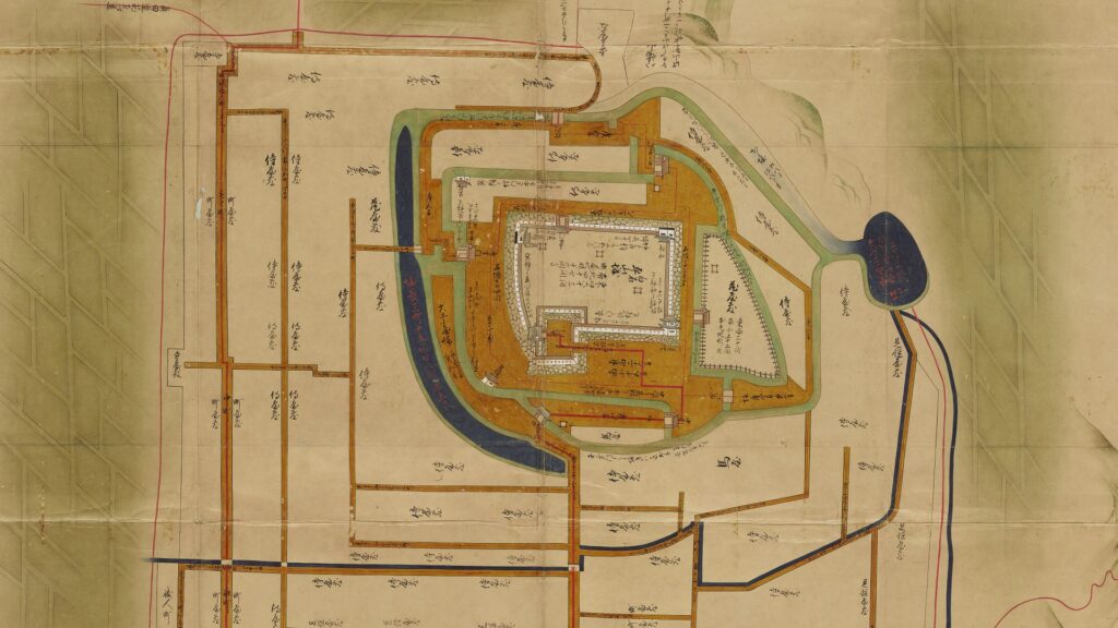
As for Shiroishi Castle itself, it is uncertain when it was first built, but it was considered an important strategic location for transportation. After the unification of Japan by Hideyoshi Toyotomi, Satonari Gamo, a senior vassal of the clan owned and modernized the castle by building stone walls and the Main Tower. He would later improve several other castles like Kasama Castle, which can be seen as a hidden master of castle constructions. The Katakura Clan lived and improved the castle more based on the essential structures Satonari built.
The ruins of Kasama Castle
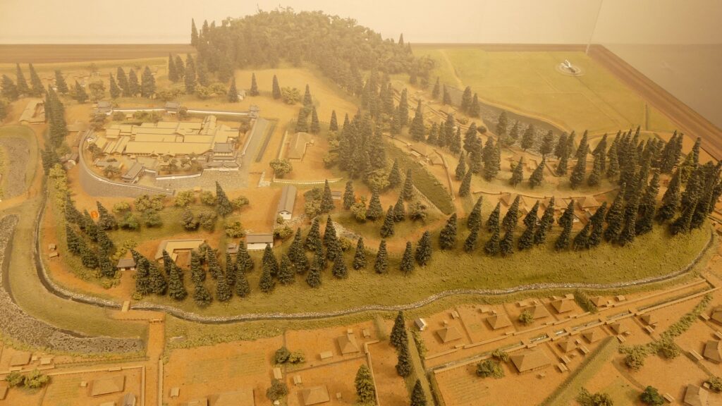
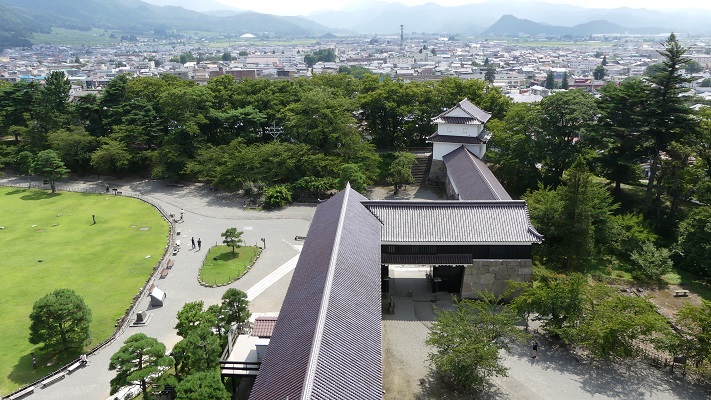
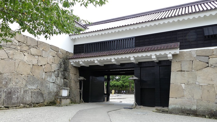
The castle had several enclosures on a hill. The Main Enclosure on the top had the main buildings of the castle, such as the three-level Main Tower, Main Gate, Back Gate, Main Hall, and two two-level turrets. They were exactly the same items as what other independent lords had. However, the Main Hall also had an interesting feature. The hall had two front entrances, one for locals and the other only for the lord of the Date Clan, the master of the Katakura Clan. The hall also had the rooms, called Onari-goten, where only the lord could stay.
The miniature model of Kasama Castle, exhibited by Shiroishi Castle History MuseumThe miniature model of the main enclosure of Shiroishi CastleThe part of the Main Hall in the miniature model above, the entrance for the locals is marked by the blue circle and that only for the lord of the domain is marked by the red circle
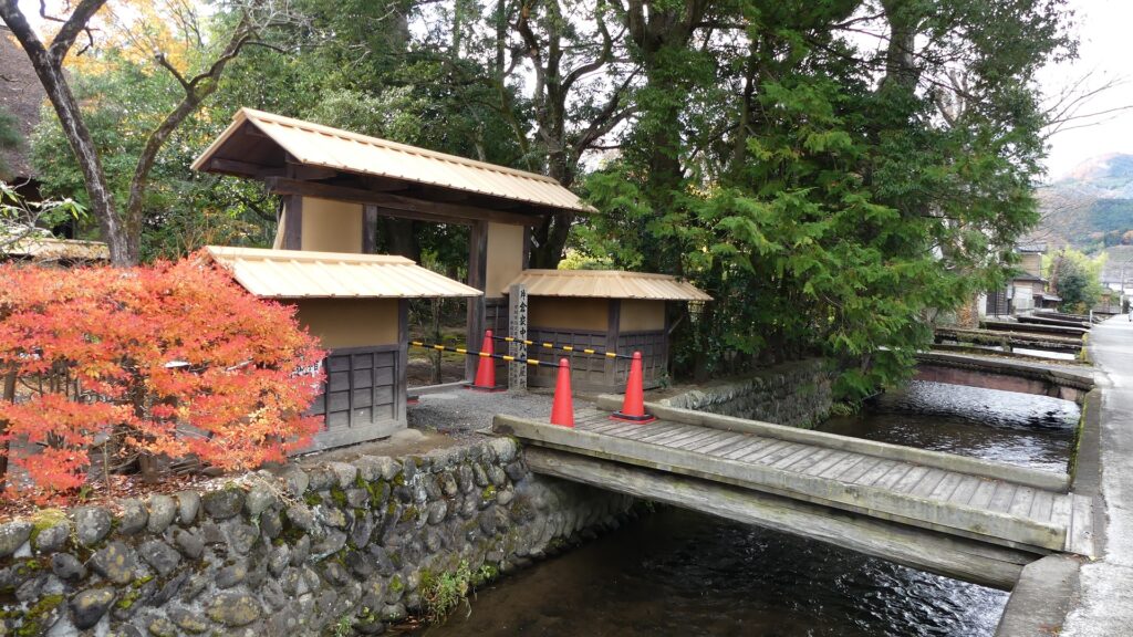
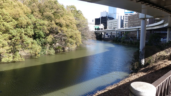
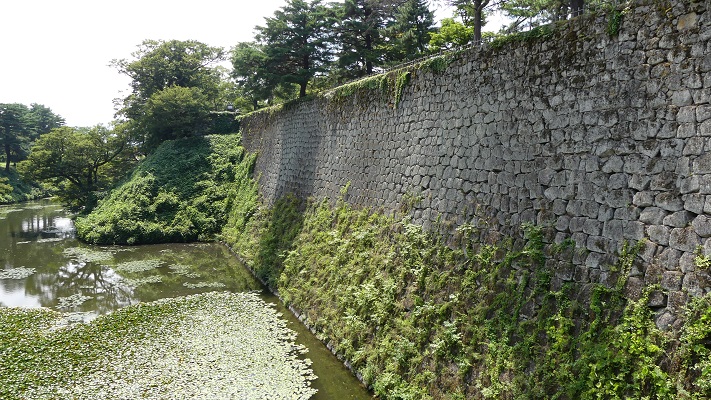
The Katakura Clan also developed the castle town below the hill, where the retainers and other citizens lived in. Waterways were also developed in the town for defensive purposes and living. For example, there were Samurai residences in the Third Enclosure, part of the town, which was surrounded by the Sawabata River and the waterways. The residences were relatively smaller than other residences of independent domains. This was because the retainers under the Katakura Clan had lower incomes than those who served independent lords.
Part of the Illustration of Shiroishi Castle in the Sendai Domain, Oshu Region, the third enclosure along the Sawabata River is in the front, exhibited by the National Archives of JapanThe remaining Samurai residence along the Sawabata River
One of stages of Meiji Restoration
In 1868 during the Meiji Restoration, an important event happened to the castle again. Many domains against the New Government in the Tohoku Region held the Shiroishi Meeting in the castle. This was because the Sendai Domain was their leader and the castle could also be a hub for them. This event would be the trigger for the Boshin War between the government and the domains. However, the castle was eventually opened as its real master, the Sendai Domain had surrendered to the government.
この城は、東京の輪郭を生み出しました。
This castle created the outline of Tokyo.
外郭の概要~Overview of Gaikaku
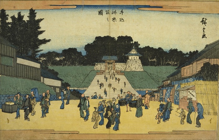
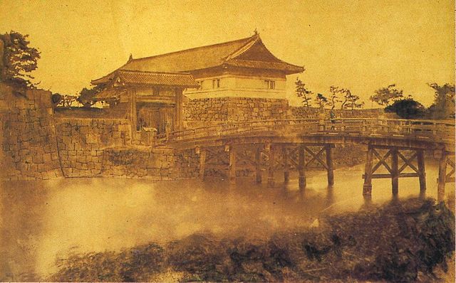
江戸城の外郭は、外堀に囲まれた区域であり、その外周は約16kmあり、市街地をも含んでいました。見附と呼ばれる大型の門と橋が、約50セット堀と主要街道の交差点に置かれていて、民衆と交通を監視していました。これらの施設は明治維新後にほとんど撤去されてしまいます。そのためほとんどの人たちは東京に城があったことなど気付きません。それでは、東京にある外郭の痕跡を巡ってみましょう。 The outline of Edo Castle called Gaikaku was the surrounding area from the outer moat whose perimeter was about 16 km, including even the city area. About 50 sets of large gates and bridges called Mitsuke were placed at the intersections of the moat and major roads to check people and transportation. These facilities were mostly demolished after the Meiji Restoration. So most people don’t realize there was a castle in Tokyo. Then, let me introduce the traces of Gaikaku in Tokyo.
江戸城の外郭ライン、ラインの色は以下のセクション毎に分かれています~The line of Edo Castle’s Gaikaku, the color of the line is linked to each section below
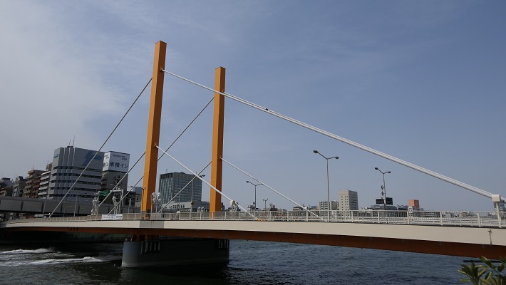
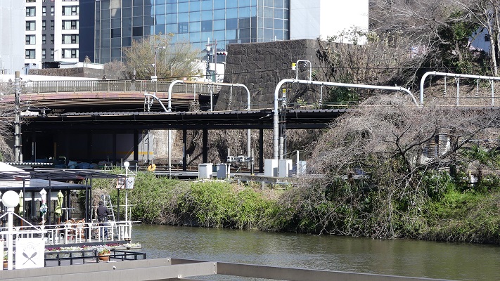
隅田川エリア~Sumida-gawa River Area
江戸時代の初め、隅田川は外堀の一部として認識されていました。そのため幕府は、日光街道上の千住大橋を除いて、この川に橋を架けることを禁じていました。1657年の明暦大火の後は、江戸の安全確保と都市化のため、他の橋も架けられるようになりました。 At the beginning of the Edo Period, Sumida-gawa River was regarded as part of the outer moats. Because of it, the Shogunate banned bridges from being built on the river excluding Senju-Ohashi Bridge on Nikko Road. After the great fire of Meireki in 1657, more bridges were built on the river for the increase of safety and urbanization of Edo City.
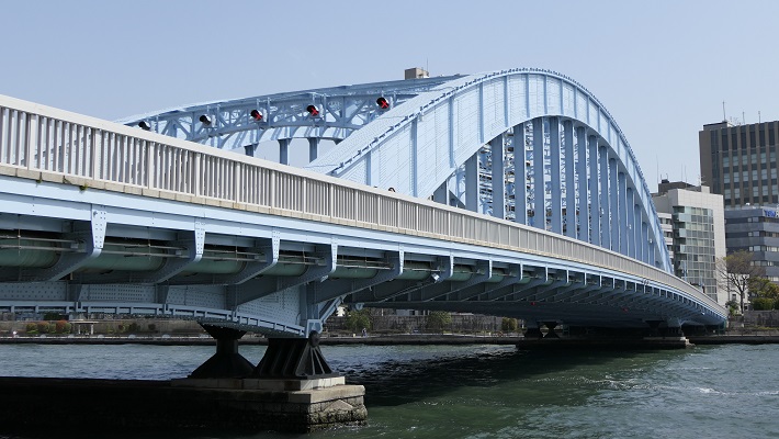
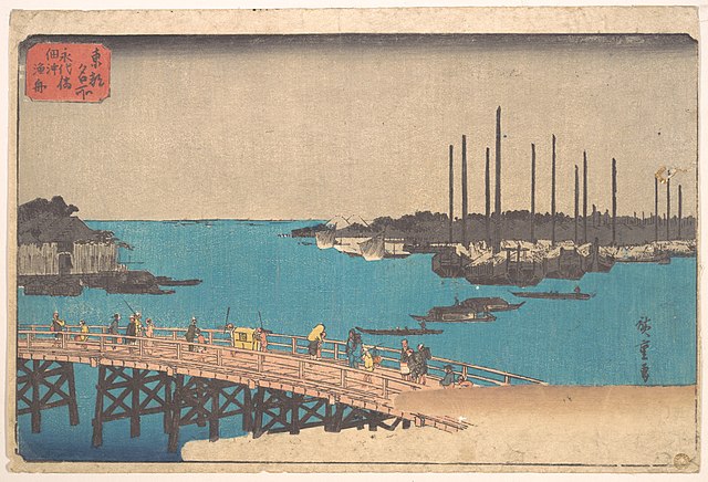
隅田川に架かる永代橋~Eitai-bashi Bridge over Smida-gawa River
隅田川エリアのライン~The line of Sumida-gawa River Area
永代橋~Eitai-bashi Bridge:
隅田川に架けられた4番目の橋です。現在の橋は、1923年の関東大震災の火災により失われた後、1926年に再建されたものです。すでにそれから100年近く経過しており、重要文化財に指定されています。 It is the forth bridge on Sumida-gawa River. The present bridge was rebuilt in 1926, after it was destroyed by the fire in the Great Kanto earthquake in 1923. It is nearly 100 years old, and has become an Important Cultural Property.
現在の永代橋~The present Eitai-bashi Bridge歌川広重「東都名所」より「永代橋佃沖漁舟」、江戸時代~”Eitai-bashi Bridge and fishing boats off Tsukuda Island” from the series “Famous Places in the Eastern Capital” attributed to Hiroshige Utagawa in the Edo Period(licensed under Public Domain via Wikimeidia Commons)
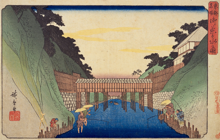
新大橋~Shin-Ohashi Bridge:
こちらは3番目に架けられた橋です。先代の橋は関東大震災を生き延びました。現在の橋は1977年に架け替えられたものです。江戸時代のこの橋は、歌川広重の有名な浮世絵に描かれたことで知られています。 It is the third bridge on the river. The former bridge survived the Great Kanto earthquake. The present one replaced it in 1977. The bridge in the Edo Period is known for being drawn in a famous Ukiyoe Painting by Hiroshige Utagawa.
現在の新大橋~The present Shin-Ohashi Bridge歌川広重「名所江戸百景」より「大橋あたけの夕立」、江戸時代~”Sudden shower over Shin-Ohashi Bridge and Atake” from the series “100 Famous Views of Edo” attributed to Hiroshige Utagawa in the Edo Period(licensed under Public Domain via Wikimeidia Commons)
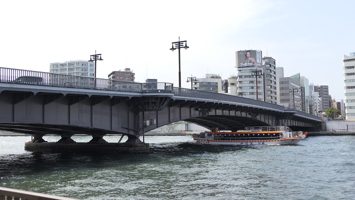
両国橋~Ryogoku-bashi Bridge:
2番目に架けられた橋です。この橋の周りは歓楽街になりました。江戸時代から夏にはこの辺で花火の催しが開かれています。近くにはまた外堀の一部である神田川の河口があります。 The second bridge on the river. The area around the bridge became a place of amusement. Fireworks displays have been also held around in the summer since the Edo Period. There is the estuary of Kanda-gawa River nearby which is another part of the outer moats.
現在の両国橋~The present Ryogoku-bashi Bridge葛飾北斎「富嶽三十六景」より「御厩川岸より両国橋夕陽見」、江戸時代~”Sunset across Ryogoku Bridge from the Bank of Sumida River at Onmayagashi” from the series “Thirty-six Views of Mount Fuji” attributed to Hokusai Katsushika in the Edo Period(licensed under Public Domain via Wikimedia Commons)
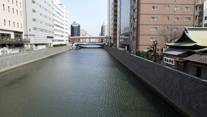
神田川エリア~Kanda-gawa River Area
「神田川」という名前は明らかに川です。ところが、この川は完全に人口物で、堀や運河として使われました。江戸時代初期に、幕府の下で伊達氏が本郷台地を掘り進んで造りだしたのです。幕府は川に沿って必要な施設を設置していました。掘削で出た残土は、下町周辺の埋め立てに使われました。 The name “Kanda-gawa” clearly shows a river (“gawa” means river.). However, the river is completely artificial, and was used as a moat and canal. In the first Edo Period, the Date clan under the Shogunate created it to cut across Hongo plateau. The Shogunate set facilities they needed along the river. The waste soil from the digging was used to reclaim the sea around downtown.
神田川~Kanda-gawa River
神田川エリアのライン~The line of Kanda-gawa River Area
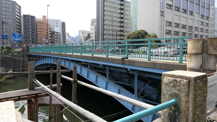
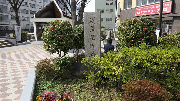
浅草橋門跡~Asakusa-bashi Gate Ruins:
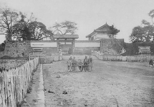
この門は川と浅草を通る日光街道の交差点に築かれました。しかし明治維新後間もなく撤去されました。そのため、何らかの記念碑でもなければ、そこに何があったかはわかりません。 This gate was built at the intersection of the river and Nikko Road passing Asakusa. But it was removed soon after the Meiji Restoration, so we can’t see what was seen in the past without some kind of monument.
現在の浅草橋~The present Asakusa-bashi Bridge記念碑のみがあります~There is just a monument浅草橋門の古写真~The old photo of Asakusa-bashi Gate(licensed under Public Domain via Wikimedia Commons)
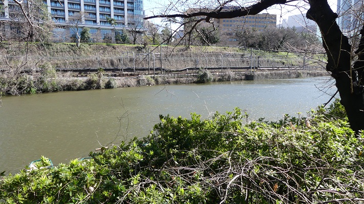
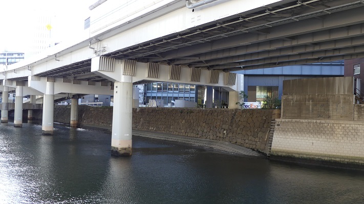
仙台堀~The Sendai Moat:
「仙台」という名前は伊達氏が仙台を拠点としていたことに由来します。JR御茶ノ水駅近くの橋からは深くえぐられた川の一部を見ることができます。JR中央線はその谷に沿って走っています。 The name “Sendai” derived of the Date clan from Sendai. You can see the part of the river being cut deeply from the bridge near JR Ocha-no-Mizu Station. JR Chuo line goes along the valley.
現在の仙台堀~The present Sendai Moat
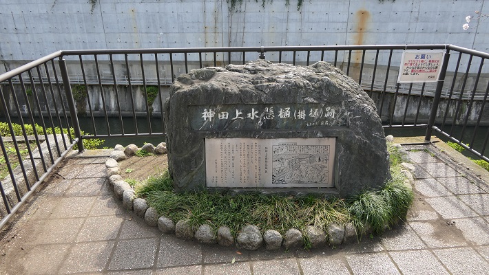
水道橋跡~The Water Bridge Ruins
かつて神田上水がこの水道橋によって川を横断していました。井の頭池を水源として江戸市街に給水していました。この周辺の街と、近くにある「水道橋」駅の名前はここから来ています。 Kanda water supply went across the river using the Water Bridge. It came from Inokashira Pond to feed Edo City. The names of the town around and the station nearby “Suido-bashi” comes from the bridge.
水道橋の記念碑~The monument of Water Bridge記念碑周辺の風景~A view around the monument歌川広重「東都名所」より「御茶之水之図」、江戸時代~”The picture of Ocha-no-Mizu” from the series “Famous Places in the Eastern Capital” attributed to Hiroshige Utagawa in the Edo Period(出典:国立国会図書館)
外堀の西側部分~The western part of the outer moats
この部分は1638年までに江戸城建設の総仕上げとして築かれました。自然の谷の地形を利用しています。城の中心を砲撃から守ることを意図し、堀の内側に土塁を積み上げ、外側よりも高くなるようにしています。 This part was built to finalize the construction of the Edo Castle by 1638. It used a natural valley terrain. It aimed to protect the center of the castle from a cannon attack outside by setting the inside of the moat much higher with earthen walls than the outside.
弁慶濠~Benkei-bori Moat
外堀の西側部分のライン~The line of The western part of the outer moats
牛込門跡~Ushigome-mon Gate Ruins:
門の両側の石垣が現存しています。門跡の周辺は現在JR飯田橋駅として利用されています。門跡の反対側は神楽坂になっていて、外堀は谷底に位置しているのがわかります。牛込濠と呼ばれるその堀は、門跡の西側にほぼそのまま残っており、とても広大に見えます。 The stone walls from both sides of the gate remain. The area around the ruins are now used for JR Iida-bashi Station. The opposite of the ruins is Kagura-zaka slope, so you can see the outer moat located in the bottom of the valley. The moat called “Ushigome-bori” in the west of the ruins remain like it was, and looks very spacious.
牛込門跡~Ushigome Gate Ruins歌川広重「牛込神楽坂之図」、江戸時代~”The picture of Ushigome and Kagurazaka” attributed to Hiroshige Utagawa in the Edo Period(出典:国立国会図書館)牛込濠~Ushigome-bori Moat
市ヶ谷門跡~Ichigaya-mon Gate Ruins:
石垣がいくらか残っており、外側から堀を渡って門に伸びる土橋も残っています。周辺はまたJR市ヶ谷駅の一部として使われています。 There are some remaining stones, and the earthen bridge from outside to the gate across the moat remains. The area around is also part of the for JR Ichigaya Station.
市ヶ谷門跡~Ichigaya-mon Gate Ruins市ヶ谷門の古写真~The old photo of Ichigaya-mon Gate(licensed under Public Domain via Wikimedia Commons)
四谷門跡~Yotsuya-mon Gate Ruins:
門の片側の石垣が残っていますが、周辺の堀は既に埋められています。一例として、門跡西側の以前堀だったところは上智大学のグラウンドとして使われています。広大な敷地を眺めながら、内側の土塁の上を歩くことができます。 There are some remaining stone walls on one side of the gate, but outer moats around are already filled. For example, the former moat in the west of the ruins is used as the ground for Jochi University. You can walk on the inside earthen walls and enjoy a view of the spacey area.
残っている石垣~The remaining stone walls四谷門の古写真~The old photo of Yotsuya-mon Gate(licensed under Public Domain via Wikimedia Commons)上智大学のグラウンド~The ground for Jochi University
外堀が失われたエリア~The lost outer moat area
東京の都心では、いくつかの理由で外堀は既に失われています。現在では外堀通りとして自動車道になっています。過去にはどんな景観だったのか想像するのは困難です。 In the center of the Tokyo city area, the outer moat was already lost for several reasons. It is now used as the Sotobori (means onter moat) Street for automobiles. It is difficult for us to understand what can be seen in the past.
外堀通り、ビル街の谷間のようです~Sotobori Street, just like a valley among the buildings
外堀が失われたエリアのライン~The line of the lost outer moat area
赤坂門跡~Akasaka-mon Gate Ruins:
門の石垣の一部が、赤坂見附(幕府の施設であった名前と同じ)交差点の近くに残っています。「弁慶濠」と呼ばれる現存堀が門の西側にあります。そこから続く「溜池」堀は失われています。 Part of the stone walls for the gate remain near the Akasaka Mitsuke (same as the Shogunate facility’s name) Intersection. A remaining moat called “Benkei-bori” is in the west of the gate. The following moat called “Tame-ike” has lost.
赤坂門跡~Akasaka-mon Gate Ruins
「溜池」交差点~The Tame-ike Intersection:
堀の名前が交差点の名前として残っています。溜池とは貯水池の意味です。江戸時代の初期には、江戸の人々は川をせき止め、飲料水として使っていたようです。 The name of the moat remains for the intersection. Tame-ike means reservoir. At the beginning of the Edo Period, people in Edo City seemed to dam a river, and use it for drinking water.
溜池交差点~Tame-ike Intersection
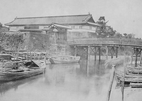
呉服橋交差点~The Gofuku-bashi Intersection:
この交差点は東京駅の近くにあります。ここには外堀と「呉服橋」という橋と呉服橋門がありました。今現在、これらの痕跡は何もありません。 The intersection is near Tokyo Station. There was an outer moat, a bridge called “Gofuku-bashi” and Gofuku-bashi Gate. They have completely removed it. We can’t see any trace of them now.
呉服橋交差点~Gohuku-bashi Intersection呉服橋門の古写真~The old photo of Gofukubashi-mon Gate(licensed under Public Domain via Wikimedia Commons)
日本橋川エリア~Nihonbashi-gawa River area
ここは外堀の最後の、または最初の部分です。この箇所は江戸城の内堀の近くです。ここから外堀が市街の外側に向かって渦巻き状に伸びているので、堀を逆に辿っていくこともできます。日本橋川もまた人工川であり、元々あった川のルートを変えるために作られました。この川の上流は、平川という元あった川と同じようです。 It is the last part of the outer moats, or the first part. The part is near the inner moat of Edo Castle. We can see the outer moats spiral towards the outside of the city, so you can trace the moats backward. Nihonbashi-gawa River is also artificial and was built to change the routes of original rivers. The upper stream of the river might be the same as the original river called Hirakawa River.
日本橋川沿いの石垣~The stone walls along Nihonbashi-gawa River
日本橋川エリア~Nihonbashi-gawa River area
常盤橋門跡~Tokiwabashi-mon Gate Ruins:
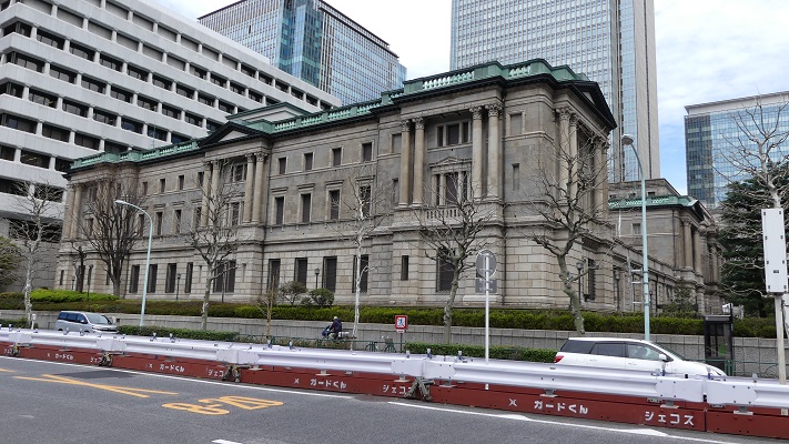
この門の石垣がよく残っています。そのため国の史跡に指定されています。堀を渡って門に至る石橋は、明治時代に門の他の石を使って築かれたものです。近くには日本銀行旧館の建物があり、こちらは重要文化財に指定されています。 The stone walls of the gate remain well. That’s why they have been designated as a National Historic Site. The stone bridge across the moat to the gate was built using other stones from the gate in the Meiji Era. You can also see the old building for Bank of Japan nearby, designated as an Important Cultural Property.
常盤橋門跡の石橋~The stone bridge of Tokiwabashi-mon Ruins常盤橋門の古写真~The old photo of Tokiwabashi-mon Gate(licensed under Public Domain via Wikimedia Commons)日本銀行旧館~The old building for Bank of Japan
一ツ橋門跡~Hitotsubashi-mon Gate Ruins:
この門と堀周辺の石垣が残っています。江戸時代後半に、将軍の一族である一橋家の屋敷がこの門内にありました。 There are some remaining stone walls for the gate and the moat around. The hall for the Shogun’s relative called Hitotsu-bashi clan was inside the gate in the late Edo Period.
現在の一ツ橋門と残っている石垣~The present Hitotsubashi-Bridge and remaining stone walls堀周辺の現存石垣~The remaining stone walls around the moat
雉子橋門跡~Kijibashi-mon Gate Ruins:
ここが外堀の終点に当たります。ここから内堀が近くに見えます。日本橋川は更に上流から流れてきています。その上流を辿っていくと外堀の違う地点、小石川門の近くに到達します。実はこの上流の部分は一旦幕府によって埋められますが、明治時代になって水上交通の便ため、掘り返されました。 This is the edge of the outer moats. You can see the inner moat nearby. The river flows from a much upper area. You can follow that the upper stream and you’ll reach another spot of the outer moat near Koishi-kawa Gate. In fact, the upper stream was once filled by the Shogunate, but was dug again for water transportation in the Meiji Era.
現在の雉子橋~The present Kijibashi-Bridge
私の感想~My Impression
外堀の全てを辿ってくには1日では足りないでしょう。ですので、少しずつ部分的に訪れてみるのもよいでしょう。どちらにしても行ってみれば、江戸城はインフラ、文化、商業などの面で東京の中心につながっていることが実感できます。 It will need more than one day trip to trace all of the outer moats, so you can visit part of them one by one. Anyway, after visiting them, you can realize that Edo Castle has been the center of Tokyo in infrastructure, culture, business and so on.
牛込門跡と飯田橋駅~Ushigome-mon Gate Ruins and Iidabashi Station
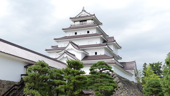
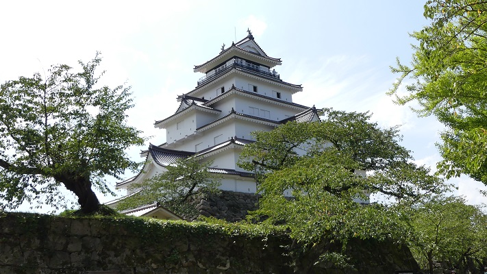
この城の天守は東北地方唯一の5層天守です。
Its Main Tower has been the only five-layer one in Tohoku Region.
若松城の外観復元天守~The apparently restored Tenshu keep of Wakamatsu Castle
立地と歴史~Location and History
葦名氏が築城~Ashina clan first built it
現在の福島県の会津地域は、鉄道や自動車が普及する以前は交通の要地でした。戦国時代にはこの地域を巡って葦名氏と伊達氏がしのぎを削りました。葦名氏が最初に、恐らくは後の若松城と同じところに黒川城を築きました。城は会津盆地の低台地の西端にあり、その南北を二つの川に挟まれていました。 The Aizu area in now Fukushima Prefecture was an important point for transportation before the rise in trains and automobiles. In the “Sengoku” or Warring States Period, the Ashina clan and the Date clan battled each other over the area. Ashina first built Kurokawa Castle probably at the same place as later Wakamatsu Castle. The castle was on the western edge of a mild plateau in Aizu Basin sandwiched by two rivers in the north and south directions.
福島県の地図、深緑部分が会津地域~The map of Fukushima Prefecture, the part of dark green is Aizu area(licensed under Public Domain via Wikimedia Commons)
城の位置~The location of the castle
蒲生氏郷が天守を建設~Ujisato Gamo constructed Tenshu
1590年、天下人の豊臣秀吉は「奥州仕置」を宣言し、東北地方で彼の裁量による領地の配分を行い、黒川城にやってきました。秀吉はそのとき領主であった伊達からこの城を取り上げ、配下の蒲生氏郷に与えました。氏郷は城の大改修を始め、東北地方では初めて石垣を使った台上に天守を築き、城の名前を「若松」と改めました。更に、この天守は7層の建物であったと言われ、きっとこの地方の人たちを驚かせたことでしょう。 In 1590, the ruler Hideyoshi Toyotomi declared “Oshu-Shioki” which refers to the assessment of his territorial ownership in Tohoku Region, and came to Kurokawa Castle. He took the castle away from Date, the lord of it then, and gave it his men, Ujisato Gamo. Gamo started the renovation of it, built the first “Tenshu” or Main Tower on its base using stone walls for the region, and renamed the castle “Wakamatsu”. It is said that the Tenshu was even a seven-layer building that must have surprised people in the region.
蒲生氏郷肖像画、会津若松市立会津図書館蔵~The portrait of Ujisato Gamo, owned by Aidu Wakamatsu Library(licensed under Public Domain via Wikimeidia Commons)
加藤氏が新天守と出丸で強化~Kato clan improved it with new Tenshu and Demaru
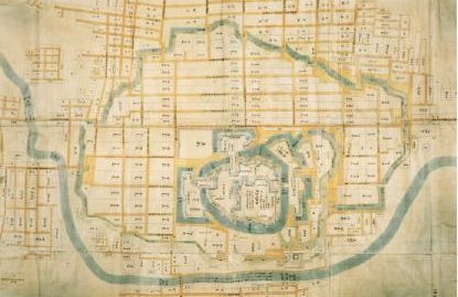
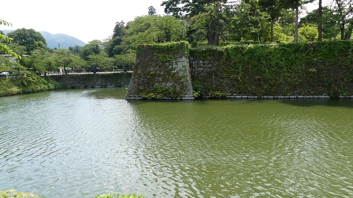
城の後継の領主、加藤氏もまた城を強化しました。加藤は地震で傾いていた天守を5層の新しい天守に置き替え、天守がある「本丸」は高石垣と堀に囲まれていました。加藤はまた「出丸」と呼ばれる強力な防御拠点を、本丸を守るためその北方と西方に築きます。この城には「二の丸」や「三の丸」といった曲輪が東方にあり、自然の障壁として湯川がありました。その上に、総構えと呼ばれる外堀、土塁と16つの門から成る外郭があり、その外周は約6kmでした。 The following lord of the castle, the Kato clan also improved it. Kato replaced the Tenshu, which had leaned due to an earthquake, with a new five-layer one at “Honmaru” enclosure that were surrounded by high stone walls and moats. They also built the defense strongpoints called “Damaru” in the north and west to protect Honmaru. The castle had other enclosures such as “Ninomaru” and “Sannonaru” in the east, and a natural hazard as Yukawa River. Moreover, the castle had an outline called “Sou-Gamae” with outer moats, earthen walls and 16 gates whose perimeter wad about 6 km.
若松正保城絵図、福島県立博物館蔵、江戸時代~The illustration of Wakamatsu Castle in Shoho Era, owned by Fukushima Prefectural Museum, in the Edo Period(福島県資料より引用)
若松城が標的に~Wakamatsu Castle was targeted
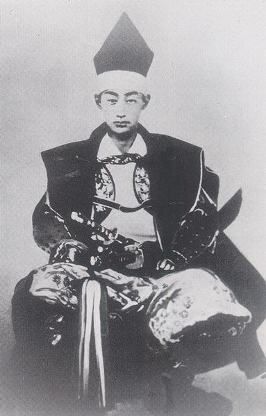
その後、松平氏が長年城と町を統治していました。彼らは精強さと徳川幕府への忠誠で知られていました。そのため幕末の京都において反体制者と戦うことになります。最後の領主、松平容保は幕府から京都守護職に任命され、孝明天皇からも信頼されました。ところが状況が変わり、長州藩、薩摩藩といった反体制側が今後は明治天皇のもと新政府となってしまったのです。新政府は幕府が降伏した後は、容保がいる会津藩を罰しようとしました。その標的が若松城でした。 After that, Matsudaira clan governed the castle and town for many years. They were known for strength and their loyalty to the Tokugawa Shogunate. That made them fight with dissidents in Kyoto at the end of the Edo Period. The last lord, Katamori Matsudaira was assigned for the Military Governor of Kyoto by the Shogunate, and supported by Emperor Komei. However, the situation was changed, the dissidents such as the Choshu and Satsuma Domains became the New Government under Emperor Meiji instead. The government tried to punish the Aizu Domain under Katamori after the surrender of the Shogunate. Its target was Wakamatsu Castle.
松平容保写真、会津若松市蔵~The photo of Katamori Matsudaira, owned by Aizu-Wakamatsu City(licensed under Public Domain via Wikimeidia Commons)
出丸が敵を撃退し籠城戦に~Demaru repelled enemy, and held castle long
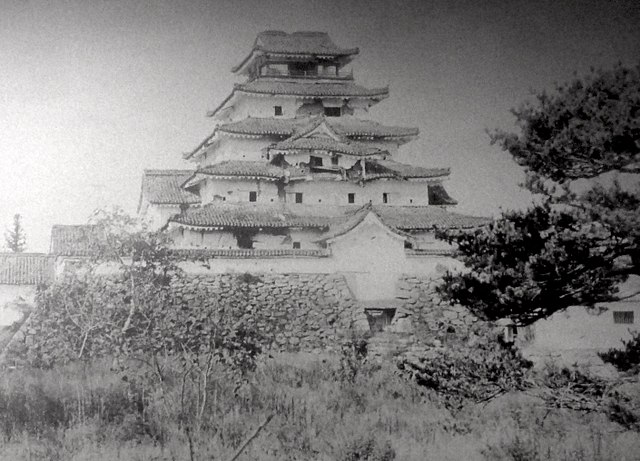
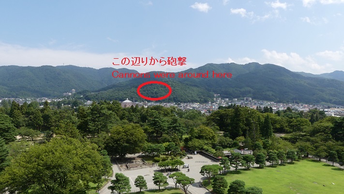
1868年8月23日、近代装備の政府軍が城を攻撃しましたが、撃退されました。北出丸が防御したのです。200年以上前に出来た防衛システムが、近代戦争においてさえその頑丈さを証明したのです。軍は方針を変え、外郭を取り囲み、遠くから城に砲撃を加えました。城はかなりの損害を被りましたが、武士たちは闘志を失いませんでした。包囲戦は1ヶ月続きます。やがて援軍の見込みもなくなり、政府軍は総攻撃により外郭を突破しました。容保は9月22日に降伏しました。少年兵による白虎隊を含む会津藩士の死体は、新政府により埋葬を許されなかったといいます。 The Government Army with modern equipment attacked the castle on August 23, 1868, but was warded off. The north Demaru blocked it. The defense system established over 200 years ago proved its toughness even in a modern war. The army changed the way, surrounded the outline, and shot cannons into the castle from far away. The castle was so damaged, but the warriors kept fighting spirit. The siege lasted for one month. There would be no hope to have a reinforcement, and the army launched a full-scale attack to break the outline. Katamori had to surrender on September 22. It is said that the war dead of Aizu Domain, including a boy military unit, called Byakkotai were not allowed to be buried by the Government.
戦いで損傷した天守~The Tenshu damaged by the battle(licensed under Public Domain via Wikimeidia Commons)天守から見た砲撃陣地跡~A view of the former artillery position from Tenshu
特徴~Features
復元された5層天守~Restored 5-layer Tenshu
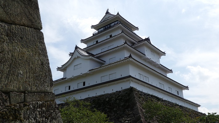
現在、地元の人たちは通常この城のことを、よく知られた愛称である「鶴ヶ城」と呼んでいます。城跡は「鶴ヶ城公園」という名の歴史公園として、城の中心の基礎部分が復元天守とともに残っています。天守は外観復元され、博物館としても使われています。加藤が築いた5層天守を、蒲生が築いた元からの石垣の上に再現しています。 Now, local people usually call the castle “Tsuruga-jo”, its famous nickname. The ruins of castle remain as a historical park called Tsuruga-jo Park with the foundation of the central castle and the restored Tenshu . Tenshu is apparently restored and also used as a museum. It emulates Kato’s five-layer Tenshu on Gamo’s original stone walls.
その石垣は天守に比して少し大きいようにも見えますが、蒲生の7層天守にはピッタリだっともいいます。 The stone walls look little large for the Tenshu because Gamo’s seven-layer one might be fitter.
建物と石垣の境目部分~The border part between the building and the srone walls
更には天守の瓦が最近赤いものに取り替えられました。これが元来の様式であり、寒い気候でも耐久性があるとのことです。 In addition, the roof tiles of Tenshu were recently replaced with red colored ones which were original style and durable under cold climate.
赤瓦~The red rooftiles(taken by 松波庄九郎 from photoAC)
他の建物と遺跡~Other buildings and ruins
城周辺の航空写真~The aerial photo of around the castle
他には、鉄門、干飯櫓といった建物が復元され、漆喰塀により天守とつながっています。 Other buildings like Kurogane Gate and Hoshii Turret were also restored connected with Tenshu by plaster walls.
天守から見た鉄門と干飯櫓~Kurogane Gate and Hoshii Turret from Tenshu鉄門~Kurogane Gate
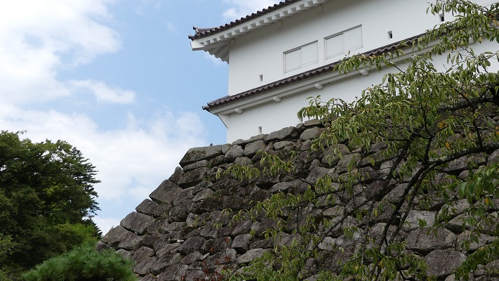
それから本丸の東側に沿っている加藤が最初に築いた高石垣は必見です。 You should check out the remaining high stone walls along the east side of Honmaru that Kato first built.
本丸東側の高石垣~The high stone walls along the east side of Honmaru高石垣は本丸東口を防御します~The high stone walls guard the east entrance of Honmaru
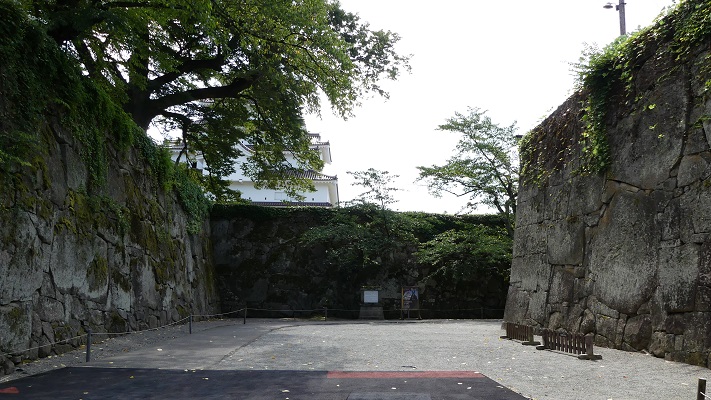
また、本丸の北側と西側には「出丸」の構造が残っていますので、是非ご覧ください。 You can also see the structure of the defense system “Dameru” in the north and west of Honmaru.
北出丸の入り口~The entrance of the north Demaru西出丸の入り口~The entrance of the west Demaru
外郭の遺跡としては僅かですが甲賀町口郭門跡などがあります。 There are few ruins of the outline such as the Kogamachi Gate Ruins.
その後~Later History
元武士が保存のため買い上げ~Fromer warrior bought it to preserve
明治維新後、1874年に一般に公開後、城の全ての建物は撤去されました。元会津藩士の遠藤敬止は城跡の土地を買い上げ、1890年に以前領主だった松平家に寄付し、その保全を図りました。昭和初期、市が城跡を公園地として保有し、最終的には1934年に国の史跡に指定されました。 After Meiji Restoration, all the buildings of the castle were demolished after the exhibition to the public in 1874. Keishi Endo, a former warrior of Aizu Domain bought the land of the castle ruins and donated them to the former lord Matsudaira to keep them in 1890. In the first Showa Era, the city owned the ruins for a park. In 1934, they were lastly designated as a National Historic Site.
現在の天守は1965年に復元~The present Tenshu restored in 1965
私の感想~My Impression
会津藩は敗れてしまいましたが、会津の多くの人たちは明治時代に、女性を含め教育界や官界などで活躍しました。高い教育を受けていたからです。その歴史を知れば、会津への旅はもっと有意義になると思います。 Despite Aizu Domain being beaten, many people in Aizu succeeded in the Meiji Era, for example, in the educational and the official worlds, including women. Because they were well educated. I think leaning more about the history of Aizu will make your travel there more interesting.
本丸の北入口、太鼓門~The north entrance of Honnmaru called “Taiko-mon” or the Drum Gate
ここに行くには~How to get There
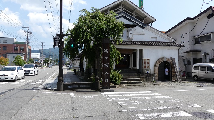
東京などの都市から東北新幹線を使ってこられるのでしたら、郡山駅から高速バスに乗るのが便利です。城の近くに直接行きつけるからです。郡山駅西口でバスに乗って、鶴ヶ城合同庁舎前バス停で降りてください。北出丸から入っていけます。 If you use the Tohoku Shinkansen super express to get there from cities like Tokyo, it can be useful to take the express bus from Koriyama station. Because it takes you directly to near the castle. Take the bus at the west exit of Koriyama station, and take off at the Tsurugajo-Godochosha-Mae bus stop. You can enter at the north Damaru.
城の北入口~The north entrance of the castle北出丸の外観~The appearance of the north Demaru
会津若松駅からは、6番バス乗り場からハイカラさんバスに乗り、鶴ヶ城入口、鶴ヶ城北口、または鶴ヶ城三の丸口で降りてください。 車の場合は、磐越自動車道会津若松ICから約15分です。公園には西出丸、東口、南口に駐車場があります。 From Aizu-Wakamatsu station, you can take the Haikara-san bus at the No.6 bus stop, and take off at the Tsurugajo-Iriguchi, Tsurugajo-Kitaguchi or Tsurugajo-Sannomaru-Guchi bus stop. If you want to go there by car: It takes about 15 minutes from the Aizu-Wakamatsu IC on Banetsu Expressway. The park offers parking lots at the west Demaru, the east entrance and the south entrance.