59.姫路城その1~Himeji Castle Part1

困難を乗り越え奇跡的に生き残った最高の城
The best castle that miraculously survived difficulties

概要~Overviews

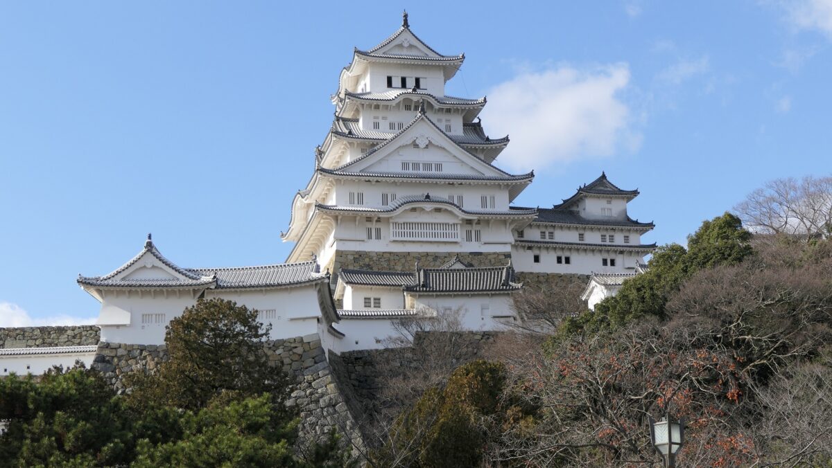
姫路城は、その白亜の天守群を世界中に知られており、よく「白鷺城」という別名で呼ばれたりしています。大天守は、日本の城で現存している12天守の中では最大のものであり、31.5mの高さ(天守台石垣を含めると45.35m)があります。大天守、3基の小天守、その他の構造物と合わせた一体が国宝に指定されています。
Himeji Castle is known around the world for its beautiful group of white Main Towers and is often nicknamed White Heron Castle or “Shirasagi-jo”. The Large Main Tower is the largest one out of the 12 remaining main towers in Japanese castles, which is 31.5m high (45.35m including the stone wall base). The Large Main Tower, the three Small Main Towers, and the other structures on the property have been designated as National Treasures of Japan.
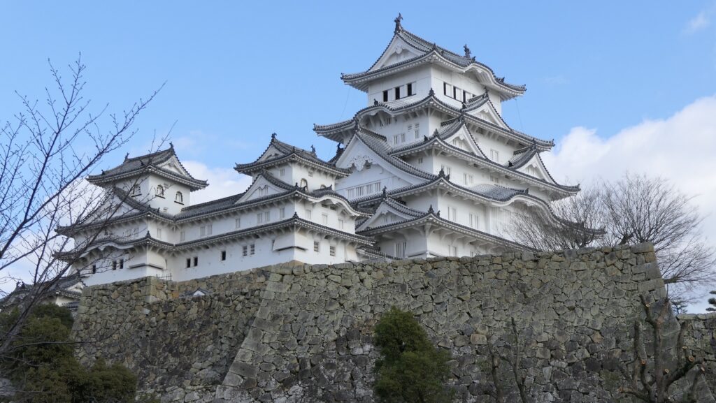
姫路城の天守群~The group of the Main Towers of Himeji Castle

更には、多くの曲輪、石垣、水堀など、城の基礎部分が、ほとんどそのまま残っていて、天守を取り囲んでいます。これら城の主要部分はまた、国の特別史跡に指定されています。27基の櫓、15基の門、32枚の塀という、数多くの建物がその基礎の上に現存しています。これらは全て国の重要文化財に指定されています。
In addition, the current structure of the castle mostly consists of a lot of enclosures, stone walls, and water moats surrounding the Main Tower. The main portion of the castle is designated as a National Special Historic Site. The remaining buildings on the structure include as many as 27 turrets, 15 gates and 32 walls. They have all become Important Cultural Properties.
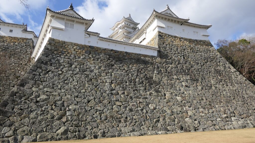
天守を囲む櫓と石垣~One of the turrets and stone walls surrounding the Main Tower

その上に、この城は日本の歴史の中で重要な役割を担いましたが、それは後述します。その役割を終えた後でも、幸運もあったかもしれませんが、日本の人々はこの城を守り続けました。現在この城は、姫路市の最も有名で且つ大事なシンボルとなっています。1993年からは日本では初となる世界文化遺産にも指定されています。
Moreover, the castle had an important role in Japanese history, which I will describe later.
Even after that role ended, the people of Japan continued to maintain the castle, although some people might say it survived by good luck. Now, people consider the castle as the greatest, most respected symbol in Himeji City. It has been a cultural site on the World Heritage List since 1993, which was the first case in Japan.
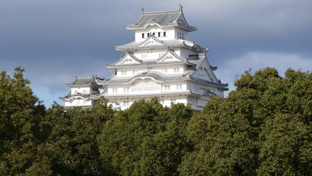
天守(正面)~The Main Tower (the front)

これらのことから私は、一般的に日本のどの城がベストかと聞かれた場合、それぞれの方に好みがあるにしても、それは姫路城ですと明言できます。
For those reasons, if I am asked from someone which castle is the best in Japan generally, I can clearly answer it is Himeji Castle, though each has his/her own preference.

立地と歴史~Location and History

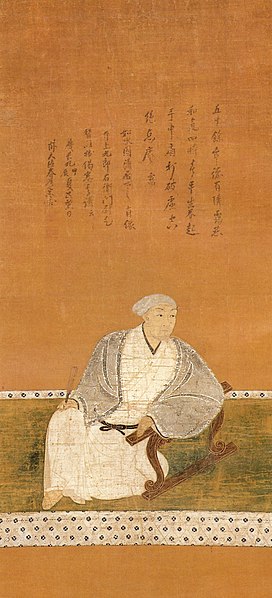
姫路城は、兵庫県西部の播州平野にある標高45.6m姫山の上にあります。この城は、最初は14世紀に赤松氏によって築かれたと言われていますが、詳細は不明です。城周辺の地域は肥沃で交通の要所であり、山陽街道が通っていました。ただしこの城は、周りにある多くの城のうちの一つに過ぎませんでした。この状況は戦国時代の16世紀、黒田官兵衛が城を所有していた時に変わりました。東には織田氏、西には毛利氏が姫路城周辺の地を狙っている中、官兵衛は織田氏に味方することを決意しました。官兵衛は、姫路城を織田の家臣である羽柴秀吉に差し出したのです。秀吉は、後に天下人である豊臣秀吉となります。
Himeji Castle is located on 45.6m high Himeyama mountain in the Banshu Plain, the western part of Hyogo Prefecture. It is said that the castle was first built by Akamatsu Clan in the 14th century, but the details are uncertain. The area around the castle was fertile and important for transportation where the Sanyo Road passed through, but the castle was among the many castles around. The situation changed in the late 16th century during the Sengoku Period when Kanbe Kuroda owned the castle. With the Oda Clan on the east and the Mori Clan on the west, aiming to invade the area around the Himeji castle, Kanbe decided to support the Oda Clan. He offered his Himeji Castle to Oda’s retainer, Hideyoshi Hashiba, who later became the ruler of Japan and subsequently changed his name to Hideyoshi Toyotomi.
城の位置~The location of the castle

黒田官兵衛肖像画、崇福寺蔵~The portrait of Kanbe Kuroda, owned by Sofukuji Temple (licensed under Public Domain via Wikimedia Commons)

秀吉は毛利の領地を侵略するため、この城を根拠地とし、城の拡張を行いました。秀吉時代の城には三層の天守がありましたが、詳細はその遺跡が現在の天守の下にあるため明らかになっていません。城の基本的な構造はこの時代に確立したと言われています。1582年、秀吉と官兵衛は姫路城から100km近く西方にある備中高松城を攻撃していました。そのとき本能寺の変が起こり、秀吉と官兵衛の主君である織田信長が明智光秀により殺されました。秀吉は直ちに西方の毛利氏と講和を結びます。これにより秀吉は、主には徒歩による移動で重い荷物を自ら運ぶしかなかった前近代の軍隊を、わずか3日で姫路城に戻すことができたのです。彼はこの城で準備を整えてから出陣し、光秀を倒した後、天下を掌握することに成功しました。
Hideyoshi was based at the castle to invade Mori’s territory, and developed the castle. The castle of Hideyoshi’s period had a three-layer Main Tower; the details of which are uncertain because its ruins are under the present Main Tower. It is said that the basic structure of the castle was established at that time. In 1582, Hideyoshi with Kanbe attacked Bicchu-Takamatsu Castle, nearly 100km away from Himeji Castle on the west. The Honnoji Incident happened where Hideyoshi’s and Kanbe’s boss, Nobunaga Oda was killed by Mitsuhide Akechi. Hideyoshi quickly made peace with the Mori Clan. This allowed Hideyoshi to quickly return to Himeji Castle within 3 days with pre-modern large troops travelling mainly by foot and transporting heavy items. He prepared and left the castle to beat Mitsuhide and was successful in taking over control of Japan.
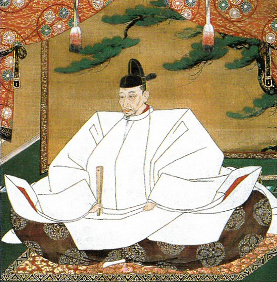
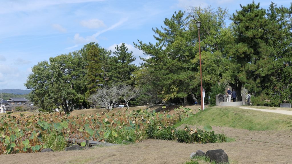
豊臣秀吉肖像画、加納光信筆、高台寺蔵~The Portrait of Hideyoshi Toyotomi, attributed to Mitsunobu Kano, ownd by Kodaiji Temple(licensed under Public Domain via Wikimedia Commons)
備中高松城跡~The ruins of Bicchu-Takamatsu Castle

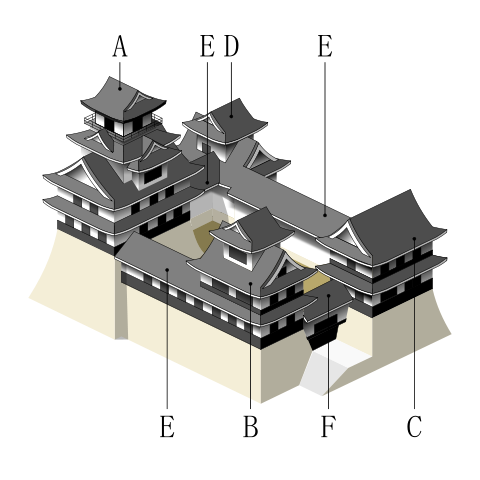
秀吉の死後、豊臣氏に代わって徳川家康が1600年に実権を握りました。家康は、娘婿である池田輝政を吉田城から姫路城に移しました。輝政は後に姫路藩の初代藩主になります。輝政の役目は、大坂城にいた豊臣氏をいまだ支持するかもしれない西国大名を監視することでした。彼は1601年から1609年の間に城の大改修を行います。天守は、5層の大天守と3基の小天守に置き換えられました。これらは、渡櫓によりつながっていて「連立式」天守と呼ばれます。輝政は姫山の上にある秀吉の城の構造を引き継ぎつつも、多くの櫓、門、練塀、石垣を加えたのです。結果的に城は、小さな曲輪を複雑に組み合わせたものとなりました。例えば、今でも観光客は天守にたどり着くまで10以上もの門を通らなければなりません。
After Hideyoshi died, Ieyasu Tokugawa got the power instead of the Toyotomi Clan in 1600. Ieyasu transferred his son-in law, Terumasa Ikeda, from Yoshida Castle to Himeji Castle. Terumasa later became the founder of the Himeji Domain. Terumasa’s role was to monitor the lords in western Japan, who might still support the Toyotomi Clan at Osaka Castle. He did major renovations to the castle between 1601 and 1609. The Main Tower was replaced with the five-layer Large Main Tower and three Small Main Towers. They are connected by the Roofed Passage Turrets, which are called Connected Type or “Renritsu-shiki”. Terumasa followed Hideyoshi’s structure of the castle on Himeyama mountain, but he added lots of turrets, gates, plaster walls, and stone walls. As a result, the center of the castle became very complex with combined small enclosures. For example, visitors must pass through as many as over 10 gates to reach the Main Tower.
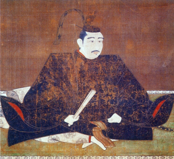
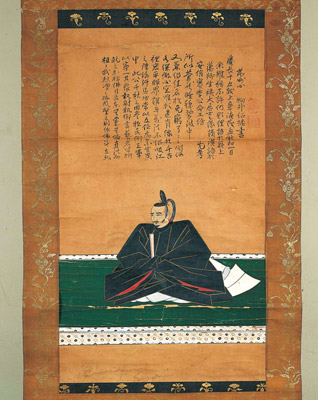
池田輝政肖像画、鳥取県立美術館蔵~The Portrait of Terumasa Ikeda, owned by Tottori prefectural art museum (licensed under Public Domain via Wikimedia Commons)
連立式天守:大天守(A)、小天守(B,C,D)、渡櫓(E)、櫓門(F)~Connected Type :Large Main Tower(A), Small Main Tower(B,C,D), Roofed Passage Turrets(E), Turret Gate(F) (licensed by Mukai via Wikimedia Commons)

更には、城は姫山の西にある鷺山を取り込んで拡大しました。鷺山の上には西の丸が築かれました。三の丸が姫山の南の平地に築かれました。城の水堀は、城の裏側から渦巻き状に広がっていました。一周目は、姫山の上にある城の中心部と、二の丸と三の丸を囲んでいて、内堀と呼ばれました。二周目は中堀と呼ばれ、武士の屋敷を含む区域を囲んでいました。外堀は、中堀の途中から分かれ出て、南方と東方にあった城下町までも囲んでいました。輝政は、現在私たちが見ているものと、ほとんど近い所まで城を築き上げました。
In addition, the castle was extended to take in the Sagiyama mountain, the west of Himeyama. The Nishinomaru or the Western Enclosure was built on the Sayima mountain. The Sannomaru or the Third Enclosure was built on the plain area to the south of Himeyama. The water moats of the castle started from the back and spread like swirling. The first turn surrounded the center of the castle on Himeyama, Nishinomaru, and Sannnomaru, which was called the Inner Moat. The second turn called the Middle Moat surrounded the area including warriors’ houses. The Outer Moat separated from the halfway of the Middle Moat and even surrounded the castle town on the south and east directions. Terumasa built the castle nearly like what we see now.
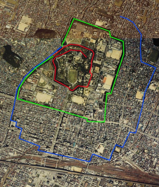
城周辺の起伏地図~The relief map around the castle

赤線:内堀、緑線:中堀、青線:外堀~The red line: the Inner Moat, the green line: the Middle Moat, the blue line: the Outer Moat (Copyright © Ministry of Land, Infrastructure, Transport and Tourism via Wikimedia Commons)

輝政は残念ながら1613年に亡くなってしまいます。徳川幕府は城主を、幕府の重臣である本多忠政に変えました。忠政は城の造営を続け、西の丸を改築したり、運河を掘ったりしました。西の丸は更に広大となり、多くの兵士を収容できるようになりました。よって、中心部の曲輪とは異なる広々とした外観です。。1615年に豊臣氏は幕府により倒されましたが、幕府は姫路城主に西国大名の監視を担わせ続けました。そのため、有能な人材を宛がうため、何度も城主は交替させられます。18世紀の中頃からは、酒井氏が幕末まで城を統治しました。恐らくは社会が安定したからでしょう。城の創建以来、一度もここで戦が起こらなかったため、度々「不戦の城」とも呼ばれています。
After Terumasa unfortunately died in 1613, the Tokugawa Shogunate changed the lord of the castle to Tadamasa Honda, a senior vassal of the Shogunate. Tadamasa continued work on the castle such as improving the Nishinomaru and developing a canal. Nishinomaru became more spacious which could accommodate large troops, so it looks different from other central enclosures. Though the Toyotomi Clan had been defeated by the Shogunate in 1615, it still made the lord of Himeji Castle stay to monitor the lords in western Japan. For this reason, the lord of the castle was replaced by a capable person several times by the Shogunate. From the middle 18th century, the Sakai Clan continued to govern the castle until the end of the Edo Period. Perhaps it could be because the society became stable. No battles have occurred at the castle since it was built, so it is sometimes called “an anti-war castle”.
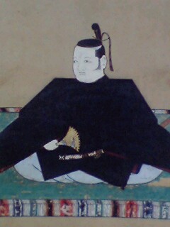
本多忠政肖像画~The portrait of Tadamasa Honda (licensed under Public Domain via Wikimedia Commons)
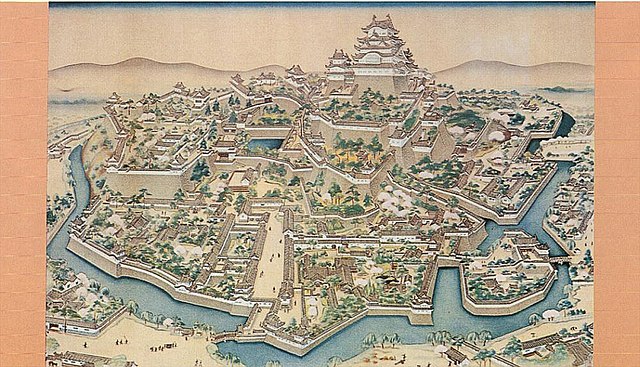
明治初期の姫路城の外観~The appearance of Himeji Castle in the first Meiji Era (licensed under Public Domain via Wikimedia Commons)

しかしながら、幕末になってこの城は初めての危機を迎えます。1868年に岡山藩などの他藩を含む新政府軍により包囲されたのです。これは酒井氏が幕府の要職についていたためです。城にいた武士たちは降伏を申し出ましたが、攻撃側は受け入れず砲撃を始めました。備前門という門の瓦が幾枚か破損しましたが、それだけでした。単なるパフォーマンスだったのかもしれません。その後城の武士たちは降伏し、城を新政府に引き渡しました。
However, at the end of the Edo Period, the castle faced its first crisis. The New Government Army including other domains, such as Okayama, surrounded the castle in 1868. This is because the Sakai Clan was in charge of an important position for the Shogunate. The warriors in the castle had sworn allegiance, but the attackers didn’t accept it and opened fire. Some tiles of a gate called Bizen-mon were destroyed, but that was all. It may have been like a performance. The warriors in the castle later surrendered and handed over control of the castle to the New Government.
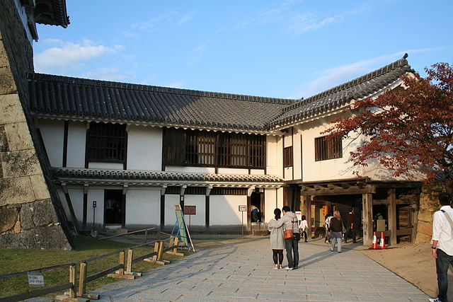
備前門~The Bizen-mon Gate (licensed by Corpse Reviver via Wikimedia Commons)

その後~Later History

明治維新後、姫路城の一部は日本陸軍によって使用されました。三の丸周辺の建物は撤去されました。天守を含む他の建物も売られたが、買主は撤去する費用が高すぎたために権利を放棄したとも言われています。真相は不明です。もし本当なら、城にとって第2の危機でした。
After the Meiji Restoration, part of Himeji Castle was used for the Japanese Army. Some buildings around Sannomaru were demolished. It is said that other buildings including the Main Tower were also sold, but the buyer waived the right, because it was too expensive for him to demolish them. This story is unclear. If true, it was the second crisis of the castle.
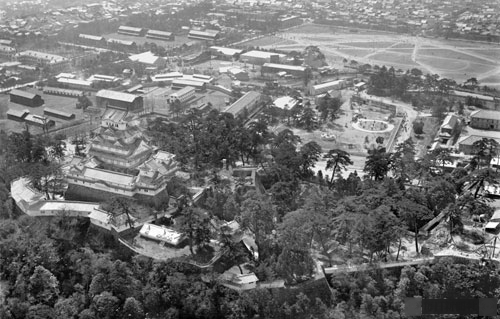
1936年時点の姫路城の写真~The photo of Himeji Castle in 1936 (licensed under Public Domain via Wikimedia Commons)

1878年、中村重遠大佐が姫路城と名古屋城を保存することを陸軍に提案しました。その提案は政府によって認められ、城を維持するための予算が組まれました。これは、城が文化遺産として認められた最初の事例であり、画期的なことでした。1910年に明治の大修理が行われました。実は、天守がその自重により少しずつ傾いてきていたのです。
In 1878, a military officer, Shigeto Nakamura suggested the need to preserve Himeji and Nagoya Castles to the Japanese Army. It was allowed by the government who created a budget to maintain the castles. This is the epoch-making event that castles were considered as cultural properties for the first time. The Meiji Great Repairs was done in 1910. In fact, the Main Tower was leaning little by little due to its own weight, before it was repaired.
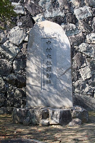
城内にある中村重遠の顕彰碑~The monument of Shigeto Nakamura in the castle (licensed by Corpse Reviver via Wikimedia Commons)

第二次世界大戦中の1945年、姫路空襲の時に最後の危機が城に迫りました。姫路市の市街地はほとんど焼き尽くされましたが、城は無事でした。焼夷弾が天守に飛び込んできたのですが、幸い不発だったのです。残念ながら、同じく政府により維持されてきた名古屋城は、爆撃により燃えてしまいました。終戦直後、姫路の人たちは無傷であった姫路城に大変勇気づけられたといいます。現在、2回の大修理(昭和と平成)の後、姫路城は往時のような輝きを取り戻しています。城のために大変な努力をした人々と幸運に感謝しなければならないでしょう。
The last crisis came to the castle when the Himeji Air Raid happened in 1945 during World War II. The town area of Himeji City was mostly burned, but the castle wasn’t affected. A firebomb was dropped into the Main Tower, luckily it didn’t explode. Unfortunately, the Nagoya Castle, which was also being maintained by the government was burned down by bombs. People in Himeji were very encouraged by the fact that Himeji Castle was still intact just after the war. Today, after two more great repairs (Showa and Heisei), Himeji Castle gets the brilliance back like its peak time. I think we have to be thankful for the great effort of the people at the castle and for good fortune.
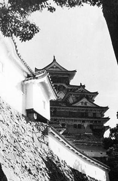
空襲に備え黒い網をかけられた大天守~The Large Main Tower covered by the black screen to prevent from an air raid (licensed under Public Domain via Wikimedia Commons)

「姫路城その2」に続きます。To be continued in “Himeji Castle Part2”

106.脇本城~Wakimoto Castle

安東氏が最盛期のときの城
The castle when the Ando clan was its peak

立地と歴史~Location and History

舟運で繁栄した出羽国~Dewa Province Prospering by Ships

近代以前、大量輸送は船によって行われましたが、海上での航海は危険でした。船が十分発達していなかったからです。日本の場合、中世においては、商業船は主には太平洋ではなく、瀬戸内海や日本海などの内海を航行していました。そのため、当時は内海沿いの大きな港をもつ地域が繫栄しました。出羽国(現在の秋田、山形県を合わせた範囲)はそのような地域でした。
Before the Modern times, mass transportation was done by ships, but sailing on ocean could be dangerous because ships were not developed enough. In the case of Japan, in the Middle Ages, merchant ships sailed mainly on islands seas, such as the Seto Island Sea and the Japan Sea, not on the Pacific Ocean. For this reason, areas with a large port along the island seas prospered at that time.
Dewa Province (combining what is now Akita and Yamagata Prefectures) was one such areas.

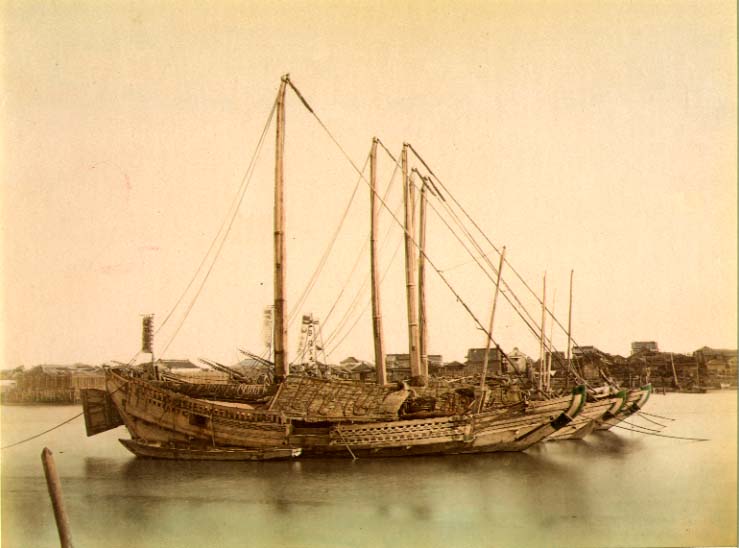
1860年代の日本古来の弁財船~Traditional Japanese junks in 1860s (licensed under Public Domain via Wikimedia Commons)

秋田で力をつけた安東氏~Ando Clan has power at Akita

安東氏は、北出羽(大体今の秋田県)を根拠地として海上交通を支配して大きな勢力となりました。戦国時代(日本中の地方大名が覇権をめぐって争った時代)には安東氏は、檜山安東氏と湊安東氏の2つのグループに分かれていました。檜山安東氏は北秋田にあった檜山城に住み、湊安東氏は南秋田にあった湊城を拠点としていました。
The Ando Clans had a great power to manage the marine transportation based in the north Dewa (roughly now Akita Prefecture). In the “Sengoku” Period- a period when local clans around Japan were fighting for control over all of the country- the Ando Clans was divided into two groups namely the Hiyama-Ando Clan and the Minato-Ando Clan. The Hiyama-Ando Clan lived in Hiyama Castle which was located on the northern part of Akita, while the Minato-Ando Clan lived in Minato Castle located on the southern part of Akita.

城の位置~The location of the castle

安東愛季は、最初は檜山安東氏の総領でしたが、湊安東氏に固有の跡継ぎがいなかったため、取り込むことに成功しました。彼は、秋田全域を統治することで最も有力な戦国大名の一人になったのです・
Chikasue Ando was at first the lord of the Hiyama-Ando, but was able to take over the Minato-Ando as it didn’t have its own successor. As a result, he ruled over the entire Akita and became known as one of the greatest warlords.

安東愛季の肖像画、東北大学附属図書館蔵~The portrait of Chikasue Ando, owned by Tohoku University Library (licensed under Public Domain via Wikimedia Commons)

安東愛季が脇本城を拡張~Chikasue Ando develops Wakimoto Castle

愛季は1577年、彼の本拠地を檜山城と湊城の間にある城に移しました。彼が選んだ城が脇本城だったのです。この城は最初は15世紀に築かれたと言われていますが、その後愛季が東日本では有数の規模の山城にまで拡張しました(約150ヘクタール)。この城は、男鹿半島の根元にある100mの高さの丘の上に築かれ、重要な商業港であった土崎湊の近くでもありました。また、主要道路の「天下道」が城の中を通っているため、非常に戦略的な立地であり、城の領主は完全に交通を制御することができました。
Chikasue moved his home base to a castle located between Hiyama and Minato Castles in 1577. The castle that he chose was the Wakimoto Castle. The castle is said to be first built in the 15th century, then Chikasue developed the castle as one of the largest mountain castles in eastern Japan (about 150 hectare). The castle was located on a 100m high hill in the connecting part of Oga Peninsula, near an important trading port called Tsuchizaki-minato. This location proved to be very strategic as a main road called “Tenga-michi” ran between the two sides of the castle giving the Lord full control over transportation.

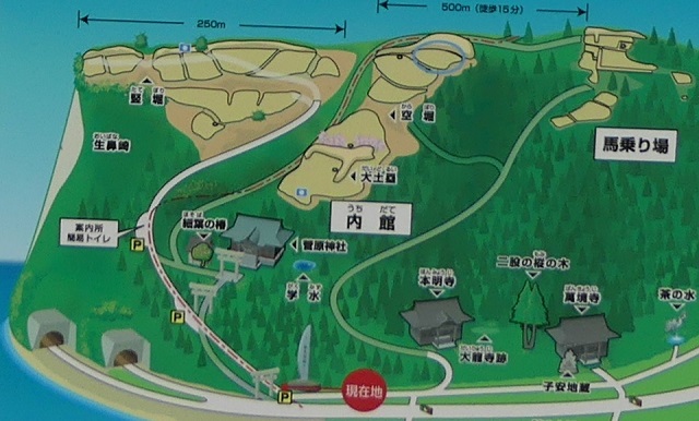
遺跡の全体図、現地案内板より~The whole map of the ruins, from the signboard at the site

愛季は支配者として絶頂期にあって、領土を拡張する一方、織田信長といった外の有力戦国大名とは手紙や贈り物により親交を深めました。ところが、1587年の戦いのさ中、彼は突然の病に倒れ、亡くなってしまいます。彼の息子、実季は湊城に住み、最終的には1602年に徳川幕府により関東地方に移されてしまいました。脇本城はそれから廃城となってしまったようです。
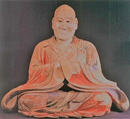
Chikasue was at the peak of his career as an administrator expanding his territory and building relationship with other great warlords such as Nobunaga Oda by sending letters and gifts. However, during a battle in 1587 he suddenly fell ill and died. His son, Sanesue lived in Minato Castle and was lastly transferred to Kanto Region by the Tokugawa Shogunate in 1602. Wakimoto Castle seemed to be abandoned since then.

安東実季木造、羽賀寺蔵~The wooden statue of Sanesue Ando, owned by Haga-ji Temple (licensed under Public Domain via Wikimedia Commons)

特徴~Features

城跡へ登っていく~Walking up to Castle Ruins

現在、脇本城跡は今もって非常に広大であり、5つの地区に分けられています。しかしながら、5つの地区全てが等しく整備されているわけではありません。そこで、私の訪問時には、一番整備されている「内館」1箇所を見学しました。ここは城の中心部分であり、現在はより整備されていて、観光客が訪れやすいようになっています。
Now, the ruins of Wakimoto Castle are still very large, and they are divided into five areas. However, not all the 5 areas have been developed equally. So, when I visited, I covered the one that was most developed which is “Uchidate”. This was the main portion of the castle, and now is further developed for tourists to visit easily.

城周辺の航空写真~The aerial photo of around the castle

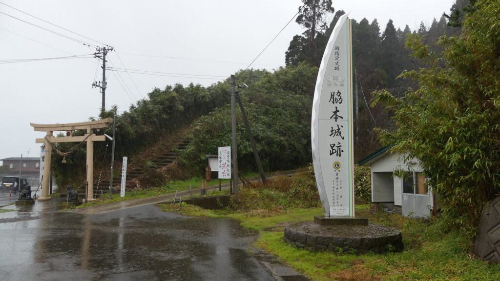
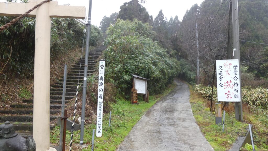
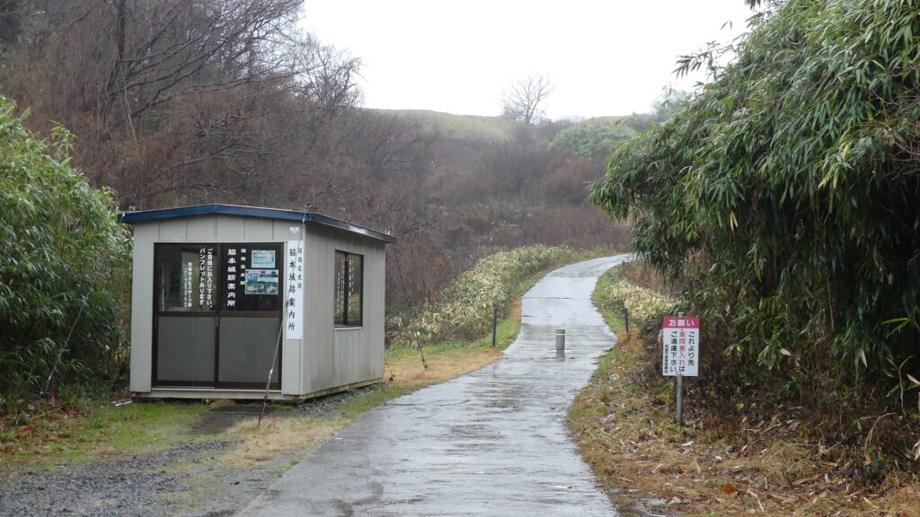
城跡の入口は国道101号線沿いにあります。車で来られた方のために駐車場があります。そこから城跡への道を登っていく必要がありますが、それはかつてからある「天下道」の一部分です。更に進んで城跡の案内所を過ぎると、丘の頂上部分が見えてきます。
The entrance of the ruins is alongside National Route 101. You can park at a parking lot if you are driving. Then, you need to walk up the road to the ruins which was part of the old road, “Tenga-michi”. When you go farther passing through the guide house of the ruins, you will see the top of the hill.

城跡の入口~The entrance of the castle ruins
残っている「天下道」~The remaining “Tenga-michi” road
案内所を越えて頂上へ~Passing the guide house to the top

生鼻崎周辺~Around Oihana-saki Cape

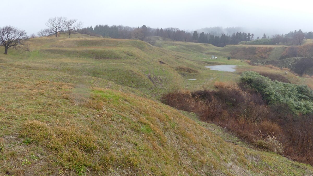
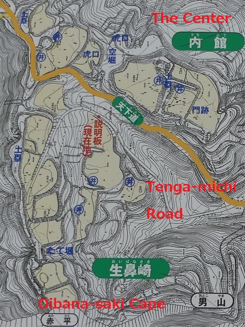
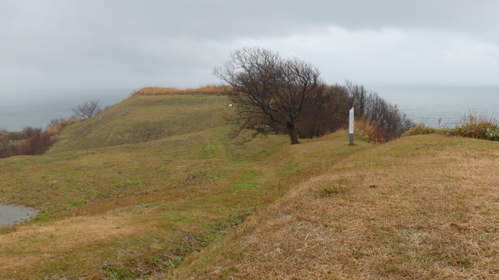
基本的に、戦国時代の東日本では、城の基礎部分は土造りでした。城跡には建物はありませんが、土塁、空堀、虎口などが残っています。丘の頂上に登ってみると、左手(西の方角)には、海に突き出ている「生鼻崎」という岬の上にたくさんの曲輪があるのがわかります。それらの曲輪は岬の先端に向かって列を作って並んでいます。実はかつてはもっと多くの曲輪が岬と共に海に伸びていたのですが、江戸時代の地震のときに崩壊してしまいました。歴史家はこれらの曲輪は安東氏の家臣の屋敷地として使われたのではないかとしています。岬の先端では、日本海の荒々しい姿が見えます。
Basically, the foundations of the castles, in eastern Japan during the Sengoku Period, were made out of soil. The ruins have no buildings, instead they have earthen walls, dry moats, entrances, etc. When you climb on top of the hill, you will see a lot of enclosures on a cape called “Oibana-saki”, sticking out to the sea on the left on the west direction. You can see that these enclosures are in lines towards the top of the cape. In fact, there were many more enclosures with the cape spread to the sea in the past, but they collapsed when an earthquake happened in the Edo Period. Historians speculate that they were used for the Ando clan’s retainers’ houses. At the top of the cape, you can also have a wild view of the Japan Sea.

内館地区の地図、現地案内板に注記~The map of Uchidate Area, from the signboard at the site, adding notes
岬に伸びる曲輪~The enclosures spreading to the cape
生鼻崎周辺の想像図、現地案内板より~The imaginary drawing around Oibana-saki Cape, from the signboard at the site
日本海の眺め~A view of the Japan Sea

城の中心部分~Center of Castle

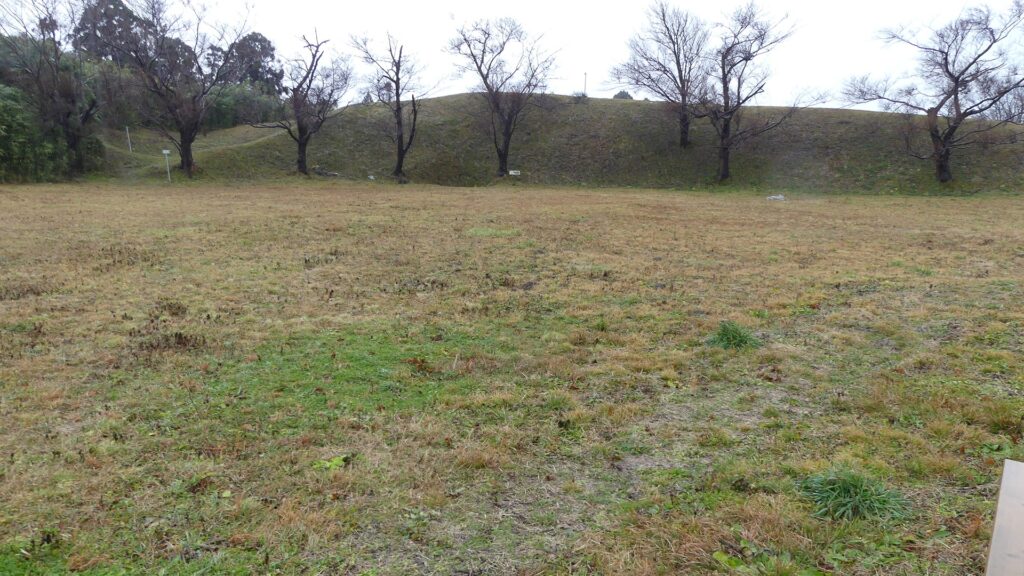
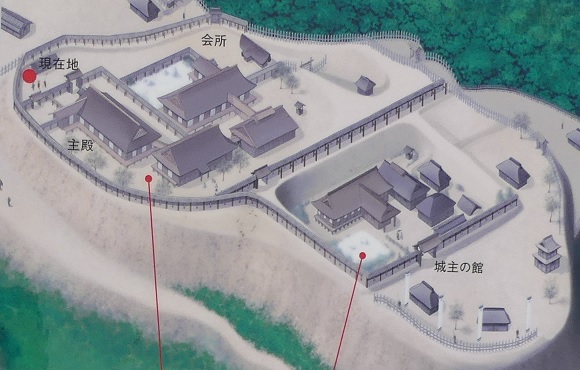
道の反対側の東の方向には、空堀に囲まれたもっと大きな曲輪があります。この辺りが、城の中心地であったと考えられます。歴史家は、北側には別々の目的で作られた2つの建物があったと推定しています。一つは公式の儀式で使われた「主殿」という建物で、もう一つはお客をもてなす「会所」という建物です。
There are two larger enclosures surrounded by dry moats on the opposite side of the route on the east direction. They are supposed to be the center of the castle. Historians also speculate that two buildings on the northern side were used for other purposes. For example one of them was used as the building for the public ceremonies called “Shuden’ and the other for hosting the guests called “Kaisho”.

城の中心部分~The center of the castle
空堀~The dry moat
北側の曲輪~The north enclosure
中心部の想像図、現地案内板より~The imaginary drawing around the center, from the signboard at the site

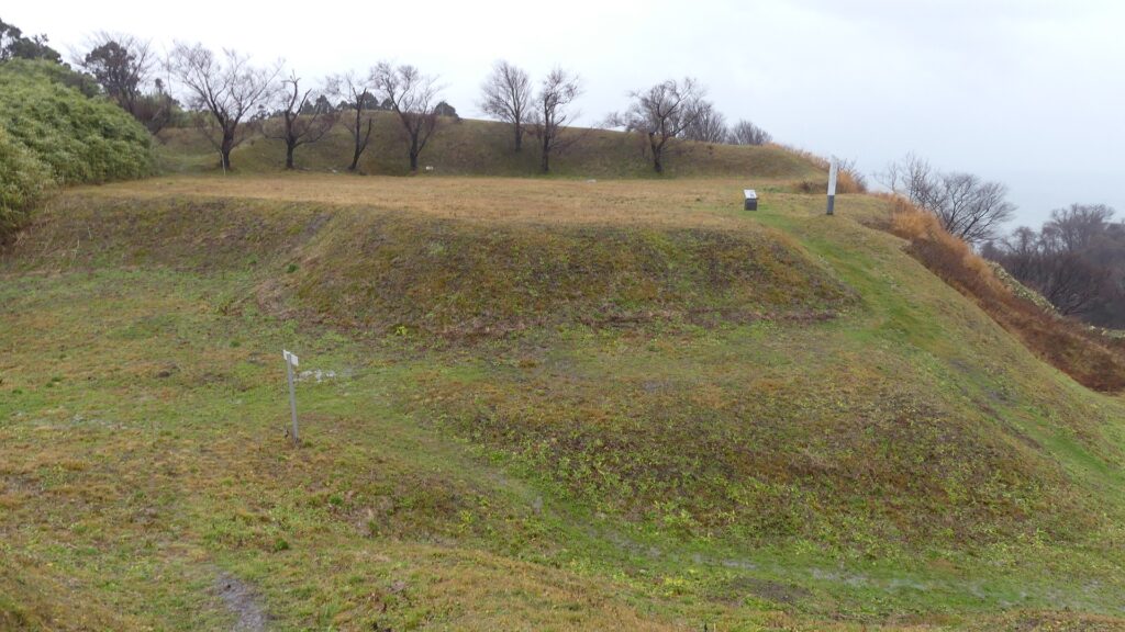
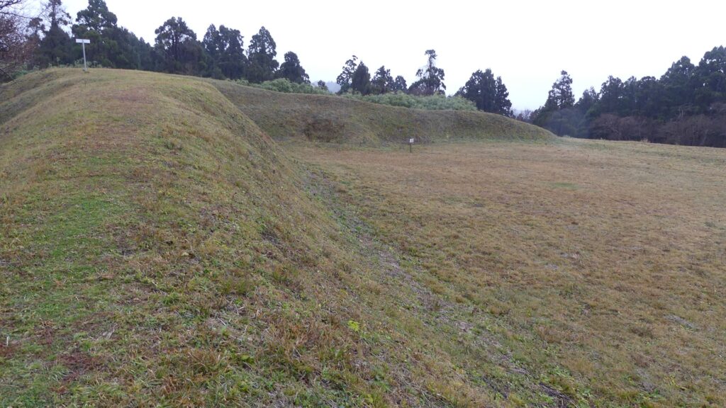
もう一つの南側の曲輪は高くて太い土塁に囲まれており、これもまたとても大きいものです。ここには城主の館があったと考えられています。愛季が住んでいたのでしょうか。この曲輪からは、海岸線とかつては城下町であった街並みの素晴らしい景色が望めます。
The other southern enclosure is surrounded by high thick earthen walls, and it is also very large one. This is thought to be used as the house of the lord. I wonder if Chikasue lived in it. From the enclosure, you can also have a great view of the coast line and the town which was once the castle town.
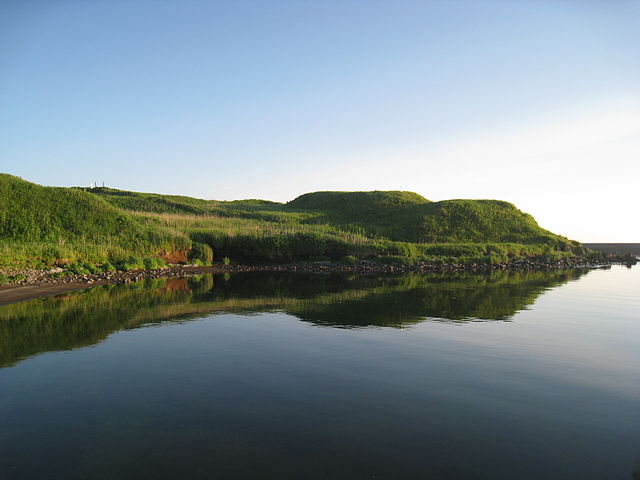
土塁に囲まれた南側の曲輪~The south enclosure surrounded by the earthen walls
海岸線の景色~A view of the coast line

その後~Later History

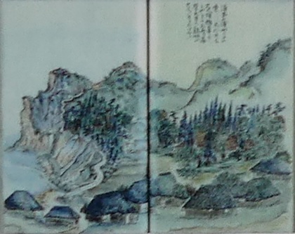
江戸時代の1804年、有名な旅行家の菅江真澄が脇本城の城跡を訪れています。彼は日記に城跡のことを記録し、スケッチも残しました。1993年からは調査が行われており、この城が非常に大きな規模であったことがわかりました。そのため、城跡は2004年に国の史跡に指定されました。
In 1804 of the Edo Period, a famous traveler, Masumi Sugae visited the ruins of Wakimoto Castle. He recorded the ruins on his diary and left his sketches of them. Investigations have been done since 1993 and it was found out that the castle had a huge scale. Because of it, the ruins were designated as a National Historic Site in 2004.
菅江真澄の脇本城のスケッチ、現地案内板より~One of Sugae’s sketches for Wakimoto Castle, from the signboard at the site

私の感想~My Impression

私が脇本城跡に行ったときは、ひどい天気でした。更に「内館」地区しか行っていません。それでもこの城跡が大変な規模だということは言えます。もし晴れた日に十分時間が取れれば、もっと城跡を満喫できると思います。他の有名な城に比べてこの城の研究は始まったばかりです。この城から新たな発見がもたらされるのが楽しみです。
When I visited the ruins of Wakimoto Castle, the weather was very bad. In addition, I saw only one area called “Uchidate”, but I was able to witness the large scale of the ruins. If you have enough time to visit the ruins in a fine day, you can enjoy them more! I think the study for the castle have just started compared with other famous castles. I will be looking forward to seeing the new discovery from the castle.

岬側からの城跡の風景~A view of the castle ruins from the cape

ここに行くには~How to get There

車で行く場合:秋田自動車道昭和男鹿ICから約30分かかります。城跡の入口に駐車場があります。
電車の場合、JR男鹿線脇本駅から城跡まで歩いて約30分かかります。
東京から脇本駅まで:新幹線に乗り、秋田駅で男鹿線に乗り換えてください。
If you want to go there by car: It takes about 30 minutes from the Showa-Oga IC on Akita Expressway. There is a parking lot at the entrance of the ruins.
By train, It takes about 30 minutes from Wakimoto Station on JR Oga line to the ruins on foot.
From Tokyo to Wakimoto Station: Take the Shinkansen super express and transfer to Oga line at Akita Station.

リンク、参考情報~Links and References

脇本城跡、男鹿市観光協会(Oga city tourism association)
・「日本の城改訂版第150号」デアゴスティーニジャパン(Japanese Book)
・「土崎港(秋田港)の「みなと文化」/渡辺英夫」(Japanese Paper)

1.根室半島チャシ跡群~The ruins of chashi in Nemuro Peninsula

そこには確かにアイヌの人々がいたのです。
The Ainu people certainly lived there.

立地と歴史~Location and History

アイヌの人々とチャシ~Ainu people and Chashi

チャシはアイヌの人々によって築かれた城であると言われています。しかし詳細は不明のままです。彼らは文字を持たなかったからです。チャシとはアイヌ語で柵または柵で囲まれた場所を意味します。アイヌは北海道一帯に住んでいた先住民族で狩猟、漁撈、そして交易を生業としていました。彼らの出自もまた明らかではありませんが、13世紀頃までには独自の文化を確立したようです。そしてサハリンから千島列島に至る広大な範囲でその存在を示したのです。
Chashi are said to be castles which were built by the Ainu people, but the details are uncertain, because they had no written language. Chashi means fences or a fence line in Ainu language. Ainu are native people around Hokkaido who earned a living by hunting, fishing, and trading. Their origin is also uncertain, but they seemed to establish their own culture around the 13th century, and had a presence in a large area ranging from Sakhalin to the Kuril Islands.

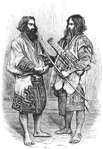
イザベラ・バードによるアイヌ男性のスケッチ、19世紀~The painting of Ainu men, attributed to Isabella Lucy Bird, in the 19th Century(licensed under Public Domain via Wikimedia Commons)

発掘の成果によれば、500以上のチャシが16世紀から18世紀の間に築かれました。その当時、「サパネクル」と呼ばれたアイヌの頭領が、オホーツク、沿海州、日本の本州から来た日本人までも含む外国人との交易により力をつけていきました。これらの頭領たちがチャシを作ったと考えられています。多くのチャシは簡単な構造で、柵や空堀で囲まれた単一の曲輪でした。しかしながら、根室半島では、もっと複雑な構造の多くのチャシがありました。恐らくこの半島の頭領たちがより大きな勢力を持っていたからでしょう。
According to excavations, over 500 of Chashi were built between the 16th and 18th centuries. At that time, several heads of Ainu called “Sapanekuru” were increasing their power by trading with foreign people even form Okhotsk and Primorskii, and Japanese whose origin was the Japanese mainland. It is thought that these heads mainly built the Chashi. Many of Chashi were simple with one enclosure surrounded by a fence line and dry moat. However, in Nemuro Peninsula, there were a lot of Chashi which were more complex. It could be because the heads in the peninsula had more power than others.

城の位置~The location of the castle

なぜチャシが作られたか~Why were Chashi built?

なぜチャシが作られたかについては、いくつかの説があります。もっとも広く知られているのは、「日本人」に抵抗する戦いの準備のためというものです。チャシが作られた地域が、17世紀に徳川幕府下の松前藩と実際に戦ったシャクシャインの勢力圏と一致しているからです。
There are several possible reasons for why Chashi were built. The most widely accepted theory is that they were built to prepare for battle against “Japanese”. This is because the area where they were built matches the influence area of Saksaynu who actually fought with Matsumae Domain under Tokugawa Shogunate in the 17th century.

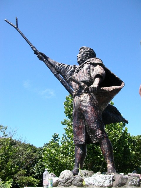
シャクシャイン像~The statue of Saksaynu(taken by Yuka2018 from photoAC)

アイヌの頭領たちが交易で得た財物をめぐってお互いに争っていたからではないかという人もいます。進化したチャシには部外者が母屋に入るを防ぐための仕掛けが多く見られます。その建物には財物がしまってあったはずです。他には、祈祷所、祭りの場所、集会所、交渉の場所などが挙げられています。
Others point out that the heads of Ainu might have fought with each other over their properties gotten by trading. They found out that some advanced Chashi had many works to prevent outsiders from entering their main building. The building must have stored their properties. Other supposed reasons are for worship sites, festival grounds, public meeting places, places for negotiation, and so on.

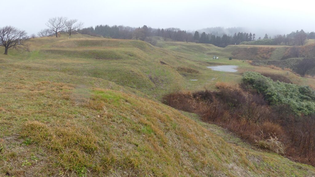
ヲンネモトチャシの曲輪~An enclosure of Wonnemoto Chashi

アイヌの悲しい歴史~Ainu’s sad history

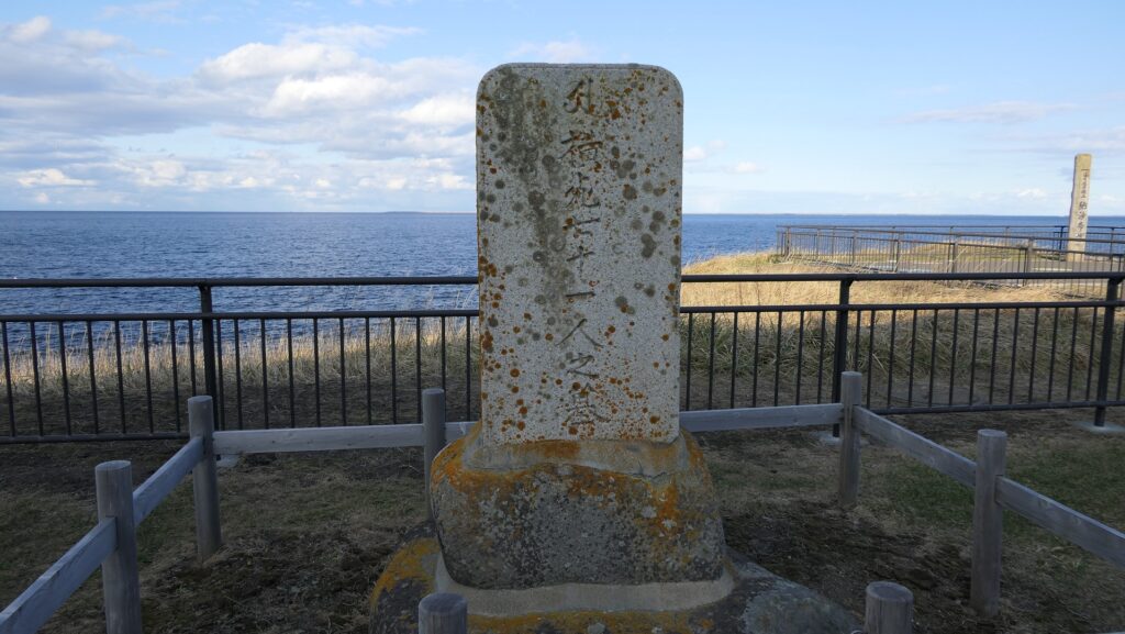
18世紀後半、松前藩の御用商人たちがアイヌの人たちを搾取しました。「メナシクル」と呼ばれた東北海道の若いアイヌの人たちがこれに激怒し、日本人に対して反乱を起こしました(クナシリ・メナシの戦い)。彼らはまたアイヌの年長の頭領たちに対しても不満があったとされています。チャシはこの戦いに備えて完成したのかもしれません。多くのアイヌと日本人がこの戦いで殺され、負傷しましたが、最後は松前藩により鎮圧されました。
In the late 18th century, the merchants, who were agents of Matsmae Domain, exploited Ainu people. Young Ainu people in eastern Hokkaido called “Menashikuru” were very angry about it and rebelled against Japanese (Menashi-Kunashir Rebellion). They were supposed to be also angry at the old heads of Aine. Their Chashi might have been completed for the battle. Many of Ainu and Japanese were killed and wounded in the battle, and lastly Matsumae Domain put down the rebellion.

乱で亡くなった日本人の墓碑~The tombstone of the Japanese killed in the rebellion

その後、松前藩はアイヌに対して交易を制限し、その結果、アイヌの社会は縮小していきました。その一方で徳川幕府と近代の日本政府はアイヌを日本人に同化させる政策を行いました。アイヌの人口は19世紀までに劇的に減少しました。チャシは全て放棄され、そして忘れ去られました。
After that, Matsumae Domain forced Ainu to limit their trading, as a result, the Ainu community was declining. Meanwhile, Tokugawa Shogunate and the modern Japanese government had the policy to assimilate Ainu into Japanese. The population of Ainu significantly decreased by the 19th century. Chashi were all abandoned and have been forgotten.

チャシから望むオホーツク海~Sea of Okhotsk from a Chashi

特徴~Features

現在、根室市には30以上ものチャシ跡がありますが、そのうち24ヶ所が国の史跡に指定されています。そしてそのうちの2ヶ所が観光客向けに整備されています。
Now, Nemuro City has over 30 ruins of Chashi, 24 of them are designated as a National Historic Site, and two of them are developed for visitors by the city as below.

城周辺の地図~The map around the castle

ノツカマフ1号、2号チャシ跡~Ruins of Notsukamafu N0.1 and No.2 Chashi

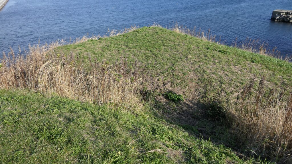
これらのチャシ跡はマップ湾に伸びるノツカ岬上にあります。1号チャシは、直径が約30mあり、2~3mの深さの空堀により隔てられ且つ囲まれた2つの丸い曲輪から構成されます。そのうちの一つには土橋を渡って入っていくことができます。
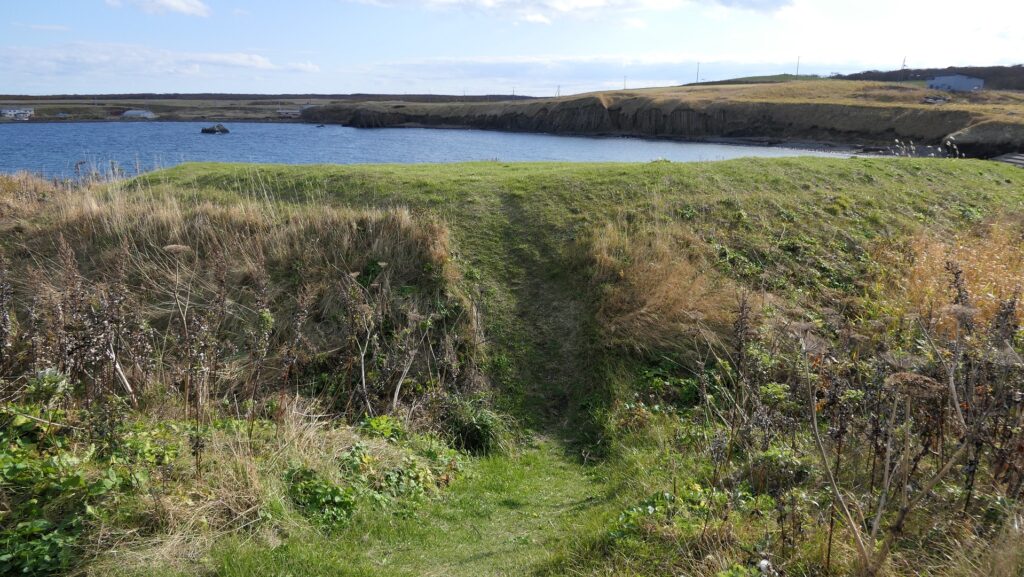
The ruins of these Chashi are on a cape Notsuka extending from Mappu Bay. No.1 Chashi consists of two round enclosures with a diameter of around 30m, divided and surrounded by 2 to 3m deep dry moats. You can enter one of them through an earthen bridge.

城周辺の航空写真~The aerial photo of around the castle

遺跡への入口~The entrance to the ruins
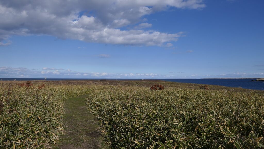
遺跡に続く小径~The trail which leads to the ruins
1号チャシへの土橋~The earthen bridge to No.1 Chashi
1号チャシからの眺め~A view from No.1 Chashi
1号チャシのもう一つの曲輪~Another enclosure of No.1 Chashi

2号チャシはもっと浅い空堀に囲まれた単一の丸い曲輪から成ります。そのため、この曲輪は未完成だったのではないかとも言われています。ノツカマフは、クナシリ・メナシの戦いでのアイヌの指導者が処刑された場所です。
No.2 Chashi has a single round enclosure with a more shallow dry moat surrounding it, so it is said that it might have been uncompleted. Notsukamafu is where the Ainu leaders of Menashi-Kunashir Rebellion were executed.

2号チャシ~No.2 Chashi
2号チャシの端部分~The edge of No.2 Chashi

オンネモトチャシ跡~Ruins of Wonnemoto Chashi

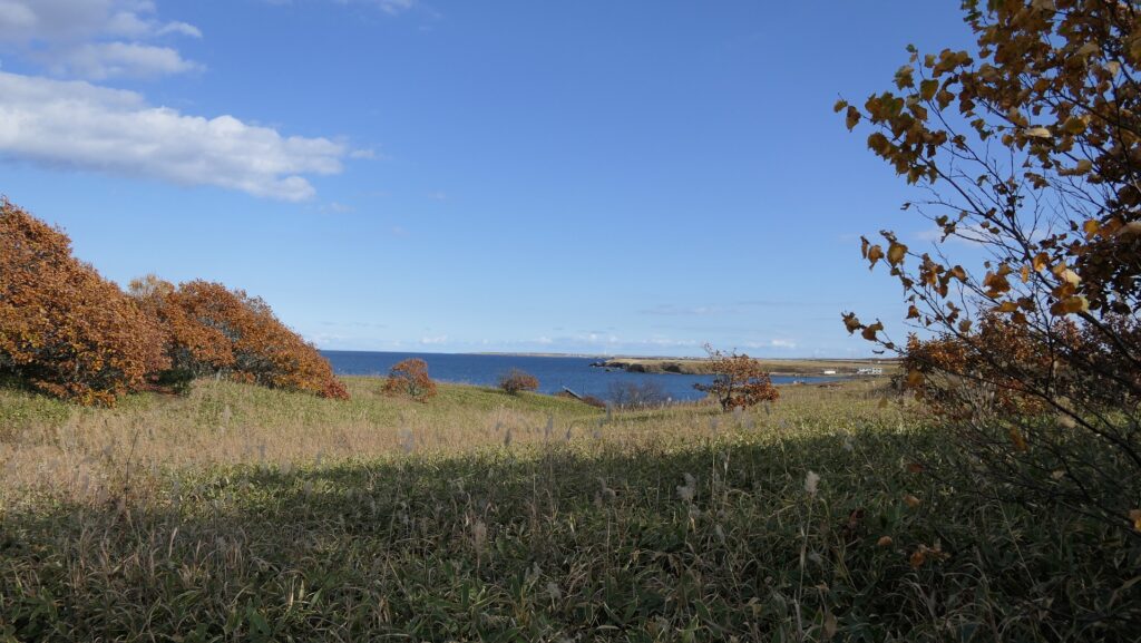
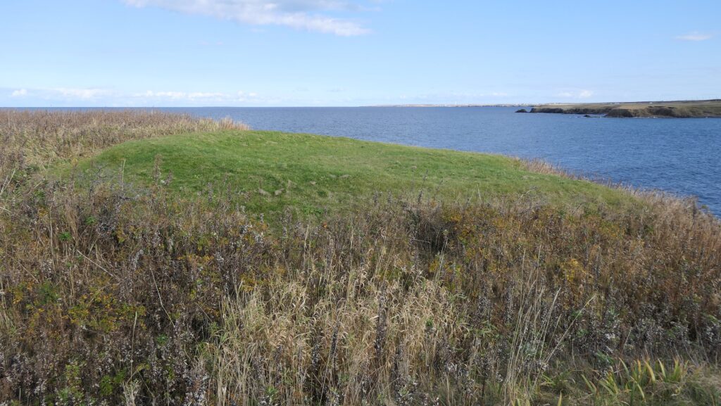
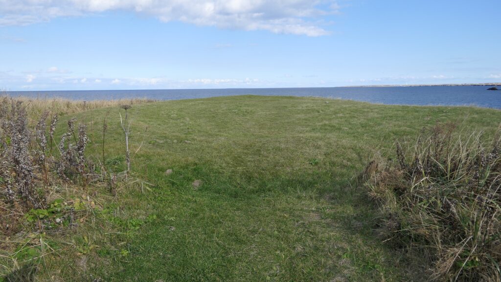
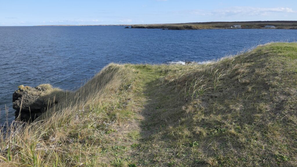
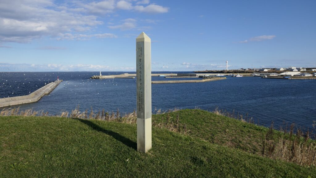
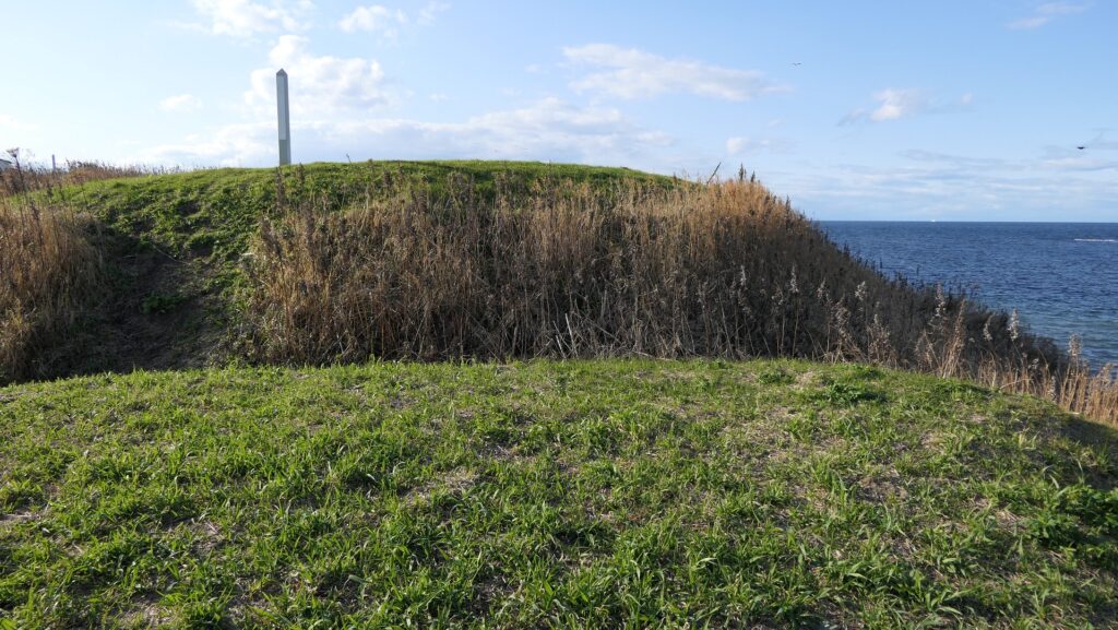
この遺跡は、温根元湾の西側から突き出た岬の上で、階段状の2つの平面から構成されます。湾の東側にある温根元漁港から見ると、なかなか壮観です。その平面は、四角く成形された曲輪で、これらもまた空堀により隔てられ且つ囲まれています。岬の先端に巧みに盛られているのがわかると思います。これらの曲輪の上に立つと、北海道の大地とオホーツク海の雄大な景色が堪能できます。
The ruins are two flat surfaces of steps on a cape protruding from the western side of Wonnemoto Bay. They have a great view when you see them from the Wonnemoto fishing port on the eastern side. The surfaces are square shaped enclosures, also divided and surrounded by dry moats. You can see them well mounded at the top of the cape. When you stand on both of them, you can see a wild landscape of the land of Hokkaido and the sea of Okhotsk.

城周辺の航空写真~The aerial photo of around the castle

温根元漁港から見たオンネモトチャシ~Wonnemoto Chashi from the Wonnemoto fishing port(licensed by 1467jp via Wikimedia Commons)
遺跡への入口~The entrance to the ruins
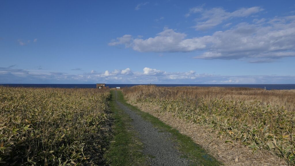
遺跡に続く小径~The trail which leads to the ruins
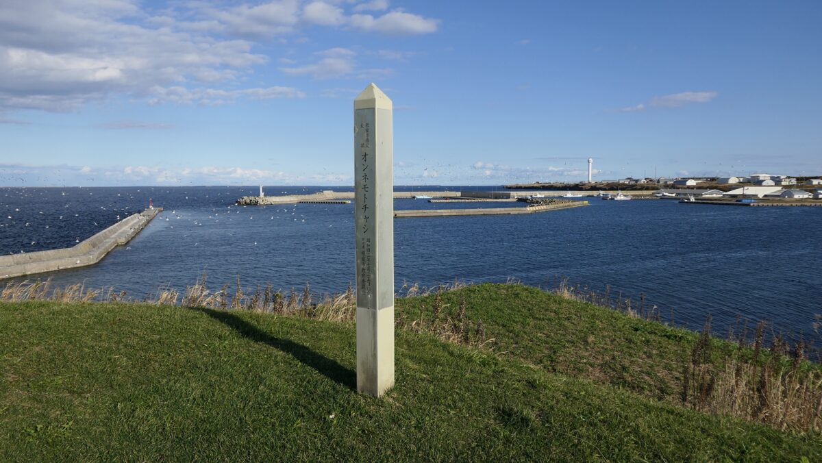
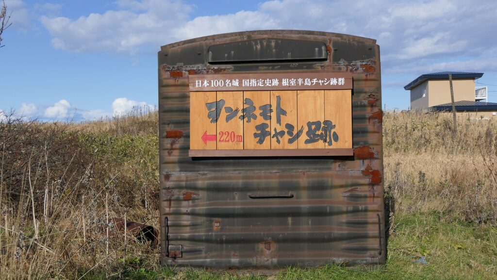
ヲンネモトチャシの標柱~ The signpost of Wonnemoto Chashi
2段になっている曲輪~The two step enclosures
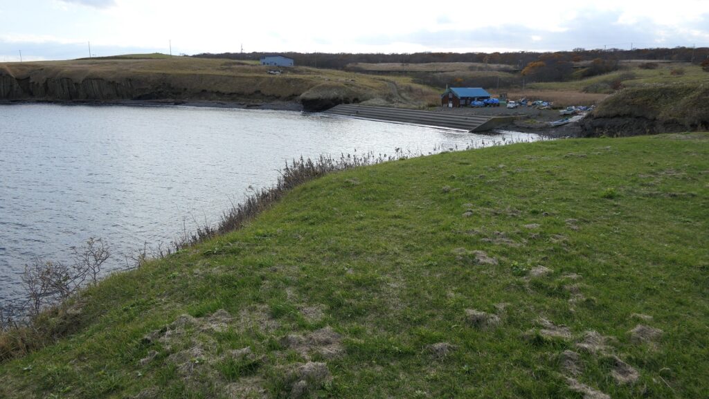
温根元漁港~The Wonnemoto fishing port
遺跡からの眺め~A view from the ruins

その後~Later History

チャシの研究が進んだのは1970年代からです。歴史家が日本人や外国人が記録した古書や文書を紐解いたのです。残っているアイヌの口述歴史を調査した人もいました。行政側も北海道中のチャシ跡の発掘を進めています。その結果、根室市一帯には多くの進化したチャシがあり、歴史上の事件にも関わっていることがわかりました。市にある24ヶ所のチャシが1983年に「根室半島チャシ跡群」として国の史跡に指定されました。
The study of Chashi has been improved since the 1970s. Some historians researched old books and documents Japanese or foreign people recorded. Others investigated the remaining oral history of Ainu. Local governments have been excavating the ruins of Chashi across Hokkaido. They found out that the area around Nemuro City had many developed Chashi which are also related to the historical events. The 24 of Chashi in the city were designated as a National Historic Site called “The ruins of Chashi in Nemuro Peninsula” in 1983.

オンネモトチャシとオホーツク海~Wonnemoto Chashi and Sea of Okhotsk

私の感想~My Impression

最初にチャシ跡に立ったときには、正に地の果てに来たという感じがしました。根室市は実際、日本が南千島列島は自分の領土だと主張しているにしても、事実上ロシアとの国境の最前線にあります。しかしアイヌの歴史を学んでみると、アイヌにとってオホーツクは開かれた海だったのです。彼らには国境などないからです。チャシは最終的には日本人との闘いのために使われたのかもしれませんが、彼らなりのやり方でチャシを築き、繁栄した時期もあったのです。もし日本とロシアの間の懸案が解決された折には、開かれた海は北海道の地に戻ってくるのでしょうか。
When I first stood on the ruins of Chashi, I felt like I came to the edge of the earth. Nemuro City is actually in front of the border between Japan and Russia, though Japan insists that south Kuril Islands belong to it. After I learned about the Ainu history, I think that Okhotsk was an open sea for Ainu, because they had no border. Chashi might have lastly been used for battle with Japanese, but they had prospered by building Chashi in their own way. I wonder if the problem between Japan and Russia was resolved, the open sea could come back to Hokkaido.

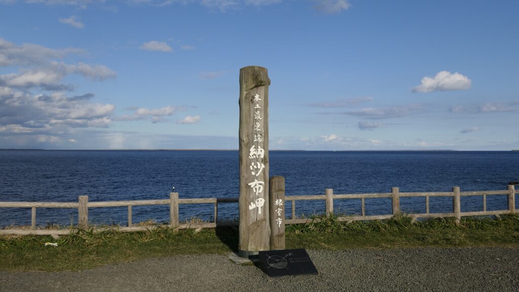
日本最東端の地、納沙布岬~Nosappu Cape, The easternmost tip of Japan

ここに行くには~How to get There

これらの遺跡に行くには、車を使うことをお勧めします。
ノツカマフとオンネモトの遺跡跡は両方とも根室半島北海岸の道道35号線沿いにあります。両方の遺跡の入口前に小さな駐車スペースがあります。根室駅から約30分位のところです。
I recommend you to visit them by car.
Both the ruins of Notsukamafu and Wonnemoto are alongside Hokkaido Prefectural Route 35 in the northern coast of Nemuro Peninsula. There is a small parking lot in front of the entrance of the both ruins. It takes about 30 minutes from Nemuro Station.

リンク、参考情報~Links and References

根室半島チャシ跡群、根室市観光協会(Nemuro City Tourism Association)
・「列島縦断「幻の名城」を訪ねて/山名美和子著」集英社新書(Japanese Book)
・「歴史群像121号、戦国の城/道東のチャシ群」学研(Japanese Magazine)