200.勝連城~Katsuren Castle

美しい、しかしとても強力な城です。
Beautiful, but very strong castle

立地と歴史~Location and History

有名なグスクの一つ~One of famous Gusuku

14、15世紀ころ、琉球諸島(現在の沖縄諸島)は貿易によって栄えました。結果、琉球には「按司」と呼ばれた有力な豪族が多く現れ、中国や他国と貿易を行い、力をつけていきました。彼らは沖縄諸島一帯に、300以上の大規模な要塞を築き「グスク」と呼ばれました。勝連城は代表的なグスクの一つです。
Around the 14th and 15th centuries, the Ryukyu Islands (what is now Okinawa Islands) prospered thanks to trading. As a result, many powerful clans in Ryukyu called “Aji” traded with China and other countries, and had great power. They built over 300 large-scale fortresses called “Gusuku” around the Ryukyu Islands. Katsuren Castle was one of the representative Gusuku.

城の位置~The location of the castle

発掘の成果によれば、この城は最初は14世紀初めころ築かれました。これはグスクとしてはとても早い時期です。当初しばらくは勝連按司がこの城を保有していたと言われています。15世紀初頭に阿麻和利が10代目且つ最後の城主となり、この城は最盛期を迎えます。発掘では、高価な中国製陶器の破片も見つかっています。古い琉球歌集である「おもろそうし」には、この城は日本の武士の都、鎌倉のように栄えていた、と書かれています。
According to the excavation, the castle was first built around the beginning of the 14th century which is very early time for Gusuku. It is said that Katsuren Aji clan first owned the castle for a while. In the beginning of the 15th century, Amawari became the 10th and last lord of the castle that reached its peak time. The excavation also found pieces of valuable Chinese ceramic ware. A collection of traditional Ryukyu songs called “Omorososhi” says the castle prospered like Kamakura, the warriors’ capital of Japan.

琉球王国の進貢船、沖縄県立博物館・美術館~A tribute ship from the Ryukyu Kingdom, Okinawa Prefectural Museum and Art Museum collection(licensed under Public Domain via Wikimedia Commons)

船のようなグスク~Gusuku looking like Ship

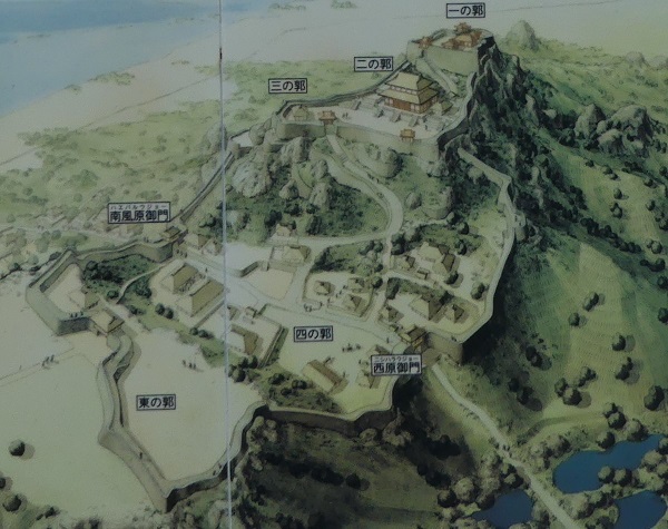
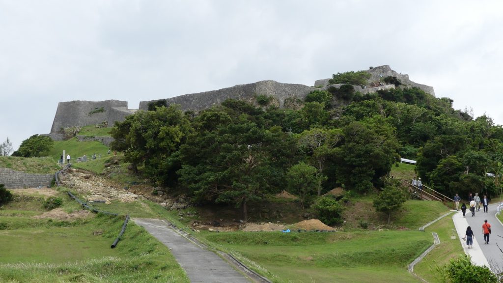
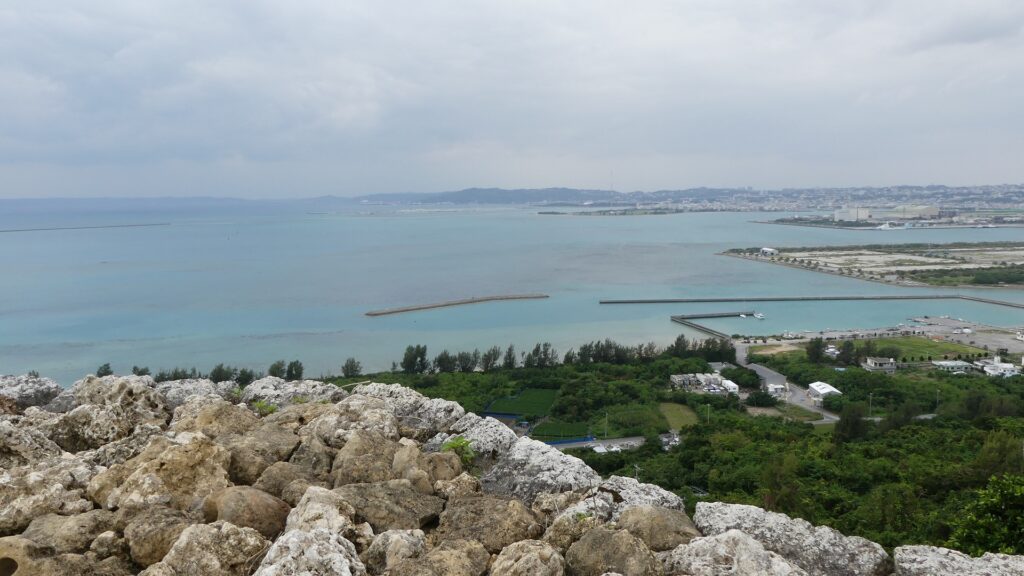
勝連城は、沖縄本島の東海岸にある勝連半島の付け根に位置していました。城の近くには貿易港もありました。城は3つの部分からなっていました。北西の部分は「ニシグスク」と呼ばれ、98mの高さの丘上にあり、城の主要且つ最も高い位置にある部分でした。真ん中の部分は、低い位置で城の入口に当たりました。南東の部分は、「へーグスク」と呼ばれ、違う丘の上にありましたが、北西部分よりは低くなっていました。結果的に、城は当時の船の形のように見えたため、別称で「進貢船のグスク」とも呼ばれました。
Katsuren Castle was located in the connecting part of Katsuren peninsula, the eastern coast of Okinawa Island. There was also a trade port near the castle. The castle had three parts. The northwest part called “Nishi-gushiku” on a 98m high hill was the main and highest part of the castle. The middle part was low and the entrance of the castle. Lastly, the southeast part called “He-gushiku” was on another hill lower than the northwest part. As a result, the castle looked like a traditional ship which was nicknamed “the Gusuku of a ship for tribute”.

城周辺の起伏地図~The relief map around the castle

城の想像画~The imaginary picture of the castle(現地説明板より~from the signboard at the site)

阿麻和利の乱~Amawari Rebellion

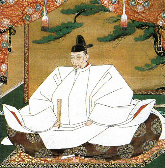
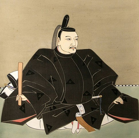
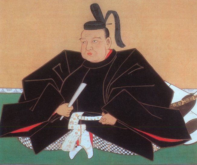
阿麻和利は有力な按司となり、その勢いは琉球王国の王に並ぶほどでした。実際、国王は彼の娘を阿麻和利に嫁がせ、親戚としていました。ところが、阿麻和利は国王に取って代わろうとしたと言われています。まずは国王の家臣、中城城の護佐丸を滅ぼします。次に王国を攻撃する準備をしますが、彼の妻は国王である彼女の父に夫の計画を伝えたのです。1458年、3日間の籠城戦の末、阿麻和利はついに王国によって討たれてしまいました。歴史家の中には、王国の方が阿麻和利をだましたのだという人もいますが、真相は不確かです。
Amawari became a great Aji, almost an equal to the king of the Ryukyu Kingdom. The king actually married his daughter with Amawari to make him his relative. However, it is said that Amawari wanted to take over for the king. Amawari first beat the king’s retainer, Gosamaru at Nakagusuku Castle. Amawari secondly prepared to attack the Kingdom, but his wife informed her father, the king, of her husband’s plan. Amawari was finally beaten by the Kingdom after the three-day siege in 1458. Some historians argue that the Kingdom might have deceived Amawari and beat him. The fact is still uncertain.

阿麻和利の墓~The tomb of Amawari(licensed by Kugel~commonswiki via Wikimedia Commons)

特徴~Features

城跡に入る~Entering Castle Ruins

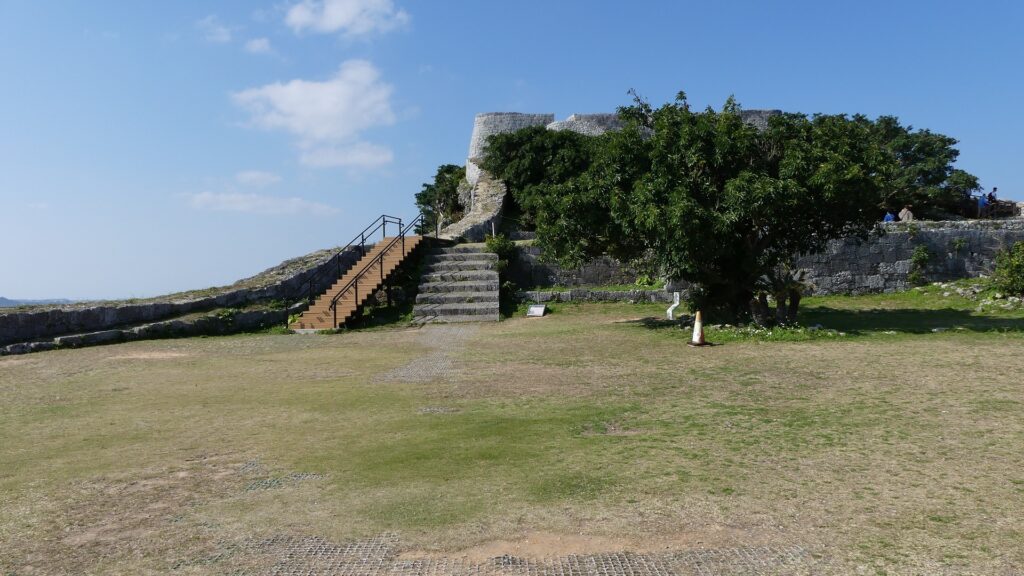
現在、勝連城跡は主にその北西部分に残っています。城跡を車で訪れる場合は、城跡休憩所の所に駐車できます。休憩所では城跡に行く前に城のことを学ぶこともできます。
Now, the ruins of Katsuren Castle remain mainly in the northwest part. If you drive your car to visit the ruins, you can park at the guide house. You can also learn about the castle at the house before you walk to the ruins.

城周辺の地図~The map around the castle

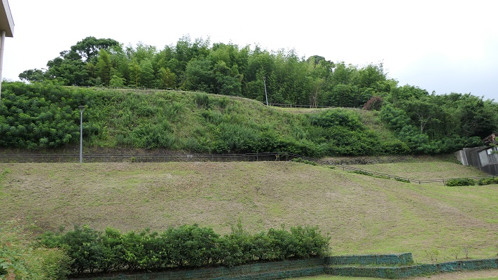
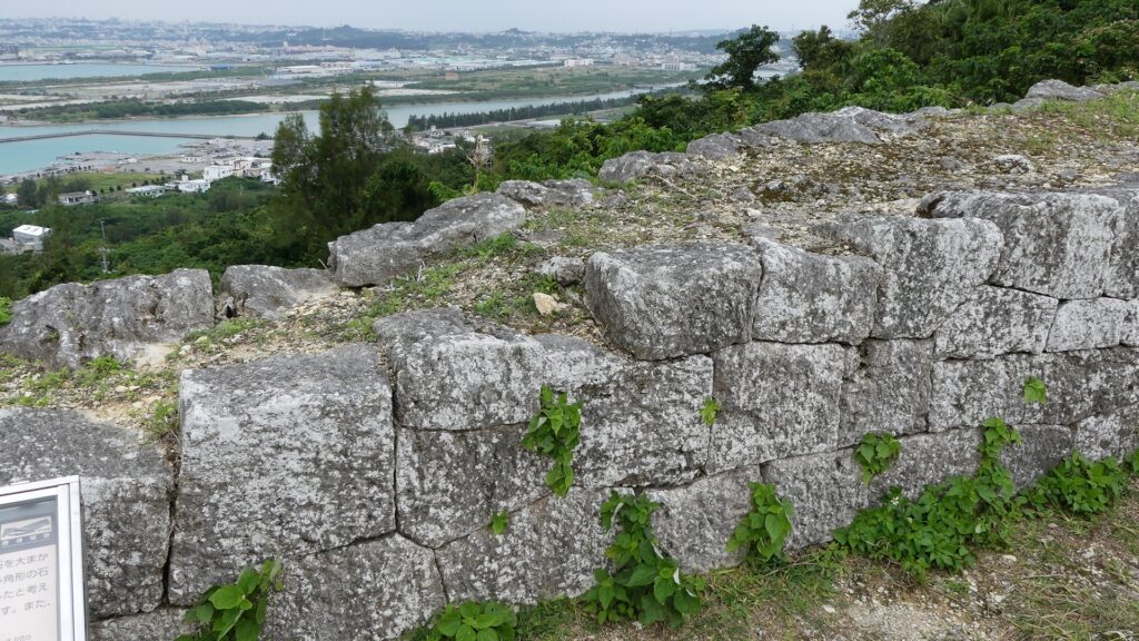
最初に城跡に入るには、西原御門跡、四の曲輪と呼ばれる城の入口である中間部分を通っていきます。「外郭」と呼ばれる石垣が、この曲輪と南東部分を囲っていましたが、現在ではその基礎部分しか見ることができません。
You will first enter the ruins through the ruins of Nishihara Gate, the entrance of the castle at the middle part called the Forth Enclosure. The stone walls called the Outer Fence or “Gaikaku” rounded the enclosure and the southeast part, but you can only see their base now.

城跡の入口~The entrance of the castle ruins
外郭の基礎部分~The base of the outer fence

内郭と石垣~Inner Fence and its Stone Walls

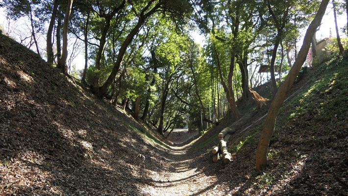
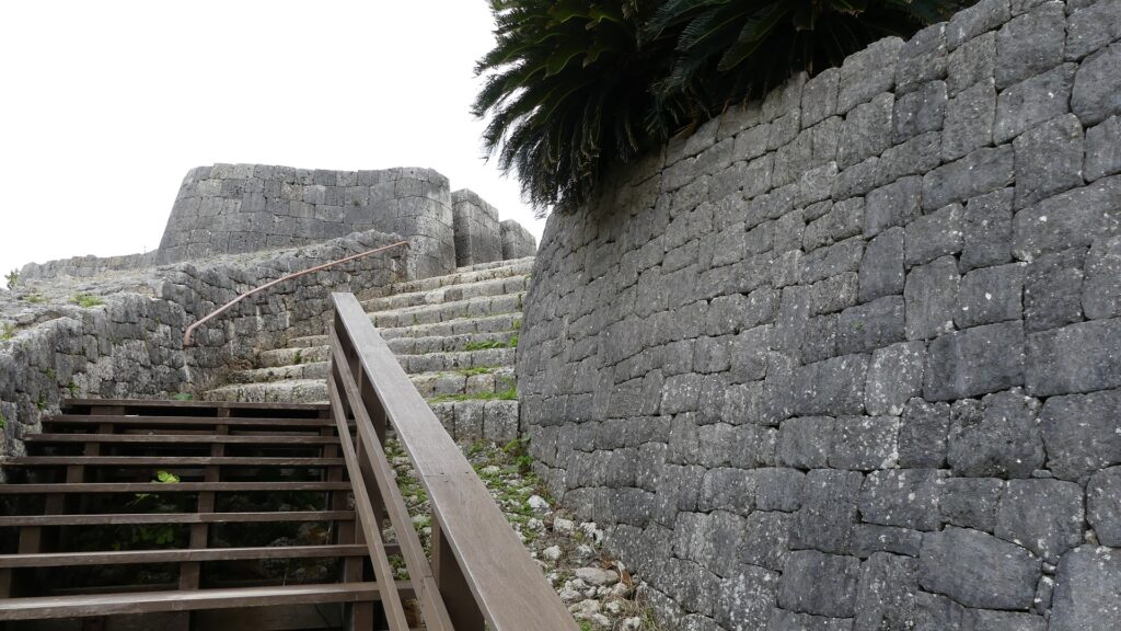
過去には石畳が西原御門と反対側の南風原御門から北西部分の方に伸びていました。現在では過去と同じルートに作られた木製階段に通って進んでいきます。
In the past, the stone pavement spread from another gate called Haebaru Gate at on the opposite side of Nishihara Gate to the northwest part. You will now go through the wooden stairway on the same line as the past.

南風原御門跡から見た風景~A view from the ruins of Haebaru Gate
城跡に伸びるルート~The pavement to the castle ruins

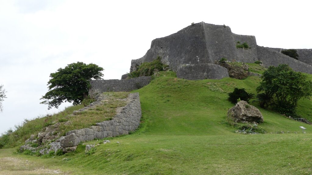
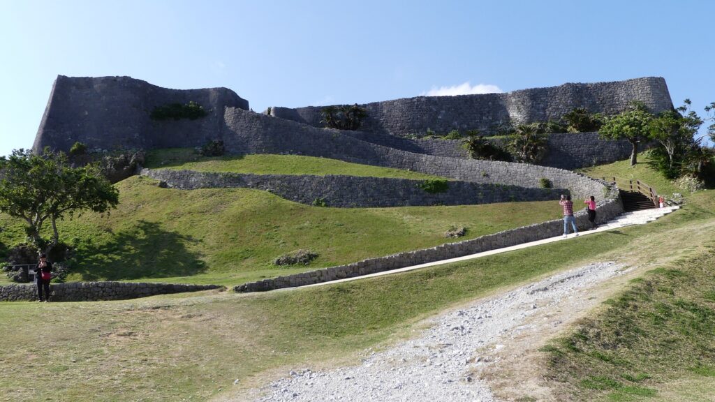
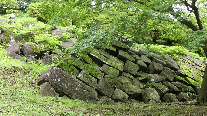
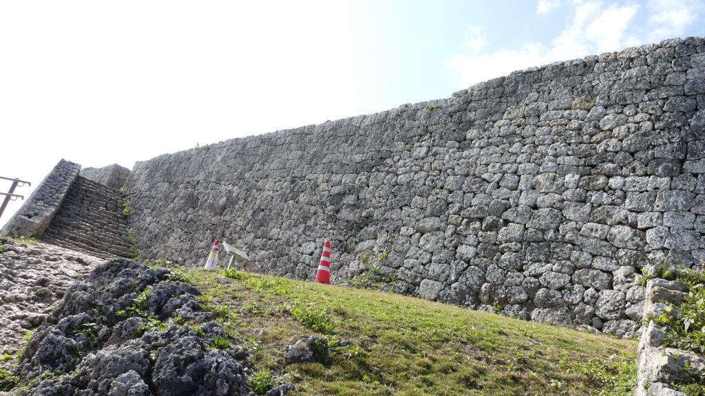
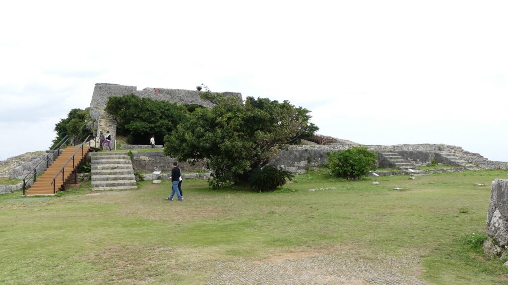
北西部分は、一段目の三の曲輪、二段目の二の曲輪、最上段の一の曲輪から成り立っています。この部分を囲んでいる石垣は「内郭」と呼ばれ、よく保存されており、美しく、そして強固です。
The northwest part consists of the Third Enclosure as the first tier, the Second Enclosure as the second tier, and the First Enclosure as the last tier. The stone walls surrounding this part are called the Inner Fence or “Naikaku” and remain very well-preserved and look very beautiful and strong.

内郭の全景~The whole view of the inner fence

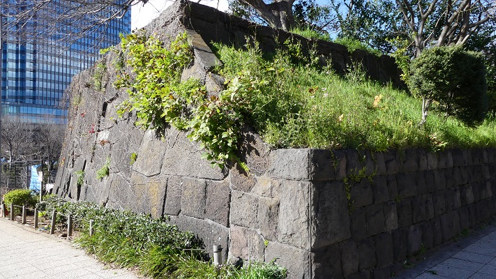
この城のほとんど全ての石垣は、「布積み」と呼ばれる方法で、四角く加工された石灰岩で水平に積まれています。また、それを鈎状に組むことで強度を増すための工夫も見られます。
Almost all of this castle’s stone walls are piled with square processed lime stones horizontally, the method called “Nuno-zumi”. They are also arranged in a hooked pattern to increase their strength.

勝連城の石垣~The stone walls of Katsuren Castle

曲輪群と素晴らしい景色~Enclosures and Great Views

三の曲輪の石垣は、訪れる人の前に立ちはだかります。この曲輪に門があり、今はその土台の石垣を見ることができます。この辺りは防衛上重要な地点であったにちがいありません。この曲輪の中は、儀式の場所として使われたようです。
The stone walls of the Third Enclosure stand out high for visitors. The enclosure had a gate, and We can see the gate’s stone wall base. The route to the enclosure turns at a right angle at the gate. This area must have been the an important point for defense. The inside of the enclosure seemed to be used as the space for ceremonies.

三の曲輪の入口~The entrance of the Third Enclosure
三の曲輪の内部~The inside of the Third Enclosure

二の曲輪には首里城の正殿ような舎殿がありました。すなわち、この城では最も重要な場所ということです。主殿の屋根は瓦葺きであり、当時の琉球では大変稀なことでした。これらのことからもこの城がいかに栄えていたかがわかります。
The Second Enclosure had the palace like the the Main Palace in Shuri Castle. That meant this place was the most important for the castle. The palace had roof tiles which were very rare for that period in Ryukyu. These facts also prove the prosperity of the castle.

主殿跡~The ruins of the main palace

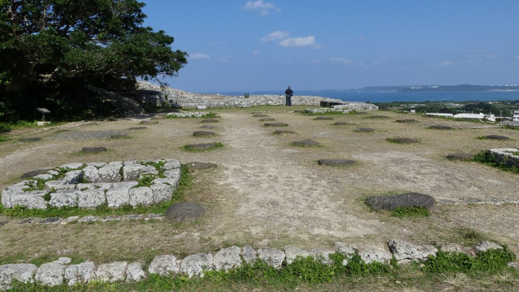
一の曲輪は、詰めの曲輪です。この曲輪には敵の攻撃を防ぐため、三の曲輪のように、正面の高石垣と屈曲した入口がありました。この曲輪にも瓦屋根の建物がありました。この場所は最も高い位置にあり、障害物もないため、ここからは360度の素晴らしい景色を堪能できます。
The First Enclosure is the last enclosure. The enclosure, like the Third Enclosure, has high front stone walls and a bent entrance route to prevent enemies from attacking. The enclosure also had a building with roof tiles. This place is the highest point with no obstruction, so you can have an excellent 360 degrees view from it.

一の曲輪の石垣~The entrance of the stone walls
一の曲輪の入口~The entrance of the First Enclosure
一の曲輪からの南方の景色~A southern view from the First Enclosure
一の曲輪からの北方の景色~A northern view from the First Enclosure

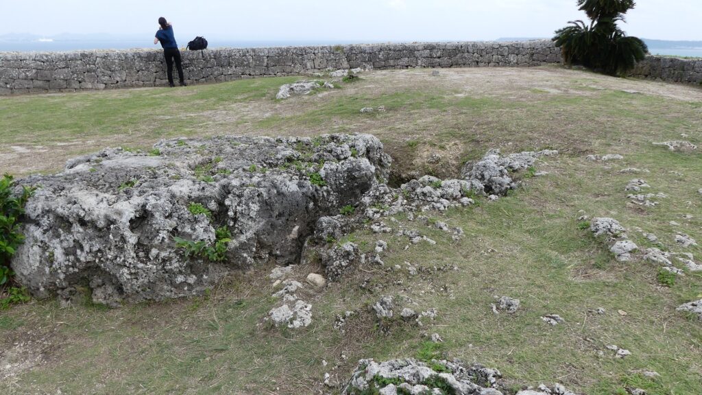
この城には「御嶽」と呼ばれる多くの祈願所がありました。これは琉球のグスクに見られる共通の特徴です。例えば、一の曲輪には「玉ノミウヂ御嶽」跡があり、それでは城を守るための霊石が祀られていました。建物がその石の上に建てられていました。
The castle had many spots for praying called “Utaki”. That was the common feature for Gusuku in Ryukyu. For example, there are the ruins of “Tamanomiuji-Utaki” in the First Enclosure where people prayed the holy stone for protecting the castle. The building was built on the stone.

「玉ノミウヂ御嶽」跡~The ruins of “Tamanomiuji-Utaki”

その後~Later History

阿麻和利が倒されても城は祈願所として使われていましたが、いつしか廃城となりました。三の曲輪にある「肝高の御嶽」跡はその時代のものです。城のほとんどの石垣は長い間残っていたようです。ところが、約100年前の大正時代と昭和初期に、残念ながら多くの石垣が工事資材として遺跡から運び出され使われてしまいました。そのために外郭の石垣は基礎だけになっているのです。第二次世界大戦後、遺跡は国の史跡に指定されました。ついには、2000年から琉球王国のグスク及び関連遺産群として世界遺産に登録されています。
Although the castle was still used as the a places for prayer for a while after Amawari had been beaten, it was abandoned at some point. The ruins of “Chimudaka-nu-Utaki” in the Third Enclosure are from that period. Most stone walls of the castle seemed to remain for a long time. However, in the Taisho Era and the first Showa Era, about 100 years ago, many stones were unfortunately taken away from the ruins for and used as construction materials. That’s why we now see only the base of the Outer Fence. After World War II, they were designated as a National Historic Site. Lastly, they have also been on the World Heritage List as Gusuku Sites and Related Properties of the Kingdom of Ryukyu since 2000.

肝高の御嶽があった三の曲輪~The Third Enclosure where Chimudaka-nu-Utaki was

私の感想~My Impression

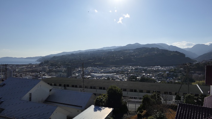
勝連城は素晴らしい景勝地です。グレーの石垣、緑の丘、沖縄の青い海が素晴らしいコントラストを醸し出しています。ここからの眺めもまた特別なものです。その上にこの城は、まるで阿麻和利から1世紀後の日本本土の戦国時代の山城のように強力だと思います。この城は美しさと強さを併せ持っていると断言できます。
Katsuren Castle is a great place to visit, because its gray stone walls, the green hill, and Okinawa’s blue sky can make a very good contrast. Views from the ruins are also very special. Moreover, I think the castle is so strong that is just like a mountain castle in the mainland of Japan in the Sengoku Period, about one century after Amawari. I can definitely say this castle has both of beauty and strength.

城跡からの眺め~A view from the castle ruins

ここに行くには~How to get There

ここには車で行かれることをお勧めします。
那覇空港から:
車の場合、那覇空港自動車道に名嘉地ICから入り、西原JCTで沖縄自動車道に合流し、沖縄北ICで降りてください。城跡はそこから10km以内で、休憩所に駐車場があります。
I recommend you to visit it by car.
From the Naha Airport:
By car, enter Naha Airport Expressway at the Nakachi IC, join Okinawa Expressway at the Nishihara JCT, and get off the expressway at Okinawa-Kita IC. The ruins are within 10 km of the IC, and the guide house offers a parking lot.

リンク、参考情報~Links and References

勝連城跡World Heritage Katsuren-Jo Site
萩原さちこの城さんぽ 第23回 勝連城(Only Japanese)
・「列島縦断「幻の名城」を訪ねて/山名美和子著」集英社新書(Japanese Book)
・「日本の城改訂版第88号」デアゴスティーニジャパン(Japanese Book)

21.江戸城その4~Edo Castle Part4

この城は、東京の輪郭を生み出しました。
This castle created the outline of Tokyo.

外郭の概要~Overview of Gaikaku

江戸城の外郭は、外堀に囲まれた区域であり、その外周は約16kmあり、市街地をも含んでいました。見附と呼ばれる大型の門と橋が、約50セット堀と主要街道の交差点に置かれていて、民衆と交通を監視していました。これらの施設は明治維新後にほとんど撤去されてしまいます。そのためほとんどの人たちは東京に城があったことなど気付きません。それでは、東京にある外郭の痕跡を巡ってみましょう。
The outline of Edo Castle called Gaikaku was the surrounding area from the outer moat whose perimeter was about 16 km, including even the city area. About 50 sets of large gates and bridges called Mitsuke were placed at the intersections of the moat and major roads to check people and transportation. These facilities were mostly demolished after the Meiji Restoration. So most people don’t realize there was a castle in Tokyo. Then, let me introduce the traces of Gaikaku in Tokyo.

江戸城の外郭ライン、ラインの色は以下のセクション毎に分かれています~The line of Edo Castle’s Gaikaku, the color of the line is linked to each section below

隅田川エリア~Sumida-gawa River Area

江戸時代の初め、隅田川は外堀の一部として認識されていました。そのため幕府は、日光街道上の千住大橋を除いて、この川に橋を架けることを禁じていました。1657年の明暦大火の後は、江戸の安全確保と都市化のため、他の橋も架けられるようになりました。
At the beginning of the Edo Period, Sumida-gawa River was regarded as part of the outer moats. Because of it, the Shogunate banned bridges from being built on the river excluding Senju-Ohashi Bridge on Nikko Road. After the great fire of Meireki in 1657, more bridges were built on the river for the increase of safety and urbanization of Edo City.

隅田川に架かる永代橋~Eitai-bashi Bridge over Smida-gawa River

隅田川エリアのライン~The line of Sumida-gawa River Area

永代橋~Eitai-bashi Bridge:

隅田川に架けられた4番目の橋です。現在の橋は、1923年の関東大震災の火災により失われた後、1926年に再建されたものです。すでにそれから100年近く経過しており、重要文化財に指定されています。
It is the forth bridge on Sumida-gawa River. The present bridge was rebuilt in 1926, after it was destroyed by the fire in the Great Kanto earthquake in 1923. It is nearly 100 years old, and has become an Important Cultural Property.

現在の永代橋~The present Eitai-bashi Bridge
歌川広重「東都名所」より「永代橋佃沖漁舟」、江戸時代~”Eitai-bashi Bridge and fishing boats off Tsukuda Island” from the series “Famous Places in the Eastern Capital” attributed to Hiroshige Utagawa in the Edo Period(licensed under Public Domain via Wikimeidia Commons)

新大橋~Shin-Ohashi Bridge:

こちらは3番目に架けられた橋です。先代の橋は関東大震災を生き延びました。現在の橋は1977年に架け替えられたものです。江戸時代のこの橋は、歌川広重の有名な浮世絵に描かれたことで知られています。
It is the third bridge on the river. The former bridge survived the Great Kanto earthquake. The present one replaced it in 1977. The bridge in the Edo Period is known for being drawn in a famous Ukiyoe Painting by Hiroshige Utagawa.

現在の新大橋~The present Shin-Ohashi Bridge
歌川広重「名所江戸百景」より「大橋あたけの夕立」、江戸時代~”Sudden shower over Shin-Ohashi Bridge and Atake” from the series “100 Famous Views of Edo” attributed to Hiroshige Utagawa in the Edo Period(licensed under Public Domain via Wikimeidia Commons)

両国橋~Ryogoku-bashi Bridge:

2番目に架けられた橋です。この橋の周りは歓楽街になりました。江戸時代から夏にはこの辺で花火の催しが開かれています。近くにはまた外堀の一部である神田川の河口があります。
The second bridge on the river. The area around the bridge became a place of amusement. Fireworks displays have been also held around in the summer since the Edo Period. There is the estuary of Kanda-gawa River nearby which is another part of the outer moats.

現在の両国橋~The present Ryogoku-bashi Bridge
葛飾北斎「富嶽三十六景」より「御厩川岸より両国橋夕陽見」、江戸時代~”Sunset across Ryogoku Bridge from the Bank of Sumida River at Onmayagashi” from the series “Thirty-six Views of Mount Fuji” attributed to Hokusai Katsushika in the Edo Period(licensed under Public Domain via Wikimedia Commons)

神田川エリア~Kanda-gawa River Area

「神田川」という名前は明らかに川です。ところが、この川は完全に人口物で、堀や運河として使われました。江戸時代初期に、幕府の下で伊達氏が本郷台地を掘り進んで造りだしたのです。幕府は川に沿って必要な施設を設置していました。掘削で出た残土は、下町周辺の埋め立てに使われました。
The name “Kanda-gawa” clearly shows a river (“gawa” means river.). However, the river is completely artificial, and was used as a moat and canal. In the first Edo Period, the Date clan under the Shogunate created it to cut across Hongo plateau. The Shogunate set facilities they needed along the river. The waste soil from the digging was used to reclaim the sea around downtown.

神田川~Kanda-gawa River

神田川エリアのライン~The line of Kanda-gawa River Area

浅草橋門跡~Asakusa-bashi Gate Ruins:

この門は川と浅草を通る日光街道の交差点に築かれました。しかし明治維新後間もなく撤去されました。そのため、何らかの記念碑でもなければ、そこに何があったかはわかりません。
This gate was built at the intersection of the river and Nikko Road passing Asakusa. But it was removed soon after the Meiji Restoration, so we can’t see what was seen in the past without some kind of monument.

現在の浅草橋~The present Asakusa-bashi Bridge
記念碑のみがあります~There is just a monument
浅草橋門の古写真~The old photo of Asakusa-bashi Gate(licensed under Public Domain via Wikimedia Commons)

仙台堀~The Sendai Moat:

「仙台」という名前は伊達氏が仙台を拠点としていたことに由来します。JR御茶ノ水駅近くの橋からは深くえぐられた川の一部を見ることができます。JR中央線はその谷に沿って走っています。
The name “Sendai” derived of the Date clan from Sendai. You can see the part of the river being cut deeply from the bridge near JR Ocha-no-Mizu Station. JR Chuo line goes along the valley.

現在の仙台堀~The present Sendai Moat

水道橋跡~The Water Bridge Ruins

かつて神田上水がこの水道橋によって川を横断していました。井の頭池を水源として江戸市街に給水していました。この周辺の街と、近くにある「水道橋」駅の名前はここから来ています。
Kanda water supply went across the river using the Water Bridge. It came from Inokashira Pond to feed Edo City. The names of the town around and the station nearby “Suido-bashi” comes from the bridge.

水道橋の記念碑~The monument of Water Bridge
記念碑周辺の風景~A view around the monument
歌川広重「東都名所」より「御茶之水之図」、江戸時代~”The picture of Ocha-no-Mizu” from the series “Famous Places in the Eastern Capital” attributed to Hiroshige Utagawa in the Edo Period(出典:国立国会図書館)

外堀の西側部分~The western part of the outer moats

この部分は1638年までに江戸城建設の総仕上げとして築かれました。自然の谷の地形を利用しています。城の中心を砲撃から守ることを意図し、堀の内側に土塁を積み上げ、外側よりも高くなるようにしています。
This part was built to finalize the construction of the Edo Castle by 1638. It used a natural valley terrain. It aimed to protect the center of the castle from a cannon attack outside by setting the inside of the moat much higher with earthen walls than the outside.

弁慶濠~Benkei-bori Moat

外堀の西側部分のライン~The line of The western part of the outer moats

牛込門跡~Ushigome-mon Gate Ruins:

門の両側の石垣が現存しています。門跡の周辺は現在JR飯田橋駅として利用されています。門跡の反対側は神楽坂になっていて、外堀は谷底に位置しているのがわかります。牛込濠と呼ばれるその堀は、門跡の西側にほぼそのまま残っており、とても広大に見えます。
The stone walls from both sides of the gate remain. The area around the ruins are now used for JR Iida-bashi Station. The opposite of the ruins is Kagura-zaka slope, so you can see the outer moat located in the bottom of the valley. The moat called “Ushigome-bori” in the west of the ruins remain like it was, and looks very spacious.

牛込門跡~Ushigome Gate Ruins
歌川広重「牛込神楽坂之図」、江戸時代~”The picture of Ushigome and Kagurazaka” attributed to Hiroshige Utagawa in the Edo Period(出典:国立国会図書館)
牛込濠~Ushigome-bori Moat

市ヶ谷門跡~Ichigaya-mon Gate Ruins:

石垣がいくらか残っており、外側から堀を渡って門に伸びる土橋も残っています。周辺はまたJR市ヶ谷駅の一部として使われています。
There are some remaining stones, and the earthen bridge from outside to the gate across the moat remains. The area around is also part of the for JR Ichigaya Station.

市ヶ谷門跡~Ichigaya-mon Gate Ruins
市ヶ谷門の古写真~The old photo of Ichigaya-mon Gate(licensed under Public Domain via Wikimedia Commons)

四谷門跡~Yotsuya-mon Gate Ruins:

門の片側の石垣が残っていますが、周辺の堀は既に埋められています。一例として、門跡西側の以前堀だったところは上智大学のグラウンドとして使われています。広大な敷地を眺めながら、内側の土塁の上を歩くことができます。
There are some remaining stone walls on one side of the gate, but outer moats around are already filled. For example, the former moat in the west of the ruins is used as the ground for Jochi University. You can walk on the inside earthen walls and enjoy a view of the spacey area.

残っている石垣~The remaining stone walls
四谷門の古写真~The old photo of Yotsuya-mon Gate(licensed under Public Domain via Wikimedia Commons)
上智大学のグラウンド~The ground for Jochi University

外堀が失われたエリア~The lost outer moat area

東京の都心では、いくつかの理由で外堀は既に失われています。現在では外堀通りとして自動車道になっています。過去にはどんな景観だったのか想像するのは困難です。
In the center of the Tokyo city area, the outer moat was already lost for several reasons. It is now used as the Sotobori (means onter moat) Street for automobiles. It is difficult for us to understand what can be seen in the past.

外堀通り、ビル街の谷間のようです~Sotobori Street, just like a valley among the buildings

外堀が失われたエリアのライン~The line of the lost outer moat area

赤坂門跡~Akasaka-mon Gate Ruins:

門の石垣の一部が、赤坂見附(幕府の施設であった名前と同じ)交差点の近くに残っています。「弁慶濠」と呼ばれる現存堀が門の西側にあります。そこから続く「溜池」堀は失われています。
Part of the stone walls for the gate remain near the Akasaka Mitsuke (same as the Shogunate facility’s name) Intersection. A remaining moat called “Benkei-bori” is in the west of the gate. The following moat called “Tame-ike” has lost.

赤坂門跡~Akasaka-mon Gate Ruins

「溜池」交差点~The Tame-ike Intersection:

堀の名前が交差点の名前として残っています。溜池とは貯水池の意味です。江戸時代の初期には、江戸の人々は川をせき止め、飲料水として使っていたようです。
The name of the moat remains for the intersection. Tame-ike means reservoir. At the beginning of the Edo Period, people in Edo City seemed to dam a river, and use it for drinking water.

溜池交差点~Tame-ike Intersection

呉服橋交差点~The Gofuku-bashi Intersection:

この交差点は東京駅の近くにあります。ここには外堀と「呉服橋」という橋と呉服橋門がありました。今現在、これらの痕跡は何もありません。
The intersection is near Tokyo Station. There was an outer moat, a bridge called “Gofuku-bashi” and Gofuku-bashi Gate. They have completely removed it. We can’t see any trace of them now.

呉服橋交差点~Gohuku-bashi Intersection
呉服橋門の古写真~The old photo of Gofukubashi-mon Gate(licensed under Public Domain via Wikimedia Commons)

日本橋川エリア~Nihonbashi-gawa River area

ここは外堀の最後の、または最初の部分です。この箇所は江戸城の内堀の近くです。ここから外堀が市街の外側に向かって渦巻き状に伸びているので、堀を逆に辿っていくこともできます。日本橋川もまた人工川であり、元々あった川のルートを変えるために作られました。この川の上流は、平川という元あった川と同じようです。
It is the last part of the outer moats, or the first part. The part is near the inner moat of Edo Castle. We can see the outer moats spiral towards the outside of the city, so you can trace the moats backward. Nihonbashi-gawa River is also artificial and was built to change the routes of original rivers. The upper stream of the river might be the same as the original river called Hirakawa River.

日本橋川沿いの石垣~The stone walls along Nihonbashi-gawa River

日本橋川エリア~Nihonbashi-gawa River area

常盤橋門跡~Tokiwabashi-mon Gate Ruins:

この門の石垣がよく残っています。そのため国の史跡に指定されています。堀を渡って門に至る石橋は、明治時代に門の他の石を使って築かれたものです。近くには日本銀行旧館の建物があり、こちらは重要文化財に指定されています。
The stone walls of the gate remain well. That’s why they have been designated as a National Historic Site. The stone bridge across the moat to the gate was built using other stones from the gate in the Meiji Era. You can also see the old building for Bank of Japan nearby, designated as an Important Cultural Property.

常盤橋門跡の石橋~The stone bridge of Tokiwabashi-mon Ruins
常盤橋門の古写真~The old photo of Tokiwabashi-mon Gate(licensed under Public Domain via Wikimedia Commons)
日本銀行旧館~The old building for Bank of Japan

一ツ橋門跡~Hitotsubashi-mon Gate Ruins:

この門と堀周辺の石垣が残っています。江戸時代後半に、将軍の一族である一橋家の屋敷がこの門内にありました。
There are some remaining stone walls for the gate and the moat around. The hall for the Shogun’s relative called Hitotsu-bashi clan was inside the gate in the late Edo Period.

現在の一ツ橋門と残っている石垣~The present Hitotsubashi-Bridge and remaining stone walls
堀周辺の現存石垣~The remaining stone walls around the moat

雉子橋門跡~Kijibashi-mon Gate Ruins:

ここが外堀の終点に当たります。ここから内堀が近くに見えます。日本橋川は更に上流から流れてきています。その上流を辿っていくと外堀の違う地点、小石川門の近くに到達します。実はこの上流の部分は一旦幕府によって埋められますが、明治時代になって水上交通の便ため、掘り返されました。
This is the edge of the outer moats. You can see the inner moat nearby. The river flows from a much upper area. You can follow that the upper stream and you’ll reach another spot of the outer moat near Koishi-kawa Gate. In fact, the upper stream was once filled by the Shogunate, but was dug again for water transportation in the Meiji Era.

現在の雉子橋~The present Kijibashi-Bridge

私の感想~My Impression

外堀の全てを辿ってくには1日では足りないでしょう。ですので、少しずつ部分的に訪れてみるのもよいでしょう。どちらにしても行ってみれば、江戸城はインフラ、文化、商業などの面で東京の中心につながっていることが実感できます。
It will need more than one day trip to trace all of the outer moats, so you can visit part of them one by one. Anyway, after visiting them, you can realize that Edo Castle has been the center of Tokyo in infrastructure, culture, business and so on.

牛込門跡と飯田橋駅~Ushigome-mon Gate Ruins and Iidabashi Station

リンク、参考情報~Links and References

江戸城外堀跡、千代田区観光協会Edo Castle outer moat trace, VISIT CHIYODA
・「江戸城の全貌/萩原さち子著」さくら舎(Japanese Book)
・「幻の江戸百年/鈴木理生著」筑摩書房(Japanese Book)
・「よみがえる日本の城2」学研(Japanese Book)

「江戸城その3」に戻ります。~Back to “Edo Castle Part3”
「江戸城その2」に戻ります。~Back to “Edo Castle Part2”
「江戸城その1」に戻ります。~Back to “Edo Castle Part1”

23.小田原城~Odawara Castle

この城には2つの顔があります。
This castle has two faces.

八幡山古郭から見た復興天守~The reconstructed Tenshu keep from Hachimanyama-Kokaku (old castle)

立地と歴史~Location and History

小田原城は大まかに、「八幡山古郭」と呼ばれる古い西側の部分と、通常「小田原城」と呼ばれている新しい東側部分に分けられます。新しい方は、JR線から簡単にアクセスでき、小田原駅の南側にあります。この城は最初は中世に大森氏により築かれたと言われています。
Odawara Castle can roughly be divided into an older western part called “Hachimanyama-Kokaku” and a new eastern part, which we now usually call “Odawara Castle”. The new part can be easily accessed by JR railways, and is located the south of Odawara Station. It is said that the castle was first built by the Omori clan in the Middle Ages.

小田原中心部の航空写真~The aerial photo of the central Odawara(国土交通省航空写真に加筆)

また、北条早雲が伊豆国(現在の静岡県東部地方)から来て大森氏から城を奪ったとも言いますが、詳細は不明です。戦国時代には、北条氏がこの城を本拠地として使いました。新しい部分の方に館を構え、古い部分の方は籠城するときに使われたようです。
It is also said that Soun Hojo from Izu Province (now the eastern part of Shizuoka Pref.) seized it from the Omori, but these details are uncertain. During the Warring States Period, the Hojo clan utilized the castle as their home base. It seems they lived in the hall in the new part and used the older part for besieged.

北条早雲肖像画の複製、小田原城天守閣蔵~The replica of the portrait of Soun Hojo, owned by Odawara Castle(licensed under Public Domain via Wikimedia Commons)

この城は3回籠城戦を経験しました。まず上杉謙信、次には武田信玄によるものです。2人ともよくその強さを知られた戦国大名ですが、北条は両方とも城を守り切ることに成功しました。最後の3回目は、天下人の豊臣秀吉による名高い1590年の小田原征伐と呼ばれる戦いです。
The castle was besieged three times. First, by Kenshin Uesugi. Second, by Shingen Takeda. While both are well known strong warlords, the Hojo were successful in defending the castle both times. The third and last one was the famous Siege of Odawara in 1590 by the ruler Hideyoshi Toyotomi.

上杉謙信肖像画~The portrait of Kenshin Uesugi(licensed under Public Domain via Wikimedia Commons)

北条は秀吉と戦いたくありませんでした。この戦いが始まったのは、秀吉が決定した北条と真田の領地の取り決めを、北条が破ったからだと言われています。しかしある歴史家は、秀吉は最初から北条と戦って排除するために騙したのだと主張しています。私は、その方が妥当と思います。
Hojo didn’t want to fight with Hideyoshi. It is said that the battle started with Hojo defying Hideyoshi’s decision of the territories of Hojo and Sanada. However, a historian argues that Hideyoshi tried to fight and exclude Hojo from the first, then deceived them. I’d rather prefer the later.

豊臣秀吉肖像画、加納光信筆、高台寺蔵~The Portrait of Hideyoshi Toyotomi, attributed to Mitsunobu Kano, owned by Kodaiji Temple(licensed under Public Domain via Wikimedia Commons)

どちらにしろ、戦いの前に北条は城下町を含む城全体を、巨大な土塁と空堀で囲みました。これを「総構え」といいます。その外周は約9kmあり、一部は二重三重に囲まれていました。秀吉は、20万以上の軍勢をもって3ヶ月間城を取り囲みました。
Anyway, before the battle, Hojo surrounded the whole area including the castle town by huge earthen walls and trenches called “So-gamae”. Their perimeter was about 9 km and part of them were doubled or tripled. Hideyoshi laid siege to the castle with over 200,000 soldiers for three months.

赤い線は総構え土塁の推定ライン~The red line shows the estimated line of So-gamae earthen walls

籠城している間に、ほとんどの北条の支城は落城しました。多くの歴史家は北条は成す術がなかったと言います。一方では、秀吉側は一兵たりとも小田原城の中には侵入できなかったのです。事実、秀吉自身がこの戦いの後、彼の大坂城でこの城を真似ています。この戦いに参加した多くの他の大名も同様でした。
During the siege, most of Hojo’s branch castles were captured. Many historians say there was nothing for Hojo to do. On the other hand, any soldier on Hideyoshi side was not able to invade the inside of Odawara Castle. In fact, Hideyoshi himself emulated the castle for his Osaka Castle after the battle. Many other lords who joined the battle did so too.

大坂城~Osaka Castle

北条は、秀吉に降伏した後改易となりました。しかし秀吉は味方に対しても過酷でした。彼は徳川家康に対して、領地に戻ることなくそのまま北条の領地に移るよう命令しました。織田信雄もまた移封を拒んだため改易となります。江戸時代には、城の領域は新しい部分だけに縮小し、小田原藩に属しました。
Hojo got fired after he surrendered to Hideyoshi, who was also cruel to his supporters. He ordered Ieyasu Tokugawa to directly move to Hojo’s territory without returning home. Nobukatsu Oda was also fired because he rejected his transfer. In the Edo Period, the castle was reduced to the new area belonging to Odawara Domain.

相模国小田原城絵図部分、江戸時代~Part of the illustration of Odawara Castle in Sagami Province, in the Edo Period(出典:国立公文書館)

特徴~Features

現在、小田原駅の東口からは、JRの線路に沿って小田原城の本丸まで近道で行くことができます。もし時間があれば、正面の方に向かって、それからお城端通りを右に曲がってください。その内に二の丸に着きますが、ここは最近整備計画が完了したところです。
Now, from the east entrance of Odawara Station, you can take a shortcut directly to the Honmaru enclosure of Odawara Castle along the JR railways. If you have time, I recommend going towards the front, then turn right on Oshirobata Street. You will reach the Ninomaru enclosure where the development project was done recently.

城周辺の地図~The map of around the castle

城への登城ルートが再現されていて、復元された馬出門と銅門を通ります。これらは、古写真や図面などを基に復元されました。
The original route to the castle has been recreated with the restored Umafdashi-mon Gate and Akagane-mon Gate. They were restored based on old photographs, drawings and so on.

馬出門~Umafdashi-mon Gate
銅門~Akagane-mon Gate

そこから更に登っていくと、常盤木門を通り過ぎて天守に到着します。両方とも昭和時代に外観復元されたものです。
You can go up further and arrive at the Tenshu keep passing through the Tokiwagi-mon Gate. Both of them were apparently restored in the Showa Era.

本丸に向かいます~Going to Honmaru enclosure
常盤木門~Tokiwagi-mon Gate

天守は博物館としても使われています。左後方から戻ってくると、1923年の関東大震災で崩れたままになっている本丸石垣も見ることができます。
Tenshu is also used as a museum. If you return taking the left back route, you can also see abandoned stones which collapsed from Honmaru stone walls when Great Kanto Earthquakes in 1923 happened.

外観復元天守~The apparently restored Tenshu keep
崩れた石垣~The collapsing stone walls

古い方の小田原城にご興味があるのでしたら、近くにいくつか遺跡があります。
If you interested in the older part of Odawara Castle, there are few ruins near it.

古城周辺の地図~The map of around the old castle

・八幡山古郭東曲輪:ここは古城の端に当たりました。最近整備されて一般公開されています。ちょっと地味に見えますが、ここからは海を背景に天守の写真を撮ることができます。ここはちょうど線路を挟んで天守の反対側にあるからです。
・The Eastern Enclosure of Hachimanyama-Kokaku: It was the edge of the old castle. It has been developed recently and open to the public. It still seems to be simple, but you can take a picture of Tenshu with the background of the sea because of its location being just the opposite of Tensh across from the railways.

八幡山古郭東曲輪~The Eastern Enclosure of Hachimanyama-Kokaku
曲輪からの眺め~A view from the enclosure

・小峰大堀切:ここは「総構え」の数少ない遺構の一つです。この遺構のうち、「東堀」は約170mの長さがあり、一部曲がりくねっています。堀の底を歩いて通り抜けできるので、大きさを実感できます。小田原城下全体をこのような壮大な仕掛けで取り囲んでいたのです。
・Komine large-scale trenches: They are a few remaining ruins of “So-gamae”. Out of them, The East Moat “Higashi-bori” is about 170m long and partly zigzagged. You can walk through the bottom of the trench and feel how large it is. Imagine such huge structures surrounded the whole of Odarwara City!

東堀大堀切~Higashi-bori large-scale trench
曲がりくねった部分~The zigzaged part

・三の丸外郭新堀土塁:こちらは2012年から公開されている場所です。第二次世界大戦前まで皇族の閑院宮家の別荘でした。戦後になって、小田原市がある機関から購入しました。ここからは、小田原周辺の山や海を一望に見渡せます。秀吉が本陣を置いていた石垣山城も見えます。
・Sannomaru outline Shinbori earthen walls: They have been open since 2012. The ground was used for the second house of the Imperial Family Kaninnomiya before World War II. After the war, Odawara City bought it from an institution. You will have a great view of mountains and the sea around Odawara including the ruins of Ishigakiyama Castle where Hideyoshi built his stronghold.

三の丸外郭新堀土塁~Sannnomru outline Shinbori earthen walls
土塁からの眺め~A view from the earthen walls

その後~Later Life

明治維新後、ほとんどの城の建物は撤去されました。明治中期には、城跡は御用邸の一つとして使われましたが、関東大震災で壊滅してしまいます。その後、小田原城址公園として整備されました。天守は1960年に再建されますが、それまでは天守台の上に観覧車がありました。
After the Meiji Restoration, most of the castle buildings were demolished. In the mid Meiji Period, the ruins of the castle were used as one of the Imperial Villas, but the Great Kanto Earthquakes broke all of them. After that, they were developed as Odawara Castle Park. Tenshu keep was rebuilt in 1960 after a Ferris wheel was installed on the Tenshu base.

天守台の上の観覧車、1950年代~The Ferris wheel on the Tenshu base, in the 1950s(小田原市Websiteより引用)

私の感想~My Impression

日本語には「小田原評定」という比喩表現があり、延々結論が出ない会合のことを指します。北条は3ヶ月の間降伏するか否か逡巡していたと思われたのでしょう。ところがこの表現は、この戦いから100年以上後の江戸時代の軍記物により最初に広まったのです。滅びた北条は反論できません。
In Japanese, there is a figurative expression called “Odawara Hyojo” which means an inconclusive conference. People think Hojo wondered if they should surrender or not during the three month siege. However, the expression first spread more than 100 years after the battle in war chronicles of the Edo Period. The defeated Hojo couldn’t argue that.

北条氏政肖像画、北条氏四代目当主、小田原城天守閣蔵~The portrait of Ujimasa Hojo, the forth head of the Hojo clan, owned by Odawara Castle(licensed under Public Domain via Wikimedia Commons)

守備側の主な2つの選択肢としては、援軍を待つか、攻撃側を撃退するかでしょう。私は、北条は同盟を結んでいた伊達政宗の援軍を待っていたのだと思います。しかし、正宗はついには秀吉に臣従してしまい、一方秀吉を撃退することも不可能でした。残ったのはいかに降伏するかです。実際、北条の降伏とその条件を交渉する使者が行き来していました。その条件は、北条は一部の領地を維持できるものであったと言われています。北条はそれを受け入れましたが、最終的には再び騙されてしまったのです。
The two major options for defenders are to wait for reinforces or to repel the attackers. I think that Hojo was waiting for Masamune Date who was once their ally, but finally served Hideyoshi as a vassal. The other option, beating Hideyoshi back was impossible. The rest was how they surrendered. Indeed, some messengers suggested Hojo surrender and negotiate conditions. It is said that the condition might allow Hojo to keep part of their territory. Hojo accepted that, but they were deceived again in the end.

伊達政宗像、仙台市博物館蔵(The picture of Masamune Date owned by Sendai City Museum)licensed under Public Domain via Wikimedia Commons

ここに行くには~How to get There

新しい方の「小田原城」または八幡山古郭東曲輪に行くには:
電車の場合は、小田原駅から徒歩で約10分です。車の場合は、西湘バイパス小田原ICから約5分です。小田原城址公園周辺に私営の駐車場があります。
小峰大堀切または三の丸外郭新堀土塁に行くには:
電車の場合は、小田原駅から徒歩で約20~30分です。車の場合は、小田原厚木道路荻窪ICから約5分です。遺跡近くの城山公園に駐車可能です。
To the new “Odawara Castle” or The Eastern Enclosure of Hachimanyama-Kokaku:
When using train, it takes about 10 minutes on foot from Odawara Station. When using car, it takes about 5 minutes from the Odawara IC on Seishou Bypass. There are private parking lots around Odawara Castle Park.
To Komine large-scale trenches or Sannomaru outline Shinbori earthen walls:
When using train, it takes about 20 to 30 minutes on foot from Odawara Station. When using car, it takes about 5 minutes from the Ogikubo IC on Odawara-Atsugi Road. You can park at the Shiroyama Park near the ruins.

リンク、参考情報~Links and Refernces

【公式】小田原城 難攻不落の城~【Official】Odawara Castle Immortal Castle
小田原市、まち歩きパンフレットOdawara City, Town walk brochure
小田原城街歩きガイド(Only Japanese)
・「北条氏滅亡と秀吉の策謀、森田善明著」洋泉社(Japanese Book)
・「よみがえる日本の城2」学研(Japanese Book)