立地と歴史~Location and History
佐竹氏が新しく作った城~New Castle Satake Clan built
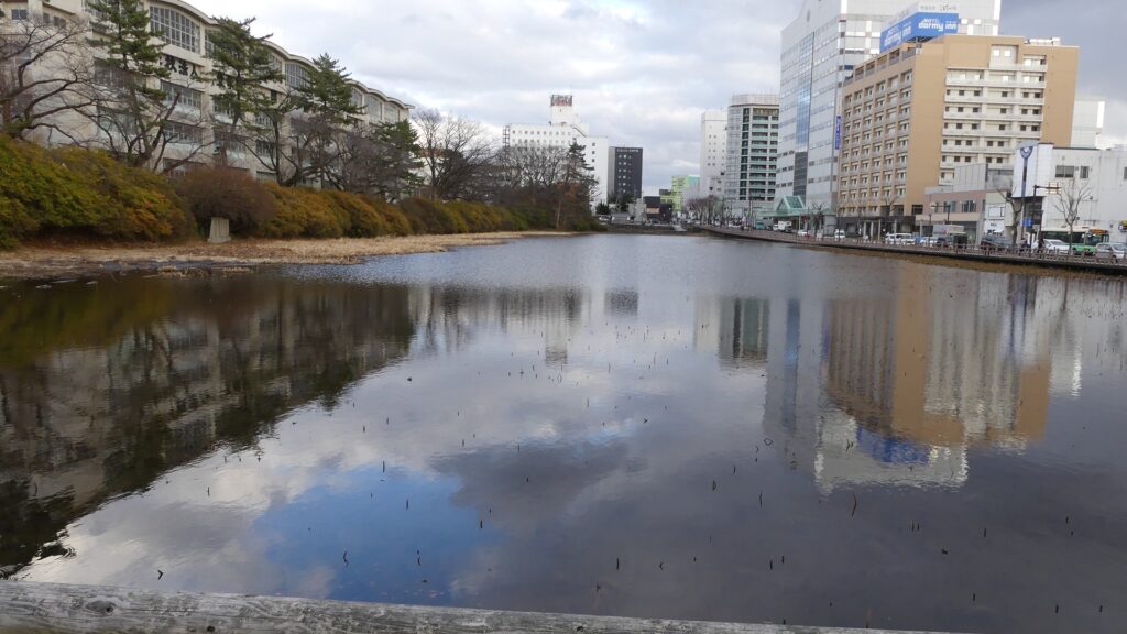
佐竹氏は古代の終わり頃から常陸国(現在の茨城県)を拠点としてきました。16世紀後半、彼らは水戸城に住み、その領土は54万8千石もの石高に相当しました(その当時の日本で8番目の大大名)。ところが、1602年に徳川幕府により東北地方の秋田に移されてしまいます。1600年に起こった関ヶ原の戦いにおいて、幕府をはっきりとは支持しなかったからです。その領土は20万石まで削減されましたが、新しい土地で新しい城を築くことを決心しました。それが久保田城でした。
The Satake Clan had been based in Hitachi Province (what is now Ibaraki Prefecture) since around the end of the Ancient times. In the late 16th century, they lived in Mito Castle and their territory was worth as much as an earning of 548 thousand Koku in rice (the 8th largest lord in Japan at that time). However, they were transferred to Akita in Tohoku Region by the Tokugawa Shogunate in 1602, as they didn`t firmly support the Shogunate when Battle of Sekigahara happened in 1600. The size of their territory was reduced (to 200 thousand Koku in rice), but they decided to build their new castle in the new land. This was Kubota Castle.
お家芸だった土の城~Building Castles of earth was their Specialty
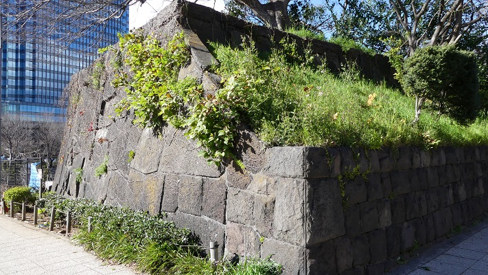
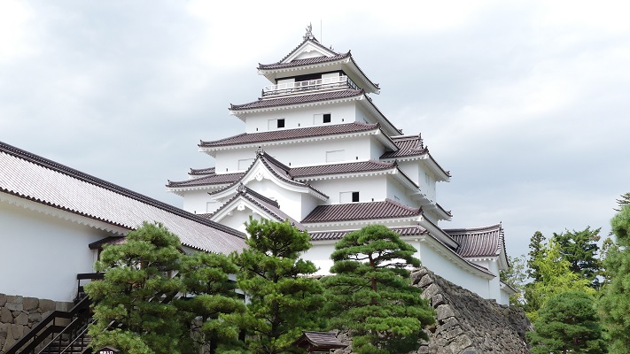
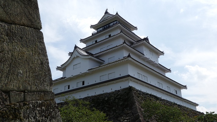
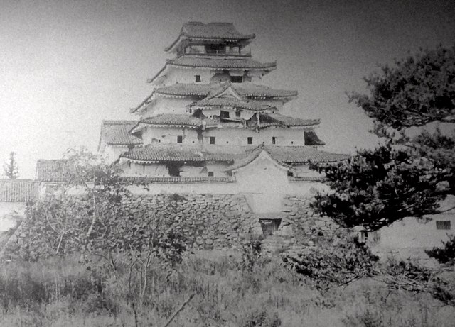
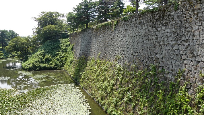
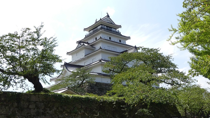
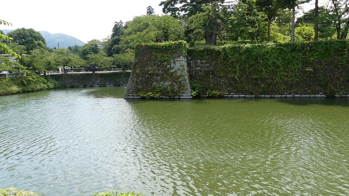
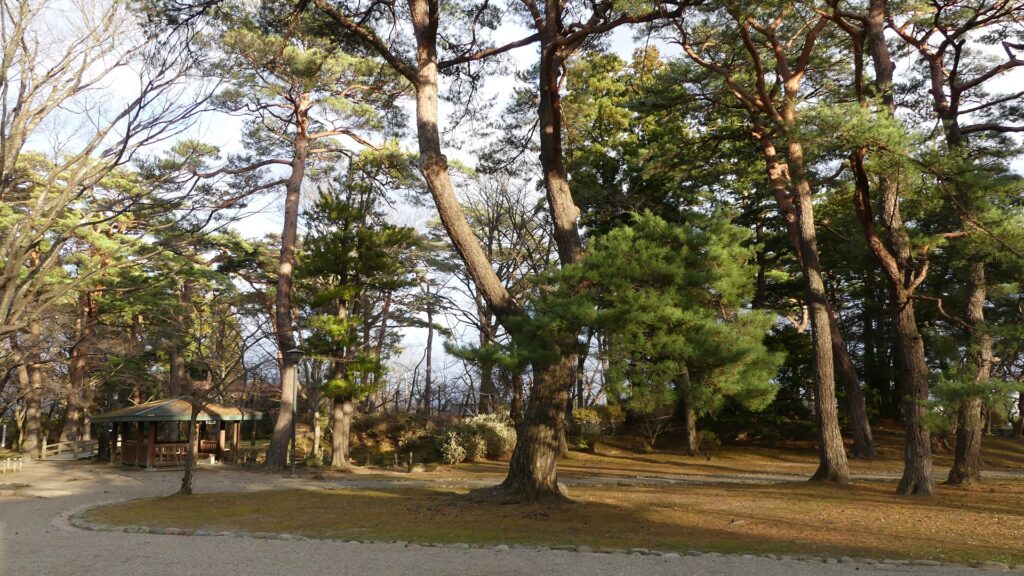
久保田城は、旭川沿いの標高40mの神明山の上に築かれました。この城には天守はなく、ほとんどが土造りによるものでした。その理由としては、佐竹氏には石垣や天守を作る技術がなかったからとか、幕府の権威を恐れたためと言われてきました。佐竹氏が秋田に移った当時は、他の大名たちにとっては、石垣と天守がある城を作るのが普通でした。しかしながら、土造りの城を作ることは佐竹氏のお家芸だったのです。その証拠として、水戸城も挙げられます。佐竹氏はそこで技術を進化させ、佐竹氏の後の徳川氏はその土造りの城を最後まで使い続けました。佐竹氏は土造りだけで強力な城を作ることができたのです。
Kubota Castle was built on a 40m high mountain called Shinmei-yama alongside Asahigawa River. The castle was almost all made of earthworks with no Main Tower. It has been said that the reason for it is that Satake had no ability and techniques for building stone walls and a Main Tower, or they feared the Shogunate`s authority. In the same period as Satake moved to Akita, it was usual for other lords to build a castle with stone walls and a Main Tower. However, building a castle of earthworks was the specialty of the Satake Clan. There is evidence also with Mito Castle, Satake Clan improved this technique, and it was used by the Tokugawa Clan following Satake as a castle of earthworks till the end. That meant Satake could build a strong castle using only earthworks.
自然地形を生かした巧みな配置~Clever Arrangement using Natural Terrain
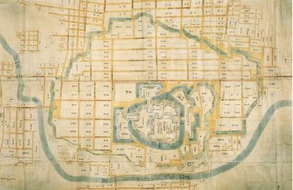
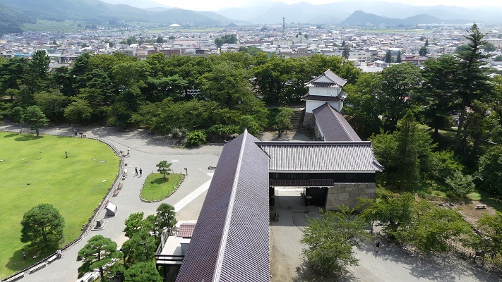
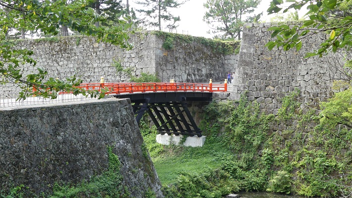
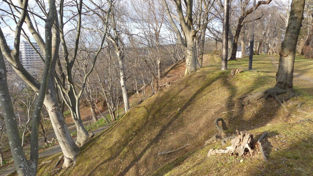
城の中心部は、内堀に囲まれ、二段になっていました。上段は「本丸」であり、下段は「二の丸」になっていました。中心部の周りは「三の丸」となっていて、外堀に囲まれていました。更には、三の丸の外側且つ川の内側には「西曲輪」「北の丸」が設置されていました。本丸には御殿があり、領主が住んでいました。本丸には5つの門がありましたが、外部からは二の丸を通らなけらば行けないようになっていました。佐竹氏は、自然の地形を生かしながら巧みな配置を行い、20年以上の工事の後、城を完成させました。
The center of the castle had two tiers, surrounded by the inner moat. The upper tier was called “Honmaru” or the Main Enclosure, and the lower tier was called “Ninomaru” or the Second Enclosure. Around the center, there was “Sannnomaru” or the Third Enclosure, surrounded by the outer moat. In addition, “Nishikuruwa” or the Western Enclosure and “Kitanomaru” or the Northern Enclosure were placed outside the Third Enclosure inside the river. The Main Enclosure had the Main Hall where the lord lived, and four turrets instead of the Main Tower. It also had five gates, but anyone from the outside the castle had to go through the Second Enclosure to reach it. Satake complete the castle with clever arrangement and using natural terrain after over 20 year construction.

佐竹氏は江戸時代の期間中、久保田藩を統治しましたが、その支配は安定しませんでした。秋田は強風地帯であり、藩の民衆は風害による飢饉や、洪水や風雨による被害に苦しみました。これらにより一揆が頻発し、藩は予算不足に陥りました。久保田城も度々火災に見舞われますが、その都度再建されました。
Satake governed their Kubota Domain all through the Edo Period, but their governance was not stable. Akita was a very windy area, so the people of the Domain suffered several famines from dry winds, flood and water damage. It often caused riots, as a result, the Domain lacked resources. Kubota Castle also suffered fires, but was repaired and restored each time.
特徴~Features
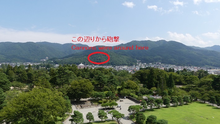
城周辺の航空写真~The aerial photo of around the castle城跡の千秋公園へ~To Senshu Park as Castle Ruins
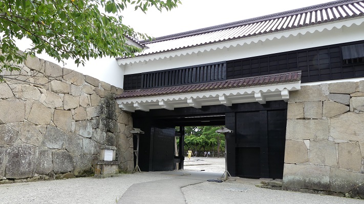
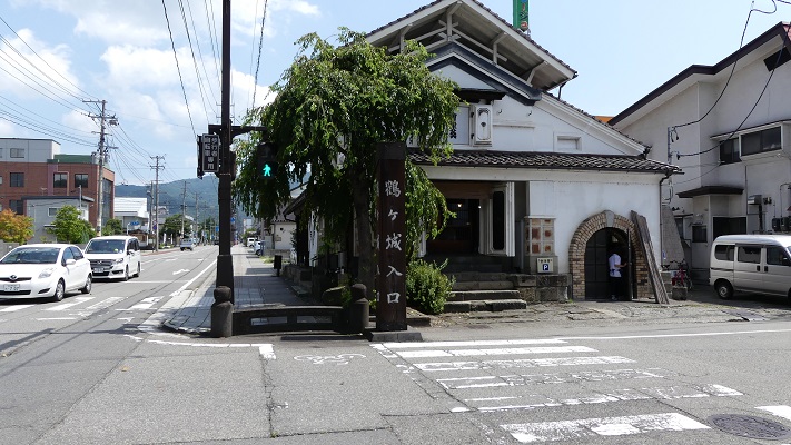
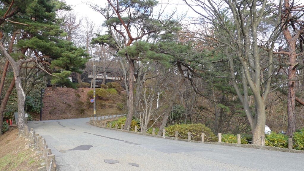
現在、久保田城跡は千秋公園となっています。観光客は通常南から中土橋を通って現存する外堀を渡って三の丸や二の丸に向かいます。過去は東側にある黒門が城の正門でした。二の丸には広い敷地があり、かつては官庁や倉庫などの建物がありました。佐竹史料館では、久保田藩や佐竹氏に関する展示を行っています。
Now, the ruins of Kubota Castle has become Senshu Park. Visitors usually go across the remaining Outer Moat through Nakadobashi Bridge on the south to the Third and Second Enclosures. In the past, Kuro-mon Gate on the east was the front entrance of the castle. The Second Enclosure has a large space where buildings such as offices and warehouses were built. Satake Historical Museum exhibits the histories of Kubota Domain and the Satake Clan.
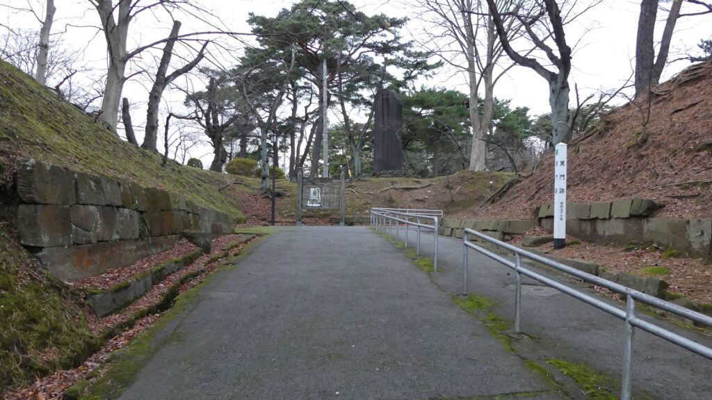
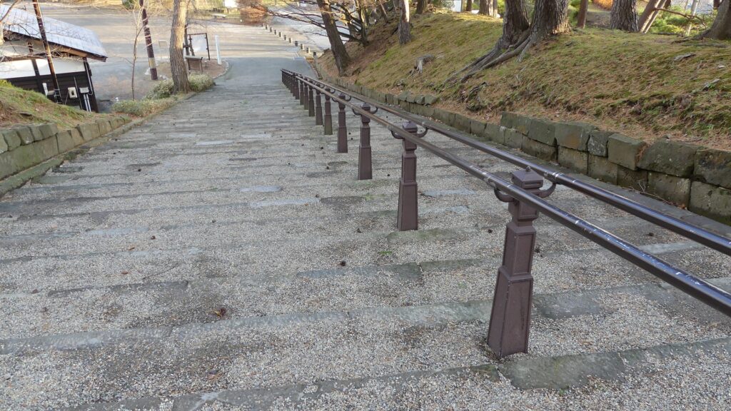
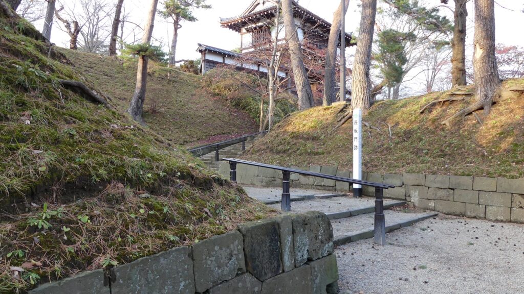
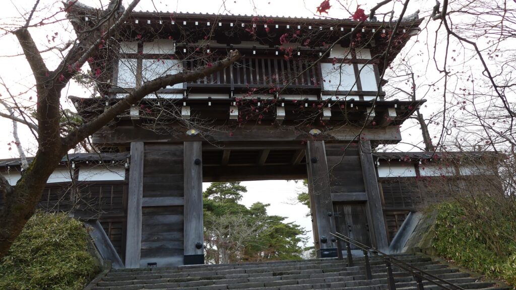
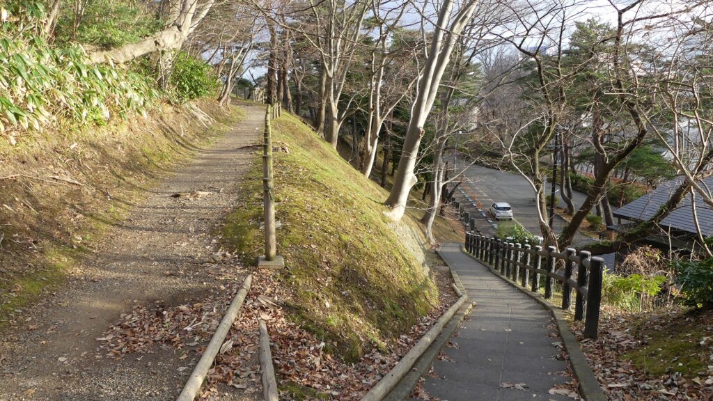
本丸への長い坂~Long Slope to Main Enclosure
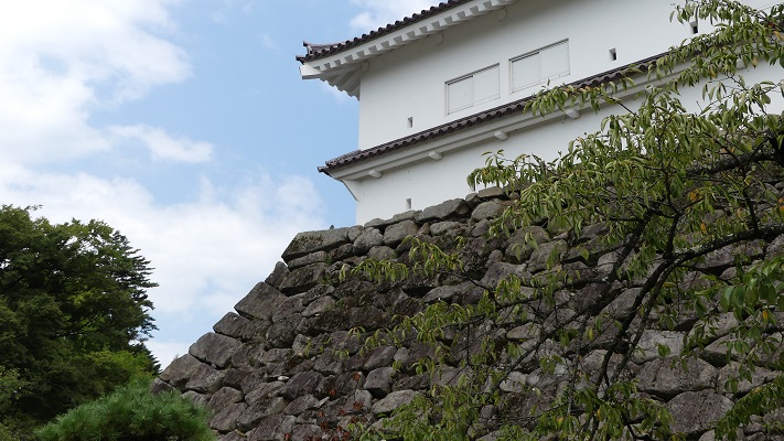
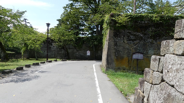
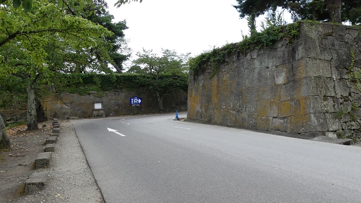
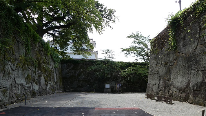
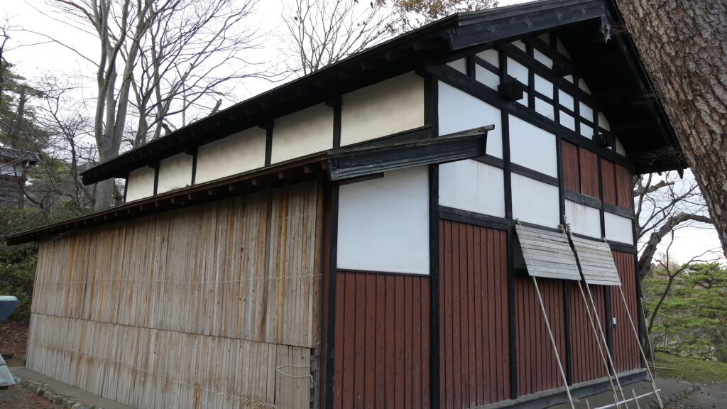
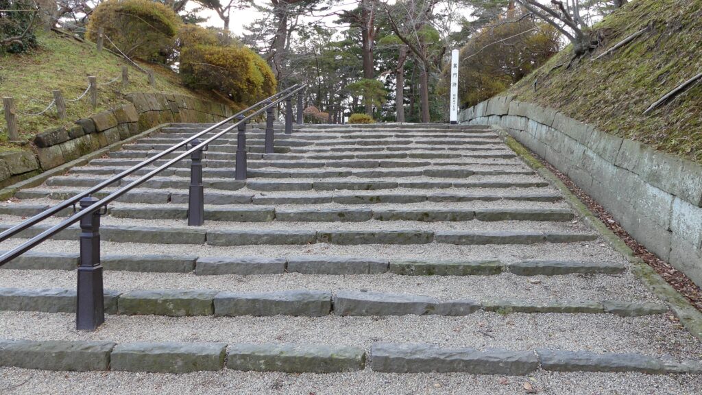
本丸へは、「長坂」と呼ばれる長く曲がりくねった階段を通って登っていきます。この場所はとても重要だったため、一部石垣が使われています。「長坂門」という門がちょうど曲がっている箇所に立っていました。階段を登り切った所には、本丸の正門である表門が復元されています。門の傍らには「御物頭御番所」という警護所が城で唯一の現存建物として残っています。
You can walk up to the Main Enclosure through a long and curved stairways called “Nagasaka” or the Long Slope. Stone walls have been partly used, as this spot was very important. A gate called “Nagasaka-mon” stood at the curved part. At the end of the stairways, Omote-mon Gate, the front gate of the Main Enclosure has been restored. There is the guardhouse called “Omono-gashira Gobansho” which is the only remaining building in the castle beside the gate.
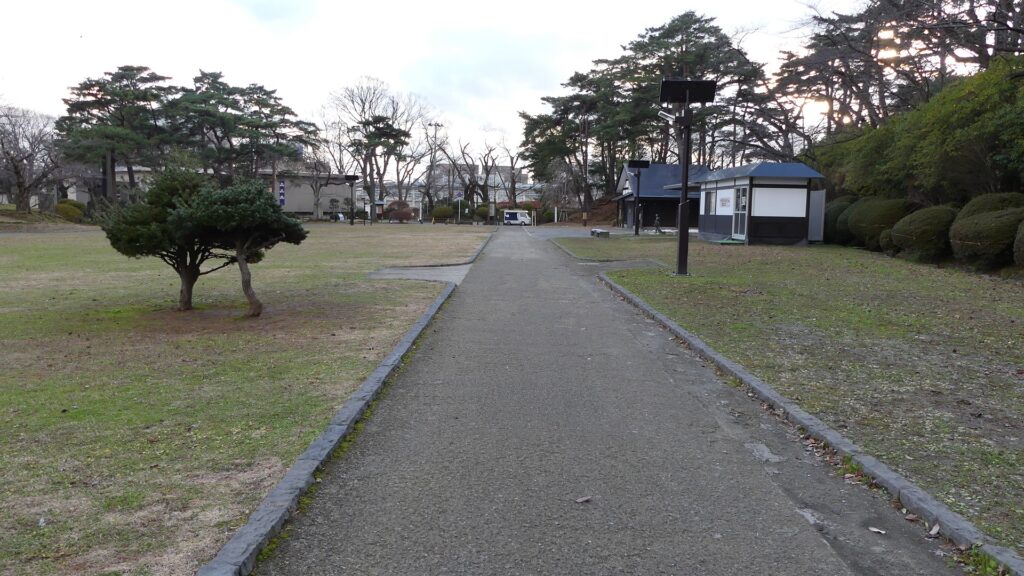
土造りの本丸~Main Enclosure made with Earthworks
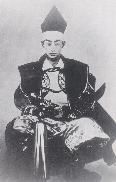
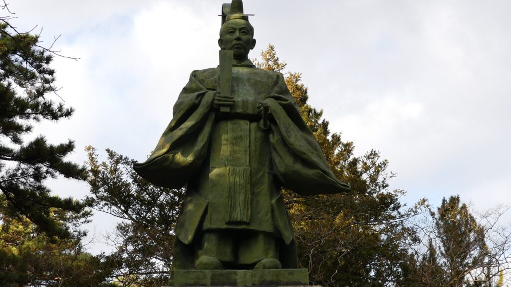
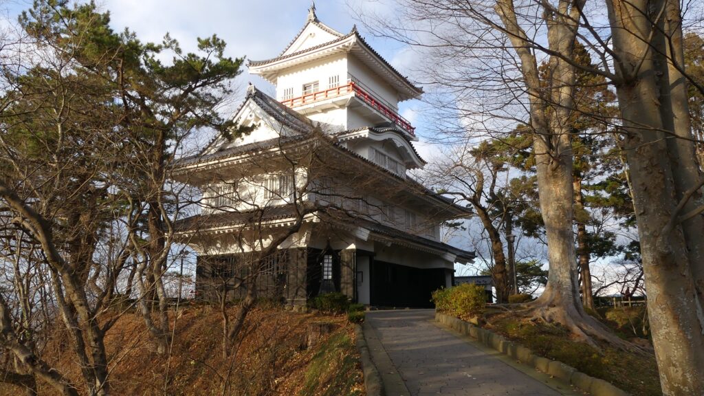
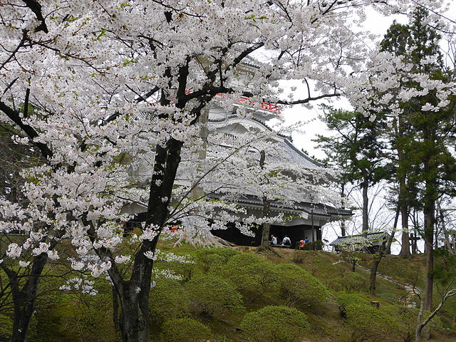
本丸の中心には神社と最後の領主の銅像があります。城のようには見えないかもしれませんが、本丸を歩き回ってみれば、城の基礎は土だけですが、とても頑丈にできていることがわかると思います。櫓の一つ、御隅櫓が曲輪の北西角に再建されています。見晴らしをよくするために、元あったものより高く作られています。本丸にはいくつか出入口があるので、登ったり降りたりしてみると、この城がいかに自然の地形をうまく生かしているかが見て取れるでしょう。
The center of the Main Enclosure has a shrine and the statue of the lord of the castle. It may not look like a castle, however if you walk around the Enclosure, you can find the foundation of the castle is made of only earth, but strongly. One of the turrets, Osumi-yagura Turret has been rebuilt at the northwest corner of the Enclosure. It is built much higher than the original one for viewing. The Enclosure has several entrances such as the Back Gate, so you can also walk up and down enjoying how the castle uses natural terrain cleverly.
その後~Later History
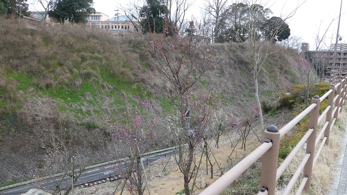
明治維新後、久保田城は1872年に秋田県庁舎となりました。この城はまた、秋田県と秋田市の始まりともなったのです。ところが、1880年にほとんどの城の建物は燃えてしまいます。1890年になって以前の領主、佐竹氏が城跡を買い上げ、秋田市に土地を公園として貸し出し、千秋公園と名付けられました。久保田藩の元藩士たちは1892年に公園に桜の苗を寄付しました。そのため、公園は桜の花でも有名になっています。
After the Meiji Restoration, Kubota Castle became the Akita prefectural office in 1872. That meant the castle also was the origin of Akita Prefecture and Akita City. However, most of the castle buildings were burned down in 1880. In 1890, the former lord, Satake Clan bought the castle ruins and lent the land to Akita City as a park named Senshu Park. Former warriors of the Kubota Domain donated cherry plants for the park in 1892, so that’s why the park has also become famous for its cherry blossoms.
私の感想~My Impression
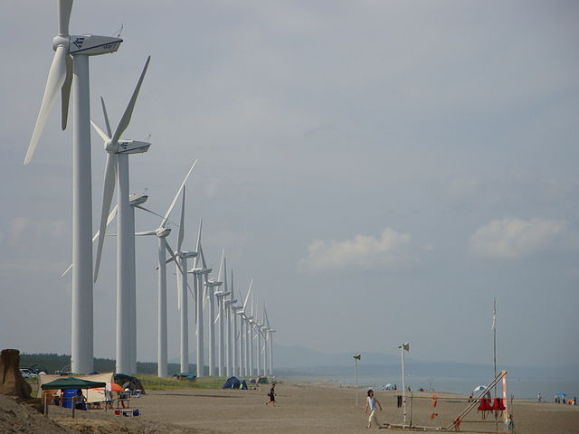
久保田城跡は、かつて近代公園として整備されたため、単なる公園としてしか見えないかもしれません。城跡の基礎部分をよく見れば、本当は土でできた城だとも気付いていただけると思います。この城と、これも佐竹氏が築いた水戸城とを比べてみるのもいいでしょう。秋田県は今、かつては苦しめられた風が強い気候を生かし、風力発電を推進しています。一方、現職(2021年3月現在)の秋田県知事は佐竹氏の子孫の方です。秋田は、伝統と革新の両方を重んじているようです。
You may find the ruins of Kubota Castle just like a park, because they were once developed as a modern park. You can also find the ruins was really a castle made of earth if you look at the foundation of the ruins carefully. It may be a good idea to compare this castle with Mito Castle that the Satake Clan built as well. Akita Prefecture is now developing lots of wind farms using the windy climate that they suffered from in the past. On the other hand, the governor of Akita Prefecture right now (Mar2021) is a descendant of the Satake Clan. I think Akita is trying to take good care of both tradition and innovation.
ここに行くには~How to get There
城跡までは、JR秋田駅西口から歩いて約10分です。
東京から秋田駅まで:秋田新幹線に乗ってください。
車で行く場合:秋田自動車道の秋田中央ICから約20分です。千秋公園に駐車場があります。
It takes about 10 minutes from the west entrance of JR Akita station to the castle ruins on foot.
From Tokyo to Akita st.: Take the Akita Shinkansen super express.
If you want to go there by car: It takes about 20 minutes from the Akita-Chuo IC on Akita Expressway. Senshu Park offers a parking lot
リンク、参考情報~Links and References
・久保田城、秋田市公式サイト(Akita City Official Website)
・「よみがえる日本の城9」学研(Japanese Book)
・「日本の城改訂版第60号」デアゴスティーニジャパン(Japanese Book)